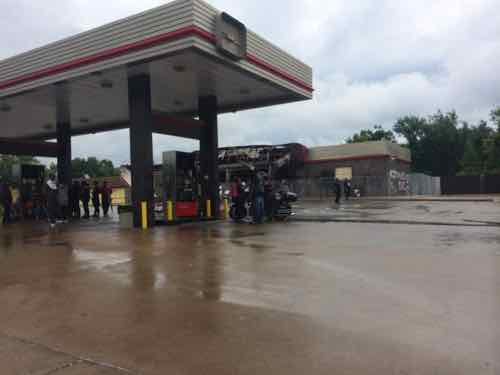
This afternoon the Urban League is going to give more details about something they released on Friday, a new center at the site of the burn-out QuikTrip on West Florissant in Ferguson:
On Friday, the Urban League said the center would be “an important extension of its services in North County to further the League’s mission of empowering communities and changing lives.”
The center will “expand the Urban League’s work to broaden access to education/job training, employment and economic self-reliance for residents of the St. Louis metro area,” the League said in a news release.
A news conference is set for Monday afternoon to announce details, which the Urban League would not provide Friday. (Post-Dispatch)
Job training is needed in Ferguson, a better-trained workforce will benefit the entire region.
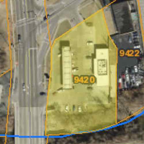
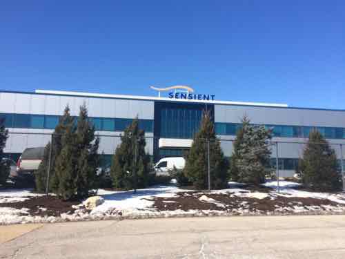
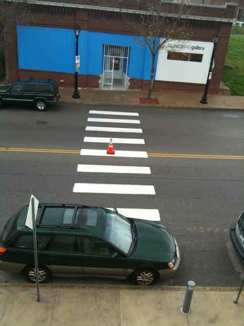
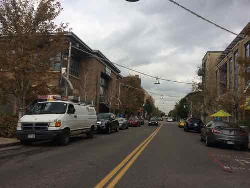
The former QuikTrip at 9420 W. Florissant on August 16, 2014, click image for mapSt Louis County records list the irregularly-shaped property as being 1.14 acres.
St Louis County records list the property as being 1.14 acres with irregular borders. This afternoon we might see preliminary ideas for the planned building. Hopefully the Urban League is planning to build the structure out at the street corner, close to the public sidewalk. My fear is they’ll set a building at the back, behind parking. The latter would send the wrong message to a community with many who use sidewalks and public transit. Since they’ll be starting with a cleared site I’m hopeful, I applaud the effort but remain cautious until I see specifics.
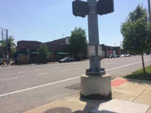
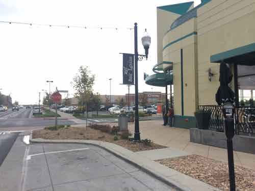
The press conference will be held 3pm at the Urban League’s non-walkable St. Louis County Operations Center at 8960 Jennings Station Road. To be fair, it’s located in a rented former grocery store built in 1967.
We can all agree St. Louis must retain existing employers and attract new ones. Unfortunately, St. Louis has a habit of forgetting about urban design along the way. Let’s take a look two examples; one within the proposed 100 acres site for the National Geospatial-Intelligence Agency and one to the immediate West.
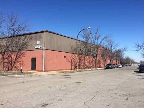
First is a warehouse currently occupied by Faultless Healthcare Linen.
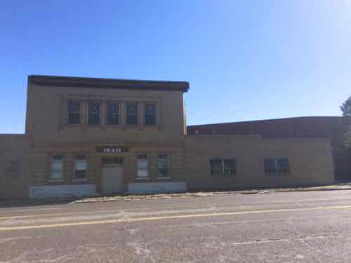
This warehouse, built in 1991, will be razed if the National Geospatial-Intelligence Agency picks the city site over three others in the region.This small building from 1899 helps hide the awful warehouse behind it.
I remember when this was built in 1991 — I’d just moved to Old North St. Louis and passed it daily on Jefferson. One street was closed, the rest are faced with blank concrete block walls.
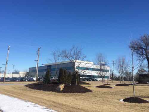
The next example is Pharmaceutical company Sensient Colors Inc., their 30-acre campus at 2515 N. Jefferson is to the West of the potential National Geospatial-Intelligence Agency site.
The newest Sensient building was built in 2004 faces Jefferson but no entrance here, no public sidewalks even.Looking NE from Elliot Ave between N. Market & Benton. The company has removed many public sidewalks from the public-right-of-way adjacent to their facility.
Never heard of Sensient? I hadn’t either, but you’ve likely seen their products — on your plate.
Most of the world’s largest food and beverage manufacturers use Sensient colors and flavors to make their household brand-name food and beverage products. (St. Louis Business Journal)
Now, the demand for natural colors is suddenly outpacing demand for synthetics, and Sensient, which makes both, is responding. It has sophisticated technology it won’t explain (it does mention doing “supercritical CO2 extraction”) to pull the coloring agents from botanicals. It has a Fusion Precise Natural Color system that lets customers specify not just a particular color, but also a subtle shade of that color. And it has a head start: 60 years’ experience with natural colors. (St. Louis Magazine)
I get it, they have trade secrets. Still, in a city people do walk to work — especially from public transit. I believe we can retain/attract employers without turning our city into a suburban office park.
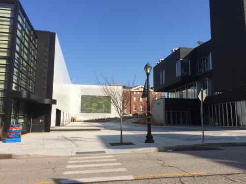
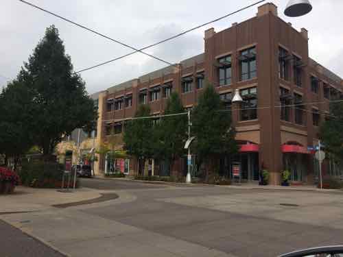
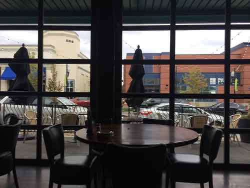
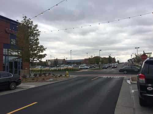
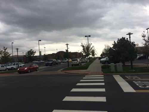
It’s Friday so that means a post with good news. Today’s good news is that the area of Midtown known as Grand Center is beginning to implement some of the improvements from their master plan. The blocks between Grand & Spring are very long — too long. They’d painted crosswalks at midpoints years ago, but these crossing points didn’t work for those of us in wheelchairs. Even the able-bodied could face difficulties with parked cars, motorists not stopping, etc.
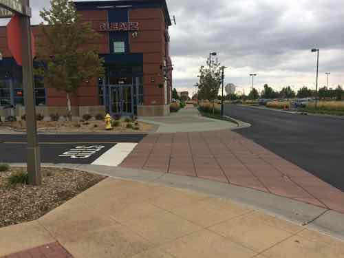
So last month I was happy to see a new crossing on Olive between the Nine Network (KETC) and St. Louis Public Radio (KWMU)
The curb gently bows out to narrow the crossing with of Olive. Looking North, the Nine Network on the left, St. Louis Public Radio on the right, the new Media Commons plaza center.Looking the other direction you can see both new ramps built within the parking lane.
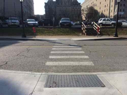
In April 2010, while visiting the Pulitzer, I photographed the problem in Grand Center: paint but no ADA ramps, cars able to block the crosswalk. The following was very common in Grand Center so I’m very glad to see it getting addressed!
The Subaru wagon is parked in line with other cars. but blocking the crosswalk. No ramp on either end of the crosswalk. April 2010
Pushing the ramps out into the parking lane puts pedestrians where they can look both directions and where motorists can see pedestrians entering the crosswalk so they can stop to let them cross. Tomorrow will be a nice day so get out and take a walk. See you Sunday with a new poll.
BOARD BILL NO. 198 INTRODUCED BY ALDERMAN SCOTT OGILVIE, ALDERWOMAN LYDA KEWSON, ALDERWOMAN MEGAN GREEN, ALDERMAN SHANE COHN, ALDERWOMAN CHRISTINE INGRASSIA, ALDERWOMAN CAROL HOWARD An ordinance repealing Ordinance 68663, codified as Chapter 3.110.120 of the Revised Code of the City of St. Louis and in lieu thereof enacting a new ordinance relating to a “complete streets” policy for the City of St. Louis, stating guiding principles and practices so that transportation improvements are planned, designed and constructed to encourage walking, bicycling and transit use while promoting safe operations for all users.
The first reading of the bill was in November, this will be the first hearing on it. The full Bill, as introduced, can be viewed here (5 page PDF). As noted in the summary above, it repeals & replaces Ordinance 68663 — a “Complete Streets” law adopted a few years ago. This new bill is more — complete.
The best part is the creation of a Complete Streets Steering Committee, comprised of:
Directors or their designees from the Departments of Streets, Planning and Urban Design, Board of Public Service, Health Department, Department of Parks, Recreation, and Forestry, and the Office of the Disabled.
This committee would meet quarterly and:
Develop short-term and long-term steps and planning necessary to create a comprehensive and integrated transportation network serving the needs of all users;
Assess potential obstacles to implementing Complete Streets practices;
Develop an action plan to more fully integrate complete streets principles into appropriate policy documents, plans, project selection processes, design manuals and maintenance procedures;
Provide an annual written report and presentation to the Board of Aldermen showing progress made in implementing this policy.
I’m a huge fan of Retrofitting Suburbia, the redevelopment of formerly auto-centric suburban retail sites. In late September, while on my honeymoon, I got to see three different examples in the Denver area. Two site once had traditional enclosed malls, the third was previously an airport. We started with the oldest and finished with the newest.
Englewood, CO
In June 2000 the CityCenter Englewood project opened, replacing Cinderella City mall that had opened just 32 years earlier:
The mall was completed and officially opened for business on 7 March 1968 and once held the distinction of being the largest covered shopping center west of the Mississippi River. It featured four sections: Rose Mall, Gold Mall, Shamrock Mall and Cinder Alley. In addition, the Center Court area was known as the Blue Mall. It was demolished in 1999. (Wikipedia)
Englewood was founded in the 19th Century but largely developed in the Post-WWII era. Like many post-war suburbs, it lacked a downtown. By the 1980s newer malls had eclipsed Cinderella City. In the late 1990s they saw the replacement of the mall and the coming of light rail as an opportunity to build a downtown:
CityCenter Englewood replaced Cinderella City with a transit-oriented development (TOD). This TOD is a pedestrian-friendly, mixed-use concept that includes retail, entertainment, residential, office, civic and open space elements with a transit focal point. The former Foley’s building was renovated into the new Englewood Civic Center, which houses the City Hall offices, the Library, Municipal Court, and the Museum of Outdoor Arts. The Civic Center was the first feature of CityCenter Englewood to open when it made its debut in June 2000.
The Civic Center creates the cornerstone of the redevelopment of Cinderella City that includes Wal-Mart, Trammell Crow apartments with first floor retail, Office Depot, the Sports Authority, IHOP, Qdoba, and other retail and commercial businesses, second floor office with first floor retail, an RTD light rail station, and a Bally’s Fitness Center. (City of Englewood)
You can see a current aerial here, and a 1991 aerial here. In the Southwest corner of the site an anchor store building was retained, as was part of the structured parking. The adjacent street grid was brought through the site. Apartments were added nearest the new light rail station, big box stores added to the east end of the site. All connected by a grid of streets and sidewalks.
The former anchor store that remained is nope the Englewood Civic CenterThe light rail station is to the left, the Walmart down the road to the right. Yes, a Walmart is across the street from a large 3-story apartment building that has street-level retail.
Not bad for an early example of such a project. We saw people walking as we drove through, others can be seen in Google Street View.
Lakewood, CO
The Villa Italia mall opened two years before Cinderella City, in 1966. By the 1990s Lakewood officials saw both malls dying off, they didn’t want a vacant mall in their city.
A referendum was held in 1997, which authorized “urban renewal” to redevelop Villa Italia into a more conventional downtown district, something that the post-war suburb had never had.
In 1998, Lakewood entered into a joint venture with Denver-based Continuum Development. Continuum purchased the land beneath the mall from the Bonfils-Stanton Foundation in September 1999 and acquired the buildings and ground leases from Equitable in early 2001. The site was rezoned (from that of an enclosed shopping center to a mixed-use development) and the redevelopment plan put in motion.
Villa Italia closed in July 2001, demolition began the following January. Belmar opened in 2004. Like CityCenter Englewood, streets were cut through the site. Not private driveways, public streets with public sidewalks. The pedestrian grid was as equally important as the vehicular grid, not an afterthought.
You can view an old aerial here and a current one here.
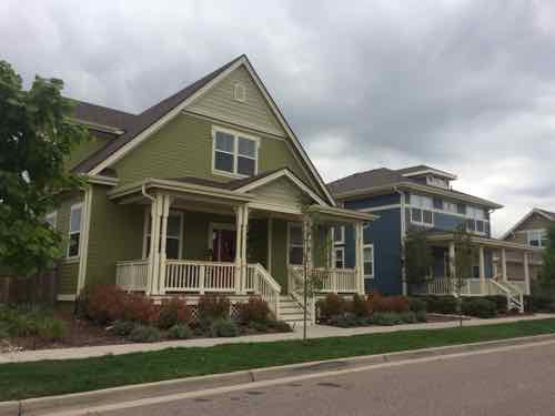
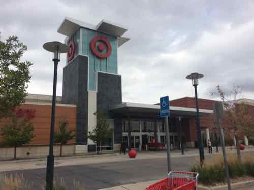
A new street at BelmarThe new buildings have a variety of uses and architectural stylesIt too has big boxes, this is the side view of Target.
A former anchor department store building was kept, it’s now a Dick’s Sporting Goods store. New housing is on the perimeter of the site, surrounding the retail core.
Stapleton
When Denver decided to build a new airport east of the developed region the question became what to do with the old airport.
b
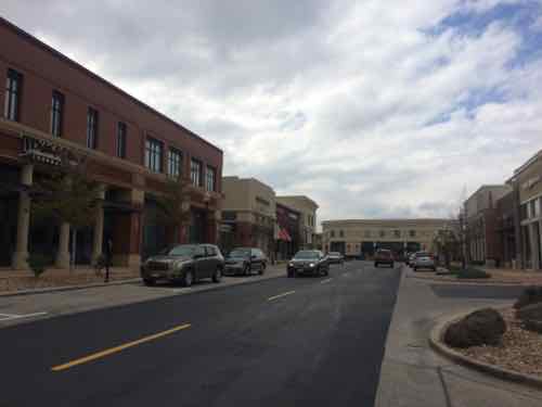
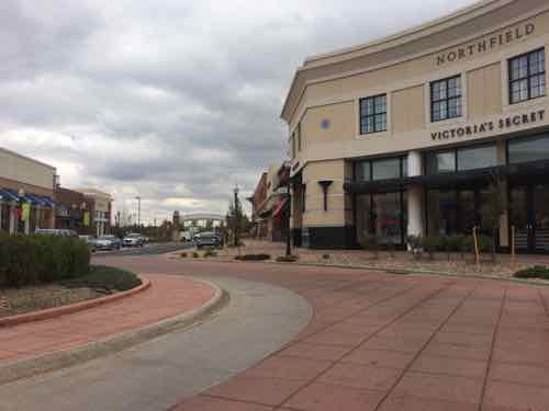
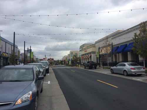
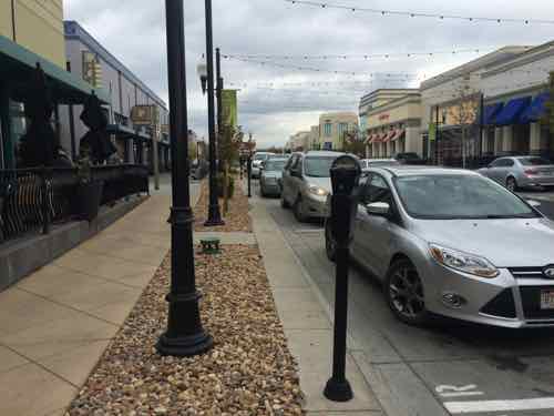
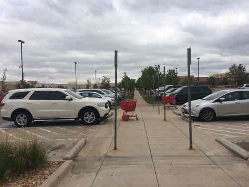
A wide variety of new housing is part of Stapleton, including single family homes, apartments, townhouses, etcAn internal street in the center of the main retail area called The Shops at Northfield StapletonAnother viewAnother street in the core of the retail area, note the on-street parkingDespite plenty of free parking on the perimeter, to park in the center requires payment. The silver Ford Focus was our rental for 3 days of our 7-day honeymoonLooking out at the street from our lunch tableJust beyond the center you can see big box stores and large parking lots.Like the two previous examples, pedestrian connectivity was planned from the start to connect everything together.The urban-ish area on the left, big box to the right. All walkable & drivable.Another view from the retail center looking toward the big boxes on the perimeter.Target is among the many big box stores at StapletonLooking out from Target, their walkway connects to the Stapleton pedestrian network beyond Target’s parking lot.The street where we parked terminated in a Bass Pro Shops store, also connected to the sidewalk system
The overall site is massive, as you might expect from a former airport. It has many residential neighborhoods, distinct retail areas, and a business park.
Final thoughts
All three are variations on the New Urbanist/Retrofitting Suburbia theme. While I wouldn’t want to live at any of the three I know someone like me, who uses a wheelchair often, can get to businesses at each development on a sidewalk network. All three remain very car friendly, I drove to all three. Providing the option to walk doesn’t make them less appealing to motorists. Some pedestrians probably arrived by car but decide to explore on foot rather than drive from store to store.
AARP Livibility Index
The Livability Index scores neighborhoods and communities across the U.S. for the services and amenities that impact your life the most
Built St. Louis
historic architecture of St. Louis, Missouri – mourning the losses, celebrating the survivors.
Geo St. Louis
a guide to geospatial data about the City of St. Louis