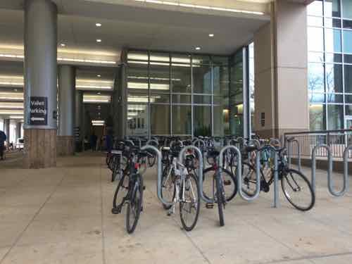
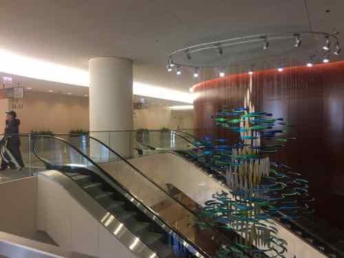
The Texas Eagle train uses 2-level trains like this one, the Lincoln Service to/from Chicago uses a one level train.
In October 2021 I booked an Amtrak trip to Chicago for a weekend next month. At that time the trip was scheduled to take 5 hours 40 minutes to Chicago Union Station, via Lincoln Service. This is faster than it has been over the years — improving every year since the American Recovery and Reinvestment Act of 2009 was signed by president Obama. Amtrak recently revised my trip — it’ll now take only 5 hours 25 minutes. Fifteen minutes quicker than before!
Amtrak will implement a schedule change for Chicago to St. Louis Lincoln Service and Texas Eagle trains, effective December 13.
These schedules reflect a maximum authorized speed of 90 mph for Trains 300 – 307 and Trains 21 & 22. Chicago to St. Louis corridor travel times are reduced by approximately 15 minutes, end-to-end.
Updated schedules now on Amtrak.com reflect these changes, as do new bookings, eTickets and other boarding documents.
This is a step toward 110 mph schedules that are planned for the next 12 to 18 months. These improvements use federal grants and other funds from the Illinois Department of Transportation. (Amtrak)
These speeds aren’t close to high-speed rail experienced in other parts of the world, but it is very welcomed.
Driving a car is still faster, but it’s exhausting and very expensive to park in Chicago, station to station is 297 miles, requiring 4 hours 20 minutes. Of course, that’s assuming no restroom/eating/stretch breaks.
Kansas City is closer to St. Louis than Chicago is, so you’d think both driving & train travel would be less. Driving is 250 miles — 47 miles less than to Chicago, requiring 3 hours 37 minutes. Makes sense. The train trip to Chicago, however, is 5 hours 40 minutes.
Yes, the trips used to take the same amount of time even though one is closer. Now the STL to CHI train is faster. Once more improvements and speeds of 110 mph are achieved the time difference of traveling to Chicago compared to Kansas City will be even greater.
It would be nice to see similar improvements made to better connect St. Louis and Kansas City, spanning the width of the state.
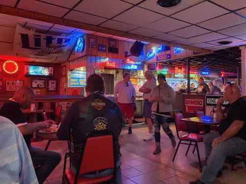
We knew Saturday would be a gorgeous day so we decided to drive up the Great River Road along the Mississippi River north of Alton IL. Our first stop would be a favorite, Fast Eddie’s Bon Air. We knew it had been cited for Covid violations in October 2020:
A longtime and popular restaurant in Alton was recently cited for not complying with COVID-19 restrictions in the area.
Illinois State Police said based on a complaint, they did a COVID-19 compliance check on Fast Eddie’s Bon Air. Officers issued a notice of non-compliance to the manager on duty and advised them on a time frame to get into compliance, police said.
After about an hour, Illinois State Police officers returned and issued a dispersal order and then after another 30 minutes, officers returned and issued a Madison County non-traffic complaint. Police said the manager signed and accepted the written complaint on behalf of Fast Eddie’s. (KSDK)
That was over six months ago, they likely learned how to comply. Or so I thought. I was thinking maybe tables wouldn’t be spaced as far apart as they should be for proper social distancing. We’re both fully vaccinated so I thought we could take a chance.
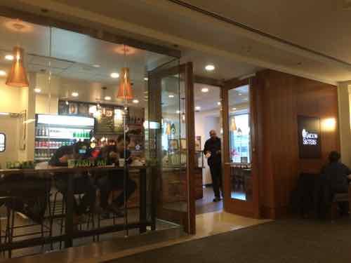
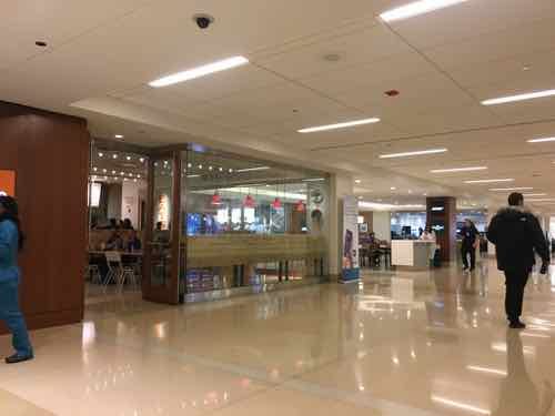
We arrived before they opened so we’d be among the first to enter. This photo was taken at 10:55am, 5 minutes before the door was unlocked.
We were the third group in the door, but our order number was 2nd. A long line of bikers was behind us. Inside I got us a table while my husband ordered.
As I waited I began noticing how different this was than every other restaurant we’d patronized during the pandemic:
No employees are wearing masks. Not our drink server, not the manager walking around, not anyone behind the counter.
Customers are walking around inside without masks. No mask while ordering, finding a table, going to the bathroom, picking up their order.
Only a few other customers wore a mask.
I told my husband we had to eat quickly and leave. Had we not left quickly I’d have likely confronted the manager, which would have ruined the day we had planned.
Here’s a few pics from the rest of the beautiful day.
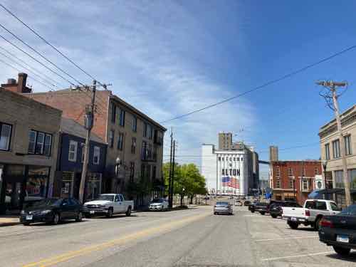
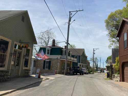
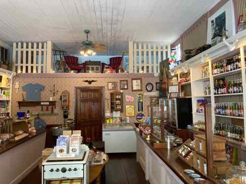
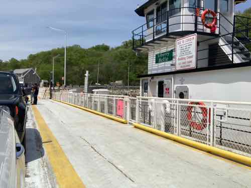
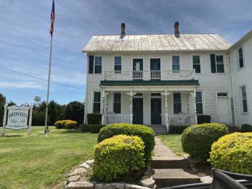
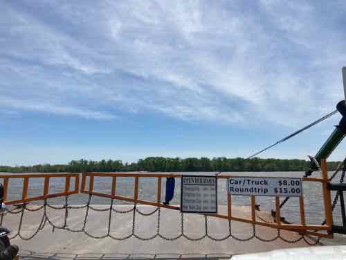
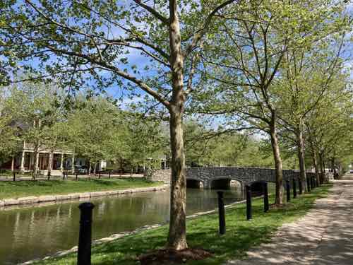
Downtown Alton IL is so charming, wonderful scale and the hills create interesting views. Click image for Downtown Alton website.Next we drove through the historic village of Elsah IL– one of our favorites. Click image for Elsah tourism info.We stopped at the Elsah General Store and got some baked goods for dessert, ate them outside. The shop owner wore a mask. They even accepted payment via ApplePay! Yes, click the image to view their website & hours.When we reached the free Brussels Ferry we crossed the Illinois River. This ferry is operated by the Illinois Department of Transportation. Click image for more information.I’ve done this trip numerous times over the last 30 years, but this was the first time I went a few miles out of our way to see Brussels IL. This is the village hall. Click the image to see the Wikipedia page, learn things like it was founded in 1822!We continued driving through Calhoun County IL until we reached the Golden Eagle Ferry to cross the Mississippi River into St. Charles County MO. Click image for more information.New Town at St. Charles was an easy stop as we headed for I-370. As predicted, it looks much better now that the trees have matured. Click the image for the official New Town website.
At the end of our day we stopped at a convenience store near New Town. The employee and some fellow customers were wearing masks, but customers came & went without any masks.
The pandemic is still going on, people are still getting sick & dying.
In 2005 congress passed the REAL ID Act, but adoption has been slow. Missouri just began issuing REAL ID-compliant licenses this year. Three states (New Jersey, Oklahoma, and Oregon) still aren’t compliant.
What’s the big deal?
On October 1, 2020, travelers will need a “REAL ID-compliant” driver’s license, US passport, US military ID or other accepted identification to fly within the United States.
The REAL ID Act established minimum security standards for the issuing of state licenses and their production. It also prohibits federal agencies from accepting licenses from states not meeting those minimum standards for certain activities. That includes boarding federally regulated commercial aircraft, entering nuclear power plants and entering federal facilities.
To get a REAL ID-compliant state driver’s license, the US Department of Homeland Security requires applicants provide documentation showing their full legal name, their date of birth, their Social Security Number, two proofs of address of principal residence and lawful status. (States may impose more requirements.) (CNN)
The REAL ID Act faced widespread opposition from numerous groups, states. The final deadline is now less than a year away. If you have a passport, however, you can fly after October 1, 2020 without a REAL ID.
Today’s poll is very straightforward:
This poll will close at 8pm tonight. Wednesday morning I’ll share how you can tell if your license/ID is REAL ID-compliant or not. Can’t wait?
I often spend days, weeks, or months thinking about a post before writing it. I’ve been thinking about today’s post for over 5 years now!
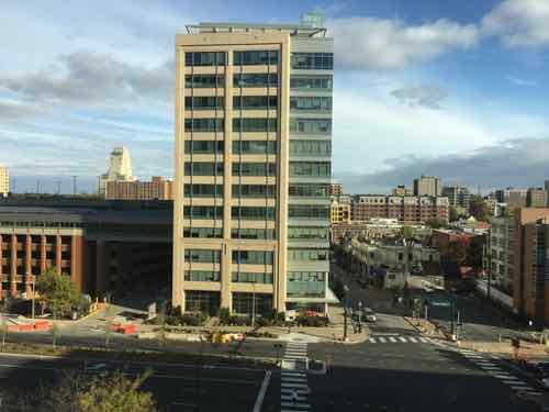
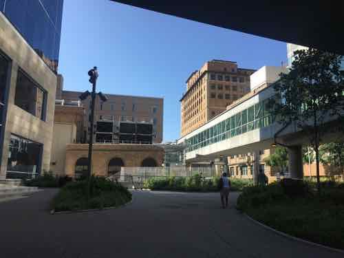
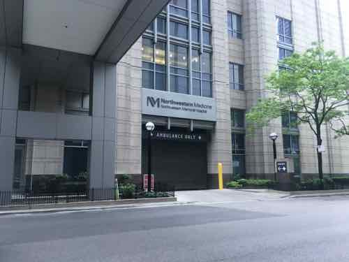
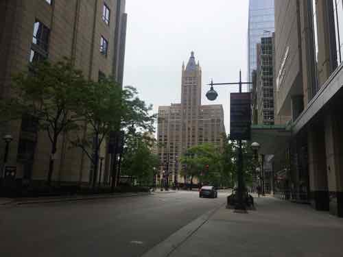
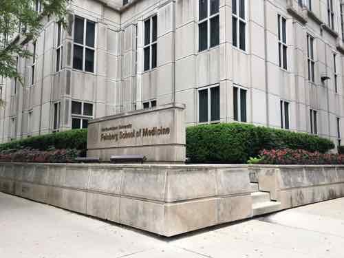
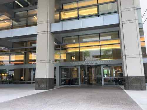
It was May 2014 when we first stayed at friend’s newly purchased vacation condo in Chicago’s Streeterville neighborhood — across the street from Northwestern Hospital. Not a wide boulevard either, Erie Street is like most of Chicago’s streets — two drive lanes and two parking lanes.
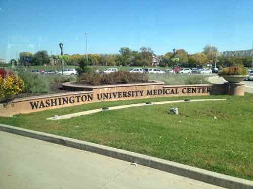
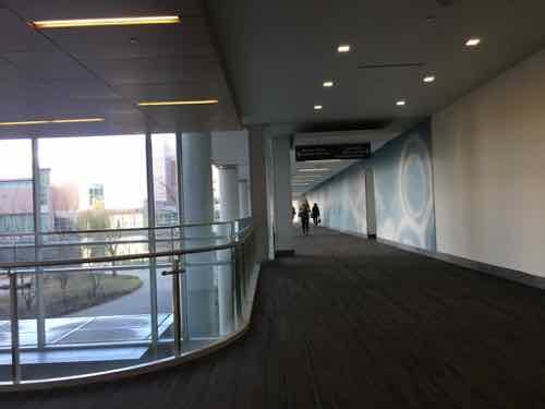
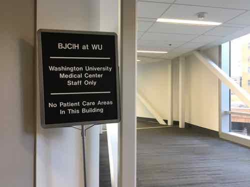
We experienced the busy sidewalks but also the internal walkway system connecting the campus’ numerous buildings, complete with bridges over roadways. I immediately thought how different it felt from St. Louis’ Washington University Medical Campus (WUMC)/Barnes-Jewish Hospital (BJC).
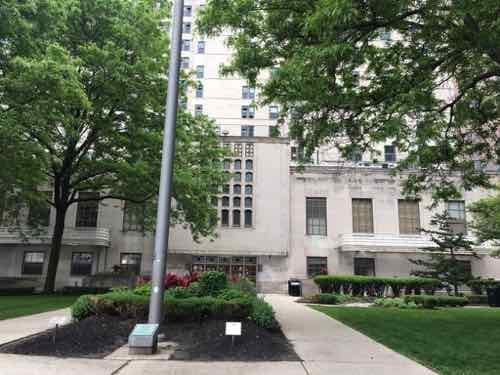
St. Louis’ Washington University Medical Campus is prominently identified along Kingshighway, Forest Park Ave, etcPoints along Kingshighway are now labeled A, B. C, etc…
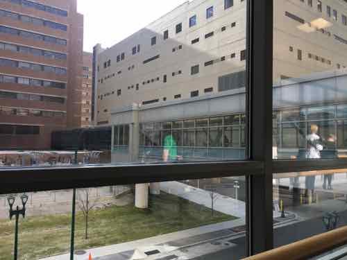
In the Fall of 2017 I had an unexpected emergency surgery and an overnight stay at BJC, I got to experience the walkway going from the Center for Advanced Medicine to Barnes. Then again the next morning going to the bus transit center. Yes, usually you don’t leave hospitalization via public transit, but that’s how I got there with my power wheelchair and a very broken wrist.
I’ve visited the Northwestern campus numerous times while visiting Chicago and I’ve returned to WUMC/BJC for numerous appointment and to photograph/observe the walkway. I’m finally in a position to compare observation of the two.
First, the similarities between the two:
Were built over decades, slowly expanding.
Began life in an affluent neighborhood of gridded streets.
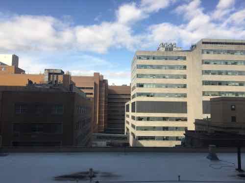
Comprised of generic beige buildings, parking garages.
Lots of people & cars.
Have an internal network to help people navigate from building to building indoors.
Have one hard edge (Lake Michigan in Chicago, Forest Park in St. Louis)
Given all the above similarities you’d think the two would function the same. But no, the end results are vastly different! This post will hopefully explain the differences I’ve observed and their impact on each campus and surrounding neighborhoods.
In short, the major differences can be reduced to:
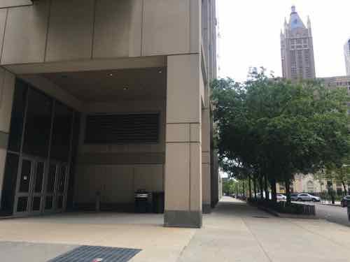
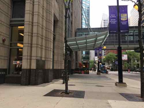
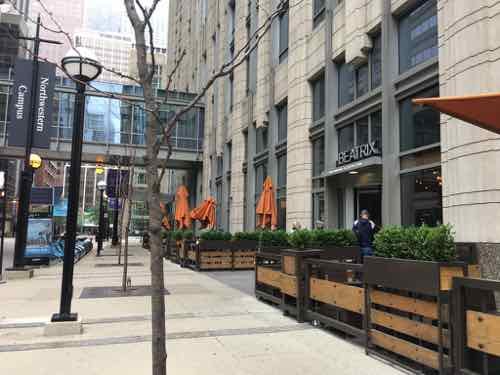
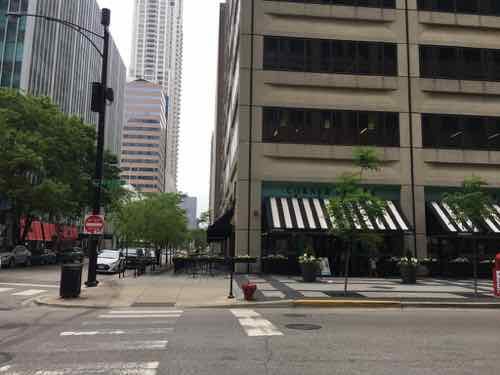
Sidewalk level activities: Many of Northwestern’s buildings, especially newer ones, have “active” ground floors — mostly restaurants.
Street grid: Northwestern didn’t alter the street grid, WUMC/BJC has decimated the grid.
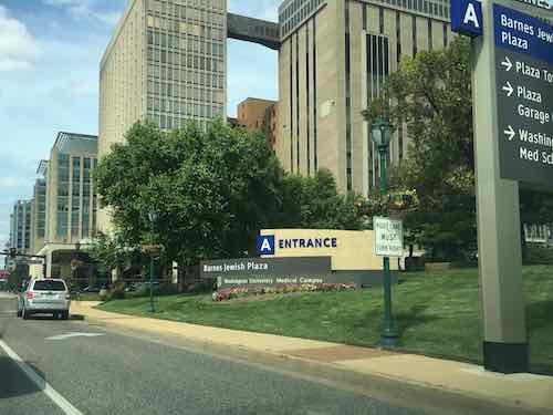
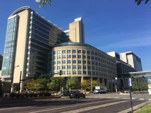
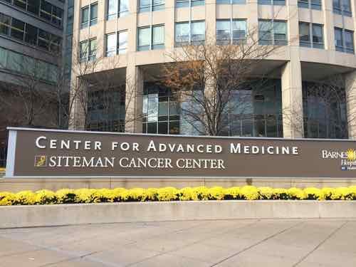
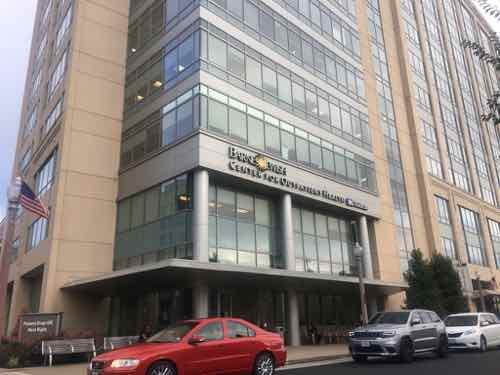
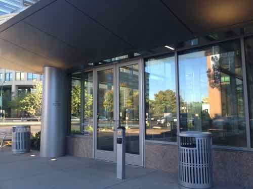
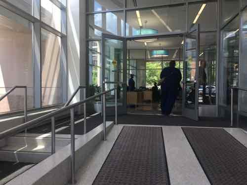
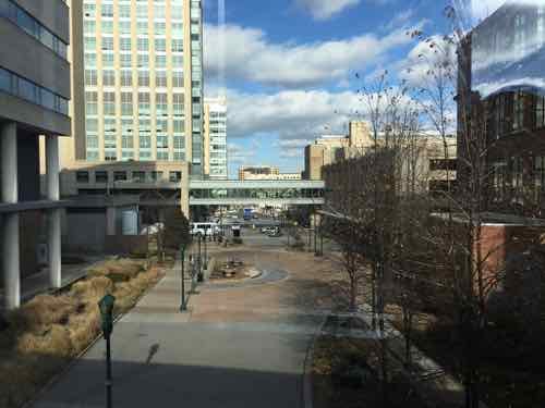
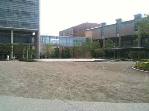
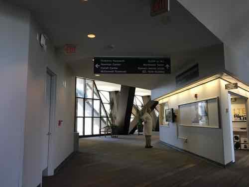
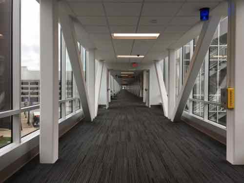
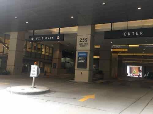
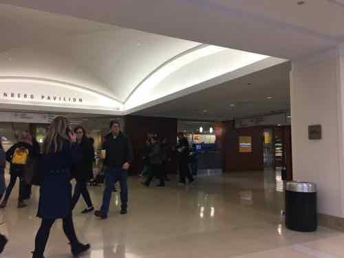
The Center for Advanced Medicine (CAM) building on the SW corner of Forest Park & Euclid avenues is a very busy placeAs a pedestrian you can’t enter the building directly off of either major avenue.Pedestrians have a narrow walk next to the large auto drive to reach the actual entry.The newer Center for Outpatient Health across Forest Park Ave did not repeat the pedestrian access problem of CAM.It is built right up to Euclid. An auto drive for patient drop-off is on the back side.Pedestrians get their own entrance right off the Euclid sidewalk.There’s a change of level but the ramp is wide and direct, the steps are narrower and off to the side. Through the windows you can see the automobile drive & patient drop-off entrance.Looking North on what used to be Euclid Ave., the CAM building is on the left.Looking at the closed Euclid from the WUMC/BJC walkway system — called LINK. Entering LINK from CAM is pretty natural, but the rest is convoluted.Back on the ground for a moment, another closed part of Euclid, the LINK is visible.In the background is the busiest light rail station in Metro’s system. LINK overlooks it, but they don’t connect.This was the view to the North from my hospital room in November 2017.The LINK winds its way around connecting all the buildings.Sometimes it is in a spacious areaThere are a few retail outlets, but not many. There was also a tiny Sprint store.Windows give you a glimpse of where you are.When I was discharged a nurse had to escort me to Metro’s bus transit center because there is no good public route from the BJC hospital to transit! Her card had to be used a couple of times along the way.Finally I’m on my way to the bus. This walkway also connects to massive parking garages for staff.Here we are, the entrance to the garage where the buses converge on the ground level.
Before moving on I should note that I was very pleased with my treatment and all those who took care of me that visit and my other appointments, cataracts surgery, etc.
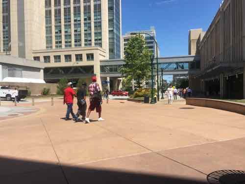
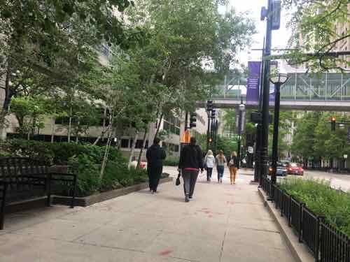
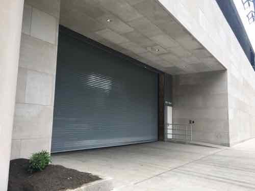
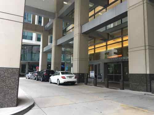
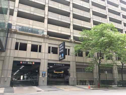
Am ambulance only drive for the emergency departmentAn auto area for the outpatient building next door to where we stay while in Chicago. You can see all the way through to the next block. To the left there are three retail spaces spaces — including on both street corners.The sidewalks are wide with street trees.There are some truly awful buildings along some of the sidewalks. No retail, no life.But old historic buildings, including ones not owned by Northwestern still exist within the street grid.One of the oldest campus buildings is very attractive — much more so than most everything around it.Another example of not everything along the sidewalks was interesting. That’s mostly reserved for the corners at intersections.One of the newest buildings. Being located mid-block it didn’t have any sidewalk retail.Another older building, not exactly inviting.Here is a corner, which is very active.Another cornerAnd another cornerMedical entrance mid-blockAnother auto drop-off areaAn older parking garage with a mid-block entrance
Now let’s go inside their walkway system.
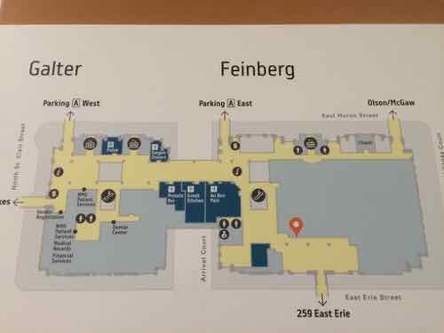
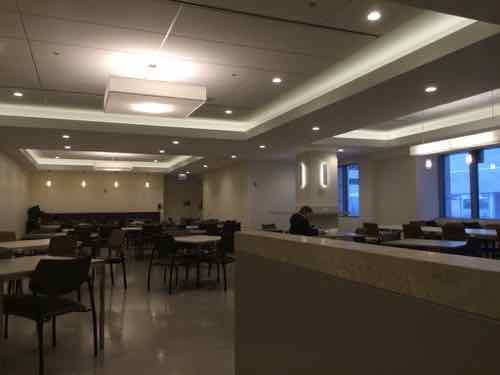
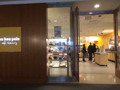
There are numerous maps posted, all showing how to reach the street grid outside and other buildingsBuilding lobbies invite you to the walkway system.An internal intersection in a central building. A couple of food court areas are very close to this point.One of the newest food court seating areas with lots of seatingThere are many different food retailers located along their walkway system, most concentrated in a couple of central areas.Another restaurantTheir walkways always seen to be busy.
CONCLUSION:
Both medical campuses have good & bad buildings. While Northwestern does a far better job activating corners it is the fact they still have corners that explains why the sidewalks are so full of people. The non-medical public, like us, are able to easily get through the campus on the sidewalks or via the enclosed walkway system. Northwestern’s campus isn’t a monolithic fortress to go around — you can go right through it just like you would elsewhere in Chicago.
I’m firmly convinced the many closed streets within St. Louis’ Washington University Medical Campus are largely responsible for the relative lack of pedestrian activity. Short of reopening the closed streets, I don’t think there’s anything we can do to fix the problem.
There’s a lot more detail I’d hoped to include, but I knew I just had to get this post finished. I might do some followup posts.
In the recent non-scientific Sunday Poll readers overwhelmingly indicated they’d consider using Amtrak if trains departed/arrived at St. Louis Union Station.
Q: Agree or disagree: I’d consider taking Amtrak if trains arrived/departed at St. Louis Union Station
Strongly agree: 22 [53.66%]
Agree: 6 [14.63%]
Somewhat agree: 2 [4.88%]
Neither agree or disagree: 5 [12.2%]
Somewhat disagree: 0 [0%]
Disagree: 3 [7.32%]
Strongly disagree: 3 [7.32%]
Unsure/No Answer: 0 [0%]
Well, to the nearly 75% who agreed I have some bad news for you. Amtrak trains will never use Union Station again. Ever.
For more than 28 years I’ve lived in St. Louis I’ve heard people suggesting the return of Amtrak to Union Station and for 28 years I’ve just been struck by a complete lack of understanding about rail service and station design.
The decline of trail [rail] travel began following World War II, as traffic dropped significantly, even while railroads began to update their passenger fleets with new equipment in the 1950s hoping to retain passengers and ward off ever increasing competition from the automobile and airplane (the development of jet propulsion only worsened the situation). Technically, passenger rail travel peaked in this country during the first two decades of the 20th century and slowly declined thereafter, particularly with the onset of the Great Depression. However, it also did not help that President Dwight Eisenhower enacted the Interstate Highway System in 1956 (also known as the National Interstate and Defense Highways Act). By that time railroads were beginning to see the writing on the wall and cutback their services, with most giving it up altogether by the start of Amtrak in 1971. (American-Rail.com)
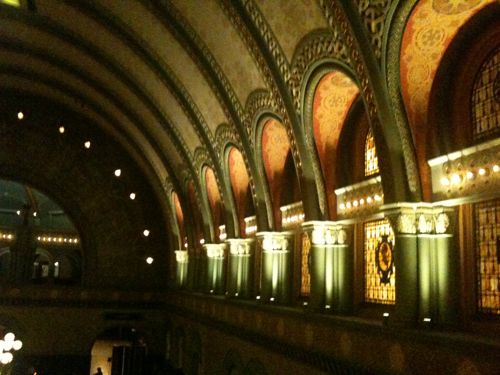
By the time the stock market crashed in 1929 St. Louis Union Station had been open for 35 years. This was a poor time to be the largest U.S. railroad station. The last train pulled out from the huge train shed 49 years later. The main building (from “Headhouse”) hadn’t been used for nearly a decade. With only a few trains per day having such a huge facility made no sense. It would’ve happened sooner if another option existed.
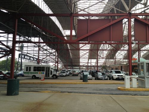
Under the big shed in 2012
You might point out the Kansas City still uses their Union Station for Amtrak service. Yes, yes they do. It’s a through-station, not an end-station.
Through-stations and end-stations are completely different design and planning problems. They generate completely different kinds of space and completely different sensations of arrival and departure. It’s pointless, for example, to compare New York’s dreary Penn Station, a through-station, with magnificent Grand Central, an end-station. They are apples and radishes. (Human Transit)
In the 19th century when 22 railroads built Union Station they correctly saw St. Louis’ population computing to grow. They wanted a facility they wouldn’t outgrow like the original St. Louis Union Station on 12th (Tucker). They decided their station would be an end-station, not a through-station. Half a century later the decline of rail passengers, the failure of passenger rail companies, and the fact Chicago beat St. Louis as the midwest end city meant St. Louis Union Station, a beautiful design, was incredibly obsolete for rail travel.
Kansas City’s Union Station has been able to reutilize most of the building to other uses, with Amtrak using a small part for ticketing and waiting, It’s a short distance out to the platform at the through tracks. From the back of the shed at St. Louis Union Station it’s still a very long distance to the tracks — plus office buildings and the closed movie theater block the path.
In the 70s Amshack was built at the tracks. I recall using this in the 90s. Then a slightly nicer Amshack 2 was built, I used this in the aughts. The station I’ve used the most opened a decade ago…today. Yes, it took until November 21, 2008 to open a proper station. I was there for the ribbon cutting ten years ago, and I’ve been back many times since as a traveling customer.
Comptroller Darlene Green speaking at the opening ten years ago
Over the last decade the maintenance was allowed to get behind, prompting me to label it Amshack 3 in 2017. Thankfully it was improved on my last train trip, in February 2018.
Please understand Union Station is a magnificent asset to St. Louis — but it was last useful as a train station about 75 years ago. Embrace the current station, or use the new Alton Station if you’re headed North on Amtrak. The rail improvements started during the Obama administration have greatly improved the St. Louis to Chicago experience. Stop waiting for trains at Union Station — use the station we’ve had for the last decade.
AARP Livibility Index
The Livability Index scores neighborhoods and communities across the U.S. for the services and amenities that impact your life the most
Built St. Louis
historic architecture of St. Louis, Missouri – mourning the losses, celebrating the survivors.
Geo St. Louis
a guide to geospatial data about the City of St. Louis