Home » Transportation » Recent Articles:

What Will California’s 2035 Ban of Internal Combustion Engine Cars Mean to the St. Louis Region, If Anything?

September 8, 2022 Electric Vehicles (EVs/BEVs), Featured, Politics/Policy, Transportation Comments Off on What Will California’s 2035 Ban of Internal Combustion Engine Cars Mean to the St. Louis Region, If Anything?
A friend’s Tesla Model 3 on South Grand, October 2019

Last month the California Air Resourses Board (CARB) voted to approve new statewide regulations that will gradually reduce the number of passenger vehicles powered solely by gasoline or diesel in their state. They drafted these regulations after California Gov. Gavin Newsome issued an executive order a year ago to make this happen.

”California regulators voted Thursday to ban the sale of all new gasoline-powered vehicles by 2035 as the state looks to aggressively tackle the climate crisis.” (NBC News)

So what will this mean for the St. Louis region? In the short term, very little. In the long term, however, it will greatly impact St. Louis and the rest of North America. Possibly the world. 

First we must understand it’s the federal government, through the Environmental Protection Agency (EPA) that sets nationwide standards for emissions and such. However, unlike the other 49 states and the District of Columbia, our most populous state is allowed to set standards that are stricter than federal policy. The EPA must first issue a waiver for California’s new regulation. It’s highly unlikely the Biden administration will attempt to block it. Still, a GOP lawsuit is challenging California’s right to set a stricter emissions standard. 

As the most populous state California is also the biggest car market in the nation, its population is more than double Missouri & Illinois combined!  In the past the following states have opted to follow California’s stricter standards: Connecticut, Delaware, Maine, Maryland, Massachusetts, New Jersey, New Mexico, New York, Oregon, Pennsylvania, Rhode Island, Vermont, Washington state and Washington D.C. So far two stated, Massachusetts and Washington, have already indicated they will follow California’s lead. The combined vehicle sales in this states is huge! Combined with future ICE vehicle bans in Europe and the world’s largest car market (China) that is pushing EVs it’s clear new internal combustion engines will be rare before 2035 arrives.

It will be very challenging, but auto manufacturer’s line ups will meet these higher standards…for everyone, essentially becoming a national standard. Some have suggested by 2035 there will be nearly zero consumer demand for ICE vehicles. This new rule will rapidly accelerate the transition to electric vehicles.

Let’s look closer at California’s 2035 ban on fossil fuel vehicles. First, it doesn’t mean they’re banning existing gas powered vehicles — they can be driven, and used models can be bought & sold.

“Starting with 2026 models, 35% of new cars, SUVs and small pickups sold in California would be required to be zero-emission vehicles. That quota would increase each year and is expected to reach 51% of all new car sales in 2028, 68% in 2030 and 100% in 2035. The quotas also would allow 20% of zero-emission cars sold to be plug-in hybrids.” (CNN)

While 2035 model year vehicles are still a dozen years away,  2026 models are will be here in just 3 years! To scale up production manufacturers will need to sell EVs beyond states with an EV mandate, though if supplies are limited the inventory will go to those states so they meet the requirements.

 By 2025 plug-in hybrids (PHEVs) must achieve 50 miles in pure electric mode — a substantial increase from the 18-25 miles seen in current PHEVs. In the last decade a lot of PHEVs were only available in California, going forward expect more to be nationwide. Motorcycles and large trucks will be regulated separately, with a longer time frame.

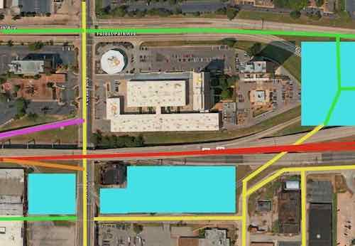
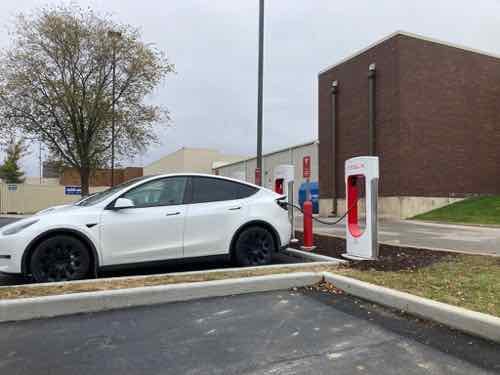
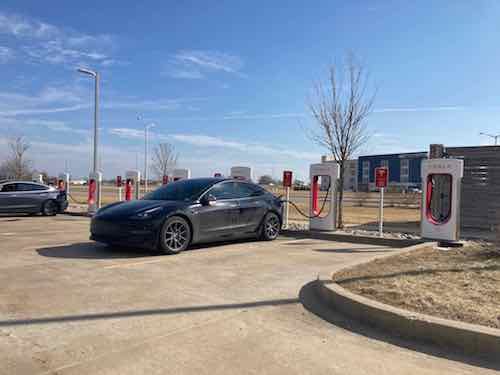
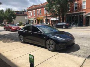
Dealerships in the St. Louis region will offer more EVs, and fewer fuel burning vehicles. They’ll also need to renovate their facilities to be able to charge & service the electric cars they’ll be selling. The selection of EVs will rapidly increase, just as the selection of new gas vehicles will decline. Municipalities like St. Louis with many residents parking on city streets will need a way to charge their vehicles. 

Businesses that depend on gas vehicles will need to reinvent themselves. For example, places that do oil changes, radiator flushes, and transmission work will consolidate — fewer will be necessary. Something else will occupy that real estate in the future.

QuikTrip in Granite City, IL. February 2011.

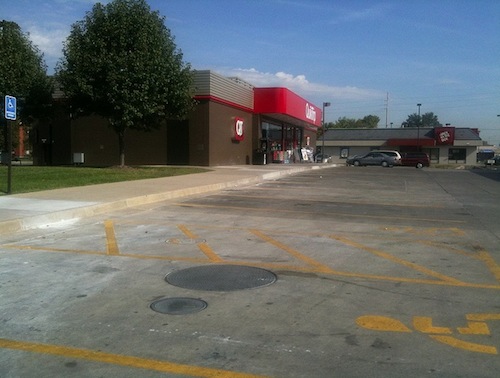
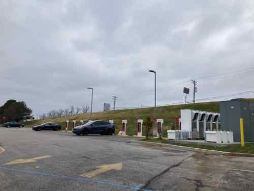
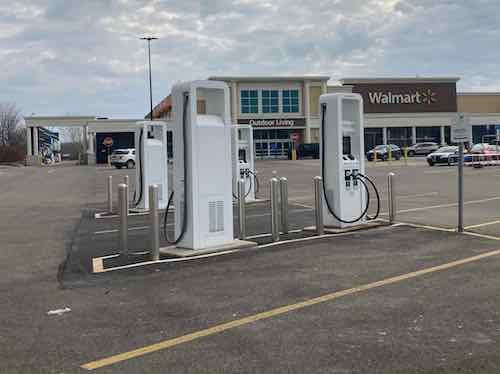
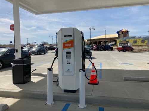
Gas stations make very little money from fuel, their profit comes from the convenience store portion of the business model.  Many are owned by individuals living in our region, not corporations in other states.  Those located near interstates can add high speed charging points to lure travelers to stop and spend money while replenishing their batteries.

Some gas stations will close. Eventually we’ll see gas deserts with few options for filing up that classic 2020 Toyota Corolla you’re driving until it dies. Auto parts stores will still be around for a long time, but they can’t survive on selling wiper blades.

At the start of the 20th century a major restructuring happened as the change from horse & buggy to cars took place. Jobs building carriages, caring for horses, etc went away. Such a restructuring is beginning now, with this mandate.

Those of you alive in 2040, 2050 will be part of a different St. Louis. It’s impossible to predict how it will all play out, but rest assured things won’t be static. The combination of vehicles going electric and the temperatures getting hotter will necessitate physical changes.

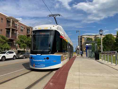
I hope the region will occupy less total land in the future, with considerably less impervious surfaces per capita. Hopefully the entire region will see a much higher use of public transit.  And yes, our electrical grid will need to improve.  Users will also need to learn to minimize using electricity during periods of peak demand.

Exciting times.

– Steve Patterson


Rethinking Interstate 64 (aka U.S. 40) In Midtown St. Louis, Between Compton & Grand

August 15, 2022 Accessibility, Featured, Midtown, Planning & Design, Transportation, Walkability Comments Off on Rethinking Interstate 64 (aka U.S. 40) In Midtown St. Louis, Between Compton & Grand

Regular readers know I have a strong dislike of the interstate highways that were forced through existing dense urban neighborhoods, destroying social networks and dividing neighborhoods. So it’s no surprise I’ve thought about I-64 in Midtown St. Louis for decades.

Aerial of the vast area immediately west of Compton. Source: Apple Maps. Click image to view area in Google Maps.

It was August 2021 when I learned MoDOT would be undertaking the huge task of rethinking the stretch of I-64 between Jefferson and Kingshighway.  Nine months later, in May 2022, the Future 64 planning project finally went public:

The I-64 Corridor between Kingshighway and Jefferson is an essential route for homes, schools, and businesses. The Missouri Department of Transportation (MoDOT) is working with the community to determine the future of the corridor in terms of needs and desired outcomes. Before MoDOT makes any improvements to the corridor corridor, it will evaluate the existing conditions of roadways, interchanges, surface streets, and bicycle/pedestrian access.   

The method the department is using is formally known as a Planning and Environmental Linkages study or PEL. This PEL study will look at the potential impact future projects will have on the environment, the community, and connectivity in the area. MoDOT is conducting the PEL now so when funding is identified for corridor projects, construction can begin sooner.

The PEL study for the I-64 central corridor is called: Future64: Community. Transportation. Together. The title reflects the importance of public engagement and community involvement in this process. As a result, this study will incorporate ongoing engagement that is equitable and inclusive to help ensure that a wide range and extensive number of voices are heard, and that equity is the focus of proposed solutions. (MoDOT/Future64)

Typically MoDOT doesn’t take the time to rethink, they just replace what was there. Example: the South Broadway bridge over I-44 downtown being replaced without any pedestrian sidewalk (see This Is Our Chance To Reconnect Two Neighborhoods Long Separated By Highways).

So this planning effort is an important milestone.

After the project went public some immediately began posting their ideas, but I’m a little slower in both my analysis and presentation.  Now, a year after I began thinking about specifics, I’m ready to share what I’ve come up with — and why.

First we need to look back at what the area looked like pre-interstate. In February 1909 if you were heading west on Market and reached Jefferson the main road bent to the left but became Laclede. Market west of Jefferson was a minor residential street. Between Beaumont & Leffingwell the road split again, with Laclede continuing ahead and Manchester off to the left. To repeat: Market briefly became Laclede, which split off to Manchester at a diagonal. Yes, Manchester used to run at a diagonal heading through what later became known as Mill Creek Valley toward downtown.

From the February 1909 Sanborn map we see Manchester, not Market, intersecting with Compton. Click image to see the full page view on the University of Missouri digital library website.

Go ahead, look at a map and visually draw a line between Manchester & Vandeventer and Compton & Market. Because of the many rail lines Manchester wouldn’t have been a straight line, it would have bent to the north of them. My point is a century ago streets continued uninterrupted, but highways/interstates (and industrialization) radically altered the landscape to make life easier for those behind the wheel of those noisy new horseless carriages (shaking cane). It’s possible the Manchester  connection was severed prior to the highway but I didn’t want to further delay this post while searching the Post-Dispatch archives for the answer.

It’s a given that I-64/U.S. 40 will not be removed, or buried in a big dig. What is happening now will determine how it looks and functions for the next 50-70 years. Next we need to list and look at what I see as the problems to solve by changing how the highway and interchanges are currently configured.

  • Large amount of land used, wasted
  • Pedestrian & bicycle navigation of area is challenging, nearly impossible, the local street network decimated
  • Driving the area is also challenging, with awkward & confusing on/off ramps
Looking west northwest from Compton & Spruce…if only I had a drone to get video/aerial photos
The Grand exit from eastbound I-64 may have made since in the 1950s/60s but not today
After a right right turn back drivers that exited eastbound I-64 are facing west at Grand

Okay, here’s my proposed solution.

Below I’ll look at this in two sections. Click image to view larger version.

Key:

  • Yellow: existing streets
  • Green: new or revised streets
  • Red: interstate
  • Purple: existing ramp
  • Orange: new on/off ramps
  • Light blue:

Let’s start on the left/west side.

The biggest change from the left is the awkward existing Grand exit from eastbound I-64 has been replaced by a more conventional ramp. Drivers would be going up as they exited, but that would help them slow down. With the current ramp gone the building right at Grand & I-64 could be incorporated into a new development on reclaimed land. I’d also bring Forest Park Ave up to grade at Grand for a more conventional intersection.
The new exit would come up to Grand, the light could be moved. If the elevated section is completely replaced it would make this easier. The new eastbound exit would be similar to the one at 14th — just up instead of down.
Removing the current exit would free up a lot of land that can be used for new construction near the Grand MetroLink station and the heavily used #70 Grand MetroBus.
With Forest Park ducking under Grand the intersection on top is awkward for drivers, bicyclists, and pedestrians. As with Forest Park & Kingshighway, this intersection needs to be at grade and conventional.

Ok, lets move down to the big area to the east.

It makes sense to continue to allow interstate drivers in both directions an exit in this area. but it can be accomplished in a far more compact manner.  Specifics below.

The two green circles are roundabouts. Market Street could continue into the center of the newly developed area. Ideally 5+ story building would be built as a terminus to the view when heading west on Market. A new north-south connection through the new development would allow access to Spruce Street and the other parts south of I-64. The eastbound lanes of I-64 would need to be shifted north to give room for the on/off ramps at roundabout at Compton & Spruce. The westbound lanes of I-64 can shift south to free up land for development.

I’m not a traffic/civil engineer so I might not have sufficient room for say acceleration/deceleration on on/off ramps or some other detail, but I think this accomplishes the job of fixing the current problems. It gives more room for development, and increases connections for all modes of travel.

I’d love to see the new development include a variety of residential price points from low income to top market rates, parking available at a rate of less than one space per dwelling unit. It shouldn’t all be expensive housing geared toward college students. Other uses include office, retail, small manufacturing, perhaps business incubator space, etc.

I don’t know that I’ll live long enough to see any changes, but hopefully these ideas will be helpful to the process.

— Steve Patterson


EV Passed Sales Tipping Point and EV Charging Coming to Biggest Truck/Travel Stop Chain

July 19, 2022 Electric Vehicles (EVs/BEVs), Featured, Transportation Comments Off on EV Passed Sales Tipping Point and EV Charging Coming to Biggest Truck/Travel Stop Chain

Couple of big items in the recent news about electric vehicles (EVs) means I’ve got to stop procrastinating on several posts about EVs, specifically EV charging. Most EV owners charge at home, overnight while sleeping. The sore subject of EV charging for renters and home owners without off-street parking is for a future post.

Today is the first of a couple of posts on driving an EV between metropolitan areas. As stated above, a couple of things are changing regarding EVs:

The U.S. is the latest country to pass what’s become a critical EV tipping point: 5 per cent of new car sales powered only by electricity. This threshold signals the start of mass EV adoption, the period when technological preferences rapidly flip, according to the analysis.

For the past six months, the U.S. joined Europe and China — collectively the three largest car markets — in moving beyond the 5 per cent tipping point. If the U.S. follows the trend established by 18 countries that came before it, a quarter of new car sales could be electric by the end of 2025. That would be a year or two ahead of most major forecasts. (Financial Post)

I know 5% isn’t much, but Merriam-Webster defines a tipping point as “the critical point in a situation, process, or system beyond which a significant and often unstoppable effect or change takes place.” EV adoption will now pick up, it’s no longer just early adopters.

Again, most EVs are charged at home, or sometimes at work. It is when you want to travel outside your metropolitan area that you need to think about using a public charger. Like EV sales, charger networks are quickly growing, though still small.

Tesla superchargers on the outer edges of the South County Center parking lot. Near I-55 & I-255/270. December 2020
Tesla superchargers behind the Brentwood Target, near I-64/I-170. November 2021
Tesla Suprechargers in a sporting goods store parking lot in Springfield IL, near I-72 & I-55. March 2022

Electrify America is one of the leading charging networks, with the more connections at speeds of 150-350kW than any other charging network. It’s a subsidiary of Volkswagen, part of their settlement for the dieselgate scandal.

As part of a consent decree reached with United States officials in 2016, Volkswagen agreed to numerous actions, with US$2 billion in total, to promote electric vehicle use over 10 years to atone for the additional air pollution it caused. One aspect of the program was a pledge to establish a public electric vehicle charging network.

The Electrify America brand was unveiled in January 2017, along with its first phase of station buildout. Its first station opened in May 2018, in Chicopee, Massachusetts. In 2022, Siemens became its first external investor with a minority shareholder stake and a seat on the board. (Wikipedia)

Most of the Electrify America (EA) chargers I’ve seen are located in Walmart Parking lots, which are spacious and often near interstate highways. All non-Tesla EVs can use their chargers without an adapter. Thus, many non-Volkswagen EV manufacturers have embraced the network. Examples include Ford, Hyundai, and EV-only VinFast.

Electrify America EV chargers in the parking lot of a Walmart in Springfield IL, near I-55 & I-72.. March 2022

General Motors is going a different direction, one that will dramatically increase the number of direct current (DC) chargers nationally:

GM and Pilot Company are employing EVgo, which, with over 850 locations, is the most extensive fast-charging network in the country. EVgo will install, operate, and maintain GM and Pilot Company’s charging network through its eXtend program, with the first wave of chargers expected to be operational by 2023. Along with the EVgo logo, the chargers will be branded with both the Pilot Flying J logo and GM’s charging brand, Ultium Charge 360. (Car and Driver)

This is a smart move by GM, Pilot, and EVgo. Why? General Motors wants to become the leading seller of EVs in North America, while Volkswagen Group (VW, Audi, Porsche, and others) wants to be the worldwide leader. VW’s Electrify America and Electrify Canada networks are part of their strategy for dominance.  So it makes sense GM would want to be a part of a competing charging network.

Pilot/Flying J is among the  biggest chain of travel/truck stops, with 550 “locations in 44 states and six Canadian provinces.” Fuel sales drive sales of food, drinks. They clearly recognize the need to diversify so they can also attract travelers in EVs. The EVgo network has been around a while, in St. Louis you’ll see their chargers at Commerce Bank locations — not convenient to interstate travelers. This deal gives EVgo access to large travel center real estate very close to interstate exists, something it very much needed.

Locating chargers at facilities open 24 hours a day give users a chance to use the restroom, get a bite/beverage, etc. Very different from current chargers, including Tesla’s extensive supercharger network.

Adding EV charging  to 500+ existing travel centers isn’t going to be cheap, but this is a part of GM’s $750 million dollar investment in EV charging infrastructure. A major investor in Pilot is Berkshire Hathaways (Warren Buffet). Other travel centers/stops like Oklahoma City-based Love’s will likely quickly form similar partnerships.

50kW chargers at Wally’s in Fenton, near I-44. April 2022.

You might be thinking about non-semi centers like Buc-ee’s and the new copycat Wally’s, the latter with a location along I-44 in Fenton MO.  Well, the well-known Buc-ee’s chain partnered with Tesla to bring their supercharger network to its locations in numerous southern states. Tesla will eventually open their network to non-Tesla EVs. Where does that leave the two locations of Wally’s and frankly most of EVgo’s network?

In the slow lane.

Let me explain what I mean by slow lane. Let’s suppose you get a new 2022 Hyundai Ioniq 5 with its very fast 800 volt architecture and want to take a road trip.  The 6-figure Porsche Tycan is the best-known example of an EV with 800v architecture, the Hyundai & cousin Kia EV6 are the lowest priced EVs sold in North America with very fast 800v architecture.

If you stop at a charger with a rate of 150kW-350kW your stop will be considerably shorter than had you stopped at a 50kW charger.

Going from 15% to 66% on 150kW+ would require just 15 minutes of charging time.

On the other hand, at 50kW going from 30% to 100% would require 70 minutes.  To be fair as batteries get toward 100% the rate of charging does slow.

Additionally Wally’s two locations doesn’t use one of the major charging networks, or accept major credit cards. Instead you have to download another app onto your smartphone, add funds to that app, then use the app to charge your EV. Just downloading, setting up, and funding a new app would require more than the 15 minutes spent charging at Electrify America.

The followup to this post will be on the subject of planning a road trip in a variety of EVs, comparing route planning apps, charging networks, and technology.

No, we’ve not bought an EV.  I’ve just finally gotten somewhat of a handle on the topic.

— Steve Patterson


Potential North-South & County Light Rail Line Should Include ‘Green Track’

June 30, 2022 Environment, Featured, North City, Planning & Design, Public Transit, Transportation Comments Off on Potential North-South & County Light Rail Line Should Include ‘Green Track’

No, I don’t want the rails to be painted green. Instead I want the space between the rails to be green with vegetation, where possible.

Why? Aesthetics, cooler temperatures, management of stormwater runoff, etc.

Pre-Katrina you could see natural green track in New Orleans LA, April 2004

Green track isn’t limited to only historic lines, it’s increasingly common in Europe with some limited use in North America.

Over more than 6 (six) decades Green Tracks are popular through out Europe in dense urban areas. They are a fantastic tool to mitigate stormwater issues, to reduce noise and certainly to beautify their integration. Green light rail tracks demonstrate environmental responsibility and they value their customers by making things nice, green and beautiful. Today there are over 500 miles of Green light-rail tracks in Europe.

The living green layers within and around the tracks reduces the noiseand absorbs stormwater. Thus, reducing combined sewer overflow. Modern track systems are typically Ballastless Tracks or Slab Track systems. Basically, a traditional elastic combination of ties/sleepers and ballast is replaced by a rigid construction of concrete or asphalt. Because such systems are ideal for greenery, it is even possible to create additional stormwater retention and detention from surrounding impervious areas with the system.

Already, in 1995 Green Roof Technology filed patents for greening systems on Ballastless Track systems. Currently there are around 300 miles of green tracks in Germany alone. As a result, these tracks eliminate at least 150,000 gallons of water per years from entering the combined sewer system.

In North America, Baltimore started with some experimental Green Light-rail Tracks in 2011 insisting on Sedum mats. The testing was less promising because Sedum mono-cultures are not a good choice for most green light-rail track system. Unfortunately the advice from Green Roof Technology using a smart mixtures of grasses, herbs and wildflowers was not heard. Some call it learning by doing – well – they just don’t do it. (Green Roof Technology).

Typically rails are supported by ballasts, treated wood or concrete pieces set into the ground perpendicular to the rail. Our original 1993 light rail line used wood ballast, the 2006 Shrewsbury extension (aka Blue) line was constructed with longer-lasting concrete ballasts.

Our current lines are Red & Blue so naturally I’d like this new line to be the Green Line. Green track for the Green Line!

It can’t be everywhere, but in many places it can be. A lot of the new line would be in the center of Natural Bridge, which recently went through a quick traffic calming project that reduced vehicle travel lanes to one per direction. Adjacent to Fairgrounds Park the center is green — would be greener if not on top of asphalt.

Looking east toward Grand
Looking west from the same location.

I think the green looks nice, helps keep the area slightly cooler.

While we’re on the subject of alternatives to impervious concrete, another would be water — yes, wet track! Rail going through a fountain…

Not sure if or where this might work, but I think it’s very interesting. Perhaps on Jefferson near the stop near Olive or Market? Guests in new hotels could look down from their rooms and see transit & water converge.

I’d just like us to consider something other than boring ordinary impervious paving.

— Steve Patterson


North-South MetroLink Study Update Looking To Stay On Jefferson Avenue, Avoid Previously Planned Circuitous Route

June 16, 2022 Environment, Featured, Planning & Design, Public Transit, Transportation Comments Off on North-South MetroLink Study Update Looking To Stay On Jefferson Avenue, Avoid Previously Planned Circuitous Route

The idea of a North-South MetroLink light rail line has been discussed for many years — too many. We’ve had a couple of studies and locally preferred alternatives over the 15+ year period. Currently Metro is looking at the most recent and “tweaking” it to make it work financially with the city funds from our transit tax. So when I heard this would be included in the Citizens for Modern Transit (CMT) June “Talking Transit” online event I immediately registered. It took place a week ago, but it’s online — link in a moment.

The last alternative was eastbound on Natural Bridge, coming south on Parnell/Jefferson to Cass (to include the large NGA workforce), east to 14th, eventually to 10th, back over to 14th, west on Chouteau, south on Jefferson.

2018 detail map showing the North-South MetroLink in orange. This is no longer possible because of the convention center expansion project closing 9th street.

So basically on Jefferson north of Cass and south of Chouteau, but taking a highly circuitous detour to go through downtown — and briefly east of Tucker.  The distance between those two points on Jefferson is 1.6 miles — in basically a straight line that would require no left or right turns.m

In a 2006 post I suggested a modern tram route on Jefferson, with a new MetroLink station where Jefferson crosses over the existing light rail line, so riders could transfer between lines. Well 16 years later they’re looking at doing basically just that — run in-street light rail on Jefferson with the addition of a MetroLink station at Jefferson. This was disclosed by Bi-State Development President & CEO Taulby Roach at 3:23 in CMT’s event a week ago (watch 0n YouTube).

Bi-State graphic, the orange-yellow mostly vertical line in the center shows the initial phase being evaluated now.  The pink sections are “areas of persistent poverty.”


With the NGA, Centene Stadium (MLS) and planned new hotels (Jefferson & Market) this a hot corridor.

The rail wouldn’t be a tram in mixed traffic, it would be in a separate dedicated center section, still low-floor though. The vehicles for both are nearly identical. In-street light rail vs tram basically means dedicated right-of-way and fewer stops, to improve overall speed.

Obviously I’ve long thought a stop at Jefferson on the original MetroLink was a good idea — the distance between the Union Station & Grand stations is just so excessive. I often talk about focusing on corridors, not circuitous routes, and Jefferson is an obvious corridor for a transit project.  It’s not a perfectly straight line, but it would eliminate a huge amount of turns.

Like previous North-South studies, the idea of going out west on Natural Bridge allows a future phase to connect into North County. This could help get county residents to employment opportunities at NGA, and in Downtown West/Midtown.

The American-made Brookville Liberty vehicle can go off-wire for short distances. Dallas TX April 2015

The study update is looking at the latest low-floor vehicles to use. Because of some tight points they’re looking at vehicles that could run for short distances on battery, with the usual catenary most of the distance. This is called off-wire. An example is the Brookville Liberty, in use in cities like Dallas, Milwaukee, and Oklahoma City.  I have no idea which specific vehicles Metro is considering, but the technology to go without a catenary for a short distance is proven.

Interior of Brookville Liberty with low center section and step up seating at each end. Dallas TX, April 2015.
Brookville Liberty at a stop in Milwaukee WI, June 2021
Low-floor center section of Brookville Liberty makes boarding easy. June 2021.

I’d hoped to have visited Oklahoma City by now and ride their Brookville Liberty vehicles., but rental cars & flights have just been too expensive. Again, I’m not sure what vehicles Metro is considering, this is the only off-grid vehicle I’ve ever ridden before.

In the CMT event on Zoom Taulby Roach indicated they’re planning on closed platforms  — having to pass through a fare gate to reach the platform.  This coincides with Metro’s platform project to install fare gates at all MetroLink stations in Missouri & Illinois.

Hopefully Metro’s latest look at North-South rail will result in actual construction, eventual operations.

Steve Patterson


Advertisement


[custom-facebook-feed]

Archives

Categories

Advertisement


Subscribe