Home » Transportation » Recent Articles:

New Book — ‘Curbing Traffic: The Human Case for Fewer Cars in Our Lives’, by Melissa Bruntlett and Chris Bruntlett

September 24, 2021 Books, Featured, Transportation Comments Off on New Book — ‘Curbing Traffic: The Human Case for Fewer Cars in Our Lives’, by Melissa Bruntlett and Chris Bruntlett

This is the first of three books I received in July, so they’re newish. My health insurance is better now so I’m getting caught up.

I’ve posted before about my interest in electric cars, but also interest in and use of public transportation. My electric “vehicle” is a 2008 power wheelchair which I use in combination with public transit. The able-bodied can use a bike with transit, instead of a wheelchair.

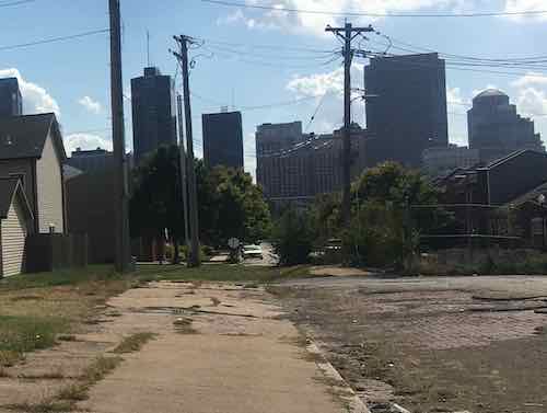
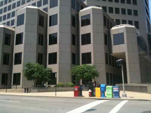
Like so many others, I realize switching all internal combustion vehicles for electric ones isn’t going to solve the major problems with the automobile: they require a lot of space, for example.  Today’s newish book looks at reducing the number of cars on our roads and filling our cities on huge surface lots or parking structures.

In 2019, mobility experts Melissa and Chris Bruntlett began a new adventure in Delft in the Netherlands. They had packed up their family in Vancouver, BC, and moved to Delft to experience the biking city as residents rather than as visitors. A year earlier they had become unofficial ambassadors for Dutch cities with the publication of their first book Building the Cycling City: The Dutch Blueprint for Urban Vitality. [see August 2018 post on their first book here.]

In Curbing Traffic: The Human Case for Fewer Cars in Our Lives, Melissa and Chris Bruntlett chronicle their experience living in the Netherlands and the benefits that result from treating cars as visitors rather than owners of the road. They weave their personal story with research and interviews with experts and Delft locals to help readers share the experience of living in a city designed for people.

In the planning field, little attention is given to the effects that a “low-car” city can have on the human experience at a psychological and sociological level. Studies are beginning to surface that indicate the impact that external factors—such as sound—can have on our stress and anxiety levels. Or how the systematic dismantling of freedom and autonomy for children and the elderly to travel through their cities is causing isolation and dependency.

In Curbing Traffic, the Bruntletts explain why these investments in improving the built environment are about more than just getting from place to place more easily and comfortably. The insights will help decision makers and advocates to better understand and communicate the human impacts of low-car cities: lower anxiety and stress, increased independence, social autonomy, inclusion, and improved mental and physical wellbeing.

The book is organized around the benefits that result from thoughtfully curbing traffic, resulting in a city that is: child-friendly, connected, trusting, feminist, quiet, therapeutic, accessible, prosperous, resilient, and age-friendly.

Planners, public officials, and citizen activists should have a greater understanding of the consequences that building for cars has had on communities (of all sizes). Curbing Traffic provides relatable, emotional, and personal reasons why it matters and inspiration for exporting the low-car city. (Island Press)

This isn’t about eliminating all cars, just moving to fewer cars than today. Here are the authors explaining their view:

You can read the full introduction and much of the first chapter (The Child-Friendly City) on Amazon. (Kindle preview is longer than the softcover preview.)

— Steve Patterson


Few Exposed Brick Pavers Covered With Asphalt

June 10, 2021 Featured, North City, Transportation, Walkability Comments Off on Few Exposed Brick Pavers Covered With Asphalt

Most older streets in St. Louis were paved in cobblestones or paver bricks, few exist anymore.  Asphalt paving is significantly smoother, just far less attractive. In 1953 the Cochran Gardens high rise public housing complex opened, but construction closed off 8th Street between O’Fallon Street and the alley south of Cass Avenue. Eighth Street was reopened when the high rise towers were replaced with the mixed-income Cambridge Heights townhouses & apartments, except 8th wasn’t connected through to the little stub of a street to Cass.

This October 2, 2019 view is looking south on 8th from Cass. You can see the land just after the alley, Cambridge Heights, and the downtown skyline on the horizon. In the foreground you can see brick pavers. It looked like it had been paved over decades ago, but most was long gone so the old bricks were exposed.
On May 5th I returned home tfrom a press conference at the Chain of Rocks water treatment plant to see city crews paving over the small amount of bricks.
Closer view
A couple of days later I went back to see the finished results.The concrete in the foreground was part of the new river bridge project, when Cass was raised in height over the interstate.

This half block of 8th Street gets very little traffic, the uniformity of the asphalt paving does look better than it did with patches of old asphalt and broken bricks. This is better, but I still miss seeing the bricks.

— Steve Patterson


The 9th/10th One-Way Couplet Needs To Return To Two-Way ASAP

May 25, 2021 Downtown, Featured, Planning & Design, Transportation Comments Off on The 9th/10th One-Way Couplet Needs To Return To Two-Way ASAP

More than six decades ago 9th & 10th streets were changed from two-way to one-way in the opposite directions — a one-way couplet. This still exists from Clark Ave on the south to Cass Ave on the north — a distance of 1.2 miles. The north end used to continue past Cass to connect to I-70, but it was shortened when construction on the newest bridge over the Mississippi River began approximately 15 years ago. The south end still connects to I-64 ramps.

The purpose of one-way streets decades ago was to quickly get cars into downtown in the morning, then back out after work. They did their job…a little too well. Downtown was so quick to empty out nobody stuck around for shopping, dinner, or a show. There many reasons why downtowns emptied out, but one-way streets were a major contributor. To make downtown St. Louis enjoyable as a place to live, work, and visit all the one-way streets need to return to two-way traffic eventually. When Locust Street west of 14th switched back to two-way a dozen years ago it made a huge difference.

For nearly 50 years  9th & 10th extended north of Cass Ave to connect to I-70, but that ended with the 2010 start of a new bridge over the Mississippi River, later named the Stan Musial Veterans Memorial Bridge. But downtown 9th & 10th weren’t the original couplet of paired opposite direction one-way streets.

Let’s look at the original one-way couplets in the downtown central business district (Arch to 12th/Tucker):

  1. Northbound 4th & southbound Broadway (aka 5th)
  2. Southbound 6th & northbound 7th
  3. Southbound 8th & northbound 9th
  4. Southbound 10th & northbound 11th

The first still exists today, the rest have all been changed to the point they no longer function as original intended. Three streets lots blocks to the convention center & dome: 6th, 7th, 8th. Ninth will soon be added to that list.  Sixth street lost blocks to Kiener Plaza & the hotel south of Market. Both sixth & seventh streets lost blocks to the original downtown Busch Stadium (now Ballpark Village), and the current Busch Stadium. And finally northbound 9th Street is closed for one block between Market & Chestnut because the designers of Citygarden didn’t think about a pedestrian signal at 9th & Market. D’oh!

I’ve posted about changing these opposite one-way streets back to two-way traffic numerous times, but now it’s urgent. When the convention center expansion begins a couple of blocks of 9th will be closed, but that’s not the urgent reason for restoring two-way traffic. The vacant AT&T Tower downtown at 909 Chestnut (bordered by 9th, Chestnut, 10th, and Pine) is why these streets need to revert to two-way traffic. Why?

909 Chestnut was built at the headquarters for Southwestern Bell Telephone, later purchased by AT&T

The entrance and exit to the small underground garage was designed with the one-way streets in mind, the entrance was off northbound 9th and the exit was onto southbound 10th. The 44-story building has been vacant since 2017, but eventually someone will renovate it. When they do it would be easy to switch the entrance and exit. If the building is renovated while 9th & 10th are still one-way it’ll be impossible to make them two-way in the future.

The original entrance off nb 9th could be an exit after future renovations.
The original basement entrance could just as easily be the exit.
On the opposite side of the building we have the original exit onto sb 10th. Again, this could easily be the entrance if 10th was two-way.

Since built, exiting traffic has come out southbound just before Chestnut. Switching the exit from 10th to 9th wouldn’t change this potential conflict point.

The building has lost value and changed hands numerous times, eventually someone is going to renovate it. 

The 1.4 million-square-foot, 44-story office building on Chestnut Street is the largest office building by square-footage in the region, and the 1986 structure built for a single tenant has posed a vexing challenge amid a downtown market already struggling with the highest office vacancy rate in the metro area. 

AT&T vacated its lease in September 2017 and about 2,000 of the company’s employees relocated nearby in buildings at 801 Chestnut and 1010 Pine streets. (Post-Dispatch, May 2019)

For comparison here are some other large vacant buildings downtown

Since 909 Chestnut was built as a headquarters it was connected to buildings to the east & west. Another block west was a large company parking garage. The garage under 909 Chestnut is small, was built for service vehicles and company executives. A MetroLink light rail station is only a block away, but parking obsessed assumes everyone has a car.

The building footprint is too small to ramp up to use some upper floors for parking. A car elevator or automated system are the only options to get cars up higher, but they’re very costly.

Eventually someone will figure it out. When they do 9th & 10th should be two-way traffic.

— Steve Patterson


Hodiamont Streetcar Ended Service 55 Years Ago, Right-of-Way To Become Trail

May 21, 2021 Featured, Public Transit Comments Off on Hodiamont Streetcar Ended Service 55 Years Ago, Right-of-Way To Become Trail

Fifty-five years ago today the last streetcar ended service. That line was the Hodiamont. West of Vandeventer Ave. it ran on a private right-of-way, not mixed with vehicles on the street.

Looking East on the last eastern section of the Hodiamont Right-of-Way, 2012

For a time after the last streetcar Metro (then known as Bi-State Development Agency) ran a bus down the private strip.  The bus was a huge improvement over old fashioned streetcars — faster, quieter, flexible, etc.

Not sure when buses stopped using the Hodiamont right-of-way. Currently Great Rivers Greenway is working on making it a trail.

The Hodiamont Tracks were once the route of a streetcar line and in later years a bus route.  While the bus route is no longer active, the 3.5 mile corridor has the potential to become a greenway that would link the St. Vincent and the future Brickline Greenways. (GRG)

In the ideal world a new streetcar/light rail line would occupy this corridor as it snakes through neighborhoods.

I’d love to go back in time to ride the streetcars and see the neighborhoods at their peak. Of course, I’d also have to see the segregation of housing and transportation.

— Steve Patterson


Auto-Centric Pandemic, Vaccine Site Adjacent To Light Rail Station Didn’t Mention Using Transit

March 25, 2021 Central West End, Featured, Public Transit, STL Region, Transportation Comments Off on Auto-Centric Pandemic, Vaccine Site Adjacent To Light Rail Station Didn’t Mention Using Transit

The previous 12 months have highlighted how auto-centric the United States is. So far during this pandemic we’ve seen drive through food banks, and COVID-19 testing. Each with cars backed up for miles. To keep the cars on the road there were also lines at licensing offices.

From May 28, 2020:

On Friday, May 29 CVS Health will open 22 new COVID-19 drive-thru test sites across Missouri, including locations in St. Louis.

CVS Health expects to have up to 1,000 locations across the country offering this service by the end of May.

The testing will be by appointment only. You won’t go into the store, but sit in your car and administer the test. (Fox2)

From June 11, 2020:

Many St. Louis-area residents endured long lines and waiting times at licensing offices Thursday, which recently re-opened due to COVID-19 worries.

Thursday, a News 4 crew found some people who waited several hours at two licensing offices in west St. Louis County, where only a few people are allowed inside at one time to due to COVID-19 restrictions. (KMOV)

From November 25, 2020:

From California to New York, pictures have emerged of thousands of people waiting to receive groceries from their local food banks ahead of the Thanksgiving holiday.

It’s one side effect that has cropped up as a result of the coronavirus pandemic that continues to sweep the nation. Experts say the problem is rooted in high unemployment and low cash flow. (CNBC)

So it was no surprise when it came time for vaccinations that many sites weren’t accessible by foot or public transit. As with food & testing, people in their cars were backed up for miles to get a shot.

Last Thursday:

Traffic was backed up for more than a mile in both directions entering the county’s drive-thru mass vaccination site. The event, put on by the St. Charles County Health Department with support from the Missouri National Guard, was expected to vaccinate 4,000 people by the time it wrapped up Thursday evening. (KMOV)

Monday I got my first shot. I’d been on a waiting list at BJC only, as I knew I’d be able to take transit. Many people signed up for multiple lists with the expectation they’ll drive wherever they need to.

Valet parking makes sense, especially for those who can’t walk far.

I was given a choice of vaccination sites, but I picked the 4353 Clayton location because I knew it was adjacent to the Cortex MetroLink station. The instructions from BJC, however, didn’t mention transit at all.

  • Due to social distancing restrictions, do not arrive before your scheduled time.
    • If you arrive earlier, please remain in your vehicle until it’s time to enter the building.
  • Please park in the lot at the front of the building, labeled “30 minute visitor,” or the lot west of the building, labeled “2 hour visitor.”
    • Free valet parking is also available at the front of the building.
    • Click here for a parking map.

Despite my criticism of their lack of mentioning transit, the entire process was very well orchestrated. Outside they had signs & people to direct drivers. At the building they had people stationed at every step to keep the flow going. I was in and out in under a half hour!

– Steve Patterson


Advertisement


[custom-facebook-feed]

Archives

Categories

Advertisement


Subscribe