Home » Transportation » Recent Articles:

Opinion: Illinois & Missouri Need To Study ‘Vehicle Miles Driven’ Tax To Replace Fuel Taxes

September 12, 2018 Featured, Missouri, Politics/Policy, Transportation Comments Off on Opinion: Illinois & Missouri Need To Study ‘Vehicle Miles Driven’ Tax To Replace Fuel Taxes
Fuel prices include taxes in the posted price

The recent non-scientific Sunday Poll on how Illinois should fund road infrastructure maintenance/improvements was because of current political commercials in their heated race for governor.

J.B. Pritzker is up with a new ad, attacking GOP Gov. Bruce Rauner and an affiliate of the Republican Governors Association over ads criticizing the Democratic governor candidate about a vehicle mileage tax.

The Rauner ad features a woman identified as “Denise Smith” warning that Pritzker “wants a car tax, which will also come along with a tracking device.” State Solutions, an RGA affiliate, accuses Pritzker in an ad of plans for a 1.5-cent-per-mile vehicle mileage tax.

Pritzker in January told the Daily Herald the idea of a vehicle mileage tax was worth “exploring” but has since said he was open to ideas on how to pay for a capital bill and wasn’t wedded to it. He did not identify a specific amount of mileage tax as the State Solutions ad alleges. (Chicago Tribune)

I used the following, from a 2016 article, to explain Illinois’ options for paying for needed roads, as outlined by the Metropolitan Planning Council (MPC):
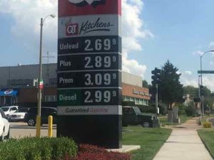
GAS TAX
The MPC argues the state will need to raise $2.7 billion a year, half to spend and half to go towards bonds:

This is equivalent to a $0.30/gal increase in state motor fuel taxes and a 50 percent increase in vehicle registration fees. The tax and fees should be indexed to the consumer price index to keep pace with inflation. MPC recommends the state constitution be amended to create a transportation trust fund to protect this revenue. To acknowledge the effect of these increases on lower- and middle-income Illinoisans, the state earned income tax credit should double to 20 percent of the federal amount.

Because the state’s motor fuel tax has been unchanged for so long, Illinoisans are paying far less for road maintenance today when inflation is calculated:

The Illinois Senate has used the MPC’s estimates to draft legislation that would raise the gas tax by 30 cents, making it the highest gas tax in the nation.

Of course, not everyone is happy with that proposal. The Illinois Chamber of Commerce says Illinois needs to look into other options to fix roads. The Chamber’s recommendation includes an increased state income tax and a lower wholesale gas tax, while getting rid of some tax exemptions for goods like food and medicine.

MILEAGE TAX

Senate President John Cullerton has proposed a different way to get around a gas tax hike; a mileage tax. Illinoisans would pay 1.5 cents per mile in one of three payment options. From the Daily Herald:

Drivers could have a device that tracks the miles through geolocation technology, charging only for the miles driven on public highways and roads.

Alternatively, they could have an odometer tracker, which reports only number of miles driven, not where. The downside to this, notes Susan Martinovich of CH2M, an environmental and engineering consulting firms, is that drivers would be charged for miles driven out of state.

Finally, Illinoisans could opt out of installing any devices and pay a flat mileage tax of 1.5 cents per mile for 30,000 miles.

A mileage tax would also help the state raise revenue even as gas usage declines, thanks to better fuel efficiency and electric cars. The MPC’s plan also recommended Illinois stop raising funds tied to gas purchases eventually. It pushed for a mileage tax system by 2025. (GovTech.com)

Cullerton, a Democrat, introduced SB3267 in February 2016. It never got far in the legislative process.

I want to step back from politics and look at the big picture.

The first US state tax on fuel was introduced in February 1919 in Oregon. It was a 1¢/gal tax. In the following decade, all of the US states (48 at the time), along with the District of Columbia, introduced a gasoline tax. By 1939, an average tax of 3.8¢/gal (1¢/L) of fuel was levied by the individual states.

In the years since being created, state fuel taxes have undergone many revisions.[6] While most fuel taxes were initially levied as a fixed number of cents per gallon, as of 2016, nineteen states and District of Columbia have fuel taxes with rates that vary alongside changes in the price of fuel, the inflation rate, vehicle fuel-economy, or other factors. (Wikipedia)

The first federal fuel tax happened after all the states had fuel taxes — in 1932 during the end of the Hoover administration. The initial temporary tax became permanent.  Eventually federal fuel taxes became part of a trust fund for roads. All was good for decades, but then it began to change:

The Corporate Average Fuel Economy (CAFE) standards are regulations in the United States, first enacted by the United States Congress in 1975, after the 1973–74 Arab Oil Embargo, to improve the average fuel economy of cars and light trucks (trucks, vans and sport utility vehicles) produced for sale in the United States. (Wikipedia)

These CAFE standards have been highly effective at improving the fuel economy of vehicles. Less fuel, however, means less revenue for roads. Politicians at the state & federal levels are reluctant to increase fuel taxes. The smart solution is to look at a Vehicle Miles Traveled (VMT) tax. Oregon, the first state with a fuel tax became the first state to begin a test of a mileage tax.

Way back in 2001, Oregon recognized the problem that many state legislatures are now staring down: gas tax revenue is falling inexorably as vehicles become more fuel-efficient, threatening transportation budgets. The state launched a task force that investigated 28 alternative funding mechanisms before selecting a mileage tax as the one that best met a wide range of criteria: fairness, efficacy, ease of implementation, public acceptance, enforceability, privacy protection, etc.

In 2006, the state recruited 299 volunteers for participation in a year-long trial of a prototype system. Because any real-world mileage tax will be phased in over a long period of time, it has to harmonize with the existing gas tax. The Oregon experiment neatly solved this problem with a pay-at-the-pump system:

* A small GPS receiver in participants’ cars tracked miles driven.
* When participants went to the gas station to fill up, a wireless scanner at the pump detected the GPS receiver and recorded the car’s current mileage, which was then sent to a central database to determine miles driven since the last payment. No specific location data was transmitted.
* The payment system at the gas station applied either the standard gas tax (for cars that didn’t have a GPS system) or the mileage tax (for participating cars). The experiment was designed to be revenue neutral, so fees were about the same in either case. (Terrapass)

Of course, a VMT tax also has drawbacks:

Poor, disadvantaged, and rural people tend to commute farther than the affluent, and drive less efficient cars. The gas tax already charges them disproportionately. A straightforward VMT would too. Any lawmakers crafting a Vehicle Miles Traveled framework would need to consider such concerns. Again, technology could come to the rescue, identifying drivers who merit discounts or subsidies. (Wired)

If the feds & states all switched to a VMT tax to replace fuel taxes we’d see much more compact development, greater use of public transit. etc. — in a few generations. Missouri & Illinois should both join Oregon & others in studying VMT:

California is conducting a pilot VMT study, and the state of Washington is expected to conduct one, as well. Connecticut, Delaware, New Hampshire, and Pennsylvania have all applied for federal support to test how a VMT tax could work across multiple states. (Brookings)

It’s time to change how we fund road construction.

— Steve Patterson


New Book — ‘Building the Cycling City: The Dutch Blueprint for Urban Vitality’ by Melissa Bruntlett and Chris Bruntlett

August 31, 2018 Bicycling, Books, Featured, Transportation Comments Off on New Book — ‘Building the Cycling City: The Dutch Blueprint for Urban Vitality’ by Melissa Bruntlett and Chris Bruntlett

Here in the U.S., St. Louis in particular, bike lanes are a cheap way to use up extra road width. A little paint here and there, with unresolved intersections that often place cyclists in the wrong place — especially for a left turn. In the Netherlands bike infrastructure is on a different level entirely.

In car-clogged urban areas across the world, the humble bicycle is enjoying a second life as a legitimate form of transportation. City officials are rediscovering it as a multi-pronged (or -spoked) solution to acute, 21st-century problems, including affordability, obesity, congestion, climate change, inequity, and social isolation. As the world’s foremost cycling nation, the Netherlands is the only country where the number of bikes exceeds the number of people, primarily because the Dutch have built a cycling culture accessible to everyone, regardless of age, ability, or economic means.

Chris and Melissa Bruntlett share the incredible success of the Netherlands through engaging interviews with local experts and stories of their own delightful experiences riding in five Dutch cities. Building the Cycling City examines the triumphs and challenges of the Dutch while also presenting stories of North American cities already implementing lessons from across the Atlantic. Discover how Dutch cities inspired Atlanta to look at its transit-bike connection in a new way and showed Seattle how to teach its residents to realize the freedom of biking, along with other encouraging examples.

Tellingly, the Dutch have two words for people who ride bikes: wielrenner (“wheel runner”) and fietser (“cyclist”), the latter making up the vast majority of people pedaling on their streets, and representing a far more accessible, casual, and inclusive style of urban cycling—walking with wheels. Outside of their borders, a significant cultural shift is needed to seamlessly integrate the bicycle into everyday life and create a whole world of fietsers. The Dutch blueprint focuses on how people in a particular place want to move.

The relatable success stories will leave readers inspired and ready to adopt and implement approaches to make their own cities better places to live, work, play, and—of course—cycle. (Island Press)

Here’s the contents:

  • Introduction: A Nation of Fietsers
  • Chapter 1: Streets Aren’t Set in Stone
  • Chapter 2: Not Sport. Transport.
  • Chapter 3: Fortune Favors the Brave
  • Chapter 4: One Size Won’t Fit All
  • Chapter 5: Demand More
  • Chapter 6: Think Outside the Van
  • Chapter 7: Build at a Human Scale
  • Chapter 8: Use Bikes to Feed Transit
  • Chapter 9: Put Your City on the Map
  • Chapter 10: Learn to Ride Like the Dutch
  • Conclusion: A World of Fietsers

You can see a preview here. The authors live in Vancouver and write about walking, cycling here.

If cycling as a mode of transportation interests you and you’re not impressed with our half-ass bike lanes, Building the Cycling City should be on your reading list.

— Steve Patterson


Well-Used Bus Stop Is A Muddy Hole After It Rains

August 20, 2018 Accessibility, Featured, Public Transit, Transportation, Walkability Comments Off on Well-Used Bus Stop Is A Muddy Hole After It Rains

Usually when I go to my regular doctor I take either the #97 (Delmar) MetroBus or MetroLink to connect with the southbound #90 MetroBus at Goodfellow or Forest Park station, respectively. However, depending on the bus schedule and my appointment time I’ll take the #10 MetroBus from Olive @ 16th to the Gravois-Hampton MetroBus Transit Center, and then catch the #90 MetroBus heading northbound. The alternative takes about 15 minutes longer, but often will get me to my destination closer to my appointment time.

The #10 (Lindell-Gravois) MetroBus ends at the transfer center on the NE corner of Hampton & Gravois

But I only take the Gravois-Hampton alternate if it hasn’t rained recently. You see, the bus stop I use to catch the Northbound #90 is a muddy hole if it has rained recently.

The bus stop is where thw standing water is on this October 2014 photo.

‘The Northbound #90 bus stays on Hampton rather than pulling into the transit center. Riders getting off/on must use the grassy tree lawn.

At the bus stop looking South toward the MetroBus transit center
Looking North, note the bus stop sign is mounted very high on the poll — and facing the street. I couldn’t read the stop ID from my wheelchair.
Cropping later I could see it’s stop #3275
The tree lawn is quite wide here, you can see how the grass is well-worn.
Up close I could see a tire track likely made when it was muddy

Even dry this stop is a problem when boarding. When the bus driver puts out the ramp/lift it leaves a huge gap my chair must get up — this is because all the use has worn this spot down so it’s lower than the curb and surrounding grass. Recently I was waiting in the grass just before the stop to avoid this problem. It’s adenegrated  experience for everyone dry or wet, impossible for us wheelchair users when wet.

Metro occasionally gets grants to improve accessibility of MetroBus stops — #3275 needs to be toward the top of the list for improvement.

— Steve Patterson


After A Quarter Century, Still No Transit-Oriented Development At St. Louis’ Light Rail Stations

July 30, 2018 Featured, Public Transit, Transportation Comments Off on After A Quarter Century, Still No Transit-Oriented Development At St. Louis’ Light Rail Stations

Tomorrow is an important day for transit in St. Louis. At 10am Tuesday 7/31, 2018 a new MetroLink station will open along the original segment. The original light rail alignment opened 25 years earlier on July 31, 1993.

I was 26 and a huge supporter of rail transit, but I didn’t live or work anywhere near amy of the stations. At the time I lived in Old North St. Louis, a year later I bought a 2-family in Dutchtown. I was working in Rock Hill. MO.

MetroBus picking up riders at the Wellston MetroLink station– taking them to their final destination. The Wellston Station still lacks any transit-orioented development (TOD).

As a result of where I lived & worked, light rail wasn’t of any use to me. Switching jobs from Rock Hill to North St. Louis to Kirkwood didn’t change the lack of usefulness to me. However, I do recall a few times I’d catch the bud to take MetroLink to the airport for a rare trip.

East St Louis

It wasn’t until after moving downtown, and my February 2008 stroke a few months later, that I really began to use our public transit system on a regular basis. In the last decade I’ve traveled far more miles on MetroBus than via light rail.  Trips involving light rail almost always involve a MetroBus on one end, or both.

Crowds fill trains after fireworks on July 4th, 2012
MetroLink trains travel in a short tunnel under the historic Union Station train shed.

The St. Louis region only a little bit of heavy rail commuter lines to places like Jennings & Ferguson, Webster Groves, Kirkwood, etc. Light rail in the form of streetcars was the primary type of rail transit in the St, Louis region. A line even connoted Illinois into downtown St. Louis, coming in under Tucker Blvd.

Prior to WWII the bus began to replace streetcar lines — it was smoother and quieter than the old streetcars. The final streetcar line ended in May 1966. So when modern rail transit was being conceived in the 1980s the choices of right-of-way was limited. In 1989, as part of the work on light rail the City of St. Louis traded bridges with the Terminal Railroad Association. The TRA got ownership of the MacArthur Bridge and the city got the Eads Bridge and tunnel under downtown’s central business district.  Rail use of the Eads/tunnel ended in 1974 because then-new locomotives couldn’t navigate the bridge or tunnel. New light rail vehicles, however, would fit nicely. This was an excellent use of right-of-way and a great way to cross the Mississippi River.

Eads Bridge with the Admiral in early 1991
ABOVE: The view to the west of the Sunnen MetroLink station in Maplewood is radically different now, just bare earth.

An old freight corridor was acquired that would take the original alignment from downtown St. Louis through numerous municipalities in St. Louis County toward the airport. On opening day trains didn’t reach the airport terminals, it stopped at the Hanley Station. The main terminal was opened soon after. The East Terminal (#2) station came years later.

The only structure at North Hanley is a parking garage, added years after the station opened.

Extensions were made in St. Clair County, IL and in 2006 a Missouri extension to Shrewsbury via Clayton.

The Shrewsbury MetroLink station opened with the blue line extension on August 26, 2006.

The Blue Line to Shrewsbury was costly as many residents along the alignment wanted the trains underground rather than at grade. The line was built to continue South from Shrewsbury, but nearly 12 years later that seems like a non-starter.

In the 25 years since the original line (Red) opened, and nearly 12 years since the Shrewsbury line (Blue) opened, we’ve not seen any transit-oriented development around the stations. We’ve had some transit-adjacent development, but mostly nothing. This is because smart land use planning wasn’t implemented at each station prior to construction. Development around the Maplewood station on the Blue line has been a lot of new car dealerships.

Tomorrow morning service will begin at the new CORTEX station located between Grand and Central West End (BJC). The CORTEX district tries to market itself as pedestrian-friendly. Compared to most of the St. Louis region, it’s a pedestrian’s paradise. For this pedestrian, however, it’s a typical mediocre attempt at best. Sidewalks are narrow, surface parking lots face rail line, the original CORTEX building still lacks an ADA-compliant accessible route. Ribbon cutting for the new station begins at 10am, I’ll be there, weather permitting.

The new station can be tracked from Boyle Ave on the West, or Sarah Street on the East end, though it’s closer to Boyle. Those using Boyle from the North or South will have no problems tomorrow. Same for those using Sarah from the North. As of Thursday last week, those trying to enter/exit the station from/to South Sarah will have ro use the street.

You’d think finishing sidewalks to/from a transit station would be important, but not in St. Louis
A wide sidewalk runs along the North side of the tracks between Sarah & Boyle, looking West from Sarah Street.
An Eastbound train is seen passing by the station last week.

We’ve invested a lot in light rail, but we’ve not always been smart about it. We’ve not leveraged it to created dense walkable nodes around stations. Going back after the fact is proving just as hard, if not harder, than if it had been done 25 years ago.

— Steve Patterson


Proposed Rail Transit Through Downtown, An Alternative To Delmar

July 16, 2018 Featured, Public Transit, Transportation Comments Off on Proposed Rail Transit Through Downtown, An Alternative To Delmar

Last week I promised an alternative to the proposed alignment for the proposed northside-southside light rail study. At the time I thought my alternative would work only with the Cass option, but it could work with the North Florissant alignment. First, a look at the overall plan at this point.

The overall route map

Now let’s examine the downtown inset from the upper right.

From the South the line comes North on 14th from Chouteau, East on Clark. 9th Street would be used for northbound vehicles, 10yth Street for Southbound. All would use Convention Plaza (aka Delmar) to 14th Street. Stations would be at Clark, Pine, & Washington.

Now let’s examine the downtown inset from the upper right.

Two alternatives to 14th & Cass to Parnell (Jefferson) & Natural Bridge

In 2007-2008 the plan stayed on 14th rather than go East into the Central Business District. This new alignment through the CBD is much better for transit users and visibility that transit is an option.

This is looking West at Clark from 9th. The rail line would come toward us on Clark then turn North on 9th (our right)
Now we’re looking North on 9th, the Stadium West garage is on the right
Looking North on 9th from Walnut — there’s plenty of height for the rail vehicles, overhead wires, etc
Since opening in 2009 Citygarden has unofficially closed 9th Street. Would rail be allowed but not other vehicles?
The reason they closed 9th is because they didn’t figure out how to let pedestrians using the “hallway” to know when it was safe to cross 9th
At 10th Street the “hallway” needs to be continued into the next block, along with a system of pedestrian signals.
Looking West at Convention Plaza, formerly Delmar, from 9th Street.

My question was why rush to get to 14th Street? Why not go further North on 9th/10th before heading West? It’s likely too late for a change since they plan to submit to East-West Gateway, our MPO, late next month. Still, I took a look at alternatives to Delmar to reach 14th from 9th/10th.

The next block North of Delmar is MLK Dr
St. Louis loves to give away public property, is MLK between 10th-11th is a narrow private service drive. MLK was also vacated West of 11th
Cole is a nice wide option, but West of Tucker you can see it narrows considerably.

With MLK & Cole ruled out that leaves only one other option: Cass Ave. I’ve written before about 9th & 10th through the Columbus Square neighborhood being excessively wide one-way streets — from when they served as long on/off streets for I-70. Since the bridge construction changed traffic patterns, 9th/10th are way too wide and little used. Running the rail lines on 9th/10th through the center of this neighborhood would help connect it to downtown, partially making up for the convention center (1977) and dome (1993) closing access via 6th/7th/8th.

Looking South at 9th from Cass
Commercial storefront building might become viable if served by rail transit rather than infrequent bus service.
Looking West on Cass from 9th
Looking North from Cass & Tucker. It would be nice if people driving intro St. Louis from this point saw rail transit on Cass
Lots of vacant land at this important intersection, development could be served by rail transit,,
Looking West on Cass from Tucker,
The long-vacant Cass Bank at 13h & Cass might get developed if rail t=ran down Cass
14th Street sidewalks near Cass are horrible, booked in many places or too natrrow due to encroachments like this.

I think more north city residents would be served by extending the line on 9th/19th to Cass. It could continue on Cass to Jefferson or use 13th or 14th to connect to North Florissant ,Connecting the development node at Cass & Tucker to downtown and to NGA West is important.

In the interest of full disclosure, by the end of this year my husband and I will very likely be new residents of the Columbus Square neighborhood, moving from our loft in Downtown West to a smaller place.More on that later. Still, I’ve been photographing & writing about the area for years.

It’s probably too late to consider 9th.10th to Cass, but I had to share it.

— Steve Patterson


Advertisement


[custom-facebook-feed]

Archives

Categories

Advertisement


Subscribe