Home » Walkability » Recent Articles:

New Grocery Store Located Among Walkable Neighborhoods Not Designed For Pedestrian Customers/Employees

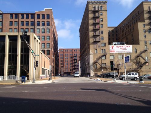
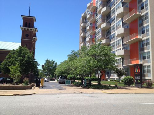
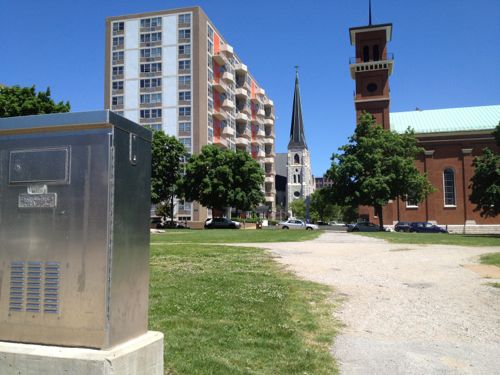
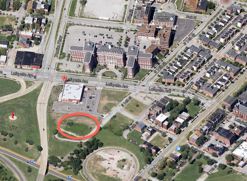
A new grocery store will open soon on the near south side, between Soulard to the east, Lafayette Square to the west, and The Georgian/King Louis Square to the north, Lasalle Park. The I-55/I-44 highway interchange is to the south. Technically this is located in the Peabody Darst Webbe neighborhood, partly named after the  former public housing project that were located where King Louis Square was built years ago.

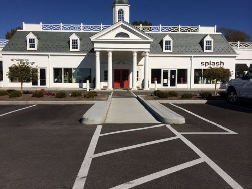
Fields Foods is our vision come to life. A full-service grocery store rooted in the heart of historic Lafayette Square near downtown St. Louis. The Lafayette Square area is one of St. Louis’ oldest neighborhoods with historical stores, parks and homes. It’s truly one-of-a-kind, and that’s why it’s the perfect fit for our store.

Our team of friendly, dedicated, knowledgeable foodies guides our customers through a vast arrangement of local, healthy, delicious foods that will inspire your inner gourmet. You will walk through lush fields sampling vine-ripened fruits and vegetables. Stroll down urban streetscapes and visit the local butcher and baker. Head down to the docks to our seafood shack and enjoy what truly fresh from the sea means. And if you’re not in the mood to cook tonight, that’s okay. Stop by our prepared food section and pick up a slice of brick oven pizza, a toasty panini, salads and so much more. Need a bit more than a slice of pizza? We have a chef on staff creating restaurant quality dinners for carry out. A Sushi bar and a Wine and Beer cellar stocked with vintages from across the globe and local craft beers completes your experience.

Many area residents, tired of having to drive to the grocery store, welcome a neighborhood store they can walk to.

“Can’t wait to have a grocery store within walking distance. Actually I can see the store from my 3rd floor window.”— Jean C.  commented on a Facebook picture.

A market here was proposed in early 2007:

Koman recently partnered with Chris Goodson of Gilded Age on plans for an $80 million mixed-use development just east of the Lafayette Square neighborhood and just south of downtown. Goodson’s Georgian Square development includes plans for a Walgreens, grocery store and coffee shop. Goodson has helped transform Lafayette Square in recent years. In 1999 he helped spearhead the creation of an $8.5 million tax increment financing district in Lafayette Square. Through Gilded Age, a development company Goodson founded with partner Trace Shaughnessy, he has developed more than $125 million in real estate projects since 1996. He also is president of the St. Louis Board of Police Commissioners. (St. Louis Business Journal

Immediately south of downtown, another grocery store is under development. St. Louis-based Gilded Age plans to break ground on a Walgreens across the street from its Georgian Condominiums this August. Next to the Walgreens, a City Market grocery store, a unit of SuperValu, will open in the summer or fall of 2008, said Gilded Age principal Chris Goodson. (St. Louis Business Journal

In March 2008 things were still moving forward:

The SLDC already has approved forgivable loans for two other projects to receive funding from the pool of excess revenue: Gilded Age and Koman Properties’ planned $30 million first phase of its Georgian Square retail development, across from Gilded Age’s Georgian condominium project, will receive $300,000. The developers have signed an agreement with Walgreens to locate on the site, said Gilded Age principal Chris Goodson. A City Market grocery store, a division of Supervalu, and a Starbucks are also planned for the development. “We’re moving forward with the Walgreens, that will be built first,” Goodson said.  (St. Louis Business Journal

The Walgreens opened in 2009. Several other attempts were made to get a grocery store here, but each fell through:

When Gilded Age announced plans for a grocery in 2007, it was with Minneapolis-based Supervalu, a project that never materialized. Other pending deals with Phoenix-based grocery chain Sunflower Farmers Market and local operator Sappington Farmers’ Market also failed to move forward. (stltoday.com)

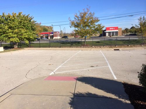
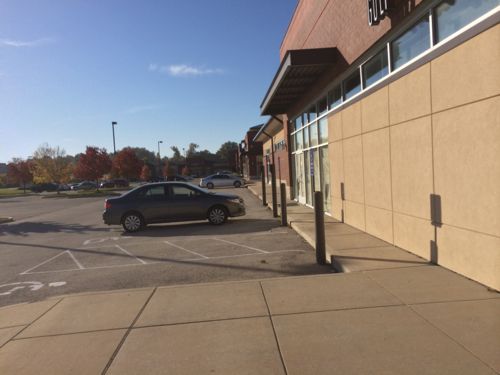
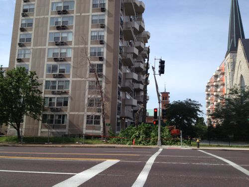
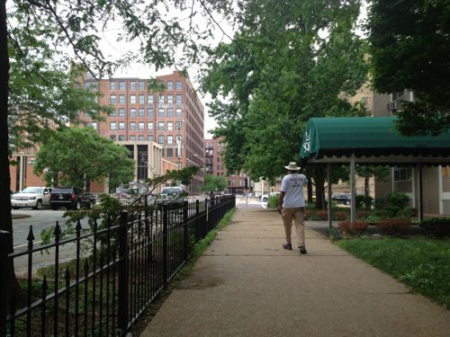
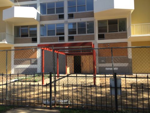
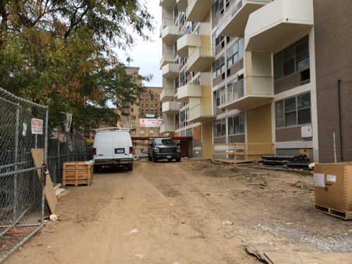
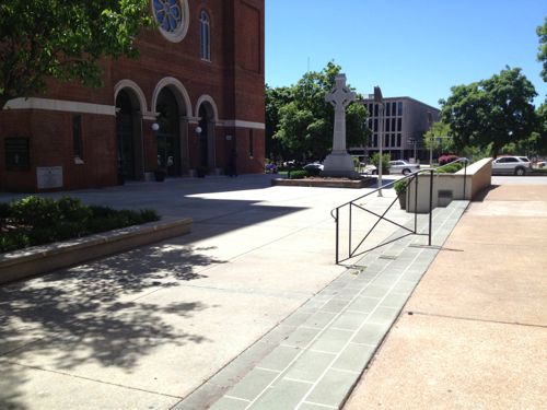
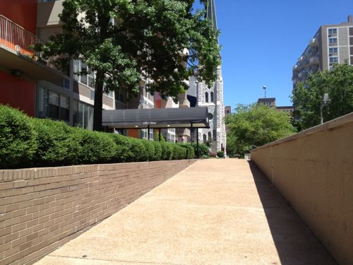
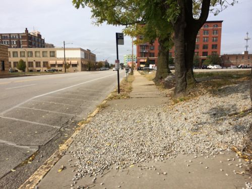
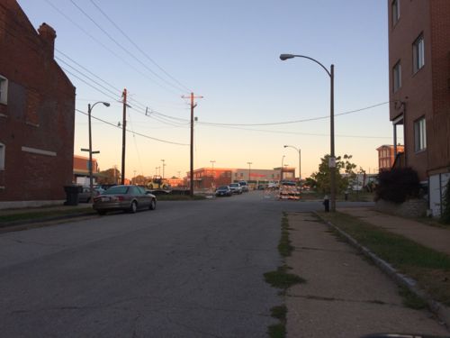
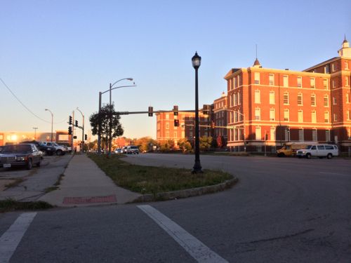
I’m very glad to see the store nearing completion. It’ll provide needed jobs, though jobs may be lost elsewhere as people change where they buy groceries. Sadly, it doesn’t appear any consideration to the many who will arrive daily on foot, some pushing strollers, and even the occasional wheelchair user.  Let’s start in the adjacent Bohemian Hill to the east.

Looking west on Soulard St, the new Fresh Fields is on the left, Walgreens center.
Looking west on Soulard St, the new Fresh Fields is visible on the left, Walgreens center.
The concrete curbs between the parking lot and Soulard St are already poured, no provisions for ramps, sidewalk
The concrete curbs between the parking lot and Soulard St are already poured, no provisions for ramps or a sidewalk
Looking south across Lafayette Ave on 14th the new grocery store is straight ahead
The circle indicates the location where the new store is being built
The circle indicates the location where the new store is being built next to the Walgreens
The area has good sidewalks but it takes careful planning to design new developments to encourage walking.
The parking lot will blend into the Walgreens lot

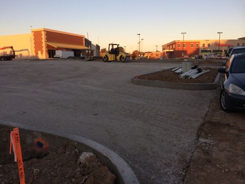
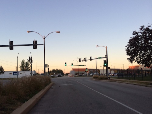
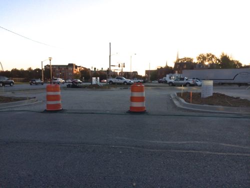
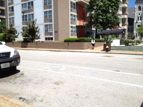
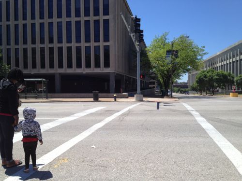
I understand most customers and many employees will drive to this new store. I also know many will opt to walk here from home, Walgreens, nearby bus stop, etc. How many isn’t know, but if we do a pedestrian count later it’ll surprise you just how many do walk, or bike.  Had the civil engineers, architects, & developers actually planned a welcoming sidewalk approach the numbers would be higher. From press releases and articles it’s clear they’re  not targeting local residents, “Goodson and Randol also hope the store’s proximity to major highways will attract customers entering or leaving downtown St. Louis.” (Sauce)

Clearly the city has been working with the developers for six years on this project, there was time to figure out how residents of his own project across the street can walk to his new grocery store.  The city failed big time by not requiring good pedestrian access.

Hopefully, somehow, I’ll be proven wrong when the grocery store opens January 4th.

— Steve Patterson


Automobile Driveway Replaced With Pedestrian Access Route

Every so often I get back to a once-familiar place and I’m pleasantly surprised by positive changes. Recently I drove through the strip mall on Ladue Road that formerly contained a Wild Oats store, in a space previously occupied by a Schnucks. Wild Oats was bought out by Whole Foods in 2007, leaving the dated center largely vacant. The strip center underwent renovations in 2012.

A pedestrian route leads to a space formerly occupied by Lammert's Furniture
A pedestrian route leads to a space formerly occupied by Lammert’s Furniture

A decade ago I visited the Wild Oats every morning before work, but I’d forgotten the exact layout of the parking lot. So I turned to Google Maps and it still showed the old pattern, with a wide auto driveway where the dedicated pedestrian path is now.

The before view from Google streetview. Click image to view in Google Maps

Most of the center, including the pedestrian access, is located in Ladue, while the east end is located in Clayton. St. Louis County records indicate this strip mall was built in 1960, a time when wide auto driveways were valued but more and more developers & retailers know walkability and a more pleasant arrival sells, especially to those with disposable incomes.

Kudos to those responsible.

— Steve Patterson


This Building Not Approved For Occupancy

November 1, 2013 Accessibility, Featured, Planning & Design, Retail, St. Louis County, Suburban Sprawl, Walkability Comments Off on This Building Not Approved For Occupancy

I’d never heard of Tee’s Golf Grill until Monday when I was driving around the Chesterfield Valley, it closed in July 2012:

The 10,400-square-foot golf center opened in early 2011 at 103 Chesterfield Valley Drive. “We’re doing a full-service sports bar and grill,” Ben Rassieur IV, Tee’s owner with Phil Harris, told Sauce magazine at the time. In addition to the bar and grill, Tee’s had 330-square-foot golf simulators that visitors used to practice their swings. (St. Louis Business Journal)

I’m not sure if the building was constructed new for this tenant, or a previous tenant. I also don’t know why this business closed so soon, but I found a number of issues that should be addressed by the owner before the next tenant leases the space.

Paper over the windows, only car is my rental
Paper over the windows, only car is my rental. But look, no ramp to access the front door! Click image to view on Google Maps. 
The ramp is off to the side, requiring the disabled to go into the driveway to access it. I prefer ramps when walking with my cane, so do folks who use walkers.
There's a ramp & crosswalk out to the sidewalk that connects to other development, but no ramp to access it.
There’s a ramp & crosswalk out to the sidewalk that connects to other development, but no ramp to access it.
We can see the walk to the entry is minimal width.
This sticker was affixed to both entrances to this building. I wonder if the City of St. Louis uses something like this to improve compliance?

This building shares the same site with a multi-tenant building to the south, yet there isn’t an ADA-compliant accessible route connecting them, as required.

I will attempt to share the above issues with the owner and St. Louis County.

— Steve Patterson


The Former 16th Street For Able-Bodied Pedestrians Only

In 1951 the Plaza Square urban renewal area was defined. More than a decade later, in 1962, six new apartment buildings finally opened on four city blocks that were completely razed, except for two churches, which remained. In addition to removing hundreds of existing buildings, 16th Street was also removed. Both churches and two of the six buildings fronted a new pedestrian-only walkway where 16th Street had been. For over 50 years this has remained mostly unchanged, and, I’ll argue, has been part of the reason behind the decline in the area.

First, some background provided by city staff highlighted in a 1970 report:

In 1951, shortly after the establishment of the Land Clearance for Redevelopment Authority, Plaza Square became a federally-assisted Title I Urban Renewal Project. A bond issue for the project was submitted to voters in 1953 and failed, but was approved later in that year. Execution began in 1954 and rebuilding was done by the Urban Redevelopment Corporation. The Federal Government defrayed two-thirds of the $2,618,000 loss incurred in the write-down and the City bore the remaining third. By developing a park and making street and utility improvements in the area, the City exceeded its required contribution by $114,500. This was applied as credit to the cost of another project at a later date.  

The present 16-acre, $20 million Plaza Square Apartment project completed in 1962, contains 1,090 apartments in six multi-story buildings. In addition, it includes two rehabilitated churches with expanded sites, a small park, shopping facilities, and a $2 million office building for the Blue Cross Group Hospital Service. The Plaza Project also has been a significant link in the concept for an East-West Axial Mall extending from Aloe Plaza eastward to the riverfront arch.   

In the mid-1960’s, occupancy lagged in the project. In 1966, in an attempt to alleviate this problem, the Bethesda Foundation took title to one of the buildings. The Bethesda Townhouse is now a non-profit residence for senior citizens who lease the dwelling units for life. By 1970, the occupancy rate had reached 88% in the Plaza Square Project.

The success of Plaza Square has had far reaching consequences since it was the first of its kind in the City. One of the most important aspects was the fact that Federally assisted renewal program encouraged private investment in the reconstruction of the City. Its success provided the stimulus for later revitalization projects such as the Civic Center redevelopment.(History of Renewal)

The non-profit building for seniors later became the Blu condos, many of which became rentals or were sold at auction. This post is a look at the pedestrian-only path left after 16th Street was removed. This matters to me personally because I live at 16th & Locust and need to reach the bus stop & city offices at 16th & Market (map).

For years there was no pedestrian signal or crosswalk to cross Olive at 16th.
For years there was no pedestrian signal or crosswalk to cross Olive at 16th. The walkway can be seen beyond the car
Sometime after May 2011 pedestrian signals were installed and a single crosswalk was painted on the east side of 16th. In this picture the new owner of the building on the left was cutting down old trees, blocking the narrow walkway.
In 2012 pedestrian signals were installed and a single crosswalk was painted on the east side of 16th. In this 2013 picture the new owner of the building on the left was cutting down old trees, blocking the narrow walkway.
Looking north at 16th from the south side of Olive
Looking north at 16th from the south side of Olive. Pedestrians wanting to cross from the west side of 16th must cross 16th first, or jaywalk.
Same view but further south on the former 16th, now church parking.
Looking north on the walkway  before renovation of the adjacent building began. This area became a haven for trouble once that building became vacant, the church had the fence installed then.
Looking north on the walkway before renovation of the adjacent building began. This area became a haven for trouble once that building became vacant, Centenary Church had the fence installed then.
The apartment building entry is getting rebuilt, it faces the Centenary parking lot
The fence keeps you from reaching the labyrinth and church entry. They're considering a gate once the apartment building is occupied again
The fence keeps you from reaching the labyrinth and church entry. They’re considering a gate once the apartment building is occupied again
Looking north from the labyrinth, with parking beyond. The labyrinth was built in the 80s or 90s.
Looking north from the labyrinth, with parking beyond. The labyrinth was built in the 80s or 90s as a meditative space before or after services.
During the renovations of this building the walkway is closed to the public. This building will be for "active adults", 55+
During the renovations of this building the walkway is closed to the public. This building will be for “active adults”, 55+
When you reach Pine there is no curb ramp to cross, besides you face the private auto  driveway for St. John's
When you reach Pine there is no curb ramp to cross, plus you face the private auto driveway for St. John’s. To cross Pine mid-block I must go to a driveway off to my right and go to the church driveway, then to west to continue.
From here there's no wheelchair access to the plaza in front of St. John
From here there’s no wheelchair access to the plaza in front of St. John. The bus stop and city office building is in the background
Looking the opposite direction we see the apartment entrance on the left
From the park looking across Chestnut there's no place to cross, not even a driveway.
From the park looking across Chestnut there’s no place to cross, not even a driveway.
From 16th & Market you can see where you want to go. The able-bodied can do it, but few do because it isn't a friendly walk.
From 16th & Market you can see where you want to go. The able-bodied can do it, but few do because it isn’t a friendly walk.
Once at Market you can see the bus stop and city offices.

Few people use the former 16th Street walkway, it’s dark, narrow, uneven, and uninviting. I’m forced to take 17th, 15th or 14th instead. Like I said at the opening, I think this dead walkway has been a contributor to problems in the Plaza Square area.When the general public avoids an area and when a church erects a fence to keep out unsavory activity then you know a problem exists — a problem created by the poor design. It performs the opposite of how it was intended, a safe & pleasant car-free zone.

Cars are activity generators. The drivers are eyes on the street, police can drive down streets.

I’d like to see the community look at all options for 16th, including:

  1. Revising the walkway so it is ADA-compliant.
  2. Remaking the walkway so it is wider, more inviting and ADA-compliant.
  3. Reopening 16th Street to traffic, on the same scale as north 14th in Old North. Both were a 60 foot public right-of-way.
  4. Making Chestnut and Pine two-way streets again

I met with clergy from both churches, neither likes the idea of losing parking or the space in front of each respective entrance. Meanwhile, the owner of four of the six Plaza Square buildings wants to build a parking garage between two of the buildings, without losing the historic designation needed for tax credits (via NextSTL).

— Steve Patterson


Gravel on Sidewalk Next to MetroBus Stop

For a couple of years I’ve  come across a problem that I hadn’t addressed, until now.

blah
Gravel from an adjacent lot spilled out onto the public sidewalk on Washington Ave just west of 21st St, click image for location.

The few times I’ve been through here I’ve gotten through without getting struck, it seems the sidewalk underneath the gravel is just fine. Still it’s annoying to me and I’m sure it is to any pedestrian trying to catch the bus, or visit the Downtown Children’s Center in the background.

I checked Google’s street view where this doesn’t appear but the lot has bare dirt. My guess is the gravel was placed on the dirt to prevent erosion. Well, the dirt isn’t washing away…

I’m going to send this to the Streets Dept and to Metro, hopefully between the two the gravel will get removed. If an adjacent property owner is at fault, I hope they get billed for the cleanup costs.

— Steve Patterson


Advertisement


[custom-facebook-feed]

Archives

Categories

Advertisement


Subscribe