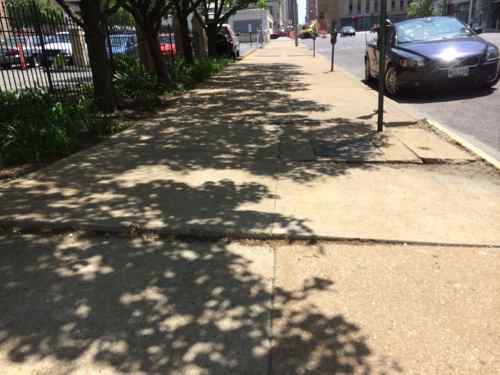
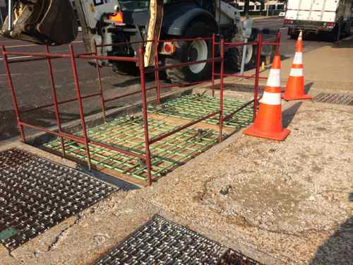
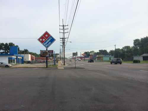
Back on May 6th I got fed up with the sidewalk condition along Olive at 13th, so I emailed Bill Burkhardt, the city employee in charge of asphalt, and copied his boss, Director of Streets Todd Waelterman.
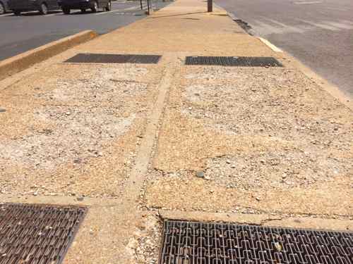
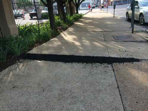
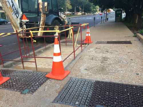
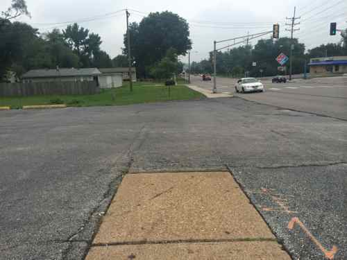
One of the photos I sent showed bucked sidewalk sections, the raised edges were hard to pass over in my wheelchair and a trip hazard for others.Another, in the same block, to the east, two concrete utility covers were very roughLess than a week later a little asphalt was now placed at various points to make the sidewalk less hazardous, but the rough utility covers remained for months.But on August 27th I noticed one had been removed, now facing westThe following day it was prepped for new concreteOn September 6th the other was removedOn September 15th the 2nd had been poured but workers remained.September 17th all workers are gone, both rough utility lids replaced,
Turns out the underground utility vaults belong to Ameren, the worker I spoke to said the lids shouldn’t have been allowed to get that bad. Eventually the sidewalk needs to be replaced, but the asphalt makes it tolerable in the meantime. Very glad the city contacted Ameren about their lids.
My March post prompted a post, and a followup post, from the State Journal-Register in Springfield:
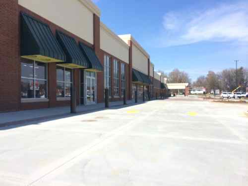
Also in response to Sunday’s column, Ward 7 Ald. Joe McMenamin came to the newspaper office Monday morning to show us plans for the Hy-Vee grocery store coming to MacArthur Boulevard, replacing the blighted old Kmart building. I am no expert, but it looks to me like Hy-Vee is doing it right. McMenamin used orange marker to show the new sidewalks on both north and south ends of the store and pedestrian access to the store, including two ways for pedestrians to get to the entrance from across busy MacArthur. He used green marker to show the landscaping. There’s a lot.
This is not because of pressure from the city, however. Hy-Vee is doing this on its own. On its own, the company is going above and beyond what Springfield city ordinances require. If only every company was as classy. But they aren’t, which is why the city needs more stringent requirements. (Critique of Springfield’s image touches nerve)
Reading this in April 2013 got me curious about a future store opening in an old Kmart, an important part of retrofitting suburbia is the reuse of existing vacant retail buildings.
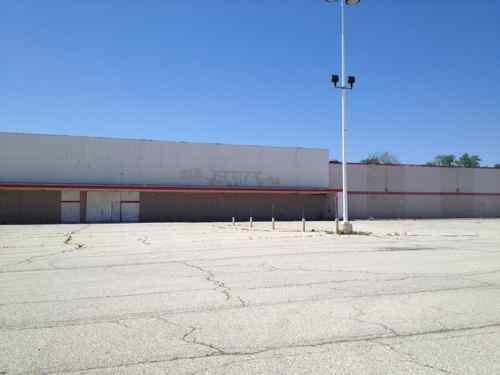
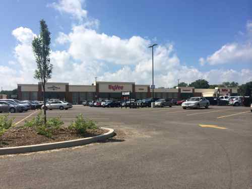
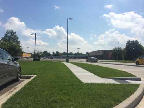
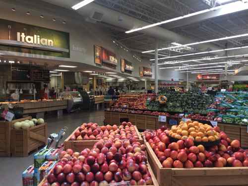
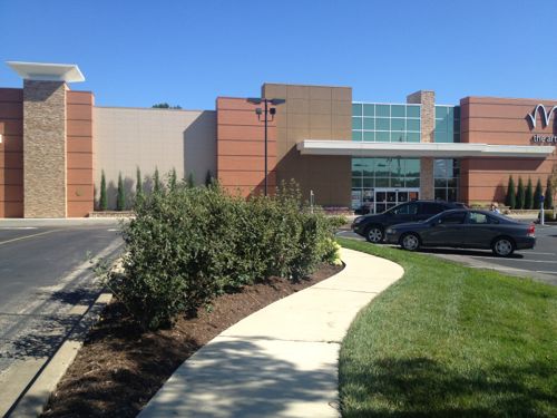
Visiting Springfield in May 2013 we went by the Kmart store – vacant for a decade. Click image for map.In April 2014 we saw the retrofit in progress. The only sidewalk connection was to the north, not two ways as indicates a year earlierLast month we visited the Hy-Vee store, which opened earlier in the summerAfter our previous visit they added a second pedestrian route, this one to the south. Why wasn’t this done when all the curbs were formed, concrete poured?Two pedestrians ignore the circuitous route and walk directory to exit.Looking back out, this route was retrofitted after new concrete was poured for this project. Not the right way!The 24-hour store is very nice
The Hy-Vee faces MacArthur Blvd, a busy Springfield arterial road, yet none of the two sidewalk connections are direct. Three bus lines run on MacArthur in front of the store.
Still, the St. Louis region does no better. The Target store on South Hampton is similar, accessible pedestrian access is to the north & south, not directly from Hampton. The build pedestrian-friendly cites the buildings should connect to the public sidewalk network in such a way the general public (read: alb;e-bodied) will use the paved accessible route because it’s the most direct path to the entrance.
Here’s a good example:
The redevelopment of an old Schnucks & shopping center added a pleasant way to reach stores from Manchester Rd in Des Peres. Click image to read post from 2012.
No pedestrian is going to walk in the entry driveway here, or hunt on the sides for a way in. For good design, developments should have accessible pedestrian routes conneting directly as possible to all adjacent public sidewalks. The Hy-Vee in Springfield, like our Target on Hampton, has three adjacent streets. Both connect to just two of the three streets, ignoring the primary street. Pedestrian fail.
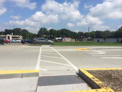
Two buildings out nest MacArthur Blvd were razed, the entire site (paving, curbs, etc) are all brand new. This could’ve been so much better.
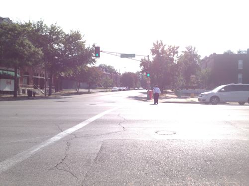
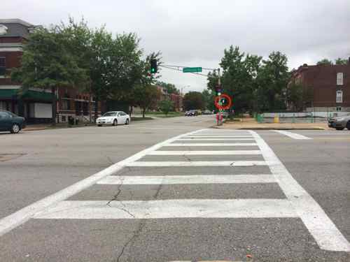
September 2013: a female pedestrian makes her way across Jefferson at RussellSeptember 2014: Within the last year automatic pedestrian signals have been added (circled in red) and the crosswalks made more visible.
It’s a small start, a few low-cost improvements until a new streetscape can be planned and funded. For those who cross Jefferson at Russell these are welcomed changes.
Vision Statement: The Vision for West Florissant Avenue comes from community and stakeholder input received through multi-faceted outreach efforts. These have included public workshops and virtual walking tours, interviews with community leaders, input from the Community Committee and Technical Advisory Committee, an Agency workshop, and an online survey and mapping tool. The Vision Statement has distilled this community and stakeholder input, with the most significant community values expressed as how the corridor should look, feel, and contribute to the community’s future.
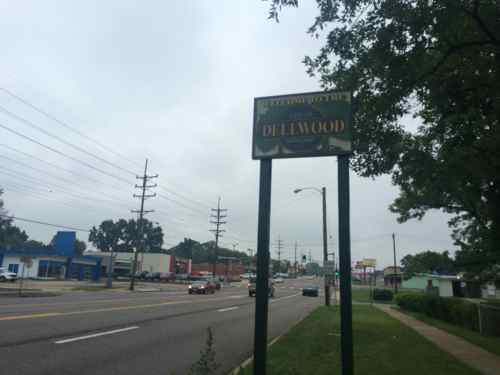
Project Area: The West Florissant Avenue Great Streets Project area is located in North St. Louis County, within the cities of Ferguson and Dellwood (Map 1.1). The Project area extends for approximately 2.6 miles, beginning at I-270 in the north and continuing to the East-West rail line at Emerson Electric headquarters and Buzz Westfall Plaza in the south (Maps 1.2 and 1.3; note change in map orientation). Th e Project area includes parcels that front the corridor, plus additional parcels along the key intersecting streets of Pershall Road and Chambers Road. Th e street corridor itself is owned and maintained by St. Louis County. Th e Project area parcels are about evenly divided between the cities of Ferguson and Dellwood; a few parcels also fall within Jennings city limits at the southeast end of the corridor. Several key landmarks and retail centers are located within or near the Project area. Dellwood City Hall is near the intersection of West Florissant Avenue and Chambers Road. The Project area also includes Dellwood Park and Dellwood Recreation Center. St. Louis Community College Florissant Valley Campus is just outside the northwest end. In addition to these landmarks, there are 160 acres of open space or park within one mile of the Project area, including open space associated with Maline Creek. A major shopping center is at the northern end of the corridor, with access to I-270. Just outside the southern end of the Project area, Buzz Westfall Plaza is another major retail center. The West Florissant Avenue corridor has been designed primarily to serve motorized vehicles, which is reinforced by the direct access to and from I-270 the road provides. The corridor is served by Metro Transit bus route #74, one of the most heavily-used lines in the system, and a future transit center is planned for Pershall Road in the northeast part of the Project area; its estimated completion date is in 2015. While sidewalks are present, many other pedestrian amenities are not, and the corridor is not pedestrian-friendly. The corridor currently does not have designated bicycle facilities, and is little used by bicyclists. As communities take an increasingly holistic view of streets and incorporate more of these Great Streets principles, our streets will serve multiple functions and become better places.
The supporting documents are on their West Florissant page, I’ve uploaded each to Scribd for quick reference:
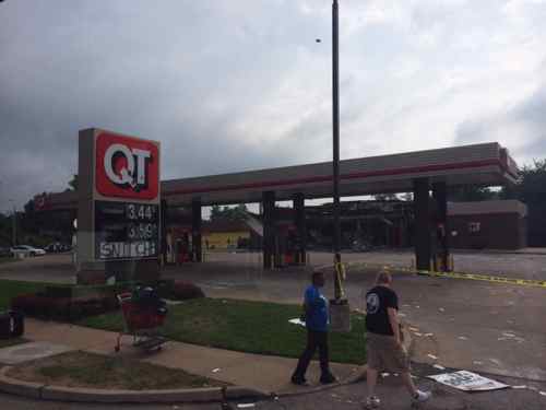
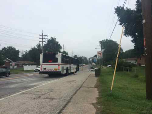
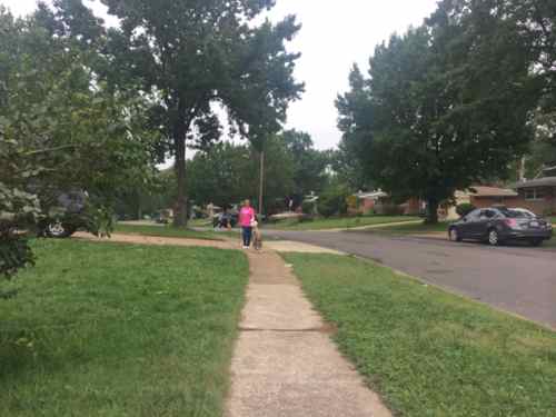
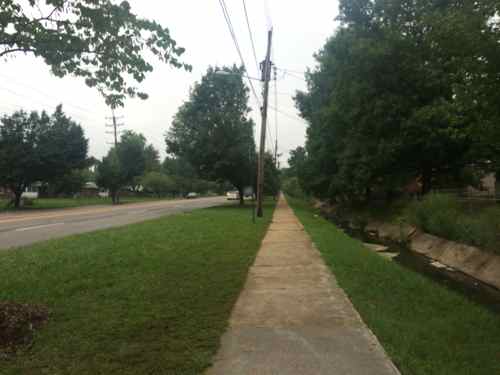
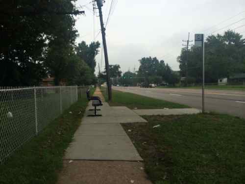
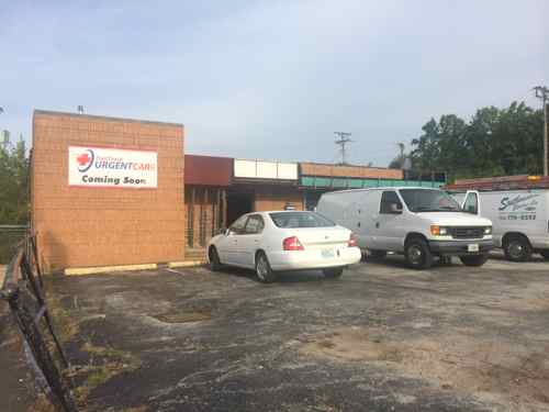
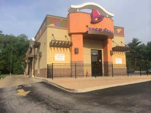
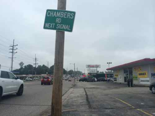
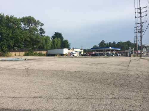
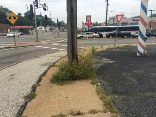
Burnt out QT at 9420 West Florissant on Monday Aug 11, 2014, 9:37am. What will replace the QT? A new QT? A used car lot? A new commercial development? A park?North of the QT the area changes from suburban commercial to suburban residential, W. Florissant is served by the 74 MetroBus routeA woman walking her dog on Nesbit Dr in the Northland Hills subdivision of late 1950s ranch homesOn the east side, between Nesbit Dr & Highmont Dr, you get a long stretch with no intersecting streets, a concrete creek separates W. Florissant from backyards. But look, street trees!The bus stops along W. Florissant were recently improved to be accessible, which benefits all users.Just past the bus stop is the Dellwood city limits, W. Florissant returns to being commercial.Commercial starts up sooner on the west side of W. FlorissantIn this area of W. Florissant the pedestrian experience is odd; different surfaces, different distances from the road. Very unplanned!The grass between the sidewalk and parking lot is a welcomed relief from all the pavingThe former Fox Trap nightclub is becoming an urgent care facility.Like the McDonald’s in Part 1, this Taco Bell fails to have the required ADA access route from the public sidewalk. This was built in 2007.Almost to Chambers Rd., here the pedestrian space blends with parking lotsBetween the Taco Bell and the corner gas station is a rare vacant parcel of land.This image sums up how pedestrians are treated. The bus in the background is the #61 heading WB on Chambers Rd.
AARP Livibility Index
The Livability Index scores neighborhoods and communities across the U.S. for the services and amenities that impact your life the most
Built St. Louis
historic architecture of St. Louis, Missouri – mourning the losses, celebrating the survivors.
Geo St. Louis
a guide to geospatial data about the City of St. Louis