Home » Walkability » Recent Articles:

An Open Letter To St. Louis’ Bicycle/Pedestrian Coordinator, Jamie Wilson

Jamie,

This open letter is in response to your February email reply regarding my posts St. Louis Fails At Crosswalks, Part 1 and Part 2. You wrote:

Thanks for your input on the crosswalks. I’m working on improving our pedestrian facilities and we will get better. Please feel free to send me other locations you’ve noticed besides those mentioned. I’d also value any pics you may have from other cities in your travels that have different approaches.

Since you asked, I put together information on problems I’ve seen here in St. Louis, along with solutions I’ve seen in other cities. I’m making this open to increase public awareness and discussion. It does cause me concern that a “traffic engineer” is in charge of pedestrian & bike issues — it is traffic engineering that has made it such a liability to be a pedestrian or cyclist in this city & region. This is reflected in pedestrian deaths.

That said, I do know engineers can do good work — when they think like pedestrians instead of drivers! The Portland Pedestrian Design Guide, dated June 1998, is a great place for you to start your re-education. Yes, a document nearly two decades old shows how far behind St. Louis is when it comes to addressing the needs pedestrians.

Here’s my initial list — in no particular order:

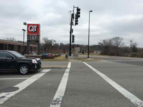
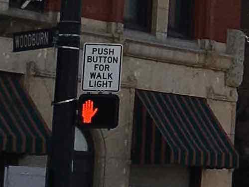
  1. Do not require pedestrians to press a button to get a WALK signal — except in very limited circumstances.
  2. Make sure every leg of a signalized intersection includes a pedestrian signal — with countdown timer.
  3. Allow pedestrians to cross at each leg of an intersection.
  4. Give pedestrians a head start with a WALK signal a few seconds before the traffic light turns green.
  5. Give pedestrians the walk before left-turning traffic, trailing left instead of leading left.
  6. Time pedestrian signals consistently. Some say DON’T WALK while traffic still has 30-60 of a green light remaining.
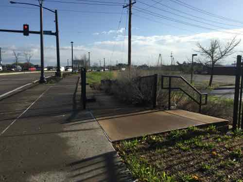
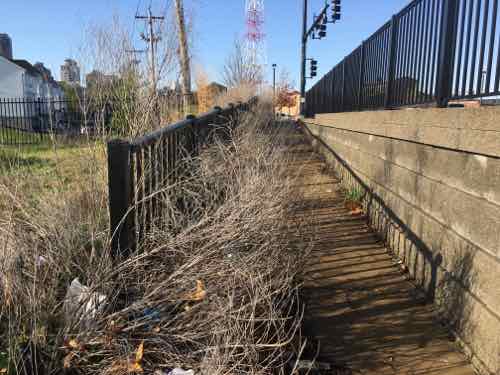
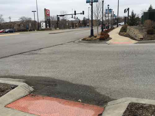
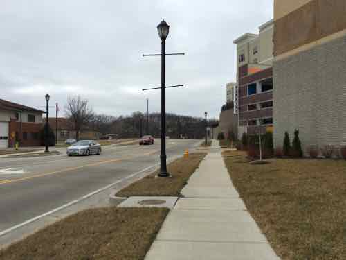
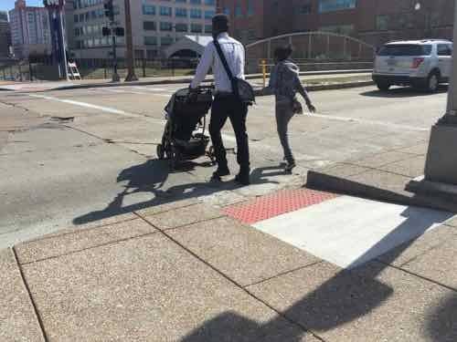
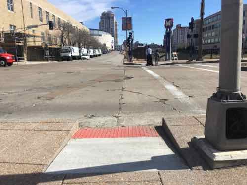
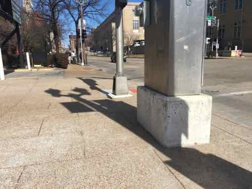
  7. Make sure sidewalks are level, not cracked. Sufficiently wide through path so pedestrians can meet/pass — not single file.
  8. Ramps perpendicular to curb, not on the apex of the corner.
  9. Use street trees and/or parked cars to separate pedestrians from vehicles
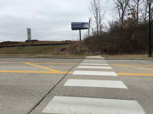
  10. Mid-Block crossings should be marked in the middle — a center sign and/or overhead light/sign

I don’t have photos to illustrate all ten items, but here are some:

A crosswalk & pedestrian signal in Cincinnati OH
The sign above the pedestrian signal lets pedestrians know this signal requires activation
They al;so mark the buttons too let pedestrians know they need to activate the walk signal.

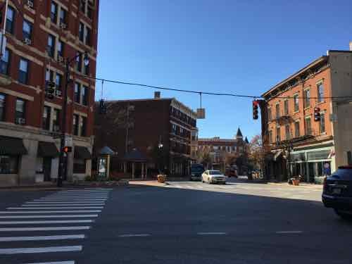
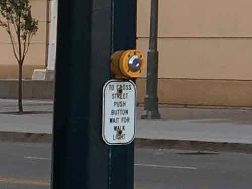
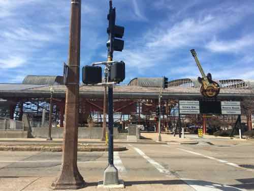
In their downtown the bulk of the crossings were automatic, no activation required. This is how it should be in places with higher pedestrian traffic. There were a couple of places where they need a button but that was only to activate audio signals for those visually-impaored — a sign was there to let the rest of us know it was an audio signal — we didn’t need to press it to get a WALK signal.

Cincinnati

As Oklahoma City rebuilds downtown the new crosswalks are very wide, curb ramps can accommodate many users. July 2012

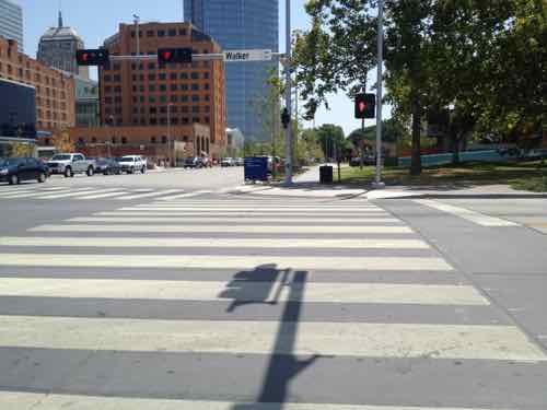
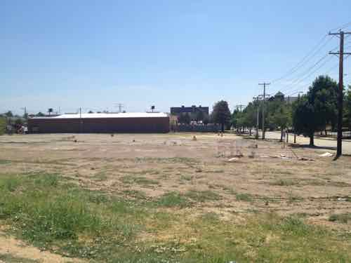
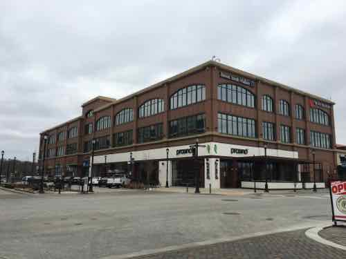
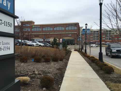
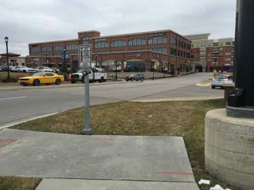
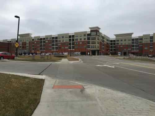
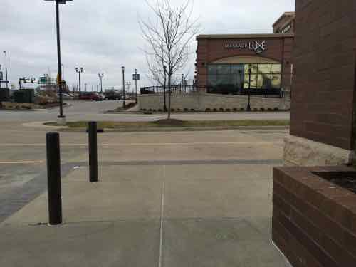
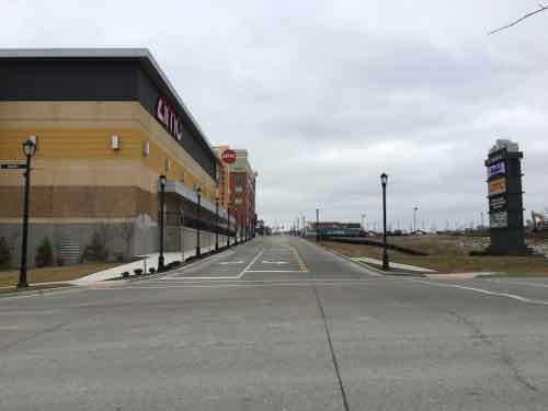
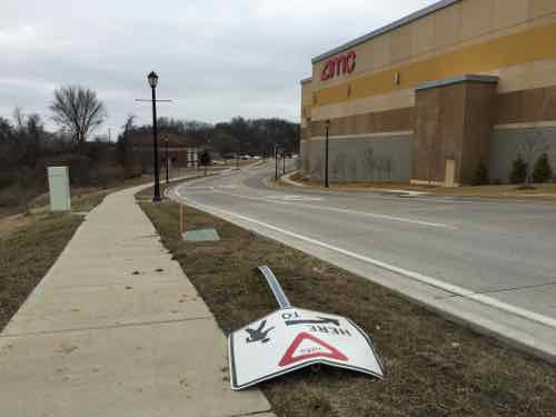
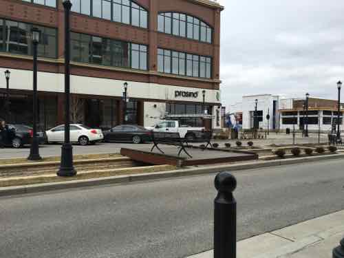
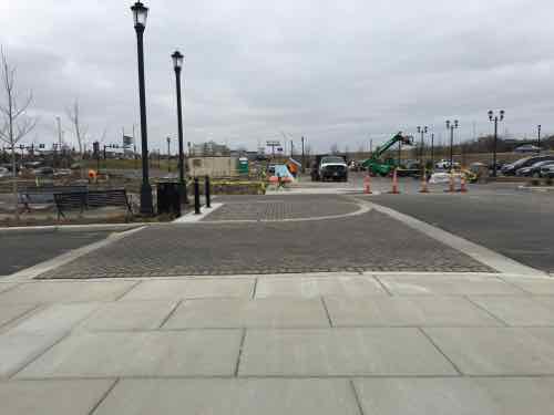
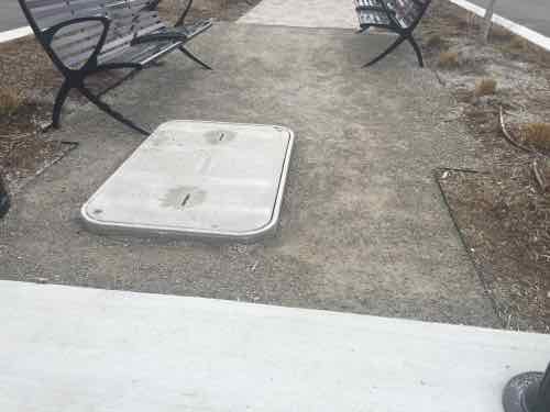
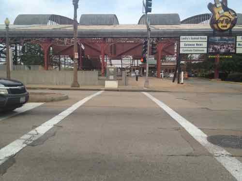
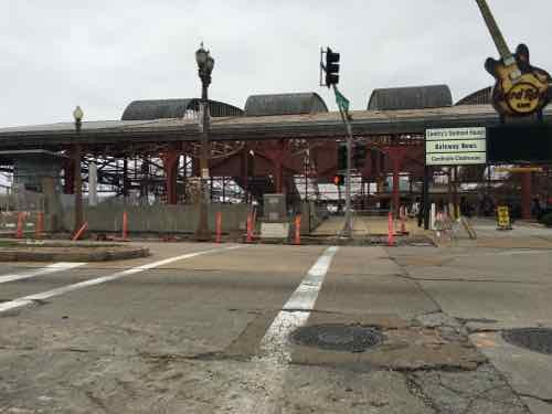
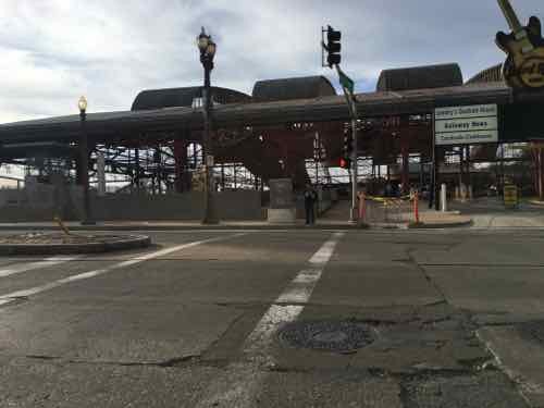
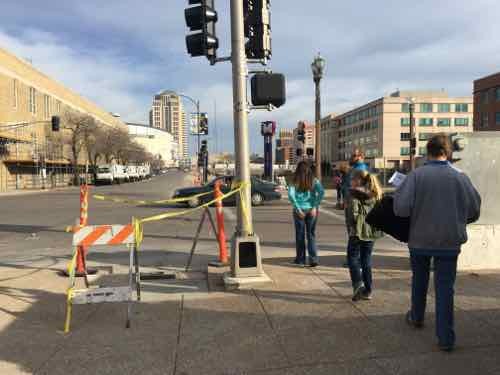
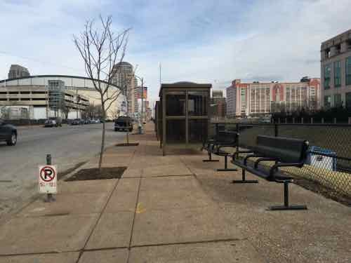
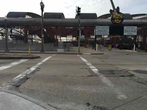
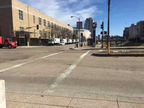
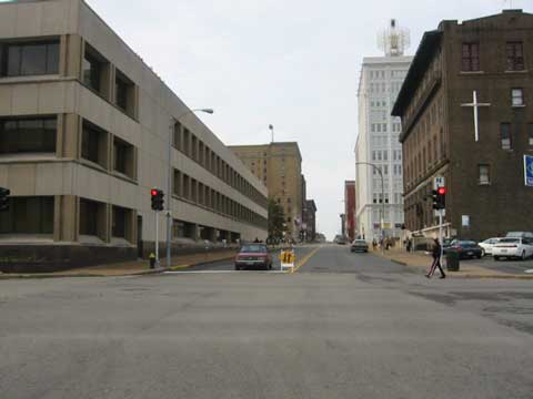
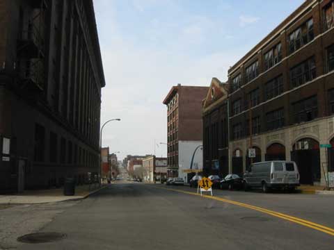
Contrast this with the narrow crosswalks and curb ramp in/around Ballpark Village — which are undersized for game-day pedestrian volume. As I find more examples in my photo library I’ll do a new post(s). In the meantime, I’d like us to take a walk.Ideally, we’d arrange for a power wheelchair for you to use so we can cover more territory.

Additional reading:

And please take 20 minutes to watch Dan Burden:

— Steve Patterson


McKee’s Gas Station & Grocery Proposal Highly Suburban In Plan — Inappropriate Near Central Business District

In a December 2011 post, titled Downtown’s New Entrance, I said the following of developer Paul McKee’s plans along the new Tucker coming into downtown from the Stan Musial Veterans Memorial Bridge:

I’m still concerned the new buildings will lack connections to adjacent sidewalks. St. Louis now has a “Complete Streets” policy, but no requirement for adjacent properties to connect. The ADA requires minimal connection but a building can be built and occupied without it, leaving enforcement up to those who complain. If we take McKee, and his consultants, at their word the area will be pedestrian-friendly. My preference, of course, would be a requirement by ordinance. Former 5th Ward Alderman April Ford-Griffin never would initiate such a requirement and I don’t expect any of the three woman running to fill the vacant seat to do so either. The election is December 20th. Good or bad, McKee has the Tucker & Cass area under control. But what about south of Biddle St? The 1986 McDonald’s was just razed and replaced. The new one does have an ADA access route from one of the four streets bordering the property, but it’s still a prototype  best suited for a suburban/rural highway exit.

I used the following graphic/caption in that post:

The following message popped up when I went to save this image from the source"Since we are still in the early design phases of the project, we ask that you please not copy our images yet since these designs are not final."
The following message popped up when I went to save this image from the source”Since we are still in the early design phases of the project, we ask that you please not copy our images yet since these designs are not final.”

New buildings were shown up to the streets, with parking behind — the way we should be things in the center of the region. Someone may drive to work, but it makes walking to lunch, for example, feasible.   Constructing new buildings back behind surface parking is typical suburbia — it has no place in the urban core of the region — not minutes from the Central Business District.

Years ago Paul McKee said he wanted to build walkable urbanism — not the drivable suburbia he was known for. Last week he presented a plan for two new buildings, one on each side of Tucker, that are highly suburban in their site planning.

The GreenLeaf Market will be located at 1408 N. 13th St., not far from the Stan Musial Veterans Memorial Bridge. Right across the street, McKee said there will be the ZOOM Store — a gas station, store and car wash.

“We expect the ZOOM Store to open by Thanksgiving and the other market to open by March 1,” McKee said.  (St. Louis Public Radio)

The worst-case scenario has come true — McKee is planning to build suburbia within minutes of the central business district. Not the pedestrian & transit-friendly vision he initially communicated.

On the left/East is Zoom gas station, and on the right/West is Greenleaf grocery store
On the left/East is Zoom gas station, and on the right/West is GreenLeaf grocery store
Crop of ZOOM gas station: Pedestrians are shown on the sidewalks, but no route to enter the business
View as motorists drive up to the pumps.
Crop of GreenLeaf grocery store. Like the gas station, no route shown for the pedestrians on the Tucker sidewalk to reach the entrance
Typical auto-centeric viewpoint

Both would be easy to have a pedestrian access route to a side street — ZOOM to O’Fallon and GreenLeaf to 13th. Technically achieving the bare minimum required by the Americans with Disabilities Act (ADA) is still a long way from being pedestrian-friendly.

I’ve defended McKee’s efforts to build new urbanism in areas such as the 22nd St Parkway interchange, Pruitt-Igoe, and Tucker & Cass. That was based on him indicating his intention to do something positively urban, not ordinary suburban.  These first buildings will set the pattern for this area.

I’ve been visiting & photographing this area since work on the new Tucker began. Here are some images from 2012:

Looking South at the new Tucker from Cass Ave, both sides have large land areas ready for development. July 2012 image
This land os all North of the proposed grocery store and Cass Ave. How will this be filled in? What route will people who live/work here take to walk to the grocery store? July 2012 image
Site of the proposed gas station, July 2012 image

Last month I went back again:

I knew from my earlier visits that O'Fallon St no longer connected to Tucker. Is this to change if the gas station gets built?
I knew from my earlier visits that O’Fallon St no longer connected to Tucker. Is this to change if the gas station gets built?
A ramp that's too narrow because of plants goes from Tucker down to O'Fallon
A ramp that’s too narrow because of plants goes from Tucker down to O’Fallon
O'Fallon St just currently just ends. Reopening to Tucker would further complicate the traffic intersection
O’Fallon St just currently just ends. Reopening to Tucker would further complicate the traffic intersection
View looking toward Tucker from the site of the proposed gas station.
Southbound on Tucker, the grocery store would be built on the right past the billboard
View from 13th looking at the proposed grocery store site. The wall is the last bit of the tunnel where the commuter train went under Tucker

How we begin building on these large swaths of land matter, we need to ensure people can walk from building to building in the most direct manner possible — not some circuitous route or through surface parking lots. I’ve already contacted Good Natured Family Farms to tell them I welcome a grocery store — but not in a suburban form.

— Steve Patterson


A Detailed Look at the Streets of St. Charles

Last month I posted about the Streets of St. Charles after driving through it, see Indulge In Urban Living’ At Streets of St. Charles. In that post I wrote:

To most residents of St. Charles County this is more urbanity than they ever thought they’d see on their side of the Missouri River.

A decade or more ago this site would’ve been developed as a big box with an even bigger parking lot. Smaller buildings would’ve dotted the perimeter. Visitors would’ve been expected to arrive via car and to drive to reach other buildings on the site.  From my brief observations, it appears the planners have made sure pedestrians can reach every building via a sidewalk.

While I’m not going to give up my downtown loft to live here, it’s an improvement over old-school development patterns.

I didn’t feel I could be too harsh based on just driving through. So, later in February, I returned in my power wheelchair so I could spend more time there —  to see how well it works…or doesn’t. Within the project boundaries it works fairly well, they’ve made a much better effort than most developments to make sure each business is accessible as a pedestrian. Attempting to reach adjacent & nearby developments proved difficult, though the blame for that isn’t necessarily the fault of this developer.

To reach the Streets of St. Charles I took the St. Charles Area Transit's I-70 bus from the North Hanley station in St. Louis County, click image to see post in new tab/window
To reach the Streets of St. Charles I took the St. Charles Area Transit’s I-70 bus from the North Hanley station in St. Louis County, click image to see post in new tab/window

I arrived at just before 10am — in need of a bathroom. I knew the adjacent Quik Trip would be a good choice.  Just how to get to it.

I know the QT is on the other side of this, office building -- the first built on the site
I know the QT is on the other side of this, office building — the first built on the site
Staying on the sidewalk near the office building i end high up, overlooking the QT
Continuing I'm down lower, but no access route from here
Continuing I’m down lower, but no access route from here
Back on the West side, on the lower sidewalk heading right toward the QT
Even though planned and built simultaneously, nobody thought to connect them! Pavers were added to keep people out of the planter -- but that doesn't work for me.
Even though planned and built simultaneously, nobody thought to connect them! Pavers were added to keep people out of the planter — but that doesn’t work for me.
So I turn West, towered 5th St, to see if I can find a way into the QT
Looking back
Looking back
Crossing the drive heading South
Crossing the drive, heading South
The sidewalk on the QT side of the drive looks like it wants to go into the development -- but no.
The sidewalk on the QT side of the drive looks like it wants to go into the development — but no.
On the South (far) side of the QT now
Found it!
Found it!
From the back side of the QT, looking North toward the office building -- no pedestrian connection
From the back side of the QT, looking North toward the office building — no pedestrian connection
From the front side of the QT, looking North toward the office building -- no pedestrian connection
From the front side of the QT, looking North toward the office building — no pedestrian connection
Back out along 5th St I see signs for the charming historic district ahead -- too early for lunch. Oh never mind, the sidewalk doesn't continue past this driveway
Back out along 5th St I see signs for the charming historic district ahead — too early for lunch. Oh never mind, the sidewalk doesn’t continue past this driveway
I'm back along the North St that connects 5th to Main, this woman parked in the parking lot, right, then walked through the planter to reach the crosswalk. Nobody seemed to plan a way for motorists to walk from their cars to the buildings!
I’m back along the North St that connects 5th to Main, this woman parked in the parking lot, right, then walked through the planter to reach the crosswalk. Nobody seemed to plan a way for motorists to walk from their cars to the buildings!
I headed toward Main St, the East edge of the development, The sidewalk here seemed narrow.
The parking garage entrance
The pedestrian entry to the garage, the movie theater on the left
I went up to the top level of the garage. Here we see the back of the residential building -- which hides the garage from view
I went up to the top level of the garage. Here we see the back of the residential building — which hides the garage from view
Looking North from the top level of the parking garage we see site prep underway for the Drury Hotel to be built soon, I-70 beyond. My lunch destination is just out of view to the left.
Back on the sidewalk, heading East toward Main St
Looking South along Main St
But I want to see if I can get to the historic Main Street from here, since I couldn't via 5th St
But I want to see if I can get to the historic Main Street from here, since I couldn’t via 5th St
Heading North, about to go under I-70. The Ameristar Casino complex can be seen in the upper right
I must cross over to the East side of Main St to continue heading North
Good crosswalk, though pedestrian refuge in the middle would've been comforting
Good crosswalk, though pedestrian refuge in the middle would’ve been comforting
Looking back
Looking back
After going under I-70 the sidewalk suddenly ends -- just shy of the casino & hotel entrance drive and the South end of the historic district. So I turn around and head back.
After going under I-70 the sidewalk suddenly ends — just shy of the casino & hotel entrance drive and the South end of the historic district. So I turn around and head back.
As you can see I was close. The distance between this new development and the casino is only a half mile.
I stayed on the East side of Main St, the AMC theater is on the left, the new hotel will be on the right
The pedestrian crossing sign had been run over
It still wasn't 11am so I stopped and had a hot chocolate at Picasso's, ground floor of the residential building
It still wasn’t 11am so I stopped and had a hot chocolate at Picasso’s, ground floor of the residential building
I leaned public restrooms are in the adjacent hallway connecting the parking garage to the street
There are several of these places to cross the center of the street or sit on a bench --- not ADA-compliant,
There are several of these places to cross the center of the street or sit on a bench — not ADA-compliant,
Heading North for lunch, the hotel will be built to the right
Looking West at restaurants under construction. In the foreground is another non-ADA crossing
My destination is Pieology Pizza
I can cross here, a raised crosswalk
Construction workers to the West managed to put cones in the pedestrian path. I was able to move the first and go around the others
This is what most developments miss -- being able to access every building on the site. A Noodles & Co will open in the space next door
This is what most developments miss — being able to access every building on the site. A Noodles & Co will open in the space next door
Accessible crossing toward the future hotel
Pieology Pizzeria is one of several quick pizza chains where each is made right in front of you
My pizza & salad
My pizza & salad
After lunch I noticed the center median has a path, but it isn't really accessible because vertical heights are too tall
After lunch I noticed the center median has a path, but it isn’t really accessible because vertical heights are too tall
In the end, the feeling of urbanism is very limited to this block.

The internal site issues are pretty easy to correct, including a direct connection toward QT. Other problems, beyond the site, are more complex. St. Charles City, St. Charles County, MoDOT, etc all need to play a role in better connecting this site to its surroundings.

— Steve Patterson


Metro Makes Long-Needed Changes at 18th & Clark, Still Violates ADA

In a couple of weeks Metro’s new North County Transit Center will open, so many MetroBus routes will see major changes:

Metro’s quarterly service change on March 14 will impact the operations of 48 MetroBus routes in the St. Louis metropolitan region, including the introduction of nine new MetroBus routes and discontinuation of service on eight routes. This service change will also introduce a new and completely redesigned MetroBus service plan for North St. Louis County, made possible with the opening of the new North County Transit Center in Ferguson, Missouri on March 14. (Metro)

On that same day, changes will take place in downtown (technically Downtown West):

The Civic Center Transit Center is scheduled to be closed down for construction activity shortly, at a date to be decided. In advance of the closure, Metro has prepared bus stops at 18th Street & Clark Street, adjacent to the Union Station MetroLink, to provide the same system connectivity. 

The routing and schedules of the routes serving the Civic Center Transit Center have been modified to serve 18th Street & Clark Street to ensure the same connections with the other MetroBus routes and MetroLink at Union Station instead.

Please note that till the closure of the Civic Center Transit Center, these routes will continue to serve the Civic Center Transit Center. Public Announcement of the closure of the Civic Center Transit Center will be made in advance of the event. (Metro)

The following MetroBus routes will change to include 18th & Clark.

  • 10 Chippewa
  • 32 ML King-Chouteau
  • 41 Lee
  • 73 Carondelet
  • 80 Park-Shaw
  • 94 Page
  • 97 Delmar
  • 99 Downtown Trolley
  • 40X I-55 Express
  • 58X Twin Oaks Express
  • 410X Eureka Express

When I need to catch the #10 Westbound I do so at 16th & Olive, but starting March 14th it’ll use 18th rather than 14th Street. Same goes for the #97  — I usually catch it at 16th & Washington but it’ll turn on 18th.  Those who ride the #94 & #97 to Washington & 14th, then catch the #99 Downtown Trolley to take them the rest of the way into the Central Business District (CBD), will need to figure out an alternates. Perhaps catching the Trolley bus at Civic Center/18th & Clark? That’ll require more time though — years ago more bus routes entered the CBD.

For a few months now I’ve been watching the changes at 18th & Clark. I posted about the upcoming Civic Center changes in 2014, see Civic Center Transit Center Sans Trees, Awaiting Redo.

Before I get into the recent changes along Clark I want to show you the before conditions, in October 2011 & August 2012.

Looking west toward the Union Station MetroLink Station from 16th & Clark, October 2011.
At 18th pedestrians had worn a more direct path since MetroLink opened in 1993, October 2011
The crosswalk to Union Station led directly to a curb, those of us in wheelchairs had to go outside the crosswalk and use the auto exit, at right -- a clear ADA violation for years, August 2012
The crosswalk to Union Station led directly to a curb, those of us in wheelchairs had to go outside the crosswalk and use the auto exit, at right — a clear ADA violation for years, August 2012

Ok, so now you’ve seen the before. In December last year I began seeing work going on so I braved the cold one day to get some pics:

The asphalt in the parking lane was removed, sidewalk & curb ramp at 16th also removed, December 2015
The old bricks were visible, street trees gone, December 2015
The corner was completely opened up, forms were placed for new concrete, December 2015
Looking West across 18th you can see the curb & sidewalk have been removed, December 2015
From the West side of 18th looking back, December 2015

I was encouraged seeing the West end of the crosswalk completely removed — a fresh start so it’ll be done correctly! I returned a month later, in late January:

Now we can see the sidewalk has been widened, replacing half the parking lane, January 2016
About halfway between 16th -18th the extra sidewalk narrows to the original width, January 2016
Looking across 18th we see at the end of the crosswalk --- A NEW CURB! WTF!?!
Looking across 18th we see at the end of the crosswalk — A NEW CURB! WTF!?! January 2016
Pedestrians taking the direct route from MetroLkink East across 18th, with the ramp on the left, January 2016

I returned again, a month later, on February 26th:

The widest park, near 16th
The widest park, near 16th, February 2016
Temporary bus shelters added in the narrow section makes it tight, February 2016
There are new benches in places , February 2016
Crosswalk not yet changed to include the new curb ramp, February 2016

The ramp location behind the crosswalk is a head scratcher, for sure. I resisted the urge to post it to social media — opting to wait until the project is closer to completion.  I even went back yesterday to see if the crosswalk had been changed. It hasn’t. I also discovered another problem: pedestrian signal location.

I arrived on the West side just as people pushing a stroller used the ramp to cross 18th
That's when I noticed the pedestrian signs, far right, wasn't visible. The ramps also aren't aligned, but we already knew they wouldn't.
That’s when I noticed the pedestrian signs, far right, wasn’t visible. The ramps also aren’t aligned, but we already knew they wouldn’t.
The pedestrian signal is visible only when way South pf the ramp & crosswalk
From the same spot you can see the ramp. My chair is very fast so I was able to wait for the walk signal then move to the ramp & cross -- but not everyone can move so quickly
From the same spot you can see the ramp. My chair is very fast so I was able to wait for the walk signal then move to the ramp & cross — but not everyone can move so quickly
From the East side you can see the back of the pedestrian signal and how it doesn't relate to the other side
From the East side you can see the back of the pedestrian signal and how it doesn’t relate to the other side

The best words that come to mind are gross incompetence. Both sides were completely opened up — all new concrete. That was the time to move pedestrian signals so they align with the crosswalk, to build the new ramps so they also align. I’m not sure if St. Louis’ new bike-pedestrian coordinator reviewed this, but other civil engineers did see it on paper. This is yet another thing making me realize I need to live in another city.

— Steve Patterson


A Decade Since Locust Street Returned To Two-Way Traffic

February 16, 2016 Downtown, Featured, History/Preservation, Planning & Design, Transportation, Walkability Comments Off on A Decade Since Locust Street Returned To Two-Way Traffic

A decade ago I was still living in South St. Louis, but I posted about a street I would move to within 2 years:

What a difference! Today I drove the full length of Locust Street from 14th west to Teresa (just shy of Grand). For the first time since I’ve lived in St. Louis, I was able to drive eastbound on Locust. It was like a totally different street!

Heading westbound from downtown you see new markings on the street when you are approaching 14th Street behind the library. The right lane becomes a right-turn only lane while the left lane is forward or a left turn. Ahead you can see temporary two-way signs that will likely stay around until people have adjusted to the change.

Driving down the street I noticed myself not wanting to drive as fast. With only a single lane in my direction and cars coming the other way in their lane it just didn’t seem like a high-speed escape route anymore. I knew if would feel different but it was more profound than I had anticipated. Locust St. Now Two-Way West of 14th!

That was ten years ago today — here are a few of images from that post:

In November 2007 I bought a loft in the building on the left.
Looking West from 14th & Locust. This signalized intersection still doesn't have crosswalk markings. Click image to see recent post on crosswalks.
Looking West from 14th & Locust. This signalized intersection still doesn’t have crosswalk markings. Click image to see recent post on crosswalks.
Looking West from 17th

I can imagine  how awful these last eight years would’ve been if Locust St had remained one-way Westbound. Hopefully we’ll get around to changing Pine & Chestnut back to two-way traffic West of Tucker (12th) – 14th.

— Steve Patterson


Advertisement


[custom-facebook-feed]

Archives

Categories

Advertisement


Subscribe