Please vote in the poll, located in the right sidebar
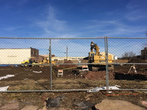
Paul McKee’s “Northside Regeneration” has been controversial since before it became public, it has faced court challenges and has experienced delays. Now, however, it seems to be ready to move forward.
The question for the poll this week is what qualities should be priorities of the project? Please select your top from from the list provided in the poll in the right sidebar.
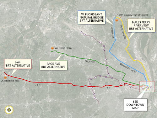
In September readers picked the I-64 BRT route between downtown and Chesterfield as their favorite of four bus rapid transit (BRT) routes being studied by the Transportation Corridor Improvement Group (TCIG), which “consists of staff from Metro, EWGCOG, the City of St. Louis, St. Louis County, and MoDOT”.
“None” was 2nd in the poll, but the next actual route favored was the West Florissant – Natural Bridge BRT option. On Tuesday the TCIG recommended two locally preferred alternative routes to Metro’s Operations Committee:
After careful consideration and analysis of the transportation corridors, the TCIG recommended as the locally-preferred alternative two BRT projects: I-64 between Chesterfield and Downtown St. Louis, and a north-south route connecting North St. Louis County to Downtown St. Louis primarily via West Florissant Avenue and Natural Bridge Avenue.
The 1-64 BRT corridor spans 23 miles between the City of Chesterfield and Downtown St. Louis. It would serve a limited number of park-and-ride stations along I-64 between Chesterfield Mall and the Central West End. From the Central West End it would travel along Forest Park Avenue into Downtown St. Louis, making a loop through Downtown before ending at the Civic Center Station. As currently proposed, its service frequencies would match MetroLink, and transit prioritization strategies would be implemented along the corridor to speed transit travel.
The I-64 BRT would serve a Central Corridor that hosts 55,000 people and 115,500 jobs within one half-mile, outside of Downtown St. Louis. The addition of this high-performance service to the Metro System would provide the region’s first rail-like transit option in West St. Louis County, offering the first opportunity for all-day, single-seat service between Chesterfield and Downtown St. Louis, and reducing transfers from other areas by half. Along with reducing transfers, it would improve transit travel time within the corridor by 30%, making it a much more attractive alternative to the personal automobile. Ridership projections from EWGCOG’s regional travel demand model show a potential ridership market of 5,100 weekday riders, 2,100 (41%) of whom would be new “choice” riders. That market is projected to grow to 6,800 weekday riders by 2040.
I-64 BRT CONSUMER BENEFIT
End-to-end transit travel time reduced from 76 minutes to 53 minutes
– Compared to auto travel time of 25 minutes
– Offers motorists option of comfortable, affordable, productive commute
Corridor ridership projected to increase 357% from 1,115 to 5,100 weekday riders opening year; 6,800 in 2040
– 2,100 (41%) new “choice” riders opening year
Enhanced service
– BRT option provides single-seat service not currently available
– Reduce transfers by 50%
– End-to-end service available all day, rather than only peak
– Create additional hubs to make local bus service more efficient
This route makes a lot of sense to me. It gets a higher level of transit service on this corridor without the enormous infrastructure expense that would be required for light rail. It would run down Forest Park Ave & Boyle, running right past the proposed IKEA and connecting with the proposed new CORTEX MetroLink station. Transit time would be reduced from three times driving to twice driving. For some that’s still a non-starter, but for others it would allow them to avoid driving/parking headaches while being able to be productive. It doesn’t need to get every driver out of their cars to be a success.
The other transit project included in the LPA is an arterial-based BRT route connecting North St. Louis County to Downtown St. Louis. This service would operate out of the new North County Transit Center, running 16 miles to Downtown via West Florissant Avenue, Lucas and Hunt Road, and Natural Bridge Avenue. As currently proposed, its service frequencies would match MetroLink; stations with a high level of customer amenities would be spaced a minimum of one mile apart; and transit prioritization strategies would be implemented to speed travel.
The combined West Florissant-Natural Bridge corridor hosts 70,000 people and 18,000 jobs within a half-mile, not counting Downtown St. Louis. Supplementing the local bus network in this strong and proven transit market will give residents of North St. Louis City and near-North County their first high-performance, rail-like transit option. It will reduce transit travel time and any required transfers by half. It would also greatly improve access and travel time between some of the region’s most disadvantaged areas and major jobs centers in Downtown and the Central Corridor, particularly if paired with the I-64 BRT option. Ridership projections from EWGCOG’s travel demand model show a potential ridership market of 3,200 weekday riders, 600 (19%) of whom would be new “choice” riders.
W. FLORISSANT–NATURAL BRIDGE BRT CONSUMER BENEFIT
End-to-end transit travel time reduced from 85 minutes to 42 minutes
Corridor ridership projected to increase 23% from 2,610 to 3,200 opening year and 2040 (Natural Bridge)
600 (19%) new “choice” riders
Enhanced service
BRT option supports fast single-seat ride to Downtown St. Louis
If paired with I-64 BRT, travel from North County to CWE and West County would require only 1 transfer between 2 high-speed routes; currently requires multiple transfers and 2-3 local routes
Unlike going to Chesterfield, reaching downtown from North St. Louis County isn’t very direct via car or transit. This will help reduce travel time for existing transit users and is expected to attract new riders. The streetscape improvements along the route will benefit everyone in the area.
Additional information
Travel speeds competitive with MetroLink
Avg MO MetroBus speed = 16.02 mph
Avg MO MetroLink speed = 25.63 mph
I-64 BRT speed = 26.04 mph
WFNB BRT speed = 25.71 mph
The report has very detailed cost projections, here’s the summary:
I-64 BRT: $37.9M capital; $4M net operating
West Florissant – Natural Bridge BRT: $39.1M capital; $2.6M net operating
Additional operational revenue would be necessary for this additional service.
Next Steps
Metro’s board is expected to vote to approve these two locally preferred routes at their March 28th meeting. If approved it goes to East-West Gateway Council of Governments, the Metropolitan Planning Organization (MPO) for the St. Louis region. Once part of our 2040 transportation plan we can seek capital funding through the Federal Transit Administration’s Small Starts program.
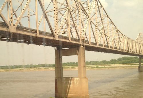
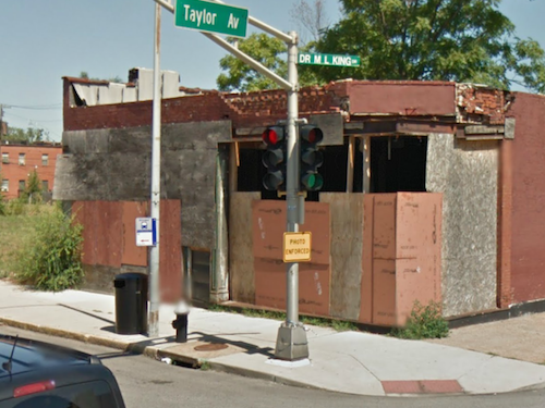
This is my 10th year blogging on Dr. Martin Luther King Jr. Day, on each of the previous nine years I’ve taken a look at Dr. Martin Luther King Drive in the City of St. Louis. Let’s start at the Mississippi River withn the King Bridge, originally known as the Veterans Memorial Bridge.
The MLK Bridge viewed from an Amtrak train in 2012
The Veterans Memorial Bridge was built by the City of East Saint Louis as a toll bridge, opening in 1951. At the time, it was the 6th longest cantilevered truss bridge in the US, and the largest cantilevered truss bridge over the Mississippi River. It carried US-40 and US-66 from 1955 until 1967. When the Poplar Street interstate highway bridge opened as a free bridge in 1967, the toll revenue from the Veterans Memorial Bridge dropped off dramatically. Eventually, both the bridge and the City of East Saint Louis would end up going bankrupt. The bridge was renamed in honor of Dr. Martin Luther King, Jr. in 1968. The structure continued to go downhill until it had to be taken over by the Saint Louis Port Authority and rebuilt in the late 1980’s, opening again in early 1989. (Source)
At that time drivers coming into St. Louis on the newly renamed bridge crossed under the elevated highway but the road split — Delmar Ave. to the left (south) or Franklin Ave. to the right (north). This 1958 aerial is clearer than the 1971 aerial. My guess is there was debate in St. Louis about which street to rename for Dr. King. This is just a hunch given the fact it wasn’t until 1972 that part of Franklin Avenue and Easton Avenue were renamed to honor Dr. King. I hope to do some research on the naming process before MLK Day 2015.
MARTIN LUTHER KING DRIVE (E-W). (Official designation is DR. MARTIN LUTHER KING DRIVE.) Following the route of the early trail from St. Louis to St. Charles, this street was officially named St. Charles Rock Road in 1865 and renamed Easton Avenue in 1881 to honor Rufus Easton, an early St. Louis postmaster. It received its present name following the assassination of the Reverend Martin Luther King, Jr., in 1968. King won a Nobel Prize in 1964 for his work to gain full civil rights for black Americans.
EASTON AVENUE (E-W). Honored Rufus Easton, who was named St. Louis’ first postmaster in 1805. He also served as Missouri’s first attorney general and gained recognition as one of the leading lawyers of his day. The name Easton still occasionally appears on city street maps although Easton Avenue is now known as Dr. Martin Luther King Drive. (St. Louis Library Street Index):
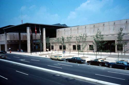
Just a few years later we began removing blocks of Dr. Martin Luther King Drive, first the two blocks were between 7th-9th for the Cervantes Convention Center, which opened in 1977. This cut off the ability to drive directly from the King Bridge onto MLK Drive.
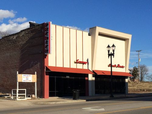
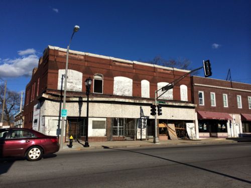
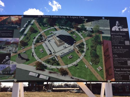
There are now several groups working in the Wellston Loop area, each with the stated goal to revitalize the area. Their strategies are diverse and not entirely compatible with each other. Over the next year I plan to talk with the various players, asking each why they think their strategy will be successful.
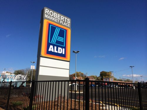
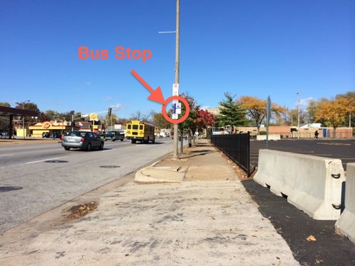
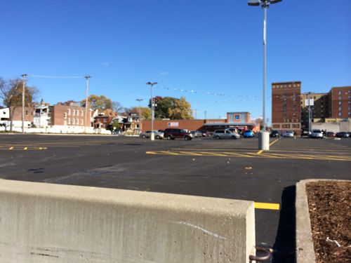
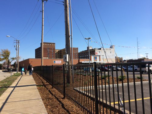
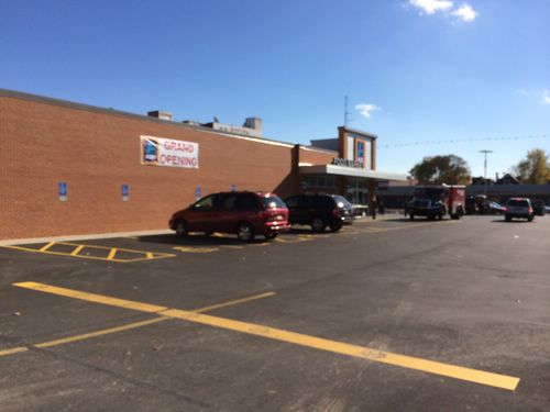
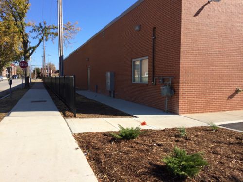
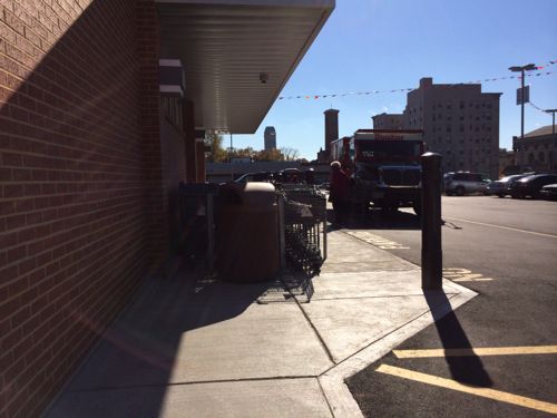
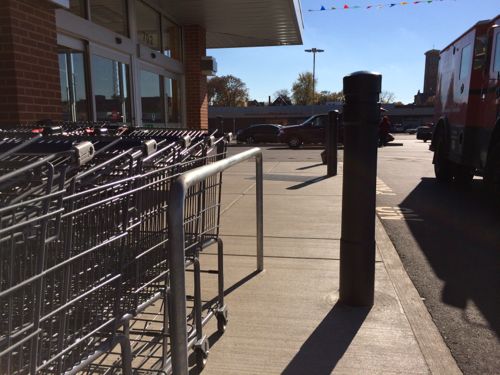
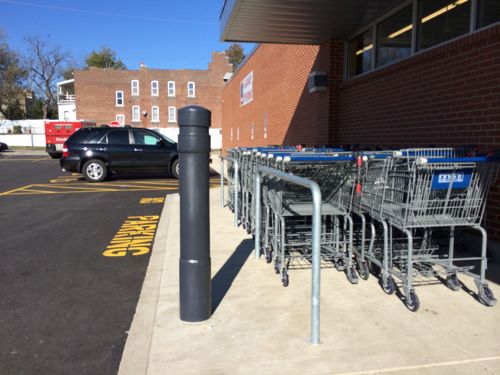
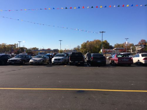
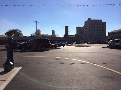
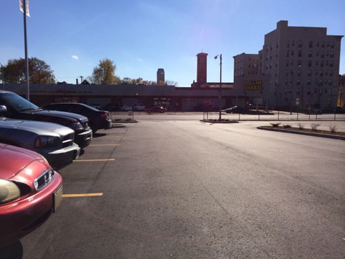
The Roberts Market Place has opened at Kingshighway & Delmar, the site of a former Schnucks. Discount grocer ALDI, the only business so far, is the anchor. Unfortunately, it is designed to be driven to, not walked to.
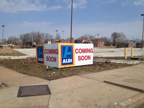
Roberts Market Place on the NE corner of Kingshighway & Delmar, click image for map linkThe same corner back in AprilLooking east along DelmarLooking north along Kingshighway, a stop for the #95 MetroBus is circled in red. Concrete barriers block the auto driveway.The fencing blocks pedestrian access, except at the auto driveways. Not welcoming at allLooking east along Enright Ave we see a family leaving ALDIAn opening in the fence at the auto driveway.At least a walkway was provided at one pointNot a straight shot or wide enough if you meet someone, but as a bare minimum it works…except…Who fits between the carts & bollard? Certainly nobody using a cane, walker, scooter, or wheelchair! #adafailLooking back at the problem from the opposite sideLooking west toward KingshighwayLooking south toward DelmarGetting closer toward Delmar we can see the fence forces pedestrians to enter/exit via the auto driveway
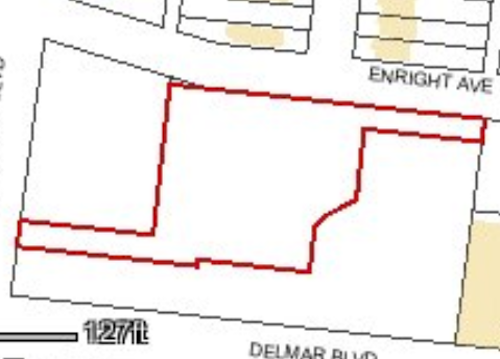
Seriously? The one minimal pedestrian route from a secondary road is blocked by a bollard!?! As I mentioned in April, the site has been divided into three parcels.
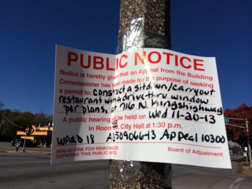
Outline of the ALDI parcel, the other two are just parking right now.A hearing will be held on the 20th for a drive-thru fast-food restaurant at the Kingshighway & Enright parcel
It would’ve been relatively easy to plan a north-south sidewalk through the site connecting Enright to Delmar, with a perpendicular walk connecting to the bus stop on Kingshighway. This would’ve provided a pedestrian route to all three adjacent streets and to all three parcels. Instead we’ve got another development that ignores pedestrians almost entirely.
The #97 (Delmar) bus and #95 (Kingshighway) bus generate lots of pedestrian traffic at this location. Many customers & employees of ALDI, a new drive-thru, and a third place will arrive on foot. Development in our neighborhoods should be designed to welcome motorists, bicyclists, and pedestrians. This must be mandated, developers aren’t going to do it on their own — especially not in low-income areas where they do as little as possible.
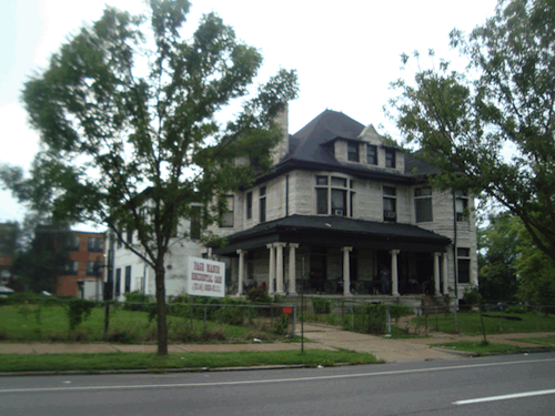
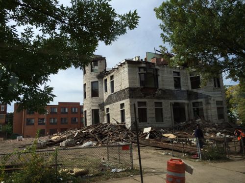
The once-stately residence at 3630 Page Boulevard was used as an assisted living facility for years. Now the 1888 structure is being razed.
2009 photo of ‘Page Manor’ from GEO St. LouisEarlier this week from the #94 MetroBus
The sad part is this property is in the 19th ward, so Cultural Resources wasn’t even given a chance to review the request for the demolition permit. Most of the city is in a “preservation review” area where trained staff look at requests for demolition, referring some to the Preservation Board for a decision on the fate.
Note: city records list the property address as 3630 Page Blvd, but Page Manor used the address 3636 Page Blvd.
AARP Livibility Index
The Livability Index scores neighborhoods and communities across the U.S. for the services and amenities that impact your life the most
Built St. Louis
historic architecture of St. Louis, Missouri – mourning the losses, celebrating the survivors.
Geo St. Louis
a guide to geospatial data about the City of St. Louis