January 16, 2023Featured, MLK Jr. Drive, North CityComments Off on 19th Annual Look at the State of St. Louis’ Dr. Martin Luther King Jr. Drive Pt 2: Kingshighway to City Limits
This post continues looking at Martin Luther King Jr. Drive in St. Louis, west of Kingshighsway. For east of Kingshighway see Part 1.
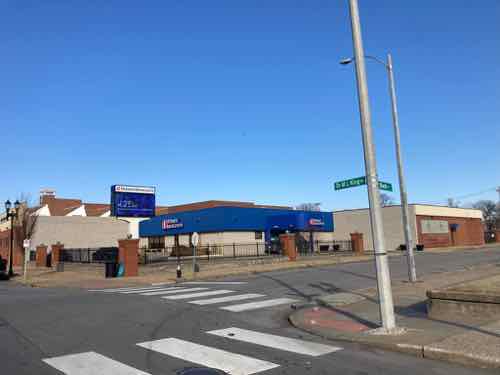
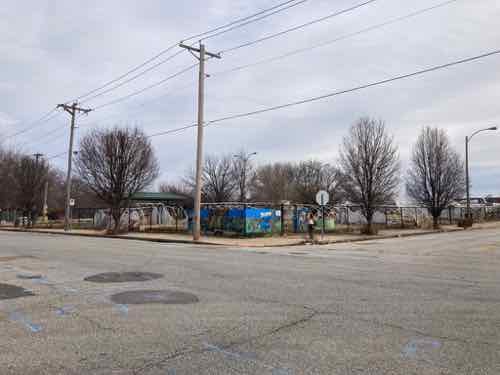
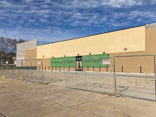
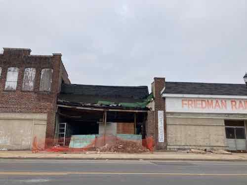
The MLK corridor is underserved by financial institutions, so it’s nice to see a bank on the NW corner of MLK & Belt Ave., within the huge Friendly Temple Church complex.
Unfortunately like so much this too is auto-centric, set back behind auto storage. There are no provisions for a pedestrian ADA accessible route — pedestrians must use automobile driveways to reach the accessible building entrance. Pedestrians are likely prohibited from using the drive thru lane on the east side. An accessible parking space is provided, but it doesn’t have the required high sign at the front of the space.
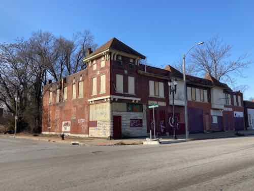
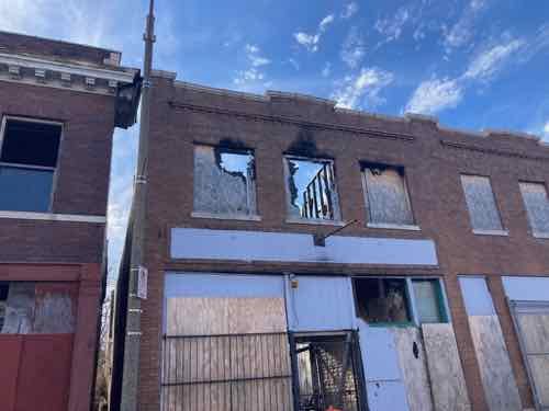
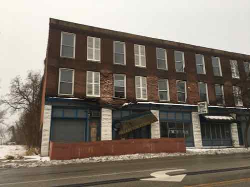
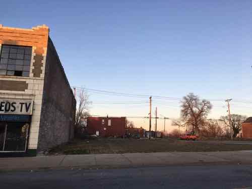
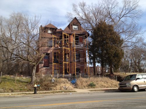
A favorite building of mine, located on the SW corner of MLK & Blackstone Ave, continues to fall apart. The load-bearing side wall is starting to crumble.
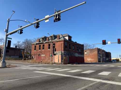
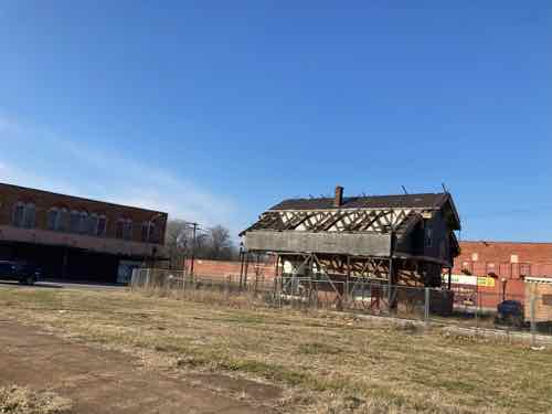
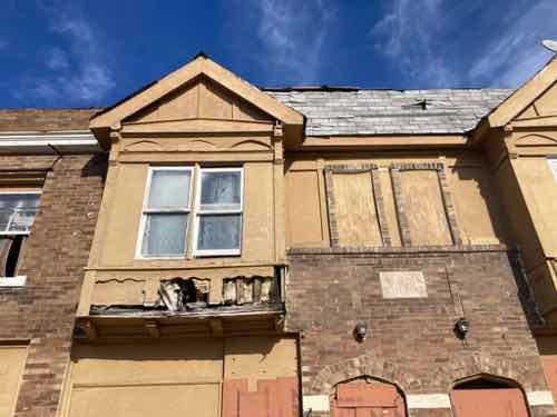
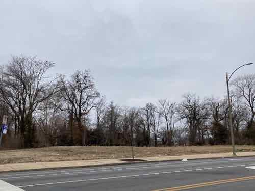
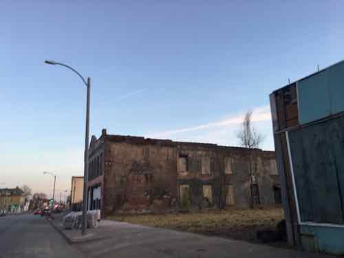
Just to the west, on the SW corner of MLK & Goodfellow Ave, is another great building slowly decaying.
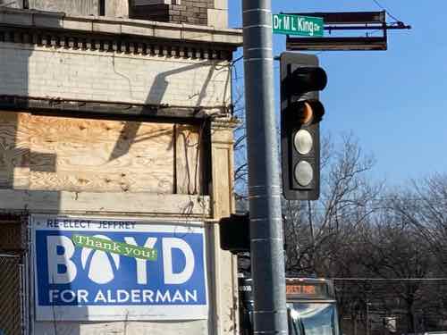
Looking west on MLK at Goodfellow Ave. we see the previous building on the left, a handsome but newer old building on the NW corner,
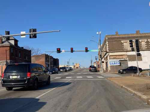
Both street sides of this building have campaign billboards for Jeffrey Boyd — he and two others resigned in 2022 in a pay-to-play scandal. All 3 were found guilty, headed to prison.
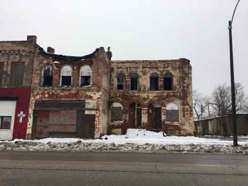
A little further west, up a slight grade, is another building I like that’s crumbling.
Another view
At 5879 MLK is the 22nd Ward Headquarters, the one-time office of Jeffrey Boyd.
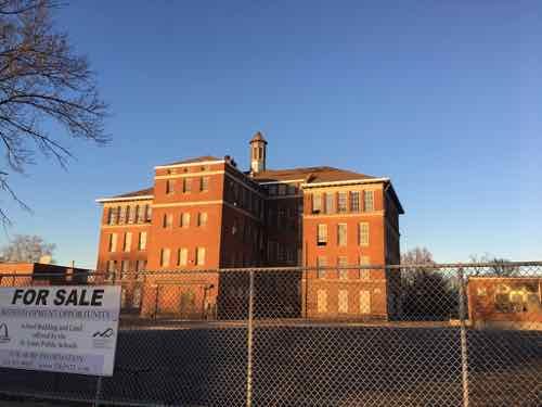
At 5930 MLK is a former J. C. Penny department store. Gorgeous International Modern design. Would love to see this renovated and occupied. IDEA: a hydroponic with a storefront market.
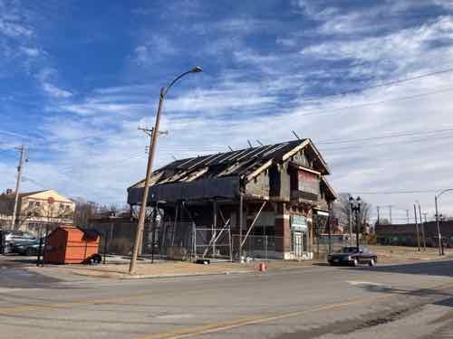
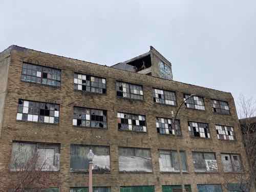
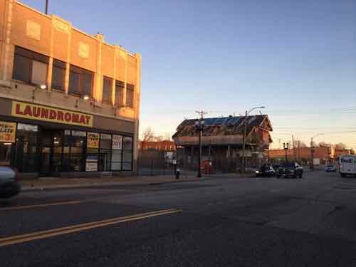
West of Euclid the iconic Wellston Loop streetcar building…continues to deteriorate. A couple of years ago it was covered and protected, but those efforts appear to have stopped. In the 90s the vacant lot you see held a nice 5+ story building.
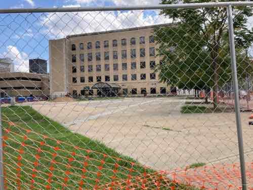
As seen from Dr. Martin Luther King Jr. Drive at the city limits.
From east to west MLK Dr passes through the following wards: 14, 11, and 12. It’s a boundary for the 10th ward.
North St. Louis is the least populated part of the city, so each ward is physically larger than other wards. The bad news is this means lots of problems, poverty, etc. On the plus side the solutions that should be implemented are largely big picture, not micro neighborhood by neighborhood. The latter is how we end up with nice urban infill around a renovated historic building…across the street from a gas station/convenience store (see Arlington Grove vs Mobile in Street View.
The urban Arlington Grove Apts as seen from the auto-centric gas station across the street, 2013
Hopefully new aldermen will be more open to urbanist planning rather than continuing the failed suburbanization of the city. I’m not optimistic.
— Steve ———————————————————————— St. Louis urban planning, policy, and politics @ UrbanReviewSTL since October 31, 2004. For additional content please consider following on Facebook, Instagram, Mastodon, Threads, Bluesky, and/or X (Twitter).
Today’s post is a look at Martin Luther King Jr Drive in the City of St. Louis — my 18th annual such post. As in the 17 times prior, I traveled the length in both directions looking for changes from the previous year.
Streetsign
Not much has changed since MLK Day 2021 but I’ll detail them later. First I want to address how the street gots it name, and when. After Dr King was assassinated in Memphis in 1968 some cities began almost immediately to rename major streets in his honor. St. Louis took four years.
This Day in St. Louis History, February 17, 1972: Martin Luther King Boulevard is dedicated A Board of Aldermen bill was passed that changed the name of Easton Avenue and portions of Franklin Avenue to Martin Luther King Boulevard. Alderman C.B. Broussard was a primary sponsor, and he announced that the change was part of a nationwide organized drive to rename streets in honor of the murdered civil rights figure.
Sounds good, but in fact-checking I discovered it is partly inaccurate. I should’ve checked the accuracy in 2017. “Dedicated” implies an event, media, long-winded speeches, and big scissors to cut a ribbon — which did not occur.
Here’s what really happened:
February 18, 1972: A bill was introduced to rename part of Franklin Avenue and all of Easton Avenue. (Post-Dispatch 2/19/1972 P7)
March 21, 1972: Board of Aldermen gave final approval to bill 20-2 earlier in the day. (Post-Dispatch 3/21/1972 P27)
Spokesperson for Mayor Cervantes said he would sign the bill the following week. (Post-Dispatch 3/31/1972 P19)
Post-Dispatch editorial expressed “reservations” about renaming Franklin & Easton for Dr. King. They weren’t sure it was a worthy honor. They favored a new park or boulevard. (Post-Dispatch 4/2/1972 P108)
East St. Louis mayor James E. Williams Sr. announced his city would rename the Veterans Memorial Bridge and Illinois Ave to honor Dr. King. This would mean a person could travel from the east limits of East St. Louis to the west limits of St. Louis on roads honoring Dr. King (Post-Dispatch 4/11/1972)
After the official change before businesses changed their letterhead, and the public continued to use the old names. Unfortunately it was only a few years after MLK was honored through East St. Louis IL and Saint Louis that construction began on a convention center, closing two blocks of King Blvd between 7th and 9th. D’oh!
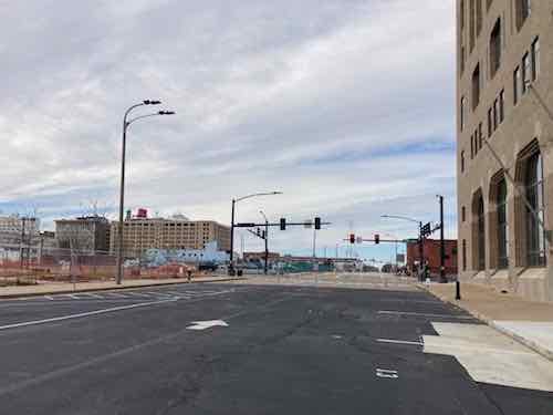
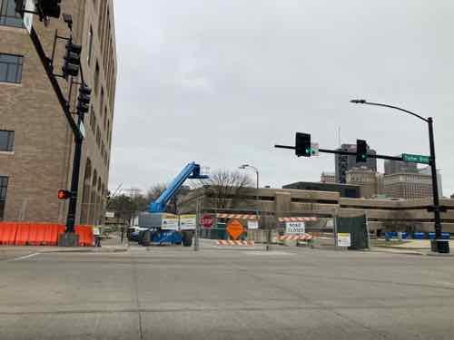
Ok, let’s start on the east end and heading west.
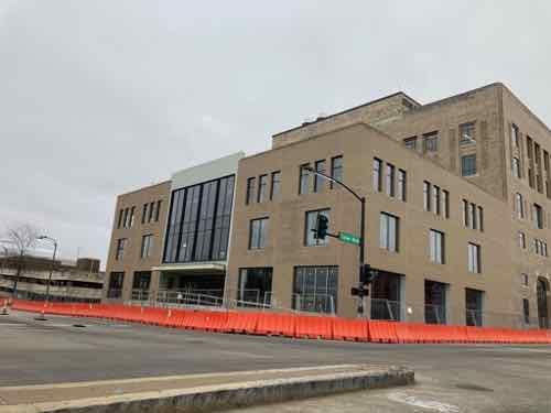
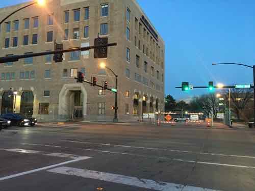
On MLK, facing west toward Tucker Blvd. On the right is the former Post-Dispatch building, now housing the St. Louis offices of digital payment company Square. On the left is Interco Plaza. This block is now one-way westbound.
Interco Plaza, a public park, after being “closed for renovation” in September 2021 as a way of relocating the unhoused that had set up camp. The background is St. Patrick Center, a non-profit organized to “combat homelessness.” This public park has not yet reopened to the public.
A year ago I mentioned the old buildings that were razed on MLK just east of 14th. Now we have a surface parking lot with zero fencing, landscaping, trees, etc. Plus a new driveway. Why do hip tech businesses locate in downtowns if they don’t want to design for downtowns?
Imo’s Pizza is adding onto the east side of their headquarters/warehouse. 16th Street has been closed to vehicles and pedestrians for years — a subtle way to say “keep out” to north side who want to enter the more prosperous Downtown West neighborhood.
Hard to see in this photo, but clear plastic bottles have been put into the holes in a chainlink fence. I found it interesting. NW corner of MLK & Vandeventer.
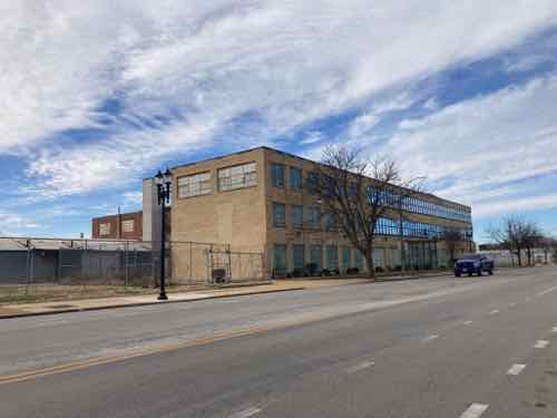
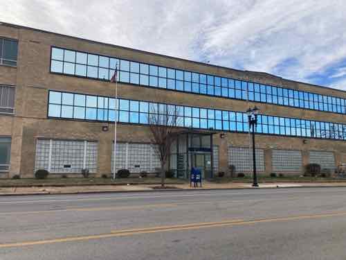
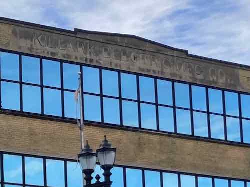
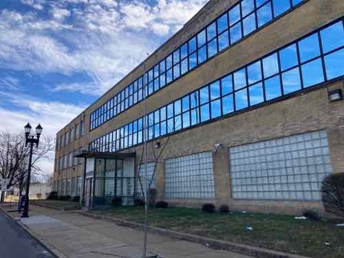
Last month the non-profit Dismas House announced it bought the former 15-acre Killark Electric Manufacturing property at 3940 MLK.
Liked the 100k SF building for many years, not a fan of the replacement windows that were installed decades ago. Killark first leased the site in 1918, not sure when they bought it or built this building.
“KILLARK ELECTRIC MFG CO.” is in stone at the top of the main building. City records list 8 buildings on the site, but I can only see records for six. Of the 6, the oldest is from 1892 and the newest is 1966.
The glass-enclosed entry doesn’t look original, but it has been in place as long as I can recall.
From MLK I could see a community garden at Sarah & Evans. Click image to see Good Life Growing’s website.
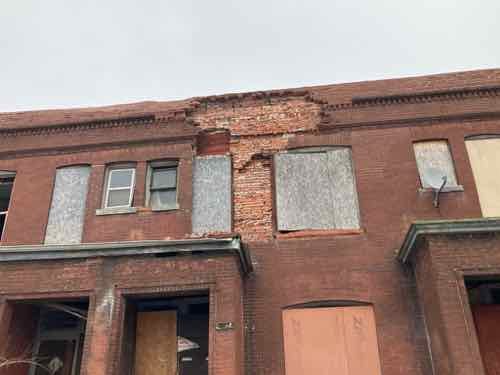
More bricks have fallen off the front of 4277 MLK.
4749 MLK has looked bad for years, but thankfully it has been getting some stabilization.
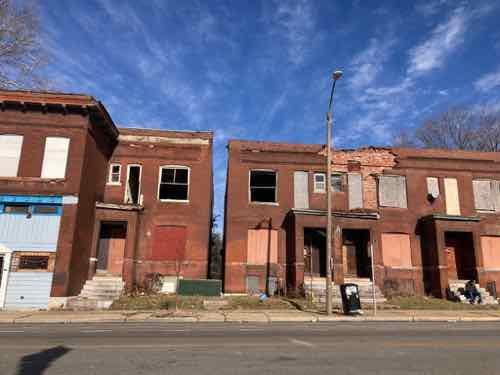
4859 MLK has also looked bad for a long time, noticed a little bit of the side wall has collapsed. 4961 next door is also in poor condition. The building on the left is privately owned, right is owned by the LRA. Both were built in 1905.
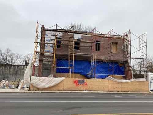
The setback building at 4973 MLK, just east of Kingshighway, has been mostly finished for many years. New this year is temporary construction fencing. The side lot out to Kingshighway has been disturbed recently.
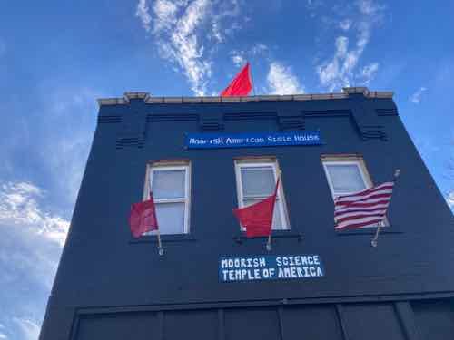
5084 MLK is now a Moorish Science temple.
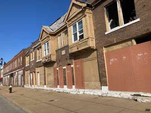
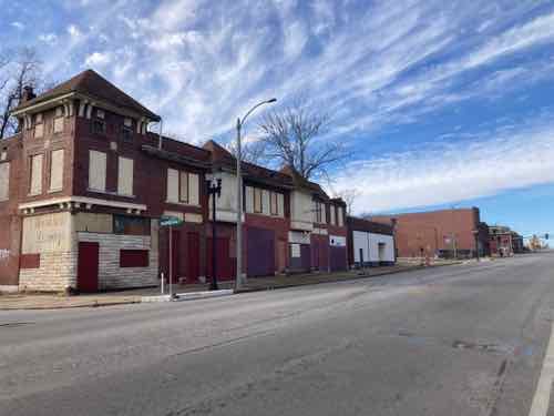
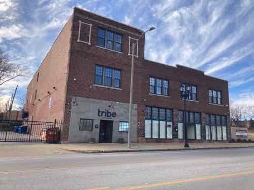
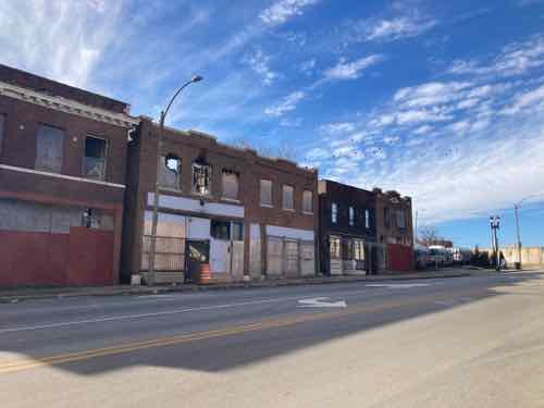
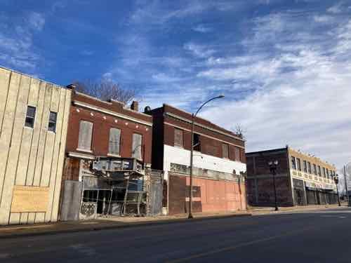
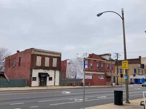
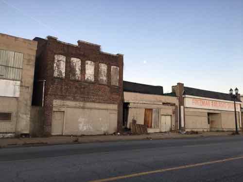
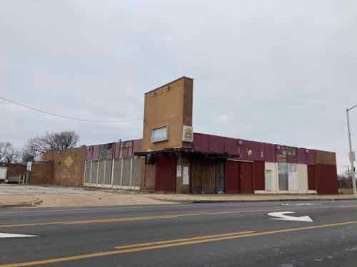
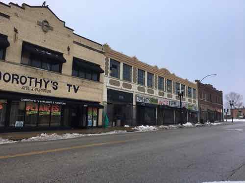
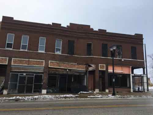
The nice composition of buildings at 5700+ MLK still look stable.
5736 MLK is a medical cannabis dispensary, or will be once it actually opens — click the image to view their currently bare bones website. The space next door is a meeting/event space. Both very positive in an area short on good news.
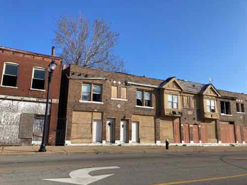
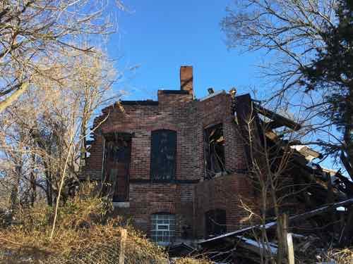
Just west of Goodfellow we see one unit worse than the others.
Floors and the roof are gone, accelerating deterioration of the brick walls. 5810 MLK
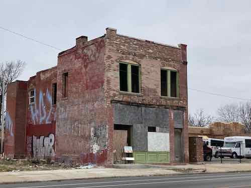
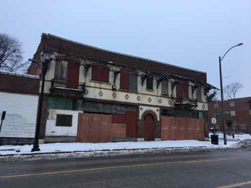
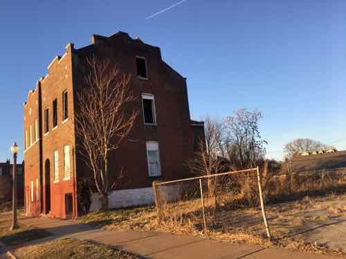
5861 MLK, built in 1907, is showing some wear. The stone plaque over the center doors says it’s the “Kinsey Building”.
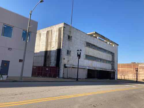
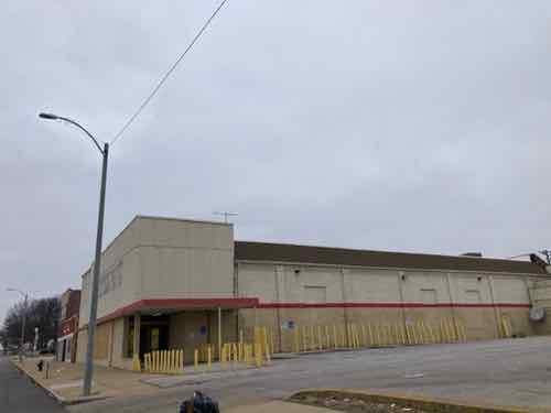
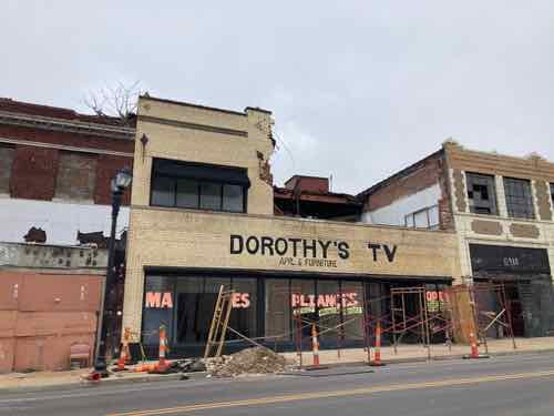
The former JC Penny department store at 5930 is still standing. Would love to see this building renovated and occupied.
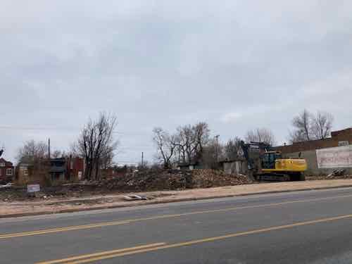
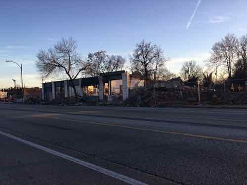
The buildings across the street may not survive as long. The gap is where a building was lost in 2020.
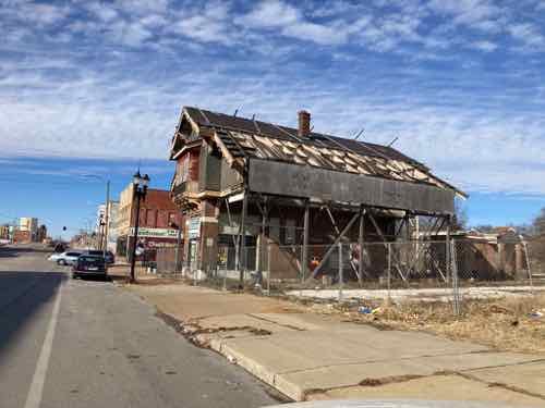
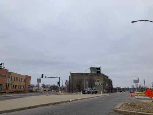
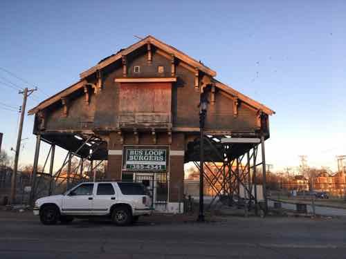
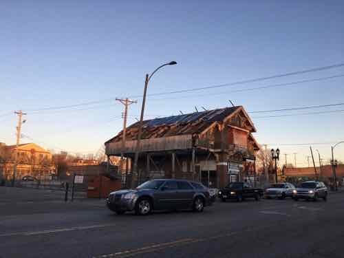
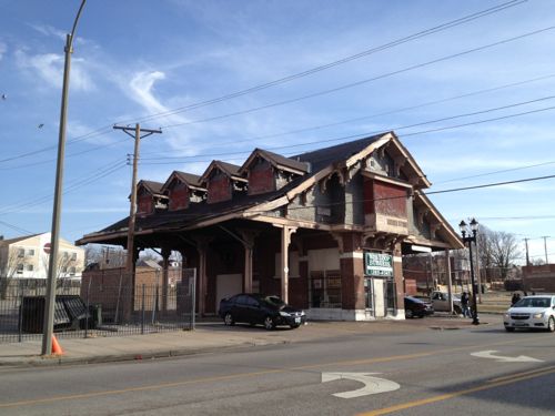
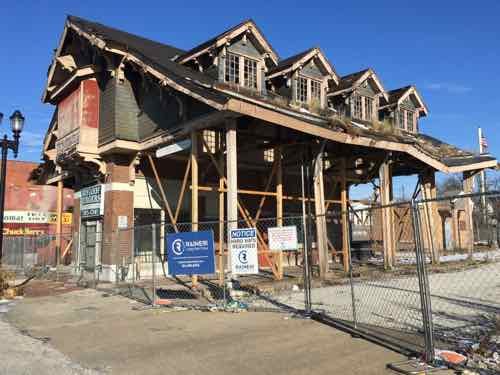
The famous Wellston Loop transit building continues being exposed to the elements.
The west side is no better.
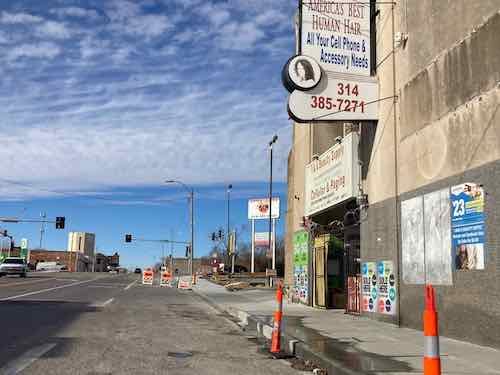
The sidewalk between Irving Ave and Kienlen Ave was just replaced. This is in Wellston — St. Louis County, just beyond the St. Louis city limits.
Like previous years a few bright spots, mostly depressing decay.
January 18, 2021Featured, MLK Jr. Drive, North CityComments Off on 17th Annual Post on Dr. Martin Luther King Drive in St. Louis
Since 2005 I’ve looked at Dr. Martin Luther King Drive every year on the national holiday to honor the civil rights leader killed in 1968. This is my 17th such post.
In St. Louis two streets were renamed in 1972 — Franklin Ave east of Leffingwell Ave and Easton Ave west of Leffingwell Ave became Dr. Martin Luther King Drive. This travels through north St. Louis from the Mississippi River to city limits.
Though not bustling like new suburban malls, it still had lots of commercial activity. In the nearly half century since the streets were renamed the black middle class largely abandoned north St. Louis — moving to either other parts of the city, north county & beyond, even out of state. With some exceptions, retail activity on Dr. Martin Luther King Drive has collapsed — as have many buildings.
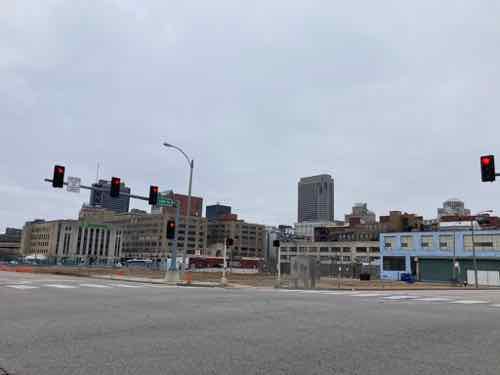
Today we’ll start at MLK & Tucker then head west. Why not start further east? Well, only one block of MLK remains east of Tucker (12th) — between 9th & 10th. On the south side of the street is the side of an anti-urban hotel and on the north side a surface parking lot enclosed by chain link fencing. The blocks between Broadway (5th) and 9th are part of the convention center and dome.
At Tucker & MLK you have the former Post-Dispatch building being renovated into office space for Square and others. All photos, except where noted otherwise, were taken on Saturday January 9, 2021.
The first block of MLK east of Tucker is closed during building renovations, left. The main entrances used to face Tucker & MLK, but that will change when it reopens.
The new main entrance will be on the opposite end, a previously windowless addition has been transformed into the new main entrance at Tucker & Cole.
In 2020 the few remaining old buildings on MLK between 13th & 14th were razed. This view from the NW corner of MLK & 14th we can see all the way to Tucker & Convention Plaza (aka Delmar).
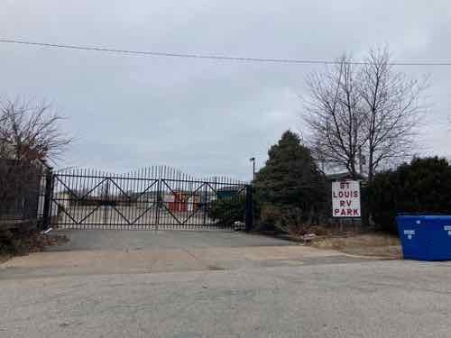
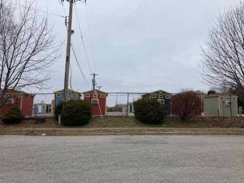
In 2020 the city leased a former RV park that occupied an entire city block bounded by MLK, Jefferson, Cole, and 23rd.
Tiny houses began being set into place so unhoused individuals could have a safe place to live.
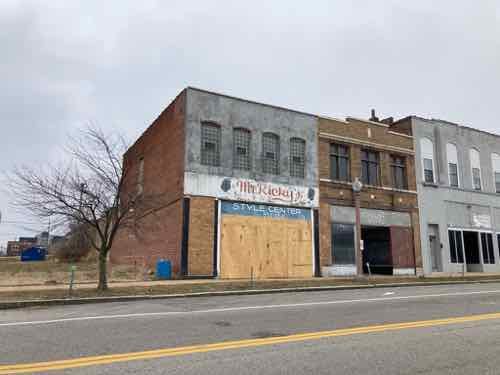
The storefront at 2706 Dr. Martin Luther King Drive was boarded up.
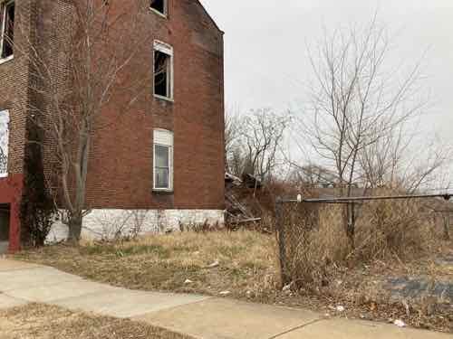
I’ve been watching the house at 3047 MLK slowly deteriorate. It has stood here since 1880.
In 2012 the rear wing was still intact.
The McKee-owned warehouse in the triangle where Page & MLK meet is another that has been slowly crumbling.
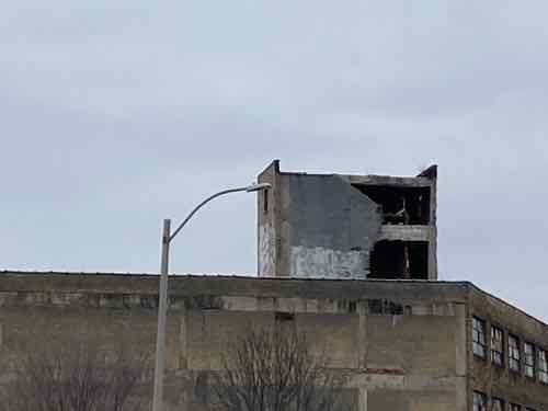
The MLK side is actually the back. At the top you can see a wall on the mechanical penthouse has collapsed.
Here’s a cropped view to show the wall collapse. This will allow more water & animals into the structure.
On the block west of Whittier Street stood large 3-story building. In the foreground the sign for the late Ald Sam Moore is still in place at the Ville Mall business incubator he helped build. It’s suburban-style front parking lot is in stark contrast to businesses in older buildings across MLK
A better view of the site where a large 3-story warehouse stood for decades.
From my 2019 post: Bricks are starting to fall from this building. It should be stabilized, but it’ll likely be allowed to crumble until neighbors demand it be razed.
The well-proportioned, but vacant, building at 4277 MLK has lost brick from the exterior row.
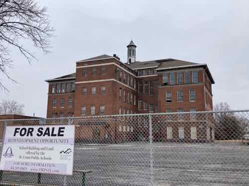
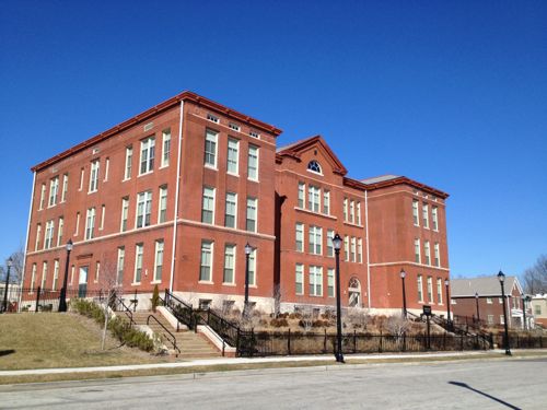
The closed Marshall School building that faces Aldine Ave is still awaiting a buyer.
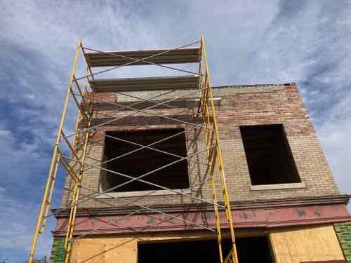
A positive sign just west of Newstead, very glad to see this building getting some attention.
This handsome building at 4524 MLK needs attention to keep it from getting beyond the ability to save it.
The building at 4534 MLK is getting some tuck pointing to help it keep standing.
Something is happening at 4668 MLK.
In the last 16 years the building has been a dollar type store at least twice, it’s closed again. 4949 MLK
For a few years now a new building has been under construction at 4973 MLK, set back suburban-style. It looks finished, but has yet to be occupied.
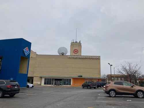
The former Sears on Kingshighway near MLK is now the Urban League, the building is still named after Victor Roberts.
The auto & tire business at 5018 MLK is burnt out.
The facade at 5153 MLK has collapsed.
Last year I knew the facade wouldn’t last long so I included it for documentation purposes.
And sadly one of my favorite buildings in the entire city was finally razed.
5716 MLK in 2019.
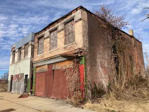
The former National market at 5870 MLK has had other uses over the years, last as Ali Market. A medical marijuana dispensary license has been awarded to Growing Jobs Missouri. Hopefully this will still happen.
In late August 2020 the upper floor collapsed while the business at 5917 MLK was open. I doubt the building will be here next year. Click image to see Post-Dispatch story in a new tab.
Here is what it looked like in 2019.
As in prior years there are a few bright spots along an otherwise bleak street.
As long as there is extreme poverty in this world, no man can be totally rich even if he has a billion dollars.
— Dr. King, “The American Dream” speech, June 6, 1961 at Lincoln University. Listen here, quote at 14:23.
Today is the annual holiday to honor the civil rights activist Dr. Martin Luther King Jr., who was assassinated in Memphis in 1968.
Martin Luther King Jr. (January 15, 1929 – April 4, 1968) was an American Christian minister and activist who became the most visible spokesperson and leader in the Civil Rights Movement from 1955 until his assassination in 1968. Born in Atlanta, Georgia, King is best known for advancing civil rights through nonviolence and civil disobedience, inspired by his Christian beliefs and the nonviolent activism of Mahatma Gandhi.
King led the 1955 Montgomery bus boycott and in 1957 became the first president of the Southern Christian Leadership Conference (SCLC). With the SCLC, he led an unsuccessful 1962 struggle against segregation in Albany, Georgia, and helped organize the nonviolent 1963 protests in Birmingham, Alabama. He helped organize the 1963 March on Washington, where he delivered his famous “I Have a Dream” speech.
On October 14, 1964, King won the Nobel Peace Prize for combating racial inequality through nonviolent resistance. In 1965, he helped organize the Selma to Montgomery marches. The following year, he and the SCLC took the movement north to Chicago to work on segregated housing. In his final years, he expanded his focus to include opposition towards poverty and the Vietnam War. He alienated many of his liberal allies with a 1967 speech titled “Beyond Vietnam”. J. Edgar Hoover considered him a radical and made him an object of the FBI’s COINTELPRO from 1963 on. FBI agents investigated him for possible communist ties, recorded his extramarital liaisons and reported on them to government officials, and on one occasion mailed King a threatening anonymous letter, which he interpreted as an attempt to make him commit suicide.
In 1968, King was planning a national occupation of Washington, D.C., to be called the Poor People’s Campaign, when he was assassinated on April 4 in Memphis, Tennessee. His death was followed by riots in many U.S. cities. Allegations that James Earl Ray, the man convicted of killing King, had been framed or acted in concert with government agents persisted for decades after the shooting. (Wikipedia)
Following King’s death many cities began renaming streets in his honor. In 1968 the Veterans Bridge, opened in 1951 over the Mississippi River, was renamed to honor King. Four years later, after much debate, St. Louis joined other cities by renaming two streets through the city after King — beginning at the Missouri end of the Martin Luther King Bridge.
Dr. Martin Luther King Drive starts down by the Mississippi River’s edge, and follows what was Franklin Avenue, making fits and starts in the convention center. King Drive continues westward, following old Franklin until just west of Jefferson Avenue. There, it abandons Franklin and gives King’s name to Easton, which, for generations, was an important shopping and socializing avenue for the blacks and whites in the northern part of the city and the inner ring suburbs of St. Louis County. (St. Louis Public Radio)
By 1972 the Wellston Loop shopping district, once second only to downtown, on Easton at the city/Wellston city limits, was already in decline. In 1965 Northwest Plaza had opened a short 15 minute drive further into St. Louis County.
In 1972 some wanted a more prominent street renamed after King — Lindell, for example. These days streets are not renamed, an honorary designation is added but addresses aren’t changed.
Let’s start today’s look at Martin Luther King Jr. Drive at the west end at the Wellston Loop.
For decades this was the point where streetcars turned around to head back downtown. The last few years a tarp had cover the roof, but it is no longer in place.
In this view you can see the lack of tarp protecting the building from water damage.
The street is increasingly sparse. I still miss the 4-story building that was on the other side of the Loop building. Click image for more information on that building.
As it looked in 2013
2017
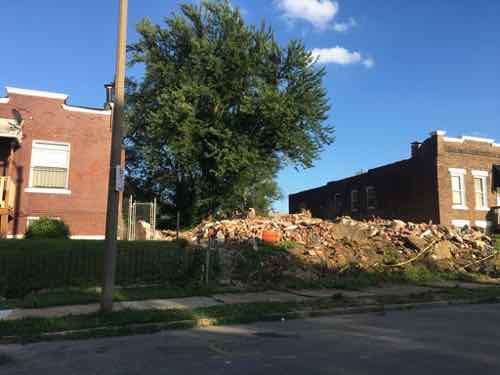
The 2-story building on the NW corner of MLK Drive and Hamilton is now gone. It wasn’t remarkable, but it was part of a continuous group on that block — now a hole. This is part of the Wells-Goodfellow neighborhood which was getting a huge demolition focus in 2019.
Just after demolition in August 2019.
Up close in July 2019
Last year
The group a year ago.
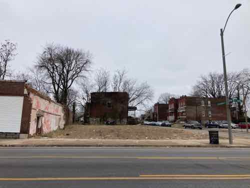
Just west of Union is the vacant site, I’d watched the home deteriorate for years.
In 2017
In 2013
East of Union is a still intact group of commercial buildings. One looks like it was hit by a car. Reviewing Google Streetview this happened after August 2017.
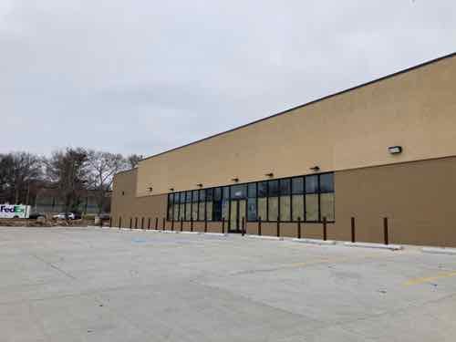
Just east of Kingshighway (4965 Dr. Martin Luther King Dr) a new building has been under construction since last summer, but the future occupant is unclear. City records list WM Grand Plaza LLC of Ballwin as the owner.
Recently palleted bricks site on the sidewalk where a building once stood.
Last year I said this was “Another building in need of stabilization.” It was actually two buildings, both from 1893. 4740-42 Dr. Martin Luther King Drive.
The former John Marshall School at Newstead is still vacant and deteriorating.
4208-4216 Dr. Martin Luther King Drive is in the final stages of demolition.
Last year bricks were starting to fall from it, I said then “It should be stabilized, but it’ll likely be allowed to crumble until neighbors demand it be razed.”
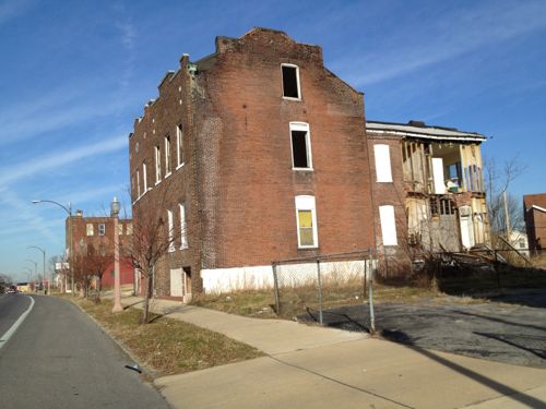
Another building I’ve been watching crumble is 3047 Dr. Martin Luther King, the back wing has now completely collapsed. Built in 1880 it is owned by the City’s Land Reutilization Authority (LRA)
In 2012 the rear wing was still intact…sorta.
At Tucker the former Post-Dispatch newspaper building is being converted to offices for Square.
In some of the years past long vacant buildings were getting renovated, new housing being built. Those positives remain, but otherwise the deterioration continues.
Looking at the Wells Goodfellow neighborhood last week was very depressing (see Readers Mixed On Latest Blight Removal Effort). On my visits seeing dilapidated houses being leveled I knew nobody was going to invest the money needed to have saved even one structure, let alone hundreds or the thousands throughout the city’s most sparsely populated neighborhoods.
!912 Clara Ave, left, and 1904 Clara Ave are occupied, the two houses in between were just razed.
Basically the city is partnering with a new non-profit, St. Louis Blight Authority, to clear four city blocks of vacant homes, overgrown trees, trash, etc. Occupied homes in the 4-block zone would remain.
The St. Louis Blight Authority is the organization behind a project to clear a four-block area in the Wells-Goodfellow neighborhood. The organizers believe the initiative could be just the beginning of a more far-reaching program. (St. Louis Public Radio)
Today I have a few critical observations, then I’ll offer some possible solutions.
Last week I searched the Missouri Secretary of State’s business listings to find out more about this new non-profit organization — I wanted to know structure, board members, etc. Guess what — no such organization exists! I was also unable to find a website — not even a Twitter account. Transparency is important, If we’re told a non-profit is involved that non-profit should actually exist.
Another personal observation is “Wells Goodfellow” is an awful name for a neighborhood — The “Wells” refers to 19th century transit magnate Erastus Wells, “Goodfellow” is a major north-south street — more on that later.
Wells/Goodfellow is part of an historic section known as Arlington, which takes its name from John W. Burd’s Arlington Grove subdivision of 1868. A memorable disaster in the history of the Arlington area occurred in October 1916, when the Christian Brothers College building at North Kingshighway and Easton Avenue (now Martin Luther King Drive) was destroyed by fire, one of the worst in the City’s history, taking 10 lives.
The area received its name from John W. Burd’s Arlington Grove subdivision of 1868. More subdivisions were built in the mid-1880s, with residential construction continuing until 1910. By the mid-1920s, the last of the residential subdivisions were opened. (St. Louis)
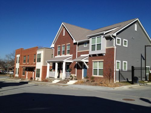
The 2013 housing development in the neighborhood uses the name Arlington Grove, so that name probably shouldn’t be used for the entire neighborhood.
Former Arlington School in North St. Louis is now residential
The 22 new buildings have similar materials but unique designs.
Some other name with Arlington in it could be good though. Perhaps just the Arlington neighborhood? Or something to do with land developer William Burd (1818-1885)? Though Burd isn’t the most marketable name and I don’t know his politics. Was he a slave owner? His wife Eliza’s maiden name is interesting: Goodfellow.
A new name could help change perceptions for residents, property owners, workers, and outsiders. The Old North St. Louis neighborhood wouldn’t have had lots of redevelopment & new construction if it was still called Murphy-Blair.
Possible solutions for the neighborhood are varied, need to be discussed in public sessions to obtain a consensus on how to move forward. My initial brainstorming came up with the following:
Do nothing
Push for new infill housing
Abandon the center
Let me explain each of these options.
1. Do nothing
This means nothing different, maintain the status quo. So tear down houses once they’ve become a major eyesore. Continue city services (water, sewer, trash, police, fire, etc) to those who remain.
2. Push for new infill housing
Try to get Habitat for Humanity or another entity to build new housing on vacant lots. It would probably make sense to concentrate new construction on one or two blocks at first. These lots are narrow so you’d need 2-3 lots per new single family house. Include some multi-family construction as well. Existing infrastructure (streets, alleys, sidewalks, water, sewer, etc) may need to be upgraded on these blocks.
3. Abandon the center
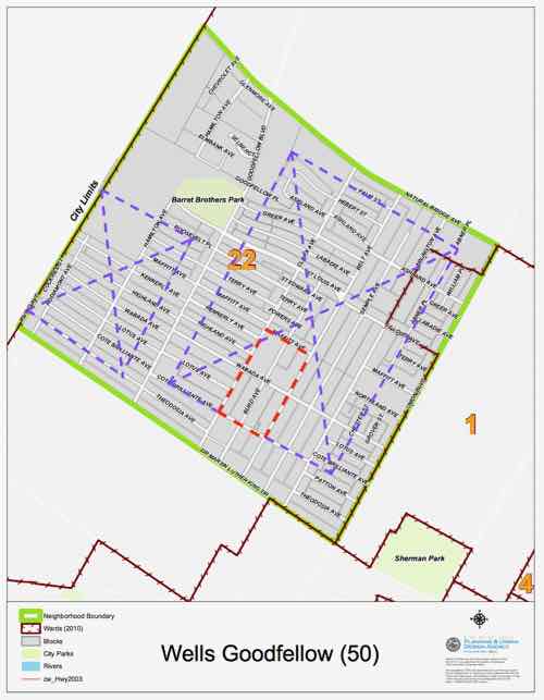
This will likely be the most controversial option, here it goes. Blocks that front onto the major streets of Dr. Martin Luther King, Goodfellow, Natural Bridge, and Union would be supported. New development would occur in these blocks only — to reinforce existing corridors. Everything inside of those blocks would be, over time, cleared. All interior streets, alleys, etc would be removed. The interior land could be used for urban agriculture or perhaps a large employer. This would create two cleared areas, one on each side of Goodfellow.
The small red area is the 4-block area where recent demolition was concentrated. Occupied residences remain in that area and on every city block. The two purple areas that could be completely cleared for urban agricultural use would be split by concentrated development fronting Goodfellow.
This solution is a drastic measure, but it or something similar might be the best hope for a neighborhood that has lost population to the point where it no longer functions. I don’t foresee anyone being forced to move or sell their home. Nature and economics is taking a toll quickly enough.
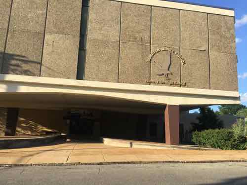
Langston Middle School is within the big purple area, but it is no longer listed as a school on the St. Louis Public Schools website. The building might be usable for hydroponics.
There are likely other buildings within the purple clear zones that could be reused within the cleared area. This area would still need water/sewer but not miles of alleys/streets/sidewalks.
Conclusion
I’ve presented a range of options, I’m sure if we put our heads together we can come up with many more.
The question I have is who will lead the effort to determine what happens next? Will it be the elderly residents who’ve stayed despite their families begging them to leave? The church leaders/parishioners who live elsewhere but drive in for Sunday services? An elected official? The nonexistent St. Louis Blight Authority?
I’m afraid the leadership vacuum will mean the “do nothing” status quo option will be selected by default.
AARP Livibility Index
The Livability Index scores neighborhoods and communities across the U.S. for the services and amenities that impact your life the most
Built St. Louis
historic architecture of St. Louis, Missouri – mourning the losses, celebrating the survivors.
Geo St. Louis
a guide to geospatial data about the City of St. Louis