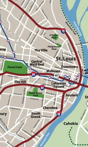
Map source: Explore St. Louis, click to view original
Lately I’ve been posting about the St. Louis Streetcar, a proposed modern streetcar line that’d primarily serve the central corridor from Downtown west to the Central West End. Though the proposed streetcar route includes a spur into North St. Louis, I believe north & south sides of the city have tended to get the short end of the transit infrastructure stick. Our Metrolink light rail opened 20 years ago serving the central part of the city, and the streetcar will double-down on this area.
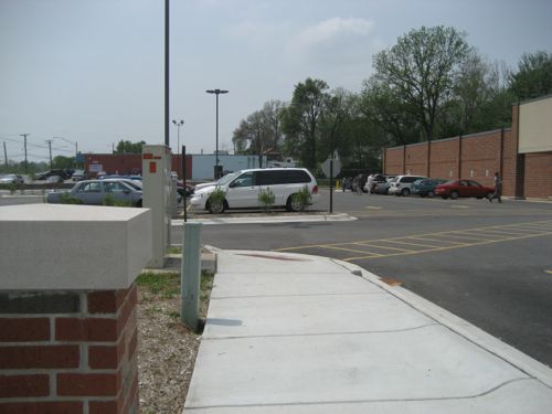
I’ll personally benefit since I live downtown, but I’d like better transit options for reaching destinations in north & south city. I recognize many people might live say in north city but work in south city, or vice versa. Existing bus routes like the #70 (Grand) only partially fills the transit needs of the city.
Improvement options I’ve listed in the poll are:
Nothing, doesn’t need improving
Run existing buses more frequently
Reduce/eliminate fares
Bigger articulated buses for the busiest routes
Buses that go from diesel in the county to electric via overhead wires in the city
Bus rapid transit (BRT) lines serving city neighborhoods
In-street modern streetcar lines serving city neighborhoods
In-street light rail lines running through the city to connect to the county
These answers will be presented in random order in the poll (right sidebar), you can select up to 3 choices. You’ll have the option to provide your own answer as well.
A number of years ago East-West Gateway Council of Governments studied light rail lines through North & South St. Louis to reach North & South St. Louis County, respectively, but it went no further.
So please vote in the poll, located to the right, and share your thoughts in the comments below. I’ll share my views when I post the poll results on Wednesday July 3rd.
In the first two parts of this series on development sites along a proposed streetcar route I looked at Olive from 15th-16th and Olive from 16th-18th. In both cases it was a small area and I looked a specific buildings and parcels of land. Heading to N. Florissant Ave. & St. Louis Ave. nearly everything is a development site.
Let’s start downtown and work our way north. At 14th & Olive you have the library on the NE corner and the library administration building & a charter high school on the NW corner. I think the library admin building has office space available for lease.
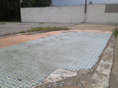
The parking lot at 14th & Locust is privately owned, a good candidate for new construction. Photo is from 2007 before the charter school added another floor to their space on the left.1400 Washington has had numerous development plans, it is now becoming a parking lot, same owner as the previous lot across the alley.I’d like to see these two buildings on Washington Ave west of 14th get renovated, along with a thin wedge between the east wall and 14th. Photo from 2011.
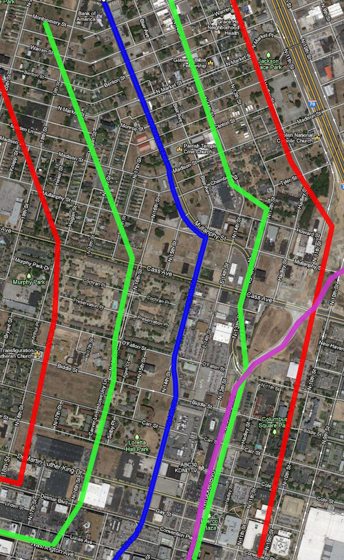
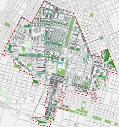
Before we go any further north it makes sense to look at the route on a map along with a development zone on each side of the line. Light rail has stations miles apart, whereas streetcars are more like buses by having more frequent stops along the route.
The blue line is the proposed streetcar route, green about 660ft (1/8th mile) and the red about 1,320ft (1/4 mile). Purple is the new bridge connecting into Tucker. Click to view in Google Maps.
The area between the green lines is the immediate area that I estimate to be part of a special transportation district with slightly higher property taxes, pro-rated based on distance. The red lines are a quarter mile distance, the usual distance a person is willing to walk.
Quite a bit of this area is in what will be one of the Northside Regeneration job centers.
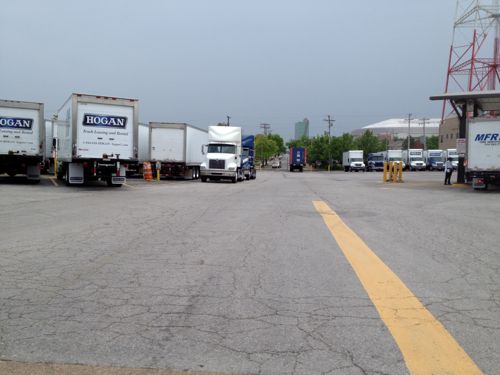
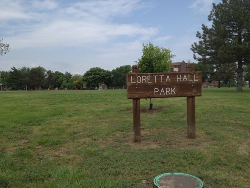
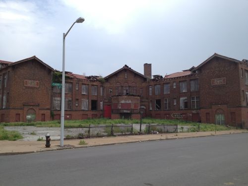
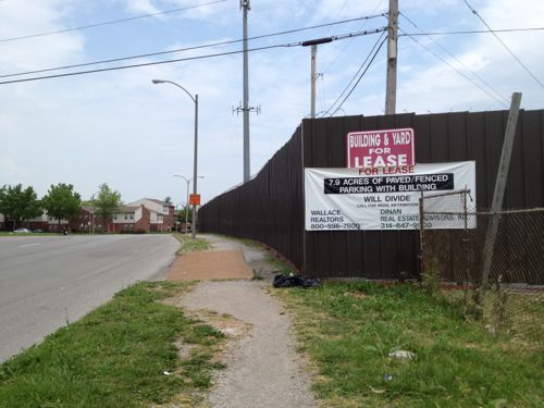
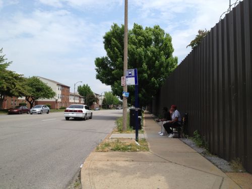
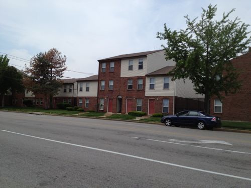
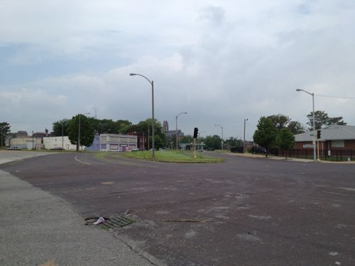
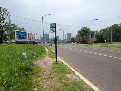
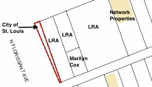
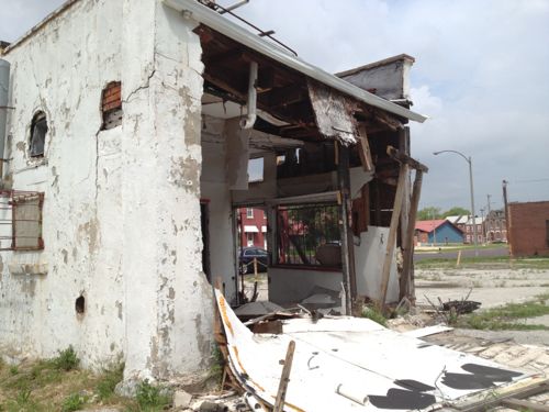
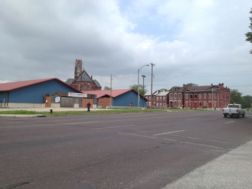
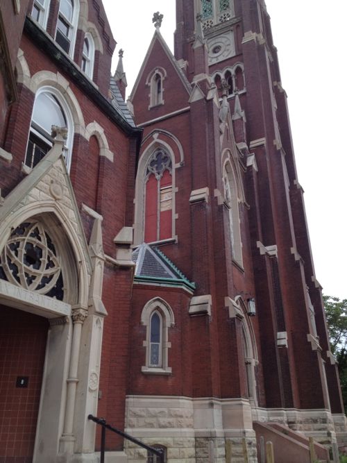
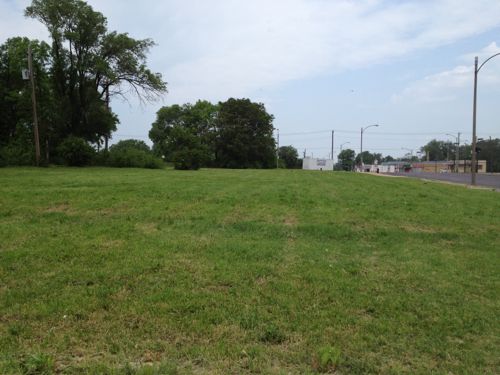
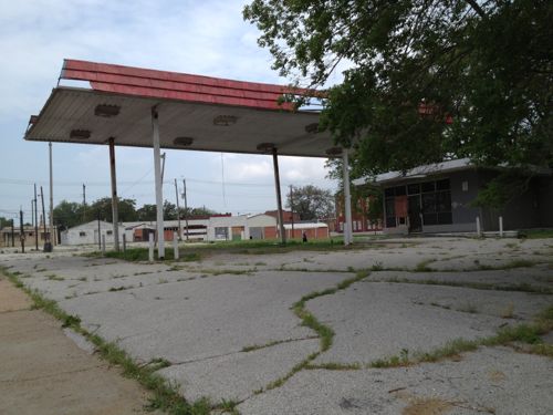
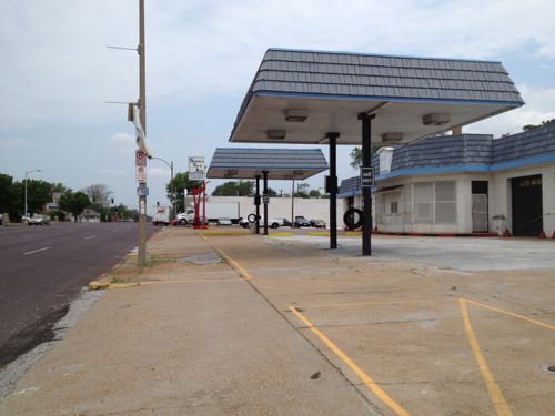
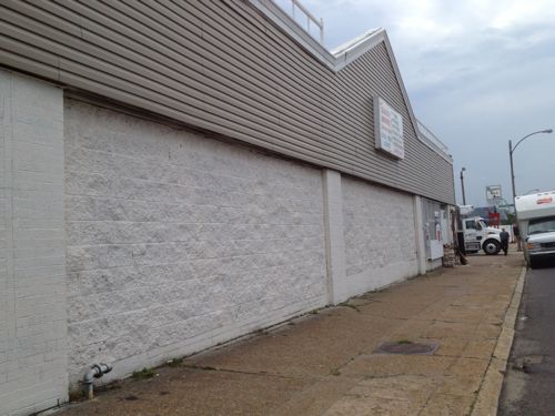
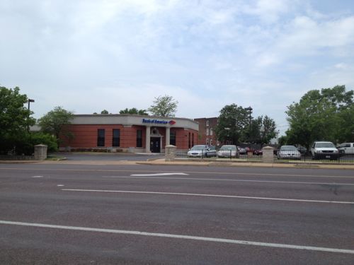
Numerous parking lots occupy significant land north of Washington Ave, ideal candidates for new construction.A former BarnesCare building built in 2001, is now vacant. With no pedestrian access and large setbacks from both MLK & 14th this building should be razed and a new urban building constructed on the site.Hogan Trucking uses two city blocks, Carr St has been vacated. Interestingly the property owner is listed as Hogan Redevelopment Corp.This site must legally remain a public park, as it has been since 1842. Click image for more information.Many would love to see the crumbling Carr School get renovated. Click image for more information on this 1908 structure.7.9 acres ready for development, the original lot boundaries remain since they were never consolidated.The 14th & O’Fallon St bus stop is always busy, but that hasn’t spurred development to date. This stop is currently served by the #32 & #74 MetroBus routesOn the west side of 14th, south of Cass, is the O’Fallon Place Apartments owned by McCormack Baron Salazar.Looking NW on N. Florissant from 14th, vacant land and mostly vacant buildings are all around.The Mullaphy Emigrant Home at 1609 N. 14th could finally get renovated if the streetcar connects the near-north side to downtown. Click image for more information on this historic structure.Looking back toward downtown we see evidence of disinvested in the area along N. Florissant near Madison St. The city says property owners are responsible for sidewalks but in this case the city is the property owner.The City of St. Louis is the legal owner of the 668 sq ft wedge-shaped lot at 1458 Madison St.This small building at 2100 N. Florissant Ave was built in 1906, the owner is in St. Louis County.A bank in Illinois now owns the unfinished daycare at 1501 Clinton & 1500 Monroe. The buildings to the north are owned by several owners, including the LRA & Northside Regeneration.The mostly vacant St. Liborious complex at Hogan & North Market is a city landmark, it is privately owned. Click image for more information.Vast open areas are prime for redevelopment along the proposed streetcar route. This is north of North Market on the west side of North FlorissantThe vacant gas station at 2418 N. Florissant was built in 1972.Two blocks north at 2618 N. Florissant is another vacant gas station, this building has been modified many times since 1938.This building, owned by a person in Atlanta GA, needs to be replaced. The Church’s Chicken could operate out of a storefront in a new building.This building from 1940 should be replaced.This bank was built in 1993 after the urban bank at the corner of N. Florissant & St. Louis Ave was razed, despite neighborhood objections. This should be replaced with an urban building on the corner.The NE corner of N. Florissant & St. Louis Ave. had a cute diner until 1998
With so much vacant land & buildings, this stretch of the proposed streetcar line has the greatest potential for redevelopment. It will also be a challenge initially to get projects funded. Once the line is open and Paul McKee builds one of his job centers near Tucker & Cass things will start to take off. Form-based codes requiring dense urban design will be key to getting the right kind of construction.
It’ll take at least a decade, if not two, for this to be built out.
For years I’ve been accused of being a naive dreamer, coming up with big plans without the existing market to implement. I’ve just smiled and continued sharing my long-term vision for St. Louis.
In June 2007 I wrote:
The 22nd Street Interchange, part of an abandoned highway concept from a few decades ago, needs to be ripped out with the land returned to active tax-paying use. The Missouri Dept of Transportation (MoDOT) should rework the interchange at Jefferson Ave to allow for on/off ramps in both directions and therefore eliminating the need for the current ramps at 22nd. MoDot could sell the land to fund the revisions to the highway ramps. (St. Louis Should Abandon Linear Gateway Mall Concept)
Then in December 2008 I wrote:
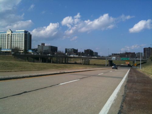
I picture a new bridge at I-64/40 and Jefferson Ave — one with a single point urban interchange (SPUI) and both East & West on/off ramps. Build that and then remove the 22nd interchange completely. Bring in form-based zoning codes to require a denser urban environment. Make a strong connection through the back of Union Station (between the shed & highway) so that pedestrians from this newly developable land have the opportunity to walk to Metrolink and the 14th street transit station beyond that. The fact that much of this area is already excavated and free of utility lines would simplify the construction of underground parking in new buildings. (MoDOT Needs To Put The 22nd Street Interchange On Any Wish List For Funding)
By May 2009 I noted that St. Louis’ 22nd Street Interchange Part of McKee’s Plan so it elimination would need to be worked out with him. Presumably MoDOT agrees with McKee because they’re replacing the Jefferson bridge over I-64/40 with no plans for on/off ramps to/from the east.
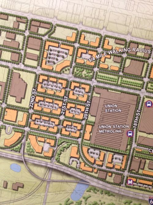
Then, last month, at an St. Louis Regional Transit Oriented Development Study presentation around the Union Station & Civic Center Metrolink stations the Denver-based consulting firm suggested largely what I had outlined years earlier.
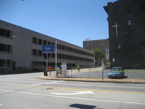
Preliminary plan around Union Station, the Drury (former YMCA) and other existing buildings should be shown in the final presentation.
Ok, they still have on/off ramps for I-64/40 to the east, but they are compact and feed into the reconnected street grid I had advocated. The above image is preliminary, I pointed out it was missing buildings like the Drury Inn on 20th, formerly a YMCA and later a gay bar/hotel/bathhouse. Hopefully their final will be more accurate than the draft shown at the last meeting.
Still they see what I and others saw, the need to repair the street grid and fill in the gaps in the urban fabric.
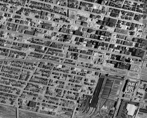
The 22nd Street interchange is just on/off ramps.1958 aerial of the area west & north of Union Station
This is not about trying to recreate the buildings and feel of the area prior to the demolition for the highway interchange. This is a forward-looking vision to create a walkable/urban environment for those interested in such. Some prefer the look & feel of new buildings, new sidewalks, new trees, etc. This is an opportunity to create an entirely new neighborhood largely from scratch yet have access to existing transit.
Per McKee’s plans, a few new employers could anchor the neighborhood. Workers & residents would attract restaurants, dry cleaners, and other services.
None of this is rocket science, it’s Urban Planning 101. St. Louis still needs lots of basics to rebuild the connections that were ripped out in the 20th Century.
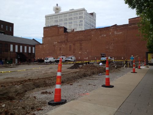
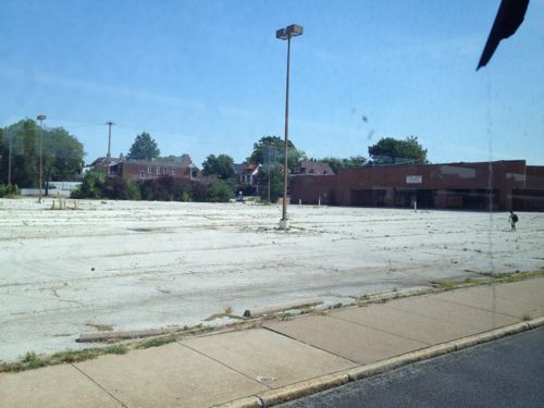
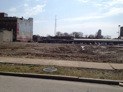
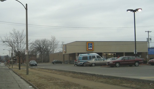
The site of the former National/Schnucks at Kingshighway & Delmar, long vacant, has now been cleared for new development. I’ve viewed the site as an opportunity to build a dense urban project, ideally connected with a Delmar extension of the future Loop Trolley. But current plans may delay dense development of the 4+ acre site for at least the next 20-30 years.
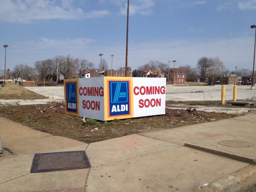
Former grocery store building sat back at the east end of the siteThe long-vacant building was recently razed.Discount grocer ALDI has announced a new location here.
But ALDI doesn’t need over 4 acres! Looking at city records online I see The Roberts Brothers has divided the site into three parcels, with ALDI buying one of the three.
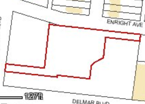
Outline of the parcel ALDI purchased with Kingshighway on the left, Delmar on the bottom.
The boundaries of the three parcels is intriguing, my guess is so all three can have automobile entrances facing Kingshighway, or at least a Kingshighway address. This new store will be part of three recently announced locations also including Creve Coeur & Des Peres (source).
My assumption is this Kingshighway & Delmar location will replace the ALDI less than a mile to the north at Kingshighway & Page (1315 Aubert).
The Aldi at 1315 Aubert (Page & Kingshighway) was built in 1991.
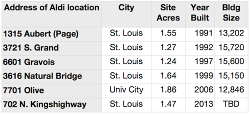
Below is a look at a few ALDI locations in the area, showing size of parcel, year built, and the building size:
Comparison of a few select ALDI locations
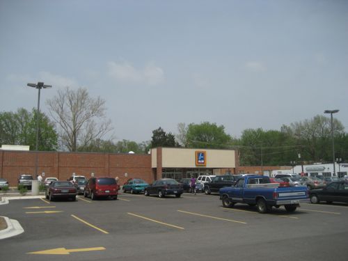
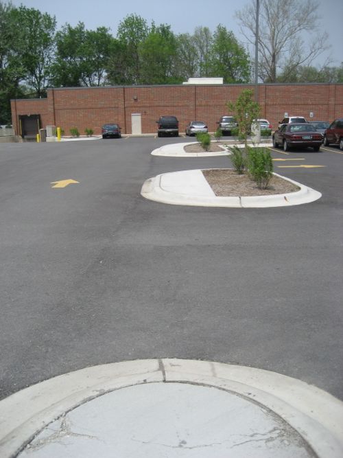
The most recently completed ALDI on the list above is the 7701 Olive location. I visited that ALDI in May 2006, shortly after it opened.
View from the Olive auto entranceA route is provided from Olive but it is not ADA-compliant.An ADA-compliant route is provided off North and South
This is how ALDI builds US locations from coast to coast. For example, in late 2010 a blogger noted the design for a dense Washington DC neighborhood (see Terrible Aldi design shows need for new parking zoning). As with so many retailers, they’ll do the cheapest design they can, barely meeting minimum standards. If we want/expect better we must demand better — raising the minimum. Retailers will meet the improved standard as long as they can get sales & profit growth. ALDI does have a few urban locations, but only in super-dense places like Queens, NY.
And before anyone says ALDI and Trader Joe’s are part of the same company let me clarify their relationship.
The [ALDI] chain is made up of two separate groups, Aldi Nord (North – operating as Aldi Markt), with its headquarters in Essen, and Aldi Süd (South – operating as Aldi Süd), with its headquarters in Mülheim an der Ruhr, which operate independently from each other within specific areas.
[snip]
Both Aldi Nord and Aldi Süd also operate in the United States; Aldi Nord is owner of the Trader Joe’s chain while Aldi Süd operates as Aldi. (Wikipedia)
Thus the ALDI we see in the US is NOT related to our Trader Joe’s stores. Another difference between our ALDI stores and our Trader Joe’s is the latter is willing to go compact in dense, walkable areas. For example, the Trader Joe’s I visited in 2009 located at 1700 E Madison St, Seattle, WA. The store is located on the ground floor with sidewalk entrance, a level of structured parking over the store and four levels of housing over that.
Garage of the Trader Joe’s in the Capital Hill neighborhood of Seattle
Madison St. in Seattle still has low-density development, like the gas station across from the Trader Joe’s, but one property at a time it is getting more urban. As it gets more urban it attracts more people, increasing the need to be more urban.
Back in St. Louis, we do the opposite. We continue to build low-density sprawl, then scratch our heads wondering why more people don’t walk, use transit, or why our population declines. I’m not suggesting development patterns are the reason for our population decline in the past, but it is a factor today.
A single story ALDI surrounded by surface parking on this corner is totally inappropriate given the context to the east and south.
As you’ve likely heard by now, last week the Missouri Supreme Court overturned a 2010 ruling that Paul McKee’s Northside Regeneration development plans were too vague for TIF financing:
After over 3 years of litigation, developer Paul McKee’s controversial Northside Regeneration Project is being allowed to proceed. On Tuesday the Missouri Supreme Court reversed a lower court decision blocking McKee’s use of so-called “Tax Increment Financing,” (TIF) for the development. (St. Louis Public Radio)
I’ve never been thrilled about how McKee handled property acquisition and maintenance, but I recognize the city’s total absence of planning and working toward a common vision left an opening for private interests without public input.
Original outline of McKee’s Northside Regeneration project
The project area is large but it’s a fraction of the city as a whole. There are many other parts of the city, north & south, dealing with continued population decline, increases in vacant buildings, and other signs of decay. Where’s the people upset the city isn’t doing anything to solicit public input in the rest of the city? Transportation, housing, jobs, education, etc are all being ignored.
The Jaco report just had Paul & Midge McKee on taking about their project, see the video here.
One of the biggest issues is the massive TIF (tax increment financing) package for the project. What needs to be understood is the pros and cons of the TIF tool. When a municipality invests in new infrastructure in stable and up & coming areas few tend to object since people see the value of improving desirable locations. Conversely, this means declining areas don’t see improvements in public infrastructure (sidewalks, roads, sewers, lighting, etc). Both are self-fulfilling in that rebuilding public infrastructure in the sable/improving areas further helps these areas while the lack of infrastructure investment in others accelerates decline in others.
Begin replacing sidewalks & lighting in sparsely populated declining neighborhoods and people will quickly question the return on that investment. This is where the TIF tool come in, a private developer agrees to invest in a blighted area and pay much more in property taxes than the municipality currently collects but only in part of that tazx is used to pay off bonds used to rebuild the public infrastructure the municipality can’t afford to rebuild otherwise.
The developer needs the new infrastructure to attract investors/buyers/tenants but the municipality can’t rebuild the infrastructure without a way to pay for it. The municipality can’t risk existing revenues to pay off bonds to rebuild the infrastructure so that means new revenue must be used. Sales taxes are a bad source for these revenues
Residential & office development don’t pay sales taxes
Sales taxes would take too long to accrue
Our sales tax rate is already sky high
This leaves property taxes as a source of revenue. To simplify things say the property is paying $100/year in property taxes but after redevelopment the property taxes will now be $200/year. With the TIF the municipality/school district would still collect the $100 it always did, $5o (increment) would go to pay off infrastructure bonds and the remaining $50 would go to the municipality/school district. Do nothing get $100/year or do the project and get $150/year.
The actual numbers will be different but you get the point: public infrastructure gets rebuilt, building happens, more taxes are collected than if nothing happened. This is a simplified view and there are cons such as favoritism for the developer(s), risk of pushing out good people, etc.
My concern is St. Louis won’t require good urbanism such as strong pedestrian connections. The infrastructure needs to be rebuilt and TIF is the best way to do that, but we need to have a say on characteristics of the final development.
AARP Livibility Index
The Livability Index scores neighborhoods and communities across the U.S. for the services and amenities that impact your life the most
Built St. Louis
historic architecture of St. Louis, Missouri – mourning the losses, celebrating the survivors.
Geo St. Louis
a guide to geospatial data about the City of St. Louis