August 19, 2019Featured, Parking, WalkabilityComments Off on Reflections on the Recent Jehovah’s Witness Conventions This Month
A large convention of Jehovah’s Witnesses was just in St. Louis. An advance group came through at the beginning of August, the main (larger) group just left yesterday. They made an impression on me, but not about beliefs — I’m still an atheist. Let me explain.
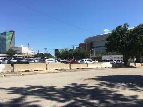
The area across Cole Street from The Dome was going to become “The Bottle District” over a decade ago. It never happened. Usually it’s just vacant and unsightly.
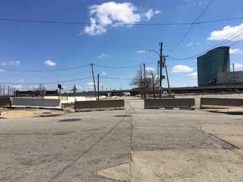
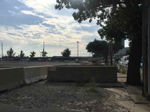
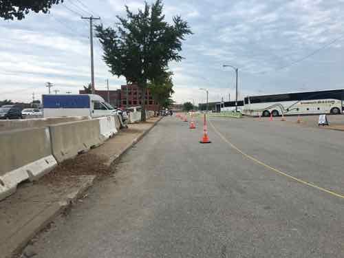
Jersey barriers blocked off many streets. Looking East from 7th & Biddle, March 2019Looking North March 2019Looking south on Broadway
In early August we noticed the first group making changes.
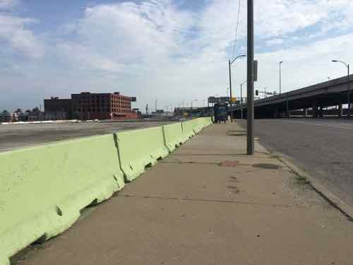
One of the most visible things they did was paint one side of the barriers this soft green color.They had equipment and were busy moving/rearranging barriers in the vacant lots.
When the recent group arrived it became clear why all that work had been done. To prep the vacant lots (all of them) for parking.
This past weekend usually vacant lots were filled with cars, saw many out of state license plates.6th Streets runs north-south through the vacant lots, they used cones to designate a pedestrian area of the street width.
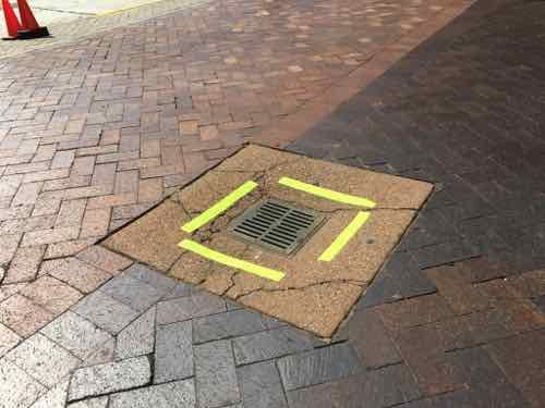
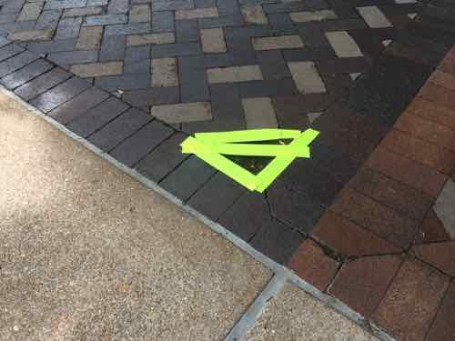
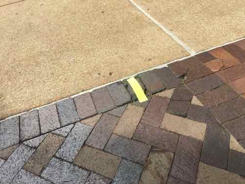
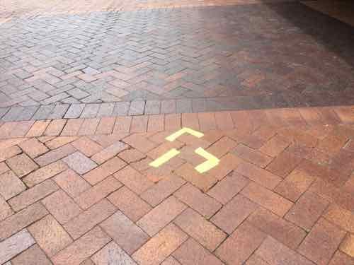
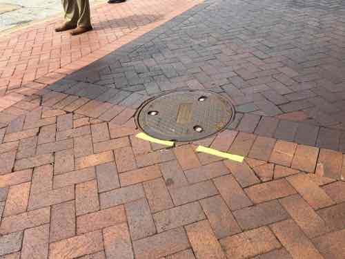
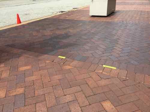
The other thing they did that caught my eye is they put down bright tape to highlight potential trip hazards around The Dome.
There were a lot more, couldn’t photograph them all. Sometimes it was missing bricks, others were raised bricks. Still others were just uneven areas.
I love that they go to so effort to make sure their membership doesn’t fall and injure themselves. Perhaps our Convention & Visitors Commission could learn a lesson from our recent guests? Perhaps Paul McKee could develop or sell the “Bottle District” land?
On Wednesday a long expected, though still unconfirmed, report indicated St. Louis will be the next city to get a Major League Soccer (MLS) expansion team.
Major League Soccer will award an expansion franchise to St. Louis, a source close to the prospective ownership group has confirmed to ESPN. The deal is expected to be announced as soon as next Tuesday.
The St. Louis Post-Dispatch was first to report that St. Louis will be MLS’s 28th team.
The ownership group, MLS4TheLou, declined to directly comment on the reports, issuing the following statement: “Major League Soccer is responsible for the timing of any announcements around League expansion, but we remain confident St. Louis has made a strong case for a team.”
MLS didn’t immediately respond to a request for comment.” (ESPN)
Now that it looks likely the team and new stadium will happen we can delve more seriously into the design of the stadium and, more importantly, the surrounding blocks.
My map of the area from 2016
Nearly four months ago we got our first look at the proposed stadium, here’s how I ended my post then:
Here’s what I think about the site, both north & south of Market Street:
The stadium & new buildings should take advantage of the existing hole for basement or underground parking.
Market Street between 20th & 21st is a deteriorating bridge, it should be removed. Under it can be filled in with foam so a new road/sidewalks can be built at grade.
Market Street should be redesigned to be friendly to pedestrians. This means narrowing the road (fewer, narrower lanes) and more crossing points. Right now there’s a crosswalk at 20th and at Jefferson –this is nearly a half a mile without a crossing.
Hopefully the changes at Union Station, including the upcoming Farris Wheel along 20th Street, will mean easier access under the train shed between the Union Station MetroLink platform on the East side of 18th to the new MLS stadium.
Metro will need to rethink downtown circulation with a revised Union Station, a MLS stadium, and hopefully active surroundings.
Pine & Chestnut have been a one-way couplet for decades. Once the on/off ramps to/from I-64 are gone both streets should be returned to two-way traffic. The revised Soldiers Memorial, however, has only one eastbound lane on Chestnut between 13th-14th. Chestnut has our only protected bike lane.
I’ll probably think of more issues, hopefully the site planning being done now will address at least some of these.
My views haven’t changed, but I do have some additional thoughts now that we’re getting close. Most are questions, in no particular order:
We still need to see a proposed site plan. What is the current ownership of the current land? How much city & state property will exist beyond the stadium boundaries? Is the stadium site too small? Too large?
Because not everything will get built by the date of the first match, we need to think long-term. What might this large vacant hole look like in 10-15-20 years? What do we as a community want it to look like?
I think minority businesses should get work from infrastructure improvements, stadium, and new construction adjacent to the stadium. Big investments are being made, every part of the community should benefit.
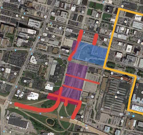
We need to plan an area larger than the stadium — I-64 on the South (since it’s a hard boundary), the West side of Jefferson (since the city is looking at Jefferson changes to accommodate the coming NGA West headquarters further North, to the North I’d say at least include Locust. To the East Union Station is a hard boundary but there are development opportunities surrounding the historic train station (16th, perhaps 14th).
Housing should be included within the larger area described above. This should be at all price points from low-income to high-end. It should include purchase & rental.
Hopefully we can agree that new low-density uses like gas stations & stand-alone fast food restaurants would be inappropriate.
Pedestrian circulation needs to be considered as much, or more, than vehicular circulation. We’re going to have lots of visitors coming into town for future MLS matches, they need to be able to fly into St. Louis, take MetroLink to Union Station, easily walk to their hotel, walk from their hotel to the stadium, patronizing local businesses along the way. Will pedestrians be able to freely walk from 18th to 20th through the Union Station train shed, or will they be forced to go up to Market Street?
New infrastructure (water, sewer, electric, etc) needs to be planned for future development. Initial surface parking lots should be development sites in the future. For example, we shouldn’t need to move a water line just five years later.
Unlike Ballpark Village, the surroundings shouldn’t all be owned by the team ownership. It shouldn’t even be just one entity. A different company might work each direction from the stadium. The community plan, hopefully with form-based zoning, will ensure they all work to create what we want this area to become over time.
How can we make the area active on days without a match? One option might be having one street where restaurants are concentrated on both sides. Or maybe just at all corners?
How do we create a good West terminus to The Gateway Mall? Currently there’s a little bit of the linear park west of 20th Street. Do we end at 20th? End at a new 21st? At a new 22nd?
Will there be a place for match-day events? A side street that gets closed? A plaza adjacent to the stadium? The west end of The Gateway Mall?
Though this area is part of the Downtown West neighborhood, the stadium area needs a good name. This will help identify this district.
My fear is the rush to get a new stadium built mistakes with long-term consequences will be made. We’ve got one chance to do this right.
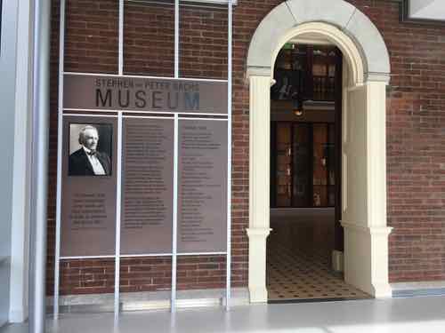
The library building at the Missouri Botanical Gardens is one of the original structures from when Henry Shaw opened his private gardens to the public in 1859 — 160 years ago. It’s a small structure, as the gardens expanded it simply outgrew it. It was rarely opened after being closed.
Since Shaw’s death in 1889, the building has served many functions—from research lab to offices to restaurant. Since its closing in 1982, it’s only open on special occasions, such as Shaw’s birthday celebration each July 24. (Missouri Botanical Garden)
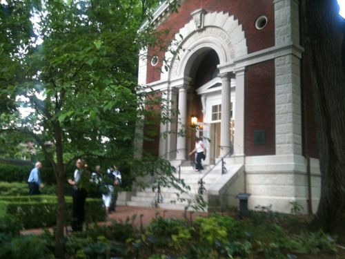
I was fortunate enough to get to see the interior on a rare opening on July 10, 2011. This meant leaving my wheelchair as the bottom of the steps and using the handrails to walk up the steps. It was worth the effort.
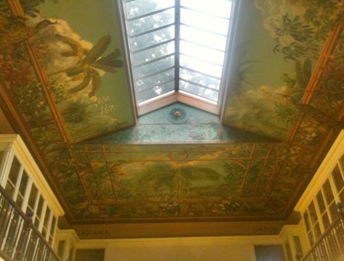
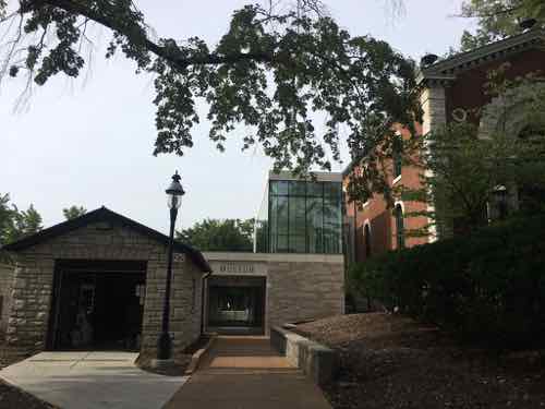
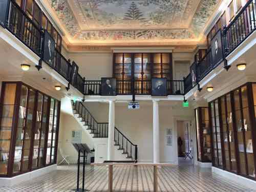
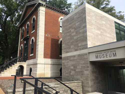
The Museum Building: Commissioned by Henry Shaw in 1858, this neoclassical building was designed by George I. Barnett and modeled after a building at the Royal Botanic Gardens at Kew, England. Originally, this building served as a small natural history museum, and housed the library.Interior in June 2011
They planned a restoration project and addition to make the building accessible. Adding onto a significant historic building, especially one designed by a noted architect, is very tricky. Most people, I think, probably assume it’s best to use the same materials & style — to try to blend in. That’s the opposite of what is recommended!
Instead you want to use modern materials from current times. It’s best to not do irreversible damage where adding on.
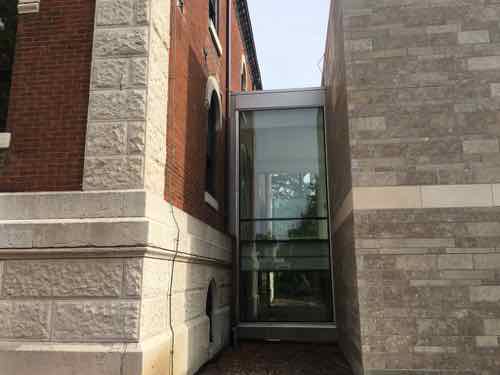
This view shows the original on the left with the 2018 addition on the right. A glass connector attaches addition to the historic. South facade.
I’ll let the architects behind the project explain the addition:
The 2,150 square foot addition is designed with a contemporary use of stone, distinguishing it from the existing building and reflecting current building technologies and materiality. A glass volume creates a formal entry on the north façade while the south façade is comprised of a modern limestone finish. The limestone masses define transparent entries both on the north and south facades. As a whole, the addition is simple, yet unique; providing much-needed access and facilities in a building that subtly complements the original historic structure. (Christner)
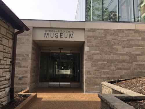
As you approach the historic main entrance from the North you’re directed toward the left.
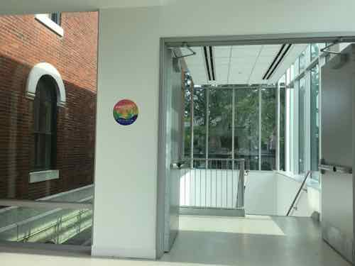
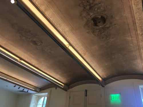
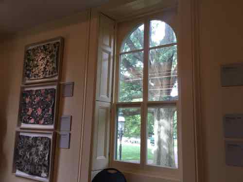
You see this sign first.You turn and see the addition, the garage on the left is old — but not historic.Approaching the entrance you can see through to the South entrance. This view shows an upper floor of glass walls.Looking back North from inside the upper level — the glass box is where the stairs come up. The elevator is behind me.No matter how you get up one level, this is what you see. A little bit of the outside wall is now inside. A former window becomes the opening into the main historic space.This is looking North, toward the original main entrance doors.This is the view looking South. The new addition is accessed at the back left, just past the bookcase. The upper level mezzanine is not open to the public.In the back (south) room a vaulted ceiling had been hidden for decades by a dropped plaster celling.Built-in shutters on the sides of the windows in the back space.Back at the South side you can see how stone on the addition conceals the elevator.
The addition not only provides access to the historic spaces, it also provides much-needed restrooms & drinking fountains on the East side of the garden. It opened last year, but it was only recently I got to see & experience it.
I’m so glad so many parents use baby strollers in public, it’s an added incentive to makes spaces accessible to everyone. Kudos to everyone involved with this project.
August 5, 2019Featured, Planning & Design, RetailComments Off on My Favorite Grocery Store In The City of St. Louis: ALDI Gravois Plaza
I remember my first time entering an ALDI grocery store. It was the early 90s, I’d just moved to St. Louis and was looking for work. They were hiring for management positions. So I went to the location that was on the southeast corner of Jefferson & Lafayete.
The interior lighting was awful, the packaged food all contained questionable ingredients, and they only accepted cash — not even debit cards. The management positions required relocation, which didn’t interest me. I also wasn’t interested in becoming a shopper.
In the late 90s or so living in Dutchtown & Mt. Pleasant neighborhoods I would occasionally shop at the ALDI on South Grand (1992) or Gravois near Kingshighway (1997), though what I’d buy was very limited. I’d usually shop at the Shop-n-Save at Gravois Plaza, or the Schnucks at Loughborough Commons.
Then in late 2007 I moved to Downtown West and, in early 2008, had a massive stroke. In February 2013 my then-boyfriend moved in with me — we needed more food on a budget.
Over the last few years I’ve become a huge fan of German grocery store chain ALDI. Because of their limited selection it’s not the only place we buy groceries, but we go once a month to stock up. Each week is a big stock up trip: ALDI, Trader Joe’s, Costco, Target. In between I get a few items at Culinaria 2-3 times per week. Yesterday was the first weekend of the month, so I went to ALDI.
The nearest ALDI to our apartment is at Natural Bridge & Grand (1999). I’ve shopped there once in the last year. It was ok. I’ve also been to the ALDI in Jennings a few times. However, usually I would drive to the newer ALDI at Delmar & Kingshighway (2013).
When Shop-n-Save closed up all their remaining locations (2017) I wondered how long that space would stay vacant. A few years earlier the ALDI on Grand wanted to take over the former McDonald’s location, closing the street between them, so they could build a new store. Thankfully they weren’t allowed to close Phillips Place.
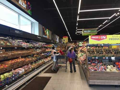
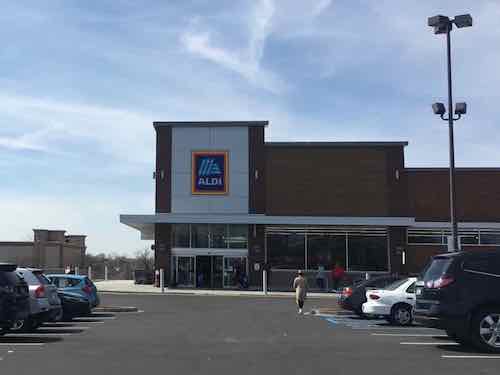
So it was no surprise when ALDI announced they were taking part of the former Shop-n-Save location. When I first went to the new location after it opened I was very glad it adopted their new interior design that we’d seen in a newish ALDI in St. Louis County.
In older ALDI stores produce is hidden in a back corner far from the entrance. Their new design puts it right up front. The black ceiling and LED lighting give a much more upscale appearance.
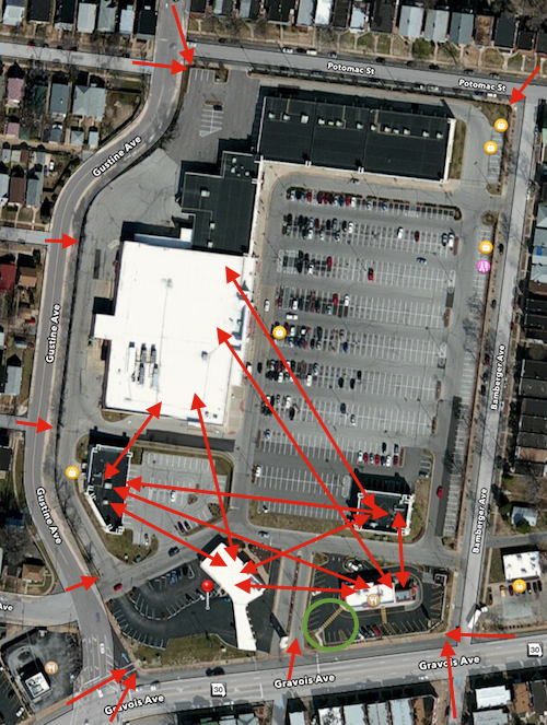
While the new location is a very pleasant shopping experience, getting here isn’t easy for pedestrians. Most weeks we do our bulk shopping together with our car. There have been weeks, depending upon my husband’s work schedule, where I use transit to get essentials. If that occurs on an ALDI week/weekend, I’ll have to go back to Kingshighway & Delmar. I’ve posted before how Gravois Plaza has zero ADA-compliance accessible routes from public sidewalks to any building on site. The newish Wendy’s is the only exception.
Red arrows show the many pedestrian routes with no provisions, the one green arrow is for the Wendy’s. Click map above to see December 2013 post
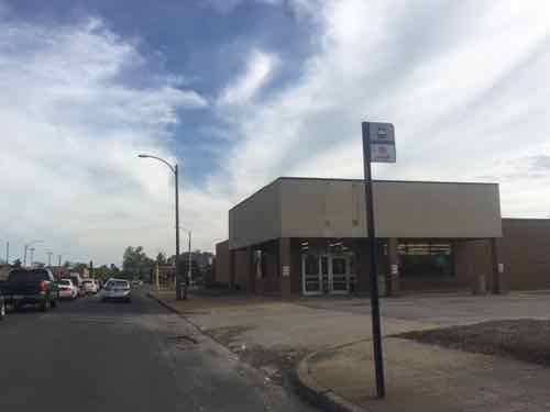
The previous ALDI was great for pedestrians, right up to the sidewalk with a bus stop right out front on the busy #70 bus.
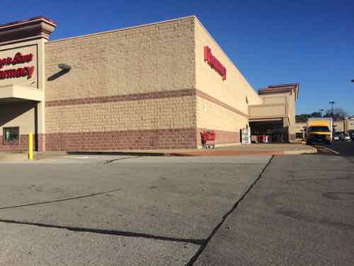
The now-closed ALDI at 3701 S. Grand.
b
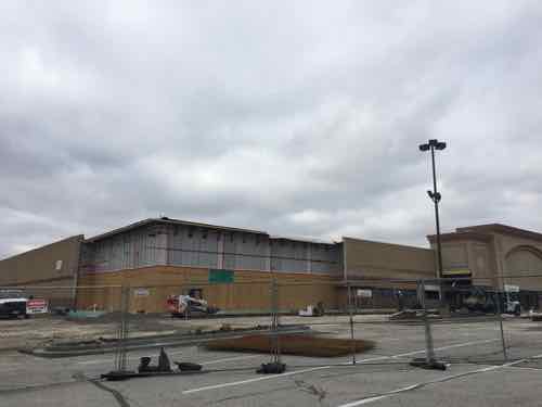
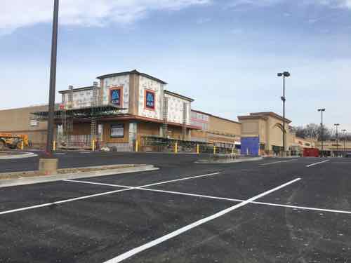
This is the corner of the old Shop-n-Save where ALDI is now located. October 2014 photoIn December 2018 the corner blocks had been removed.In February 2019 the corner began resembling other ALDI stores.We first shopped at the new ALDI on March 27, 2019
Even though it’s my favorite favorite grocery store, for now, it is not perfect. Most ALDI stores have disabled parking next to the building, allowing us to walk into the store without needing to cross a busy drive. Here the disabled parking is out front — meaning I must cross the main drive for the entire shopping center. When exiting the store and going to our car with a cart I have to work really hard to keep the cart from dragging me into the drive/lot faster than I can walk — the slope doesn’t appear that drastic, but it is. So I have to walk slower across the drive.
The store is still compact compared to other supermarkets, but this ALDI feels more spacious than older ALDI locations. Yesterday afternoon it was very busy. We even saw at least six Instacart food delivery shoppers in the store! That’s one way to get around trying to access the store as a pedestrian/transit user.
We’ve been very pleased with everything we’ve bought — except cold dill pickles in the deli case. I still have to read labels as some items still contain high-fructose corn syrup. Very glad they accept all major credit cards and have ApplePay at registers. Hopefully at some point pedestrian access will be retrofitted at Gravois Plaza.
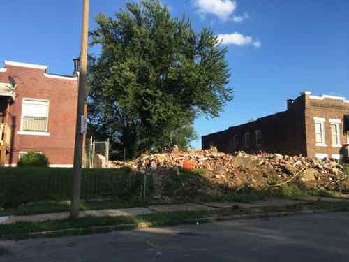
Looking at the Wells Goodfellow neighborhood last week was very depressing (see Readers Mixed On Latest Blight Removal Effort). On my visits seeing dilapidated houses being leveled I knew nobody was going to invest the money needed to have saved even one structure, let alone hundreds or the thousands throughout the city’s most sparsely populated neighborhoods.
!912 Clara Ave, left, and 1904 Clara Ave are occupied, the two houses in between were just razed.
Basically the city is partnering with a new non-profit, St. Louis Blight Authority, to clear four city blocks of vacant homes, overgrown trees, trash, etc. Occupied homes in the 4-block zone would remain.
The St. Louis Blight Authority is the organization behind a project to clear a four-block area in the Wells-Goodfellow neighborhood. The organizers believe the initiative could be just the beginning of a more far-reaching program. (St. Louis Public Radio)
Today I have a few critical observations, then I’ll offer some possible solutions.
Last week I searched the Missouri Secretary of State’s business listings to find out more about this new non-profit organization — I wanted to know structure, board members, etc. Guess what — no such organization exists! I was also unable to find a website — not even a Twitter account. Transparency is important, If we’re told a non-profit is involved that non-profit should actually exist.
Another personal observation is “Wells Goodfellow” is an awful name for a neighborhood — The “Wells” refers to 19th century transit magnate Erastus Wells, “Goodfellow” is a major north-south street — more on that later.
Wells/Goodfellow is part of an historic section known as Arlington, which takes its name from John W. Burd’s Arlington Grove subdivision of 1868. A memorable disaster in the history of the Arlington area occurred in October 1916, when the Christian Brothers College building at North Kingshighway and Easton Avenue (now Martin Luther King Drive) was destroyed by fire, one of the worst in the City’s history, taking 10 lives.
The area received its name from John W. Burd’s Arlington Grove subdivision of 1868. More subdivisions were built in the mid-1880s, with residential construction continuing until 1910. By the mid-1920s, the last of the residential subdivisions were opened. (St. Louis)
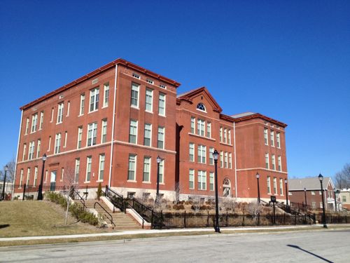
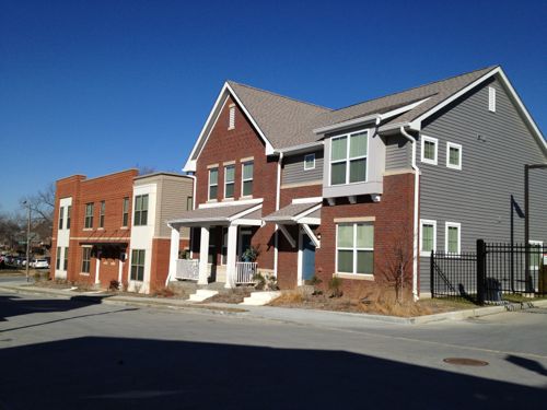
The 2013 housing development in the neighborhood uses the name Arlington Grove, so that name probably shouldn’t be used for the entire neighborhood.
Former Arlington School in North St. Louis is now residentialThe 22 new buildings have similar materials but unique designs.
Some other name with Arlington in it could be good though. Perhaps just the Arlington neighborhood? Or something to do with land developer William Burd (1818-1885)? Though Burd isn’t the most marketable name and I don’t know his politics. Was he a slave owner? His wife Eliza’s maiden name is interesting: Goodfellow.
A new name could help change perceptions for residents, property owners, workers, and outsiders. The Old North St. Louis neighborhood wouldn’t have had lots of redevelopment & new construction if it was still called Murphy-Blair.
Possible solutions for the neighborhood are varied, need to be discussed in public sessions to obtain a consensus on how to move forward. My initial brainstorming came up with the following:
Do nothing
Push for new infill housing
Abandon the center
Let me explain each of these options.
1. Do nothing
This means nothing different, maintain the status quo. So tear down houses once they’ve become a major eyesore. Continue city services (water, sewer, trash, police, fire, etc) to those who remain.
2. Push for new infill housing
Try to get Habitat for Humanity or another entity to build new housing on vacant lots. It would probably make sense to concentrate new construction on one or two blocks at first. These lots are narrow so you’d need 2-3 lots per new single family house. Include some multi-family construction as well. Existing infrastructure (streets, alleys, sidewalks, water, sewer, etc) may need to be upgraded on these blocks.
3. Abandon the center
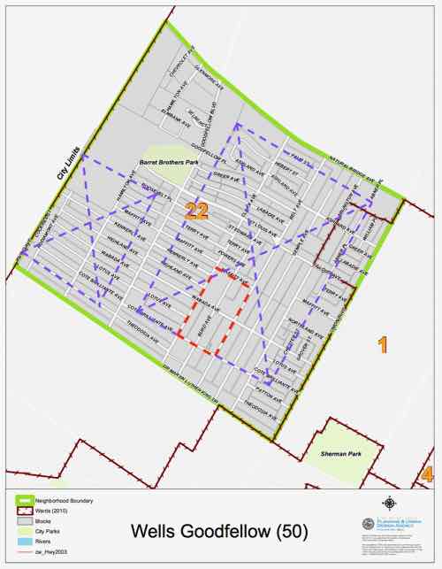
This will likely be the most controversial option, here it goes. Blocks that front onto the major streets of Dr. Martin Luther King, Goodfellow, Natural Bridge, and Union would be supported. New development would occur in these blocks only — to reinforce existing corridors. Everything inside of those blocks would be, over time, cleared. All interior streets, alleys, etc would be removed. The interior land could be used for urban agriculture or perhaps a large employer. This would create two cleared areas, one on each side of Goodfellow.
The small red area is the 4-block area where recent demolition was concentrated. Occupied residences remain in that area and on every city block. The two purple areas that could be completely cleared for urban agricultural use would be split by concentrated development fronting Goodfellow.
This solution is a drastic measure, but it or something similar might be the best hope for a neighborhood that has lost population to the point where it no longer functions. I don’t foresee anyone being forced to move or sell their home. Nature and economics is taking a toll quickly enough.
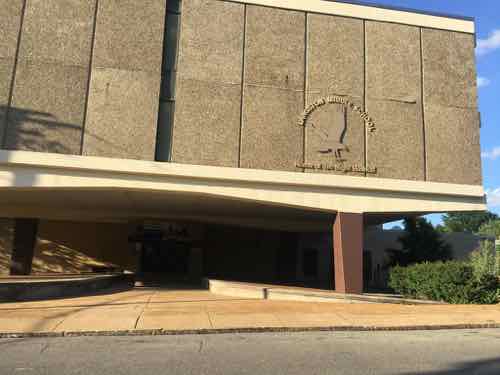
Langston Middle School is within the big purple area, but it is no longer listed as a school on the St. Louis Public Schools website. The building might be usable for hydroponics.
There are likely other buildings within the purple clear zones that could be reused within the cleared area. This area would still need water/sewer but not miles of alleys/streets/sidewalks.
Conclusion
I’ve presented a range of options, I’m sure if we put our heads together we can come up with many more.
The question I have is who will lead the effort to determine what happens next? Will it be the elderly residents who’ve stayed despite their families begging them to leave? The church leaders/parishioners who live elsewhere but drive in for Sunday services? An elected official? The nonexistent St. Louis Blight Authority?
I’m afraid the leadership vacuum will mean the “do nothing” status quo option will be selected by default.
AARP Livibility Index
The Livability Index scores neighborhoods and communities across the U.S. for the services and amenities that impact your life the most
Built St. Louis
historic architecture of St. Louis, Missouri – mourning the losses, celebrating the survivors.
Geo St. Louis
a guide to geospatial data about the City of St. Louis