Home » Planning & Design » Recent Articles:

Olive Boulevard In University City Is A Pedestrian’s Nightmare

February 25, 2019 Accessibility, Featured, St. Louis County, Walkability Comments Off on Olive Boulevard In University City Is A Pedestrian’s Nightmare

University City Missouri is a first-tier suburb of St. Louis. Many towns in the region are older, starting as rural villages.  More than a quarter century after the municipal boundaries of the City of St. Louis were set in stone way out in the rural countryside, U City began at those limits:

University City was founded by publisher Edward Gardner Lewis, who began developing the location in 1903 around his publishing complex for Woman’s Magazine and Woman’s Farm Journal. Historic buildings associated with municipal operations, including today’s City Hall, were built by Lewis as facilities for his magazine enterprise. In 1906, the city incorporated and Lewis served as its first mayor.  (Wikipedia)

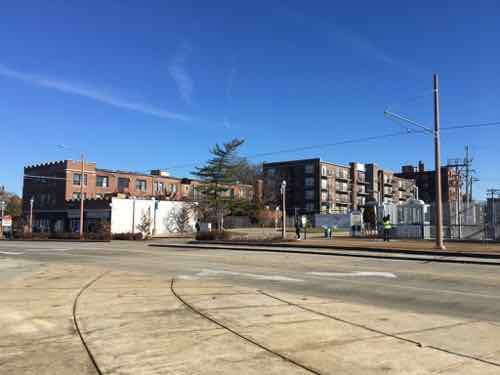
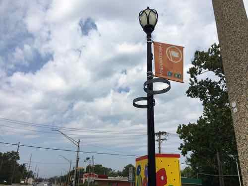
The streetcar from the city was extended West into the new suburb, turning around there. The urban business district is now knows as the Delmar Loop because of the streetcar loop to reverse direction.

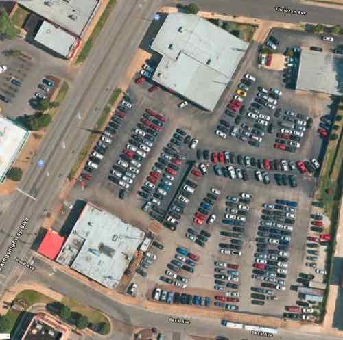
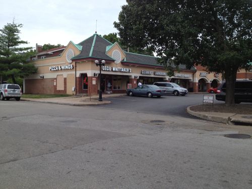
University City has a second East-West business district: Olive Boulevard. Where the Delmar Loop was established first, in the streetcar era, Olive developed later. Initially buildings were similar to those on Delmar: 2-story with residential over a business on the ground floor. As development marched Westward the automobile became more important and residential units above retail was no longer a thing — it was all about separation of uses. Business zoning meant businesses only, residential meant single-family detached homes, with a few zones for multi-family. Mixing these was considered a formula for creating blight.

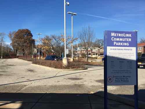
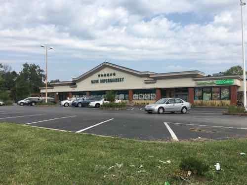
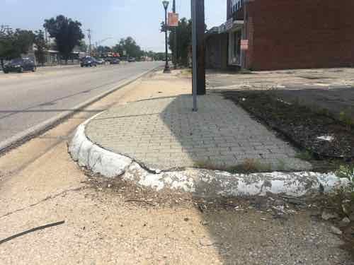
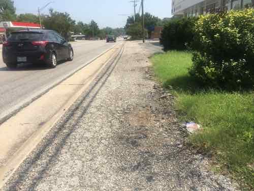
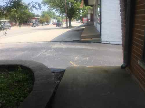
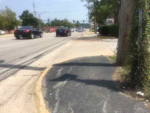
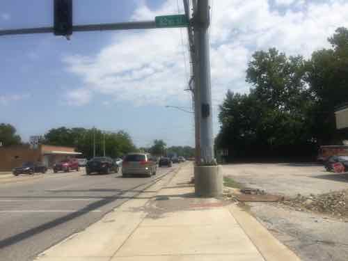
As a result, the 3.6+ miles of Olive Blvd has always been very different than the short half mile of the Delmar Loop business district located within University City’s limits. On Saturday August 25 2018 I decided to explore a portion of Olive Blvd targeted for redevelopment. Today’s post isn’t about proposed development and all the pros & cons associated with it. No, today is about documenting what exists now. My round trip took more than four hours, including stopping for lunch to eat and recharge my wheelchair. In that time I took 181 photos.

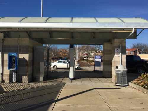
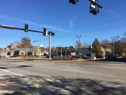
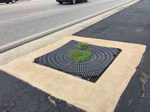
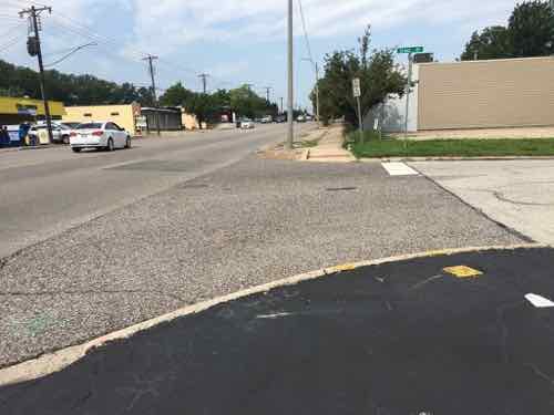
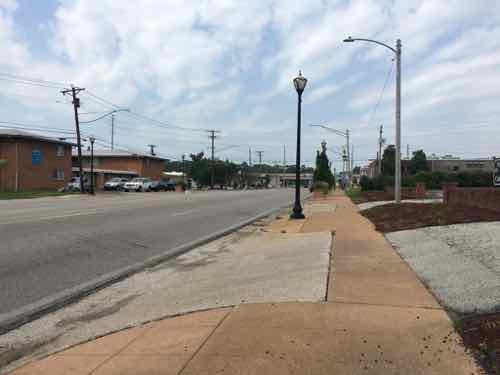
It was quite hot on that Saturday, but I feel it’s important to personally experience an area before writing about it. I’m not going to share all my images, just enough to give you a sense of the area. The #91 MetroBus starts at the Delmar Station (I arrived on the #97 MetroBus, not via MetroLink). Anyway, the #91 heads North on Skinker before turning left to head Westbound on Olive Blvd. — the start of the U City limits.

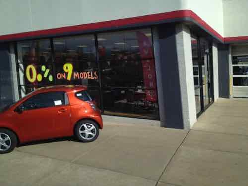
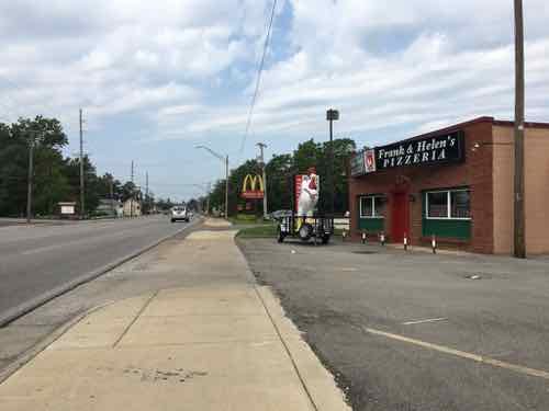
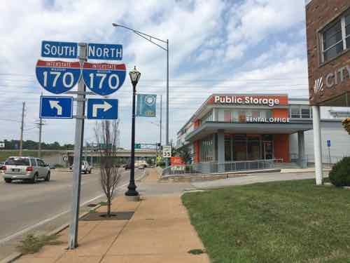
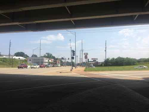
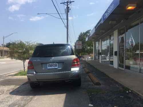
Having lived in St. Louis for over 28 years I’d driven this part of Olive many times, but this was my first time seeing it from the bus window. My interest on Saturday, however, was the far end of Olive. I got off the bus in front of Royal Banks (map).  Before I get into my photos illustrating Olive Blvd I should give you some additional background. Neither University City or St. Louis County is responsible for maintenance of the road, sidewalks, signals, etc. The State of Missouri has that responsibility because Olive Blvd is also known as state Route 340.

Route 340 is a highway in the St. Louis metropolitan area. Its western terminus is Route 100 (Manchester Road) in Ellisville, and its eastern terminus is at an intersection with Ferguson Avenue and Olive Boulevard in University City. The stretch of Route 340 between Manchester Road and the Interstate 64 / U.S. 40 / U.S. 61 interchange is known locally as Clarkson Road. The remainder of Route 340 between this intersection and its eastern terminus is variously known as Olive Boulevard (which does not connect with Olive Street in the city of St. Louis. Route 340 ends at Ferguson Avenue in University City, but Olive Boulevard continues to Skinker Boulevard on St. Louis city line. (Wikipedia)

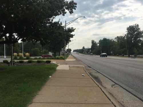
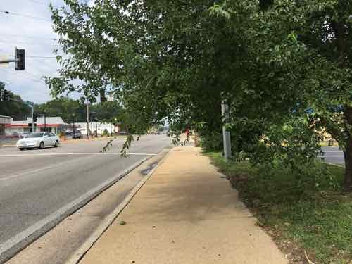
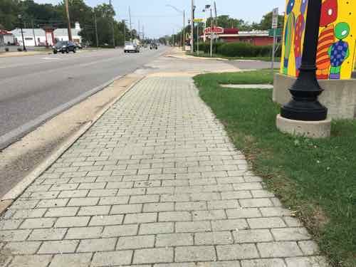
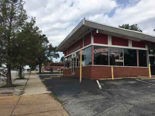
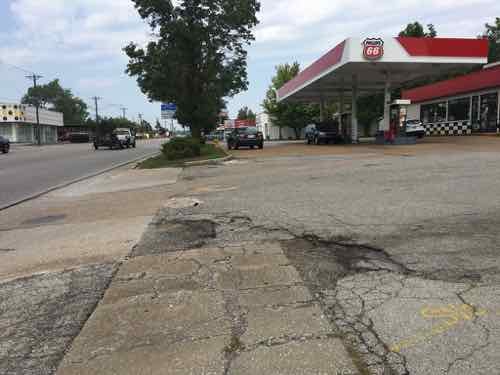
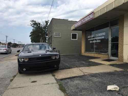
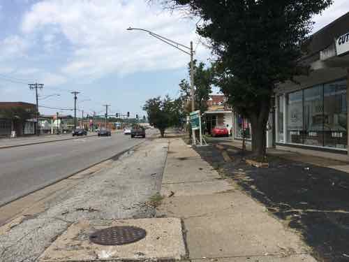
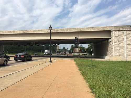
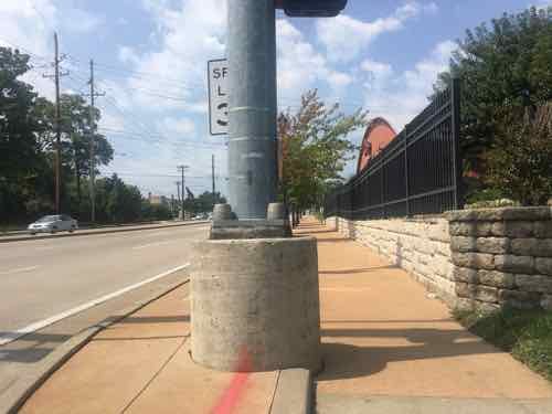
Not a divided limited-access interstate, but an urban corridor that is supposed to move more cars than other corridors — like Delmar Blvd. The headline gives away the theme — it was a nightmare.  This comes from auto-centric development in the absence of a mandate for accommodating pedestrians.

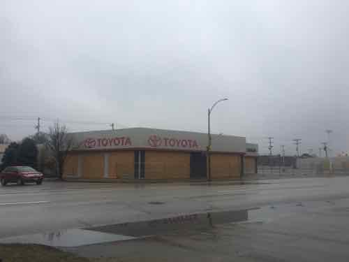
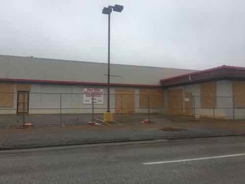
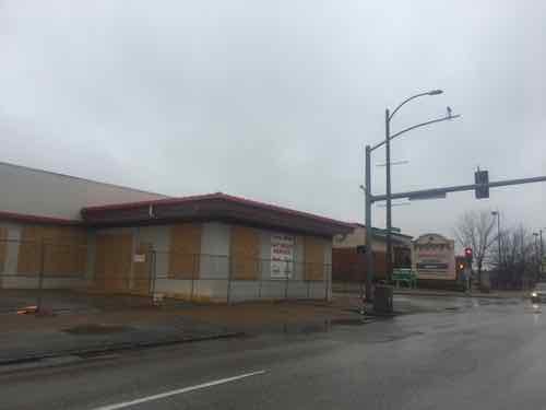
OK, let the visual tour begin.

Taken on the bus, this 1915 building has residential above commercial. This is shortly before Olive Blvd becomes Missouri Route 340. Due to parking, clear pedestrian access is limited.
Looking West as the bus continues heading on Olive Blvd to Chesterfield Mall.
Looking East from the same spot. Olive Blvd is 4 travel lanes, plus a center turn lane. Sidewalks at this point are “attached”, no tree lawn separating roadway from sidewalk.
The Royal Banks building, 8021 Olive Blvd, was built in 1971. In 1958 the land was vacant.
Next door, to the West, is a store specializing in Asian/International groceries. It was built in 1960 — has been updated many times since. Both are set way back from Olive to provide more room for parking.

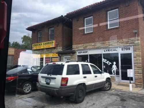
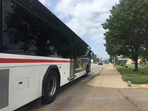
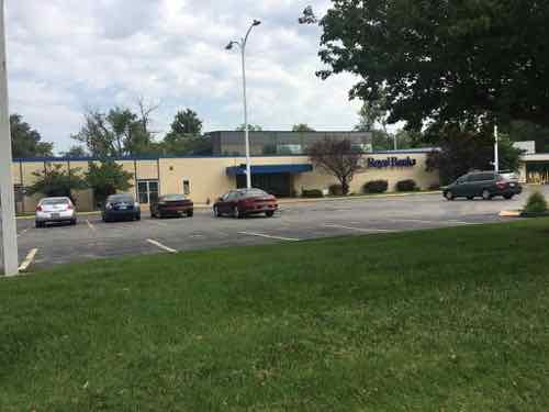
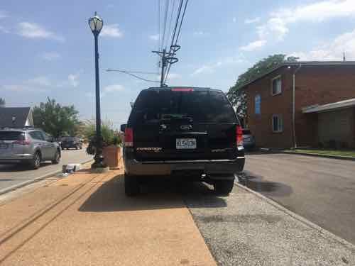
Despite the presence of a bus stop, neither provide an accessible route to their accessible building entrance. This is the case for nearly every property I encountered the next few hours.

I quickly encounter a point where foliage is hanging over the sidewalk. I’m sitting in my wheelchair and still hit it when ducking.
In places the paving changes to a paver brick intended to spruce up the pedestrian experience. As expected, they were uneven.
The streetlight is also intended to help the image of Olive. The banner is for the Olive Link International district, next to rings meant to hold planters.
This shows a 1962 pizza place is relatively close to Olive.
Broken grate around a former street tree.

The above was written back in August, shortly after taking the trip on Olive. Rather than continue procrastinating, I’m going to post more pics with limited commentary to be able to finish this post.

One of many places where no curb cut exists, there’s a good ramp across the street but not this side

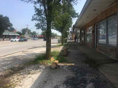
Yesterday as I was finishing up this post I reviewed all nearly 200 photos I took that hot August day. After wishing it wasn’t so cold now, I recall all the obstacles I encountered in my wheelchair. I also thought about how horrid the environment is for anyone to experience as a pedestrian.

Now that I’ve finally gotten this post completed, I can post about plans to redevelop the Western end of Olive Blvd in University City.

— Steve Patterson


Thinking about the former Ackerman Toyota site on South Kingshighway

February 11, 2019 Featured, Planning & Design, South City Comments Off on Thinking about the former Ackerman Toyota site on South Kingshighway

For decades Ackerman Toyota was located on South Kingshighway Blvd, between Tholozan Ave on the North, and Beck Ave on the South. In 2015 they announced they’d build a new dealership on the NE corner of Hampton & I-44, the site of the former MSD headquarters.

Ackerman Toyota, the southern outpost of the decades-old string of St. Louis car dealerships on South Kingshighway, is hitting the road.

After nearly 27 years at 3636 South Kingshighway, the dealership plans to move to 2000 Hampton Avenue. The three-acre site owned by the city’s Land Clearance for Redevelopment Authority is the former headquarters of the Metropolitan St. Louis Sewer District at Hampton and Interstate 44.

Jerry Ackerman, the dealership’s owner, said Thursday he hopes to begin construction by December and open his new location as early as June. (Post Dispatch, August 2015)

Today’s post isn’t about their new location, this is about the location they recently vacated.

Their old address was listed as 3636 S. Kingshighway — the address for the building on the South, at Beck Ave. It dates to 1940, per city records online. The other building on Kingshighway, at Tholozan Ave. is from 1929. Both have been remodeled so many times neither has any historic value.  A 3rd building, an anonymous service structure,  facing Tholozan, was built in 1948.

The North building, at Tholozan, was their Scion showroom until Toyota pulled the plus on that youth-oriented brand. 2012 photo
That same building yesterday, all boarded up. Again, this structure was built in 1929. Note how it comes out to both Tholozan & Kingshighway. The city says the address here is 3608 S. Kingshighway.
The South building is mostly set back from the property line.
However, the corner at Beck Ave is out to the sidewalk. South of Beck Ave is Southtown Centre.

The former car dealership contains over 145k square feet, roughly 3.3 acres. It is made up of 6 different parcels. These could be combined, or developed separately. The most likely scenario is one developer will buy all six parcels and, after consolidating them into one, develop the total site.

Aerial view, from Apple Maps. The East edge of the site is a former railroad right of way, still owned by Union Pacific.

The bottom right section is 2 of the 6 parcels, it was still a field as late as 1971. It got paved for parking sometime between 1971 and 1991, based on historic aerials of the site. In the 2015 article, linked above, Jerry Ackerman is quoted as indicating they were seeing a franchise from another manufacturer for a dealership at this location. Given that they’ve boarded the buildings my assumption is that didn’t pan out.

Good.

This site needs to cease being about the sales & service of cars. It needs to be a mix of uses, including some residential. Two and three story buildings are very common on this stretch of Kingshighway, so a dense/urban site plan would be appropriate.

It’ll be interesting to watch to see what, if anything, becomes of this site.

— Steve Patterson


Opinion: Possible Soccer Stadium Will Not Help Downtown West Without A Neighborhood Plan

December 5, 2018 Downtown, Featured, Planning & Design Comments Off on Opinion: Possible Soccer Stadium Will Not Help Downtown West Without A Neighborhood Plan

Before I begin discussing my thoughts on a possible soccer stadium in the Downtown West neighborhood, let’s take a look at the results from the recent non-scientific Sunday Poll:

Q: Agree or disagree: If awarded an MLS expansion team, the stadium could be a catalyst for the Downtown West neighborhood.

  • Strongly agree: 18 [34.62%]
  • Agree: 7 [13.46%]
  • Somewhat agree: 8 [15.38%]
  • Neither agree or disagree: 3 [5.77%]
  • Somewhat disagree: 3 [5.77%]
  • Disagree: 3 [5.77%]
  • Strongly disagree: 10 [19.23%]
  • Unsure/No Answer: 0 [0%]

Over 63% percent voted in the affirmative, I voted “somewhat agree” because yes, it could become a catalyst. With history as a guide, it most likely won’t do anything positive for the surroundings. Busch Stadium II (1966-2006) didn’t have much of an impact on adjacent blocks for the 3 decades it stood. Our NFL dome didn’t do anything for its surroundings either — the large site to the North is still vacant.

To become a catalyst for private investment a lot of planning must happen, a form-based code adopted so every property owner contributes to the same vision. Part of the problem is the current ownership group, and the last, both want to located the stadium South of Market Street — between 20th & 22nd Streets.  In February 2016 I suggested a MLS stadium North of Market bounded by 20th Street, Market, a rebuilt 22nd Street, and Pine. Only the stadium would fit, if at all. This land is also owned by the State of Missouri. This would leave lots of room for new development South of Market Street, North of Pine, etc.

Looking East toward Union Station from 22nd Street, a new Fairfield Inn is under construction on the former site of Harry’s.

Part of the area where they want to build a stadium is where Harry’s Bar & Restaurant was located at 22nd & Market St. This small site is already being developed, from September 2017:

The Fairfield, a Marriott brand, will have about 125 rooms and a two-story parking garage along with event space on the almost 1-acre site at 2144 Market Street. Developer Equis Hospitality Management of Brentwood hopes to finalize financing for the $19.5 million project by January and begin construction in January. (Post-Dispatch)

In October it was said the hotel site wouldn’t be needed for the stadium.

Across 22nd Street from the hotel, now under construction, is the St. Louis office of the FBI. Urban Stadiums should be like Chicago’s Wrigley Field, surrounded on all sides by numerous businesses that are active even on days when the stadium is empty. Not surrounded on one side by a fenced parking lot at a fortress. I doubt the FBI has any plans to relocate.  The stadium would be focused more toward Union Station, presumably. Still, the best urban stadiums are surrounded by active properties owned by others.

Financially the deal isn’t the worst. the land hasn’t generated any property taxes for decades, so by abating property taxes it’ll continue as it would if nothing were built. The city would wave taxes on construction materials like they’re doing with the hotel and other projects. This isn’t a huge gesture because most construction materials used on these projects aren’t bought from suppliers located in the city. This might be an incentive for the contractors to buy from city suppliers rather than outside suppliers.

It’s really hard to be anything but cynical about a new stadium, likely surrounded by acres of surface parking. Hopefully I’ll be pleasantly surprised…assuming the MLS awards one of the two remaining expansion teams to St. Louis.

— Steve Patterson


St. Louis City Pedestrians Finally Getting A ‘Leading Pedestrian Interval’

December 3, 2018 Featured, Walkability Comments Off on St. Louis City Pedestrians Finally Getting A ‘Leading Pedestrian Interval’

A significant change has been happening at St. Louis intersections: the leading pedestrian interval (LPI). The what?

Walk signal is on while the traffic signal is still red, 11th @ Locust.

A leading pedestrian interval (LPI) gives pedestrians the opportunity to enter an intersection 3-7 seconds before vehicles are given a green indication. With this head start, pedestrians can better establish their presence in the crosswalk before vehicles have priority to turn left. LPIs provide the following benefits:

  • Increased visibility of crossing pedestrians.
  • Reduced conflicts between pedestrians and vehicles.
  • Increased likelihood of motorists yielding to pedestrians.
  • Enhanced safety for pedestrians who may be slower to start into the intersection. (Federal Highway Administration)

The FHA says the benefit is a 60% “Reduction in pedestrian-vehicle crashes at intersections.” Video I took last month shows a 3-second LPI. Hopefully busier intersections (pedestrians & cars) get 7 second LPIs. Still. 3 seconds is better than 0!

I’m not sure if an LPI is used anywhere in St. Louis County, or the rest of the region.

— Steve Patterson


Possible Development at Forest Park-DeBaliviere MetroLink Station Will Include Lots of Parking

November 26, 2018 Featured, Planning & Design, Public Transit Comments Off on Possible Development at Forest Park-DeBaliviere MetroLink Station Will Include Lots of Parking

After 25 years the Forest Park-DeBaliviere MetroLink (light rail) station may finally be getting new higher-density development. From last week:

An Indianapolis developer plans to transform the block around the Forest Park-DeBaliviere MetroLink station with a $70 million development adding 265 apartments and 34,000 square feet of retail.

The Bi-State Development Board of Commissioners on Friday voted to proceed with the project. The Bi-State-owned parking lot at the northwest corner of Forest Park Parkway and DeBaliviere Avenue along with the drop-off lot on the east side of DeBaliviere Avenue are targeted for new apartment and retail buildings.
The privately owned strip mall to the north of the Bi-State parking lot is also part of the project, slated for a four-story, 106-apartment building with 16,000 square feet of ground-floor retail.
 
The Bi-State parking lot will be turned into a six-story building with 108 apartments and almost 13,000 square feet of ground-floor retail. Metro’s drop-off lot across the street would become a five-story, 51-apartment building with 5,000 square feet of street-level retail. Plans also call for public art and streetscape improvements. (Post-Dispatch)

Over the last quarter century other developers have also talked about developing around the station. Maybe it’ll finally happen. Over the last few years we have seen high-end high-density housing filling in gaps along Pershing Ave, to the East of DeBaliviere. Yet, five houses West on De Giverville, facing the parking lot to be developed. are two houses in poor condition.

The house missing the roof is 5727 De Giverville.

Across from a light rail transit station for 25 years. Part of the problem with this area is a lack of retail/services — namely a grocery store:

5727 De Giverville Avenue has a Walk Score of 64 out of 100. This location is Somewhat Walkable so some errands can be accomplished on foot.

5727 De Giverville Avenue is a three minute walk from the MLB MetroLink Blue Line and the MLR MetroLink Red Line at the FOREST PARK METROLINK STATION stop. (WalkScore)

Hopefully the new development will substantially increase the WalkScore for this area.  Certainly couldn’t lower it!

Metro’s free park & ride lot was redone in 2006 when the Blue line was added. This structure is also from 2006. The houses on De Giverville can be seen in the background.
Full on weekdays, the free parking at the station is usually empty on the weekends
The old kiss & ride space on the East side of DeBaliviere will also be developed.

I’ve previously posted about how awful the strip retail building at DeGiverville & DeBaliviere is — especially need to a light rail station.

Low-density suburban style strip center isn’t an asset for the area, tenants include Metro’s Transit Access Center where Call-A-Ride operations are and where disabled riders. like myself, go to get a reduced=fare card. Very low volume.

Can’t wait to see that building demolished!

Hopefully a developer will snap up the former Talayna’s on the NE corner of DeBaliviere & Pershing.

While I’m happy a new developer is interested in this area, I’m not thrilled Metro will still have 100 parking spaces (per Wikipedia).  This just increases the cost of housing & commercial rents in the new development — meaning those of us on the low end of the income scale who use transit won’t be able to afford to live here.

— Steve Patterson


Advertisement


[custom-facebook-feed]

Archives

Categories

Advertisement


Subscribe