Two weeks ago I began a critical look at the site plan for the proposed Major League Soccer (MLS) stadium with a look at the area to the south of Market Street(see Part 1). This area includes practice fields with parking below, new streets, and development sites that have been highway ramps for decades.
Today I’ll look at the area to the north of the stadium site.
Site plan
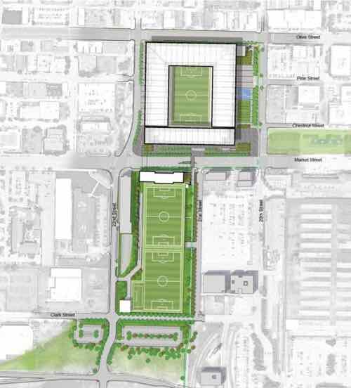
The north side of the stadium will border on Olive Street, left to right on the top of the site plan above. The blocks facing Olive and to the north are very different than the area south of Market. This area contains both rehabbed buildings, but also vacant parcels just waiting for new infill construction.
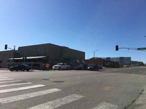
Olive Street is major east-west corridor, connecting downtown to midtown and beyond. The stadium will have a two block-long facade along Olive Street, from 20th to 22nd. So let’s begin in the middle — at 21st Street.
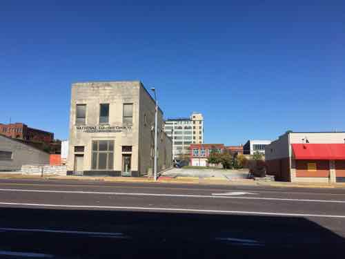
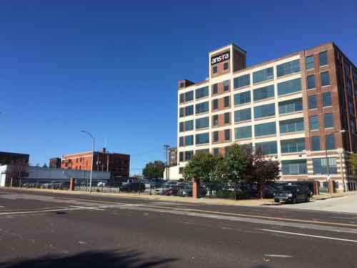
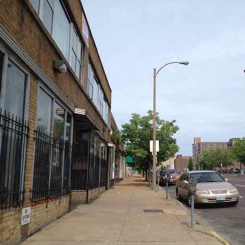
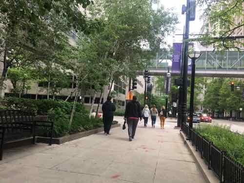
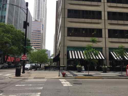
Looking north at 21st & Olive from the mid-point of the proposed MLS stadium. The Schlafly Tap Room is on the left, offices on the right, lofts in background at Washington Ave. Click image to view area in Google Street View
The site plan shows a crosswalk at 21st Street to the south, across Market Street. Given this stadium is surrounded by an urban street grid a crosswalk every block makes perfect sense. Unfortunately, the site plan doesn’t show a crosswalk at 21st Street, across Olive Street.
Will people coming to the stadium from the north go to 20th or 22nd to cross 4 travel lanes of traffic on Olive? No, they won’t. Those coming toward the stadium from the north on 21st will attempt to cross at 21st. If this intersection isn’t designed to stop traffic for pedestrians people will get hit, some killed. Why would anyone use 21st Street to head south toward the stadium?
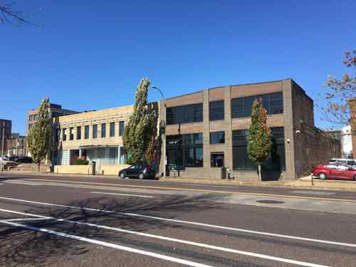
21st & Locust looking south toward Olive and center of future stadium21st & Olive, looking east toward 20thA former Imo’s Pizza on the NW corner of 20th & Olive.This 2-story building at 2011 Olive was built in 1919.Two 2-story buildings on Olive between 21st & 22nd have been renovated into offices.
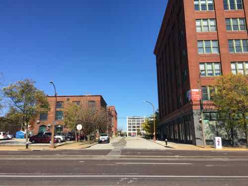
There are lots of lofts, restaurants, and such in the three blocks between Olive & Delmar. All the streets from 20th to 23rd connect to Olive, it’s reasonable to expect people to use all these streets to walk toward the new stadium. Some may come from lofts/apartments, with others parking on the streets.
There is also vacant land in this area, some state-owned. Ideally new multi-story residential buildings will fill in the gaps over the next 10-20 years. Ideally St. Louis would limit/ban surface parking in this area. Businesses like Schlafly’s Tap Room already has surface lots occupying more land than their building. A shared-use parking garage with an active ground floor (restaurant, retail, etc) with enclosed walls & ventilation would be acceptable in this area.
Hopefully the non-contributing single story buildings between Olive, Delmar, 18th, & Jefferson will be replaced with two to five story structures. If this area is to become a thriving urban neighborhood it needs to keep surface parking to a minimum. It’s already bad along Olive heading west toward Jefferson.
The apartments in the background use the NW corner of 23rd & Olive for parking.The building at 2209-11 Olive, built in 1906, has its own parking. Not sure when this building was “modernized”.The building on the NE corner of 23rd & Olive was built in 1922.At the NW corner of 23rd & Olive a large surface lot for the building on Locust detracts from Olive’s importance as an urban corridor.
No doubt the area north of Olive will change once the new stadium opens. It remains to be seen if this change will be positive, negative, or neutral. Without a consensus on the future direction, enforced through form-based zoning, my bet is on the negative.
Last week we finally saw the proposed site plan for the new Major League Soccer (MLS) stadium. It’ll be exactly where I suggested in February 2016, where I said it would be a month ago — northwest corner of 20th & Market.
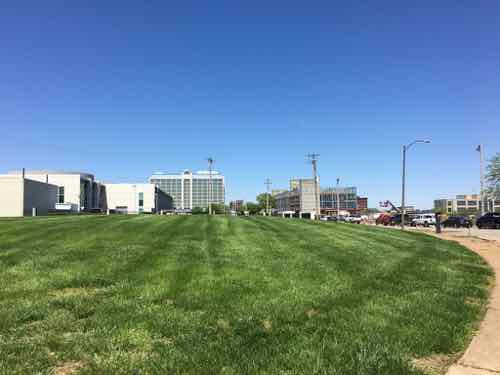
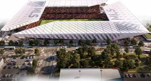
Site plan for the proposed MSL stadium published by the Post-Dispatch last week. The top is north at Olive. Union Station its in the lower right corner. The new stadium is at the top, with two practice fields south of Market — immediately east of a new hotel being built along 22nd Street.
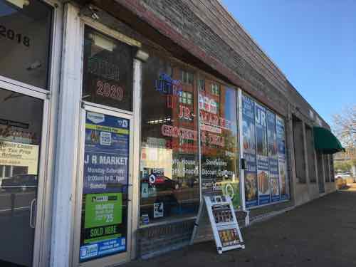
As I said last month, I thought of a smaller structure stopping at Pine on the north. But I see how more space is needed so it will go another block north, to Olive. This means razing a few buildings and relocating businesses. Understandably, one is refusing.
The owner of JR Market at 2020 Olive doesn’t want to relocate
Many, including myself, thought they’d build south of Market Street like the prior MLS group proposed. However, the site I proposed in February 2016 makes much more sense. The MLS prefers urban settings and the location north of Market gives them instant urbanism on all sides — plus two blocks of frontage along Market. South of Market there is no urbanism. None.
Ok, for a brief moment on 20th Street you’ve got Union Station’s train shed with new Farris wheel on one side with the old railway YMCA, now a hotel & restaurant, on the other. But a new stadium south of Market couldn’t be close to this single spot. Granted, if done right urbanism could build up around a new stadium south of Market.
Former railroad worker YMCA on 20th Street
Wisely, they’ve opted to fill the hole in the middle of existing buildings north of Market. The new stadium will be surrounded on all sides by multi-story structures. There’s enough surface parking that it isn’t ideal urbanism, but it’s significantly better than south of Market.
Today I want to begin to critically examine their site plan, discuss street grid changes, parking, and look at future development potential of the surroundings. The new stadium is square but one can argue the south side, facing Market, is the primary facade. The east side, facing 20th is a close second. Due to the amount of land area, we’ll start with the area south of the stadium.
I’ll admit in February 2016 I hadn’t considered practice fields. I saw the area south of Market being filled with offices, housing, etc. The area devoted to practice fields is largely dead space, perhaps school groups could use them. This keeps the team owners from having practice fields and team offices elsewhere in the region — as was the case with the Rams NFL team.
This portion of the site plan shows Market Street (top) downtown to 40/64, between 21st and 22nd. The plan shows new points to cross Market at both 21st & 22nd. It also shows 22nd getting straightened and Clark Street connecting 20th to 22nd — for the first time in decades.
I like a number of things about this design. As I thought in 2016, the stadium will be an excellent terminus to the Gateway Mall. The site plan shows a new building facing Market across from the stadium, north of the practice fields. I assume this will hold a team store, offices, etc. If this is more than a single story in height it and the stadium will give this stretch of Market a feeling of urbanism — enclosure. Combined with the new hotel finishing up at 22nd Street this will do wonders for the area.
In time the two buildings on Market between 20th & 21st will likely get replaced by multi-story structures. The rest of this block is surface parking for Union Station. I’d like to see a center parking garage with sidewalk-level storefronts and perhaps at multi-story building at the south end.
Replacing the two buildings and filling in the surface parking lots in the block bounded by Market, 20th, 21st, and Eugenia Street will not happen overnight — but I do think it will over time. It should at least.
As mentioned above, Clark Street will connect between 21st and 22nd — something it hasn’t done in decades. The site plan shows surface parking right now, a placeholder for future development. Hopefully this new Clark will be designed to permit on-street parking on both sides. Not sure what will get developed on the land between Clark and 40/64 — hopefully multi-story.
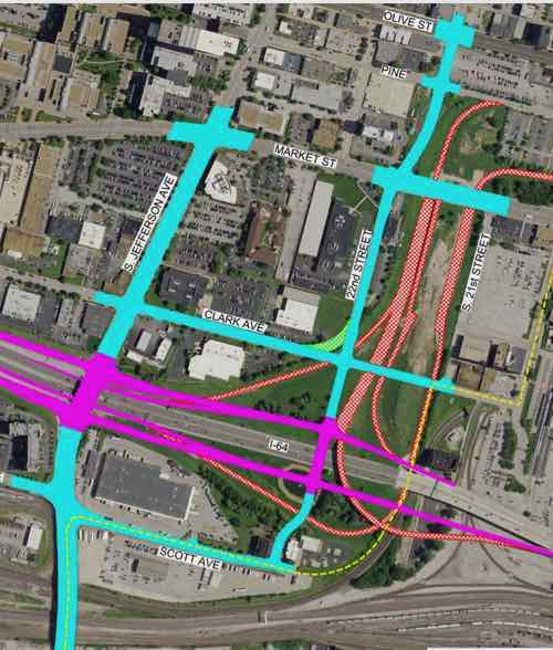
You’ll also notice 22nd street continuing south to the interstate. Changes have been in the works since Paul McKee first named the 22nd Interchange site as one of his four jobs centers. MoDot has been planning major changes to interstate entry exit points.
The pink shows new highway on/off ramps. A person driving westbound on 64 that wants to go north or south on Jefferson would exit at 22nd but stay on the side road until they reach Jefferson. A new bridge would extend 22nd Street over 40/64 to reach Scott Ave. Click image for original source — h/t to Scott Ogilvie
I love the new 22nd Street connection over the interstate! Hopefully it’ll also include pedestrian accommodations. It’s unclear from MoDot’s materials what will become of the state-owned land south of 40/64.
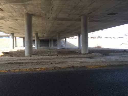
One of the benefits of developing the 22nd interchange site is the current hole makes underground parking significantly cheaper compared to excavating an area filled with dirt, foundations, utilities, etc. The MLS team plans to use the area under the two practice fields for team/staff parking. Just guessing before the first match we’ll learn that luxury box ticket holders will also get access to underground parking.
I suspect they’ll also have locker rooms, kitchens, etc under the MLS stadium itself. I also expect the area under the stadium will be connected to the parking under the practice fields. Given the area is totally open now this is a very easy proposition.
This photo under Market was in my February 2016 post. I didn’t see a need to connect the north & south sides under Market but it makes sense knowing the MLS team will be on both sides.
The connection won’t be the full width of what has existed for decades, perhaps a nice hallway for players, owners, and staff. A second service connection is likely for food service, rubbish removal, etc.
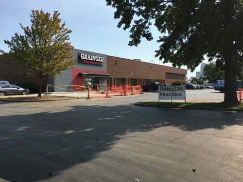
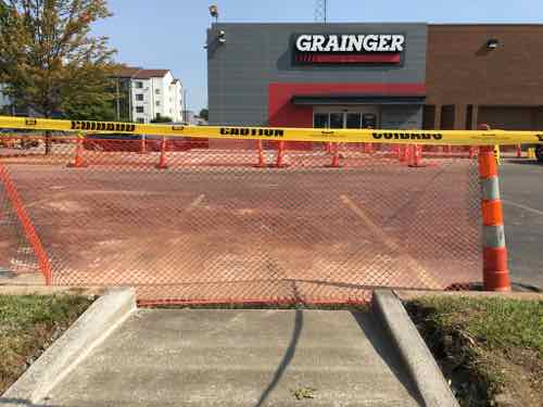
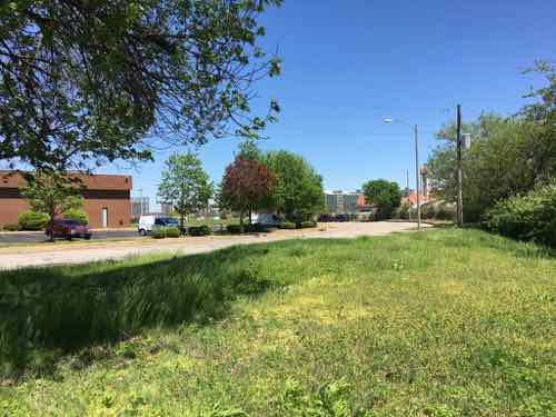
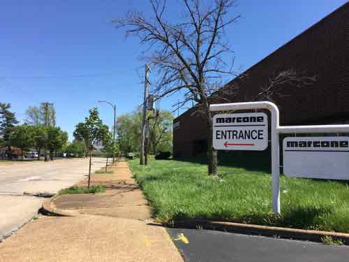
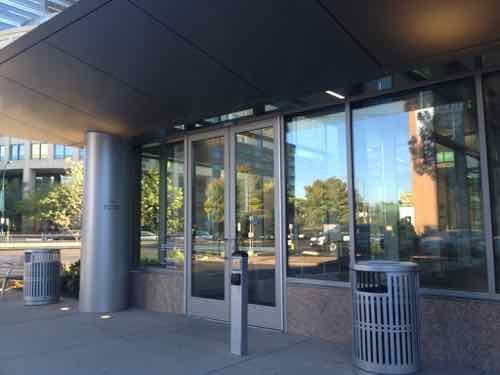
New Fairfield Inn being built on the former site of Harry’s restaurant. This view looking north on 22nd was taken in early September. FBI’s St. Louis offices on my left.The NW corner of 22nd & Clark is now grass. The seamless curve of 22nd into Clark made this difficult to develop. It’s owned by Grainger next door.Grainer Industrial Supply is a simple one-story structure set back from Clark.I was happy to see in September they were making site changes for a pedestrian connection to the public sidewalk on Clark. They own the building and land, I can see them getting an offer someday that’ll entice them to move. Dense urban infill will eventually occupy this site.Looking east as Clark curves north to become 22nd. This view will be radically different in a couple of years.Marcone Appliance supply was located on Clark, backing up to 40/64. They’ve already relocated and their property is for sale. Once Clark continued east to 21st and 22nd is extended over the interstate this will be a potentially good site for new development.
Part 2 of this series will explore another direction around the proposed MLS stadium.
In 2015 St. Louis officials were proposing razing historic buildings/districts in the North Riverfront area, between Laclede’s Landing and the Stan Musial Veterans Memorial Bridge, to build a new NFL stadium to keep the Rams in St. Louis. It never happened, in early January 2016 the Rams officially applied to relocate to Los Angeles.
The next month it was announced a group had formed to attempt to get a Major League Soccer (MLS) team in St. Louis — they were scouting for sites. I’d opposed the North Riverfront as a site for an NFL stadium, I also felt it wasn’t the best site for a smaller MLS stadium.
The site they shouldn’t consider is the North riverfront one previously targeted for a significantly larger NFL stadium — we shouldn’t tear down buildings when we have vacant land available. We have land, mostly state owned, without any buildings and a target for redevelopment for years already. I’m talking about the 22nd Street Interchange area — an area on the West side of downtown I’ve written about numerous times over the 11+ years.
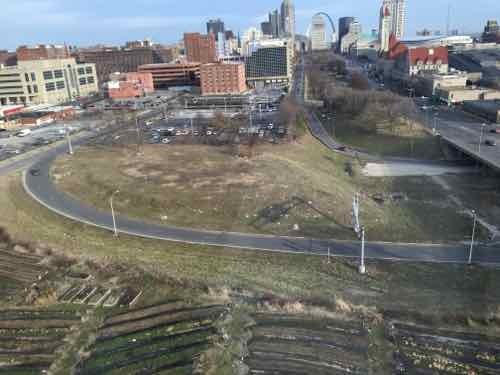
In that February 8, 2016 post I imagined fitting a stadium in between Pine, 20th, Market, and the hotel to the west. Busch Stadium fits in a space 2 blocks x 3 blocks, so a MLS stadium with less seating should fit in a smaller footprint. I emailed my post to a contact at St. Louis Development Corporation (SLDC)
Looking West from the Pear Tree Inn at 2211 Market in February 2016.
That first group proposed a stadium in the 22nd Street Interchange area, but south of Market Street, not north. I don’t know if they were already looking at this location prior to my post & email, but the entire year before development officials were so focused on the North riverfront I can’t help but think they wanted to stick with what they knew and had so much time invested in.
When the state & city residents opposed public funding a of soccer stadium the ownership group was out. When the current ownership group entered the picture in October 2018 they’d privately finance a stadium in the 22nd Street Interchange area many, including myself, assumed it’d also locate south of Market St. In April 2019 they showed some renderings, but no site plan. Again, many of us assumed the larger area south of Market St.
I can now guess this view is looking east. The parking garage roof seen at the bottom is the existing Pear Tree Inn garage. Pine, to the left of the garage, would not go through from 20th to the new 22nd Street
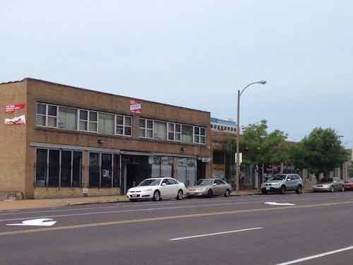
We were wrong, it will be the area I’d proposed in February 2016! However, instead of stopping at Pine the site will go one more block north to Olive. A few buildings would be razed, businesses are already being forced to relocate on short notice.
The tenants of these buildings on Olive have been told to vacate. May 2013 photoOn the sidewalk in front of the buildings that’ll likely be razed. I’ve been a fan of the 2-story buff brick building for years. May 2013 photo.
I reviewed the ownership records for these and the remaining buildings to the west, none showed a recorded change of ownership — yet. I don’t like seeing businesses and/or residents forced to move. Hopefully they’ll be offered a financial package to compensate for their time, trouble, and loss of business.
I’m also not a fan of closing streets, though Pine has been an awful one-way street for decades. Hopefully the one-way couplet (opposite directions) of Chestnut & Pine will both be returned to two-way traffic as a result of the existing on/off ramps going away.
I still want to see an official proposed site plan. Despite holes from parking lots, Olive has clung to a urban feel with multi-story buildings on both sides. I also wonder if we’ll see a revised I-64 on/off ramp that ends at Market Street — I’d be disappointed, but not surprised. Even if that happens, a lot less land could be devoted to highway on/off so the area would support additional development and tax revenue.
I often spend days, weeks, or months thinking about a post before writing it. I’ve been thinking about today’s post for over 5 years now!
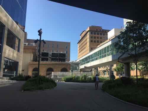
It was May 2014 when we first stayed at friend’s newly purchased vacation condo in Chicago’s Streeterville neighborhood — across the street from Northwestern Hospital. Not a wide boulevard either, Erie Street is like most of Chicago’s streets — two drive lanes and two parking lanes.
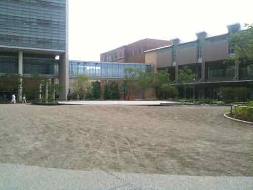
We experienced the busy sidewalks but also the internal walkway system connecting the campus’ numerous buildings, complete with bridges over roadways. I immediately thought how different it felt from St. Louis’ Washington University Medical Campus (WUMC)/Barnes-Jewish Hospital (BJC).
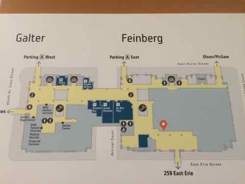
St. Louis’ Washington University Medical Campus is prominently identified along Kingshighway, Forest Park Ave, etcPoints along Kingshighway are now labeled A, B. C, etc…
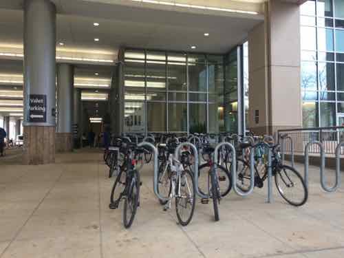
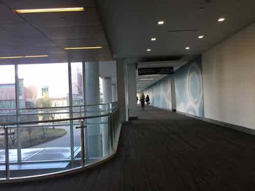
In the Fall of 2017 I had an unexpected emergency surgery and an overnight stay at BJC, I got to experience the walkway going from the Center for Advanced Medicine to Barnes. Then again the next morning going to the bus transit center. Yes, usually you don’t leave hospitalization via public transit, but that’s how I got there with my power wheelchair and a very broken wrist.
I’ve visited the Northwestern campus numerous times while visiting Chicago and I’ve returned to WUMC/BJC for numerous appointment and to photograph/observe the walkway. I’m finally in a position to compare observation of the two.
First, the similarities between the two:
Were built over decades, slowly expanding.
Began life in an affluent neighborhood of gridded streets.
Comprised of generic beige buildings, parking garages.
Lots of people & cars.
Have an internal network to help people navigate from building to building indoors.
Have one hard edge (Lake Michigan in Chicago, Forest Park in St. Louis)
Given all the above similarities you’d think the two would function the same. But no, the end results are vastly different! This post will hopefully explain the differences I’ve observed and their impact on each campus and surrounding neighborhoods.
In short, the major differences can be reduced to:
Sidewalk level activities: Many of Northwestern’s buildings, especially newer ones, have “active” ground floors — mostly restaurants.
Street grid: Northwestern didn’t alter the street grid, WUMC/BJC has decimated the grid.
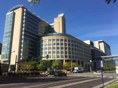
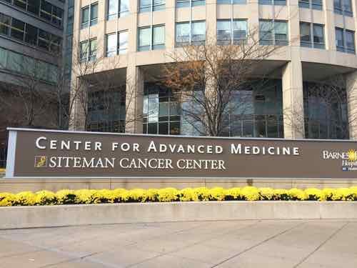
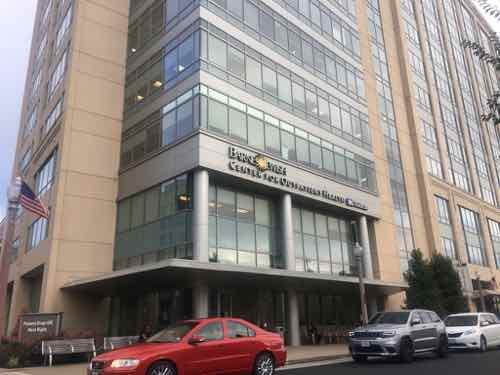
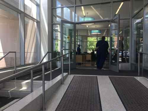
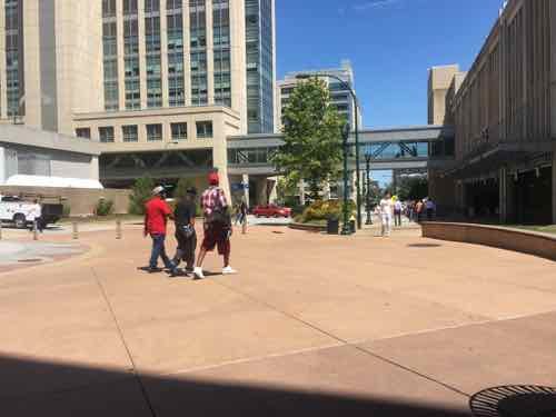
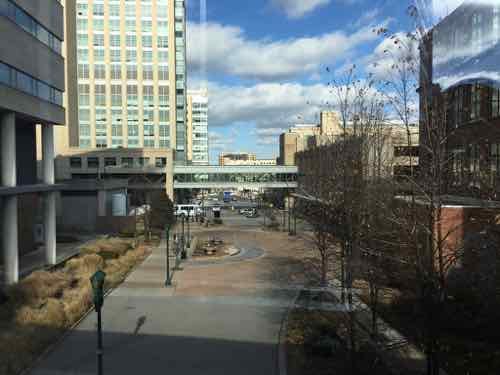
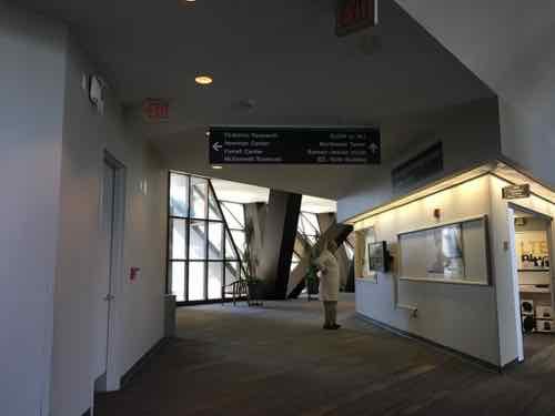
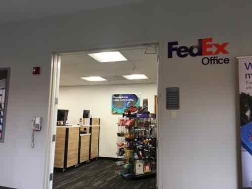
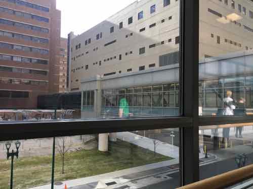
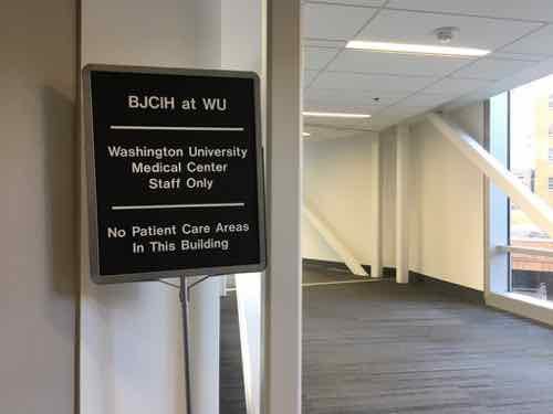
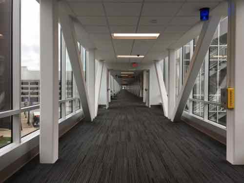
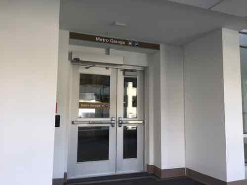
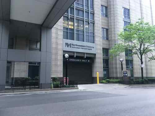
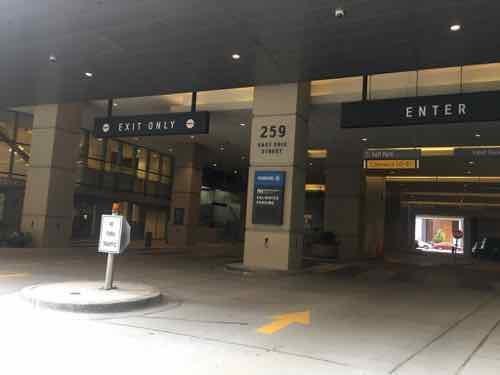
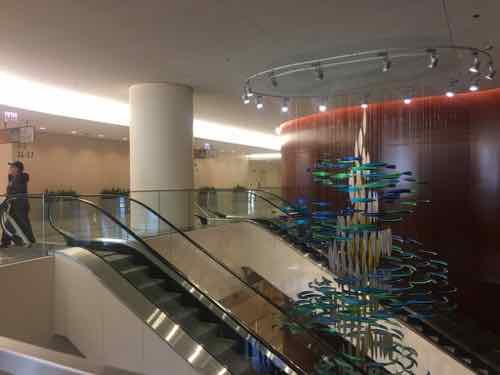
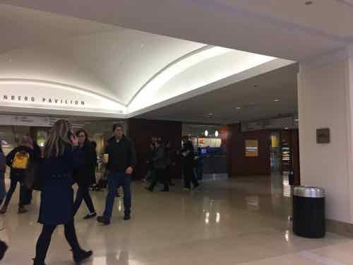
The Center for Advanced Medicine (CAM) building on the SW corner of Forest Park & Euclid avenues is a very busy placeAs a pedestrian you can’t enter the building directly off of either major avenue.Pedestrians have a narrow walk next to the large auto drive to reach the actual entry.The newer Center for Outpatient Health across Forest Park Ave did not repeat the pedestrian access problem of CAM.It is built right up to Euclid. An auto drive for patient drop-off is on the back side.Pedestrians get their own entrance right off the Euclid sidewalk.There’s a change of level but the ramp is wide and direct, the steps are narrower and off to the side. Through the windows you can see the automobile drive & patient drop-off entrance.Looking North on what used to be Euclid Ave., the CAM building is on the left.Looking at the closed Euclid from the WUMC/BJC walkway system — called LINK. Entering LINK from CAM is pretty natural, but the rest is convoluted.Back on the ground for a moment, another closed part of Euclid, the LINK is visible.In the background is the busiest light rail station in Metro’s system. LINK overlooks it, but they don’t connect.This was the view to the North from my hospital room in November 2017.The LINK winds its way around connecting all the buildings.Sometimes it is in a spacious areaThere are a few retail outlets, but not many. There was also a tiny Sprint store.Windows give you a glimpse of where you are.When I was discharged a nurse had to escort me to Metro’s bus transit center because there is no good public route from the BJC hospital to transit! Her card had to be used a couple of times along the way.Finally I’m on my way to the bus. This walkway also connects to massive parking garages for staff.Here we are, the entrance to the garage where the buses converge on the ground level.
Before moving on I should note that I was very pleased with my treatment and all those who took care of me that visit and my other appointments, cataracts surgery, etc.
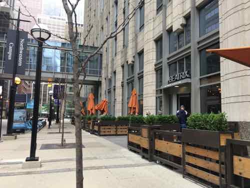
Am ambulance only drive for the emergency departmentAn auto area for the outpatient building next door to where we stay while in Chicago. You can see all the way through to the next block. To the left there are three retail spaces spaces — including on both street corners.The sidewalks are wide with street trees.There are some truly awful buildings along some of the sidewalks. No retail, no life.But old historic buildings, including ones not owned by Northwestern still exist within the street grid.One of the oldest campus buildings is very attractive — much more so than most everything around it.Another example of not everything along the sidewalks was interesting. That’s mostly reserved for the corners at intersections.One of the newest buildings. Being located mid-block it didn’t have any sidewalk retail.Another older building, not exactly inviting.Here is a corner, which is very active.Another cornerAnd another cornerMedical entrance mid-blockAnother auto drop-off areaAn older parking garage with a mid-block entrance
Now let’s go inside their walkway system.
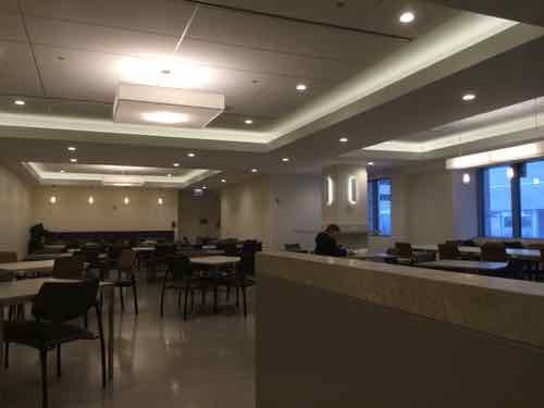
There are numerous maps posted, all showing how to reach the street grid outside and other buildingsBuilding lobbies invite you to the walkway system.An internal intersection in a central building. A couple of food court areas are very close to this point.One of the newest food court seating areas with lots of seatingThere are many different food retailers located along their walkway system, most concentrated in a couple of central areas.Another restaurantTheir walkways always seen to be busy.
CONCLUSION:
Both medical campuses have good & bad buildings. While Northwestern does a far better job activating corners it is the fact they still have corners that explains why the sidewalks are so full of people. The non-medical public, like us, are able to easily get through the campus on the sidewalks or via the enclosed walkway system. Northwestern’s campus isn’t a monolithic fortress to go around — you can go right through it just like you would elsewhere in Chicago.
I’m firmly convinced the many closed streets within St. Louis’ Washington University Medical Campus are largely responsible for the relative lack of pedestrian activity. Short of reopening the closed streets, I don’t think there’s anything we can do to fix the problem.
There’s a lot more detail I’d hoped to include, but I knew I just had to get this post finished. I might do some followup posts.
St. Louis has some positive things going on lately, Square announcing they’re moving/expanding from Cortex to downtown, Major League Soccer awarded a St Louis ownership group an expansion team, etc. These will bring new needed investments and jobs.
Will any benefit reach those north & south of the “central corridor?” The central corridor runs from the central business district west to the burbs.
A friend on Facebook said Square’s move downtown will cause more gentrification. Not sure he’s correct, but the challenge of attracting investment and jobs without leaving out large segments of the region is real.
This is a good opportunity to talk about how we bring new investments without negative consequences. It’ll help me get these thoughts out of my brain.
The process of repairing and rebuilding homes and businesses in a deteriorating area (such as an urban neighborhood) accompanied by an influx of middle-class or affluent people and that often results in the displacement of earlier, usually poorer residents.
Gentrification is a major problem in many regions, but here we still have so many highly vacant neighborhoods. Sure, the average worker can’t afford a downtown loft, but that’s not gentrification.
First we need to look at how we got here.
By the 1920s the white middle class began leaving the City of St. Louis for life in the suburbs. With new people moving to the city from rural areas looking for work the census didn’t show what was happening.
In 1948 the Supreme Court ruled on a St. Louis case, saying racial restrictive covenants couldn’t be enforced through the courts (Shelley v Kraemer). This prompted more white middle class residents to flee. Upwardly mobile black middle class residents were now able to purchase nicer housing than where they’d been limited to previously.
This house at 4600 Labadie was at the center of the case Shelley v Kraemer
Post WWII brought many to the region looking for work, others just trying to escape oppressive Jim Crow laws in the South. Basements and attics were crudely converted into living spaces. Large homes were subdivided. The population was too high, our housing stock just couldn’t handle all the people resulting in overcrowding. In 1950 St. Louis recorded its highest population — 856,796.
It didn’t help that entire neighborhoods were being razed for “urban renewal” projects and others being divided as highway construction cut wide paths through densely-populated neighborhoods.
Neighborhoods like Fountain Park remained respectable middle class, just now black instead of white. Eventually the black middle class got older, while some would stay but others began buying housing in North County as the white middle class there began moving to St. Charles County.
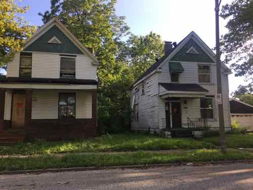
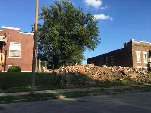
Some north city neighborhoods have been without the black middle class for decades now. In these neighborhoods the working poor have also been leaving, seeking affordable housing in other neighborhoods or in older north county areas where the black middle class have left more recently. An example is Wells Goodfellow — more vacant lots than residents.
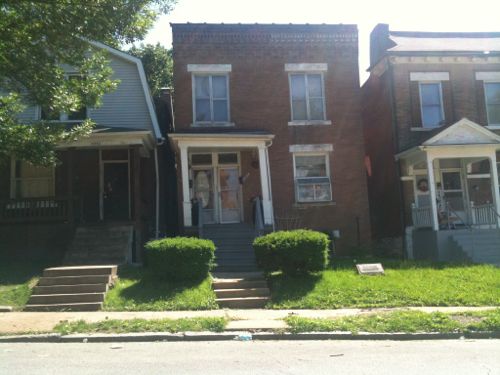
!912 Clara Ave, left, and 1904 Clara Ave are occupied, the two houses in between were just razed.
Here is what I struggle with. We need money in the city — we need middle class and more affluent people so jobs will be created. This doesn’t mean white, though that’s often what happens.
How do we change long-disinvested neighborhoods so they’re attractive to all people with more money — without pricing out those who still call the neighborhood home?
In the ideal world we’d invest in neighborhoods in a way that attracts & accommodates all races & economic classes. This means housing at a variety of price points — from low-income to high end with everything in between. Retail & restaurants should appeal to all segments and pocketbooks.
This may not be possible, I know it won’t happen without regulation. Free-market capitalism has demonstrated it is ok with excluding many. The trick is learning from other regions so we can reduce unintended negative consequences from regulations.
Unfortunately I think our city/region is too laissez-faire to enact regulations to transform vacant neighborhoods so they’ll become great neighborhoods.
AARP Livibility Index
The Livability Index scores neighborhoods and communities across the U.S. for the services and amenities that impact your life the most
Built St. Louis
historic architecture of St. Louis, Missouri – mourning the losses, celebrating the survivors.
Geo St. Louis
a guide to geospatial data about the City of St. Louis