Home » Planning & Design » Recent Articles:

North-South MetroLink Study Update Looking To Stay On Jefferson Avenue, Avoid Previously Planned Circuitous Route

June 16, 2022 Environment, Featured, Planning & Design, Public Transit, Transportation Comments Off on North-South MetroLink Study Update Looking To Stay On Jefferson Avenue, Avoid Previously Planned Circuitous Route

The idea of a North-South MetroLink light rail line has been discussed for many years — too many. We’ve had a couple of studies and locally preferred alternatives over the 15+ year period. Currently Metro is looking at the most recent and “tweaking” it to make it work financially with the city funds from our transit tax. So when I heard this would be included in the Citizens for Modern Transit (CMT) June “Talking Transit” online event I immediately registered. It took place a week ago, but it’s online — link in a moment.

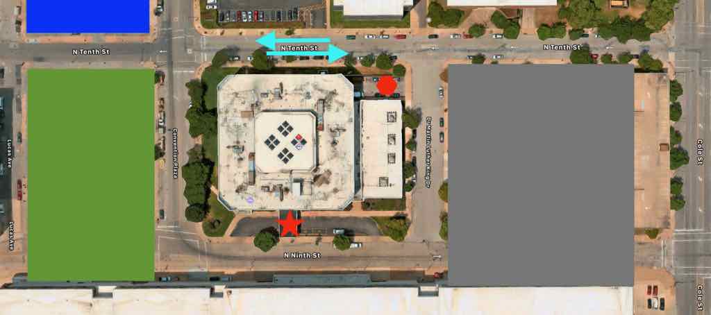
The last alternative was eastbound on Natural Bridge, coming south on Parnell/Jefferson to Cass (to include the large NGA workforce), east to 14th, eventually to 10th, back over to 14th, west on Chouteau, south on Jefferson.

2018 detail map showing the North-South MetroLink in orange. This is no longer possible because of the convention center expansion project closing 9th street.

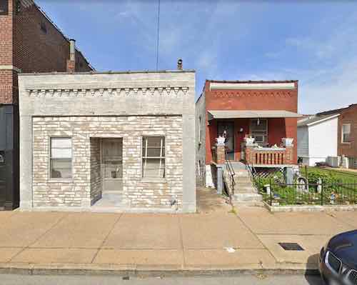
So basically on Jefferson north of Cass and south of Chouteau, but taking a highly circuitous detour to go through downtown — and briefly east of Tucker.  The distance between those two points on Jefferson is 1.6 miles — in basically a straight line that would require no left or right turns.m

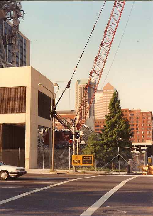
In a 2006 post I suggested a modern tram route on Jefferson, with a new MetroLink station where Jefferson crosses over the existing light rail line, so riders could transfer between lines. Well 16 years later they’re looking at doing basically just that — run in-street light rail on Jefferson with the addition of a MetroLink station at Jefferson. This was disclosed by Bi-State Development President & CEO Taulby Roach at 3:23 in CMT’s event a week ago (watch 0n YouTube).

Bi-State graphic, the orange-yellow mostly vertical line in the center shows the initial phase being evaluated now.  The pink sections are “areas of persistent poverty.”


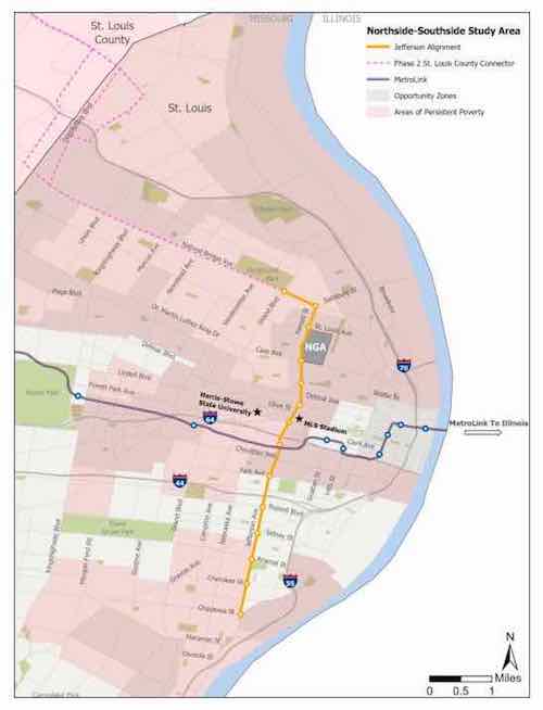
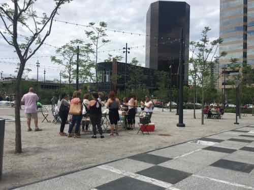
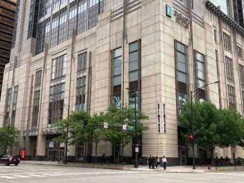
With the NGA, Centene Stadium (MLS) and planned new hotels (Jefferson & Market) this a hot corridor.

The rail wouldn’t be a tram in mixed traffic, it would be in a separate dedicated center section, still low-floor though. The vehicles for both are nearly identical. In-street light rail vs tram basically means dedicated right-of-way and fewer stops, to improve overall speed.

Obviously I’ve long thought a stop at Jefferson on the original MetroLink was a good idea — the distance between the Union Station & Grand stations is just so excessive. I often talk about focusing on corridors, not circuitous routes, and Jefferson is an obvious corridor for a transit project.  It’s not a perfectly straight line, but it would eliminate a huge amount of turns.

Like previous North-South studies, the idea of going out west on Natural Bridge allows a future phase to connect into North County. This could help get county residents to employment opportunities at NGA, and in Downtown West/Midtown.

The American-made Brookville Liberty vehicle can go off-wire for short distances. Dallas TX April 2015

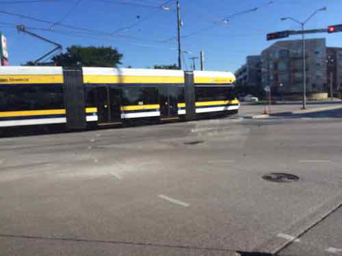
The study update is looking at the latest low-floor vehicles to use. Because of some tight points they’re looking at vehicles that could run for short distances on battery, with the usual catenary most of the distance. This is called off-wire. An example is the Brookville Liberty, in use in cities like Dallas, Milwaukee, and Oklahoma City.  I have no idea which specific vehicles Metro is considering, but the technology to go without a catenary for a short distance is proven.

Interior of Brookville Liberty with low center section and step up seating at each end. Dallas TX, April 2015.
Brookville Liberty at a stop in Milwaukee WI, June 2021
Low-floor center section of Brookville Liberty makes boarding easy. June 2021.

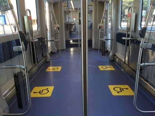
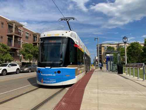
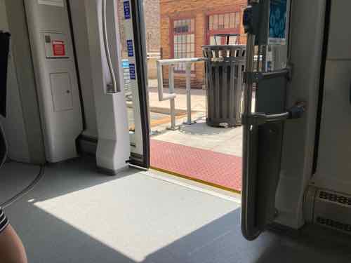
I’d hoped to have visited Oklahoma City by now and ride their Brookville Liberty vehicles., but rental cars & flights have just been too expensive. Again, I’m not sure what vehicles Metro is considering, this is the only off-grid vehicle I’ve ever ridden before.

In the CMT event on Zoom Taulby Roach indicated they’re planning on closed platforms  — having to pass through a fare gate to reach the platform.  This coincides with Metro’s platform project to install fare gates at all MetroLink stations in Missouri & Illinois.

Hopefully Metro’s latest look at North-South rail will result in actual construction, eventual operations.

Steve Patterson


Two Buildings, One Small Lot

May 26, 2022 Featured, Neighborhoods, Planning & Design, Zoning Comments Off on Two Buildings, One Small Lot

In the past you’d see multiple buildings on a single lot. Usually this was house and outhouse, stable, or garage. Large fancy homes might have servant quarters over the stable/garage — such was the case at the Campbell House. In more modest neighborhoods you might see two houses or a house and a storefront. A longtime friend owns a property that has a brick front house with full basement and a smaller frame house with a crawl space.  This was not uncommon a century ago. People would build a small house at the rear of the lot and then later build a bigger/nicer house at the front.

What’s unusual about my friend’s property is the 896 sq ft brick house with basement was built first, in 1927. Then in 1936 a 440 sq ft frame house with crawl space underneath was built. My assumption is some combination of increased population and the Great Depression is why the smaller frame house was built later. Either the owner rented out the new frame house to supplement their income, or the owner moved to the frame house so they could rent the bigger brick house and avoid foreclosure. I like that the big house is less than 900 square feet.  I looked up the address in the Post-Dispatch archives, the husband died in December 1934. So his widow likely added the small house for different financial reasons than I originally thought.

My friend has lived in each of the two houses at different times, both are rented now.

Today smaller backyard units are called Accessory Dwelling Units (ADU):

An accessory dwelling unit (ADU) is a legal and regulatory term for a secondary house or apartment that shares the building lot of a larger, primary home. The unit cannot be bought or sold separately, but they are often used to provide additional income through rent or to house a family member. For example, an elderly parent could live in a small unit and avoid having to move to an assisted living facility.

  • An accessory dwelling unit (ADU) is an additional residential building that occupies the same lot as a primary residence.
  • Examples of an ADU could be a guest house or a detached garage with a rented apartment above.
  • The establishment and use of an ADU will fall under different zoning rules and regulations depending on where you live.
  • An ADU can provide additional income in the form of rent.
  • An ADU costs money to build and upkeep and will increase monthly utility bills.

The ADU is also known as an in-law or mother-in-law unit, secondary dwelling unit, granny flat, or carriage house. An ADU usually has its own kitchen, living area, and separate entrance. An ADU may be attached to a house or garage, or it can be built as a stand-alone unit, but it generally will make use of the water and energy connections of the primary house.

Two structures on a single lot is different than the once-common two-family building, one unit over another on the same lot. The 1924 two-family I bought back in 1924 was like this, very typical for a rapidly growing St. Louis. There were also four & six unit variations.

The gray building on the left was torn down late last year, it was built on the same 40 foot wide lot as they red house on the right. Image: Google Streetview

This post is about another combination you no longer see happen — the addition of a commercial building on a lot with a residence.

In 1898 two matching red brick houses were built side by side, both 844 sq ft. Each on a 40 ft x 100 ft lot.

In this January 1903 map we see the two brick houses (pink) in a mostly wood frame (yellow) neighborhood Source: 1903 Sanborn Fire Insurance map, click image to view source page.

The houses were at 1915 & 1919 Cooper Street, between Daggett & Shaw avenues.

The twin houses were fourteen years old when, in 1912, one family built a 2-story brick commercial building on the same lot as the house at 1919 Cooper Street, its address was 1921 Cooper Street. A 40 foot wide lot with a house AND a commercial building!

The neighborhood was changing as more and more immigrants arrived from Italy. Multi-story masonry commercial buildings replaced many smaller wood frame houses. It’s not yet clear what business(es) initially occupied this new building, but in 1921 the family opened a funeral home.

In the late 1930s Cooper Street became Marconi Ave. In 1940 Calcaterra Funeral home moved to a new building on Daggett, just east of now Marconi Ave.

At some point between 1940 and 2021 the commercial building had the 2nd floor removed, the main floor converted to residential. It was 790 sq ft.

I don’t blame anyone for tearing down this building. Looking at the vacant spot now it’s hard to believe another building fit in the space for 109 years. See current on Google Streetview. Neighborhoods, including The Hill, continue to evolve.

— Steve Patterson


Renovated Kiener Plaza Reopened 5 Years Ago Today

May 19, 2022 Downtown, Featured, Parks, Plazas Comments Off on Renovated Kiener Plaza Reopened 5 Years Ago Today

Five years ago the trees at the renovated Kiener Plaza looked so new, provided no shade. Now they’ve matured nicely. Saturday we spent 2+ hours sitting in the shade.

Look at the size of the trees on the right, they provide actual shade now.
This February view shows the new visitor center building. The trees are bigger but hadn’t put on level for the seaso9n yet.
Same area, at the reopening in 2017
The awful May Amphitheater sunk into the west end of the previous Kiener Plaza.

It’s nice seeing Kiener Plaza be a space that can hold thousands of people and still function. Now if only we could do something about those two parking garages across Chestnut, to the north.

— Steve Patterson


Rethinking 811 North 9th Street (Holiday Inn Express)

May 17, 2022 Downtown, Featured, Planning & Design, Walkability Comments Off on Rethinking 811 North 9th Street (Holiday Inn Express)

I recently posted about a 1960s hotel in the Downtown West neighborhood that no longer worked (see Rethinking 2211 Market Street (Pear Tree Inn). Today is a similar look at an early 1980s hotel the no longer works: The Radisson/Ramada/Holiday Inn at 811 North 9th Street.

The primary view of the 5-story hotel is from 9th & Convention Plaza (formerly Delmar, Morgan before that). April 2016 photo

It is across 9th Street from the blank west wall of our convention center, but soon the convention center expansion will mean it is surrounded on 3 sides. Its backside will soon face the only through street passing the property.

Before I get into the problems & possible solutions a little history is important.

Cervantes Convention Center. 801 Convention Center Plaza. St. Louis Mo. August, 1977. Photograph (35mm Kodachrome) by Ralph D’Oench, 1977. Missouri Historical Society Photographs and Prints Collections. NS 30747. Scan © 2006, Missouri Historical Society.

In 1977 our convention center opened. Delmar, historically known as Morgan, was renamed to Convention Plaza between 3rd/4th and 14th Street. This street remained open as it has always been. The convention center originality occupied four city blocks bounded by Delmar/Convention Plaza, 9th, Cole, and 7th. Two blocks of Dr. Martin Luther King (formerly Franklin) and two blocks of 8th Street were erased from the grid.

The Sheraton Hotel also opened in 1977 — on the east side of the convention center, bounded by 7th, Cole, 6th, and Dr. Martin Luther King.  Then on April 1, 1981 the Radisson St. Louis Hotel opened on the west side of the convention center on  “9th at Convention Plaza”, aka 811 North 9th Street. Radisson was a very small hotel chain at the time, this was roughly #30 for them.

Demolition of the decade-old Sheraton Hotel to make room for the new football stadium. July 1992 — looking South from Cole & 7th

Ok, back to the Radisson and how it doesn’t fit 41+ years later:

Click image to see a larger view.

In this view the green box on the left is the parking lot to the south that will soon become an outdoor convention space. The blue in the upper left will be a parking garage with ground floor retail/restaurant. The grey box on the right will be new convention center space. 10th Street (left to right on top) will become 2-way traffic, unfortunately only for the short distance between Washington Ave and Cole Street. The hotel main entrance is the red star, bottom center. The red hexagon at 10th & Dr. Martin Luther King is the hotel dock/service entrance.

As always, I look first to see options where as much of the existing is retained. Maybe move the entrance/lobby from the east (9th) to west (10th) side?

This December 2012 view shows a problem with relocating the entrance to 10th Street — the 1st floor level is below the street/sidewalk. Plus the main elevators are on the east side.
Guests approaching from southbound 10th Street will be greeted by the docks and often employee cars.

Because the height of the ground floor relative to 10th Street, elevator locations, dock, etc relocating the entrance said lobby to the opposite side doesn’t look feasible — at least not to me. Again, the building has had many updates over the decades, but I don’t see anyway to avoid totally razing it. Maybe the interior has some redeaming quality to make it worth saving?

Nope!

Looking up from the 1st floor corner of the lobby. December 2012
On the 2nd floor you can see how the pool is at the center, spreading humidity and chlorine smell throughout. December 2012.

Maybe those planning the convention center expansion thought of this, but I’d have liked to have seen a land swap. Get the hotel to build a modern structure on the surface lot one block south, green in my diagram above. When the new hotel is finished tear down the old one and use that for the outdoor convention space — would be conveniently between the new wing of the convention center on the north and the new hotel on the south. Instead of 3 extra 1-block sections of streets surrounding the old hotel that land could be put to better use. The hotel could get a great new property closer to Washington Ave with zero downtime.

Again, this might have been proposed and ruled out Just not sure since the design was final when presented to the public.

So let up suppose the hotel owner, a Washington DC – based LLC, is willing to raze and rebuild on the existing site. What should they do?

Public streets all the way around is excessive paving, city maintenance. I’m at a loss how to design an attractive/functional hotel on this site, but I think creative architects could come up with some great concepts.

Short of a new building, I’d like to see the perimeter updated. Landscaping and maybe some shallow/liner retail spaces to fill in the gaps between the blank first floor walls and the public sidewalk(s).

Looking east from 10th along the south side (Convention Plaza/Delmar).

The south side has the most extra land. This isn’t inviting at all — a totally blank wall and boring turf grass. Maybe add some texture to the wall, giving it some gentle lighting at night? Or you widen the public sidewalk and build little storefronts to fill in the remaining lawn? Put a green roof on these so the hotel guests have something nice to look at from above.

In 2012 the Holiday Inn was a Ramada.

Regardless of the brand, I’d like to see the check in driveway located somewhere not between the sidewalk and the front door. It’s not impossible.

An Embassy Suites hotel in Chicago has no valet or other vehicle provision out front. Click image to see in Google Maps.
Parallel to the main street is a driveway for valet, etc. There’s an other entrance for guests to self-park.

To close I think if the 41+ year old hotel at 811 North 9th Streets remains as is, surrounded by wide streets, it’s going to be awkward for convention guests. It’s not going to look/feel good to anyone. Not sure of the best solution but I know it should be figured out before we spend millions locking it into this location.

— Steve Patterson


Vacant Land Near Centene Stadium Awaits New Construction

May 12, 2022 Downtown, Featured, MLS Stadium, Planning & Design, Real Estate Comments Off on Vacant Land Near Centene Stadium Awaits New Construction

Centene Stadium (St. Louis) – Wikipedia, the soccer stadium finishing up construction now, is reshaping the Downtown West neighborhood.   This got me thinking about a vacant parcel just south of the stadium, next to the former YMCA that became a Drury Hotel in the 1980s. The official address is 222 South 21st Street.

Looking west across 20th from the St. Louis Wheel. March 2021

This site is 9.16 acres, is one parcel, and owned by Bi-State Development (aka Metro) since July 2019. According to city records Bi-State paid $1.65 million.

Just before Bi-State closed on the property the 1960s commercial laundry building was razed. It had a fire in 2005, that was repaired. A new occupancy permit was issued in 2018 for warehouse/storage.

Looking east from the former highway ramps. March 2010

So a 1960s commercial laundry occupied the western half of the site for decades. What about more than a century ago?

This site is outlined in red, pink means brick, yellow wood on this 1909 Sanborn Map..  Click image to view sheet from the Sanborn map.

The brown box is the new Railroad YMCA , the city block was divided by a small portion east of Tom Street, and the bigger portion west of it. When Union Station added more tracks Tom Street became 20th Street, giving the station more land up to Market Street. Many buildings between Eugenia and Market were razed so that 20th could shift west. The site now knowm as 222 South 21st Street was 13 parcels with houses and stables on the east, at Tom.

As you can tell from the 2010 photo above of the now-razed laundry, I’ve had an interest in the site for a very long time. At the time it didn’t make any sense to propose new construction — a business occupied the existing building and the site was on a tiny short block of Clark Ave, between 20th & 21st.

Now Clark Ave will soon connect to 22nd Street, I-64, and Jefferson Ave.  I thought of this site again earlier this year when I saw an article about a 7-unit apartment building in Philadelphia built on leftover land measuring only 11′ x 93′. View in Google Street View.

This site is considerably larger. What I’d do is build an apartment building on the east end that has zero off-street parking. With the Union Station MetroLink light rail station nearby this is ideal for some apartments without parking, since structured parking is so costly.

The west end of the site has great views of the new soccer practice fields, build tall enough and you can see over the Drury Hotel parking garage.  A rooftop patio would be outstanding.

A garage entrance off the low end of the alley would keep the perimeter public sidewalks unbroken. Creative architects could probably come up with many options to maximize the site without any surface parking or curb cuts.

I think 2-3 buildings ranging from low-income to high end would do this site justice, and provide a nice range of options. It would require thinking differently, but so did getting 7 units on a parcel only 11’x93’.

— Steve Patterson


Advertisement


[custom-facebook-feed]

Archives

Categories

Advertisement


Subscribe