In parts 1-3 I looked at the areas south, north, and east of the coming soccer stadium. Today a look at the area west of the new stadium.
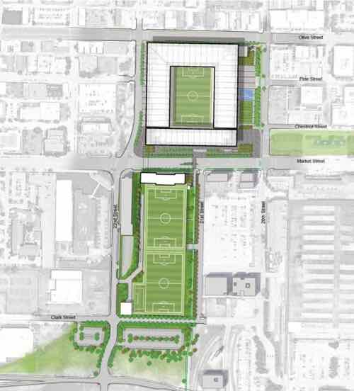
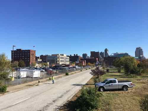
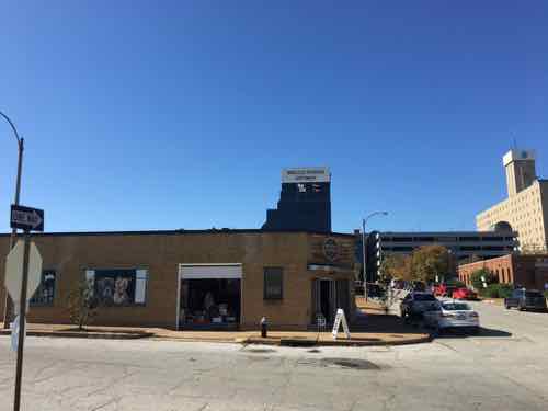
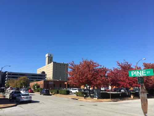
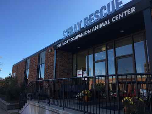
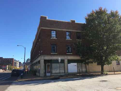
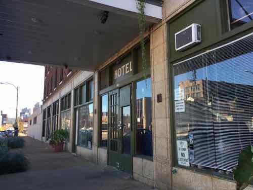
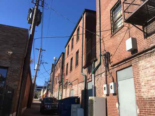
The site plan has the stadium at the top, bounded by Olive on the north, 20th on the east, and a new 22nd Street on the west. Pine will be closed between 20th and 22nd. Team offices and two practice fields will be south of Market.This image shows the two block long section of Pine that’ll be vacated. Surveyors were working the day last fall that I was out photographing.The tallest structure in the area west of the stadium is the Pear Tree Inn, 2211 Market Street. Built in 1965 it’s unfortunately set back from Market Street in a very suburban manner. There’s no pedestrian accessible route…just an automobile parking lot. I’d like to see the space between the tower and street infilled over time to urbanize Market Street. It seems wasteful to raze the entire property and start over, but that would likely produce a better product — good for another 50+ years.The back of the Pear Tree, at 23rd & Pine, a low rise parking garage also built in 1965. The site is a full city block, it is underutilized.Across Pine from the Pear Tree Inn’s garage is a building type more typical of the area — boring single story infill. 2229 Pine was also built in 1965.Across 23rd from the Pear Tree garage is a little warehouse building from 1948, currently used as a resale shop.View of the northwest corner of 23rd & Pine, as seen from the southeast corner.The St. Louis American newspaper leases the 1964 one-story building at 2315 Pine.Across Pine is Stray Rescue at 2320 Pine, built in 1964. They own this building and the 1948 warehouse shown earlier. Owning their building will help insulate them if demand for the area increases dramatically in the coming decades.Moving north to Olive we have the Firestone tire & auto at 2310 Olive — built in 1964 (seeing the pattern?)On the southeast corner of 23rd & Olive is the Lincoln Hotel, 2222-2230 Olive. Built in 1928, this is the oldest structure directly west of the new stadium.The Lincoln isn’t a fancy boutique hotel, it’s an SRO — single room occupancy. I fear the new stadium will put economic pressure on the owner to turn it into an expensive hotel, reducing the number of SRO rooms in the city.The Lincoln as seen from the rear alley.
It appears in the 1960s nearly every building west of the new highway ramps was razed and replaced. Thankfully they left the street grid, though Pine is one-way westbound to Jefferson.
This couple of blocks of Pine between the new stadium at 22nd and Jefferson will need to be returned to 2-way traffic. This will need to include a signal change or removal at Jefferson — likely planned as part of the changes to Jefferson being made to help workers get from I-64 to the new NGA West headquarters being built at Jefferson & Cass.
I suspect the west side of the stadium along 22nd will be the back side, but maybe those functions will be part of the underground access. Hopefully it’ll be presentable.
Expect the area bounded by 22nd, Market, Jefferson, and Olive to look very different 30+ years from now, maybe much sooner.
When I was a kid washing the car often meant getting the garden house out and washing the car on our driveway. Or it meant going to the self-serve car wash with individual stalls. You get your bills changed to quarters and when it’s your turn you’d pull into the stall and wash your car. Fancy ones had a soapy brush option. Often I’d get wet from splash back from the high pressure sprayer.
I was aware of other car washes, from songs like Jim Croce’s Car Wash Blues and Rose Royce’s Car Wash. Gas stations began to add automatic car washes to entice more people to stop and buy gas — the wash was often cheaper with purchase of fuel.
Large size dedicated automatic car washes aren’t new, but slowly they’ve replaced the manual DIY car washes I remember as a kid. For years I’d go to the Waterway car wash that was at Forest Park & Vandeventer — now The Standard apartments. I was glad to see this large site be redeveloped with a 5-story apartment building.
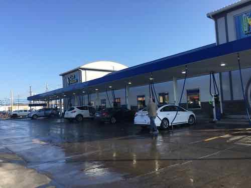
Lately it seems throughout South City and in much of St. Louis County a new breed of automatic car washes are popping up frequently. As my husband handles the car maintenance, I’d not been to a car wash in at least seven years. That recently changed when we were running errands and decided to stop at a newer car wash on Kingshighway, which replaced a former QuikTrip gas station.
My husband had been to this and other car washes many times, but it was a first for me. I was driving so I had to use the touch screen to purchase the wash we wanted. We drove up to the wash and handed the attendant our receipt, he warned us Hyundai shark fin radio/navigation antennas have come off before.
My husband with our white Hyundai
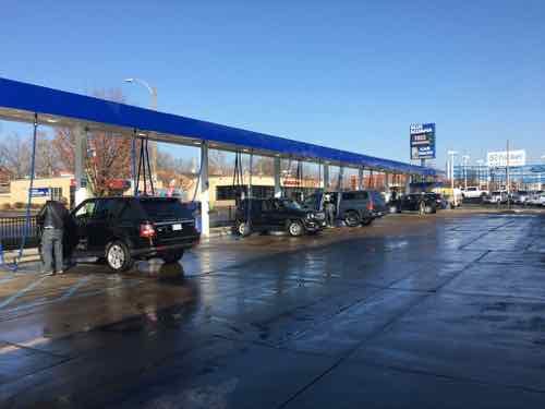
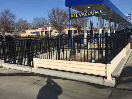
After the wash we stopped at the “free” vacuum area. Free vacuum?!? The site plan is such that you must go through the paid wash to reach the vacuum area. This saves needing a stack of quarters to vacuum out the interior. I can’t tell you how many times in the past my vacuum time has run out before I was finished.
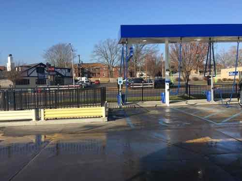
Another row of vacs near the Kingshighway sidewalk.A spot to collect water runoff. The vacs are on a central system.I was happy to see one disabled spot.
The urbanist in me is aghast at the trend for all these new large car washes, although this stretch of Kingshighway and most suburban arterials are so far from being pleasant pedestrian environments. Still, if there’s an expectation for these corridors to improve then such designs shouldn’t be permitted up against the public sidewalk.
Suburbs Rock Hill and Crestwood each rejected another automatic car wash in their municipalities, in 2018 & 2019, respectively.
January 13, 2020Accessibility, Featured, WalkabilityComments Off on Eads Bridge Remains Inaccessible Years After Arch Project “Completed”
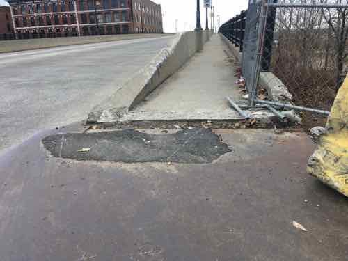
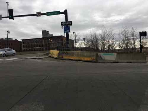
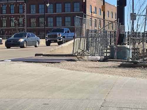
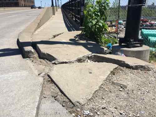
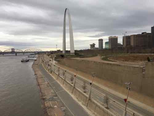
Thursday last week I decided to go see the level of the Mississippi River before we began getting rains and localized flooding. The best view is from the pedestrian walkway on the south side of the Eads Bridge top deck. I knew there had been accessibility issues at the west end of the sidewalk, but the I’d seen some asphalt had been put down to lessen the problem.
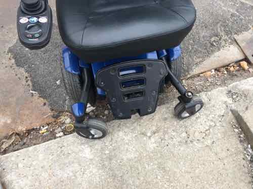
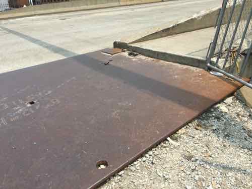
The loaner wheelchair I’m using couldn’t get over the huge gap.
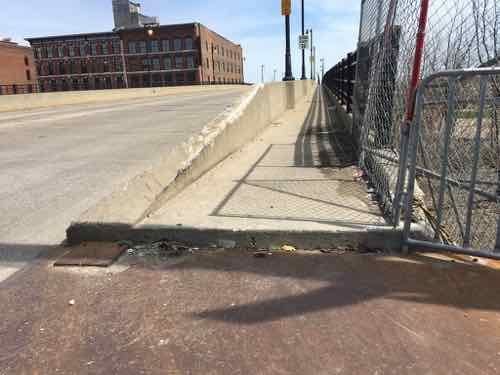
So I had to stand up and, while not falling, drag the chair up onto the sidewalk by pulling on each front caster, alternating from left to right. Someone saw me and came to help when I was nearly finished.
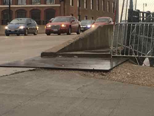
This is the view as I approached. The steel plate and asphalt are more recent, but now ineffective.If we step back across Memorial Drive we see barricades have been placed to physically prevent anyone from going from the Eads to Arch grounds, or vice versa.
It seems a contractor on the Arch project accidentally busted into the MetroLink light rail tunnel beneath the Eads Bridge/Washington Ave. Since Metro owns the bridge & tunnel it’s up to them to get it fixed.
Let’s take a look at my older photos, in reverse order.
May 31, 2019. A steel plate covered the gravel but no asphalt yet to get upMay 2, 2019April 1, 2019March 16, 2019May 7, 2017 is my oldest photo of the problem. This is when I began conversations with various officials about being able to access the pedestrian walkway in my wheelchair.
So this problem is about three years old at this point. Three years!
I did get to see the river level last week, but it took far more effort than it should have.
As Spring flooding season begins I’d like to get regular photos to show how water is approaching and eventually covering Lenore K. Sullivan Blvd. I live close by so this shouldn’t be the issue it is.
December 20, 2019Featured, Planning & DesignComments Off on Design: Automotive Taillights Need Separate Amber Turnsignals
Today’s blog post is one of those I’ve been wanting to do for a few years now. The subject is been a pet peeve of mine for at least four decades now.
Previously I’ve posted about automotive headlights, so today is about taillights. Specifically the varied design of automotive taillights, and how ours differ from the rest of the world.
First we need to review the four components that make up rear light assemblies:
Tail light — the red light that is on when your lights are on.
Brake light — the red light that comes on when you hit the brakes.
Turn signal/indicator — the flashing light to indicate your turn. In combination these are the emergency flashers.
Backup lights — the white lights that come on when you put the car into reverse gear.
Government regulations on these four vary widely in different parts of the world. North America, as you might expect, is out of step with the rest of the world.
To explain my views on taillights I’ve assigned A-F grades to the various types:
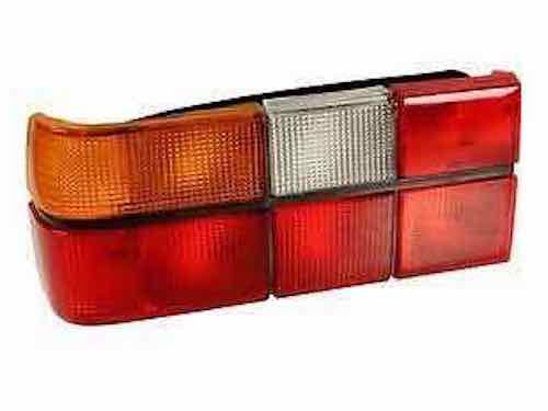
Grade: A
Tail light assembly from the 80s Volvo 740/760 sedans. Clockwise staring in the upper left is the amber turn signs, backup light, and four separate red sections — I no longer recall which did what. One is brake only, one is taillight, and one was a rear fog light, and one was just a reflector.
Separate taillight & brake light — the brake light is dark even when the lights are on, when the brakes are pressed a dark space becomes lighted.
Amber turn signal lens — not just an amber bulb behind a clear lens, but an amber lens.
An A+ also has a rear fog light.
Examples I’ve owned: 1987 Volvo 740 Turbo, 1986 Saab 900S, 1986 Saab 900 Turbo
New: no new cars have A-grade taillights.
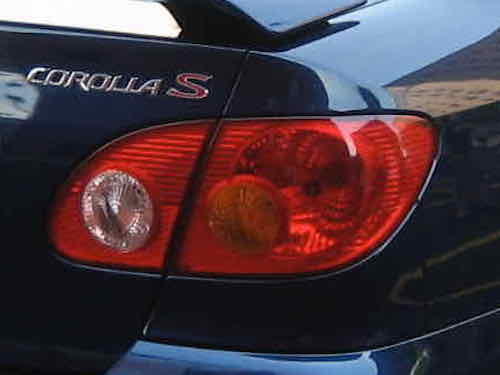
Grade: B
My 2004 Toyota Corolla had an amber turn signal lens.
Combined taillight & brake light
Amber turn signal lens
Examples I’ve owned: 1974 Ford Mustang II, 1975 Mercury Monarch, 1984 Dodge Colt, 1988 Mitsubishi Mirage, 2004 Toyota Corolla, 2000 Volkswagen Golf,
New: none that I can think of
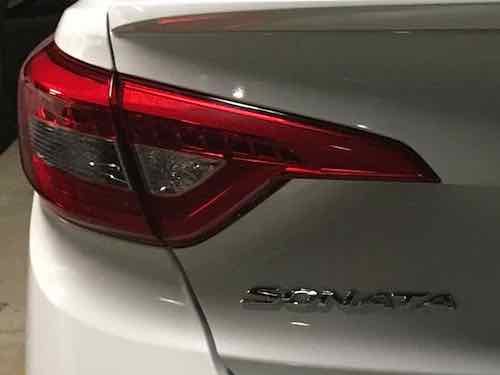
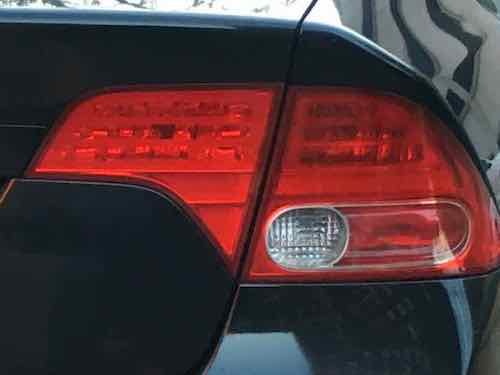
Grade: C
Our current Sonata has LED taillight & brake lights, the amber incandescent turn signal bulb is behind the clear lens on the left.
This is like the 2007 Civic we had, the small red section in the bottom is a separate turn signal. The 2009-10 models of the 8th generation had a slight change — the turn signal lens became clear with an amber bulb. Those models get a C grade.
combined taillight & brake light
Separate turn signal, red lens
Examples I’ve owned: 1999 Audi A4 Avant, 2007 Honda Civic
New: Many
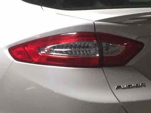
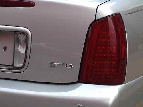
Grade: F
Ford’s Fusion is one of the most frustrating. In some years of this generation the red is simply reflector. The clear part on the left is combined taillight/brake light/turn signal — all in red LEDsThis is just a pic I had of a Cadillac. It may in fact have a separate red turn signal, but so many cars just have a big red blob only capable of doing one function at a time.
combined taillight, brake light & turn signal
Example: 1979 Ford Fairmont Futura, 1971 Dodge Demon,
New: Most sold today, including Tesla!
As you can see my grading scale gives a higher priority to taillights that give each function its own light independent of the others. Amber for turn signals because a different color next to red brake lights has greater visibility. And we all want our brake lights and turn signals to be seen, right?
Also infuriating are aftermarket taillight assemblies that have less visibility than the factory units. Also, dark smoke taillight covers significantly reduce visibility. Individuals changing their lights say they’re doing an “amber delete” on their vehicles. Time & money to make their cars less visible to others — crazy!
One reason I long preferred European cars was their taillights. Very…European. Not anymore, even Volvo & Mercedes are selling new vehicles in North America with D-grade taillights. These same vehicles sold in the rest of the world have significantly better taillights — because regulations in other countries require it!
Thankfully I’m not the only person who feels this way. Here’s an excellent 13-minute video of a guy explaining the differences.
Here’s more:
Here’s the fundamental issue: the US (and Canada, but they’re just piggybacking on our regs) is the only place in the world where the rear turn indicator may be red, instead of orange/yellow/amber. Up front, indicators need to cast an amber light to differentiate from the white headlamps, but out rear you can actually just use one red-shining bulb for stop/tail/turn functions, as many cars do — especially trucks and jeeps and other vehicles that use off-the-shelf cheap trailer-type lights. (Jalopnik)
U.S. regulations have minimum lit area requirements for turn signals, brake lights, etc. But these standards are from the 1950s!
The minimum size was adopted in the mid-1950s when a Society of Automotive Engineers lighting committee met in Arizona and evaluated cars with different rear lighting configurations. The engineers peered at the cars as they were driven away, then voted on which systems they thought looked okay. There were two reasons for specifying minimum lit area: the lens plastics available in the 1950s weren’t very colorfast or heatproof, and requiring a minimum lit area was a way to ensure, without design-restrictive explicit requirements, that the lens would be a minimum distance away from the hot bulb, to stave off fading and cracking. (A Car Place)
Gee, lighting has changed a little in 60+ years.
The U.S. needs to modernize our automotive lighting regulations so closely resemble those in the rest of the world.
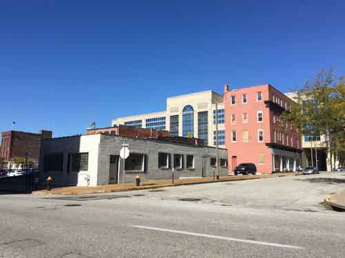
Today I continue my detailed look at the proposed Major League Soccer (MLS) stadium site plan and surroundings. In part 1 I looked at the stadium and practice fields to the south of Market Street. In part 2 I looked at the need for a pedestrian crossing at 21st & Olive, plus the development potential north of Olive.
The planned MLS stadium (top) would be bounded by Olive (top), a new 22nd Street (top left), Market Street (center), and 20th Street (top right)
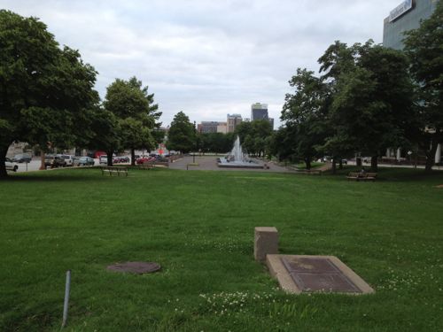
Today I’ll look at the area east of the stadium, including 20th Street itself. As you can see above, the stadium is set back from 20th Street to create an urban plaza for events. The problem is the other side of 20th isn’t urban at all. It’s either an open plaza (Aloe Plaza) or surface parking.
Aloe Plaza across from Union Station cleared away “undesirable” buildings, followed by decades more demolition creating the largely failed Gateway Mall. This 2013 view is looking west from 18th Street.Meeting of the Waters by Carl Milles.
Parking lanes are fine if the corners are “bulbed” to reduce crossing distances, but unacceptable if they’re marked as “no parking.” If the outside parking lanes aren’t going to be used for parking then the space needs to be sifted from unused roadway to pedestrian space. The site plan looks like it is trying to reduce crossing distance, hopefully we’ll get some detail soon on their plan for 20th.
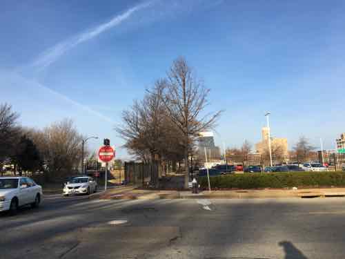
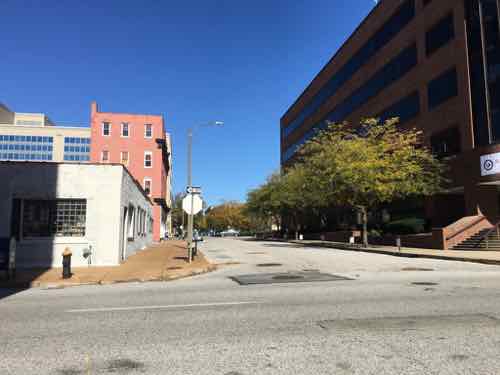
Looking West from 20th & Chestnut in this 2016 image shows how wide 20th is — 2 drive lanes plus 2 parking lanes.
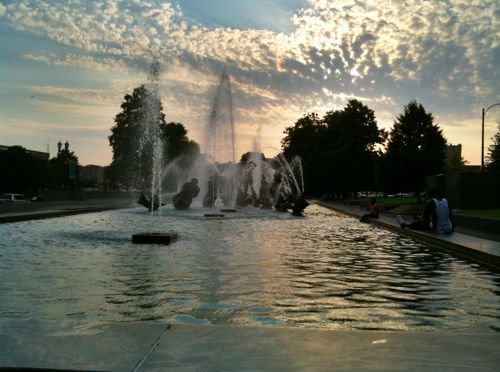
A plaza across from a plaza. I’d like to see Aloe Plaza get completely redone — the 1939 Meeting of the Waters sculpture/fountain is the only thing significant about the two block space. At the 20th Street end I’d place a new park building with a restaurant and rooftop dining. This would help create a sense of urban feel at 20th & MarketChestnut. Perhaps the space isn’t one restaurant, but several with shared dining space? A way to serve as restaurant incubator space for up & coming chefs? A 2-story building is needed facing 20th between Market & Chestnut — food makes the most sense.
Back to 20th & Chestnut, specifically the block on the NE corner.
Looking north from 20th & Chestnut — fenced surface parking for tenants of apartments in an old historic building facing Pine.The apartment building is the only structure left on the entire city block, 19th Street was even vacated for use by the newer building in the block to the east.
The only way to urbanize this is the same as the west end of Aloe Plaza — at least a 2-story building. This wouldn’t need to be deep, it could be a shallow liner building.
There’s nothing that jump-starts a place people will love to walk like liner buildings. It doesn’t matter whether you’re helping a place recover from sprawl or building a new neighborhood center; liner buildings get far more bang for the buck and make things possible today that would be completely impossible until years in the future using conventional mixed-use building types.
Liner buildings are very thin buildings that line the edge of a street, plaza, square, or other public space. They can be as little as 8-10 feet deep for retail uses and 12-14 feet deep if they include residential uses. They may be a single story high, or they may be several stories tall.
Liner buildings are a great way to build affordable housing, especially for those who don’t have a car.
Ideally the apartment owner would build underground or above grade structured parking for their tenants to make much better use of the large site. That said, no open parking garage should face Aloe Plaza — it should be closed with mechanical ventilation if across from the park. My guess is they won’t want to block views from the apartment’s windows. It could be great from an urban perspective, but would be challenging for a private for-profit owner.
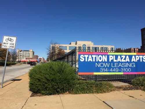
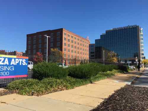
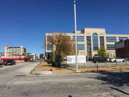
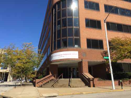
The block to the north (bounded by Pine, 20th, Olive, and 19th) will likely see the most change in the next 10-20 years.
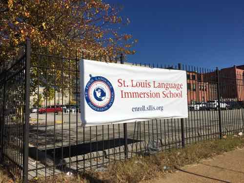
Looking north from 20th & Pine. Police headquarters is in the background, across Olive.The banner marks the fact the lot is now owned by the St. Louis Language Immersion charter school. The school recently moved into a building in the next block east.The rest of the block is a few smaller buildings on the east end.Looking north at 19th, from PineThis former office building turned charter school was built in 1987. Another entrance on Olive doesn’t have steps
Like the other directions, there will be some who wish to raze & pave, others who want to go up. These are mutually exclusive as surface parking devalues land to the point it doesn’t pay to build up nearby.
The area to the east includes areas that need development, but current ownership means that might not occur for many years, if ever. The next part will look at building back 22nd Street and the blocks to the west of the proposed soccer stadium.
AARP Livibility Index
The Livability Index scores neighborhoods and communities across the U.S. for the services and amenities that impact your life the most
Built St. Louis
historic architecture of St. Louis, Missouri – mourning the losses, celebrating the survivors.
Geo St. Louis
a guide to geospatial data about the City of St. Louis