Home » Planning & Design » Recent Articles:

St. Louis’ Original “Little Italy” Neighborhood: North Downtown/Columbus Square

June 3, 2019 Downtown, Featured, Neighborhoods, North City, Urban Renewal Comments Off on St. Louis’ Original “Little Italy” Neighborhood: North Downtown/Columbus Square
Bocce is one of many long-standing traditions on The Hill

When you think of an Italian neighborhood in St. Louis, The Hill naturally comes to mind.

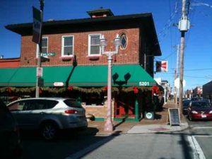
The Hill’s roots are interspersed with the history of St. Louis, generating two of the region’s proudest exports – world-class athletes and Italian cuisine. Baseball’s Yogi Berra and Joe Garagiola grew up here, and today it maintains a traditional collection of authentic Italian bakeries, grocery stores, restaurants and mom-and-pop trattorias.

Everything is colorful here – even the fire hydrants are painted red, white and green. Twenty-first century additions include coffee houses, studios, retail and small businesses that create additional energy in the cozy enclave. Its epicenter is one intersection that sums it up perfectly, with St. Ambrose Catholic Church on one corner, an Italian bakery/restaurant on another, an import shop across the street, and a neighborhood tavern/bocce garden on the fourth corner. (Explore St. Louis)

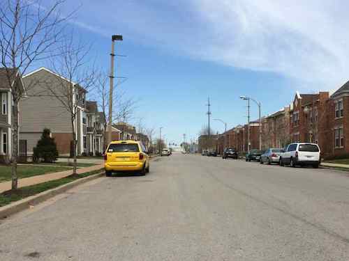
In the late 19th & early 20th century immigrants from Sicily first settled in the ethnically diverse neighborhood on the North edge of the Central Business District and further North — the southern part of today’s Columbus Square neighborhood.

The Italians came to St. Louis in the late 1880s. They lived in what is now downtown St. Louis among the Germans, Greeks, and Irish and attended St. Patrick’s Catholic Church or Our Lady Help of Christians in an area referred to as Little Italy, along Cole Street.

In the early 1900s, the Italians started another community southwest of Little Italy called The Hill. By the mid-1900s, most Italians had left Little Italy and moved to The Hill. (St. Louis Genealogical Society)

By the time they arrived the shopfronts, flats, and tenements were already old. In addition to the races mentioned above, Jewish families also called the neighborhood home.

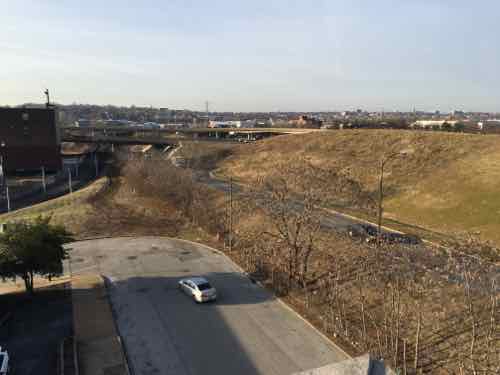
Before going further it’s important to note that today’s boundary lines didn’t exist. Highways didn’t cut through neighborhoods, wide streets like Cole were the same width as Carr.  Cole wasn’t even called Cole.

Here’s a look at East-West street names and what they were called in 1909, starting at Washington Ave and going North to Cass:

  • Washington Ave was Washington Ave
  • Lucas Ave was Lucas Ave
  • Convention Plaza was Delmar, called Morgan in 1909. (Could’ve been the Morgan divide?)
  • Dr. Martin Luther King was Franklin
  • Cole was Wash
  • Carr was Carr
  • Biddle was Biddle
  • O’Fallon was O’Fallon.
  • Cass was Cass

Again, Cole today is a very wide street that separates Downtown from Columbus Square. Like Franklin to the South, and Carr to the North, it was a normal neighborhood street — not a dividing line.

Franklin Ave looking East from 9th, 1928. Collection of the Landmarks Association of St Louis

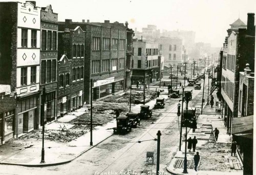
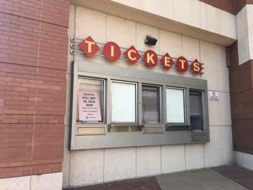
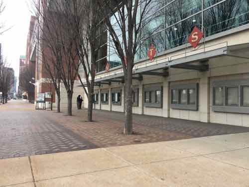
Major change came as the city decided to widen comfortable neighborhood streets like Franklin. Everything in the photo above has been part of the convention center since the mid-1970s. One neighborhood spaghetti joint became St. Louis’ top restaurant — Tony’s:

Before Tony’s, the Bommarito family had St. Louis’ first Italian bakery. It was at 7th and Carr Streets, plus they operated a spaghetti factory at 10th and Carr.  Tony’s was created by Anthony Bommarito in 1946, and, in its earliest life was a small café, soon to be called Tony’s Spaghetti House and by the early 1950s Tony’s Steak House. It was located just north of the heart of downtown at 826 N. Broadway between Delmar Boulevard (formerly Morgan St.) and Franklin Avenue in the old Produce Row district at the edge of the soon to disappear Little Italy neighborhood. Family names of those who lived nearby included: Polizzi, Impostato, Olivastro, Lapinta, Viviano, Difirore, Impielizzeri, Tocco, Arrigo, Marino and Capone. (Tony’s)

In the early 1990s Tony’s was forced to relocate because of the construction of the football stadium being built to get an NFL expansion team. Ton’y was on the East side of Broadway, part of today’s Baer Plaza. As indicated above, Broadway was also part of Produce Row, before moving to 2nd & North Market in the 1950s. [Produce Row history]

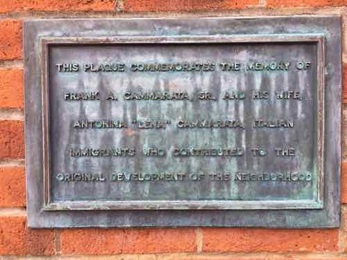
At least one Italian immigrant from the neighborhood likely worked at Produce Row: Frank Cammarata.

Small plaza on the SW corner of 11th & Carr was built in 1981 as part of the Columbus Square apartments, now known as CitySide.
A small plaque on the South wall reads: “THIS PLAQUE COMMEMORATES THE MEMORY OF FRANK A. CAMMARATA, SR., AND HIS WIFE, ANTONIA “LENA” CAMMARATA, ITALIAN IMMIGRANTS WHO CONTRIBUTED TO THE ORIGINAL DEVELOPMENT OF THE NEIGHBORHOOD.

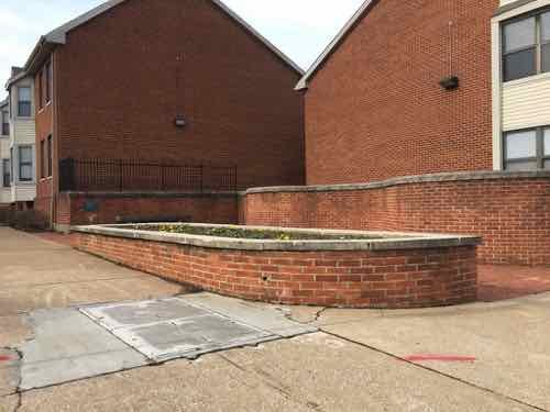
This little plaque is why I began looking into Italian immigrants into the neighborhood. Here’s what I’ve learned through a lot of digging:

Frank Cammarata’s middle name was William. He was born in Italy and came to the states on August 28 1913, via Canada.  A Joseph Cammarata was already in St. Louis, presumably his brother, with various addresses over the years: 614 Biddle, 616 Biddle, 618 Biddle,  1003 N 6th, and 1121 N 11th. In 1915 Frank Cammarata was living at 805A Carr.

Directories  & census listed Frank as a fruit pedlar, though he was no longer working by the 1940 census.  Lena Cammarata died in late August 1939, they were living at in  the Shaw Neighborhood at 4152 Castleman. Frank Cammarata died in 1950 at age 72, still living in Shaw on DeTonty.

The Cammarata’s were already living on Castleman in 1929. I contacted the apartment complex owner, the Mills Group, online to see if they knew anything. They never responded. I stopped by the apartment leasing office to ask. Due to many steps I couldn’t enter, so I called and two women came out to chat. They didn’t even know a plaque existed. They suggested I ask the city, though the plaque is on their private property.

One of the Cammarata’s sons was Frank A. Cammarata, Jr. (1912-1986). My assumption is the 1981 plaque got put up because of him, but the maker goofed and put the son’s middle initial “A” instead of the father’s “W”. I’ve been unable to find anything to substantiate how they contributed to the “original development of the neighborhood” — especially since the neighborhood was already old when they were born in Italy.

As one of the oldest neighborhoods, the building stock was old. Many of the 1909 Sanborn Fire Insurance map pages indicate the neighborhood buildings are old, many are tenements.  In 1937 a private housing project, Neighborhood Gardens, was built on a single block. It had goal of providing affordable housing to low-income neighborhood residents. It failed, as the rents needed to be higher than anticipated to cover obligations.

When the federal government got into the low-income housing business the neighborhood was the site of one of the city’s first high-rise public housing projects: Cochran Gardens. It opened in 1953, a year before Pruitt-Igoe located, due west. This brings me to the story of two of the last old Italian-American businesses in the neighborhood.

From the Post-Dispatch November 9, 1936 page 33 of 36 [a daily special section)

For the last 31 years the  Rosciglione family has been, by popular appointment, official confectioners to the Italian-American population of St. Louis. For 31 years the Roscigliones, brothers and father, have been shaping almond paste fruits and flowers, molding hard sugar scenic pieces and baking rich cakes for a critical clientele. No wedding, birthday, feast day, church or State holiday has been properly observed in Italian-American homes without some sweet, traditionally symbolic of the day, from the Rosciglione kitchens at 1011 1/2 North Seventh Street. 

This would’ve been on the west side of 7th Street between Wash (now Cole) and Carr. Later in the same article:

When Frank Rosciglione came to this country in 1906 from Palermo, one brother, Tony, already in St. Louis and had a small confectionary shop on Eighth street. Business was good, so he sent for his brother, this time Frank. Shortly afterwards, the two moved their pastry tubes, baking pans and molds over to the Seventh street location. The next year business had increased again so they sent for another brother, Dominick. When they thought they were pretty well on their feet, in 1911, they sent for their mother and father who still kept the confectioners shop in the Old Country. Now all are gone except Dominick who carries on the family profession with one helper and his oldest son. 

More than 15 years after Cochran Gardens opened, the neighborhood had changed. The shiny new housing project was losing its luster. Rent strikes were happening at Cochran, Pruitt-Igoe, and other housing projects.

The Post-Dispatch on July 20, 1969 page 119 of 338 had a story about the last two Italian-American businesses leaving the neighborhood, not for The Hill, but St. Louis County.

“We cannot endanger our customers,” said tall, sandy-haired Peter Rosciglione, 47 years old. He was explaining why he was closing his 70-year-old bakery at 1011 North Seventh Street. He and his wife, Josephine, and their son, Peter, have packed up the bride-and-groom figures for the tops of wedding cakes, the ornate, old-fashioned candy jars, the molds for three-foot sugar dolls. All these things will be carefully placed in their new store in St. Louis County, at 9839 West Florissant Avenue, Dellwood.

Rosciglione related that in the last month, six customers were approached by innocent-looking small boys who asked for the time, snatched the exposed watches and ran. His shop and the Seventh Street Market, a meat market at 933 North Seventh Street, have been robbed “over and over again” after hours, though the shopkeepers have not been held up.

“I work with this on the counter,” he said, holding up a pistol. “We have to walk with our women customers to their cars to keep them from having their purses snatched. Recently  I heard that because we were spoiling the purse-snatching business for the juvenile gang, that they were out to get me.”

“This is just one mass jungle,” Rosciglione said. “The good families who live nearby in the Cochran housing project and in the neighborhood are as terrified of the gangs as our customers are. I can’t allow them to jeopardize themselves for our merchandise any more.

Rosciglione Bakery still exists today…in St. Charles, MO.

Vincenzo Rosciglione came to the United States in 1898 from Palermo, Sicily.  He opened the first Italian Bakery in downtown St. Louis at 1011 North 7th Street.  The bakery was well received by the large Italian community in the downtown area known as “Little Italy“.
Vincenzo’s son, Francesco, still in Sicily studying under a famous pastry and sugar artist, was sent for at the age of 16.  He and his wife, Cosimina, ran the well established bakery until his death in 1949.  After working under the tutelage of his father for many years, Peter and  his wife, Rose, took over the bakery.
The bakery left downtown St. Louis in 1969 and opened in Dellwood, Mo. where it remained until 1997.  Rosciglione Bakery then moved to it’s present location in St. Charles, Mo. where it continues to be family owned and operated by 4th generation, Francesco Peter Rosciglione.  (Rosciglione Bakery)
The Bommaritos and Roscigliones both lay claim to being the first Italian bakery, not sure which, if either, is correct. The Dellwood address where Rosciglione Bakery moved to in 1969 is the original Sweetie Pie’s location.
I still feel like I have so much to learn about the former residents of what’s now known as Columbus Square neighborhood. Hopefully some of you will know bits & pieces that’ll help with the puzzle.
 — Steve Patterson
 

9th & 10th Streets Need To Be Two-Way North of Cole Street

May 20, 2019 Featured, Neighborhoods, Planning & Design, Transportation, Walkability Comments Off on 9th & 10th Streets Need To Be Two-Way North of Cole Street

Five years ago I suggested 9th & 10th Streets through the Columbus Square neighborhood (Cole to Cass) be uncoupled so that both are two-way streets again. See Columbus Square: 9th & 10th Streets from May 19, 2014.

In short, 9th & 10th have been a one-way couplet (opposite directions) to facilitate vehicular travel between I-70 and downtown — passing through the Columbus Square neighborhood.  Due to the construction of the Stan Musial Veterans Memorial Bridge 9th/10th hasn’t connected to I-70 in 8-9 years. Yet, these excessively wide one-way streets remain through the neighborhood.

What has changed in the last five years?

I moved to the neighborhood nearly 5 months ago and 9th Street immediately south of Cole Street will close if the convention center is expanded. Living here, frequently crossing 9th & 10th, I can tell you they’re substantially wider than necessary. Being wide and one-way their design encourages drivers to travel at much higher speeds than should be in a residential neighborhood.

Five years ago the main obstacle to correcting this problem was the cost to alter/replace 3 traffic signals. The possible convention center expansion project includes significant changes to Cole Street — including new signals at 9th & 10th. That leaves only the relatively new signal at 9th & Cass to modify — minor work since 3 out of 4 approaches is currently two-way.  Some additional stop signs will be necessary at intersections between Cole & Cass.

Looking North on 9th Street toward Cass. It’s 44 feet from curb to curb.

We measured the width of 9th & 10th in various places five years ago, 9th @ Manhattan Place (south of Cass) was a very wide 44 feet. For comparison, Locust at 16th is a much busier street and is 42 feet wide. You need 8 feet for each parking lane, plus a max of 12 feet for each travel lane — a total of 40 feet. I’d prefer 10 or 11 foot travel lanes. There’s no money to physically narrow the streets, but a wide center “median” could be painted with stripes.

This pair of streets should’ve been returned to two-way during the 2010-2013 bridge project, but they weren’t. With the convention center project closing 9th and altering Cole, we’ve got another opportunity to correct the problem of one-way highway access streets through the center of a neighborhood — with an elementary school in between.

— Steve Patterson

b


Proposed MLS Stadium, Sans Site Plan

April 29, 2019 Downtown, Featured, Planning & Design Comments Off on Proposed MLS Stadium, Sans Site Plan

Last week artist renderings were released for a proposed soccer-specific stadium, it’ll be built if the local ownership group becomes an MLS expansion team. The MLS recently approved expanding the league from 28 to 30 teams, so it seems increasingly likely we’ll get an MLS team & stadium. Images from MLS4THELOU

When people see colorful drawings of proposed projects they’ll often get drawn into the images, letting down any critical thinking they might’ve had — they’ve served their purpose of increasing support and reducing criticism. Absent from the documents was a proposed site plan.

Site plans are never sexy, but they help explain relationships between buildings. Without a site plan it’s impossible to fully understand the quality of the design.

I’m very familiar with the area where the proposed stadium would be built. In fact, in February 2016 I posted about it when another ownership group was trying to get a MLS team following the Rams’ return to LA:

The site they shouldn’t consider is the North riverfront one previously targeted for a significantly larger NFL stadium — we shouldn’t tear down buildings when we have vacant land available. We have land, mostly state owned, without any buildings and a target for redevelopment for years already. I’m talking about the 22nd Street Interchange area — an area on the West side of downtown I’ve written about numerous times over the 11+ years.

The state-owned land is the remnants of what was to be a 1950s West loop around downtown.

The second portion of the Distributor Freeway includes ramps from Interstate 64 & U.S. 40 north to Pine Street at 20th Street. This includes short roadways from the Market Street overpass south to I-64. Plans coinciding with the construction of Truman Parkway included the 22nd Street Parkway. Officially cancelled in October 2003, the four-lane parkway was a version of the late 1950s North South Distributor Freeway running north from U.S. 40 to Dr. Martin Luther King, Jr. Drive. The project included the reconfiguring of the interchange with I-64 & U.S. 40 and required condemnation of land north of Pine Street. Increasing costs associated with acquiring land needed for the parkway ultimately led to its demise. (Source)

The 4th of the above images is the only one that might give us a clue about the site. Let’s take a closer look.

The top of a parking garage is shown at the bottom.

This garage is either an inaccurate representation of the garage attached to the Drury Inn at Union Station, located in the old railway YMCA, or a new garage. Here are a couple of views from 2016 looking at the proposed site.

Looking southwest, 21st & Clark with an I-64 off ramp behind it
Looking northwest, that’s 21st Street on the right

Here’s what I think about the site, both north & south of Market Street:

  • The stadium & new buildings should take advantage of the existing hole for basement or underground parking.
  • Market Street between 20th & 21st is a deteriorating bridge, it should be removed. Under it can be filled in with foam so a new road/sidewalks can be built at grade.
  • Market Street should be redesigned to be friendly to pedestrians. This means narrowing the road (fewer, narrower lanes) and more crossing points. Right now there’s a crosswalk at 20th and at Jefferson –this is nearly a half a mile without a crossing.
  • Hopefully the changes at Union Station, including the upcoming Farris Wheel along 20th Street, will mean easier access under the train shed between the Union Station MetroLink platform on the East side of 18th to the new MLS stadium.
  • Metro will need to rethink downtown circulation with a revised Union Station, a MLS stadium, and hopefully active surroundings.
  • Pine & Chestnut have been a one-way couplet for decades. Once the on/off ramps to/from I-64 are gone both streets should be returned to two-way traffic. The revised Soldiers Memorial, however, has only one eastbound lane on Chestnut between 13th-14th.  Chestnut has our only protected bike lane.

I’ll probably think of more issues, hopefully the site planning being done now will address at least some of these.

— Steve Patterson


Tickets Will Not Be Sold Here

March 4, 2019 Featured, Planning & Design, Popular Culture Comments Off on Tickets Will Not Be Sold Here

At least personally, paper tickets have been obsolete for a while. I either print my ticket or show it on my phone. The latter is what we did last month on our round trip to/from Chicago via Amtrak.  What about for local events?

If you plan on going to a St. Louis Blues game this season, you’ll need to have a smartphone or at least an e-mail address. Tickets to the game are now completely mobile.

Staff said you can purchase tickets through the NHL app and pull them up on your phone. (Fox2)

I use a card for transit, not a paper pass, transfer, or ticket.  All this change has me wondering about ticket windows.

I doubt these 3 ticket windows at the Forest Park MetroLink station have ever been used. These were built in 2006 when the station changed for the Blue Line to Shrewsbury.
The Dome at America’s Center (aka convention center) has ticket windows scattered around the perimeter. Several have regular signs indicating “TICKETS WILL NOT BE SOLD HERE”
Here’s another
The main ticket area is in the center of the East (Broadway) side. There are seven sections for 14 total windows, but only seven have ever been set up with transaction drawers.

These are always closed when I pass by, not much going on that requires tickets. The recent UMC conference was busy, but no ticket sales.

Then lsat week I saw activity at the far window. The sign for tickets/will call was rolled out.
Yes, people & activity at one window.
Friday last week I noticed this trailer had been put into place along Convention Plaza (aka Delmar)

The event with physical ticket sales was the 2019 Monster Jam truck show held the last two days (March 2-3). Even they link to Ticketmaster for tickets.

The days of the ticket window are numbered.

— Steve Patterson


Opinion: Closed Streets Do Not Reduce Crime

February 27, 2019 Crime, Featured, Transportation, Walkability Comments Off on Opinion: Closed Streets Do Not Reduce Crime

The recent non-scientific Sunday Poll was about closed streets and crime, prompted by a news story about new research at Saint Louis University:

St. Louis’ often-interrupted street grid is the outgrowth of the 1970s-era “defensible space” strategy to address rising crime championed by Oscar Newman, a prominent urban planner who was a Washington University architecture professor in the mid-1960s, according to the paper. That idea stems from the notion that an area is safer when residents feel a sense of ownership and control, which Newman described as allowing neighbors to focus their attention on “removing criminal activity from their communities.”

St. Louis became the birthplace of such ideas, according to the paper. And they haven’t had the desired effect. (Post-Dispatch)

Below is one such example where “Schoemehl pots”, just sections of sewer pipe, were used to limit vehicular traffic.

Schoemehl pots used in their traditional role of messing up the street grid, 2012 photo.

Their paper’s conclusion:

Oscar Newman’s defensible space theory is a product of St. Louis’s mid-century history. It is perhaps unsurprising, therefore, that St. Louis also offers a large-scale implementation of defensible space in the street barriers that constrict swaths of the city’s geography. The barriers scattered across the city’s landscape are a testament not only to former Mayor Vincent Schoemehl, the elected official most closely associated with the barriers, but to Newman himself. We have developed the most comprehensive known list of closures in the city, and find that the density of closures is not associated with less crime in neighborhoods. Our finding is an important one for St. Louis, given that addressing crime is the argument being made explicitly in the legislation that authorizes more recent installations of barriers. For other municipalities that may be considering defensible space or other techniques to “design out” crime, our findings suggest that street closures are at best ineffective and at worst associated with higher rates of violent crime in neighborhoods. They may also have secondary effects on first responders’ ability to reach the neighborhoods they serve. (Research paper)

I completely agree with the conclusions of the researchers, but I also think they should be looking at earlier changes to the urban street grid. As I’ve said before, when Harold Bartholomew (1889-1989) first arrived in St. Louis in the nineteen teens he quickly began assaulting our fine network of public streets. Writing decades later in the 1947 plan:

Since 1916 St. Louis has expended over $40,000,000 in opening, widening, connecting, and extending the system of major streets. Much has been accomplished in converting a horse and buggy street system to automobile needs. As the total volume of traffic increases, however, certain new needs arise. An example is the desirability of grade separations at extremely heavy intersections, such as at Grand and Market and at Kingshighway and Lindell. Likewise there is a need for complete separation of grade where traffic volume is sufficiently heavy to justify the cost involved. The Federal Government, which has helped finance our splendid system of national highways, has recently revised its policies and Congress has appropriated substantial funds to aid the cities in the construction of express highways and for facilitation of traffic flows from certain selected state highways through metropolitan areas to the central business districts of large cities. (1947 Plan)

In just three decades St. Louis spent today’s equivalent of nearly a half a billion dollars on dramatic changes to the street grid.  Half a billion!

Franklin Ave looking East from 9th, 1928. Collection of the Landmarks Association of St Louis

The reference to the “horse and buggy street system” illustrates he didn’t think it was suitable for the automobile. Bartholomew, a civil engineer by training, was no doubt influenced by the City Beautiful movement.

City Beautiful movement, American urban-planning movement led by architects, landscape architects, and reformers that flourished between the 1890s and the 1920s. The idea of organized comprehensive urban planning arose in the United States from the City Beautiful movement, which claimed that design could not be separated from social issues and should encourage civic pride and engagement. (Britannica)

This was soon followed by the modernists and their vision for roads to connect everything. The Futurama exhibit at the 1939 World’s Fair was hugely popular, helped shape legislation that let to destructive urban renewal projects, interstate highways slicing through cities, etc.  See original 23-minute 1939 Futurama promo video.

Oscar Newman was born in 1935, so he was barely around during the 1939 fair. With the Great Depression & WWII the ideas from Futurama were on hold until he was a teen. Newman likely went along with most others, not foreseeing any problems with additional alterations to the street grid.

By the time republished his 1972 book urban renewal & highway projects had further disrupted the street grid beyond recognition. These changes are cumulative, not isolated. Our street grid was designed for the horse and buggy times — but that’s what made it go great. Street grids can take little changes and still function. St. Louis had decades of massive overwhelming changes to the street grid.

It has proven to be excessive. Abandonment, crime, etc are the results. I don’t know that it’s repairable.

Former Biddle Street, looking East toward 9th Street

The results from Sunday’s non-scientific poll:

Q: Agree or disagree: City streets closed to through traffic reduce crime.

  • Strongly agree: 1 [3.13%]
  • Agree: 2 [6.25%]
  • Somewhat agree: 6 [18.75%]
  • Neither agree or disagree: 2 [6.25%]
  • Somewhat disagree: 2 [6.25%]
  • Disagree: 9 [28.13%]
  • Strongly disagree: 9 [28.13%]
  • Unsure/No Answer: 1 [3.13%]

More than half correct don’t think closed streets reduce crime.

— Steve Patterson


Advertisement


[custom-facebook-feed]

Archives

Categories

Advertisement


Subscribe