Home » Urban Renewal » Recent Articles:

Mill Creek Valley Neighborhood Was Less Important Than An Expressway

February 19, 2020 Featured, Urban Renewal Comments Off on Mill Creek Valley Neighborhood Was Less Important Than An Expressway

Since his arrival in St. Louis in 1915 Harland Bartholomew, a civil engineer by training, wanted cars to be able to move with greater ease. He relentlessly argued in favor of  destroying the city’s rich urban fabric, street grid, in order to save the city from urban decay. He was young and charismatic, convincing generations of St. Louisans his way was the only way.

“Horizontal, black and white photograph showing a row of dilapidated residential buildings in the 3200 block of Lawton in Mill Creek Valley. The buildings appear to be empty and awaiting demolition. Low wooden fences enclose the small front yards. There are several inches of snow on the ground.” February 16, 1960. Missouri Historical Society

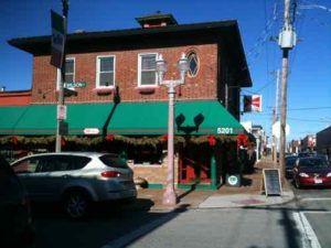
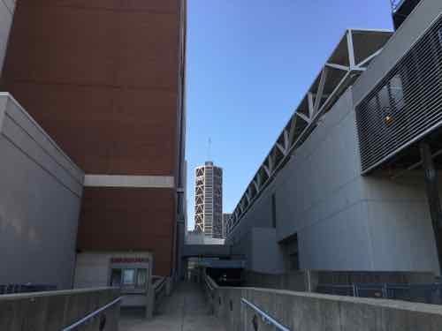
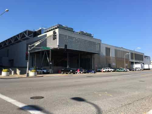
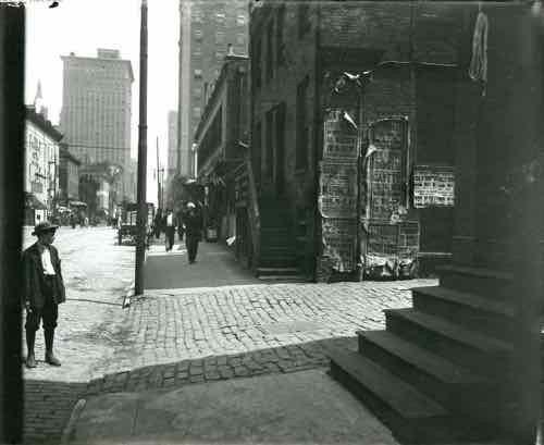
Lawton was an east-west street between Pine & Laclede, the above would’ve been just west of Compton Ave.

The chaos created by decades of Bartholomew’s projects created so much instability — far worse than than anything natural decay was creating. Widening streets and building new expressways was part of Bartholomew’s vision. It was costly but necessary, he argued.

North edge of downtown: Franklin Ave being widened, looking East from 9th, 1928. Collection of the Landmarks Association of St Louis

In 1936 the first phase of a new expressway opened between Kingshighway and Skinner, cutting through the south edge of Forest Park. This was two decades before the creation of the Interstate Highway System! A year later another section opened between Vandeventer and Kingshighway. Many could see it reaching downtown eventually.

Highway planners in those days drew lines on map to connect the dots, sometimes meandering a bit here and there to avoid an important business, like Anheuser-Busch brewery in the case of what is now known as I-55. Otherwise their lines indiscriminately cut through neighborhood after neighborhood.

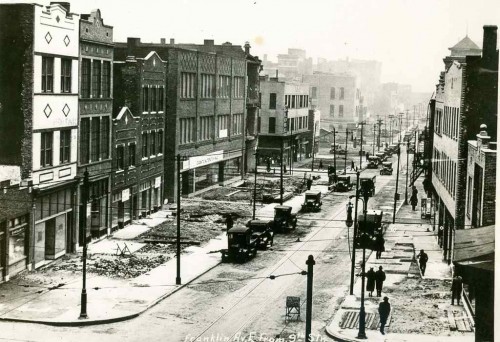
As these highways were going through the oldest parts of the city they were also going through the poorest neighborhoods. Older “slum” areas were viewed as obsolete anyway — two birds, one stone. By the 1959s Mill Creek Valley, bounded by Union Station on the east, railroad tracks on the south, Grand on the west, and Olive on the north, was a dense neighborhood.

“Horizontal, black and white photograph showing a rear view of dilapidated housing in Mill Creek Valley. View was taken from an area across the street that has already been cleared. Bricks and other rubble is strewn throughout the foreground.” Missouri Historical Society

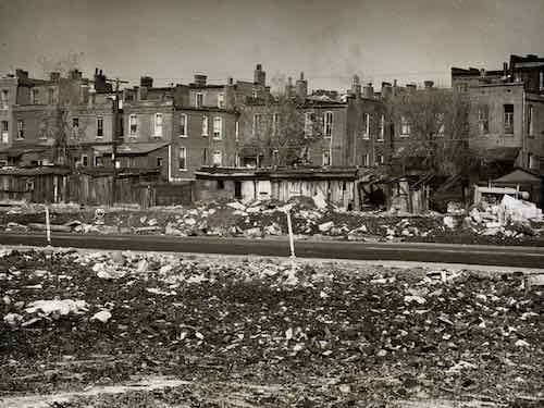
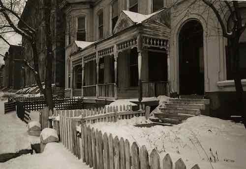
Because of segregation, it was self-contained. Yes, it was deteriorated and most residences lacked running  water and indoor bathrooms.  The buildings were nearly a century old. Numerous generations of new immigrants had begun their lives in America in this neighborhood, the last was southern blacks trying to escape Jim Crow laws while looking for work.

To an outsider it likely seemed like a horrible place, but to residents it was home. They had connections with each other, lasting institutions, etc. Poor neighborhoods all over the city were the same way, they didn’t look like much but it was the ties among the residents that was more important than the street grid or buildings. But take away the buildings and the streets and those strong ties among thousands quickly disappear. It’s an unnatural disaster.

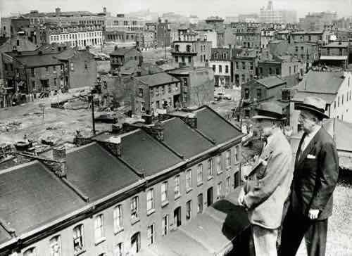
During the 1950s, Saint Louis found itself in a fervor over urban deterioration and renewal. Following Mayor Joseph Darst’s 1953 slum clearance in the Chestnut Valley area, Mayor Raymond Tucker initiated a similar project in the adjacent Mill Creek Valley. This area – bounded by 20th Street, Grand Avenue, Olive Street and Scott Avenue – housed a large African-American population, and was at one time the home to such famous African-Americans as Scott Joplin and Josephine Baker. At the start of the 1950s, the Mill Creek Valley house 20,000 inhabitants (95% African-American) and included over 800 businesses and institutions. Everything the residents needed – from grocery, clothing and hardware stores to restaurants, schools and churches – was within walking distance of their homes. The area was also home to the prominent African-American newspaper, The St. Louis Argus. However, many of these residences and institutions were considered unsanitary and in need of repair.

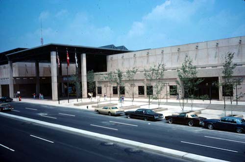
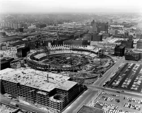
In 1951, Missouri Governor Forrest Smith signed the Municipal Land Clearance for Redevelopment Law, which brought state aid to the urban renewal efforts of Missouri’s cities. The law also created the St. Louis Land Clearance for Redevelopment Authority, whose job it was to oversee urban renewal in Saint Louis and manage its funding. Under the 1954 Federal Housing Act – which provided federal aid for renewal projects – and the passage in 1955 of a $110 million bond issue, Mayor Tucker and the City of St. Louis began the clearance and demolition of slums in Mill Creek Valley. The most of the bond revenue went towards construction of new expressways, some of which cut through parts of Mill Creek. Roughly $10 million was utilized for slum clearance. The clearance of the area would involve the relocation of many residents and businesses; most residents would never return and many businesses would cease operations. Acquisition of buildings, like the Pine Street Hotel and the Peoples Finance Building, began in August of 1958, with actual demolition starting the following year. Redevelopment of the area would include new residential, commercial and industrial zones, with the majority of land going towards new industry. Certain industries that met zoning requirements, like Sealtest Foods, would not face demolition and were allowed to stay. Redevelopment of the entire area was scheduled for completion in 1968. (UMSL)

The city systematically created disasters all over the place. The pace must’ve been overwhelming to many at the time. Hundreds of thousands were uprooted. It’s a formula for the population losses that have happened since.

“Horizontal, black and white photograph showing Mayor Raymond Tucker and Sidney Maestre on a rooftop looking over dilapidated buildings slated for clearance in Mill Creek Valley. A note on the back of the print reads: “Mill Creek Valley, 1956 / Mayor Raymond Tucker and Sidney Maestre, Chairman of Citizens Committee which drafted bond issue program, are looking over decaying buildings in blighted area.””

Mill Creek Valley was at the wrong place at the wrong time. By 1950 Bartholomew was in Washington D.C., but his raze & replace attitude continued. Other options weren’t considered, especially when the land is needed for an expressway to connect downtown to affluent western suburbs as the wealthy continued moving westward along the central corridor.

Here are the results of the recent non-scientific Sunday Poll:

Q: Agree or disagree: Mill Creek Valley was a slum (no indoor plumbing, etc); leveling it was the only option

  • Strongly agree: 0 [0%]
  • Agree: 1 [5.56%]
  • Somewhat agree: 1 [5.56%]
  • Neither agree or disagree: 0 [0%]
  • Somewhat disagree: 1 [5.56%]
  • Disagree: 4 [22.22%]
  • Strongly disagree: 10 [55.56%]
  • Unsure/No Answer: 1 [5.56%]

Again, demolition was the only option considered.  One, this generation didn’t see any value in the narrow & compact street grid or in 19th century flats. The other is they really wanted the land for a highway. As a bonus white folks could now drive on Olive & Market streets between the Central West End and downtown without having to go through a black neighborhood.

With so much uprooting & demolition it is amazing we have any residents or buildings left. The leaders at the time just couldn’t/didn’t see the tremendously negative consequences their actions would have on the city & region for decades to come. After all, everything they were doing was in an effort to save the city from decay.

— Steve Patterson


Sunday Poll: Was Razing Mill Creek Valley the City’s Only Option?

February 16, 2020 Featured, Sunday Poll, Urban Renewal Comments Off on Sunday Poll: Was Razing Mill Creek Valley the City’s Only Option?
Please vote below

On February 16, 2013 STL250 shared a 1956 photo of Mayor Raymond Tucker looking at Mill Creek Valley, with the following caption:

This Day in St. Louis History, February 16, 1959:
Mill Creek Valley becomes “Hiroshima Flats”

With $7 million from a 1955 St. Louis Civic Progress bond issue and $21 million in federal funds, the Land Clearance Redevelopment Authority began clearing the 454 acres of Mill Creek Valley, from Lindell on the north and Scott on the south, and Twentieth on the east and Grand on the west. The historically black area’s homes and dilapidated buildings were razed for 132 acres of industrial sites, 26 acres of commercial, 83 acres of residential, a 22 acre extension of St. Louis University across Grand, and the Ozark Expressway. 1,772 families and 610 individuals were displaced, some of the poorest in the city, and almost all black. Slow redevelopment after the rather quick destruction gained the giant empty fields of land the nickname of “Hiroshima Flats.” The Mill Creek Valley site is now covered by the portion of St. Louis University east of Grand, Harris Stowe State University, and the Wells Fargo Advisors buildings.

Here’s more:

By World War II, Mill Creek’s tenements and faded town houses were home to nearly 20,000 people, many of them poor blacks who had migrated north from the cotton fields. More than half the dwellings lacked running water, and 80 percent didn’t have interior bathrooms.

Tucker proposed knocking over nearly everything and starting over. In 1955, city voters overwhelmingly approved a $10 million bond issue for demolition, on the promise that the federal government would reimburse most of it. The local NAACP endorsed the idea. Work began on Feb. 16, 1959, at 3518 Laclede Avenue, where a headache ball smashed a house that dated to the 1870s. (Post-Dispatch)

From an upcoming book on Mill Creek Valley:

On December 16, 1950, my grandmother purchased a house from her landlords, Richard and Betty Bennett, at 2649 Bernard Street in Mill Creek for $1,400. She had saved the $100 down payment from her meager salary. Twenty years after leaving Earl, Arkansas, for St. Louis, she would finally have a home of her own with her son, his wife, and their eight children. She would be the last in a long line of owners of the hundred-year-old Italianate- style two-story dwelling.

My grandmother was unaware of the city’s plans when she bought her house in the neighborhood where she had lived since leaving the South. However, politicians, realtors, and religious and business leaders knew what the future held for this 450-acre neighborhood. Egged on by a series of derisive articles in the local media, the city was moving to deem the area “blighted.” The designation would pave the way for the eventual erasure of an entire African American community to make way for an interstate highway to the suburbs.

There you have it, an overview of Mill Creek Valley.  It was sixty-one years ago today that demolition began, so that’s the subject of today’s poll.

This poll will close at 8pm tonight.

— Steve Patterson


St. Louis’ Original “Little Italy” Neighborhood: North Downtown/Columbus Square

June 3, 2019 Downtown, Featured, Neighborhoods, North City, Urban Renewal Comments Off on St. Louis’ Original “Little Italy” Neighborhood: North Downtown/Columbus Square
Bocce is one of many long-standing traditions on The Hill

When you think of an Italian neighborhood in St. Louis, The Hill naturally comes to mind.

The Hill’s roots are interspersed with the history of St. Louis, generating two of the region’s proudest exports – world-class athletes and Italian cuisine. Baseball’s Yogi Berra and Joe Garagiola grew up here, and today it maintains a traditional collection of authentic Italian bakeries, grocery stores, restaurants and mom-and-pop trattorias.

Everything is colorful here – even the fire hydrants are painted red, white and green. Twenty-first century additions include coffee houses, studios, retail and small businesses that create additional energy in the cozy enclave. Its epicenter is one intersection that sums it up perfectly, with St. Ambrose Catholic Church on one corner, an Italian bakery/restaurant on another, an import shop across the street, and a neighborhood tavern/bocce garden on the fourth corner. (Explore St. Louis)

In the late 19th & early 20th century immigrants from Sicily first settled in the ethnically diverse neighborhood on the North edge of the Central Business District and further North — the southern part of today’s Columbus Square neighborhood.

The Italians came to St. Louis in the late 1880s. They lived in what is now downtown St. Louis among the Germans, Greeks, and Irish and attended St. Patrick’s Catholic Church or Our Lady Help of Christians in an area referred to as Little Italy, along Cole Street.

In the early 1900s, the Italians started another community southwest of Little Italy called The Hill. By the mid-1900s, most Italians had left Little Italy and moved to The Hill. (St. Louis Genealogical Society)

By the time they arrived the shopfronts, flats, and tenements were already old. In addition to the races mentioned above, Jewish families also called the neighborhood home.

Before going further it’s important to note that today’s boundary lines didn’t exist. Highways didn’t cut through neighborhoods, wide streets like Cole were the same width as Carr.  Cole wasn’t even called Cole.

Here’s a look at East-West street names and what they were called in 1909, starting at Washington Ave and going North to Cass:

  • Washington Ave was Washington Ave
  • Lucas Ave was Lucas Ave
  • Convention Plaza was Delmar, called Morgan in 1909. (Could’ve been the Morgan divide?)
  • Dr. Martin Luther King was Franklin
  • Cole was Wash
  • Carr was Carr
  • Biddle was Biddle
  • O’Fallon was O’Fallon.
  • Cass was Cass

Again, Cole today is a very wide street that separates Downtown from Columbus Square. Like Franklin to the South, and Carr to the North, it was a normal neighborhood street — not a dividing line.

Franklin Ave looking East from 9th, 1928. Collection of the Landmarks Association of St Louis

Major change came as the city decided to widen comfortable neighborhood streets like Franklin. Everything in the photo above has been part of the convention center since the mid-1970s. One neighborhood spaghetti joint became St. Louis’ top restaurant — Tony’s:

Before Tony’s, the Bommarito family had St. Louis’ first Italian bakery. It was at 7th and Carr Streets, plus they operated a spaghetti factory at 10th and Carr.  Tony’s was created by Anthony Bommarito in 1946, and, in its earliest life was a small café, soon to be called Tony’s Spaghetti House and by the early 1950s Tony’s Steak House. It was located just north of the heart of downtown at 826 N. Broadway between Delmar Boulevard (formerly Morgan St.) and Franklin Avenue in the old Produce Row district at the edge of the soon to disappear Little Italy neighborhood. Family names of those who lived nearby included: Polizzi, Impostato, Olivastro, Lapinta, Viviano, Difirore, Impielizzeri, Tocco, Arrigo, Marino and Capone. (Tony’s)

In the early 1990s Tony’s was forced to relocate because of the construction of the football stadium being built to get an NFL expansion team. Ton’y was on the East side of Broadway, part of today’s Baer Plaza. As indicated above, Broadway was also part of Produce Row, before moving to 2nd & North Market in the 1950s. [Produce Row history]

At least one Italian immigrant from the neighborhood likely worked at Produce Row: Frank Cammarata.

Small plaza on the SW corner of 11th & Carr was built in 1981 as part of the Columbus Square apartments, now known as CitySide.
A small plaque on the South wall reads: “THIS PLAQUE COMMEMORATES THE MEMORY OF FRANK A. CAMMARATA, SR., AND HIS WIFE, ANTONIA “LENA” CAMMARATA, ITALIAN IMMIGRANTS WHO CONTRIBUTED TO THE ORIGINAL DEVELOPMENT OF THE NEIGHBORHOOD.

This little plaque is why I began looking into Italian immigrants into the neighborhood. Here’s what I’ve learned through a lot of digging:

Frank Cammarata’s middle name was William. He was born in Italy and came to the states on August 28 1913, via Canada.  A Joseph Cammarata was already in St. Louis, presumably his brother, with various addresses over the years: 614 Biddle, 616 Biddle, 618 Biddle,  1003 N 6th, and 1121 N 11th. In 1915 Frank Cammarata was living at 805A Carr.

Directories  & census listed Frank as a fruit pedlar, though he was no longer working by the 1940 census.  Lena Cammarata died in late August 1939, they were living at in  the Shaw Neighborhood at 4152 Castleman. Frank Cammarata died in 1950 at age 72, still living in Shaw on DeTonty.

The Cammarata’s were already living on Castleman in 1929. I contacted the apartment complex owner, the Mills Group, online to see if they knew anything. They never responded. I stopped by the apartment leasing office to ask. Due to many steps I couldn’t enter, so I called and two women came out to chat. They didn’t even know a plaque existed. They suggested I ask the city, though the plaque is on their private property.

One of the Cammarata’s sons was Frank A. Cammarata, Jr. (1912-1986). My assumption is the 1981 plaque got put up because of him, but the maker goofed and put the son’s middle initial “A” instead of the father’s “W”. I’ve been unable to find anything to substantiate how they contributed to the “original development of the neighborhood” — especially since the neighborhood was already old when they were born in Italy.

As one of the oldest neighborhoods, the building stock was old. Many of the 1909 Sanborn Fire Insurance map pages indicate the neighborhood buildings are old, many are tenements.  In 1937 a private housing project, Neighborhood Gardens, was built on a single block. It had goal of providing affordable housing to low-income neighborhood residents. It failed, as the rents needed to be higher than anticipated to cover obligations.

When the federal government got into the low-income housing business the neighborhood was the site of one of the city’s first high-rise public housing projects: Cochran Gardens. It opened in 1953, a year before Pruitt-Igoe located, due west. This brings me to the story of two of the last old Italian-American businesses in the neighborhood.

From the Post-Dispatch November 9, 1936 page 33 of 36 [a daily special section)

For the last 31 years the  Rosciglione family has been, by popular appointment, official confectioners to the Italian-American population of St. Louis. For 31 years the Roscigliones, brothers and father, have been shaping almond paste fruits and flowers, molding hard sugar scenic pieces and baking rich cakes for a critical clientele. No wedding, birthday, feast day, church or State holiday has been properly observed in Italian-American homes without some sweet, traditionally symbolic of the day, from the Rosciglione kitchens at 1011 1/2 North Seventh Street. 

This would’ve been on the west side of 7th Street between Wash (now Cole) and Carr. Later in the same article:

When Frank Rosciglione came to this country in 1906 from Palermo, one brother, Tony, already in St. Louis and had a small confectionary shop on Eighth street. Business was good, so he sent for his brother, this time Frank. Shortly afterwards, the two moved their pastry tubes, baking pans and molds over to the Seventh street location. The next year business had increased again so they sent for another brother, Dominick. When they thought they were pretty well on their feet, in 1911, they sent for their mother and father who still kept the confectioners shop in the Old Country. Now all are gone except Dominick who carries on the family profession with one helper and his oldest son. 

More than 15 years after Cochran Gardens opened, the neighborhood had changed. The shiny new housing project was losing its luster. Rent strikes were happening at Cochran, Pruitt-Igoe, and other housing projects.

The Post-Dispatch on July 20, 1969 page 119 of 338 had a story about the last two Italian-American businesses leaving the neighborhood, not for The Hill, but St. Louis County.

“We cannot endanger our customers,” said tall, sandy-haired Peter Rosciglione, 47 years old. He was explaining why he was closing his 70-year-old bakery at 1011 North Seventh Street. He and his wife, Josephine, and their son, Peter, have packed up the bride-and-groom figures for the tops of wedding cakes, the ornate, old-fashioned candy jars, the molds for three-foot sugar dolls. All these things will be carefully placed in their new store in St. Louis County, at 9839 West Florissant Avenue, Dellwood.

Rosciglione related that in the last month, six customers were approached by innocent-looking small boys who asked for the time, snatched the exposed watches and ran. His shop and the Seventh Street Market, a meat market at 933 North Seventh Street, have been robbed “over and over again” after hours, though the shopkeepers have not been held up.

“I work with this on the counter,” he said, holding up a pistol. “We have to walk with our women customers to their cars to keep them from having their purses snatched. Recently  I heard that because we were spoiling the purse-snatching business for the juvenile gang, that they were out to get me.”

“This is just one mass jungle,” Rosciglione said. “The good families who live nearby in the Cochran housing project and in the neighborhood are as terrified of the gangs as our customers are. I can’t allow them to jeopardize themselves for our merchandise any more.

Rosciglione Bakery still exists today…in St. Charles, MO.

Vincenzo Rosciglione came to the United States in 1898 from Palermo, Sicily.  He opened the first Italian Bakery in downtown St. Louis at 1011 North 7th Street.  The bakery was well received by the large Italian community in the downtown area known as “Little Italy“.
Vincenzo’s son, Francesco, still in Sicily studying under a famous pastry and sugar artist, was sent for at the age of 16.  He and his wife, Cosimina, ran the well established bakery until his death in 1949.  After working under the tutelage of his father for many years, Peter and  his wife, Rose, took over the bakery.
The bakery left downtown St. Louis in 1969 and opened in Dellwood, Mo. where it remained until 1997.  Rosciglione Bakery then moved to it’s present location in St. Charles, Mo. where it continues to be family owned and operated by 4th generation, Francesco Peter Rosciglione.  (Rosciglione Bakery)
The Bommaritos and Roscigliones both lay claim to being the first Italian bakery, not sure which, if either, is correct. The Dellwood address where Rosciglione Bakery moved to in 1969 is the original Sweetie Pie’s location.
I still feel like I have so much to learn about the former residents of what’s now known as Columbus Square neighborhood. Hopefully some of you will know bits & pieces that’ll help with the puzzle.
 — Steve Patterson
 

We Must Ask Different Questions Before Expanding Our Convention Center

St. Louis is again considering keeping up with the Joneses:

The city’s convention center complex should expand to more than 900,000 square feet, half again its current size, according to a report given Thursday to the St. Louis Convention & Visitors Commission.

Such improvements would bring a “minimum” 37 percent increase in additional business and would position the downtown neighborhood “to re-energize and redevelop,” the report concluded. (Post-Dispatch)

So many red flags in this quote. I’m always suspicious about reports promising increased business — especially that conventions will energize downtown. That’s what they said of the Old Post Office parking garage that replaced the historic Century Building over a decade ago! We should have the promised 24/7 downtown by now.

Cervantes Convention Center. 801 Convention Center Plaza. St. Louis Mo. August, 1977. Photograph (35mm Kodachrome) by Ralph D'Oench, 1977. Missouri Historical Society Photographs and Prints Collections. NS 30747. Scan © 2006, Missouri Historical Society.
Cervantes Convention Center. 801 Convention Center Plaza. St. Louis Mo. August, 1977. Photograph (35mm Kodachrome) by Ralph D’Oench, 1977. Missouri Historical Society Photographs and Prints Collections. NS 30747. Scan © 2006, Missouri Historical Society.

In the mid-1960s Mayor Cervantes (1965-1973) had backed an existing plan to build a convention center West of Union Station, serving less than 75 trains per day by then. Other business leaders wanted to raze the Old Post Office and they wanted a barrier to the North to hide the 1952 Cochran Gardens public housing — which was built to clear “slums”. They pushed their own plan — in conflict with the new mayor. They didn’t get to raze the Old Post Office, but they did get to create a physical barrier between public housing and the central business district. However, a 1968 study showed the near north location would perform poorly compared to the Union Station site and another location being considered:

The bulky study that ERA delivered to the city in May 1968 concluded, “the addition of a modern convention center is both appropriate and eco- nomical,” attracting annual attendance of 518,000 (including 386,000 at conventions and tradeshows) and generating 192,000 new hotel room nights in the city every year.

Yet where the ERA assessment was quite positive about the promise of a new convention center, it also argued that the site of the proposed facility would be critical to its achieving its potential. The ERA analysis was quite direct (and prescient) in arguing that, while “a convention center can play an important role in stimulating nearby commercial development . . . construc- tion of a single building regardless of its ancillary economic benefits, seldom stimulates downtown revitalization to any great extent.”

The study examined three possible sites. A civic center location, with proximity to hotels, ample parking, and an excellent environment would yield a net annual income of $71,000. A Union Station location, at a greater distance from the center of the core, would generate a net income of $20,000. The third site, the north side, was far and away the most problematic. While the location was convenient to existing hotels, the ERA conclusion was that a center built there “would operate at a serious disadvantage.” The problem was that the location was a “marginal environment,” filled with “one-, two-, and three-story retail stores in a generally deteriorated condition.” With greater likelihood of traffic congestion, the “North Side location would seriously curtail convention center use by local residents and by conventions.” A center there would attract half the annual convention and local events of an alterna- tive site, generating far less attendance and an annual loss. (Convention Center Follies: Politics, Power, and Public Investment in American Cities by Heywood T. Sanders)

The success of a convention center didn’t matter — they wanted it to form a physical barrier:

For Sverdrup and for Civic Progress, the new Busch Stadium and the proposed convention center served purposes far beyond baseball games or association meetings. Both major public projects were viewed as changing the physical environment of the core area’s fringe, and as spurs to new private investment.

As a wall, the bulk of a massive convention center could literally shut off the business district and the big department stores from the public housing projects and “cancerous” slums to the immediate north. The entrance to the new center would face south, focused on the downtown core, bringing convention attendees from nearby hotels and restaurants. To the north would be blank walls and loading docks facing the land cleared with federal urban renewal funds. (same)

They worked/fudged the numbers and finally got the public to pay for it:

The formal assessment by Disney’s “numbers man,” Buzz Price, that one downtown official termed “very optimistic,” amply sustained the notion that millions of visitors and attendees would flock to downtown. Price’s imprimatur on the Riverfront Square project thus neatly validated the judgment of Sverdrup and the Civic Progress leadership—St. Louis was on the verge of becoming a major visitor destination. When Mayor Cervantes’s Spanish Pavilion plan was hatched, it neatly followed both the model of Riverfront Square and its location. And the premise of the 1966 ERA study of the pavil- ion was that “Millions of local residents and tourists will be attracted” to the Arch, and that the new stadium would draw “Hundreds of thousands of persons . . . many of them from 100 to 200 miles away.”

Buzz Price’s positive assessment of the Spanish Pavilion was reinforced by the Disney connection. In turn, the forecast numbers from Price and Economics Research Associates for the Pavilion’s attendance and revenues bulwarked the sense among the Civic Progress members that the downtown would see a flood of new people and economic activity. When the possibility of de- veloping a major new convention facility surfaced in 1966, the experience of Chicago, Boston, and San Diego appeared to validate the potential of a center. And once again, the assessment by ERA provided a seemingly expert and reliable forecast of the likely performance and attendance of a new convention center.

ERA’s estimates of the performance of a new center were indeed viewed as so reliable by the St. Louis business leadership that Sverdrup and his firm’s staff simply appropriated them—verbatim—for their own analyses and for the formal presentation of the Convention Plaza redevelopment plan. It was the seeming credibility of ERA, Buzz Price, and project manager Fred Cochrane, as well as the firm’s connections and reputation within the theme park industry, that sustained Mayor Cervantes’s extended commitment to the Union Station site.

St. Louis’s downtown revitalization plans were thus based on the expert judgments of the “best and the brightest” in the planning and economic analysis world. Yet the city’s business leaders were not entirely devoted to following the consultants’ recommendations. When Fred Cochrane of ERA repeatedly warned against building a convention center on a north side site, the interests and goals of a unified business leadership simply overrode his conclusion. For the members of Civic Progress and their colleagues, the interests and concerns of “Cubby” Baer, Donald Lasater, Leif Sverdrup, and the Edison brothers fully trumped outside expert advice. The new convention center was far more about “protection from erosion” than potential as a meeting venue. (same)

The Spanish Pavilion was a huge flop — less than a quarter of projected traffic. It closed within a year. Basically, we built a convention center at the location we were told would perform poorly because influential business leaders selfishly wanted it there to protect their nearby interests.

The new Cervantes Convention Center occupied four city blocks — closing 8th St & Dr. King Dr. Ninth & 7th streets were open but faced with harsh blank concrete walls for two blocks. The back of the convention center faced North sending the a message “You’re not welcome downtown.” In the early 90s the center was expanded South to Washington Ave and the dome was added to the East — closing 6th & 7th.

We need to be focusing on reconnecting neighborhoods to downtown — not continuing more than a half century of separation.

The Broadway (5th) & Cole entry to the dome
Heading West along Cole
6th St terminates into the North (Cole) facade of the dome
Rotating West we can see where the dome was attacked to the existing center at 7th St
Similar view looking South at what was 7th St
Approaching
Approaching
Looking South, view little connects the two on the North
Looking back North at the area deliberately cut off decades ago
Looking North
Looking North at 7th St
Here we see the North facade of the original 1977 Cervantes Center
Looking West we get the feeling people aren't expected...or welcomed
Looking West we get the feeling people aren’t expected…or welcomed
Other convention centers have hidden underground docks, but not here
Ok, past the semi we're almost to the corner
Ok, past the semi we’re almost to the corner
One last obstacle
One last obstacle
Now heading South on 9th next to the now 3 block long blank West wall

A 2014 review of Heywood Sanders’ book gives a good overview of the convention center fallacy:

The idea behind convention centers is to bolster the local economy by attracting visitors who would otherwise spend their money elsewhere. The best measure of success is the number of hotel room-nights they generate.

Sanders’ numbers tell the real story. Washington, D.C.’s new convention center was supposed to deliver nearly 730,000 room-nights by 2010; the actual number for that year was less than 275,000. Austin, Texas’ expanded center was supposed to bring 314,000 room-nights by 2005 but produced just 149,000. The 2003 expansion of Portland, Ore.’s convention center was expected to yield between 280,000 and 290,000 room-nights, but the actual number was 127,000 — far less than before the center’s expansion. Atlanta, Chicago, Dallas, Milwaukee, Minneapolis, Pittsburgh and Seattle are among other cities that have had similar experiences. The challenge is to find an exception to the rule.

That’s not all. When projects fail and debt service mounts, consultants routinely conclude that the center needs a “headquarters hotel,” which at the very least requires a large public subsidy. Sometimes the lack of developer interest results in the hotel being publicly owned. It’s a classic example of finding yourself in a hole and continuing to dig. (Governing)

The topic of expansion/updates was the subject of the recent Sunday Poll:

Q: Agree or disagree: Our region’s convention center, aka America’s Center, should be expanded to accommodate larger conventions

  • Strongly agree 13 [32.5%]
  • Agree 3 [7.5%]
  • Somewhat agree 4 [10%]
  • Neither agree or disagree 2 [5%]
  • Somewhat disagree 1 [2.5%]
  • Disagree 6 [15%]
  • Strongly disagree 9 [22.5%]
  • Unsure/No Answer 2 [5%]

Half agree on expansion, but the other half are split. As you’ve likely guessed, if you’re still reading, I’m very skeptical about promises made by convention center consultants.  I don’t have an answer for what we should do, only advice to begin asking the right questions.

— Steve Patterson


Replacing Our Chinatown With A Baseball Stadium Was One Of Many Mistakes

In the 1960s Urban Renewal was in full swing — remaking/destroying cities on a large scale.  The majority of people approved — few protested. The powers that be had dismissed Jane Jacobs’ 1961 critique: The Death & Life of Great American Cities.

Forty city blocks of our original city had been vacant for a quarter century when Time magazine wrote the following on July 17, 1964:

In all, some $2 billion worth of major construction is under way or planned in the metropolitan area. A 454-acre midtown tract of slums called Mill Creek Valley, filled with slum housing that cried out for rebuilding in 1954, is now one of the largest urban-renewal areas in the U.S. A substantial section of it will be set aside for an expressway to link downtown with the major expressways leading out of the city. The long neglected riverfront has been cleared for the Jefferson National Expansion Memorial Park; scheduled for completion there next year is a soaring stainless-steel arch 630 ft. high, designed by the late Eero Saarinen as a monument to St. Louis as Gateway to the West. A seven-block pedestrian mall shaded by trees and flanked by lawns is abuilding. Ground has been broken for a 1,100-car parking garage, first step in construction of a downtown sports stadium, designed by Edward Stone, that will seat 50,000, cost $89 million.

The program has its critics. The Mill Creek slums were bulldozed in 1960, but redevelopment has been so slow that the area is locally dubbed “Hiroshima Flats.” The New York Times’s Ada Louise Huxtable charged that the rebuilders had razed “the heart and history” of the city by clearing the riverfront. Defenders point out that the storied waterfront had long deteriorated into a grimy morass of dilapidated warehouses, buildings and residences. Developers have been scrupulous in preserving the architectural monuments of the area—the old courthouse and the cathedral—and have stored the best examples of cast-iron storefronts to be put on display in the new Museum of Westward Expansion. (Time)

“But these areas were bad, they had to be razed,” you might say. That was the propaganda constantly sold the public. Another such bad area that needed to be razed? The Soulard neighborhood (see 1947 reconstruction plan).  Basically if they wanted to remove something a campaign was waged to build public support. Often, there were racial motivations.

The neighborhood razed for Pruitt-Igoe was Irish. Mill Creek Valley was African-American. And what became Busch Memorial Stadium (1966-2006) had been our Chinatown since the 19th century:

The first recorded Chinese immigrant was a tea merchant named Alla Lee, who is reported to have arrived in 1857 from San Francisco. By the end of the nineteenth century, the Chinese community in St. Louis had grown to about three hundred. This community was physically centered in “Hop Alley,” a seemingly mysterious place that inspired tall tales to the contemporaries and is little known to the present St. Louisans. Along Seventh, Eighth, Market, and Walnut Streets, Chinese hand laundries, merchandise stores, grocery stores, restaurants, and tea shops were lined up to serve Chinese residents and the ethnically diverse larger community of St. Louis, the fourth largest city in the United States at the time.  

Downtown businesses wanted the gleaming new modern downtown and Chinese-Americans doing laundry didn’t fit that image. They must go! But how? At this same time those who pushed wholesale razing of large areas knew cultural institutions were a good excuse to raze existing areas — forcing the inhabitants to be relocated. Working with Cardinals owner Anheuser-Busch, the process began to push Chinatown out of downtown. This would also put the team closer to the brewery.

Hop Alley looking north on Eighth Street between Walnut and Market Streets. Photograph by unknown, 1910 Missouri History Museum Archives. Swekosky-MHS Collection n34629
Busch Memorial Stadium under construction in 1965. Source: Wikipedia

In February 1968 New York Times architecture critic Ada Louise Huxtable wrote the following about downtown St. Louis:

Except for the arch and the old courthouse, which form some genuinely provocative urban views, downtown St. Louis is a monument to chamber of commerce planning and design. It is a businessman’s dream of redevelopment come true.

There are all the faceless, characterless, scaleless symbols of economic regeneration — luxury apartments, hotels, a 50,000 seat stadium and multiple parking garages for 7,400 cars. Sleek, new, prosperous, stolid and dull, well served by superhighways, the buildings are a collection of familiar profit formulas, uninspired in concept, unvarying in scale, unrelated by any standards, principals or subtleties of planning or urban design. They just stand there. They come round, rectangular, singly and in pairs. Pick your standard commercial cliche.

The new St. Louis is a success economically and a failure urbanistically. It has the impersonal gloss of a promotional brochure. A prime example of the modern landscape of urban alienation, it has gained a lot of real estate and lost a historic city. (“Hop Alley”: Myth and Reality of the St. Louis Chinatown, 1860s-1930s)

Much of downtown remains faceless, characterless, and scaleless. The area where baseball had been played since the 19th century suffered from the loss of jobs & activity. One institution resisted the trend to locate in a modern downtown building, the symphony instead restored an old movie palace. Ada Louise Huxtable again:

The success of Powell Symphony Hall in St. Louis is probably going to lead a lot of people to a lot of wrong conclusions. In a kind of architectural Gresham’s law, the right thing wrongly interpreted usually has more bad than good results.

The first wrong conclusion is that Powell Hall represents the triumph of traditional over modern architecture. False. The correct conclusion here is that a good old building is better than a bad new one. Powell Hall represents the triumph simply of suitable preservation. And, one might add, of rare good sense.

Very rare in St. Louis. We can’t change the past, so why keep harping on it? Because we’ve not learned from our past mistakes! We keep repeating, at least attempt, to repeat them.


Readers were split in the non-scientific Sunday Poll:

Q; Agree or disagree: Building the new baseball stadium downtown in 1966, instead of in a neighborhood, was a bad decision

  • Strongly agree 5 [11.63%]
  • Agree 6 [13.95%]
  • Somewhat agree 9 [20.93%]
  • Neither agree or disagree 3 [6.98%]
  • Somewhat disagree 4 [9.3%]
  • Disagree 9 [20.93%]
  • Strongly disagree 6 [13.95%]
  • Unsure/No Answer 1 [2.33%]

Those who agreed totaled 46.51%, while those who disagreed totaled 44.18%.

We can’t undo the past mistakes, but the disastrous Urban Renewal mindset is still alive in 2016 St. Louis.

— Steve Patterson


Advertisement


[custom-facebook-feed]

Archives

Categories

Advertisement


Subscribe