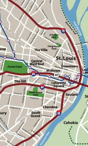
As I’ve done for the last month, this is another post on potential development sites along the proposed initial route of the St. Louis Streetcar. The sections already reviewed are as follows:
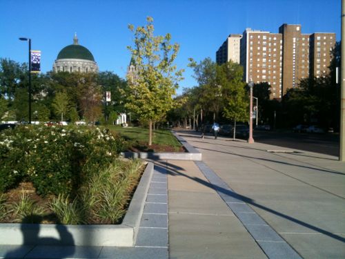
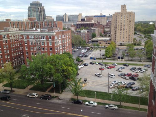
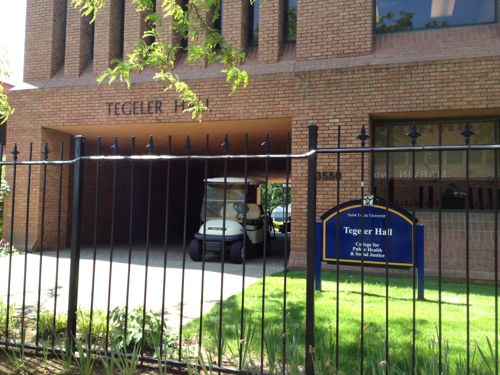
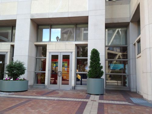
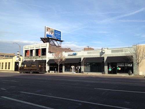
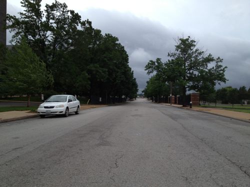
This post continues west to the end of the first phase of the route, starting at Lindell & Vandeventer to Lindell & Taylor, south on Taylor to Children’s place at the BJC hospital complex and next to the Central West End MetoBus Transit Center & MetroLink station (map).
Longtime readers know I’ve advocated a modern streetcar line for years connecting Downtown, Midtown/Grand Center, Central West End, and the Loop. My preferred route was to go north on Vandeventer then west on Delmar. I’d still like to see a streetcar on Delmar. Other options to go north from the current proposed route are at Sarah and/or Taylor. I’d like to see a decision made about future expansion so the track can be added onto without disrupting the Lindell route.
Anyway, here’s a look going west from Vandeventer:
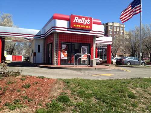
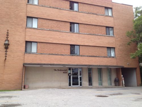
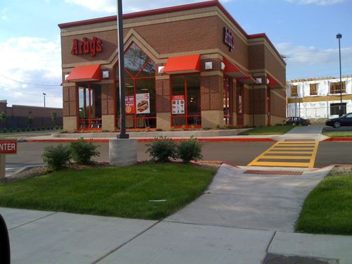
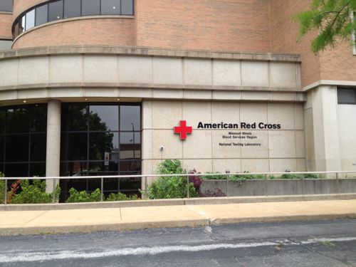
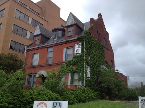
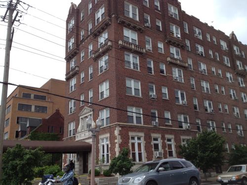
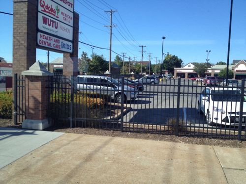
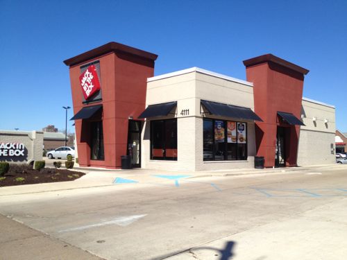
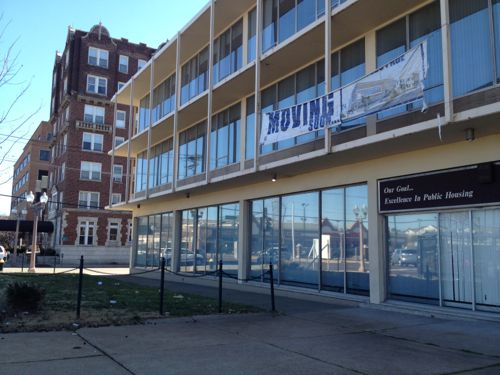
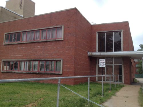
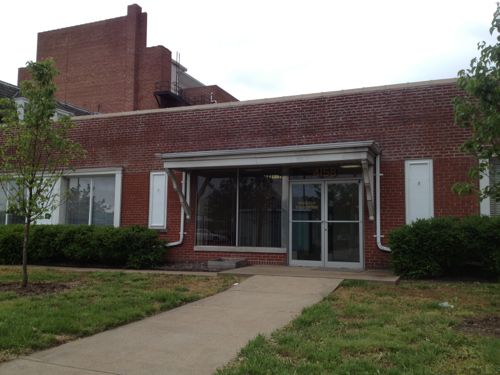
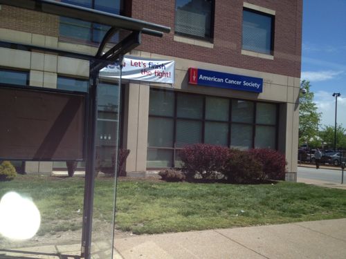
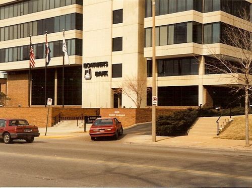
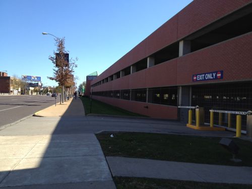
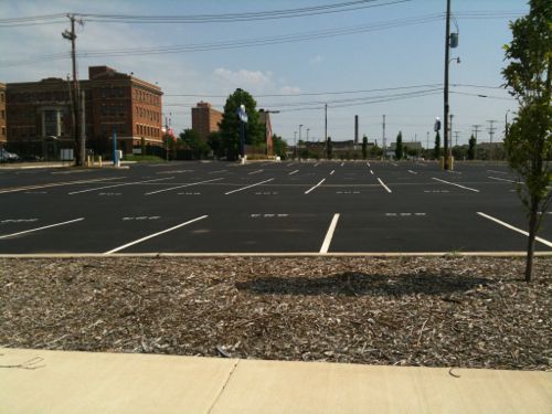
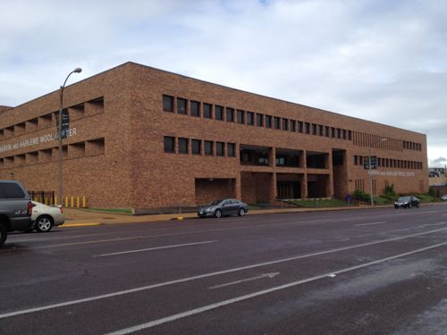
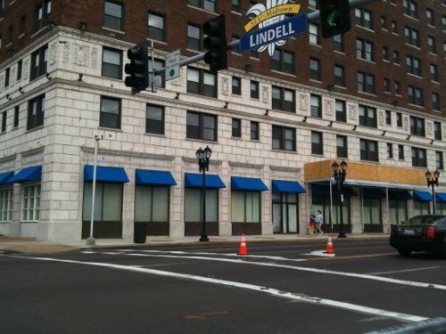
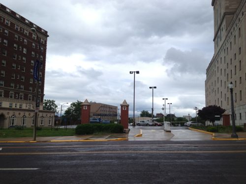
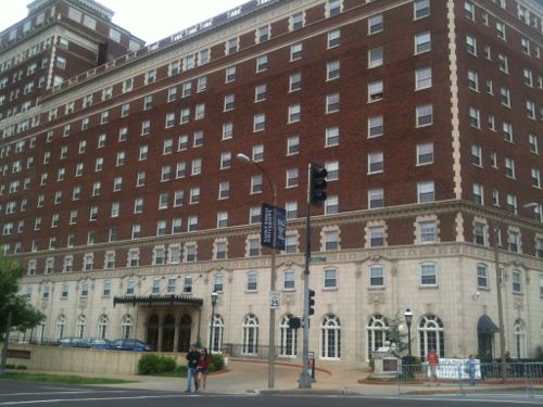
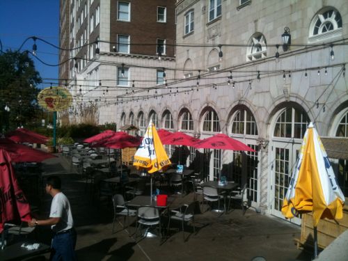
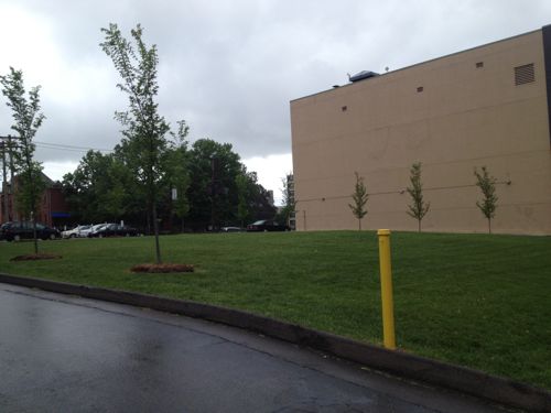
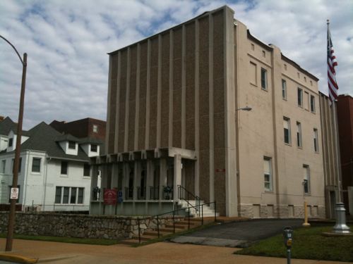
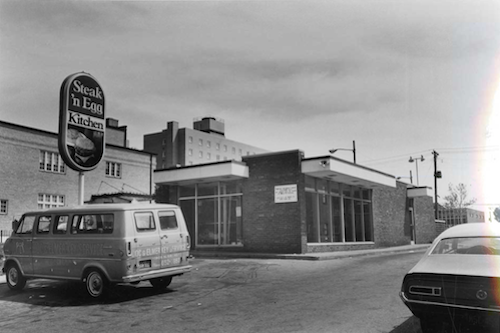
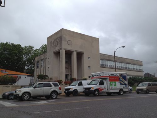
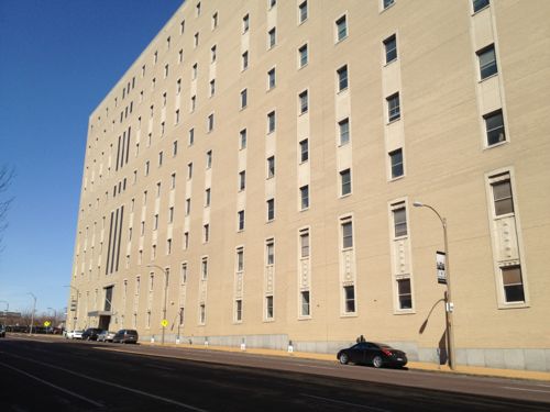
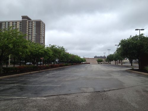
This Rally’s was built in 1993 on nearly a third of an acre site with streets on three sides (Lindell, Vandeventer, & McPherson. The land & building are owned by a firm in San Diego, CA. Given the short life expectancy of such a structure I’d expect a more urban building on this site in the first 5 years of the streetcar line.Next door the American Automobile Association of Missouri is renovating their iconic former headquarters building. CVS is building a drugstore on the west end of the site.The apartments at 3949 Lindell are being rebuilt after a 2012 fire, this is an August 2008 photo. More development of this scale will become the norm along the route, it’ll be a 10-20 year process, not overnight.A number of buildings occupy smaller lots on the south side of Lindell, these do a poor job of connecting with the sidewalkThis McDonald’s was built in 2008 on a site that is nearly an acre. McDonald’s owns the site so I wouldn’t expect to see a change for 20-30 years unless the land value increases dramatically and drive-thru sales collapseThis building, The Continental, was built in 1965. City records indicate it has 49 apartments. Density is good but it isn’t welcoming. New facade? Raze & replace?The Arby’s on Lindell, built in 2007, is also on nearly an acre siteThis American Red Cross building has good mass & density, but a poor relationship with the public sidewalk, typical for 1966.The former mansion at 4054 Lindell was built in 1896. It appears to be in decent condition so perhaps it’ll get a new owner or be razed for something more urban.The apartment building at 4066 Lindell, built in 1927, has 68 apartments. As is it provides affordable units, but renovation to go upmarket is possible, displacing low-income tenants in the process.The part of Lindell Marketplace on the east side of Sarah sits on 4.8 acres. The will get razed & redeveloped into a dense mixed-use site before the larger site to the west due to fewer tenants to inconvenience.With three outlots included, Lindell Marketplace on the west side of Sarah has 9.3 acres. It is bounded on all sides by public streets, built in 1986. Multiple ownership, anchor tenant Schnucks, and many small tenants complicate redevelopment.This Jack-In-The-Box at 4111 Lindell, built in 2011, occupies one of the three outlets.CVS wanted to raze the former Public Housing Authority building at 4100 Lindell but there was opposition. Hopefully it’ll get a nice renovation that respects the original 1957 design. I picture a ground floor restaurant with a lush patio out front, offices or apartments 0n upper floors.The 1948 building next door is more likely to get replaced than renovated.4158 Lindell is from 1948 but I see no reason why a developer shouldn’t raze it and build a mixed-use building. The Leonardo Apartments to the west is on a smaller lot and contains 34 apartments.The Walgreens at 4200 Lindell was built in 2002 on a massive 1.8 acre site. I see this as being a perfect location for Walgreens’ new upscale urban flagship format, complete with a fresh sushi bar, in a multi-story mixed-use building. Click photo for article about this new format.I’d like to see the American Cancer Society lease part of their ground floor to activate the NW corner of Lindell & Whittier StThis one-story branch bank was built in 1995 when SLU bought & razed the branch at Lindell & Grand. The site is 0.75 acres.In 2009 the San Luis Hotel was razed for a parking lot. Hopefully we’ll eventually see a new building on this siteThe Boatman’s Bank on Lindell in 1990-91, now a Bank of America, is very disconnected to Lindell.The NE corner of Lindell & Euclid was built in 1968. A high-rise was planned for this site when the economy crashed.The SW corner of Lindell & Euclid has been a parking lot for 20+ yearsThe parking lots on the east side of Kingshighway should also be considered for developmentThe west end of phase 1 would be next to the open air CWE MetroBus Transit CenterThis street would be the initial west end point, nearly zero development potential unless you’re willing to raze a garage built in 1994
There’s much more development potential here than I originally thought, but with mixed-use projects like 3949 Lindell and the planned City Walk (with a Whole Foods) it could be argued the streetcar is needed in other areas to get development rolling.
Future installments in this series will look at:
Development potential in the downtown central business district
Some challenge/changes the streetcar will create
And a poll(s) on routes for future expansion
Still, I’m excited by the transit the streetcar could provide as well as the level of development it could spur.
Map source: Explore St. Louis, click to view original
Lately I’ve been posting about the St. Louis Streetcar, a proposed modern streetcar line that’d primarily serve the central corridor from Downtown west to the Central West End. Though the proposed streetcar route includes a spur into North St. Louis, I believe north & south sides of the city have tended to get the short end of the transit infrastructure stick. Our Metrolink light rail opened 20 years ago serving the central part of the city, and the streetcar will double-down on this area.
I’ll personally benefit since I live downtown, but I’d like better transit options for reaching destinations in north & south city. I recognize many people might live say in north city but work in south city, or vice versa. Existing bus routes like the #70 (Grand) only partially fills the transit needs of the city.
Improvement options I’ve listed in the poll are:
Nothing, doesn’t need improving
Run existing buses more frequently
Reduce/eliminate fares
Bigger articulated buses for the busiest routes
Buses that go from diesel in the county to electric via overhead wires in the city
Bus rapid transit (BRT) lines serving city neighborhoods
In-street modern streetcar lines serving city neighborhoods
In-street light rail lines running through the city to connect to the county
These answers will be presented in random order in the poll (right sidebar), you can select up to 3 choices. You’ll have the option to provide your own answer as well.
A number of years ago East-West Gateway Council of Governments studied light rail lines through North & South St. Louis to reach North & South St. Louis County, respectively, but it went no further.
So please vote in the poll, located to the right, and share your thoughts in the comments below. I’ll share my views when I post the poll results on Wednesday July 3rd.
As I’ve done for the last month, this is another post on potential development sites along the proposed initial route of the St. Louis Streetcar. The sections already reviewed are as follows:
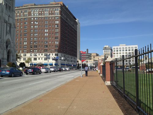
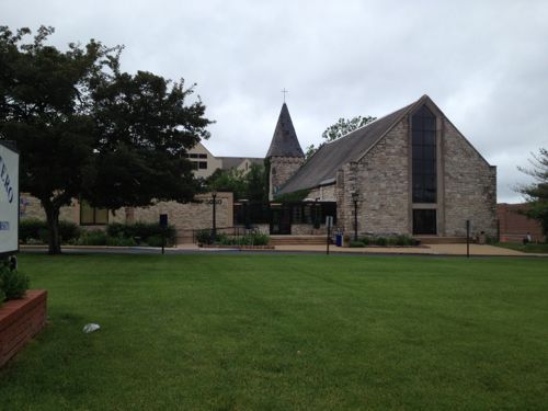
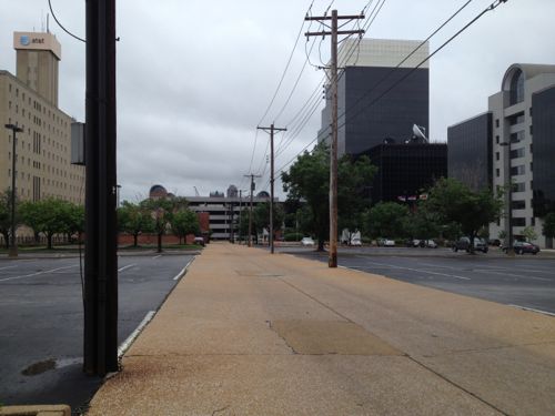
This post will cover the section from Olive & Compton to Lindell & Vandeventer (map). For those unfamiliar with the area, Olive splits off to the north but to motorists Olive becomes Lindell (pronounced Lindle). The entire south side of this stretch of Olive/Lindell is the campus of Saint Louis University (SLU). The north is a mix of SLU, private, and institutional properties.
We’ll start at Compton and head west.
Massive SLU parking garage could be fronted with a shallow “liner building” to create a relationship with the sidewalk.
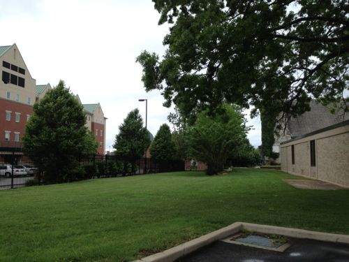
The buildings & land on the other side of Lindell from SLU’s Compton Garage are ripe for development, I’m just lacking images of them.
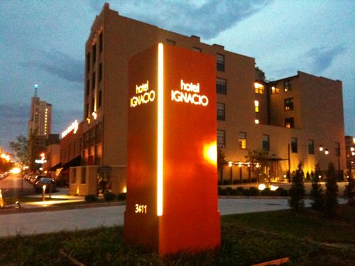
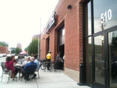
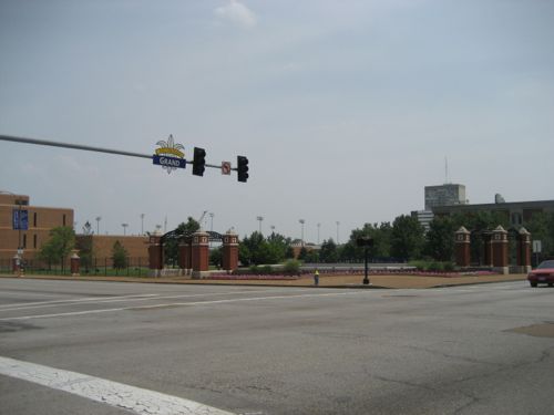
The intersection where Olive splits off to the right was redone a few years ago.gLooking the opposite directionIt shouldn’t take a streetcar to make it safeHotel Ignacio is just part of the development activity that has taken place here.The Field House Pub & Grill at 510 N. Theresa is an example of positive things already underway in MidtownThe streetcar can help the existing momentum and reduce the need for the excessive amount of surface parking.SLU could reskin this former state office building at 3545 Lindell, adding storefronts and new floors.The SLU campus east of Grand has a prison feel, fences everywhere. SLU could remove the fencing to connect to the street, like the campus west of Grand.With a new building on the right, street trees along Grand would make this a pleasant route to take to reach the streetcarIdeally SLU will build a new building on the SE corner of Lindell @ GrandAs well as the NE corner. I’d love to see a Trader Joe’s on the ground floor, with apartments above.
The corner of Lindell & Grand should get major new buildings. There are already substantial buildings in the area, especially to the north & west. These two corners were land banked by SLU so the streetcar is the perfect time to withdraw them and put them to good use activating the intersection.
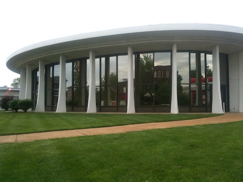
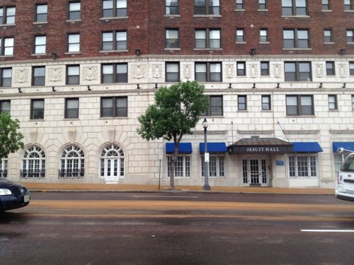
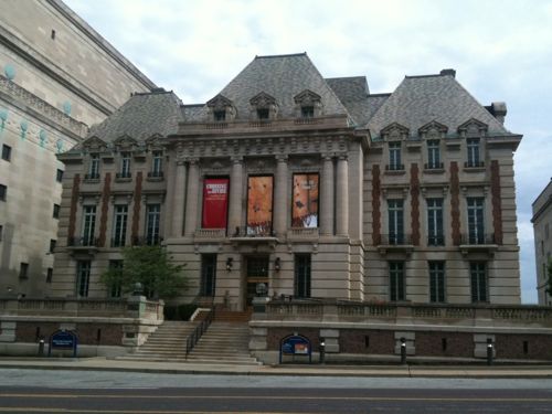
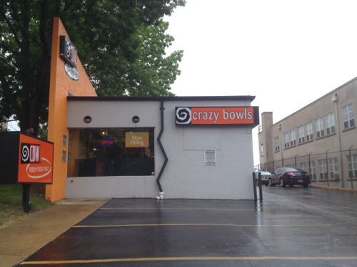
I’d love to see the ground floor of Jesuit Hall activated with a cafe or bakeryThe Lindell facade of Jesuit Hall also has opportunities for activity.The Masonic garage on Olive is awful, I can’t see this staying long-termThis section of Lindell has some stunning buildings, this is SLU’s museumThe few gaps can be filled in with massive structures, student housing over retail would be nice at Lindell & SpringMaybe we can widen the sidewalks along SpringEventually the owner of the auto repair shop at 3699 Olive @ Spring will retire and sell.The Coronado was vacant for years until the Gill’s renovated.Hopefully someone will find the right formula for the lower level space, several places have failedA few years ago SLU razed two buildings here to make room for expansion of the law school. With the law school opening downtown this land plus the old law school are availableThe various modifications to the 1914 structure at 3765 Lindell has made it rather odd looking.The Crazy Bows & Wraps location might be developed. This 1961 structure was extensively remodeled in the 90s.In 1978 it was mentioned in the Midtown Historic District nomination as a “unfortunate intrusion which should not have been allowed”, click image to view district nomination.This building, originally built for the Brotherhood of Railway & Airline Clerks, contributes to the 1978 midtown historic district. This building should be saved as it contributes to both Lindell & Vandeventer.
An interesting paragraph from the 1978 midtown nomination:
Unfortunately, Midtown is still perceived by many as a dangerous area riddled with street crime and all manner of urban ills, the most prominent of which is the current “black sploitation” fare served at the Fabulous Fox. In spite of this onus, a 1977 walking tour sponsored by the St. Louis Chapter of the American Institute of Architects and New Town/St. Louis, Inc. drew hundreds of curious and concerned
St. Louisans to Midtown. The solution for the revitalization of existing structures and the continuing education of the general public will not be easy, but to abandon Midtown is to dismiss one of the strongest concentrations of architecturally significant buildings in St. Louis.
There is more developable area north of Lindell and west of Spring, both vacant buildings and vacant land.
Retailing isn’t easy, successful brick & mortar retailers hire consultants, question focus groups, and study market trends, to get customers through the door. Store design is an important part of the equation. Many firms specialize in retail design.
I covered this topic last August after a seeing the transit agency store in Dallas (see Transit Visibility: Metro vs DART). Metro’s MetroRide store on Washington Avenue is pathetic.
Last August I showed this pic to help illustrate the problem. Which entrance is the transit store?Obviously this one, right?
Each time I visit the MetroRide store to buy transit passes I realize it is the result of a quasi-government agency that has zero competition. Where is the hungry merchant trying to drum up sales to cover the rent payment? It’s like the exclusive restaurant
I took this similar pic a few days ago, it was impossible to even tell if the lights were on.
Sure, those of us who seek it out don’t need a big neon sign or even a simple “open” sign in the window, but it might help get the attention of others walking by. Tourists might inquire about the downtown trolley and what else they can see without a car.
I’d like to see Metro make it obvious to anyone walking, or driving, past the MetroRide store to know it is a place to buy transit passes and pick up schedules. As a fan of gift shops, I’d also like to see St. Louis transit-related merchandise: t-shirts, postcards, magnets, calendars, etc. I still have a puzzle of the Philly transit map I bought on vacation in 2001, but I have almost nothing for St. Louis. I’d love a toy MetroBus.
This is the fifth post in a series looking at potential development sites along the proposed initial route of the St. Louis Streetcar. The first four parts were:
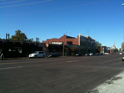
This post will cover the 0.6 mile stretch of Olive from Jefferson to Compton (map). Let’s start with the North side of Olive at Jefferson:
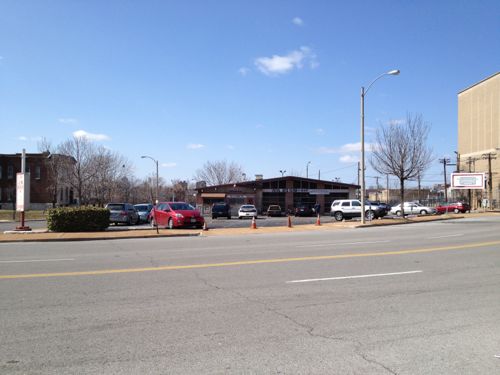
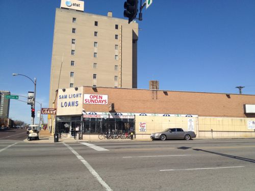
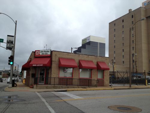
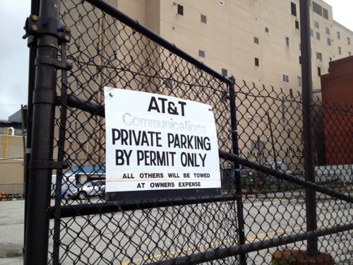
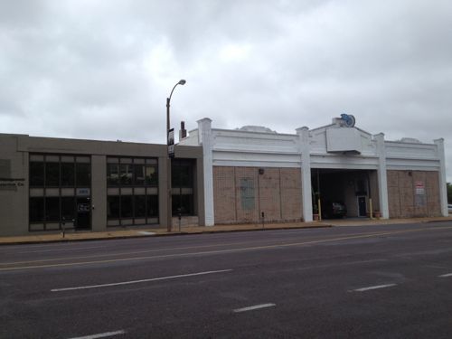
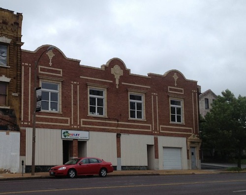
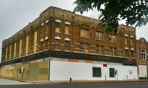
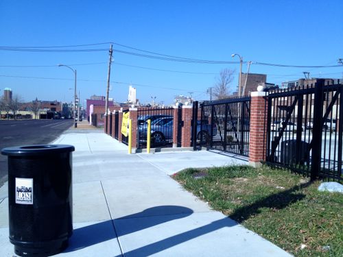
2601 Olive, well known as Sam Light Loans, was built in 1924, according to city records. I wonder if the building got a makeover in the 40s or 50s, it looks too modern foe the 20s.I posted about 2617 Olive in March 2012, it dates to 1883. Click image to see my prior post.AT&T recently built an addition on the long-vacant lot at 2621 OliveThat addition was on the east side of this AT&T Communications building at 2651 OliveThe small insurance office at Locust & Jefferson was built in 1956.AT&T owns much of the block on both sides of Locust, used for parking.Across the street is more AT&T parking on the left. Loft apartments on Washington Ave can be seen in the background.The Wells Fargo lot between Beaumont & Leffingwell could be easily developed if many employees begin riding the streetcar. Perhaps give them the option of a parking pass or a transit pass… More on Wells Fargo when I get to the south side of Olive below.The building on the left is from 1929, the one on the right from 1913. A vacant 30ft lot is to the right @ Leffingwell.2823 Olive was built in 1880, though set back from the street it would be an interesting contrast to keep this structure, while filling in on each side. The side on the left belongs to the next property to the west.This 1925 building at 2831 Olive would look even better with a new glass storefront….and a rooftop restaurantThe Castle Ballroom should get renovated with a streetcar right out front. Click image to see my post from 2011.These buildings in the 29xx block of Olive no longer look like they did 100+ years agoThe Locust Business District recently completed a fenced surface parking lot, this needs to be replaced ASAPThe Treasurer’s parking lot at 3019 Olive also needs a building, not a garage.At Cardinal Ave we have a one story structure from 1997, too new to replace right awayThe last buildings on the north side of Olive before Compton
Some existing buildings aren’t as tall as would be nice but their age/height will be a nice contrast to the new construction we should see go up over the twenty years. In short, lots of opportunities for new construction on vacant land.
OK, let’s cross Olive at Compton and return east to Jefferson. It would be impossible to look at this section of the proposed route without discussing the urban renewal clearance of Mill Creek Valley:
By World War II, Mill Creek’s tenements and faded town houses were home to nearly 20,000 people, many of them poor blacks who had migrated north from the cotton fields. More than half the dwellings lacked running water, and 80 percent didn’t have interior bathrooms.
Tucker proposed knocking over nearly everything and starting over. In 1955, city voters overwhelmingly approved a $10 million bond issue for demolition, on the promise that the federal government would reimburse most of it. The local NAACP endorsed the idea. Work began on Feb. 16, 1959, at 3518 Laclede Avenue, where a headache ball smashed a house that dated to the 1870s.
The bulldozers swiftly transformed the city’s “No. 1 Eyesore” into an area derided as “Hiroshima Flats.” Among the few buildings spared was the old Vashon High School, now part of Harris-Stowe State University. When work began in 1961 on University Heights Village apartments, only 20 original families still called Mill Creek home. (stltoday.com – A look back • Clearing of Mill Creek Valley changed the face of the city)
The area from Union Station to Grand was cleared. This area got new construction like the A.G. Edwards HQ, now Wells Fargo Advisors, LaClede Town (razed), Heritage House senior apartments, and the “flying saucer” gas station on Grand at Forest Park, now a Starbucks. n
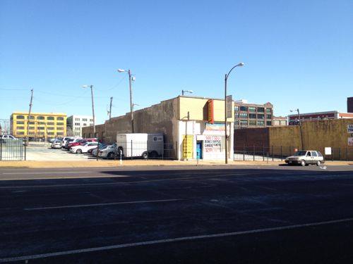
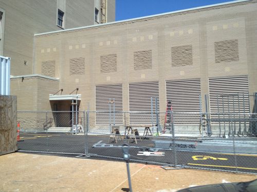
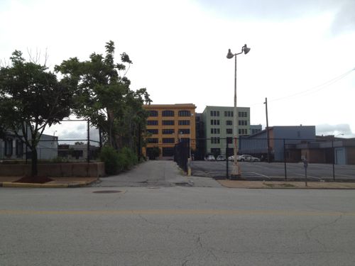
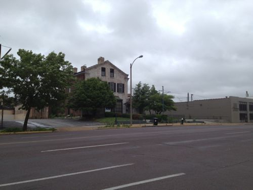
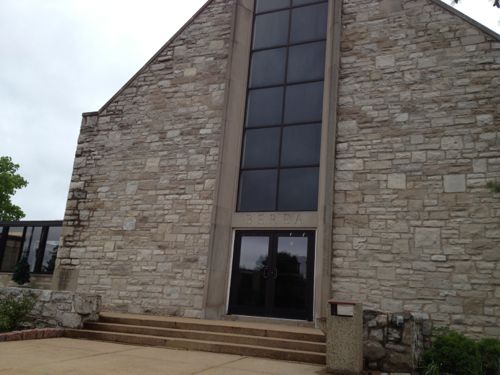
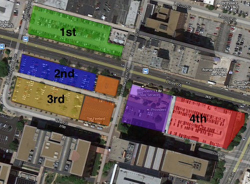
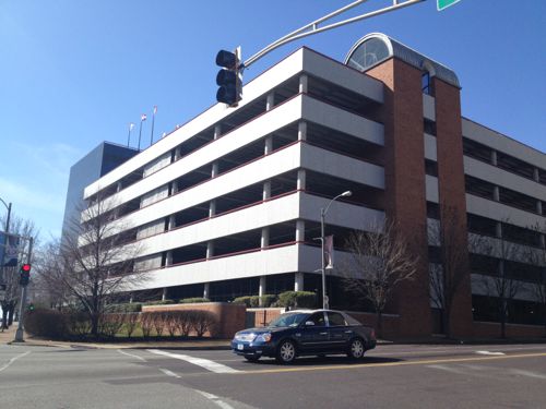
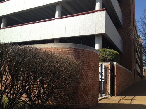
The block between Cardinal & ComptonThis facade was built after the front of the building was removed when Olive was widened. I’d like to see this endureA pocket park along the route would be nice, if it could be accessed.The former Berea Presbyterian Church is now a SLU event spaceThe central glass on the front of this church always looked too modern but I never knew the story.February 1909 Sanborn Map showed the stone (blue) church at 3015 Pine (vacated), between Garrison (vacated) on the east and Cardinal (dead end) on the west. The end facing Olive today was the back! Click image to see more of this map.I’d like to see Pine St replatted from Jefferson to Compton, it would go right through here.Sigma-Aldrich owns the land from the old church to Ewing. Given how the land is platted and fenced it appears they’re leaving a strip along Olive for future development.Ewing Ave looking south toward Market. Wells Fargo Advisors on the left, Sigma-Aldrich on the right. This too-wide street should be lined with storefronts catering to employees of both businesses, as well as students, faculty, & staff at Harris-Stowe, and residents at Heritage House.A non-propfit was formed in 1964 to build & operate low-income senior apartments, Heritage House opened in 1967.The building is well maintained but not well connected to OliveI’d like to see an addition between the sidewalk and tower with underground parking, street-level retail, 2nd floor apartments.An alley remains between Olive & Pine. I can imagine both sides being infilled over the coming decades, see diagram below.My thought of the order Wells Fargo might instill parking lots and finally raze a parking garage. The two orange squares are owned by the Beffa family, the purple by Provident.A parking garage for Wells Fargo Advisers dominates the intersection of Jefferson & Olive.A brick wall sorta hides equipment
I’m excited about the possibly having a modern streetcar line a block away from my loft, but the redevelopment potential in midtown is phenomenal. I’ve been losing sleep for the past week as I picture what this could look like at full build out. The vision must come before the bricks and mortar.
AARP Livibility Index
The Livability Index scores neighborhoods and communities across the U.S. for the services and amenities that impact your life the most
Built St. Louis
historic architecture of St. Louis, Missouri – mourning the losses, celebrating the survivors.
Geo St. Louis
a guide to geospatial data about the City of St. Louis