This is the fifth post in a series looking at potential development sites along the proposed initial route of the St. Louis Streetcar. The first four parts were:
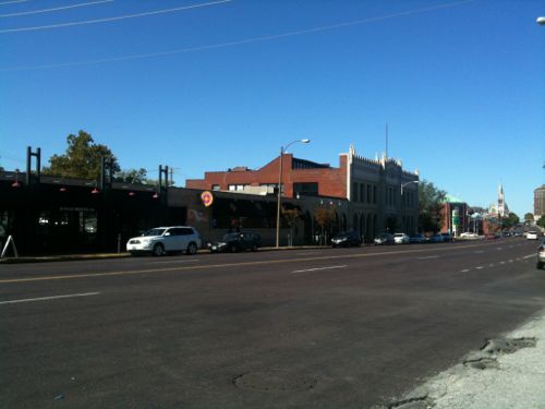
This post will cover the 0.6 mile stretch of Olive from Jefferson to Compton (map). Let’s start with the North side of Olive at Jefferson:
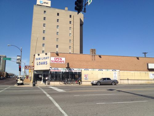
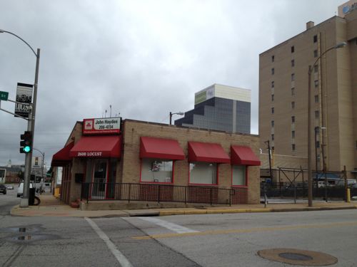
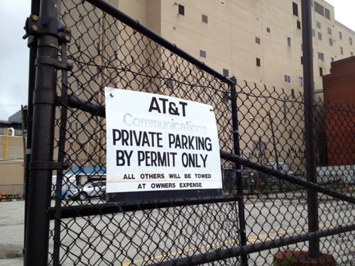
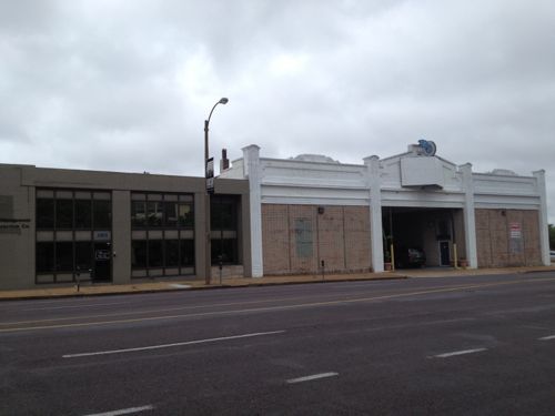
2601 Olive, well known as Sam Light Loans, was built in 1924, according to city records. I wonder if the building got a makeover in the 40s or 50s, it looks too modern foe the 20s.I posted about 2617 Olive in March 2012, it dates to 1883. Click image to see my prior post.AT&T recently built an addition on the long-vacant lot at 2621 OliveThat addition was on the east side of this AT&T Communications building at 2651 OliveThe small insurance office at Locust & Jefferson was built in 1956.AT&T owns much of the block on both sides of Locust, used for parking.Across the street is more AT&T parking on the left. Loft apartments on Washington Ave can be seen in the background.The Wells Fargo lot between Beaumont & Leffingwell could be easily developed if many employees begin riding the streetcar. Perhaps give them the option of a parking pass or a transit pass… More on Wells Fargo when I get to the south side of Olive below.The building on the left is from 1929, the one on the right from 1913. A vacant 30ft lot is to the right @ Leffingwell.2823 Olive was built in 1880, though set back from the street it would be an interesting contrast to keep this structure, while filling in on each side. The side on the left belongs to the next property to the west.This 1925 building at 2831 Olive would look even better with a new glass storefront….and a rooftop restaurantThe Castle Ballroom should get renovated with a streetcar right out front. Click image to see my post from 2011.These buildings in the 29xx block of Olive no longer look like they did 100+ years agoThe Locust Business District recently completed a fenced surface parking lot, this needs to be replaced ASAPThe Treasurer’s parking lot at 3019 Olive also needs a building, not a garage.At Cardinal Ave we have a one story structure from 1997, too new to replace right awayThe last buildings on the north side of Olive before Compton
Some existing buildings aren’t as tall as would be nice but their age/height will be a nice contrast to the new construction we should see go up over the twenty years. In short, lots of opportunities for new construction on vacant land.
OK, let’s cross Olive at Compton and return east to Jefferson. It would be impossible to look at this section of the proposed route without discussing the urban renewal clearance of Mill Creek Valley:
By World War II, Mill Creek’s tenements and faded town houses were home to nearly 20,000 people, many of them poor blacks who had migrated north from the cotton fields. More than half the dwellings lacked running water, and 80 percent didn’t have interior bathrooms.
Tucker proposed knocking over nearly everything and starting over. In 1955, city voters overwhelmingly approved a $10 million bond issue for demolition, on the promise that the federal government would reimburse most of it. The local NAACP endorsed the idea. Work began on Feb. 16, 1959, at 3518 Laclede Avenue, where a headache ball smashed a house that dated to the 1870s.
The bulldozers swiftly transformed the city’s “No. 1 Eyesore” into an area derided as “Hiroshima Flats.” Among the few buildings spared was the old Vashon High School, now part of Harris-Stowe State University. When work began in 1961 on University Heights Village apartments, only 20 original families still called Mill Creek home. (stltoday.com – A look back • Clearing of Mill Creek Valley changed the face of the city)
The area from Union Station to Grand was cleared. This area got new construction like the A.G. Edwards HQ, now Wells Fargo Advisors, LaClede Town (razed), Heritage House senior apartments, and the “flying saucer” gas station on Grand at Forest Park, now a Starbucks. n
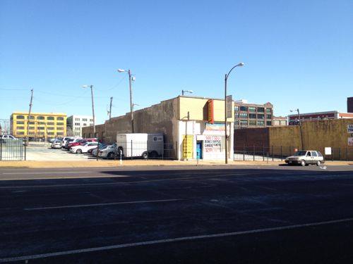
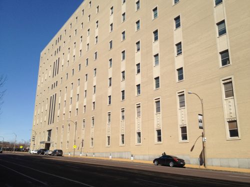
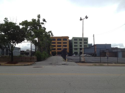
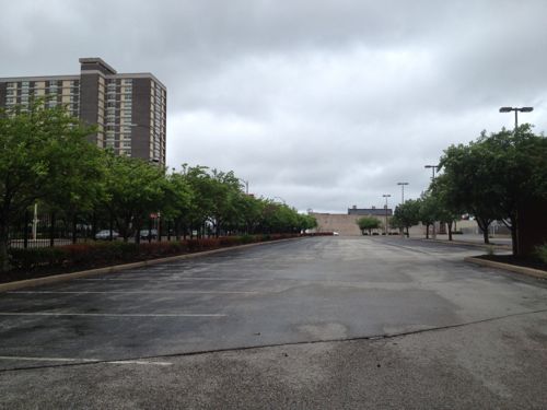
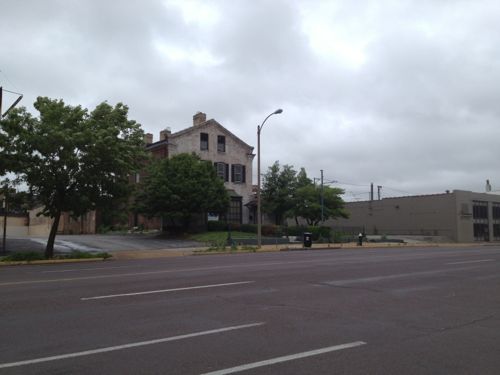
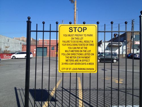
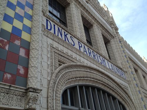
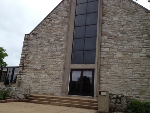
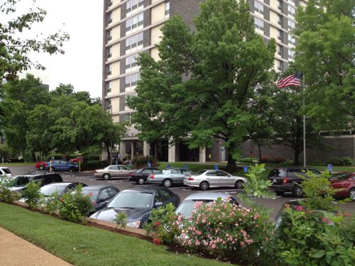
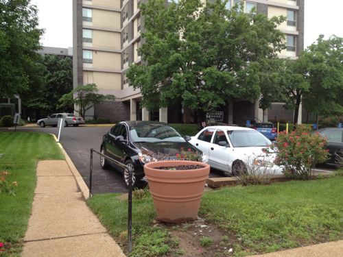
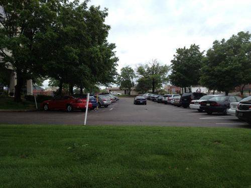
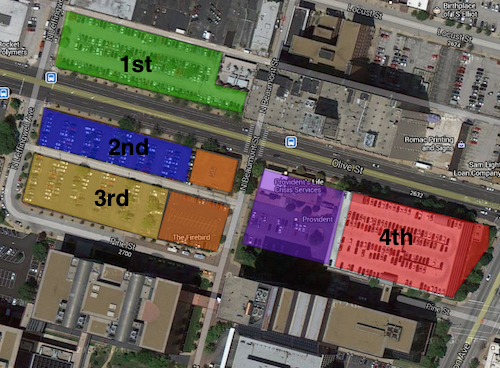
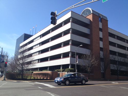
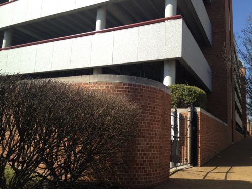
The block between Cardinal & ComptonThis facade was built after the front of the building was removed when Olive was widened. I’d like to see this endureA pocket park along the route would be nice, if it could be accessed.The former Berea Presbyterian Church is now a SLU event spaceThe central glass on the front of this church always looked too modern but I never knew the story.February 1909 Sanborn Map showed the stone (blue) church at 3015 Pine (vacated), between Garrison (vacated) on the east and Cardinal (dead end) on the west. The end facing Olive today was the back! Click image to see more of this map.I’d like to see Pine St replatted from Jefferson to Compton, it would go right through here.Sigma-Aldrich owns the land from the old church to Ewing. Given how the land is platted and fenced it appears they’re leaving a strip along Olive for future development.Ewing Ave looking south toward Market. Wells Fargo Advisors on the left, Sigma-Aldrich on the right. This too-wide street should be lined with storefronts catering to employees of both businesses, as well as students, faculty, & staff at Harris-Stowe, and residents at Heritage House.A non-propfit was formed in 1964 to build & operate low-income senior apartments, Heritage House opened in 1967.The building is well maintained but not well connected to OliveI’d like to see an addition between the sidewalk and tower with underground parking, street-level retail, 2nd floor apartments.An alley remains between Olive & Pine. I can imagine both sides being infilled over the coming decades, see diagram below.My thought of the order Wells Fargo might instill parking lots and finally raze a parking garage. The two orange squares are owned by the Beffa family, the purple by Provident.A parking garage for Wells Fargo Advisers dominates the intersection of Jefferson & Olive.A brick wall sorta hides equipment
I’m excited about the possibly having a modern streetcar line a block away from my loft, but the redevelopment potential in midtown is phenomenal. I’ve been losing sleep for the past week as I picture what this could look like at full build out. The vision must come before the bricks and mortar.
— Steve Patterson
Currently there are "32 comments" on this Article:
ASAP (as soon as possible) isn’t the same as immediately. In this context it means opening day of the streetcar the lot should be closed and construction about to begin on a new building.
Agree, a wealth of opportunity. Also agree that “The vision must come before the bricks and mortar.” You have yours, others have theirs and I’m pretty sure that the individual property owners have their own plans and “visions”. Who is going to lead this discussion? Who gets to decide? “The Locust Business District [that] recently completed a fenced surface parking lot”?! When will it move from random thoughts to a cohesive plan? And, most importantly, when will it move from talk to action? The density you’re envisioning is at least a tenfold increase over present densities, and probably twice any historic precedents. It’s not impossible – see New Town St. Charles – but will a streetcar be enough to focus development along this stretch of Olive instead of, say, Washington?
I don’t disagree with your vision – it would be great to see the CWE recreated all the way between Tucker and Kingshighway – there just doesn’t seem to be any sort of economic justification for doing so. Other segments are closer to existing activity centers, so it would require creating a new focus, here, to justify the investments you want to see happen IF they’re going to happen concurrently with, or prior to, investments that would naturally occur closer to downtown or Grand. Add in that the existing major institutional users (Wells Fargo, Harris Stowe, AT&T, the senior non-profit) apparently are more focused on “securing” their facilities than in creating an inviting, accessible streetscape and you have some significant hurdles to overcome along this stretch of the proposed route.
And one side observation – “At Cardinal Ave we have a one story structure from 1997, too new to replace right away.” This would be nearly a decade after the ADA took effect, yet the front entrance appears to be inaccessible, and its back door is truly a back door, albeit apparently at grade . . . .
Just to add to the texture of the discussion, understand that the Locust Business District is sort of in a competition with the young turk promoters of “Midtown Alley” (Google it) for leadership/vision control of the Locust area. JZ, your question from the first paragraph is the biggest question in just about every one of these “urbanist” issues: “Who is going to lead this discussion?”. Steve, re. polls and posts, a great topic for your readers would be just that.
That’s my point. I’m sure that they’ve been “involved”, but what does that really mean? Are they prepared to provide funding? Do they even have funds available? Have they provided venues for input from their constituents? Are they prepared to put zoning in place to reflect whatever vision East-West Gateway develops? When one goes to the East-West Gateway website – http://www.ewgateway.org/ – there is no apparent link to the project. The same goes when one goes to Metro’s – http://www.metrostlouis.org/Default.aspx – this mostly seems to be happening behind closed doors and in a vacuum, much like most “public” projects around the region.
I’m seeing a different pattern from prior years, earlier inclusion of all parties: early buy-in to a shared vision vs working in isolation. Leadership can change, they don’t need naysayers thinking they haven’t.
The reason they have “naysayers thinking they haven’t” is because there isn’t much evidence that anything has changed! I’m not seeing the same patterns that you are. Yes, there are a few aldermen that “get it” (Ogilvie, French), but overall it still just seems like business as usual. We have two streetcar lines being proposed that do little to actually improve transit or mobility in the city, much less the region. And while both lines can/might serve as catalysts for development along their respective corridors, if they don’t function as viable parts of a larger system, they will remain just local circulators. If we really want to jump start development, we should be focusing on providing development incentives downtown, instead of trying to draw development away from the CBD! Density, density, density!
I’m totally baffled how you can think this streetcar will “do little to actually improve transit or mobility in the city.” It will transform the area along the route, convincing many to use transit daily.
You and I have different views on transit vehicles. I see streetcars as little more than buses that run on tracks. You seem to see streetcars as some sort of magic elixir, that will convince people who don’t ride buses now to change their ignorant ways. My real world experience is that the vehicle is secondary, and that the best way to get people to embrace transit is to make it cheap/free to ride, operate very frequently and provide easy connections to a robust web of routes so riders can get to where they want to go, nearly as quickly as they can drive. Both streetcar proposals will do little of either. The Loop Trolley will require a separate fare, won’t be running during the morning rush hour and won’t offer transfers to Metro’s system. This proposal just replaces an existing bus route with a different type of vehicle, at a significant increase in cost, with no increase in service levels. Sure, they will both attract people to “check them out”, once or a few times, but neither one seems poised to convert a lot of people into daily riders.
My real world experience of studying transit in the US shows the general population 1) has a negative perception of the bus, as well as those who ride them 2) a general appreciation for rail as a mode 3) the permanence of a modern streetcar line combined with modern land-use regulations can spur development.
Agree on all three points, with the added caveat that the streetcar lines need to be a functional part of a larger transit system. Point one – more true here than in many other areas. Point two, this applies more to infrequent riders or riders going longer distances; not so much for local services. Point three – “can” is the operative word; it’s a part of the equation, not just the sole answer.
This proposal comes a lot closer than the Loop Trolley does, although the Loop line is much further along – its success or failure will color any future efforts in the region, including this one.
You ask a person on a nice day if they’d like to walk, take a bus, or take a modern streetcar to reach a destination 6 blocks away few will say bus. Some will say walk but most would say streetcar.
I’m working to help make sure all the pieces come together in this so it is a success.
And if you ask them if they want to ride a free bus that runs every few minutes (16th Street Mall Shuttle in Denver) or if they want to wait ten minutes and pay a $1 or $2 fare to ride a streetcar and the equation changes, significantly! Resources are limited, you can either invest in infrastructure or you can invest in service . . . . http://www.rtd-denver.com/FREEMallRide.shtml
J271 said: “If we really want to jump start development, we should be focusing on providing development incentives downtown, instead of trying to draw development away from the CBD! Density, density, density!”
I *think* I disagree on this point.
The reason (okay, A REASON) why downtown is somewhat stagnant is that it exists as an island. North, south, east and west there is a divide — be it racially, psychologically, geographically, infrastructurally or other — that prevents downtown from truly being the City center it should be. Develop downtown all you want in downtown and that divide will still exist.
Alternatively, by expanding the definition of downtown (psychologically, if not literally) by supporting/strengthening its edges and its connections to neighborhoods both nearby and far-flung, downtown becomes a stronger, more sustainable investment opportunity. I’d love to see the stretch of 14th get some city-centric development all the way up to Old North to (finally!) connect that dot and reduce the downtown island. Same goes with N/S Broadway, Chouteau, Gravois, Olive, Locust, etc (though it is happening organically moving west, thank god).
And this is coming from a guy who thinks that this newly-proposed streetcar line is pretty much bunk. As you said, it doesn’t integrate into any existing system, nor does it provide substantially more development incentive than what’s already there. If it leads to new deelopment along the proposed route — well, that’s great! — but I think instead the City should be working/encouraging others to fill in those blanks first, not supporting a duplicated line that takes a (just guessing here) vastly under-utilized streetcar past those blanks in the hopes someone will fill them in.
With streetcars and buses, one needs to remember how both technologies evolved. Both evolved from horse-drawn wagons. Streetcars are defined by steel wheels and steel rails. Propulsion evolved from horses, to steam-driven cables to electricity. Buses are defined by rubber tires and internal combustion engines. Tires evolved from hard rubber to natural rubber pneumatic to the synthetic rubber we see exclusively today. Internal combustion engines evolved from cranky (literally, hand cranked) gasoline to the clean diesel and CNG we see today.
The big difference (besides the obvious, rails versus no rails) is in how the reliability evolved during the 20th Century. Streetcars had a definite edge during the first quarter – coal-fired, steam-generated electricity and steel wheels on steel rails were far superior to what buses of that time could offer. Over the next quarter century, both internal combustion engines and pneumatic tires became much more reliable and, thus, much more cost effective, flexible and competitive with, or superior to, streetcars. In the last half of the century, controls evolved (power steering, power brakes, automatic transmissions on buses, computerized controls on streetcars) and air conditioning and low floor vehicles became common. Streetcars remain “more attractive” to some riders simply because they are unique, but for most riders, once the “new” wears off, it’s still all about the service, the more the better!
The real question, today, for any transit operation, is how many people do you want to move and how much flexibility do you want to have? Rail vehicles, in theory, can move more people because they can be longer. Buses are limited in length by state law and the physical limitations of operating on existing streets. Streetcars are also limited by the same physical constraints, even if they can be joined into multiple units. The real constraint for any urban system operating at street level is block length – you don’t want the back of the vehicle blocking a cross street when it’s picking up and discharging passengers at a designated stop, or just stopped at a traffic signal.
The other half of the equation is frequency – more, smaller vehicles allows more frequent service (attractive to riders) but requires more operators. Fewer, larger vehicles are more efficient but inevitably run less frequently, making them less attractive to (potential) riders. That will be the real challenge for any streetcar system – attracting enough riders to run frequently enough to continue to attract them, more than the current bus route, to justify the significantly-bigger investment. In contrast, light rail trains are only really limited by station platform length – Metro’s system can accommodate two vehicles while Denver’s and San Diego’s can accommodate four-unit trains, doubling capacity. Go to Chicago and their El and their commuter trains are even longer. This makes rail the clear winner for moving large numbers of passengers longer distances, but when it comes to operating smaller vehicles on city streets, it’s much less clear . . . .
A street car is certainly beneficial if used to compliment neighborhoods with the urban foundation already laid. The alderman’s of St louis have, however, put their own agendas ahead of the what would actually be beneficial towards growth. The proposed streetcar route is a joke. This isn’t an egg or chicken debate; simply adding a street car route to some of the more dangerous neighborhoods in St Louis is not going to spur development and growth, sorry. Bob living in his posh loft won’t be taking the street car through St Louis Ave, I dont care how progressive/Urban he thinks he is.
Using the streetcar to compliment what we already have would go much further to having people move back to the city and/or use more public transportation – A route starting near a downtown metro stop, going past Busch stadium and the convention center, near Wash Ave, up through Midtown past Saint Louis University, up to CWE and the hospitals / Forest Park and back.
Say what you want, but I think the streetcar going up so far on N 14th and N Florissant is a complete waste of money. There will be zero development up this way due to the streetcar. We need to work on getting businesses, jobs, development, and people back into the already developed, more dense parts of downtown.
Okay, so here is one view of STL “leadership”: Aldermen and their own personal agendas, weighted against the cynic “local” resident (who is very likely not a STL city resident at all!).
See, you shouldn’t assume. I am most certainly an STL city resident. Without a doubt, the streetcar route going into the North side will be a complete and utter waste of money.
Point taken, Donald. But you’d have to agree that some folks with the strongest views on what should happen in STL are indeed not City residents, but ex-pats who nonetheless feel some sort of ownership by virtue of having lived in one of the neighborhoods decades ago. In a region where only about 1 in 10 actually do live in the city, there’s plenty of that to go around. So back to leadership. Who should lead these discussions? People like Donald who seem to have a divine insight to future events in the STL?
I don’t have a ‘divine insight into future events’; I simply learn from history. And here we are, ready to repeat history. Waste more money on a project which is only going up to the North side because of politics. We all know that this isn’t the best and most efficient use of these street cars – this isn’t going to be the turning point that puts STL on the urban map of a Portland or Chicago. The taxpayers that are paying this bill are already skeptical; show them that bringing urban and downtown living can work by actually funding projects that work.
Are you referring to the history of failed revitalizations in Soulard, Benton Park and Lafayette Square? You do know that the smart money wrote off those areas too, correct? Or do you just write off the north side?
I disagree, if it connects downtown with the newly renovated 14th street mall & Crown Candy (and I mean if it runs directly down 14th to CC) then you’d have a magnet for people and a big shot in the arm for a neighborhood that is slowly coming back. This would raise property values for the neighborhood and help revitalize the area in between Old North and Downtown.
I do agree that the proposed route down 14th-Florissant is a waste of money.
It probably depends on who you talk to – there doesn’t appear to be any consensus or any sort of common vision, just a focus on getting “my” project done, to benefit “my” own little part of the region . . . .
St. Louis has extremely decentralized leadership. The board of East West Gateway is made up of leaders from all over the region, dominated by suburban interests. The city has a weak mayor and 29 mini mayors plus an independently elected comptroller and treasurer. Leaders line up behind easy projects, cheering on success, but shy away from tougher challenges. Give Slay credit – he has stood with McKee for years, in the face of much criticism. In a way, however, maybe out system of weak, decentralized leadership is a blessing. It’s hard to get anything done, and to do so requires running a citizen gauntlet that stretches from downtown to Wentzville.
AARP Livibility Index
The Livability Index scores neighborhoods and communities across the U.S. for the services and amenities that impact your life the most
Built St. Louis
historic architecture of St. Louis, Missouri – mourning the losses, celebrating the survivors.
Geo St. Louis
a guide to geospatial data about the City of St. Louis

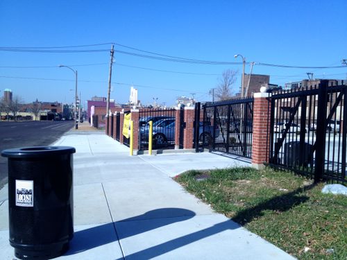

“The Locust Business District recently completed a fenced surface parking lot, this needs to be replaced ASAP”
Why so urgent? At least someone is currently using it. I would think the vacant buildings are a higher priority.
ASAP (as soon as possible) isn’t the same as immediately. In this context it means opening day of the streetcar the lot should be closed and construction about to begin on a new building.
Agree, a wealth of opportunity. Also agree that “The vision must come before the bricks and mortar.” You have yours, others have theirs and I’m pretty sure that the individual property owners have their own plans and “visions”. Who is going to lead this discussion? Who gets to decide? “The Locust Business District [that] recently completed a fenced surface parking lot”?! When will it move from random thoughts to a cohesive plan? And, most importantly, when will it move from talk to action? The density you’re envisioning is at least a tenfold increase over present densities, and probably twice any historic precedents. It’s not impossible – see New Town St. Charles – but will a streetcar be enough to focus development along this stretch of Olive instead of, say, Washington?
I don’t disagree with your vision – it would be great to see the CWE recreated all the way between Tucker and Kingshighway – there just doesn’t seem to be any sort of economic justification for doing so. Other segments are closer to existing activity centers, so it would require creating a new focus, here, to justify the investments you want to see happen IF they’re going to happen concurrently with, or prior to, investments that would naturally occur closer to downtown or Grand. Add in that the existing major institutional users (Wells Fargo, Harris Stowe, AT&T, the senior non-profit) apparently are more focused on “securing” their facilities than in creating an inviting, accessible streetscape and you have some significant hurdles to overcome along this stretch of the proposed route.
And one side observation – “At Cardinal Ave we have a one story structure from 1997, too new to replace right away.” This would be nearly a decade after the ADA took effect, yet the front entrance appears to be inaccessible, and its back door is truly a back door, albeit apparently at grade . . . .
Just to add to the texture of the discussion, understand that the Locust Business District is sort of in a competition with the young turk promoters of “Midtown Alley” (Google it) for leadership/vision control of the Locust area. JZ, your question from the first paragraph is the biggest question in just about every one of these “urbanist” issues: “Who is going to lead this discussion?”. Steve, re. polls and posts, a great topic for your readers would be just that.
East-West Gateway, the region’s MPO (Metropolitan Planning Organization), will take the lead.
And our city’s Board of Aldermen and Planning Department will follow?
They’ve been involved since the start.
That’s my point. I’m sure that they’ve been “involved”, but what does that really mean? Are they prepared to provide funding? Do they even have funds available? Have they provided venues for input from their constituents? Are they prepared to put zoning in place to reflect whatever vision East-West Gateway develops? When one goes to the East-West Gateway website – http://www.ewgateway.org/ – there is no apparent link to the project. The same goes when one goes to Metro’s – http://www.metrostlouis.org/Default.aspx – this mostly seems to be happening behind closed doors and in a vacuum, much like most “public” projects around the region.
I’m seeing a different pattern from prior years, earlier inclusion of all parties: early buy-in to a shared vision vs working in isolation. Leadership can change, they don’t need naysayers thinking they haven’t.
The reason they have “naysayers thinking they haven’t” is because there isn’t much evidence that anything has changed! I’m not seeing the same patterns that you are. Yes, there are a few aldermen that “get it” (Ogilvie, French), but overall it still just seems like business as usual. We have two streetcar lines being proposed that do little to actually improve transit or mobility in the city, much less the region. And while both lines can/might serve as catalysts for development along their respective corridors, if they don’t function as viable parts of a larger system, they will remain just local circulators. If we really want to jump start development, we should be focusing on providing development incentives downtown, instead of trying to draw development away from the CBD! Density, density, density!
I’m totally baffled how you can think this streetcar will “do little to actually improve transit or mobility in the city.” It will transform the area along the route, convincing many to use transit daily.
You and I have different views on transit vehicles. I see streetcars as little more than buses that run on tracks. You seem to see streetcars as some sort of magic elixir, that will convince people who don’t ride buses now to change their ignorant ways. My real world experience is that the vehicle is secondary, and that the best way to get people to embrace transit is to make it cheap/free to ride, operate very frequently and provide easy connections to a robust web of routes so riders can get to where they want to go, nearly as quickly as they can drive. Both streetcar proposals will do little of either. The Loop Trolley will require a separate fare, won’t be running during the morning rush hour and won’t offer transfers to Metro’s system. This proposal just replaces an existing bus route with a different type of vehicle, at a significant increase in cost, with no increase in service levels. Sure, they will both attract people to “check them out”, once or a few times, but neither one seems poised to convert a lot of people into daily riders.
My real world experience of studying transit in the US shows the general population 1) has a negative perception of the bus, as well as those who ride them 2) a general appreciation for rail as a mode 3) the permanence of a modern streetcar line combined with modern land-use regulations can spur development.
Agree on all three points, with the added caveat that the streetcar lines need to be a functional part of a larger transit system. Point one – more true here than in many other areas. Point two, this applies more to infrequent riders or riders going longer distances; not so much for local services. Point three – “can” is the operative word; it’s a part of the equation, not just the sole answer.
This proposal comes a lot closer than the Loop Trolley does, although the Loop line is much further along – its success or failure will color any future efforts in the region, including this one.
You ask a person on a nice day if they’d like to walk, take a bus, or take a modern streetcar to reach a destination 6 blocks away few will say bus. Some will say walk but most would say streetcar.
I’m working to help make sure all the pieces come together in this so it is a success.
And if you ask them if they want to ride a free bus that runs every few minutes (16th Street Mall Shuttle in Denver) or if they want to wait ten minutes and pay a $1 or $2 fare to ride a streetcar and the equation changes, significantly! Resources are limited, you can either invest in infrastructure or you can invest in service . . . . http://www.rtd-denver.com/FREEMallRide.shtml
J271 said: “If we really want to jump start development, we should be focusing on providing development incentives downtown, instead of trying to draw development away from the CBD! Density, density, density!”
I *think* I disagree on this point.
The reason (okay, A REASON) why downtown is somewhat stagnant is that it exists as an island. North, south, east and west there is a divide — be it racially, psychologically, geographically, infrastructurally or other — that prevents downtown from truly being the City center it should be. Develop downtown all you want in downtown and that divide will still exist.
Alternatively, by expanding the definition of downtown (psychologically, if not literally) by supporting/strengthening its edges and its connections to neighborhoods both nearby and far-flung, downtown becomes a stronger, more sustainable investment opportunity. I’d love to see the stretch of 14th get some city-centric development all the way up to Old North to (finally!) connect that dot and reduce the downtown island. Same goes with N/S Broadway, Chouteau, Gravois, Olive, Locust, etc (though it is happening organically moving west, thank god).
And this is coming from a guy who thinks that this newly-proposed streetcar line is pretty much bunk. As you said, it doesn’t integrate into any existing system, nor does it provide substantially more development incentive than what’s already there. If it leads to new deelopment along the proposed route — well, that’s great! — but I think instead the City should be working/encouraging others to fill in those blanks first, not supporting a duplicated line that takes a (just guessing here) vastly under-utilized streetcar past those blanks in the hopes someone will fill them in.
With streetcars and buses, one needs to remember how both technologies evolved. Both evolved from horse-drawn wagons. Streetcars are defined by steel wheels and steel rails. Propulsion evolved from horses, to steam-driven cables to electricity. Buses are defined by rubber tires and internal combustion engines. Tires evolved from hard rubber to natural rubber pneumatic to the synthetic rubber we see exclusively today. Internal combustion engines evolved from cranky (literally, hand cranked) gasoline to the clean diesel and CNG we see today.
The big difference (besides the obvious, rails versus no rails) is in how the reliability evolved during the 20th Century. Streetcars had a definite edge during the first quarter – coal-fired, steam-generated electricity and steel wheels on steel rails were far superior to what buses of that time could offer. Over the next quarter century, both internal combustion engines and pneumatic tires became much more reliable and, thus, much more cost effective, flexible and competitive with, or superior to, streetcars. In the last half of the century, controls evolved (power steering, power brakes, automatic transmissions on buses, computerized controls on streetcars) and air conditioning and low floor vehicles became common. Streetcars remain “more attractive” to some riders simply because they are unique, but for most riders, once the “new” wears off, it’s still all about the service, the more the better!
The real question, today, for any transit operation, is how many people do you want to move and how much flexibility do you want to have? Rail vehicles, in theory, can move more people because they can be longer. Buses are limited in length by state law and the physical limitations of operating on existing streets. Streetcars are also limited by the same physical constraints, even if they can be joined into multiple units. The real constraint for any urban system operating at street level is block length – you don’t want the back of the vehicle blocking a cross street when it’s picking up and discharging passengers at a designated stop, or just stopped at a traffic signal.
The other half of the equation is frequency – more, smaller vehicles allows more frequent service (attractive to riders) but requires more operators. Fewer, larger vehicles are more efficient but inevitably run less frequently, making them less attractive to (potential) riders. That will be the real challenge for any streetcar system – attracting enough riders to run frequently enough to continue to attract them, more than the current bus route, to justify the significantly-bigger investment. In contrast, light rail trains are only really limited by station platform length – Metro’s system can accommodate two vehicles while Denver’s and San Diego’s can accommodate four-unit trains, doubling capacity. Go to Chicago and their El and their commuter trains are even longer. This makes rail the clear winner for moving large numbers of passengers longer distances, but when it comes to operating smaller vehicles on city streets, it’s much less clear . . . .
A street car is certainly beneficial if used to compliment neighborhoods with the urban foundation already laid. The alderman’s of St louis have, however, put their own agendas ahead of the what would actually be beneficial towards growth. The proposed streetcar route is a joke. This isn’t an egg or chicken debate; simply adding a street car route to some of the more dangerous neighborhoods in St Louis is not going to spur development and growth, sorry. Bob living in his posh loft won’t be taking the street car through St Louis Ave, I dont care how progressive/Urban he thinks he is.
Using the streetcar to compliment what we already have would go much further to having people move back to the city and/or use more public transportation – A route starting near a downtown metro stop, going past Busch stadium and the convention center, near Wash Ave, up through Midtown past Saint Louis University, up to CWE and the hospitals / Forest Park and back.
Say what you want, but I think the streetcar going up so far on N 14th and N Florissant is a complete waste of money. There will be zero development up this way due to the streetcar. We need to work on getting businesses, jobs, development, and people back into the already developed, more dense parts of downtown.
Okay, so here is one view of STL “leadership”: Aldermen and their own personal agendas, weighted against the cynic “local” resident (who is very likely not a STL city resident at all!).
See, you shouldn’t assume. I am most certainly an STL city resident. Without a doubt, the streetcar route going into the North side will be a complete and utter waste of money.
Point taken, Donald. But you’d have to agree that some folks with the strongest views on what should happen in STL are indeed not City residents, but ex-pats who nonetheless feel some sort of ownership by virtue of having lived in one of the neighborhoods decades ago. In a region where only about 1 in 10 actually do live in the city, there’s plenty of that to go around. So back to leadership. Who should lead these discussions? People like Donald who seem to have a divine insight to future events in the STL?
I don’t have a ‘divine insight into future events’; I simply learn from history. And here we are, ready to repeat history. Waste more money on a project which is only going up to the North side because of politics. We all know that this isn’t the best and most efficient use of these street cars – this isn’t going to be the turning point that puts STL on the urban map of a Portland or Chicago. The taxpayers that are paying this bill are already skeptical; show them that bringing urban and downtown living can work by actually funding projects that work.
Are you referring to the history of failed revitalizations in Soulard, Benton Park and Lafayette Square? You do know that the smart money wrote off those areas too, correct? Or do you just write off the north side?
I disagree, if it connects downtown with the newly renovated 14th street mall & Crown Candy (and I mean if it runs directly down 14th to CC) then you’d have a magnet for people and a big shot in the arm for a neighborhood that is slowly coming back. This would raise property values for the neighborhood and help revitalize the area in between Old North and Downtown.
I do agree that the proposed route down 14th-Florissant is a waste of money.
YES.
Yes, this is exactly what I am talking about. This, IMHO, would be a true game changer if done right.
Excellent work here Steve _ thanks for showing all the images _ I know how much work that is to capture !
Thank you from Chicago
Off-topic but interesting: http://media.treehugger.com/assets/images/2012/06/pitt-07.jpeg.644x0_q100_crop-smart.jpg
Where does our community’s leadership stand on the route alignment? Where does it stand on prioritizing funding for transit expansion?
It probably depends on who you talk to – there doesn’t appear to be any consensus or any sort of common vision, just a focus on getting “my” project done, to benefit “my” own little part of the region . . . .
St. Louis has extremely decentralized leadership. The board of East West Gateway is made up of leaders from all over the region, dominated by suburban interests. The city has a weak mayor and 29 mini mayors plus an independently elected comptroller and treasurer. Leaders line up behind easy projects, cheering on success, but shy away from tougher challenges. Give Slay credit – he has stood with McKee for years, in the face of much criticism. In a way, however, maybe out system of weak, decentralized leadership is a blessing. It’s hard to get anything done, and to do so requires running a citizen gauntlet that stretches from downtown to Wentzville.