Home » History/Preservation » Recent Articles:

Replacing Our Chinatown With A Baseball Stadium Was One Of Many Mistakes

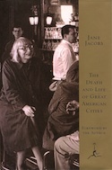
In the 1960s Urban Renewal was in full swing — remaking/destroying cities on a large scale.  The majority of people approved — few protested. The powers that be had dismissed Jane Jacobs’ 1961 critique: The Death & Life of Great American Cities.

Forty city blocks of our original city had been vacant for a quarter century when Time magazine wrote the following on July 17, 1964:

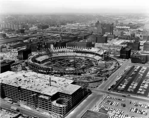
In all, some $2 billion worth of major construction is under way or planned in the metropolitan area. A 454-acre midtown tract of slums called Mill Creek Valley, filled with slum housing that cried out for rebuilding in 1954, is now one of the largest urban-renewal areas in the U.S. A substantial section of it will be set aside for an expressway to link downtown with the major expressways leading out of the city. The long neglected riverfront has been cleared for the Jefferson National Expansion Memorial Park; scheduled for completion there next year is a soaring stainless-steel arch 630 ft. high, designed by the late Eero Saarinen as a monument to St. Louis as Gateway to the West. A seven-block pedestrian mall shaded by trees and flanked by lawns is abuilding. Ground has been broken for a 1,100-car parking garage, first step in construction of a downtown sports stadium, designed by Edward Stone, that will seat 50,000, cost $89 million.

The program has its critics. The Mill Creek slums were bulldozed in 1960, but redevelopment has been so slow that the area is locally dubbed “Hiroshima Flats.” The New York Times’s Ada Louise Huxtable charged that the rebuilders had razed “the heart and history” of the city by clearing the riverfront. Defenders point out that the storied waterfront had long deteriorated into a grimy morass of dilapidated warehouses, buildings and residences. Developers have been scrupulous in preserving the architectural monuments of the area—the old courthouse and the cathedral—and have stored the best examples of cast-iron storefronts to be put on display in the new Museum of Westward Expansion. (Time)

“But these areas were bad, they had to be razed,” you might say. That was the propaganda constantly sold the public. Another such bad area that needed to be razed? The Soulard neighborhood (see 1947 reconstruction plan).  Basically if they wanted to remove something a campaign was waged to build public support. Often, there were racial motivations.

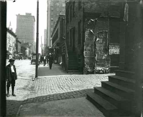
The neighborhood razed for Pruitt-Igoe was Irish. Mill Creek Valley was African-American. And what became Busch Memorial Stadium (1966-2006) had been our Chinatown since the 19th century:

The first recorded Chinese immigrant was a tea merchant named Alla Lee, who is reported to have arrived in 1857 from San Francisco. By the end of the nineteenth century, the Chinese community in St. Louis had grown to about three hundred. This community was physically centered in “Hop Alley,” a seemingly mysterious place that inspired tall tales to the contemporaries and is little known to the present St. Louisans. Along Seventh, Eighth, Market, and Walnut Streets, Chinese hand laundries, merchandise stores, grocery stores, restaurants, and tea shops were lined up to serve Chinese residents and the ethnically diverse larger community of St. Louis, the fourth largest city in the United States at the time.  

Downtown businesses wanted the gleaming new modern downtown and Chinese-Americans doing laundry didn’t fit that image. They must go! But how? At this same time those who pushed wholesale razing of large areas knew cultural institutions were a good excuse to raze existing areas — forcing the inhabitants to be relocated. Working with Cardinals owner Anheuser-Busch, the process began to push Chinatown out of downtown. This would also put the team closer to the brewery.

Hop Alley looking north on Eighth Street between Walnut and Market Streets. Photograph by unknown, 1910 Missouri History Museum Archives. Swekosky-MHS Collection n34629
Busch Memorial Stadium under construction in 1965. Source: Wikipedia

In February 1968 New York Times architecture critic Ada Louise Huxtable wrote the following about downtown St. Louis:

Except for the arch and the old courthouse, which form some genuinely provocative urban views, downtown St. Louis is a monument to chamber of commerce planning and design. It is a businessman’s dream of redevelopment come true.

There are all the faceless, characterless, scaleless symbols of economic regeneration — luxury apartments, hotels, a 50,000 seat stadium and multiple parking garages for 7,400 cars. Sleek, new, prosperous, stolid and dull, well served by superhighways, the buildings are a collection of familiar profit formulas, uninspired in concept, unvarying in scale, unrelated by any standards, principals or subtleties of planning or urban design. They just stand there. They come round, rectangular, singly and in pairs. Pick your standard commercial cliche.

The new St. Louis is a success economically and a failure urbanistically. It has the impersonal gloss of a promotional brochure. A prime example of the modern landscape of urban alienation, it has gained a lot of real estate and lost a historic city. (“Hop Alley”: Myth and Reality of the St. Louis Chinatown, 1860s-1930s)

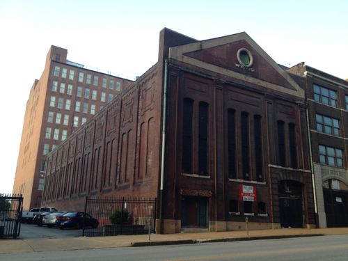
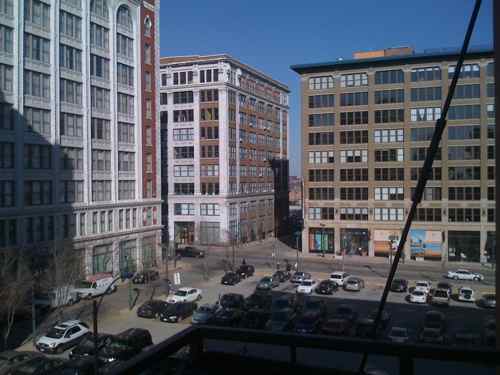
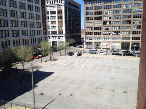
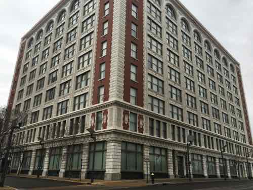
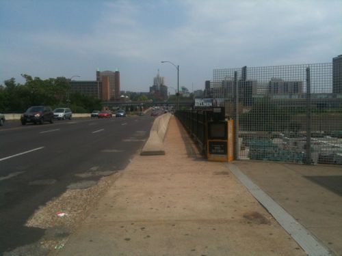
Much of downtown remains faceless, characterless, and scaleless. The area where baseball had been played since the 19th century suffered from the loss of jobs & activity. One institution resisted the trend to locate in a modern downtown building, the symphony instead restored an old movie palace. Ada Louise Huxtable again:

The success of Powell Symphony Hall in St. Louis is probably going to lead a lot of people to a lot of wrong conclusions. In a kind of architectural Gresham’s law, the right thing wrongly interpreted usually has more bad than good results.

The first wrong conclusion is that Powell Hall represents the triumph of traditional over modern architecture. False. The correct conclusion here is that a good old building is better than a bad new one. Powell Hall represents the triumph simply of suitable preservation. And, one might add, of rare good sense.

Very rare in St. Louis. We can’t change the past, so why keep harping on it? Because we’ve not learned from our past mistakes! We keep repeating, at least attempt, to repeat them.


Readers were split in the non-scientific Sunday Poll:

Q; Agree or disagree: Building the new baseball stadium downtown in 1966, instead of in a neighborhood, was a bad decision

  • Strongly agree 5 [11.63%]
  • Agree 6 [13.95%]
  • Somewhat agree 9 [20.93%]
  • Neither agree or disagree 3 [6.98%]
  • Somewhat disagree 4 [9.3%]
  • Disagree 9 [20.93%]
  • Strongly disagree 6 [13.95%]
  • Unsure/No Answer 1 [2.33%]

Those who agreed totaled 46.51%, while those who disagreed totaled 44.18%.

We can’t undo the past mistakes, but the disastrous Urban Renewal mindset is still alive in 2016 St. Louis.

— Steve Patterson


5th Anniversary of St. Louis’ Downtown Bicycle Station

April 28, 2016 Bicycling, Downtown, Featured, History/Preservation Comments Off on 5th Anniversary of St. Louis’ Downtown Bicycle Station

Five years ago today the ribbon was cut on a new concept in St. Louis — a bike station. A place where a bike commuter can shower and change clothes before going into his/her office.

The ribbon was cut just after 10am on April 28, 2011
Then we got to go inside
Secure area for storing your bike during the day
Lockers and showers are in the back,

The Downtown Bicycle Station is a project of Trailnet, which is located upstairs in the same building.

The Downtown Bicycle Station offers secure 20-hour access and features over 120 bike racks, showers and locker rooms, and is ideal for bicyclists commuting to work or looking to exercise on their lunch break.

Memberships are $20/month or $150/year.  Corporate memberships are $1,000/year for 10 users. A day membership is $5 — enter via Big Shark Bikes next door (limited to their hours).

Bike facilities have increased in these last five years, the data center at 210 N. Tucker includes a secure bike parking area  inside the building. 
Bike facilities have increased in these last five years, the data center at 210 N. Tucker includes a secure bike parking area  inside the building.

Hopefully more and more young people will be attracted to high tech and other jobs downtown — walking, biking or riding public transit to/from work.

— Steve Patterson


A Decade Since Jane Jacobs’ Death

April 25, 2016 Books, Featured, History/Preservation, Planning & Design, Urban Renewal Comments Off on A Decade Since Jane Jacobs’ Death
Cover of Death and Life of Great American Cities

Ten years ago today, one of my heroes died. Jane Jacobs, author of The Death & Life of Great American Cities, was 89. Her 1961 classic was a sharp critique of Urban Renewal — the erase & replace thinking that was commonplace at the time.  New York’s Robert Moses & St. Louis’ Harland Bartholomew were among the top advocates of Urban Renewal.

At 45, she and many others directly challenged Moses’ plan to cut an interstate highway through lower Manhattan:

Jacobs chaired the Joint Committee to Stop the Lower Manhattan Expressway (a.k.a. Joint Emergency Committee to Close Washington Square to Traffic, and other names), which recruited such members as Margaret Mead, Eleanor Roosevelt, Lewis Mumford, Charles Abrams, and William H. Whyte. Papers such as The New York Times were sympathetic to Moses, while the newly created Village Voice covered community rallies and advocated against the expressway. The Committee succeeded in blocking the project. On June 25, 1958, the city closed Washington Square Park to traffic, and the Joint Committee held a ribbon tying (not cutting) ceremony. Jacobs continued to fight the expressway when plans resurfaced in 1962, 1965, and 1968, and she became a local hero for her opposition to the project. She was arrested by a plainclothes police officer on April 10, 1968, at a public hearing, during which the crowd had charged the stage and destroyed the stenographer’s notes. She was accused of inciting a riot, criminal mischief, and obstructing public administration – after months of trials conducted in New York City (to which Jacobs commuted from Toronto), her charge was reduced to disorderly conduct. (Wikipedia)

Following her arrest, and in protest of the U.S. involvement in the Vietnam War, she, her husband (an architect)  and two draft-able sons, moved to Canada. They settled in Toronto.

A few months after her death, I was in standing in front of the home where she lived in Toronto. Crying.

The following are some videos about her, some of her speaking.

Jacobs still inspires me today, I just wish I’d known of her in high school — I would’ve studied urban planning instead of architecture, in the mid-late 1980s. May 4th will mark the 100th anniversary of her birth.

— Steve Patterson


Monogram Building, Formerly CPI Headquarters, To Become Loft Apartments

It’s time to stop calling the 9-story building at 1706 Washington Ave the “CPI” building. It has been a few years since the failed portrait studio operator occupied the building. For decades it was known as the Monogram Building, located within the Washington Avenue Historic District on the National Register, here are a couple of quotes from the listing:

The Monogram Building, rising nine stories, is a concrete-frame factory-warehouse extending eight bays on the east, elevation (facing 17th St. and 10 bays on the north (facing Washington). On both elevations, cream colored, glazed terra cotta, fashioned into shells, bound sheaves of wheat, caducei , and -foliated patterns, faces the narrow piers and spandrels which -frame triple windows . The end bays are sheathed in red brick and demarcated by terra cotta quoining. Above the two-story base, there is a foliated, bracketed cornice of terra cotta. The facade terminates with round arches formed bv the piers above the ninth story. A terra cotta cornice crowns the facade. 

and…

Rosenthal-Sloan, the “world’s largest millinery establishment,” occupied the Monogram Building at 1700 Washington constructed in 1910.” Numerous other millinery companies occupied quarters within the District and, according to one source, St. Louis was the largest millinery market in the country. ‘ Specialty items, junior dresses, for example, originated on Washington Avenue. Fashion shows were held first yearly and then twice yearly attracting thousands of buyers to the City. Large and small firms alike and the many out of town concerns that maintained offices and showrooms in the district flourished.

Before the Monogram was built in 1910, the site had already made history in St. Louis. Washington University in St. Louis, founded in 1853, opened its first building, Academic Hall, on the site on September 8, 1856. At the time, Lucas Place, now Locust St, was home to the city’s finest mansions.

Fol­low­ing the cholera epi­demic and fire in 1849, wealthy cit­i­zens became con­vinced that it was no longer desir­able to live in down­town St. Louis. James Lucas and his sis­ter Anne Lucas Hunt soon offered a solu­tion. They devel­oped the idea of the “Place,” a neigh­bor­hood with deed restric­tions that ensured it remained apart from the city and gen­eral pop­u­la­tion. The main thor­ough­fare was aptly called Lucas Place. Orig­i­nally Lucas Place (now Locust Street) extended between 13th and 16th streets when the city lim­its were just one block to the west between 17th and 18th streets. When estab­lished, Lucas Place was west of the devel­oped por­tion of the city, mak­ing it St. Louis’ first “sub­ur­ban” neighborhood. (Campbell House Museum)

The first mansion, built in 1851, was the Campbell House — the only mansion still standing.  The university occupied Academic Hall at 17th & Washington, and other buildings, until moving to its current campus in 1905. By the time the Sanborn Fire Insurance Map Co documented these blocks in February 1909, Academic Hall had already been razed.

Every building shown in this four block map is gone -- except for the streetcar powerhouse circled in purple. The Monogram was built the next year on the site outlined in red. Click image to see larger version.
Every building shown in this four block map is gone — except for the streetcar powerhouse circled in purple. The Monogram was built the next year on the site outlined in red. Click image to see larger version.
1711 Locust was a power station for the original streetcar system, the Monogram can be seen in the left background

The Monogram Building, built 1910-12, was designed by architect Albert B. Groves (1868-1925). Groves and his family lived at 5419 Maple Ave, built in 1906.  There are two entries for him in findagrave.com — here and here. Their son Theron A. Groves was also an architect.  Albert died weeks before his 57th birthday, Theron died at 65 — the wife & mother lived to 95!

This building is important to me, for 8+ years it has been a significant part of the view from my loft & balcony.

The Monogram is the building on the left in this December 2008 image. In November I posted about how CPI had lights on 24/7, click image to see post. In 2010 I moved my bed to the other bedroom away from the windows and urban light pollution.
By May 2014 the frequently full parking lot was empty, but begging to be rented by the hour & month. Click image for post.

The Monogram Building has likely had many occupants over the last century, with a variety os uses. In January it was sold:

Revive Capital Development LLC, of Kansas City, bought the nine-story building from downtown St. Louis property owner David Jump. John Warren, a vice president of commercial real estate company JLL, represented Jump’s 1706 Washington LLC in the sale that closed Monday. No financial terms were revealed.

JLL said Thursday the new owner plans to put loft apartments in the former CPI headquarters at 1706 Washington Avenue. Efforts to reach a Revive representative were unsuccessful. (Post-Dispatch)

Hopefully this new Kansas City firm will be successful. The LLC’s sole listed organizer is real estate attorney Michael D. McKinley, a partner at the law firm Lathrop & Gage.

The two detailed facades are 17th (left) and Washington (right)
The first (East) entrance facing Washington Ave
The next has a small step
The third has a taller step

It’ll be interesting to see how Revive Capital Development configures the residential units, allocates parking, uses the ground floor. Hopefully one or two of the Washington Ave entrances will be for a restaurant or retail space, with the addition of an ADA-compliant ramp.

— Steve Patterson


1960s Grand Bridge Closed For Replacement 5 Years Ago Today

It was five years ago today when St. Louis closed the 1960s Grand Ave bridge over the railroad tracks so it could be replaced:

The Grand Bridge is scheduled to close from Chouteau Avenue to the I-64 off-ramp on Monday, March 14, 2011. The bridge will close before the morning rush around 5:00 am. The bridge will be closed to traffic for about 14 months; the entire project is expected to be completed in 18-24 months. During that time, the current bridge will be completely removed and replaced. When finished, the project will provide a dramatic facelift to Midtown. (St. Louis)

The old bridge had 3 vehicles lanes in each direction and vary narrow sidewalks.

Looking north from the old transit stop, June 2010

The new bridge, with 2 lanes per direction & wider sidewalks, opened in July 2012. See: New Grand Viaduct Huge Improvement, Development Opportunities Remain.

The Grand bridge over I-44 will soon be replaced, though traffic won’t be completely cut off:

The driving surface of the bridge will be completely replaced and the bridge will be raised to meet interstate standards. Although the project will be completed in stages, drivers can expect fewer lanes across the bridge and will not be able to make left turns during construction, MoDOT said.

At least one lane will be open in each direction on Grand during each stage of construction.

Construction is expected to start in June, with all driving lanes expected to be open by the end of the year. (Post-Dispatch)

Work continues on a new kingshighway bridge over the railroad tracks South of I-44, the old bridge closed last July.

— Steve Patterson


Advertisement


[custom-facebook-feed]

Archives

Categories

Advertisement


Subscribe