Home » Public Transit » Recent Articles:

Dallas Opened Starter Modern Streetcar Line In April

Last month I told you about my Megabus trip to Dallas & back, see Thirty Hours on Megabus: St. Louis to Memphis to Little Rock to Dallas & Back. Today I want to tell you about one of the things I did in the week I was there: I rode their newest public transit line — it opened just two weeks before I arrived!

The modern streetcar approaching the end near Dallas Union Station.
The entry is level with the sidewalk.
The interior is very similar to their light rail vehicles -- the center is open for standing passengers,  wheelchairs , bikes, strollers, etc
The interior is very similar to their light rail vehicles — the center is open for standing passengers, wheelchairs , bikes, strollers, etc
The streetcar in Oak Cliff turning right onto Colorado Blvd from Zang Blvd, click image to view intersection on a map
At the other end of the line -- at least until it's extended
At the other end of the line — at least until it’s extended

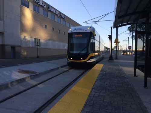
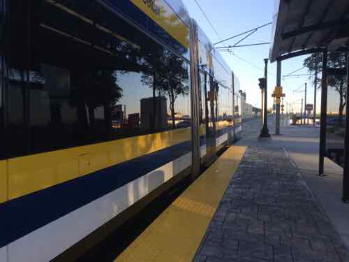
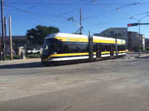
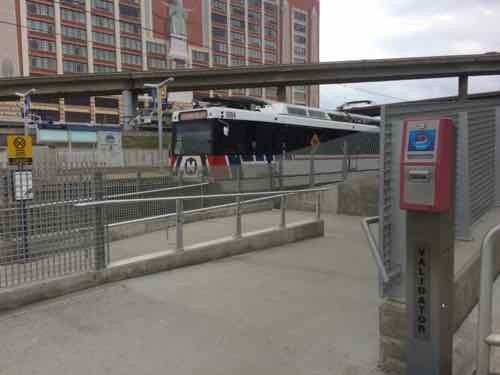
Dallas’ light rail system includes 4 lines, 62 station, a total of 90 miles (source). Our light rail, MetroLink, has two lines, 37 stations, and is 46 miles in total length (source).  But the newest rail line in Dallas isn’t more light rail — it’s a modern streetcar line connecting downtown Dallas across the Trinity River to the Oak Cliff neighborhood:

More than five years in the making, the 1.6-mile line stretches from near Union Station downtown to the intersection of Beckley Avenue and Colorado Boulevard, near Methodist Dallas Medical Center in Oak Cliff.

A group of Oak Cliff leaders — including Luis Salcedo, Jason Roberts and Griggs before his council election – laid the project’s foundation as members of the Oak Cliff Transit Authority.

A $23 million federal stimulus grant in February 2010 brought the city, Dallas Area Rapid Transit and the North Central Texas Council of Governments together as project partners. The city owns the line, DART will operate it and the council of governments has been the funding conduit.

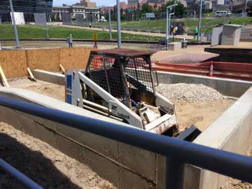
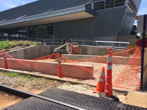
An additional $3 million in stimulus money, the allocation of regional toll-road revenue and other funding covered what has become a $50 million investment, with plans for expansion. (Dallas Morning News)

See DART Streetcar. Why didn’t they just build another light rail line? Or even a BRT (Bus Rapid Transit) line?  A light rail line would’ve been far more expensive to build, it likely couldn’t have crossed a historic bridge over the Trinity River the way the streetcar does. It’s important to note the costs are for the initial system — over a historic viaduct crossing the now-flooding Trinity River. New extensions will be far less costly per mile.

From 2014:

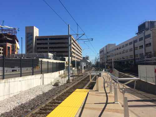
Officials have spent almost a decade planning improvements to public transportation downtown. The matter became more urgent after Dallas Area Rapid Transit’s light-rail system reached critical mass. That 85-mile network connects downtown to the suburbs in all directions. The trains run along downtown’s edges, but not deep into its business, government and entertainment hubs.

“The conversation came up that LRT will take care of regional transportation. But what about in and around downtown?” Manoy said.

That’s when the idea of electric streetcars started to gain momentum. Like most transportation hopes, funding didn’t match ambitions. For years, planners navigated a series of route ideas, grant applications and shifting bureaucratic priorities. (Dallas Morning News)

Dallas planners see the streetcar connecting the dots — eventually a highly visible line in the heart of their downtown — connecting light rail to the CBD and other districts.

Of course, their streetcar had its critics. From 2013:

The problem is that Dallas sprawls too much to make rail-based streetcars a feasible solution. To solve our public transportation problem, Dallas ought to stop looking at models like Portland, Oregon, and look at cities that more closely resemble Dallas, places like Bogota, Colombia. Bogota has become a darling of the new urbanism crowd in the last decade thanks to its development of a Bus Rapid Transit (BRT) system. 

Don’t be thrown by the B-word. Rather than a snaking web of indecipherable bus lines, like Dallas currently has, BRT systems use designated lanes, timed traffic lights, and painted ground areas to give pedestrians visual understanding of where routes go. BRT vehicles are faster, more comfortable, and more reliable than buses. And here’s the best part: for the cost of the Oak Cliff streetcar, Dallas could build a complete BRT system covering the entire city. 

Roberts likes the idea of a BRT system in Dallas, but he says it has to be perfect or it won’t work, pointing to Los Angeles’ BRT attempt, which hasn’t had the same impact as systems in Bogota and Ottawa, Ontario. (D Magazine)

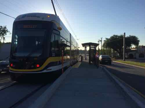
So I got to ride it just two weeks after opening, I’ve also seen where it’ll be extended to.

The streetcar currently ends at W Colorado Blvd & N Beckley Ave, there is plenty of potential for new development.  Across the street is a hospital complex. . Click image for map.
The streetcar currently ends at W Colorado Blvd & N Beckley Ave, there is plenty of potential for new development. Across the street, to the right, is a hospital complex. . Click image for map.
Their streetcar will extend to the popular Bishop Arts District (left), click for website

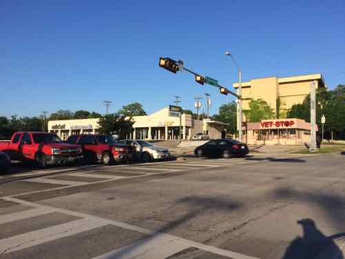
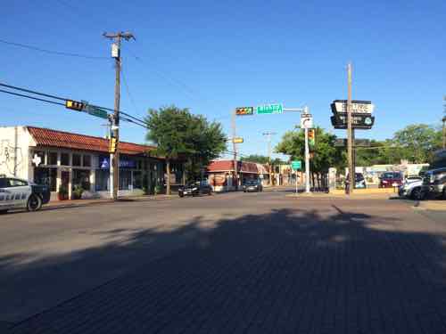
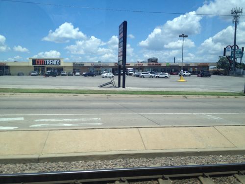
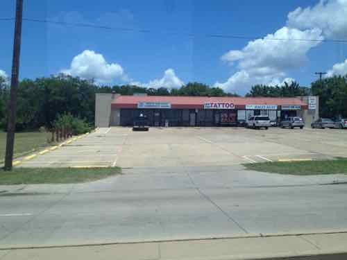
The area is charming — once you get to it!

The Bishop Arts District is home to over 60 independent boutiques, restaurants, bars, coffee shops, theaters and art galleries. Located in the heart of North Oak Cliff, one of Dallas’ most unique neighborhoods. A historical shopping district full of great finds, good eats, and good ole Oak Cliff charm! The Bishop Arts District is made up of many independently-owned shops and eateries that maintain various hours. While many of the shops stay open late on the weekends to provide a fun shop, stroll, and eat environment for visitors, the Bishop Arts District is populated with many independently-owned businesses, so please contact them directly for their hours of operation. Wine Walks are held 3-4 times a year and on 1st Thursdays of a given month. (Bishop Arts District)

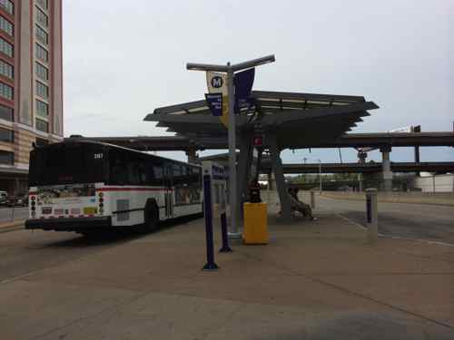
I took the free D-Link bus back downtown. For now the streetcar is also free, operating weekdays only. Once extended it’ll have longer hours and weekend service.

Again, Oak Cliff is very close to downtown Dallas but it’s geographically separated by the Trinity River  — in the news lately because of the flooding:

To my knowledge the streetcar line is dry, but the D-Link bus route might be impacted by road closures due to high water. The good thing about Dallas is they actually expand their transit systems, so I look forward to returning every few years to see the resulting development — if any.

— Steve Patterson


Northside-Southside Light Rail Wouldn’t Be Good For St. Louis Neighborhoods

Lately I’ve been hearing people wanting the build the long-planned Northside-Southside MetroLink lines. While I’m a huge advocate of public transit, rail transit in particular, this would ultimately be a costly disaster for St. Louis’ neighborhoods.

For the Northside corridor, the preferred transit alternative was a MetroLink line running from downtown St. Louis north by using rights-of-way along several streets including 14th Street, Natural Bridge Avenue, and West Florissant Avenue into North St. Louis County. Two potential preferred alternatives were selected for the Southside corridor. One was a MetroLink extension from downtown St. Louis running south using rights-of-way within 14th Street, Chouteau Avenue, the Union Pacific Railroad track and along I-55. The other possible design was a Bus Rapid Transit system from downtown south via Market Street, Grand Boulevard, to rights-of-way alongside the Union Pacific Railroad track and Loughborough Avenue, then via I-55 to South St. Louis County. (Northside-Southside Overview)

Here’s what I think these people don’t understand:

  • This would be a completely separate system from our existing light rail — Northside-Southside would use different vehicles & track. An existing line coming from the airport, for example, wouldn’t be able to run into south city. Passengers would need to exit the older high-floor light rail vehicles at the Civic Center MetroLink station and walk to 14th Street to board the new line. Fares could be integrated, but physically separate otherwise.
  • The vehicle type used would be the same as the proposed St. Louis Streetcar.  These are modern vehicles and are an excellent choice. When used as “light rail” they operate in dedicated right-of-way (ROW) with far fewer stops so as to achieve desired speeds end to end. As streetcars they stop much more frequently, putting more people closer to a stop. The tracks can be crossed easily by pedestrians & motorists. Connectivity, not speed, is the priority.
  • The goal for Northside-Southside was to end at large park-n-ride lots and get suburbanites through “scary” city neighborhoods and into downtown as quickly as possible. Stops would be over a mile apart.
  • To achieve necessary speeds the number of conflict points between rail & autos/pedestrians would need to be greatly reduced. This is accomplished by building a median down the center of the road (Natural Bridge, Jefferson) with very few points to cross. That left turn you used to make would become impossible, as would walking across the street at all but a few points.
  • Property along the routes would need to be taken, some buildings razed. This is because creating a dedicated ROW takes lots of room — more than even our generous ROWs have to offer.This light rail ROW would act similar to a highway — dividing the neighborhoods on either side in an effort to rush people through as quickly as possible.

These are not positives for the neighborhoods, unless you live near one of the few stops it won’t be useful to residents.

We don’t have any examples of light rail in the center of a road, so we need to look elsewhere. In 2012 I visited Dallas and rode their Blue Line south in the center of Lancaster Rd.

ABOVE: One of several auto-centric strip shopping centers along the Blue line
One of several auto-centric strip shopping centers along their South Blue line, the physical design of the light rail line discourages new development, walking, etc

All of my photos are from inside the light rail car or at the stations. To understand you you need to view from outside. Short of a personal visit, you can look at Google’s Street View.

This view from Google Street View shows how traffic & pedestrians from a side street are forded to turn right. Click image to view the location on a map
A 2012 photo I took of the shopping center on this corner

Light rail doesn’t appear to have spurred any development in the 18 years it has been open. The rail vehicles, however, do move at a high speed between stations. Success depends on your goals.

What the St. Louis neighborhoods North & South need is an investment in excellent localized rail transit — streetcars. Again, the vehicles are virtually identical — it is the design of the track and number of stops that make the difference. To me, the South/Jefferson County person driving downtown is likely to just stay on I-55 to reach their destination — we shouldn’t design this to persuade them to exit the highway and park in a big parking lot.

We should design & invest in infrastructure that brings the neighborhoods together, that helps local merchants.  Light rail is the wrong choice, streetcars is the best rail choice. If you’re opposed to MoDOT’s plans for Gravois you should be opposed to creating a light rail ROW in the middle of our major aerials.

— Steve Patterson


New Switchback Ramp Between Civic Center MetroLink & Gateway Transportation Center Should Reduce Accidents

To reduce pedestrians being hit by light rail trains they’ve been making changes to conflict points, this is about the access to the Civic Center MetroLink Station from the Gateway Transportation Center, which opened in late 2008.

When the Gateway Transportation Center (Amtrak & Greyhound) opened in the Fall of 2008 the access to the adjacent Civic Center MetroLink Station was a straight shot. November 2010 photo
In May 2014 work was underway
View looking the opposite direction
By March 2015 the change was complete
Now it isn't a straight shot across the tracks.
Now it isn’t a straight shot across the tracks.
Everyone must go through a wide switchback

This change may also be related to the coming smart card technology, a reader is shown above. The question I have is will I have a problem passing through the Civic Center MetroLink to reach the Gateway Transportation Center?

— Steve Patterson


Readers: Metro Should Ban Smoking at MetroBus Transit Centers Like They Do At MetroLink Light Rail Platforms

Ever since our MetroLink light rail system opened in 1993 it has been treated very differently from the MetroBus system, with the latter being sort of the bastard step-child. Smoking isn’t allowed inside bus or train vehicles but currently smoking isn’t allowed on MetroLink platforms, but is allowed at MetroBus transit centers — those places where many bus lines converge.

Looking east toward Taylor from the CWE MetroLink platform
Looking east toward Taylor from the CWE MetroLink platform. The garage at the left contains a MetroBus center where smoking is allowed but the platform where the photo was taken smoking isn’t allowed.
Many people use the Civic Center MetroBus transit center daily, where smoking is allowed despite the close quarters. 
Many people use the Civic Center MetroBus transit center daily, where smoking is allowed despite the close quarters.

When MetroLink opened in 1993 smoking was allowed on platforms, despite lobbying by light rail advocates to make platforms smoke-free Bi-State (no Metro) President John K. Leary Jr., whose wife smoked, decided to permit smoking. After he left for SEPTA in 1997 the policy was changed.

What justification is there for treating these two differently with respect to smoking? Smokers and non-smokers use both systems, which is why many MetroBus Transit Centers are located adjacent to MetroLink stations.

Here are the results from the Sunday Poll:

Q: Metro allows smoking at MetroBus Transit Centers but not on MetroLink platforms. Metro should:

  1. Ban smoking at both 29 [70.73%]
  2. Unsure/No Opinion 5 [12.2%]
  3. Allow smoking at both 4 [9.76%]
  4. Keep policy as is — smoking allowed at one but not the other 3 [7.32%]

I reluctantly accept the challenge it would be to ban smoking at thousands of bus stops, but enforcing a no-smoking policy at MetroBus Transit Centers is no different than at MetroLink stations. It’s time Metro!!

— Steve Patterson


Sunday Poll: Metro allows smoking at MetroBus Transit Centers but not on MetroLink platforms. Metro should:

Please vote in the poll, located in the right sidebar

Today’s poll is about Metro’s smoking policy. Riders can smoke at transit centers while waiting for a MetroBus, but those riders on platforms waiting for a MetroLink light rail train can’t smoke. Transit centers are points where numerous bus routes meet, often adjacent to MetroLink stations — Civic Center & North Hanley are two examples.

The poll question is:  Metro allows smoking at MetroBus Transit Centers but not on MetroLink platforms. Metro should:

The options provided, in random order, are:

  • Allow smoking at both
  • Prohibit smoking at both
  • Keep policy as is — smoking allowed at one but not the other
  • Unsure/No Opinion

The poll, as always, is on the top of the right sidebar.It’ll close at 8pm central.

— Steve Patterson


Advertisement


[custom-facebook-feed]

Archives

Categories

Advertisement


Subscribe