Home » Public Transit » Recent Articles:

Trump Is Less Than A Half Mile Away Today, Last Week I Took Public Transit 20+ Miles To Hear Bernie Sanders

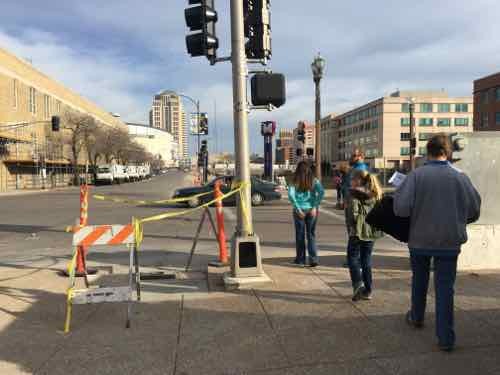
Before this year, and despite being an active voter for 30+ years, I’d never seen a presidential candidate in person. At noon today Republican frontrunner Donald Trump will be speaking at the Peabody Opera House — less than half a mile away from my downtown loft. I won’t go hear him speak — not worth minimal effort.

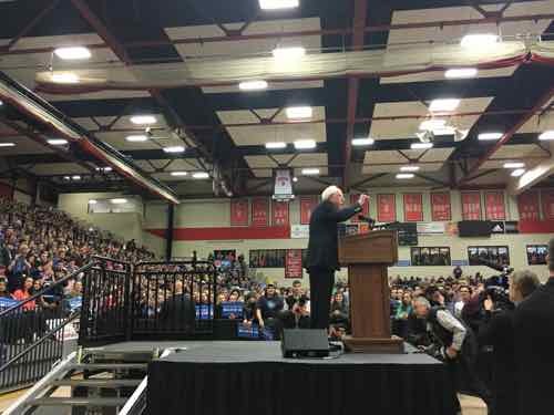
A week ago, however, I traveled 20+ miles to hear Sen. Bernie Sanders at SIUE’s Vadalabene Center. As I indicated on February 2nd, I already voted for Bernie Sanders via absentee ballot. Today’s post is mostly about my journey there and back via public transit.

You’re probably thinking it took forever, the answer is no & yes.  Getting there was as fast as driving, coming back took three times as long.

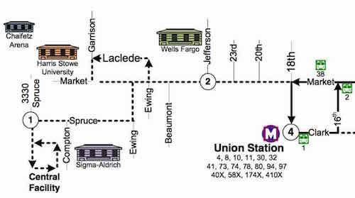
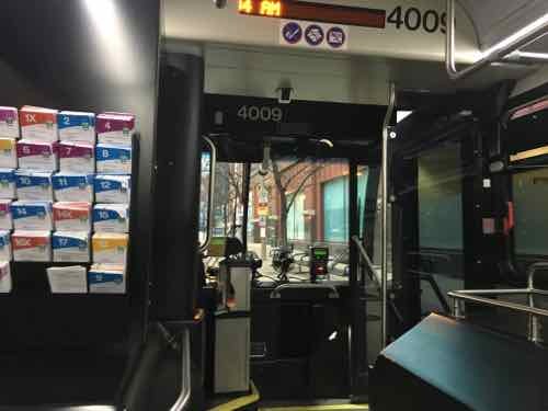
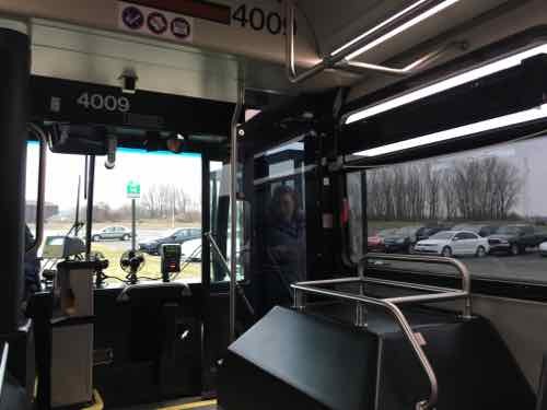
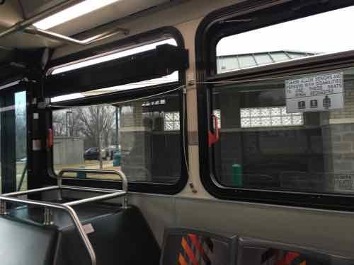
Each weekday morning the Madison County Transit 16X Edwardsville-Glen Carbon Express makes two pickups from St. Louis, it makes nine drop offs. At 7:02am I caught the first 16x at 6th & Washington Ave.  Thirty-six minutes later I was on the SIUE campus.

Driving from my loft would’ve required my husband to use our Enterprise CarShare membership so I could use our car, it would’ve taken 36-41 minutes for me to drive there. With the time it would’ve taken me to walk from parking to the line using my wheelchair on public transit saved me time — and money.

At 7:04am I was on the 16x on WB Washington Ave between Broadway & 6th. There were 5-6 people on the bus -- they boarded at Jefferson & Pine
At 7:04am I was on the 16x on WB Washington Ave between Broadway & 6th. There were 5-6 people on the bus — they boarded at Jefferson & Pine
At 7:20am we made our first stop, at a Park & Ride lot next to the Gateway Center in Collinsville IL
At 7:28am we stopped at a park & ride lot in Glen Carbon IL. The next stop was Beck Hall at SIUE

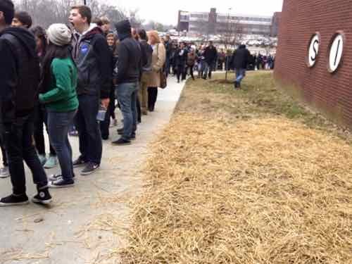
Upon arrival at the campus I didn’t stop to photograph — I wanted to get to get in lime at the Vadalabene Center. As I was making my way to the back of the line a volunteer stopped me and said I could follow her to the disabled entrance.

At 7:48am I was almost inside, myself and others who are disabled were able to bypass the long line. Had I driven the walk from the parking lot to the door would've been exhausting.
At 7:48am I was almost inside, myself and others who are disabled were able to bypass the long line. Had I driven the walk from the parking lot to the door would’ve been exhausting.
I was inside just before 8am. Mr. Sanders began speaking around 10:30am. I could not have been any closer to the stage!
I was so close I was the first person to shake his hand after he came off the stage, I took this image just after -- 11:29am
I was so close I was the first person to shake his hand after he came off the stage, I took this image just after — 11:29am
15 minutes later I was leaving the Vadalabene Center, heading for Beck Hall

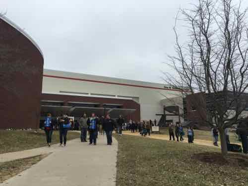
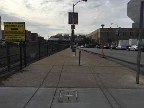
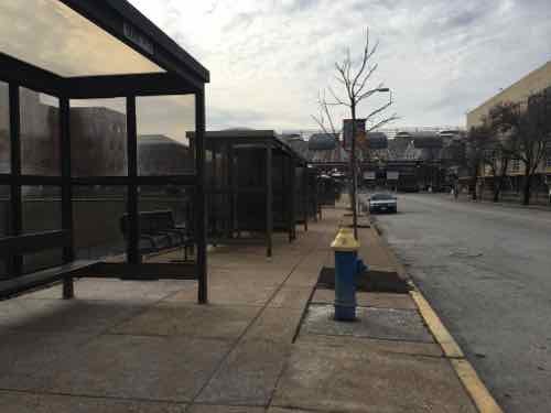
I already knew the next express bus to St. Louis wasn’t for another 4 hours — I’d need to take two buses and a train to get home.
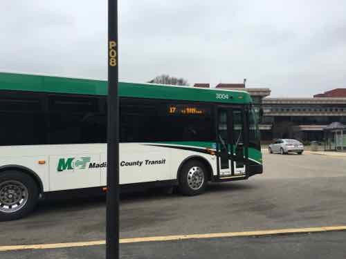
A few Madison County Transit buses came by before the next bus I needed,

I had two options:

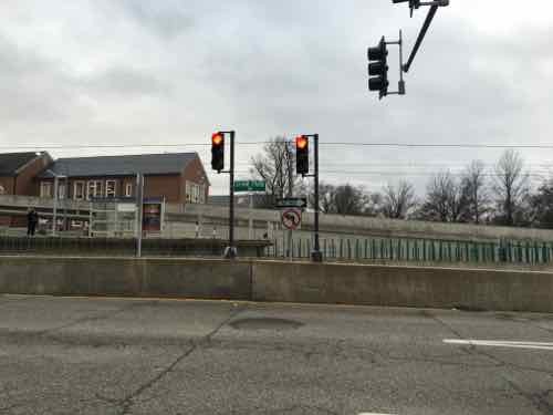
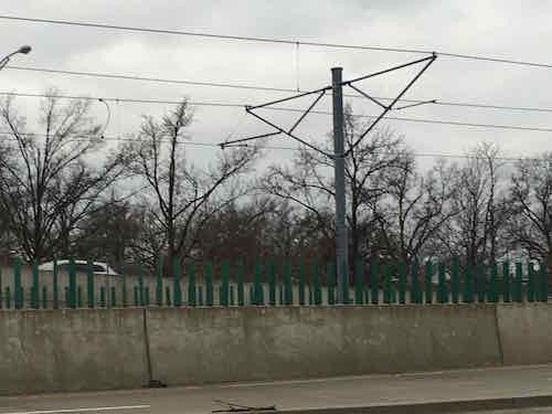
  1. #19 to Collinsville > #18 to Emerson Park > MetroLink to St. Louis
  2. #4 to Granite City > #5 to Emerson Park > MetroLink to St. Louis

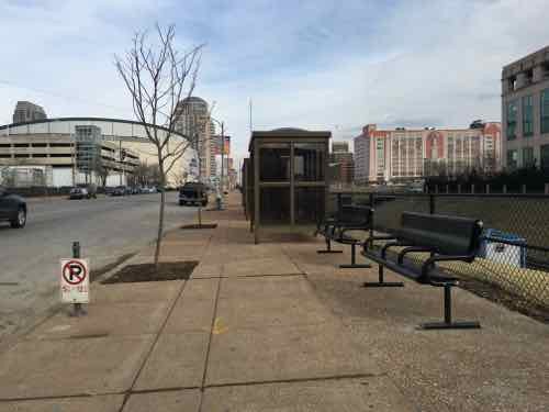
Both were within minutes of each other — just shy of two hours total. Based upon when I arrived, the #2 option via Granite City would be next. While waiting I began talking to someone else who attended the event, we talked much of the way until I got off the train downtown. Turns out he’s married to a woman I’ve known for at least a decade, they live in Webster Groves!

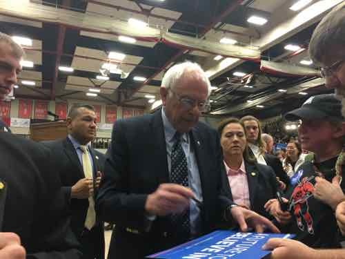
It was worth all the trouble to hear & meet Bernie Sanders!  Missouri & Illinois both hold primaries on Tuesday, along with Ohio, Florida, and North Carolina — please vote.

— Steve Patterson


Downtown Trolley Route Expands To Compton Starting March 14th

Tuesday’s post (Metro Makes Long-Needed Changes at 18th & Clark, Still Violates ADA) listed the many MetroBus route changes effective March 14th, one of which was the #99 Downtown Trolley. As mentioned in a July 2014 post, the Trolley will reach Union Station — and well-beyiond, as it turns out.

First, some history…

Me leaving the #99 Downtown Trolley after the first ride on July 6, 2010. This replaced the #99 Downtown Circulator that used non-wrapped buses. Photo by Jim Merkel, Suburban Journals
In 2014 new low-floor buses replaced the ones used since 2010
The trolley route hasn't changed except the addition of one stop on Spruce at 14th.
The trolley route hasn’t changed except the addition of one stop on Spruce at 14th.

The route — until March 14th — had a loop at each end: City Museum and Civic Center MetroBus Center. Mostly in Downtown, a little in Downtown West (West of Tucker).

Overview of new route, click image to view PDF
New West extension, only daytime on weekdays

As you can see, it’ll now turn around at 18th & Clark, with some turn arounds still at Civic Center. The main difference is going much farther West on Market Street into Midtown. This will connect more businesses with the Central Business District (CBD). It’ll also show how bad this area is for pedestrians trying to use public transit — see Harris-Stowe State University Campus Disconnected From Adjacent City.

I personally would like to see the trolley not do the 14th/Delmar/16th loop around City Museum — but continue on Washington Ave to 18th or 20th — to reach Market. This would better serve Downtown West, a stronger connection with the CBD.  Rather than them turning around on each end half would go clockwise, half counter-clockwise.

Looking forward to riding the new route, checking out the new stops.

— Steve Patterson

b

b

b

b

b

b

b


Metro Makes Long-Needed Changes at 18th & Clark, Still Violates ADA

In a couple of weeks Metro’s new North County Transit Center will open, so many MetroBus routes will see major changes:

Metro’s quarterly service change on March 14 will impact the operations of 48 MetroBus routes in the St. Louis metropolitan region, including the introduction of nine new MetroBus routes and discontinuation of service on eight routes. This service change will also introduce a new and completely redesigned MetroBus service plan for North St. Louis County, made possible with the opening of the new North County Transit Center in Ferguson, Missouri on March 14. (Metro)

On that same day, changes will take place in downtown (technically Downtown West):

The Civic Center Transit Center is scheduled to be closed down for construction activity shortly, at a date to be decided. In advance of the closure, Metro has prepared bus stops at 18th Street & Clark Street, adjacent to the Union Station MetroLink, to provide the same system connectivity. 

The routing and schedules of the routes serving the Civic Center Transit Center have been modified to serve 18th Street & Clark Street to ensure the same connections with the other MetroBus routes and MetroLink at Union Station instead.

Please note that till the closure of the Civic Center Transit Center, these routes will continue to serve the Civic Center Transit Center. Public Announcement of the closure of the Civic Center Transit Center will be made in advance of the event. (Metro)

The following MetroBus routes will change to include 18th & Clark.

  • 10 Chippewa
  • 32 ML King-Chouteau
  • 41 Lee
  • 73 Carondelet
  • 80 Park-Shaw
  • 94 Page
  • 97 Delmar
  • 99 Downtown Trolley
  • 40X I-55 Express
  • 58X Twin Oaks Express
  • 410X Eureka Express

When I need to catch the #10 Westbound I do so at 16th & Olive, but starting March 14th it’ll use 18th rather than 14th Street. Same goes for the #97  — I usually catch it at 16th & Washington but it’ll turn on 18th.  Those who ride the #94 & #97 to Washington & 14th, then catch the #99 Downtown Trolley to take them the rest of the way into the Central Business District (CBD), will need to figure out an alternates. Perhaps catching the Trolley bus at Civic Center/18th & Clark? That’ll require more time though — years ago more bus routes entered the CBD.

For a few months now I’ve been watching the changes at 18th & Clark. I posted about the upcoming Civic Center changes in 2014, see Civic Center Transit Center Sans Trees, Awaiting Redo.

Before I get into the recent changes along Clark I want to show you the before conditions, in October 2011 & August 2012.

Looking west toward the Union Station MetroLink Station from 16th & Clark, October 2011.
At 18th pedestrians had worn a more direct path since MetroLink opened in 1993, October 2011
The crosswalk to Union Station led directly to a curb, those of us in wheelchairs had to go outside the crosswalk and use the auto exit, at right -- a clear ADA violation for years, August 2012
The crosswalk to Union Station led directly to a curb, those of us in wheelchairs had to go outside the crosswalk and use the auto exit, at right — a clear ADA violation for years, August 2012

Ok, so now you’ve seen the before. In December last year I began seeing work going on so I braved the cold one day to get some pics:

The asphalt in the parking lane was removed, sidewalk & curb ramp at 16th also removed, December 2015
The old bricks were visible, street trees gone, December 2015
The corner was completely opened up, forms were placed for new concrete, December 2015
Looking West across 18th you can see the curb & sidewalk have been removed, December 2015
From the West side of 18th looking back, December 2015

I was encouraged seeing the West end of the crosswalk completely removed — a fresh start so it’ll be done correctly! I returned a month later, in late January:

Now we can see the sidewalk has been widened, replacing half the parking lane, January 2016
About halfway between 16th -18th the extra sidewalk narrows to the original width, January 2016
Looking across 18th we see at the end of the crosswalk --- A NEW CURB! WTF!?!
Looking across 18th we see at the end of the crosswalk — A NEW CURB! WTF!?! January 2016
Pedestrians taking the direct route from MetroLkink East across 18th, with the ramp on the left, January 2016

I returned again, a month later, on February 26th:

The widest park, near 16th
The widest park, near 16th, February 2016
Temporary bus shelters added in the narrow section makes it tight, February 2016
There are new benches in places , February 2016
Crosswalk not yet changed to include the new curb ramp, February 2016

The ramp location behind the crosswalk is a head scratcher, for sure. I resisted the urge to post it to social media — opting to wait until the project is closer to completion.  I even went back yesterday to see if the crosswalk had been changed. It hasn’t. I also discovered another problem: pedestrian signal location.

I arrived on the West side just as people pushing a stroller used the ramp to cross 18th
That's when I noticed the pedestrian signs, far right, wasn't visible. The ramps also aren't aligned, but we already knew they wouldn't.
That’s when I noticed the pedestrian signs, far right, wasn’t visible. The ramps also aren’t aligned, but we already knew they wouldn’t.
The pedestrian signal is visible only when way South pf the ramp & crosswalk
From the same spot you can see the ramp. My chair is very fast so I was able to wait for the walk signal then move to the ramp & cross -- but not everyone can move so quickly
From the same spot you can see the ramp. My chair is very fast so I was able to wait for the walk signal then move to the ramp & cross — but not everyone can move so quickly
From the East side you can see the back of the pedestrian signal and how it doesn't relate to the other side
From the East side you can see the back of the pedestrian signal and how it doesn’t relate to the other side

The best words that come to mind are gross incompetence. Both sides were completely opened up — all new concrete. That was the time to move pedestrian signals so they align with the crosswalk, to build the new ramps so they also align. I’m not sure if St. Louis’ new bike-pedestrian coordinator reviewed this, but other civil engineers did see it on paper. This is yet another thing making me realize I need to live in another city.

— Steve Patterson


Another Local Example of In-Street Light Rail

A couple of weeks ago I posted about a local example of light rail in center of a street, which was largely misunderstood. Objections to my Meramec Ave & Forest Park Parkway example included:

  • Cars could never cross here
  • Pedestrians have no reason to cross here
  • Several cities have light rail systems without concrete walls, have pedestrian crossings

True, true, and true. No argument. My point was many existing cross streets would no longer be able to cross streets like Natural Bridge or Jefferson if we built light rail in the right-of-way. Places to cross by car, bike, or foot would be limited.

Some of the examples people mentioned included Minneapolis and Houston. I have no personal experience with either so I turned to the internet.

Houston’s original Red Line, opened in 2004, had few obstacles. The tracks were in the street with very little dividing it from traffic (example).  Similar for their 2013 Red Line extension (example). The Green & Purple lines, opened in May 2015, are different. The Purple line has fences & barriers (example) but does provide pedestrian crossings between stations (example). Houston usually has 3-6 accidents per month, but had 17 in July.

Besides accidents, these can be slow. From 2014:

Residents of the Twin Cities greeted the opening of the new Green Line light rail link last month with joy and excitement, finally able to take advantage of a train connection between downtown Minneapolis and St. Paul. The 11-mile rail line runs through a relatively densely populated area, serves two business districts, and travels through the heart of a university.

It’s also alarmingly slow. Green Line trains are taking up to an hour to complete their journeys, and even optimistic schedules released by the local transit agency put running times at 48 minutes, or less than 14 mph on average.

Of course, the Twin Cities are hardly alone in their predicament. Recent transit lines elsewhere in the country feature similarly leisurely travel times. The new Houston North Line, for example, is averaging 17 mph. Los Angeles’ Expo Line is slightly quicker at 18 mph. Bus rapid transit and streetcar projects popping up virtually everywhere are often significantly slower. Only the Washington, D.C. Metro Silver Line, which will extend that region’s subway deep into the Virginia suburbs, will speed commuters along at an average of 32 mph. It will do so while only stopping at 5 stations, all of which will be located in the middle of expressways.

Our MetroLink, which operates in exclusive right-of-way, has an average speed of 24,7mph, according to Wikipedia. How does Metro achieve higher speeds? Less conflict points mean the vehicles can get to higher speeds between stations.  Which brings me to another local example of how Metro builds light rail to reduce conflicts/accidents. Forest Park Parkway & Des Peres Ave., prior to the Blue Line, was as signalized intersection allowing cars, bikes, and pedestrians to cross the busy roadway.

The intersection is still signalized  — and cars coming from the North can still cross here, as can pedestrians & cyclists. It’s roughly halfway between the Skinker & Forest Park stations — a mile apart.

Northbound traffic on Des Peres Ave can't cross the high-speed tracks
Northbound traffic on Des Peres Ave can’t cross the high-speed tracks
Cyclists & pedestrians must use ramps to cross over the tracks.

Anyone who thinks Metro St. Louis will build an in-street light rail system — operated at expected light rail speeds — with easy pedestrian crossings between stations is naive. It’s not going to happen — and it shouldn’t. St. Louis has enough pedestrian deaths as it is!

I think we should improve North-South public transit in the region, through the city.   I’m just looking at how Metro builds light rail and thinking it isn’t what people want.

— Steve Patterson


Local Example of Light Rail in Center of Street

For a while now I’ve been trying to convey how disastrous light rail in the center of Natural Bridge & Jefferson would be. I kept trying to think of a local example, but then the 2006 light rail extension in the center of Forest Park Parkway in Clayton came to mind.

Southbound traffic on S. Meramec in Clayton see a wall and right turn only signs at Forest Park Parkway
Southbound traffic on S. Meramec in Clayton see a wall and right turn only signs at Forest Park Parkway. Click to view in Google Street View
To achieve higher speeds,places to cross would be reduced through the use of concrete walls.

Such walls preventing pedestrians, bicyclists, and motorists and crossing the street except at a few points would be horrible for the surrounding neighborhoods. Do as I did — go to the interception of Meramec & Forest Park Parkway and see if you think that would be good for Natural Bridge or Jefferson.

— Steve Patterson


Advertisement


[custom-facebook-feed]

Archives

Categories

Advertisement


Subscribe