Downtown Trolley Route To Reach Union Station, Downtown’s Pedestrian Wayfinding Information Outdated
On Monday I posted about how the downtown trolley route hadn’t changed in its first four years of service, the only significant change being the addition of one stop. After my post I learned, not via any reply to my emails, that the trolley route will be changing — it’ll connect with Union Station. This is due for a couple of reasons. First, the upcoming Civic Center MetroBus Transit Center expansion project and the new owners of Union Station want to be connected to the rest of downtown and the trolley is popular with local tourists.
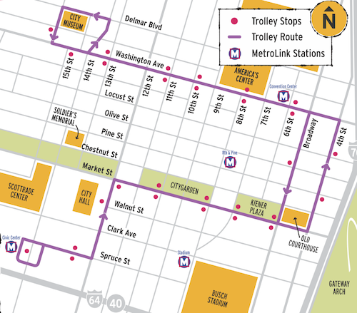
How the trolley will get to Union Station is still unknown, as is how it’ll make its way back east. My guess is a loop that includes Clark, 18th, Market and 14th. This could also include stops at the Peabody Opera House and Scottrade Center.
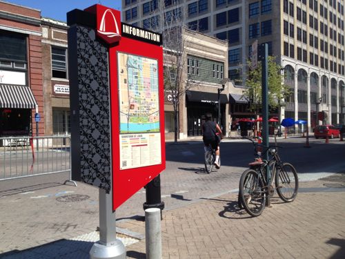
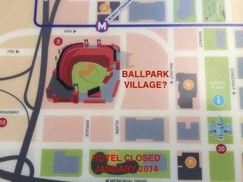
Besides not showing the downtown trolley, the information shown on the downtown wayfinding is already out of date:
- Macy’s is shown, it closed in August 2013.
- Ballpark Village isn’t listed, it opened earlier this year.
- Numerous hotels have closed or changed names
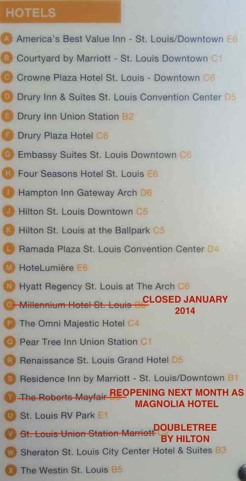
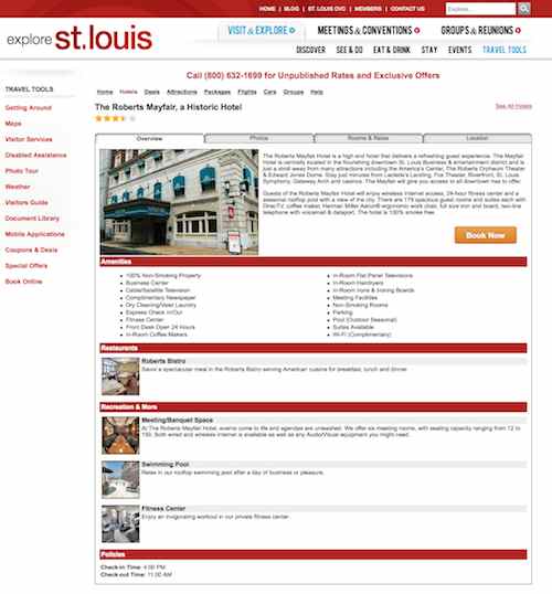
Of course it is impossible for the pedestrian wayfinding to remain 100% current all the time, I’m curious how often the CVC plans to update. It’s clearly not every year. Hopefully not more than ever two years. Sadly, the CVC’s website still shows an active listing for the Roberts Mayfair, closed for months and reopening next month as the Magnolia Hotel.
Hopefully they’ll get these wayfinding directories updated once the Downtown Trolley is extended to Union Station.
— Steve Patterson
If you want us to critique things, here are my thoughts . . . If you’re going to run the trolley to Union Station, how about adding 20th St. to the route, and run it both clockwise and counterclockwise and more frequently? If you want up to date information, how about offering printed maps at the various wayfinding map locations? You’ll see how they do it on the 16th Street Mall when you’re out in Denver – they’re easier to keep updated. And if you’re going to do a map, how about making north up? And, finally, mr. high tech, does the CVC have an app for that? If we offered this as an easily downloaded, free app, for all smart phone platforms, we’d be able to update things on a daily basis, in a way more and more people are travelling.
I totally agree doing a circle that includes 20th Street, running in both directions! This would allow the trolley to serve more locations and be more useful.
When the trolley debuted on July 1, 2010 frequency was “every 10 minutes from 10 a.m. to 2 p.m. daily, and every 20 minutes the rest of the time.” Now it’s every 14 minutes M-F until 7pm, every 20 minutes after 7pm weekdays and on weekends. I don’t see frequency being a major issue for tourists sightseeing or others using the trolley, but getting back to every 10 minutes would be nice.
Going in both directions and/or increasing frequency would likely require an additional bus and driver, depending upon how many they have in daily operation now.
I talked to a downtown retailer a couple of days ago who said they refer tourists to the trolley all the time, but they can’t get color brochures like they had in 2010. They hand out Metro’s #99 Downtown Trolley route info, which isn’t visitor friendly.
I hadn’t looked for an app but checked and downloaded the CVC’s app. It covers the region, more than downtown. It doesn’t include information about public transit. If you search ‘transit’ it mentions Metro and MetroLink service from the airport. It’s pretty weak.
Yes, we both see ways for the CVC, Downtown Partnership, and Metro to greatly improve things — but that involves getting them to realize just how beneficial it could be overall. It takes resources but I think it could pay big dividends in the long term.
I did search for ‘mayfair’ which directed me to Magnolia Hotel.
If the new Union Station owners want to be part of something bigger, the first thing they can do is get in touch with Megabus and find them a better pick-up/drop-off area! I’m embarrassed every time I step off that bus and 21st Street is travelers’ first impression of the City.
Megabus used to pull up directly adjacent to Union Station (either on 18th Street or 20th). Bring that back, please. And then visitors can hop right on the downtown trolley and start exploring the City!
I’ve seen it on 20th & 18th. We have a MegaBus trip planned for next month, last week I received the following email:
“Until Wednesday July 7th 2014, the Megabus stop for all arrivals and departures in St. Louis will be located West of Union Station on the East Side of 21st St near the intersection of Clark St and 21st St. The bus stop will not be in use after this date.
From Wednesday July 7th 2014 onwards, the megabus stop will be located on the Northbound side of S 14th Street, between Spruce Street and Clark Avenue.”
Oh, that’s new!
Still not an ideal location though, since most Megabus passengers are picked up, meaning there’ll be about 20+ cars idling in this area every time a bus is 30 minutes out. Folks can’t park in front of the bus vestibules on southbound 14th, so that leaves cramming in northbound (not possible because that’s where the bus pulls in), loading up Spruce or parking on Clark (primarily reserved spaces right now + there’s the pedestrian access mess that is the Clark/14th I-64 on-ramp). I’m guessing you’ll have a post out about it soon after.
– – –
Like I said, it’s first location was 20th (where you could walk directly into Union Station, then a brief stint at 18th (also allowing direct access). For the last two(ish) years, it’s been at 21st, snuggled between the unfinished interchange and a parking lot.
If you didn’t know where to go, you really wouldn’t know where to go. I posted a pic to Twitter a few months back of the “helpful” directions to Metrolink (included below). Thinking of you, Steve, I actually followed the directions to the ‘t’ so as to see how a handicapped or chair-dependent person might make the journey. It’s…iffy.
I’m pretty much certain though that this change of location has to do entirely with the late-night mugging that occurred at 21st Street a month or two back. I’ve been bugging Megabus/Union Station for a new location the past two years — a shame that a crime had to occur for it to finally happen.