Nineteen year ago I started this blog as a distraction from my father’s heart attack and slow recovery. It was late 2004 and social media & video streaming apps didn’t exist yet — or at least not widely available to the general public. Blogs were the newest means of …
The new NGA West campus , Jefferson & Cass, has been under construction for a few years now. Next NGA West is a large-scale construction project that will build a new facility for the National Geospatial-Intelligence Agency in St. Louis, Missouri.This $1.7B project is managed by the U.S. Army …
Book publisher Island Press always impresses me with thoughtful new books written by people working to solve current problems — the subjects are important ones for urbanists and policy makers to be familiar and actively discussing. These four books are presented in the order I received them. ‘Justice and …
This post is about two indirectly related topics: the new Siteman Cancer Center building under construction on the Washington University School of Medicine/BJC campus and an update on my stage 4 kidney cancer. Let’s deal with the latter first. You may have noticed I’ve not posted in three months, …
December 11, 2021Books, Downtown, Economy, FeaturedComments Off on Newish Book — ‘ Recast Your City How to Save Your Downtown with Small-Scale Manufacturing’ by Ilana Preuss
It’s possibly human nature that causes us to look for a magical silver bullet to fix our cities, towns, and villages. Examples might include a sports team, corporate headquarters, even a monorail. Lasting success is never that easy, it takes more effort.
Too many U.S. cities and towns have been focused on a model of economic development that relies on recruiting one big company (such as Amazon), a single industry (usually in technology), or pursuing other narrow or short-term fixes that are inequitable and unsustainable. Some cities and towns were changing, even before the historic retail collapse brought on by COVID-19. They started to shift to a new economic model that works with the community to invest in place in an inclusive and thoughtful way, with short-term wins that build momentum for long-term growth. A secret ingredient to this successful model is small-scale manufacturing.
In Recast Your City: How to Save Your Downtown with Small-Scale Manufacturing, community development expert Ilana Preuss explains how local leaders can revitalize their downtowns or neighborhood main streets by bringing in and supporting small-scale manufacturing. Small-scale manufacturing businesses help create thriving places, with local business ownership opportunities and well-paying jobs that other business types can’t fulfill.
Preuss draws from her experience working with local governments, large and small and illuminates her recommendations with real-world examples. She details her five-step method for recasting your city using small-scale manufacturing: (1) light the spark (assess what you can build on and establish goals); (2) find and connect (get out of your comfort zone and find connectors outside of your usual circles); (3) interview (talk to people and build trust); (4) analyze (look for patterns and gaps as well as what has not been said); and (5) act (identify short-term actions to help build long-term change). This work is difficult and sometimes uncomfortable, but necessary and critical for success. Preuss supports and inspires change by drawing from her work in cities from Knoxville, Tennessee, to Columbia, Missouri, to Fremont, California.
In Recast Your City, Preuss shows how communities across the country can build strong local businesses through small-scale manufacturing, reinvest in their downtowns, and create inclusive economic opportunity. Preuss provides tools that local leaders in government, business, and real estate as well as entrepreneurs and advocates in every community can use. (Island Press)
St. Louis still has manufacturing downtown, TUMS is the example that comes to my mind. We certainly could use more downtown and throughout the region.
This newish book has a video trailer featuring the author!
As usual, I like to use the contents to show how the author makes her case:
Chapter 1: What it Means to Recast Your City
Chapter 2: Why We Need a New Economic Development Model
Chapter 3: A Stronger Economic Development Model with Small-Scale Manufacturing
Chapter 4: Five Steps to Recast Your City
Chapter 5: Step 1: Light the Spark
Chapter 6: Step 2: Find and Connect with New People
Chapter 7: Step 3: Start the Conversation and Get Great Information from Your Interviews
Chapter 8: Step 4: Analyze the Input and Understand What it All Means
Chapter 9: Step 5: Be Impatient and Act Now
As Preuss said in the video, this book is for local leaders that want to change the economic outlook where they live. Any of you might be the local leader to make it happen here.
You can get a link to download the first chapter emailed to you here.
My previous post on the convention center was back in July, see: The St. Louis Region Needs to Consider No Longer Chasing Big Conventions. Basically I said leave just a little and tear down the rest. This would allow new private development and reconnect the neighborhood north of the complex to the downtown central business district (CBD) — 6th, 7th, and 8th streets have been closed for years and 9th will close if the current plan moves forward. In September the CEO of Clayco Construction, Bob Clark, proposed another alternative to the current plan.
The current plan adds more lipstick to our nearly 45 year-old pig, fixing problems created by prior applications of quick fix solutions: ballroom next to the kitchen, improved loading docks, more space, adjacent outdoor space, etc. The goal is to go after conventions that have eluded us due to inadequacies in our facilities.
My solution was to simply stop chasing after them and reconnect a neighborhood that was intentionally cut off. It is also the neighborhood where I live. So in September I was happy to see an influential CEO weigh in on the topic, but go the opposite direction.
St. Louis should scrap its $210 million convention center addition in favor of a larger, $800 million plan that would see the current downtown facility and Dome demolished, Clayco CEO Bob Clark said.
Clark said he’s pitched the larger plan to area officials for two and a half years, but is going public now because federal infrastructure money could be coming to St. Louis and a potential settlement with the National Football League looms over the Rams’ 2016 exit to Los Angeles. And Clark thinks the state of Missouri could contribute to the more ambitious proposal, solving a funding problem that limited the current plan’s scope. (St. Louis Business Journal via KSDK)
Late last month St. Louis (city of St. Louis, St. Louis County, and the Regional Convention and Sports Complex Authority) settled with Kroenke/NFL, with the former receiving $790 million dollars (before attorney’s fees).
The current main entrance at 8th & Washington Ave. was part of a major 1993 expansion to the 1977 original.
Over the years, St. Louis has missed a lot of great opportunities to revitalize its downtown neighborhoods. From losing out on railroads to Chicago to failing to merge the city with St. Louis County, so many things have happened throughout the city’s history that still prevent it from being as good as it can be. With renewed attention on reimagining the downtown convention center, I’m calling for a larger, more ambitious plan to be considered that would completely transform the city for the better.
With additional funding opportunities coming from federal infrastructure spending, a potential settlement with the NFL, and additional state funds, we have a real chance to think bigger and put forth even better ideas for America’s Center, like my proposal to build a convention center that would boost business and better connect north city neighborhoods to downtown.
Modeled after the convention center in Nashville, Tennessee, our plan envisions a modern convention center for the future that would occupy a three-block footprint near the Bottle District stretching from Carr Street south to Convention Plaza. It would provide more exhibit and meeting space and also connect to the NoW Innovation District that is already generating positive results for job growth and the local economy. And it would also play a part in keeping the city safer, since it would provide better access between the city’s northern neighborhoods and southern neighborhoods going right through downtown.
This is a project that gives us a great opportunity to build a better city for St. Louisans and share what we have to offer with visitors from all over the world. It would help solve some of the most pressing issues we face as a city, and I’m urging our local elected officials to consider it further.
Clark is correct that just adding on more space to be able to check boxes isn’t the right approach if we actually want to be seriously considered for some convention business. Yes, I’ve posted about how cities keep wasting big bucks chasing conventions, see Convention Center Follies: Politics, Power, and Public Investment in American Cities by Heywood T. Sanders from 2014. It seems to me it’d a bigger waste of money to keep attempting to make a half-ass facility into a competatibvr .
The current configuration occupies 12 city blocks (11 plus a privately owned garage surrounded on 3 sides). If the current plan goes ahead it’ll add a 13th city block. While it may then be able to check off boxes on convention event planner’s must have lists the reality is it’ll still be a spread out mess that separates the city with a huge monolithic mass with Broadway (5th Street) on the east and 10th Street on the west.
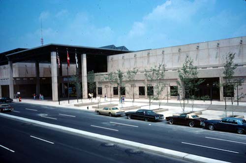
Our original 4-block Cervantes Convention Center, which opened in 1977, is still in the center of our current facility.
To the north of this mass only 8th street is closed, occupied by apartments. Sixth, 7th, and 9th all still exist in the neighborhood. The most recent plan for a north-south light rail plan includes a little bit of 9th, so the planned route would have to change.
So I’m agreeing with Bob Clark, if we want convention business we should start over with a clean slate. I haven’t been to Nashville since the Music City Center was constructed, but I looked at the website, photos, interior 360º views, aerial, and Google Streetview. Nashville’s convention center is 3 blocks long, 2 blocks wide. One city street continues through/under the building — I walked through via streetview. From the outside you cannot see the loading docks, one side is highly approachable with outdoor seating and businesses that can serve convention attendees as well as locals.
The main takeaway of Nashville’s center relative to Clark’s proposal is the street that continues rather than being vacated. In. St. Louis that allows a 3-block long convention center to orient north-south, next to the dead space known as the elevated I-44 interstate. Another is building up, not out. We’re a city, downtown buildings shouldn’t largely be single story.
View of Bob Clark’s proposal, click image to see larger view.
I’m not advocating we build Clark’s idea, I’m suggesting we start over from scratch. We’ve added on and altered the convention center built 45 years ago to the point it’s a sprawling mess. The Nashville center can’t compete with Chicago’s McCormack Place in terms of size, but it has the same light-filled open airy feeling. Our current facility will never have that. Never.
Here’s what I like about Clark’s proposal:
Fresh start, better for 21st century needs.
North-south orientation along Broadway (5th).
Better connection to Laclede’s Landing.
Cole Street (east-west) continues uninterrupted.
Sidewalk-level opportunities for storefronts around entire building, including along Cole.
A big massive building doesn’t separate the downtown CBD from the neighborhood north of Cole.
The long-vacant land north of Cole Street is utilized.
Vacant land to the west can be filled with new buildings, users, opportunities, tax revenue.
Here’s what I don’t like about Clark’s proposal:
The outdoor event space (Baer Plaza) between Broadway and I-44 is horrible. Conventioneers attempting to cross Broadway would get hit by the speeding one-way traffic. Broadway should be 2-way and this land should have hotel, apartments, condos, etc. Some of any new residential should be workforce housing and low-income housing.
7th, 9th, and 10th streets all need to be rebuilt/continue uninterrupted between Washington Ave and Cole — for pedestrians and vehicles.
Not sure keeping the existing curved entrance is a good idea.
No green roof or solar panels like they have in Nashville.
Convention Plaza needs to return to its previous name: Delmar.
The important thing is to put the brakes on the current expansion plan and take a fresh look at what it means to offer a convention center — not just how can we make a nearly half century old place less objectionable to convention planners. If we move forward with the current expansion plan we’ll be stuck with a bloated pig for at least another 20-30 years.
I feel the need to correct the record regarding Mill Creek Valley, to counter the false information being repeated.
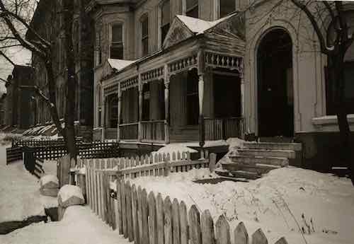
“Horizontal, black and white photograph showing a row of dilapidated residential buildings in the 3200 block of Lawton in Mill Creek Valley. The buildings appear to be empty and awaiting demolition. Low wooden fences enclose the small front yards. There are several inches of snow on the ground.” February 16, 1960. Missouri Historical Society
Though St. Louis was founded in 1764 it wasn’t incorporated until 1823. At that time “the city limits were expanded west to Seventh Street and north and south by approximately 5 blocks each.” (Wikipedia) In 1861 the limits were expanded west to Grand, but streets and development had already gone further west. The land for Forest Park was purchased in 1875 — it was located in St. Louis County, not within the city limits of St. Louis. The current municipal boundaries were set in the 1876 divorce from St. Louis County, they were rural at the time.
There was no singular cohesive Mill Creek Valley neighborhood. The large rectangular area (454 acres) the city demolished for “urban renewal”, bounded by 20th St, creek/railroad, Grand Ave, Olive St., included many communities, businesses, homes, etc. was built over many decades — neighborhoods plural. Our modern perception of neighborhoods having distinct edges didn’t exist then, your neighborhood was where you lived. People who lived between 20th & Jefferson didn’t see their area belonging to the newer area west of Compton. The fact this large area ended up being grouped together and labeled by the city as a redevelopment area doesn’t make it a single neighborhood.
Commonly the word “downtown” refers to a city’s central business district (CBD). The size/location of “downtown St. Louis ” varies depending upon who you ask. To some anything east of I-270 is downtown. When St. Louis Union Station reopened at its new facility on September 1, 1894 it was considered far west of the CBD/downtown. The original station, on the east side of 12th (now Tucker), opened on June 1, 1875.
Thus, the Mill Creek redevelopment area wasn’t the heart of downtown. Not even close. Starting at 20th and going west, it wasn’t the oldest part of the city either. The stately row houses in this area were significantly newer and nicer than the tenements east of 10th Street. It was certain old by the 1940s, just not the oldest. It was also dense and lively, with everything within a short walk. Market Street ran down the center of the rectangular redevelopment area and contained the majority of the commercial activity, but corner shops also existed.
Since the city’s founding African-Americans lived in tight pockets throughout the city and St. Louis County. The black population before the Civil War was a very small percentage.
Not all persons of color in St. Louis were slaves, and in fact, as the 19th century progressed, the number of free blacks continued to rise. This can be explained by looking at several factors. Conditions in St. Louis enabled self-purchase. St. Louis’ proximity to Illinois, a state where slavery was supposed to be illegal, allowed a small number of slaves to sue for their freedom in St. Louis courts based on the premise that they had been held as slaves for a period of time in a free state. A very small number were also set free by masters who had come to see slavery as a moral wrong. Former slaves who wished to remain in the State of Missouri as free blacks were supposed to obtain a license from the state.
In addition to the over 1,000 free blacks in St. Louis who owned small businesses, were laborers or worked odd jobs, a certain elite group of African-American St. Louisans styled “the Colored Aristocracy” were large landowners and businesspersons, many descended from some of St. Louis’ earliest residents. Several owned the large barber emporiums, while others owned drayage businesses which moved goods from steamboat to steamboat on the levee. Still others, like Madame Pelagie Rutgers, owned huge tracts of land which they sold at great profit as the city expanded. The “Colored Aristocracy” of St. Louis had its own social season and debutante balls. A member of this social class, Cyprian Clamorgan, wrote a book in 1858 called the Colored Aristocracy of St. Louis, in which he profiled the group. (National Park Service — highly recommended)
Yes, wealthy blacks in the 19th century. They didn’t live in the area we know today as Mill Creek. They lived in The Ville.
During the 1920s, The Ville was home to an elite community that included black professionals, businessmen, entertainers and Annie Malone, one of the country’s first African-American millionaires. One of St. Louis’ most historically significant neighborhoods, The Ville was home to Sumner High School, the first school west of the Mississippi River to provide secondary education for blacks. Some of the school’s best known alumni are Rock ‘n’ Roll Hall of Famer Chuck Berry, opera diva Grace Bumbry, and tennis great Arthur Ashe. During the 1920s and ‘30s, the neighborhood thrived, as more and more African-American institutions were established, including Harriet Beecher Stowe College and Homer G. Phillips Hospital.
The Ville served as the cradle of African-American culture and nurtured its rich heritage for the black population of St. Louis. Today, the soaring Ville Monument pays tribute to the neighborhood’s achievements and its famous sons and daughters. (Explore St. Louis)
Sumner High School, mentioned above, opened downtown on 11th between Poplar & Spruce in 1875 — the same year as the adjacent first new Union Station mentioned earlier:
Charlton Tandy led protests of the planned siting of Sumner High School in a heavily polluted area in close proximity to a lead works, lumber and tobacco warehouses, and the train station as well as brothels. He said that black students deserved clean and quiet schools the same way white students do. The location went unchanged, and Sumner High opened in 1875, the first high school opened for African Americans west of the Mississippi. The school is named after the well-known abolitionist senator Charles H. Sumner. The high school was established on Eleventh Street in St. Louis between Poplar and Spruce Street, in response to demands to provide educational opportunities, following a requirement that school boards support black education after Republicans passed the “radical” Constitution of 1865 in Missouri that also abolished slavery.
The school was moved in the 1880s because parents complained that their children were walking past the city gallows and morgue on their way to school. The current structure, built in 1908, was designed by architect William B. Ittner. Sumner was the only black public high school in St. Louis City until the opening of Vashon High School in 1927. Famous instructors include Edward Bouchet and Charles H. Turner. Other later black high schools in St. Louis County were Douglass High School (opened in 1925) and Kinloch High School (1936). (Wikipedia)
Sumner High was an 1867 school renamed. Originally it was District School Number Three. Source: 1960 handbook.
Locations:
1867, 5th & Lombard
10th & Chambers
1875, 11th & Spruce — now known as Sumner instead of #3.
1896, 15th & Walnut
1908 construction on the current location in The Ville neighborhood began
1910 classes began, moving from 15th & Walnut.
Wealthy blacks in St. Louis were successful in relocating Sumner t0 their neighborhood, where their homes and businesses were located.
Another well-known institution in The Ville was Homer G. Phillips Hospital.
Between 1910 and 1920, the black population of St. Louis increased by sixty percent, as rural migrants came North in the Great Migration to take industrial jobs, yet the public City Hospital served only whites, and had no facilities for black patients or staff. A group of black community leaders persuaded the city in 1919 to purchase a 177-bed hospital (formerly owned by Barnes Medical College) at Garrison and Lawton avenues to serve African Americans. This hospital, denoted City Hospital #2, was inadequate to the needs of the more than 70,000 black St. Louisans. Local black attorney Homer G. Phillips led a campaign for a civic improvements bond issue that would provide for the construction of a larger hospital for blacks.
When the bond issue was passed in 1923, the city refused to allocate funding for the hospital, instead advocating a segregated addition to the original City Hospital, located in the Peabody-Darst-Webbe neighborhood and distant from the center of black population. Phillips again led the efforts to implement the original plan for a new hospital, successfully debating the St. Louis Board of Aldermen for allocation of funds to this purpose. Site acquisition resulted in the purchase of 6.3 acres in the Ville, the center of the black community of St. Louis. But, before construction could begin, Homer G. Phillips was shot and killed. Although two men were arrested and charged with the crime, they were acquitted; and Phillips’ murder remains unsolved.
Construction on the site began in October 1932, with the city initially using funds from the 1923 bond issue and later from the newly formed Public Works Administration. City architect Albert Osburg was the primary designer of the building, which was completed in phases. The central building was finished between 1933 and 1935, while the two wings were finished between 1936 and 1937. The hospital was dedicated on February 22, 1937, with a parade and speeches by Missouri Governor Lloyd C. Stark, St. Louis Mayor Bernard Francis Dickmann, and Secretary of the Interior Harold L. Ickes. Speaking to the black community of St. Louis, Ickes noted that the hospital would help the community “achieve your rightful place in our economic system.” It was renamed in 1942 from City Hospital #2 to Homer G. Phillips, in his honor. (Wikipedia)
Prior to Homer G. Philips Hospital in the Ville, an existing building was used as City Hospital #2 between 1919-1936. That 19th century building was at Garrison & Lawton. That intersection no longer exists. Lawton was an east-west street between Pine and Laclede, known as Chestnut east of Jefferson. So yes, the first hospital for blacks in St. Louis was within the boundaries of the Mill Creek redevelopment area, for 17 years. Then the significantly larger City Hospital #2 opened in the Ville — where the wealthier black families lived.
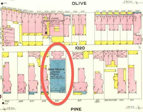
February 1909 Sanborn Map showed a stone (blue) church at 3015 Pine, labeled “Berea Presby’n Church (Negro)”. This is one the few buildings to survive the clearance of the Mill Creek redevelopment area.
As stated at the beginning, black residents lived in small pockets throughout the city. Wealth, social class, and geography separated the residents of the Ville from those in the older Mill Creek redevelopment area.
This is not to say every black person living in The Ville was wealthy, that was not the case. As poor blacks moved north to escape the Jim Crow south they likely lived where they could, including in The Ville. I know of one family that lived in The Ville during the 1940 census that had migrated from Alabama. I’d love to see maps showing where black persons lived in the region following the Civil War, showing shifts each decade. The change from 1950 to 1960 would give us better information on where families displaced by the demolition of Mill Creek relocated.
We know white home owners in the areas immediately outside The Ville had racially restrictive covenants on their properties since the early years of the 20th century. One block, now part of the Greater Ville neighborhood, was still white when the Shelley family had a white person act as the buyer so they could purchase 4600 Labdie in 1945. In 1948 the U.S. Supreme Court ruled the court system couldn’t be used to enforce restrictive covenants (Shelley v Kraemer).
This prompted many white homeowners surrounding The Ville to sell and move further away. At the same time people were being forced to leave the Mill Creek Valley redevelopment area many more options were available on the city’s north side. Yes, some may have moved into numerous high-rise public housing projects that were open prior to the February 16, 1959 start of demolition in Mill Creek.
Cochran Garden Apts, April 1953
Pruitt-Igoe, 1955
(In December 1955) a judge ruled St. Louis and the housing authority had to stop segregation in public housing.
Vaughn Apts, October 1957
The low-rise Neighborhood Gardens and Carr Square Village opened in May 1935 and August 1942, respectively. Again, segregated until 1956. One of the problems with large-scale demolition is people get scattered in the process.
The demolition was certainly a land grab, no question. Wealthy whites living west in the Central West End, Clayton, Ladue, etc had to drive on Market Street to reach Union Station and the CBD. They didn’t like driving through old dense areas, especially predominantly occupied by African-Americans.
Back east demolition was increasingly happening. Soldiers Memorial opened in 1938, Aloe Plaza opened two years later — both on the north side of Market Street. St. Louis leaders got hooked on demolition so clearing out the west entry to downtown followed. Also in the late 1930s the Oakland Express opened, a highway from Skinker to Vandeventer & Chouteau.
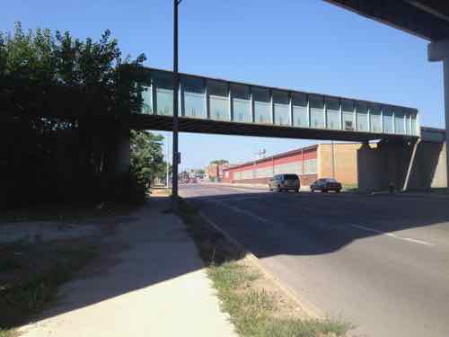
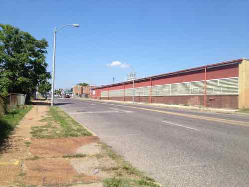
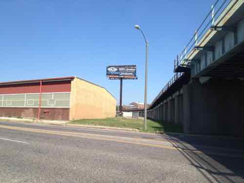
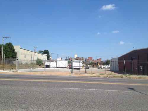
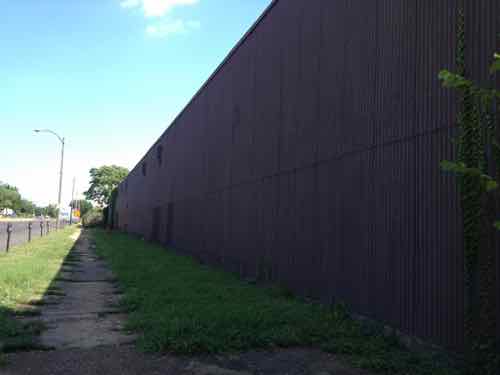
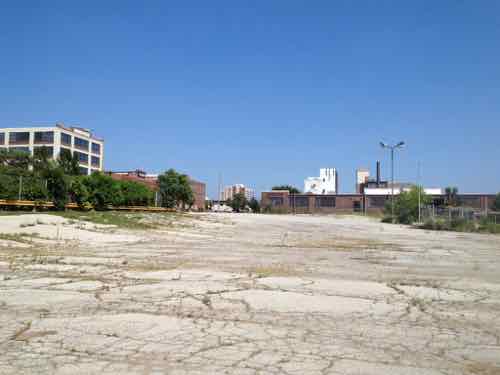
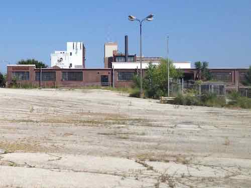
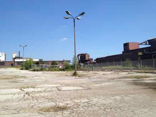
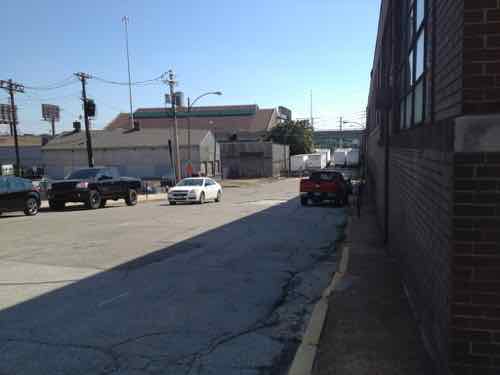
In August 2013 the vacant brake foundry in Midtown St. Louis, Vandeventer Ave. & Forest Park Ave., was an “eye sore” just south the main campus of Saint Louis University. IKEA’s announcement to build on the opposite side of Vandeventer was still a few months away. I visited the foundry site as best I could in my power wheelchair, taking 9 photos in a 20 minute period.
Before posting about the new City Foundry STL (with food hall, offices, retail space, and recently opened grocery store) I want to take you back to the afternoon of Saturday August 24, 2013:
Looking NE from the west side of Vandeventer, under I-64.
A little further north, looking toward Forest Park Ave.
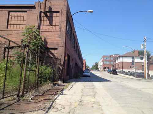
Turning east, the rail spur (right) hadn’t been used in decades.
Further north, looking east.
Now east of Vandevener, looking east along the north side of the foundry site, Forest Park Ave
From the gently-sloping parking lot within the site, looking east.
This is a cropped view from the previous image.
Into the site a little more, looking SE
Looking south along Spring Ave, the east boundary of the foundry site.
Down the hill, looking back north along Spring Ave. The eastern most foundry building is now on the left.
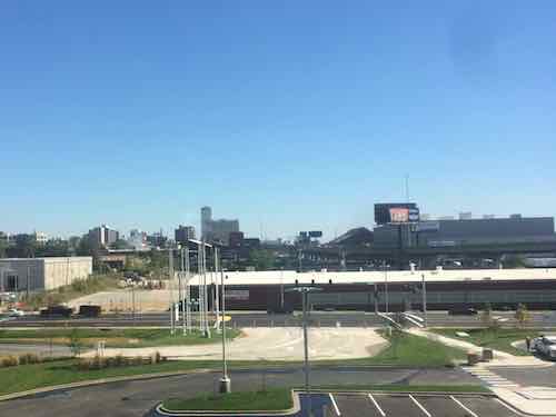
Looking east from IKEA’s 3rd floor restaurant on September 23, 2015 — the day the media was allowed to preview the new store. IKEA’s Opening Day was a week later, September 30, 2015. The foundry site to the east was unchanged more than 2 years after my visit above.
Soon I’ll use these images to compare the foundry to the completely reimagined present. The single-story building along Vandeventer was razed, all other buildings remain today. See amazing before interior photos here.
November 18, 2021Books, Featured, TransportationComments Off on New (ish) Book — ‘New Mobilities: Smart Planning for Transportation Technologies’ by Todd Litman
Mobility is very important to our lives, and humankind continues to consider new/different modes of transportation. Both of my grandfathers were born in simpler times: 1886 & 1899. The latter was my maternal grandfather, he lived until the age of 97. He saw and experienced many forms of mobility in his lifetime. Though he died just 20 miles from his birthplace he flew to both coasts and drive/rode to many places in his long life….including visiting me in St. Louis in his last few years.
How we all get from A to B is so important from a technology, environmental, policy, etc perspective. A recent book from a transportation expert Todd Litman explores the subject:
New transportation technologies can expand our world. During the last century, motorized modes increased our mobility by an order of magnitude, providing large benefits, but also imposing huge costs on individuals and communities. Faster and more expensive modes were favored over those that are more affordable, efficient, and healthy. As new transportation innovations become available, from e-scooters to autonomous cars, how do we make decisions that benefit our communities?
In New Mobilities: Smart Planning for Emerging Transportation Technologies, transportation expert Todd Litman examines 12 emerging transportation modes and services that are likely to significantly affect our lives: bike- and carsharing, micro-mobilities, ridehailing and micro-transit, public transit innovations, telework, autonomous and electric vehicles, air taxis, mobility prioritization, and logistics management. These innovations allow people to scoot, ride, and fly like never before, but can also impose significant costs on users and communities. Planners need detailed information on their potential benefits and impacts to make informed choices.
Litman critically evaluates these new technologies and services and provides practical guidance for optimizing them. He systematically examines how each New Mobility is likely to affect travel activity (how and how much people travel); consumer costs and affordability; roadway infrastructure design and costs; parking demand; land use development patterns; public safety and health; energy and pollution emissions; and economic opportunity and fairness.
Public policies around New Mobilities can either help create heaven, a well-planned transportation system that uses new technologies intelligently, or hell, a poorly planned transportation system that is overwhelmed by conflicting and costly, unhealthy, and inequitable modes. His expert analysis will help planners, local policymakers, and concerned citizens to make informed choices about the New Mobility revolution. (Island Press)
Here are the chapters so you can see how it’s organized.
Chapter 1: Introduction
Chapter 2: The Arc of Transportation History
Chapter 3: The Context of Transportation Planning
Chapter 4: A Comprehensive Evaluation Framework
Chapter 5: Evaluating the New Mobilities
Chapter 6: Analysis: How New Mobilities Can Achieve Community Goals
Chapter 7: Recommendations for Optimizing New Mobilities
Chapter 8: Conclusion
I couldn’t find a preview, but the author participated in a webinar discussing the topics in this book. This is a long presentation, but I found it interesting,
Like most new books I receive, this book isn’t a splashy coffee table book. It’s a “deep dive” into the subject. If you’re also a policy wonk then you’ll love Todd Litman and his latest book.
AARP Livibility Index
The Livability Index scores neighborhoods and communities across the U.S. for the services and amenities that impact your life the most
Built St. Louis
historic architecture of St. Louis, Missouri – mourning the losses, celebrating the survivors.
Geo St. Louis
a guide to geospatial data about the City of St. Louis
 It’s possibly human nature that causes us to look for a magical silver bullet to fix our cities, towns, and villages. Examples might include a sports team, corporate headquarters, even a monorail. Lasting success is never that easy, it takes more effort.
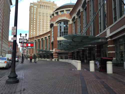

 Mobility is very important to our lives, and humankind continues to consider new/different modes of transportation. Both of my grandfathers were born in simpler times: 1886 & 1899. The latter was my maternal grandfather, he lived until the age of 97. He saw and experienced many forms of mobility in his lifetime. Though he died just 20 miles from his birthplace he flew to both coasts and drive/rode to many places in his long life….including visiting me in St. Louis in his last few years.