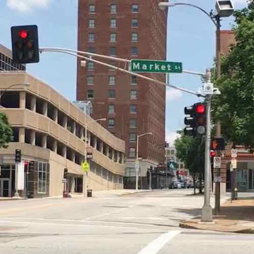
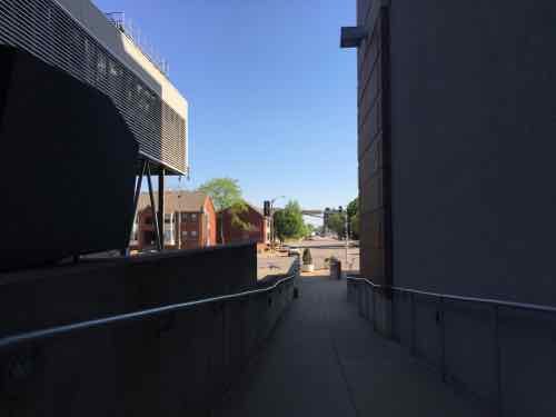
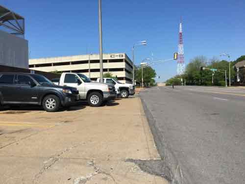
Recently my husband and I were walking/rolling back toward our loft from the Union Station MetroLink Station. For some reason we were on the East side of 18th — usually I’m on the West side. However, both sides are equally poorly designed and maintained.
Anyway, we’re Northbound on the East side of 18th as we approach Market St and I notice something I’d never seen before: Northbound vehicles get a green light but pedestrians don’t get a walk signal while the left arrow is on. Since NB vehicles are turning left I get why pedestrians on the West side of 18th St aren’t given a walk signal. You’d never want to give pedestrians the ok to walk while drivers get a left arrow — like at Tucker & Olive and Tucker & Locust.
Why should pedestrians get a walk signal? Pedestrians have the right-of-way except in cases where vehicles are given a specific signal such as a left arrow. In this cases pedestrians must wait, but in the example the only turning cars would be NB ones turning right onto EB Market — they’d yield to pedestrians crossing the street — like most intersections. My guess is this is another instance where the city just didn’t think about pedestrian users.
Let’s take a look…
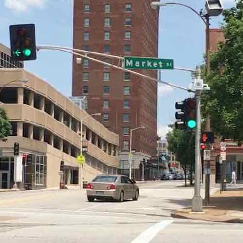
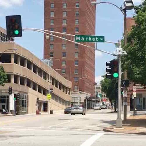
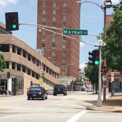
Vehicles have a red and pedestrians don’t walk, click image to view location in Google MapsNorthbound vehicles get a green light, those turning left onto Westbound Market get a left arrow. But pedestrians on the West side still get a don’t walkThe don’t walk remains as the left arrow goes yellow, then when Southbound traffic gets a green the walk signal to cross market comes onVery quickly the pedestrian signal begins to countdown to zero
Because still images can’t tell the full story I’ve put together a brief video:
Yes, another crossing at this same intersection is done correctly. If this were done right, pedestrians could cross Market St before Southbound vehicles get a green light and potentially make left turns onto Eastbound Market St — they don’ t get a left arrow so they must yield to Northbound vehicles and pedestrians crossing Market.
I see no reason why pedestrians don’t get a walk sign as soon as the Northbound traffic signal turns green.
Today post is another example of poor quality work. This isn’t about being a cash-strapped city — this is incompetence at all levels.
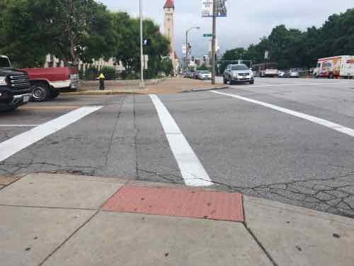
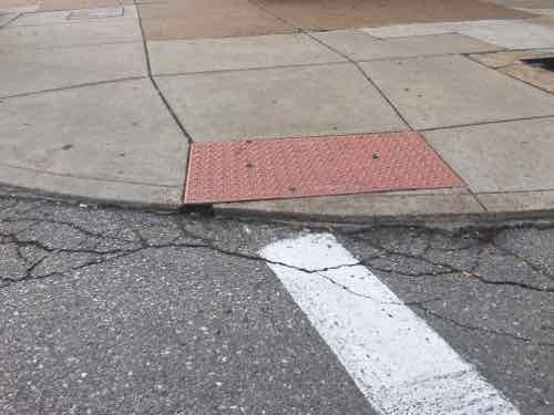
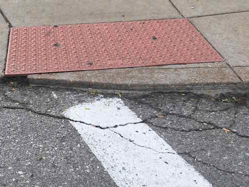
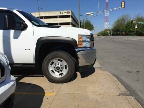
Looking West across 16th St at Market, note the location of the crosswalk relative to the detectable warning mat, click image for map to intersectionFrom the crosswalk looking toward the “ramp”Here’s a closer view of the ramp.
Looking at Google Street View I know this was done by the city sometime between September 2009 and August 2015. It was during this time the city took possession of the building from the federal government. I remember the old ramp, there are still some like it. It was done during a period when detectable warnings weren’t required, plus the location had no relationship with their crosswalk. But it was flush with the street.
The maximum vertical hight change allowable per ADA guidelines is 1/4″ — but this curb ramp is substantially higher than that. Sadly, it is very common to have greater than 1/4″ at ramps. Many are so bad I email the Streets Dept’s asphalt guy directly so they can do a non-compliant patch. Many things can be non-compliant, but still useful. This, and others, are hard to use and they damage the drive wheel on my chair. This would be very challenging for someone using a manual chair, and a trip hazard for a person walking with a cane or walker. In fact — this is a trip hazard for anyone walking here.
I have no idea if this was built by city employees or by a hired contractor. Either way, we’s never tolerate such shoddy work on our homes or cars — it shouldn’t be allowed in the public right-of-way.
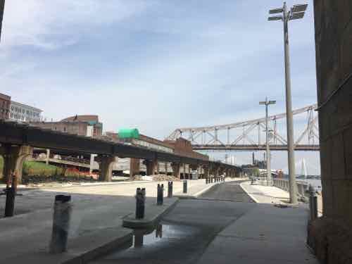
Great Rivers Greenway, the City of St. Louis, CityArchRiver Foundation and other partners invite residents from across the region to join them in celebrating the transformation of the St. Louis riverfront on Thursday, June 2. The organizations will be hosting a “Picnic on the Riverfront” event from 5:00 to 8:45 p.m., which will feature St. Louis’ largest-ever community picnic – complete with a 2,016-foot-long table with chairs – to commemorate the opening of the new riverfront beneath the Gateway Arch.
The official ribbon cutting on June 2 will begin at 5 p.m. on the overlook stage along Leonor K. Sullivan Boulevard, with remarks from dignitaries and partners. Afterward, attendees can explore the nearby Mississippi Greenway, enjoy local music and educational activities for kids and purchase dinner from food trucks and other vendors. People are also welcome to bring their own picnic meal. An interfaith blessing will kick off dinner at 6:15 p.m., followed by an aerial photo of all the picnickers. The event will end with a brief fireworks display at 8:30 p.m.
“This new front door for our region celebrates the energy, adventure and awe of the mighty Mississippi and our iconic Gateway Arch,” said Susan Trautman, Executive Director of Great Rivers Greenway, the regional parks and trails district and lead agency on the project. “We invite people to bring their friends, family and neighbors from all parts of the region to celebrate.”
The renovation of the 1.5-mile stretch of riverfront includes the recently rebuilt Leonor K. Sullivan Boulevard and extension of the Mississippi Greenway from the Biddle Street Trailhead south to Chouteau Avenue, with protected walking and biking paths. The entire riverfront was elevated an average of almost two feet to limit flooding, returning more days of the year back to the community for walking, riding bikes, sightseeing and special events. While the historic elements were preserved, such as the cobblestones lining the levee; new amenities such as benches, bike racks, lights, power outlets and a street-level stage will make the space more inviting for events and programs. The lineup for this summer and fall includes bike rides, walk/run events, the St. Louis Brewers Guild Heritage Festival, a free concert series with The Sheldon, swap meets and more.
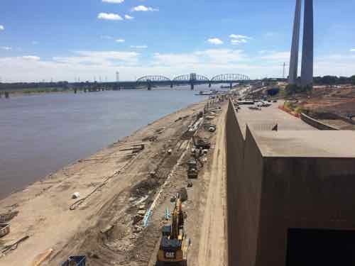
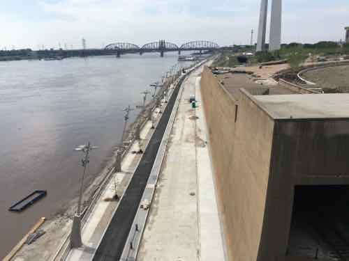
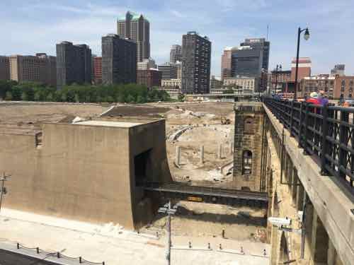
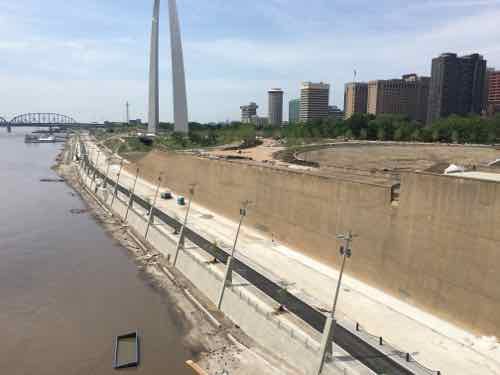
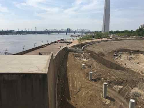
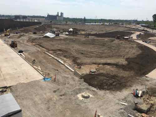
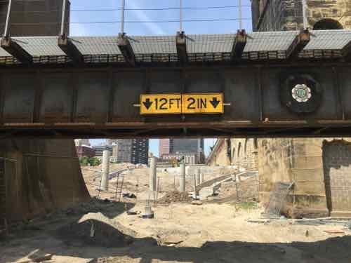
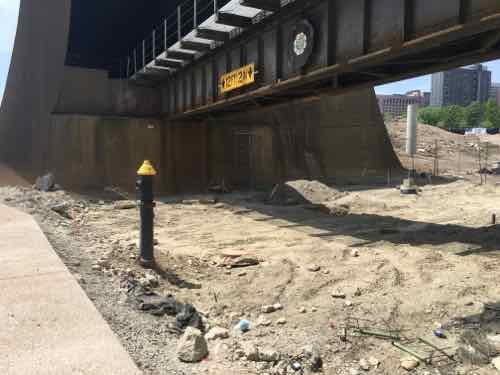
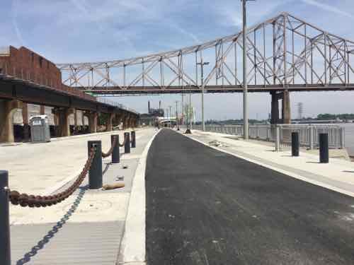
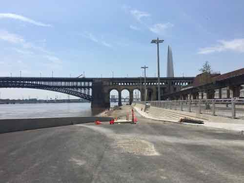
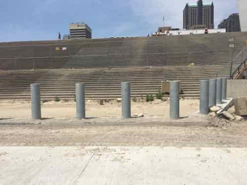
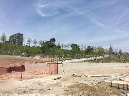
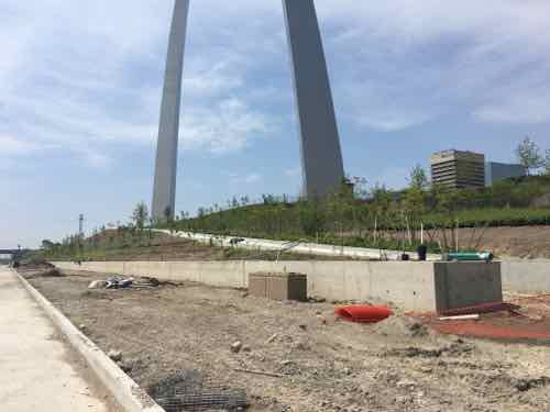
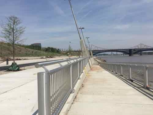
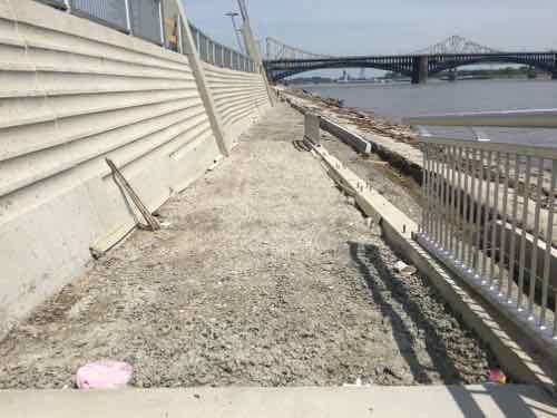
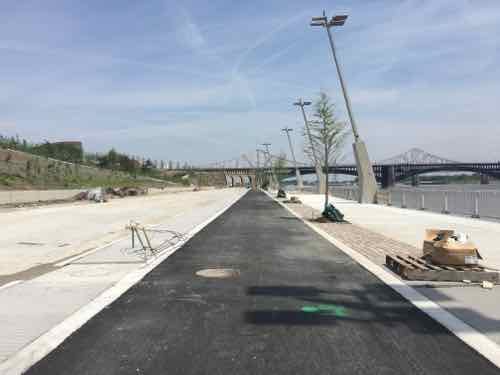
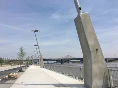
Earlier this month, on May 8th, my husband and I decided to check on the progress from the Eads Bridge. First though, a photo from September 2015:
Work continues on the North end of Lenore K. Sullivan — raising it was delayed by flooding. Click image to see September 2015 post with more imagesLooking more complete on May 8, 2016Looking West from further outLooking down riverMoving closer to downtownFurther WestDown on Lenore K Sullivan looking where Washington Ave used to beLenore K Sullivan Blvd is now higherLooking North from Eads Bridge, Laclede’s Landing area on the left beyond the elevated tracksFurther North, ML King Bridge in backgroundLooking back south toward the Eads BridgeNow at the center, some steps will be hidden by the new elevation of Lenore K Sullivan BlvdStill under constructions are four ramps from the top down to bottomThese ramps will be great for those of us in wheelchairs, pushing strollers, etcThere will also be ramps down to the cobblestonesIt appears a smooth concrete sidewalk will run along the base pf the wall next to the rough cobblestonesLooking South from the bike/job pathOne of the smartest ideas is concrete bases for light fixtures, these can go under flood waters without messing up wiring
So bring food, buy from food trucks, or just show up on June 2nd. I’m looking forward to exploring from end to end. Access is best from Chouteau or Laclede’s Landing Blvd (under the King Bridge).
St. Louis is again considering keeping up with the Joneses:
The city’s convention center complex should expand to more than 900,000 square feet, half again its current size, according to a report given Thursday to the St. Louis Convention & Visitors Commission.
Such improvements would bring a “minimum” 37 percent increase in additional business and would position the downtown neighborhood “to re-energize and redevelop,” the report concluded. (Post-Dispatch)
So many red flags in this quote. I’m always suspicious about reports promising increased business — especially that conventions will energize downtown. That’s what they said of the Old Post Office parking garage that replaced the historic Century Building over a decade ago! We should have the promised 24/7 downtown by now.
In the mid-1960s Mayor Cervantes (1965-1973) had backed an existing plan to build a convention center West of Union Station, serving less than 75 trains per day by then. Other business leaders wanted to raze the Old Post Office and they wanted a barrier to the North to hide the 1952 Cochran Gardens public housing — which was built to clear “slums”. They pushed their own plan — in conflict with the new mayor. They didn’t get to raze the Old Post Office, but they did get to create a physical barrier between public housing and the central business district. However, a 1968 study showed the near north location would perform poorly compared to the Union Station site and another location being considered:
The bulky study that ERA delivered to the city in May 1968 concluded, “the addition of a modern convention center is both appropriate and eco- nomical,” attracting annual attendance of 518,000 (including 386,000 at conventions and tradeshows) and generating 192,000 new hotel room nights in the city every year.
Yet where the ERA assessment was quite positive about the promise of a new convention center, it also argued that the site of the proposed facility would be critical to its achieving its potential. The ERA analysis was quite direct (and prescient) in arguing that, while “a convention center can play an important role in stimulating nearby commercial development . . . construc- tion of a single building regardless of its ancillary economic benefits, seldom stimulates downtown revitalization to any great extent.”
The study examined three possible sites. A civic center location, with proximity to hotels, ample parking, and an excellent environment would yield a net annual income of $71,000. A Union Station location, at a greater distance from the center of the core, would generate a net income of $20,000. The third site, the north side, was far and away the most problematic. While the location was convenient to existing hotels, the ERA conclusion was that a center built there “would operate at a serious disadvantage.” The problem was that the location was a “marginal environment,” filled with “one-, two-, and three-story retail stores in a generally deteriorated condition.” With greater likelihood of traffic congestion, the “North Side location would seriously curtail convention center use by local residents and by conventions.” A center there would attract half the annual convention and local events of an alterna- tive site, generating far less attendance and an annual loss. (Convention Center Follies: Politics, Power, and Public Investment in American Cities by Heywood T. Sanders)
The success of a convention center didn’t matter — they wanted it to form a physical barrier:
For Sverdrup and for Civic Progress, the new Busch Stadium and the proposed convention center served purposes far beyond baseball games or association meetings. Both major public projects were viewed as changing the physical environment of the core area’s fringe, and as spurs to new private investment.
As a wall, the bulk of a massive convention center could literally shut off the business district and the big department stores from the public housing projects and “cancerous” slums to the immediate north. The entrance to the new center would face south, focused on the downtown core, bringing convention attendees from nearby hotels and restaurants. To the north would be blank walls and loading docks facing the land cleared with federal urban renewal funds. (same)
They worked/fudged the numbers and finally got the public to pay for it:
The formal assessment by Disney’s “numbers man,” Buzz Price, that one downtown official termed “very optimistic,” amply sustained the notion that millions of visitors and attendees would flock to downtown. Price’s imprimatur on the Riverfront Square project thus neatly validated the judgment of Sverdrup and the Civic Progress leadership—St. Louis was on the verge of becoming a major visitor destination. When Mayor Cervantes’s Spanish Pavilion plan was hatched, it neatly followed both the model of Riverfront Square and its location. And the premise of the 1966 ERA study of the pavil- ion was that “Millions of local residents and tourists will be attracted” to the Arch, and that the new stadium would draw “Hundreds of thousands of persons . . . many of them from 100 to 200 miles away.”
Buzz Price’s positive assessment of the Spanish Pavilion was reinforced by the Disney connection. In turn, the forecast numbers from Price and Economics Research Associates for the Pavilion’s attendance and revenues bulwarked the sense among the Civic Progress members that the downtown would see a flood of new people and economic activity. When the possibility of de- veloping a major new convention facility surfaced in 1966, the experience of Chicago, Boston, and San Diego appeared to validate the potential of a center. And once again, the assessment by ERA provided a seemingly expert and reliable forecast of the likely performance and attendance of a new convention center.
ERA’s estimates of the performance of a new center were indeed viewed as so reliable by the St. Louis business leadership that Sverdrup and his firm’s staff simply appropriated them—verbatim—for their own analyses and for the formal presentation of the Convention Plaza redevelopment plan. It was the seeming credibility of ERA, Buzz Price, and project manager Fred Cochrane, as well as the firm’s connections and reputation within the theme park industry, that sustained Mayor Cervantes’s extended commitment to the Union Station site.
St. Louis’s downtown revitalization plans were thus based on the expert judgments of the “best and the brightest” in the planning and economic analysis world. Yet the city’s business leaders were not entirely devoted to following the consultants’ recommendations. When Fred Cochrane of ERA repeatedly warned against building a convention center on a north side site, the interests and goals of a unified business leadership simply overrode his conclusion. For the members of Civic Progress and their colleagues, the interests and concerns of “Cubby” Baer, Donald Lasater, Leif Sverdrup, and the Edison brothers fully trumped outside expert advice. The new convention center was far more about “protection from erosion” than potential as a meeting venue. (same)
The Spanish Pavilion was a huge flop — less than a quarter of projected traffic. It closed within a year. Basically, we built a convention center at the location we were told would perform poorly because influential business leaders selfishly wanted it there to protect their nearby interests.
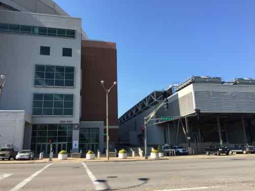
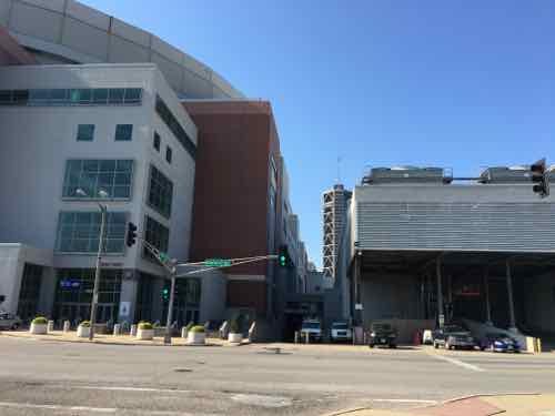
The new Cervantes Convention Center occupied four city blocks — closing 8th St & Dr. King Dr. Ninth & 7th streets were open but faced with harsh blank concrete walls for two blocks. The back of the convention center faced North sending the a message “You’re not welcome downtown.” In the early 90s the center was expanded South to Washington Ave and the dome was added to the East — closing 6th & 7th.
We need to be focusing on reconnecting neighborhoods to downtown — not continuing more than a half century of separation.
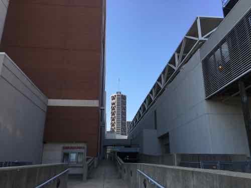
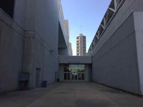
The Broadway (5th) & Cole entry to the domeHeading West along Cole6th St terminates into the North (Cole) facade of the domeRotating West we can see where the dome was attacked to the existing center at 7th StSimilar view looking South at what was 7th StApproachingLooking South, view little connects the two on the NorthLooking back North at the area deliberately cut off decades agoLooking North at 7th StHere we see the North facade of the original 1977 Cervantes CenterLooking West we get the feeling people aren’t expected…or welcomedOther convention centers have hidden underground docks, but not hereOk, past the semi we’re almost to the cornerOne last obstacleNow heading South on 9th next to the now 3 block long blank West wall
A 2014 review of Heywood Sanders’ book gives a good overview of the convention center fallacy:
The idea behind convention centers is to bolster the local economy by attracting visitors who would otherwise spend their money elsewhere. The best measure of success is the number of hotel room-nights they generate.
Sanders’ numbers tell the real story. Washington, D.C.’s new convention center was supposed to deliver nearly 730,000 room-nights by 2010; the actual number for that year was less than 275,000. Austin, Texas’ expanded center was supposed to bring 314,000 room-nights by 2005 but produced just 149,000. The 2003 expansion of Portland, Ore.’s convention center was expected to yield between 280,000 and 290,000 room-nights, but the actual number was 127,000 — far less than before the center’s expansion. Atlanta, Chicago, Dallas, Milwaukee, Minneapolis, Pittsburgh and Seattle are among other cities that have had similar experiences. The challenge is to find an exception to the rule.
That’s not all. When projects fail and debt service mounts, consultants routinely conclude that the center needs a “headquarters hotel,” which at the very least requires a large public subsidy. Sometimes the lack of developer interest results in the hotel being publicly owned. It’s a classic example of finding yourself in a hole and continuing to dig. (Governing)
The topic of expansion/updates was the subject of the recent Sunday Poll:
Q: Agree or disagree: Our region’s convention center, aka America’s Center, should be expanded to accommodate larger conventions
Strongly agree 13 [32.5%]
Agree 3 [7.5%]
Somewhat agree 4 [10%]
Neither agree or disagree 2 [5%]
Somewhat disagree 1 [2.5%]
Disagree 6 [15%]
Strongly disagree 9 [22.5%]
Unsure/No Answer 2 [5%]
Half agree on expansion, but the other half are split. As you’ve likely guessed, if you’re still reading, I’m very skeptical about promises made by convention center consultants. I don’t have an answer for what we should do, only advice to begin asking the right questions.
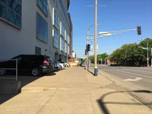
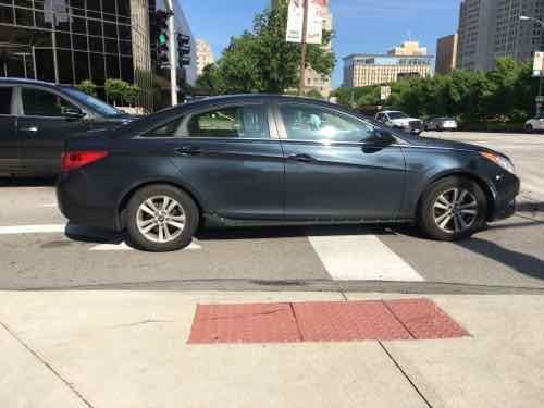
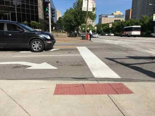
Last week, while we were out at 8th & Market. I noticed another design flaw in St. Louis’ pedestrian network.
There’s a green light but no pedestrian signal, but that’s not the main problemThe vehicle stop line is in direct conflict with the unmarked crosswalk
This is between Citygarden and Ballpark Village/Busch Stadium. The stop line and markings are recent. The detectable warnings on the sidewalk/ramp are there to help guide the visually disabled. Vehicles must stop before the stop line — but pedestrians and vehicles can’t occupy the same space at the same time.
This conflict occurs more than you think, because many of downtown’s signalized intersections fail to have marked crosswalks. If a crosswalk were marked it would’ve been obvious the vehicle stop line would be back where the Buick is in the second image.
In the 11+ years I’ve been doing this blog at least two downtown traffic studies have been done. To my knowledge, no pedestrian study has ever been conducted. Another example of nobody paying attention to what they’re doing.
AARP Livibility Index
The Livability Index scores neighborhoods and communities across the U.S. for the services and amenities that impact your life the most
Built St. Louis
historic architecture of St. Louis, Missouri – mourning the losses, celebrating the survivors.
Geo St. Louis
a guide to geospatial data about the City of St. Louis