Urban highways & interstates allow drivers to get from point A to point B quicker than had they taken surface streets, but they’re also a major divider between the existing neighborhoods they cut through. In the late 1950s the downtown’s 3rd Street Parkway was being extended north, eventually connecting with the new Mark Twain Expressway (aka I-70/I-44) in July 1961.
I live on the west side of the highway, but I can stand in my kitchen and see Broadway & Cass, on the east side of the highway. I know first hand how the highway divides the historic north riverfront from my neighborhood, Columbus Square.
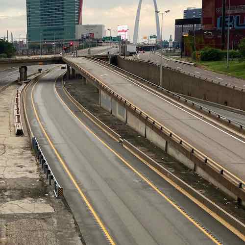
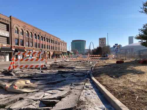
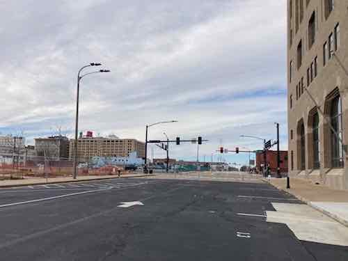
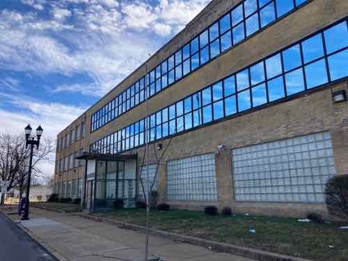
Looking south from the Cass Ave bridge over I-44, June 2020. The lane center is a southbound express lane, to the right is the express lane exit ramp to southbound Broadway.
Ideally we’d remove urban interstates and weave our neighborhoods back together, but that’s never going to happen. What should happen is when we rebuild crumbling infrastructure we add connections civil engineers in the 1950s never considered at the time the highways were planned.
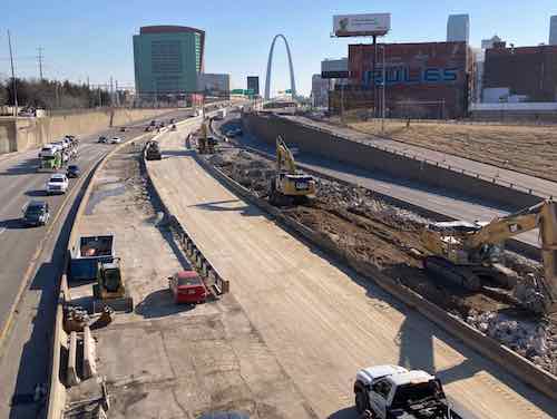
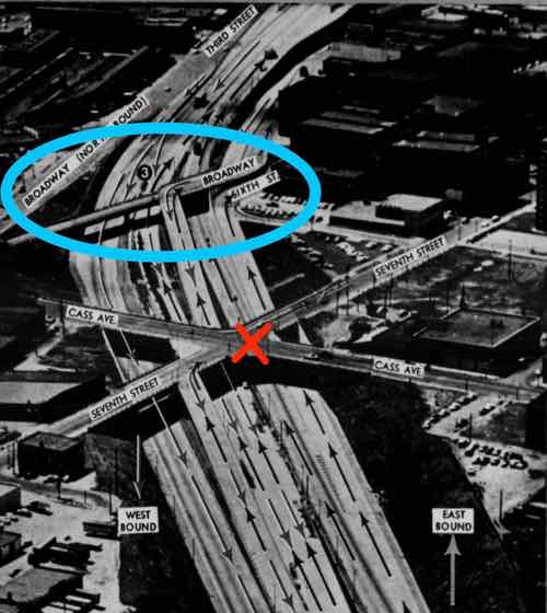
The same view Monday with southbound Broadway bridge and the exit ramp gone.The blue oval is the southbound Broadway bridge, the red X is where Csss & 7th were connected until construction began for the Stan Musial Veterans Memorial Bridge. Post-Dispatch July 9, 1961, p161.
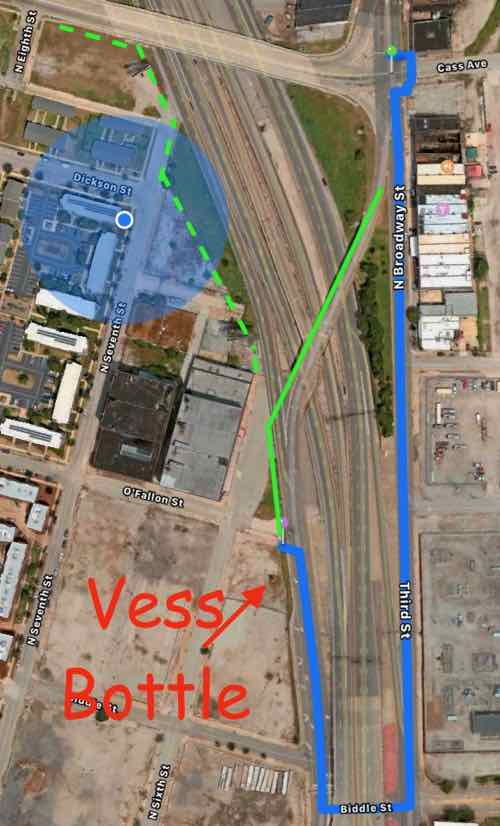
The distance from Broadway & Cass to Broadway & O’Fallon is only 2/10 of a mile, but the distance required for the last 60 years has been double that — 4/10 of a mile.
The Missouri Department of Transportation supports pedestrian facilities:
MoDOT works with planning partners to create transportation facilities that work for all users because we value bicycle and pedestrian travel. Accommodating for bicyclists or pedestrians may be as simple as providing a well-designed road that all road users share or as complex as a separate-grade structure, such as a bridge. Developing appropriate facility design for nonmotorists depends on a variety of geometric and operational factors that are inter-related, such as available right-of-way, projected traffic counts and adjacent roadway design speeds.
We strive to integrate nonmotorized travel into the existing system to provide connections where none exist to promote efficiency and to focus on a primary concern—the safety of those who depend on walking or bicycling to reach their destinations. (MoDOT)
Unfortunately MoDOT failed to accommodate the needs of cyclists and pedestrians in the replacement. This is a huge mistake — it’ll be another 60+ years before we get another chance to reconnect these areas.
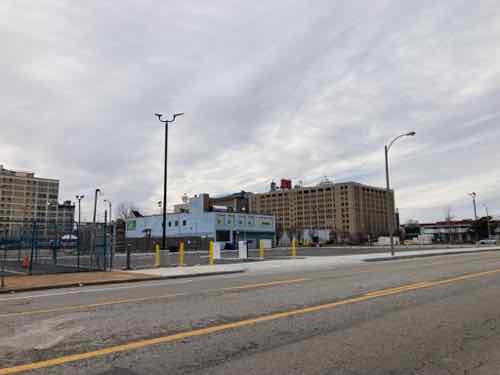
View from Broadway near Cass looking SW toward Broadway @ O’Fallon (just beyond building), June 2021The buildings on the right are part of a National Register Historic District.
You might be thinking it would be too difficult to include a pedestrian sidewalk. The old bridge, removed over the weekend, couldn’t have easily been retrofitted. But when building the new bridge entirely from the ground up it is actually pretty easy.
Here’s the overview:
The blue circle is my location. The blue line represents the route required to walk from Broadway @ Cass to Broadway @ O’Fallon — twice as far as the direct route shown in solid green. The dashed green line is how to connect Cass to 7th & 6th streets. Apple Maps
Now let’s take a look at the old bridge and highway exit ramps.
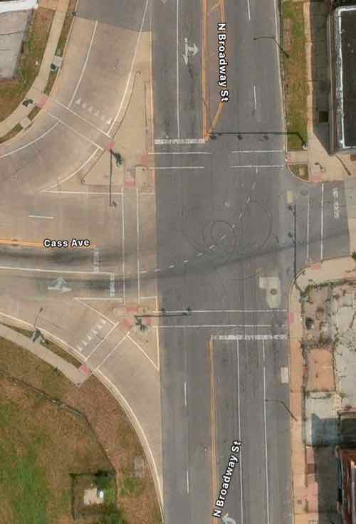
Broadway is only one lane per direction north of Cass, but it widens to 2 right turn lanes onto westbound Cass and 2 southbound lane to continue across the highway. One lane expands to four! Apple MapsSo 2 lanes of Broadway continued over the highway. The express lane exit is one lane but the Broadway exit is 2 lanes. Four lanes continue toward Cole before getting reduced to 2 further south.
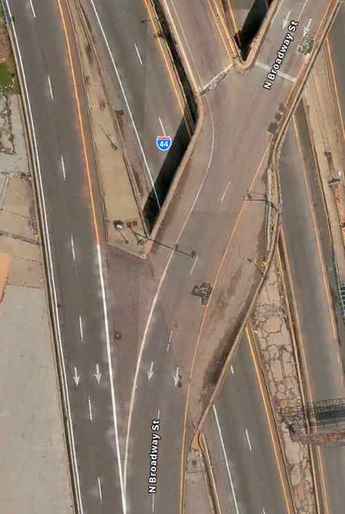
The solution is the one southbound lane of Broadway splits into 3 before Cass — one left, one right, one straight ahead. This means the same width bridge can also accommodate bikes & pedestrians. The traffic exiting the southbound express lane and the highway have plenty of length for drivers to decelerate. Rumble strips (or similar) can be used to communicate to the driver to slow down as they approach Broadway. The 2 highway exit lanes can narrow to one before Broadway. Not sure if signals are necessary or just a flashing red light and notices to yield to pedestrians.
I would like to see Broadway south of Cole to return to two-way traffic in the future, so I’d like the new bridge to accommodate 2-way traffic and pedestrians on one side.
Again, I’m trying to connect two areas that have been separated for over 60 years. Both have enormous potential for redevelopment — new construction & adaptive reuse to the south and mostly captive reuse to the north. I’d love to see football fans have pre-game drinks at Shady Jack’s Saloon and then walk down to the Dome to see the St. Louis Battlehawks when the XFL returns under new ownership.
Graphic from November 2020 post showing area predicted to have population loss.
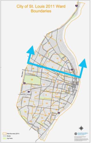
The 2020 Census results results for St. Louis showed what I had predicted, the bulk of our population loss came from northside wards. This was also true in 2010 and in 2020. No reason to think 2030 won’t be more of the same. We can sit back and do nothing, or we can help manage the situation — possibly reducing some losses in future.
By mange I mean see where population is dropping more than in other areas. We can’t just write of a third of our geographic area. I propose a group comprised of experts, residents, business owners, etc to examine data and evaluate possible solutions.
Here is some of the data I’d like to see on a big map(s):
Population by age & race
Parcels of land being used (water connection) vs unused.
Parcels of land with new or substantially renovated structures vs severally deteriorated, condemned, or vacant.
Parcels of land owned by the city, out of state owners, owner-occupied, LLC, .
Historic properties, sites.
Schools, current & former.
Employers and numbers of employees
Crime
Topography
Probably other criteria as well…
Since north city is not declining uniformly we need to see which parts that are doing better than others. Is this because 0f newer housing? Access to transit? All we know at this point is some blocks are stable and occupied while others are rapidly declining. Mapped data can tell us a lot, people on the ground familiar with their area can confirm or dispute what the data tells us. Get everyone on the same page, then reassess every few years and make adjustments as circumstances change for better or worse.
What we all need to accept is that it’s very unlikely these neighborhoods will see a major population growth. Ever. Thus some land can be returned to nature, used for agriculture, etc. The maps will show us the least populated areas with the worst housing stock — contrasted with pockets of denser areas with housing unlikely to be abandoned this decade. I’m not talking about large areas the size of Pruitt-Igoe, NGA-West, or Fairgrounds Park. It might be possible that smaller nature areas could be linked together by a trail system. A few great vacant school buildings not reused for residential might get filled with hydroponics to grow produce.
The major corridors like MLK, Page, Natural Bridge, Kingshighway, Grand, etc should remain. Many connecting streets would also remain. However, it’s possible in some areas we might be able to justify removing unoccupied streets and alleys. As St. Louis begins to look at replacing lead water supply lines those areas that’ll benefit most from the infrastructure investment should get priority over areas that can be back to nature by 2030. Old water & sewer lines might get abandoned completely in isolated areas.
The goal isn’t to cut off services to existing residents, but to use resources to strengthen and grow the existing strong pockets. On a block with say only one resident we can wait until that person moves or dies of old age. The children of longtime residents aren’t really interested in moving into the house their relative refused to leave. Conversely, a nice block with one newly-abandoned house needs help to make sure that one house gets maintenance and reoccupied as soon as possible. Quickly reoccupying a vacant building helps prevent others on the block from also being abandoned.
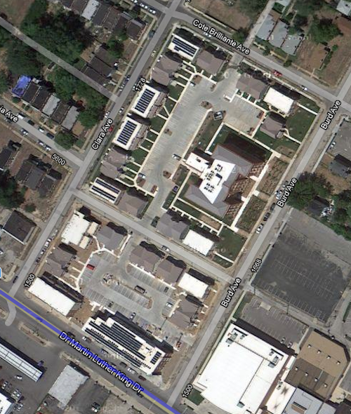
An example of a strong pocket would be MLK & Burd Ave. You’ve the Friendly Temple church and Arlington Grove housing (new housing around a renovated school that’s also housing). Substantial investment has been made, and this is home to many. We can reinforce the positives and look to expand upon that a block at a time.
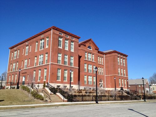
Former Arlington School has been residential since 2013Aerial after construction completed. Image: Google Maps
Just north of this pocket is a largely vacant area, part of the Wells-Goodfellow neighborhood that has gotten attention for mass demolitions. Other bright spots throughout north St. Louis include numerous tree-lined streets with well-maintained houses — it’s just hard for everyone to see & appreciate the them with so much decay. Whenever I see people wanting to raze vacant “problem” buildings I do get upset, because tearing down buildings in a random manner doesn’t improve neighborhoods for the long-term. It simply removes the current problem while likely speeding up others being abandoned as neighboring owners/residents die or move. By designating different areas for bright spot village and others as moving back toward nature we can reduce fights over razing vs preservation. I can even imagine a decent house in an area set to become nature/agriculture –it might be kept as basically a farmhouse. It wouldn’t necessarily be razed, just reimagined.
Along the way we can reevaluate I-70, an old interstate that winds its way through north city. Can we minimize this as a separating barrier in spots? Can we create areas for interstate drivers to pull off and get a bite to eat while their battery electric vehicle (BEV) charges?
One spot I see as the center of a future village is the intersection of Grand & North Florissant. That’s in part of 2 current neighborhoods, with a 3rd very close. It should be the very center of a thriving area.Why here? The intersection of two corridors should be treated as special. Both Grand and North Florissant are angled toward each other, so a person living or working here can pick either corridor to travel south — southeast on North Florissant or Southwest on Grand. Thanks to the odd street grid they have easy direct access to different parts of the city. Going northwest on North Florissant will eventually get them into St. Louis County.
By 2050 I see north St. Louis as being dotted with nice little villages, with nature in between. Primary corridors will be a line of density with restaurants, retail, offices, and multi-family housing. Rail &/or rubber tire public transit will connect these villages to each other and the larger city & region. I see walking & biking within and between villages. I see jobs growing produce outside and indoors, more jobs along the corridors. I see trees — thousands of them providing some relief from increased temperatures. The major corridors will be tree-lined, many new nature areas will become forests. I see all races, proportional to the mix in the population. Some villages, like The Ville, are predominantly black (75%, not 100%) with strong black-owned businesses. Again I’m talking 30 years, not 3.
What I don’t see are big surface parking lots for big box chain stores. I also don’t see blocks and blocks of obvious vacant residential buildings/lots.
St. Louis should use some of the money from the NFL to kick start the planning process to examine north St. Louis as I’ve described — taking stock and what we have (and don’t have) and then collectively finding solutions to change the trajectory. In the process others could come up with better ideas.
Today’s post is a look at Martin Luther King Jr Drive in the City of St. Louis — my 18th annual such post. As in the 17 times prior, I traveled the length in both directions looking for changes from the previous year.
Streetsign
Not much has changed since MLK Day 2021 but I’ll detail them later. First I want to address how the street gots it name, and when. After Dr King was assassinated in Memphis in 1968 some cities began almost immediately to rename major streets in his honor. St. Louis took four years.
This Day in St. Louis History, February 17, 1972: Martin Luther King Boulevard is dedicated A Board of Aldermen bill was passed that changed the name of Easton Avenue and portions of Franklin Avenue to Martin Luther King Boulevard. Alderman C.B. Broussard was a primary sponsor, and he announced that the change was part of a nationwide organized drive to rename streets in honor of the murdered civil rights figure.
Sounds good, but in fact-checking I discovered it is partly inaccurate. I should’ve checked the accuracy in 2017. “Dedicated” implies an event, media, long-winded speeches, and big scissors to cut a ribbon — which did not occur.
Here’s what really happened:
February 18, 1972: A bill was introduced to rename part of Franklin Avenue and all of Easton Avenue. (Post-Dispatch 2/19/1972 P7)
March 21, 1972: Board of Aldermen gave final approval to bill 20-2 earlier in the day. (Post-Dispatch 3/21/1972 P27)
Spokesperson for Mayor Cervantes said he would sign the bill the following week. (Post-Dispatch 3/31/1972 P19)
Post-Dispatch editorial expressed “reservations” about renaming Franklin & Easton for Dr. King. They weren’t sure it was a worthy honor. They favored a new park or boulevard. (Post-Dispatch 4/2/1972 P108)
East St. Louis mayor James E. Williams Sr. announced his city would rename the Veterans Memorial Bridge and Illinois Ave to honor Dr. King. This would mean a person could travel from the east limits of East St. Louis to the west limits of St. Louis on roads honoring Dr. King (Post-Dispatch 4/11/1972)
After the official change before businesses changed their letterhead, and the public continued to use the old names. Unfortunately it was only a few years after MLK was honored through East St. Louis IL and Saint Louis that construction began on a convention center, closing two blocks of King Blvd between 7th and 9th. D’oh!
Ok, let’s start on the east end and heading west.
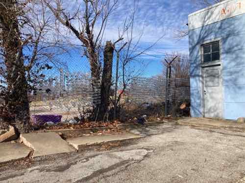
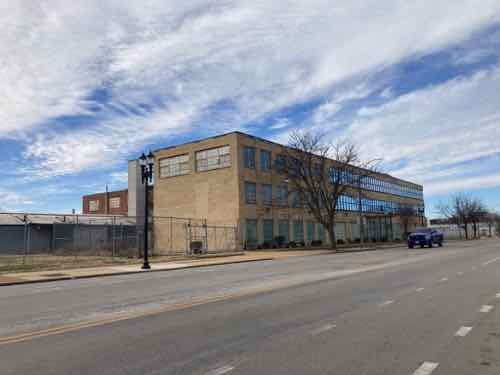
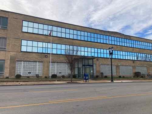
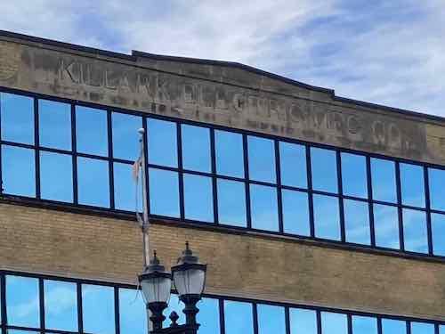
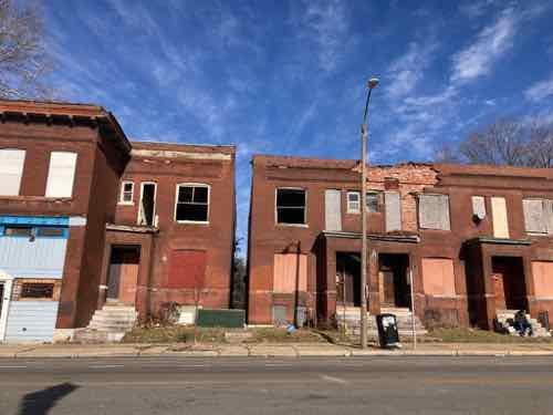
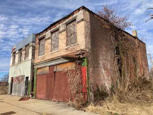
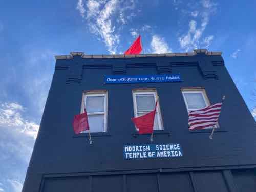
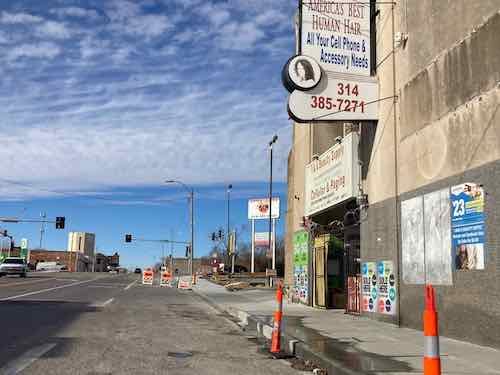
On MLK, facing west toward Tucker Blvd. On the right is the former Post-Dispatch building, now housing the St. Louis offices of digital payment company Square. On the left is Interco Plaza. This block is now one-way westbound.Interco Plaza, a public park, after being “closed for renovation” in September 2021 as a way of relocating the unhoused that had set up camp. The background is St. Patrick Center, a non-profit organized to “combat homelessness.” This public park has not yet reopened to the public.A year ago I mentioned the old buildings that were razed on MLK just east of 14th. Now we have a surface parking lot with zero fencing, landscaping, trees, etc. Plus a new driveway. Why do hip tech businesses locate in downtowns if they don’t want to design for downtowns?Imo’s Pizza is adding onto the east side of their headquarters/warehouse. 16th Street has been closed to vehicles and pedestrians for years — a subtle way to say “keep out” to north side who want to enter the more prosperous Downtown West neighborhood.Hard to see in this photo, but clear plastic bottles have been put into the holes in a chainlink fence. I found it interesting. NW corner of MLK & Vandeventer.Last month the non-profit Dismas House announced it bought the former 15-acre Killark Electric Manufacturing property at 3940 MLK.Liked the 100k SF building for many years, not a fan of the replacement windows that were installed decades ago. Killark first leased the site in 1918, not sure when they bought it or built this building.“KILLARK ELECTRIC MFG CO.” is in stone at the top of the main building. City records list 8 buildings on the site, but I can only see records for six. Of the 6, the oldest is from 1892 and the newest is 1966.The glass-enclosed entry doesn’t look original, but it has been in place as long as I can recall.From MLK I could see a community garden at Sarah & Evans. Click image to see Good Life Growing’s website.More bricks have fallen off the front of 4277 MLK.4749 MLK has looked bad for years, but thankfully it has been getting some stabilization.4859 MLK has also looked bad for a long time, noticed a little bit of the side wall has collapsed. 4961 next door is also in poor condition. The building on the left is privately owned, right is owned by the LRA. Both were built in 1905.The setback building at 4973 MLK, just east of Kingshighway, has been mostly finished for many years. New this year is temporary construction fencing. The side lot out to Kingshighway has been disturbed recently.5084 MLK is now a Moorish Science temple.The nice composition of buildings at 5700+ MLK still look stable.5736 MLK is a medical cannabis dispensary, or will be once it actually opens — click the image to view their currently bare bones website. The space next door is a meeting/event space. Both very positive in an area short on good news.Just west of Goodfellow we see one unit worse than the others.Floors and the roof are gone, accelerating deterioration of the brick walls. 5810 MLK5861 MLK, built in 1907, is showing some wear. The stone plaque over the center doors says it’s the “Kinsey Building”.The former JC Penny department store at 5930 is still standing. Would love to see this building renovated and occupied.The buildings across the street may not survive as long. The gap is where a building was lost in 2020.The famous Wellston Loop transit building continues being exposed to the elements.The west side is no better.The sidewalk between Irving Ave and Kienlen Ave was just replaced. This is in Wellston — St. Louis County, just beyond the St. Louis city limits.
Like previous years a few bright spots, mostly depressing decay.
I feel the need to correct the record regarding Mill Creek Valley, to counter the false information being repeated.
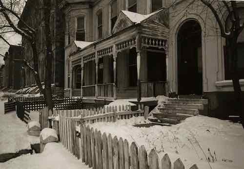
“Horizontal, black and white photograph showing a row of dilapidated residential buildings in the 3200 block of Lawton in Mill Creek Valley. The buildings appear to be empty and awaiting demolition. Low wooden fences enclose the small front yards. There are several inches of snow on the ground.” February 16, 1960. Missouri Historical Society
Though St. Louis was founded in 1764 it wasn’t incorporated until 1823. At that time “the city limits were expanded west to Seventh Street and north and south by approximately 5 blocks each.” (Wikipedia) In 1861 the limits were expanded west to Grand, but streets and development had already gone further west. The land for Forest Park was purchased in 1875 — it was located in St. Louis County, not within the city limits of St. Louis. The current municipal boundaries were set in the 1876 divorce from St. Louis County, they were rural at the time.
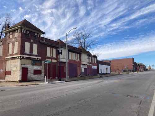
There was no singular cohesive Mill Creek Valley neighborhood. The large rectangular area (454 acres) the city demolished for “urban renewal”, bounded by 20th St, creek/railroad, Grand Ave, Olive St., included many communities, businesses, homes, etc. was built over many decades — neighborhoods plural. Our modern perception of neighborhoods having distinct edges didn’t exist then, your neighborhood was where you lived. People who lived between 20th & Jefferson didn’t see their area belonging to the newer area west of Compton. The fact this large area ended up being grouped together and labeled by the city as a redevelopment area doesn’t make it a single neighborhood.
Commonly the word “downtown” refers to a city’s central business district (CBD). The size/location of “downtown St. Louis ” varies depending upon who you ask. To some anything east of I-270 is downtown. When St. Louis Union Station reopened at its new facility on September 1, 1894 it was considered far west of the CBD/downtown. The original station, on the east side of 12th (now Tucker), opened on June 1, 1875.
Thus, the Mill Creek redevelopment area wasn’t the heart of downtown. Not even close. Starting at 20th and going west, it wasn’t the oldest part of the city either. The stately row houses in this area were significantly newer and nicer than the tenements east of 10th Street. It was certain old by the 1940s, just not the oldest. It was also dense and lively, with everything within a short walk. Market Street ran down the center of the rectangular redevelopment area and contained the majority of the commercial activity, but corner shops also existed.
Since the city’s founding African-Americans lived in tight pockets throughout the city and St. Louis County. The black population before the Civil War was a very small percentage.
Not all persons of color in St. Louis were slaves, and in fact, as the 19th century progressed, the number of free blacks continued to rise. This can be explained by looking at several factors. Conditions in St. Louis enabled self-purchase. St. Louis’ proximity to Illinois, a state where slavery was supposed to be illegal, allowed a small number of slaves to sue for their freedom in St. Louis courts based on the premise that they had been held as slaves for a period of time in a free state. A very small number were also set free by masters who had come to see slavery as a moral wrong. Former slaves who wished to remain in the State of Missouri as free blacks were supposed to obtain a license from the state.
In addition to the over 1,000 free blacks in St. Louis who owned small businesses, were laborers or worked odd jobs, a certain elite group of African-American St. Louisans styled “the Colored Aristocracy” were large landowners and businesspersons, many descended from some of St. Louis’ earliest residents. Several owned the large barber emporiums, while others owned drayage businesses which moved goods from steamboat to steamboat on the levee. Still others, like Madame Pelagie Rutgers, owned huge tracts of land which they sold at great profit as the city expanded. The “Colored Aristocracy” of St. Louis had its own social season and debutante balls. A member of this social class, Cyprian Clamorgan, wrote a book in 1858 called the Colored Aristocracy of St. Louis, in which he profiled the group. (National Park Service — highly recommended)
Yes, wealthy blacks in the 19th century. They didn’t live in the area we know today as Mill Creek. They lived in The Ville.
During the 1920s, The Ville was home to an elite community that included black professionals, businessmen, entertainers and Annie Malone, one of the country’s first African-American millionaires. One of St. Louis’ most historically significant neighborhoods, The Ville was home to Sumner High School, the first school west of the Mississippi River to provide secondary education for blacks. Some of the school’s best known alumni are Rock ‘n’ Roll Hall of Famer Chuck Berry, opera diva Grace Bumbry, and tennis great Arthur Ashe. During the 1920s and ‘30s, the neighborhood thrived, as more and more African-American institutions were established, including Harriet Beecher Stowe College and Homer G. Phillips Hospital.
The Ville served as the cradle of African-American culture and nurtured its rich heritage for the black population of St. Louis. Today, the soaring Ville Monument pays tribute to the neighborhood’s achievements and its famous sons and daughters. (Explore St. Louis)
Sumner High School, mentioned above, opened downtown on 11th between Poplar & Spruce in 1875 — the same year as the adjacent first new Union Station mentioned earlier:
Charlton Tandy led protests of the planned siting of Sumner High School in a heavily polluted area in close proximity to a lead works, lumber and tobacco warehouses, and the train station as well as brothels. He said that black students deserved clean and quiet schools the same way white students do. The location went unchanged, and Sumner High opened in 1875, the first high school opened for African Americans west of the Mississippi. The school is named after the well-known abolitionist senator Charles H. Sumner. The high school was established on Eleventh Street in St. Louis between Poplar and Spruce Street, in response to demands to provide educational opportunities, following a requirement that school boards support black education after Republicans passed the “radical” Constitution of 1865 in Missouri that also abolished slavery.
The school was moved in the 1880s because parents complained that their children were walking past the city gallows and morgue on their way to school. The current structure, built in 1908, was designed by architect William B. Ittner. Sumner was the only black public high school in St. Louis City until the opening of Vashon High School in 1927. Famous instructors include Edward Bouchet and Charles H. Turner. Other later black high schools in St. Louis County were Douglass High School (opened in 1925) and Kinloch High School (1936). (Wikipedia)
Sumner High was an 1867 school renamed. Originally it was District School Number Three. Source: 1960 handbook.
Locations:
1867, 5th & Lombard
10th & Chambers
1875, 11th & Spruce — now known as Sumner instead of #3.
1896, 15th & Walnut
1908 construction on the current location in The Ville neighborhood began
1910 classes began, moving from 15th & Walnut.
Wealthy blacks in St. Louis were successful in relocating Sumner t0 their neighborhood, where their homes and businesses were located.
Another well-known institution in The Ville was Homer G. Phillips Hospital.
Between 1910 and 1920, the black population of St. Louis increased by sixty percent, as rural migrants came North in the Great Migration to take industrial jobs, yet the public City Hospital served only whites, and had no facilities for black patients or staff. A group of black community leaders persuaded the city in 1919 to purchase a 177-bed hospital (formerly owned by Barnes Medical College) at Garrison and Lawton avenues to serve African Americans. This hospital, denoted City Hospital #2, was inadequate to the needs of the more than 70,000 black St. Louisans. Local black attorney Homer G. Phillips led a campaign for a civic improvements bond issue that would provide for the construction of a larger hospital for blacks.
When the bond issue was passed in 1923, the city refused to allocate funding for the hospital, instead advocating a segregated addition to the original City Hospital, located in the Peabody-Darst-Webbe neighborhood and distant from the center of black population. Phillips again led the efforts to implement the original plan for a new hospital, successfully debating the St. Louis Board of Aldermen for allocation of funds to this purpose. Site acquisition resulted in the purchase of 6.3 acres in the Ville, the center of the black community of St. Louis. But, before construction could begin, Homer G. Phillips was shot and killed. Although two men were arrested and charged with the crime, they were acquitted; and Phillips’ murder remains unsolved.
Construction on the site began in October 1932, with the city initially using funds from the 1923 bond issue and later from the newly formed Public Works Administration. City architect Albert Osburg was the primary designer of the building, which was completed in phases. The central building was finished between 1933 and 1935, while the two wings were finished between 1936 and 1937. The hospital was dedicated on February 22, 1937, with a parade and speeches by Missouri Governor Lloyd C. Stark, St. Louis Mayor Bernard Francis Dickmann, and Secretary of the Interior Harold L. Ickes. Speaking to the black community of St. Louis, Ickes noted that the hospital would help the community “achieve your rightful place in our economic system.” It was renamed in 1942 from City Hospital #2 to Homer G. Phillips, in his honor. (Wikipedia)
Prior to Homer G. Philips Hospital in the Ville, an existing building was used as City Hospital #2 between 1919-1936. That 19th century building was at Garrison & Lawton. That intersection no longer exists. Lawton was an east-west street between Pine and Laclede, known as Chestnut east of Jefferson. So yes, the first hospital for blacks in St. Louis was within the boundaries of the Mill Creek redevelopment area, for 17 years. Then the significantly larger City Hospital #2 opened in the Ville — where the wealthier black families lived.
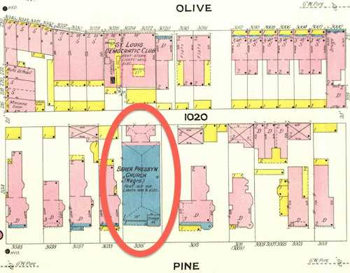
February 1909 Sanborn Map showed a stone (blue) church at 3015 Pine, labeled “Berea Presby’n Church (Negro)”. This is one the few buildings to survive the clearance of the Mill Creek redevelopment area.
As stated at the beginning, black residents lived in small pockets throughout the city. Wealth, social class, and geography separated the residents of the Ville from those in the older Mill Creek redevelopment area.
This is not to say every black person living in The Ville was wealthy, that was not the case. As poor blacks moved north to escape the Jim Crow south they likely lived where they could, including in The Ville. I know of one family that lived in The Ville during the 1940 census that had migrated from Alabama. I’d love to see maps showing where black persons lived in the region following the Civil War, showing shifts each decade. The change from 1950 to 1960 would give us better information on where families displaced by the demolition of Mill Creek relocated.
We know white home owners in the areas immediately outside The Ville had racially restrictive covenants on their properties since the early years of the 20th century. One block, now part of the Greater Ville neighborhood, was still white when the Shelley family had a white person act as the buyer so they could purchase 4600 Labdie in 1945. In 1948 the U.S. Supreme Court ruled the court system couldn’t be used to enforce restrictive covenants (Shelley v Kraemer).
This prompted many white homeowners surrounding The Ville to sell and move further away. At the same time people were being forced to leave the Mill Creek Valley redevelopment area many more options were available on the city’s north side. Yes, some may have moved into numerous high-rise public housing projects that were open prior to the February 16, 1959 start of demolition in Mill Creek.
Cochran Garden Apts, April 1953
Pruitt-Igoe, 1955
(In December 1955) a judge ruled St. Louis and the housing authority had to stop segregation in public housing.
Vaughn Apts, October 1957
The low-rise Neighborhood Gardens and Carr Square Village opened in May 1935 and August 1942, respectively. Again, segregated until 1956. One of the problems with large-scale demolition is people get scattered in the process.
The demolition was certainly a land grab, no question. Wealthy whites living west in the Central West End, Clayton, Ladue, etc had to drive on Market Street to reach Union Station and the CBD. They didn’t like driving through old dense areas, especially predominantly occupied by African-Americans.
Back east demolition was increasingly happening. Soldiers Memorial opened in 1938, Aloe Plaza opened two years later — both on the north side of Market Street. St. Louis leaders got hooked on demolition so clearing out the west entry to downtown followed. Also in the late 1930s the Oakland Express opened, a highway from Skinker to Vandeventer & Chouteau.
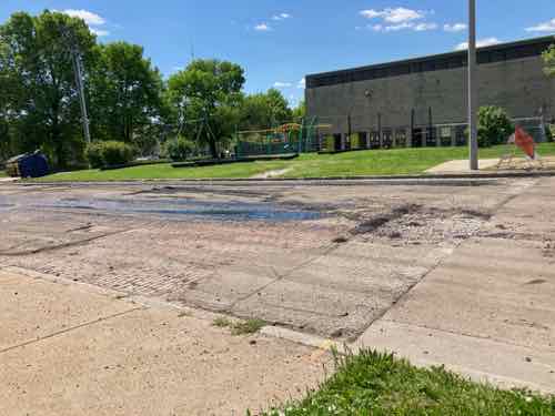
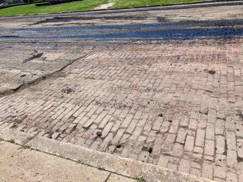
Most older streets in St. Louis were paved in cobblestones or paver bricks, few exist anymore. Asphalt paving is significantly smoother, just far less attractive. In 1953 the Cochran Gardens high rise public housing complex opened, but construction closed off 8th Street between O’Fallon Street and the alley south of Cass Avenue. Eighth Street was reopened when the high rise towers were replaced with the mixed-income Cambridge Heights townhouses & apartments, except 8th wasn’t connected through to the little stub of a street to Cass.
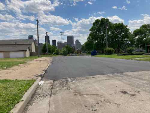
This October 2, 2019 view is looking south on 8th from Cass. You can see the land just after the alley, Cambridge Heights, and the downtown skyline on the horizon. In the foreground you can see brick pavers. It looked like it had been paved over decades ago, but most was long gone so the old bricks were exposed.On May 5th I returned home tfrom a press conference at the Chain of Rocks water treatment plant to see city crews paving over the small amount of bricks.Closer viewA couple of days later I went back to see the finished results.The concrete in the foreground was part of the new river bridge project, when Cass was raised in height over the interstate.
This half block of 8th Street gets very little traffic, the uniformity of the asphalt paving does look better than it did with patches of old asphalt and broken bricks. This is better, but I still miss seeing the bricks.
AARP Livibility Index
The Livability Index scores neighborhoods and communities across the U.S. for the services and amenities that impact your life the most
Built St. Louis
historic architecture of St. Louis, Missouri – mourning the losses, celebrating the survivors.
Geo St. Louis
a guide to geospatial data about the City of St. Louis