Coming Soon to Kingshighway & Delmar: More Low-Density Sprawl
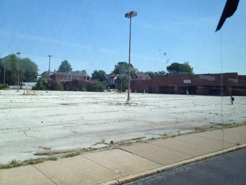
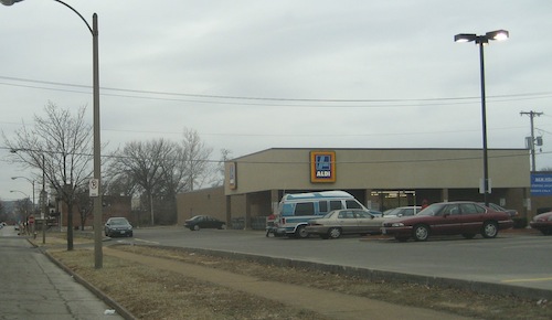
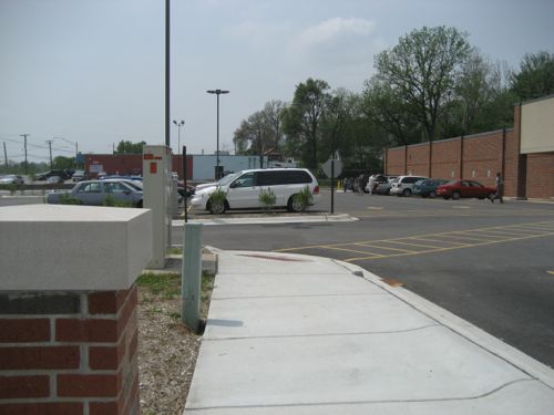
The site of the former National/Schnucks at Kingshighway & Delmar, long vacant, has now been cleared for new development. I’ve viewed the site as an opportunity to build a dense urban project, ideally connected with a Delmar extension of the future Loop Trolley. But current plans may delay dense development of the 4+ acre site for at least the next 20-30 years.
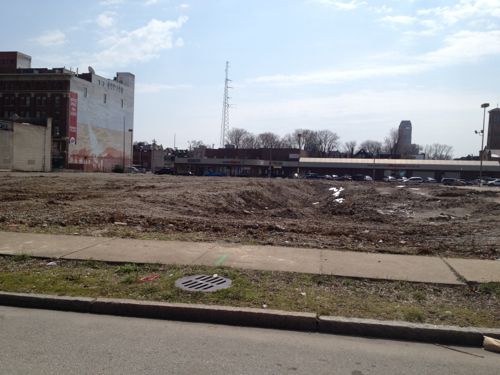
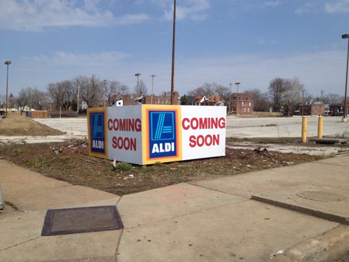
But ALDI doesn’t need over 4 acres! Looking at city records online I see The Roberts Brothers has divided the site into three parcels, with ALDI buying one of the three.
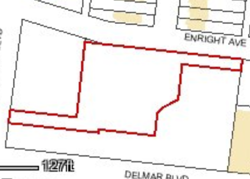
The boundaries of the three parcels is intriguing, my guess is so all three can have automobile entrances facing Kingshighway, or at least a Kingshighway address. This new store will be part of three recently announced locations also including Creve Coeur & Des Peres (source).
My assumption is this Kingshighway & Delmar location will replace the ALDI less than a mile to the north at Kingshighway & Page (1315 Aubert).
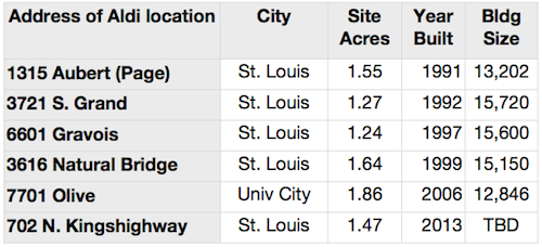
Below is a look at a few ALDI locations in the area, showing size of parcel, year built, and the building size:
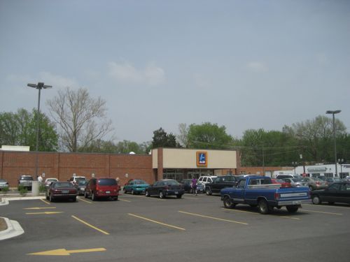
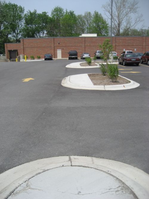
The most recently completed ALDI on the list above is the 7701 Olive location. I visited that ALDI in May 2006, shortly after it opened.
This is how ALDI builds US locations from coast to coast. For example, in late 2010 a blogger noted the design for a dense Washington DC neighborhood (see Terrible Aldi design shows need for new parking zoning). As with so many retailers, they’ll do the cheapest design they can, barely meeting minimum standards. If we want/expect better we must demand better — raising the minimum. Retailers will meet the improved standard as long as they can get sales & profit growth. ALDI does have a few urban locations, but only in super-dense places like Queens, NY.
And before anyone says ALDI and Trader Joe’s are part of the same company let me clarify their relationship.
The [ALDI] chain is made up of two separate groups, Aldi Nord (North – operating as Aldi Markt), with its headquarters in Essen, and Aldi Süd (South – operating as Aldi Süd), with its headquarters in Mülheim an der Ruhr, which operate independently from each other within specific areas.
[snip]
Both Aldi Nord and Aldi Süd also operate in the United States; Aldi Nord is owner of the Trader Joe’s chain while Aldi Süd operates as Aldi. (Wikipedia)
Thus the ALDI we see in the US is NOT related to our Trader Joe’s stores. Another difference between our ALDI stores and our Trader Joe’s is the latter is willing to go compact in dense, walkable areas. For example, the Trader Joe’s I visited in 2009 located at 1700 E Madison St, Seattle, WA. The store is located on the ground floor with sidewalk entrance, a level of structured parking over the store and four levels of housing over that.
Madison St. in Seattle still has low-density development, like the gas station across from the Trader Joe’s, but one property at a time it is getting more urban. As it gets more urban it attracts more people, increasing the need to be more urban.
Back in St. Louis, we do the opposite. We continue to build low-density sprawl, then scratch our heads wondering why more people don’t walk, use transit, or why our population declines. I’m not suggesting development patterns are the reason for our population decline in the past, but it is a factor today.
A single story ALDI surrounded by surface parking on this corner is totally inappropriate given the context to the east and south.
— Steve Patterson