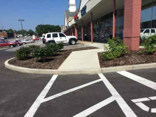
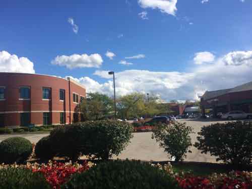
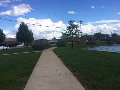
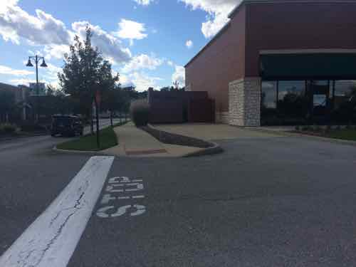
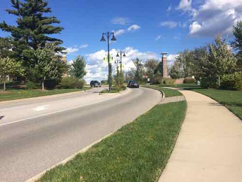
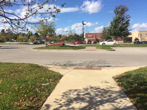
Back on July I posted about a problem accessing Yorkshire Village Shopping Center, recently completed construction had created a new obstacle! I contacted the property owner about the problem, we even met at the site once.
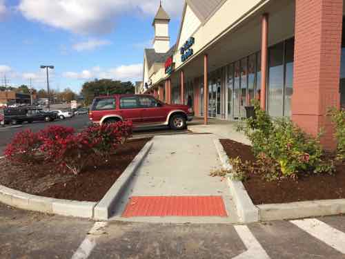
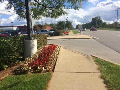
July 2014: a new curb kept the path between buildings from being accessible. I don’t know how stuff like this gets built more than two decades after the ADA, but it does all too oftenThe developer fixed the problem on October 23rd, I visited again on the 31st.Looking the other way, toward the new CVS
It’s a small change, but was much more expensive after the fact than if it had been done correctly in the first place. Their architect/engineer still insists it was compliant the way it was first built, but it wasn’t. The fact the building was existing is irrelevant:
Because barrier removal under the ADA is a continuing obligation, an accessible route may need to be provided at a later date, if a route for the general public develops or is created, and the provision of an accessible route is readily achievable. For instance, if a new bus stop is established near a site, an accessible route may have to be provided if pedestrians commonly walk between the new bus stop and the entrance to the facility. Similarly, if a sidewalk or walkway is provided between the facility and the new bus stop, an accessible route may be required. (Dept of Justice)
I’ve taken readings of the ramp, based on the slope it needs handrails on both sides to be fully compliant with ADA guidelines. If it weren’t as steep handrails wouldn’t be necessary.
Thanks to Matthew Stack of Koch Development for recognizing the problem and taking corrective action.
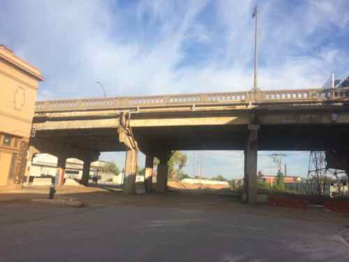
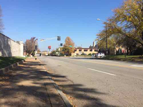
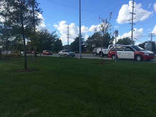
In the late 90s I lived in Dutchtown and worked on Union at I-70, three days a week I commuted by bike. I’d vary the route somewhat but it always included Tower Grove Ave. Many St. Louis area cyclists use Tower Grove Ave as their preferred north-south route but that may change in early 2015. They’re concerned about increased auto traffic during the 18 months while the Kingshighway viaduct is being replaced.
The crumbling Kingshighway viaduct will soon be history
Here’s the deal:
Starting in early 2015 Kingshighway will close between Shaw and Vandeventer for a year and a half as an aging bridge over railroad tracks is rebuilt. This arterial road carries 45,000 vehicles per day, and traffic on nearby roads is expected to increase as a result. The primary detours will be along Vandeventer, Shaw, and McRee, which will be reconfigured to accommodate more traffic. Still, the concern is that excess traffic will spill over into other streets, particularly during rush hour. To address this, the City aims to increase traffic capacity along Tower Grove Avenue between Magnolia and Shaw (blue segment on map below) during peak hours by prohibiting parking and allowing two lanes of traffic. (Safe Tower Grove Ave)
The following announcement was retrieved from the Streets Dept page on 11/2/2014:
NOTE REGARDING TOWER GROVE: A road diet and buffered bike lanes on Tower Grove Avenue from Magnolia to Shaw are part of Phase III of Bike St. Louis and all partners are committed to executing that plan. When the Kingshighway bridge construction begins in early 2015, the following things will happen:
The East side of Tower Grove Avenue from Magnolia to Shaw will be posted “No Parking” between 7-9 am and the west side will be No Parking between 4-6 pm;towing enforced.
We will paint a bikeable shoulder to be used by bicyclists during these peak times. We will maintain the share the road markings in the outside traffic lanes for use by bikes at non-peak times (when parked cars are present).
In addition alternate bike routes will be signed as a detour just as we do with vehicle traffic.
Alternate routes for cyclists will include creating a biking and walking friendly renovation of the Thurman Underpass.
Traffic levels will be monitored and evaluated regularly for changes – This could include additional parking restrictions or reducing parking restrictions and adding bike facilities.
We will install the full Phase III Bike St. Louis improvements along Tower Grove Ave as quickly as possible after monitoring how the closure is affecting all forms of traffic. We look forward to adding this and many more signage and markings to make City of St. Louis streets better for bicycles!
While the City’s proposal is inexpensive and represents minimal change for drivers, in our discussion it was widely seen as confusing and unsafe. As an example, when there are just a few parked cars (right after rush hour, for instance) many cyclists will be guided to the painted “bikeable shoulder”. Drivers will expect cyclists to ride there as well. When coming upon a parked car, though, the rider will have to quickly enter the travel lane. This is intimidating and dangerous for cyclists as well as for drivers, who will be surprised to have a bicycle suddenly appear in front of them just as the lane narrows. Alternatively, cyclists may choose to ride where the sharrows (shared lane markings) are, regardless of parked cars. This is the safer and more predictable option, but leaves the rider vulnerable to aggressive drivers who may even try to pass on the right.
The main task of bike lanes is to provide consistent guidance for all users of the road, so that cyclists know where to best position themselves, and drivers know where to expect bicycles. The City proposal provides no such service. It is confusing and open to interpretation, and is thus more dangerous than no bike lanes at all.
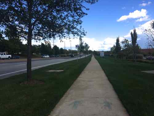
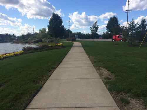
Tower Grove Ave looking North toward Shaw
The cyclists considered three alternatives to the city’s plan:
No change, keep it as is during construction
Buffered bike lanes, do the planned buffered bike lanes before construction starts
Parking protected lanes
They unanimously supported the buffered bike lanes for Tower Grove Ave. Implementing this next phase of the Bike St. Louis plan now is a smart way to mitigate the issues we’ll face when traffic on Kingshighway is detoured to other roads. By making Tower Grove Ave less desirable for cyclists we risk them driving during the 18 month construction period, making traffic worse.
We need a coherent & connected bike network to allow those who wish to commute by bike to do so. Our public right-of-ways have generous width, enough for pedestrians, cyclists, and motorists to share. Read & sign their petition here.
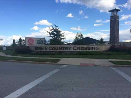
Now I’m very familiar with our public transit system and my husband uses our shared car to get to work. So I took public transit from downtown way out to Town & Country to see the shopping center 6+ years later.
Public Transit:
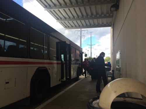
From our loft Google Maps says the drive to Town & Country Crossing, located at Clayton Rd & Woods Mill Rd., is just over 19 miles, taking 23 minutes via I-64 or 56 minutes if you avoid highways. The 57x is the MetroBus route that runs along Clayton Rd in far west county. How long does it take? From my loft it takes 68- 87 minutes, depending upon departure time and route. The 57x usually heads west from the Brentwood MetroLink station, but a few trips per day leave from the Central West End MetroBus center adjacent to the CWE MetroLink. Interestingly, catching the #10 MetroBus a block from our loft can get me to Town & Country Crossing in 77 minutes, less than some combinations involving MetroLink light rail!
The latest morning arrival weekdays is 7:34am. The next arrival? Not until 2:32pm. Clearly Metro wisely caters to worker’s schedules rather than run buses throughout the day. The 57x also serves Chesterfield.
I went out three weeks ago, Monday October 6th. I took MetroLink to the Brentwood station to catch the first afternoon trip 57x westbound.
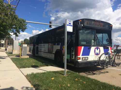
“Connecting Missouri MetroBus routes at Brentwood-I 64 Station include: #02 Red Line, #59 Dogtown, #158 Ballas-West County, and #57X Clayton Rd Express.” Click image to view station pageThe 57x I took to Town & Country stopping on Clayton Rd. between Woods Mill & Hwy 141. The concrete pad is fairly new, Metro has been working to improve accessibility of bus stops throughout the regionHowever, the next WB MetroBus stop isn’t good for many people. Town & Country Crossing is visible in the background
For the return trip I had three choices; one across Clayton Rd from where I got off the 57x, and two along the north edge of Town & Country Crossing. Here are the two next to my destination.
For the eastbound 57x the eastern most stop is at a point where the sidewalk is far away from the curb, the sign can be seen next to the red & white taxiThe stop I used was toward the west end of the shopping center, no pad to reach the bus but considerably closer than the other stop.
The 57x I took back to the east stopped at Brentwood MetroLink then continued east to the Central West End MetroBus Center, where I caught the #10 that dropped me off at 16th & Olive, a block from my loft. Because the #57 uses I-64 from Brentwood to Mason Rd the trip is relatively quick.
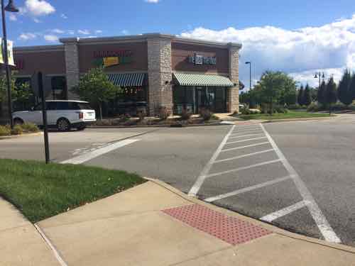
Woods Mill Plaza:
I’d never been to Woods Mill Plaza, located just east of Town & Country Crossing, so I thought I’d take a look while I was in the area. The main anchor is a Schnucks.
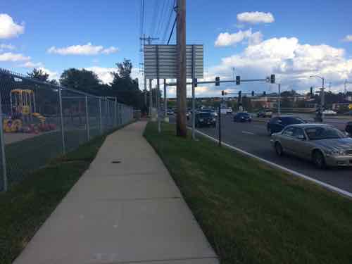
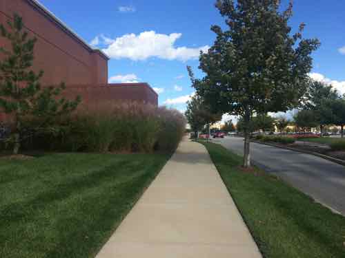
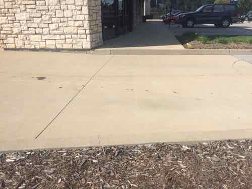
Approaching from the traffic island after crossing Clayton RdA decent sidewalk runs along Clayton Rd and includes one bus stop I previously mentioned, but no accessible route into the siteView of the various buildings from the public sidewalk. Maybe access is off of Woods Miill?The first auto in/out on Woods Mill not only lacks a pedestrian entry but blocks a straight path. I got the contract info for a Town & Country employee who said Woods Mill Plaza is responsible, he’d contact them about this.The next entry also lacked a pedestrian route. No other pedestrian route into Woods Mill Plaza was found despite the presence of sidewalks & bus stops.
From property records I learned Woods Mill Plaza was built in 1986, the 2-story office building on the site was built in 1991. If you think this site is somehow “grandfathered” you’d be very wrong:
Because barrier removal under the ADA is a continuing obligation, an accessible route may need to be provided at a later date, if a route for the general public develops or is created, and the provision of an accessible route is readily achievable. For instance, if a new bus stop is established near a site, an accessible route may have to be provided if pedestrians commonly walk between the new bus stop and the entrance to the facility. Similarly, if a sidewalk or walkway is provided between the facility and the new bus stop, an accessible route may be required. (Dept of Justice)
Moving on…
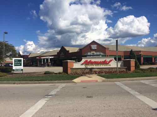
Town & Country Crossing:
As I said at the opening, my only other visit was in July 2008. I’d been impressed with what I saw then but I wanted to return in my wheelchair to see the completed shopping center. I remain impressed but did note some problems in maintenance and design.
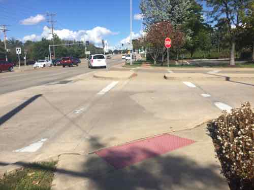
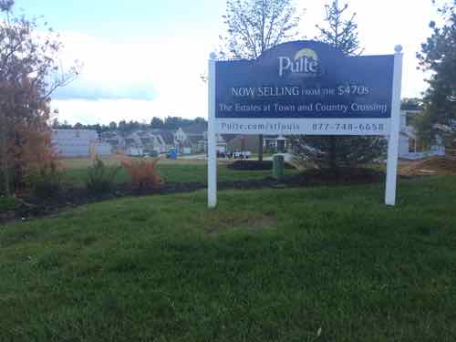
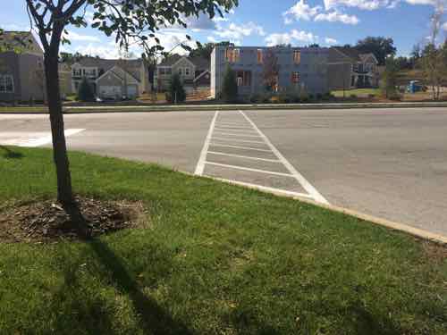
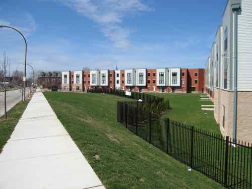
Immediately upon crossing Woods Mill I encountered a situation with a vertical height higher than allowed. This was the only problem like this I encountered in the site.Moving into the site this was the view toward Woods MillAnd the view toward Clayton Rd.I decided to follow this cute to enter the site.To the immediate west of the Clayton Rd entrance is a new home development. This land was part of the previous AT&T center where Town & Country Crossing is located now. These homes are marketed as being adjacent to the shopping center, especially the Whole Foods.However, the intended connection between the two isn’t accessible.The Clayton Rd entrance, Town & Country apparently doesn’t allow tall backlit retail signs or the developer realized a more tasteful approach is more visually appealing.The architects/engineers that originally laid our=t Town & Country Crossing gave a lot of thought to pedestrian accessibility, this is to a small out building on the west edgeView looking east along the main east-west pedestrian route, which is parallel to the main east-west auto route, the building on the left contains several storefronts and a bank is just beyond that.Unfortunately something went wrong here, despite the efforts to make this shopping center fully accessible. This is easily corrected, not sure about to the bank beyond.Looking back west you can see someone forgot to consider making sure wheelchairs/strollers could cross the driveway leading to dumpsters. Easy mistake , easy fix.Some buildings facing north toward Clayton Rd look out onto this pond.South of the Whole Foods the internal sidewalk network heads east toward Woods Mill Rd. (left) or Target (right)Looking east toward Woods Mill, the Whole Foods ids to the left, Target is behind.Ahead is Woods Mill Rd. But let’s go back west to the TargetIn front of the Target looking north, we can see a path leading out into the parking lot with disabled spots on each side, a common Target feature. .When we get further out we see it has changed to a sidewalk with regular parking spots on each sideTurning around we see the Target. So how far does this go? It connects with the original east-west sidewalk we used.The white car id headed west on the main east-west drive, the east-west sidewalk is on the other side of it.
Closing Thoughts:
Town & Country Crossing isn’t perfect, someone dropped the ball when the storefront building & bank was built in the northwest corner. Still, this remains the best example in the St. Louis region of a well connected shopping center. It still largely caters to motorists while being mostly ADA-compliant. They’re not mutually exclusive.
A week from today is the 10th anniversary of this blog. All month long I’ve looked back over the last decade, a week ago I posted about Some Positive Changes In The Last Ten Years.
So today I want to share negative changes from each calendar year I’ve published this blog:
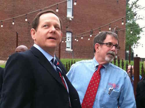
October 23, 2014Featured, Planning & DesignComments Off on Blank Renard Paper Warehouse Now Less-Blank Urban Chestnut Brewing Company
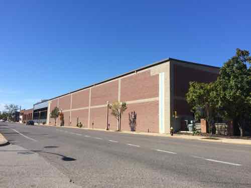
Renard Paper was building their massive blank walled warehouse on Manchester Ave in 1990, right when I moved to St. Louis. It was awful, but many saw it as progress. It was an investment, they weren’t leaving the city.
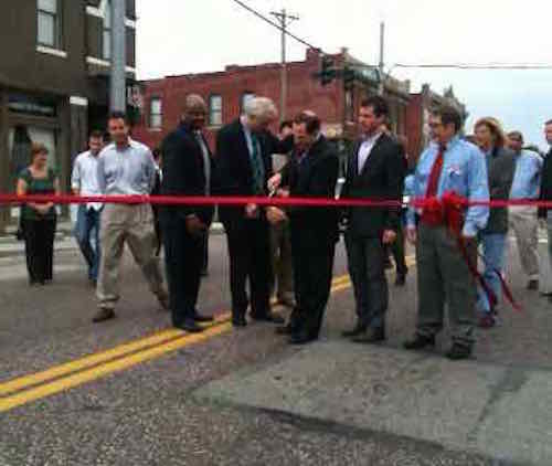
Fast forward to May 2011, the ribbon cutting for the new Manchester Ave streetscape in the section known as The Grove. Renaud Paper’s boss, Dave Renard was among the speakers talking about the vibrant area even though his own warehouse, built 21 years earlier, was a huge drag on the vibrancy at the west end of The Grove.
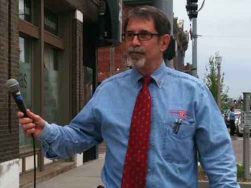
Mayor Slay cut the ribbon on May 19, 2011. Grove Community Improvement District board member, Dave Renard, is on the rightAs a long time business owner, Dave Renard was one of the speakers. The ribbon cutting couldn’t be held next to his business because the long blank wall wasn’t the vibrant message being portrayed this day.Mayor Slay & Dave Renard before the speeches & ribbon cutting
That was May 19th, less than four months later came this news:
HP Products Corporation of Indianapolis, IN has announced that they have completed the acquisition of Renard Paper Company of St. Louis, Missouri.
A done deal not even four months after talking about the future…
It wasn’t long before Renard Paper, now a division of HP Products, was located out in Earth City. Their large building with a long blank wall fronting Manchester Ave was now for sale. One argument is they were in the city paying earnings taxes for 21+ years longer than had they sold out in 1990. True enough. What we can’t possibly know is where would that end of The Grove be had Renard Paper not razed buildings to build their warehouse? Who knows, that section might be the most vibrant part. The street might have come back to life years, decades, earlier? Or the area might’ve declined further and be worse than ever to this day?
Again, it’s impossible to know.
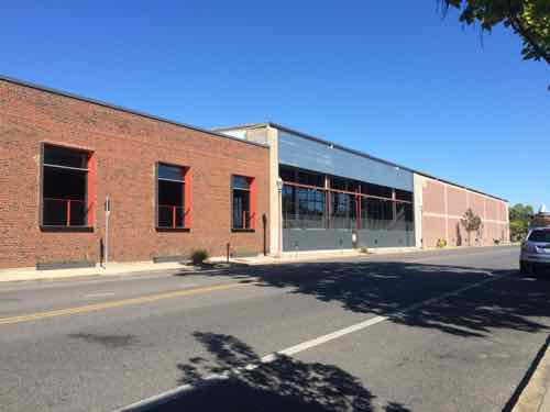
After sitting vacant for nearly two years a new buyer was found that could use the warehouse space, but they also wanted to correct the main design problem: the long blank wall.
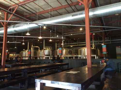
Urban Chestnut’s renovation of the Renard Paper warehouse will include a bottling line, staff offices, retail space, a kitchen and bar area, and seating for about 150 people. Windows will look out on to Manchester Avenue, and the bar will face the brewhouse. (Post-Dispatch)
The silver lining is by leaving such a warehouse Urban Chestnut was able to greatly expand their capacity. They also knew design facing Manchester Ave was important, the building’s exterior had to be altered. I couldn’t find my before pictures but you can see some Google Streetview screen captures here. I suppose Urban Chestnut did the best they could.
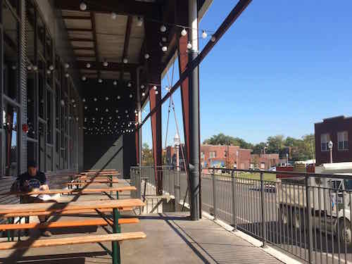
The east end, near Newstead, remains original and life suckingThe street facade on the east end of the 1990 warehouse was opened upOutdoor space where the blank wall was opened up to the street/sidewalk belowThe industrial aesthetic of the interior is well done. I visited around 2pm on Wednesday October 8th, I want to return with my husband when the place is busier
The lesson here is most newer buildings cost so much to construct the reality is it’s unlikely they’ll be razed to may way for something better in 20 years, so if you get it wrong now you’re mostly stuck with it long after the company sells out and leaves town. Short-term gain can be a long-term net negative. Urban Chestnut has basically neutralized this 1990 warehouse.
Every new building must be designed with enough long-term vision to think beyond 20 years, when the owners retire and cash out.
AARP Livibility Index
The Livability Index scores neighborhoods and communities across the U.S. for the services and amenities that impact your life the most
Built St. Louis
historic architecture of St. Louis, Missouri – mourning the losses, celebrating the survivors.
Geo St. Louis
a guide to geospatial data about the City of St. Louis