Last month I wrote Cortex District Needs A Pedestrian Circulation Plan Before IKEA Is Built knowing a master plan was in the works, or had already been approved. Still, I couldn’t find a copy online. I began emailing CORTEX directly, and then others, until January 10th when I got the response I was looking for:
Good morning, Steve:
John Hoal forwarded me your query about the Cortex Station Area Plan report. I spoke with SLDC, who confirmed that the report was not, in fact, posted on-line. The report has since been posted to SLDC’s website, and the link to the report materials is included below.
Thanks, Steve. Please let us know if you have any additional questions or require further information.
Best regards,
Timothy Breihan
H3 Studio
Turns out the report was finalized in October 2012! Fifteen months later, after my inquiries, it was made available online. This work was funded by tax payers and should’ve been made available when finalized:
The work that provided the basis of this publication was supported by funding under an award with the U.S. Department of Housing and Urban Development through East-West Gateway Council of Governments. The substance and findings of the work are dedicated to the public. The author and publisher are solely responsible for the accuracy of the statements and interpretations contained in this publication. Such interpretations do not necessarily reflect the views of the Government or the East-West Gateway Council of Governments. (Page 2)
Ok, it’s online now so let’s take a look:
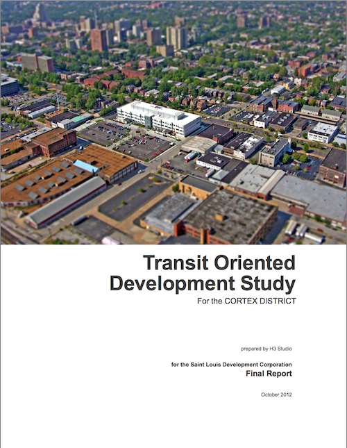
Cover of the TOD study for CORTEX. Click cover to view on Scribd.
From the objective at the start:
Originally developed as a light-industrial enclave, the CORTEX district faces major challenges moving forward to make itself feel welcoming, pedestrian-friendly, and fundamentally connected to its surrounding neighborhoods and amenities. (Page 6)
[snip]
The Transit Oriented Development Study (TOD) for the CORTEX District (the Study) seeks to establish projections for net new riders on the MetroLink light rail system over a 20-year planning horizon resulting from the construction of a new MetroLink station in the CORTEX District. This Study is focused on proposed ridership projections based on planned investments in CORTEX and the surrounding areas. Metro Saint Louis Transit and the Bi-State Development Agency (Metro), owners and operators of the MetroLink and MetroBus transit systems, have established target thresholds as goals for proposed stations.
This station will be an invaluable asset in the future development potential of both the CORTEX district and the region-wide MetroLink system. The proposed station has the potential to function both as a transit option for current and future area residents and employees, as well as a major amenity and connective element for the surrounding neighborhoods and residents. In order to capitalize on years of public and private investment and attract and retain the best and the brightest, it is imperative that development in the CORTEX district unlocks the latent potential present in the district’s enviable location in the heart of Saint Louis. The City of Saint Louis, Metro, and CORTEX possess a significant opportunity to recreate the district as a key link between surrounding neighborhoods, with the ability to tie these neighborhoods together with public spaces, great pedestrian streets, mixed-use development, and multi-modal transit access. (Page 6-7)
The first “consensus issue” surrounding CORTEX is listed as:
1. Forest Park Avenue is perceived as unfriendly to bikes and pedestrians for east-west travel and crossing. (Page 11)
Really? The planning process gets into trouble when too much weight is given to public input. Forest Park Avenue has what they want to create one block south on Duncan Ave.; on-street parking which separates traffic from pedestrians, tree lawns with mature trees, etc. But a few neighbors that probably don’t walk indicated they don’t like Forest Park Ave., possibly because they were steered that way, so it’s dismissed as an east-west pedestrian route. The crossings do need to be improved to get people into the CORTEX District and to/from the proposed MetroLink station.
Under “scenerio 1” to increase transit ridership they list:
Focus TOD residential and mixed-use development between Sarah Avenue and Vandeventer Avenue and extend planned Duncan Avenue streetscape improvements east to Vandeventer. (Page 14)
But the proposed IKEA will prevent the new pedestrian-friendly Duncan Ave from reaching Vandeventer Ave, occupying most of the residential/mixed-use development area. Will this plan be amended to deal with that new reality? This is why major streets (Forest Park Ave.) shouldn’t be ignored in favor of expendable streets (Duncan Ave). Are ridership projections still valid with a large mixed-use area on the east side of the proposed station?
Let’s continue:
4. ENSURE PEDESTRIAN AND BIKE CONNECTIVITY, SAFETY, AND COMFORT
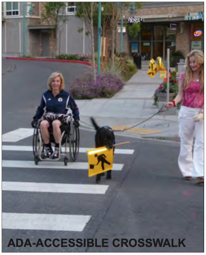
The photo on Page 119 labeled as “ADA-Accesible Crosswalk” shows a non-ADA compliant ramp. No diagrams are included on how to make ramps & crosswalks ADA-compliant.
Transit-oriented developments and districts rely on safe, comfortable, walk-able and bike-able streets and public spaces to provide access to transit. In the CORTEX district, streets are currently designed to give preference to vehicular traffic; most streets have only a 36-foot curb-to-curb width, which accommodates only two travel lanes and two parallel parking lanes. In addition, sidewalks are only 4- to 5-feet wide, pedestrian right-of-ways are often obstructed by utility poles and other infrastructure, and there are few street trees or other pedestrian amenities. Given limited right-of-way width and vehicular traffic restrictions, enhancing bike and pedestrian connectivity, safety, and comfort will need to occur on some streets while vehicular service requirements are accommodated on others. Actions to achieve this strategy include:
Create “pedestrian first” streets and vehicular-centric streets through the district.
Repair all sidewalks and maximize sidewalk width in all locations.
Provide planting strips and/or tree lawns on all streets.
Relocate utility poles and other infrastructure out of pedestrian right-of-ways.
Provide lane-width, shared lane markings (“Super Sharrows”) on all streets.
Provide parallel parking on all streets.
Provide street trees on all streets with a maximum spacing of 40-feet on-center.
Provide pedestrian-scaled street lights with a maximum spacing of 80-feet on center.
Provide trash receptacles, benches, bike racks, safety call boxes, and other street furniture.
Provide ADA-accessible curb cuts, oriented perpendicular to the street, at all intersections and crosswalks.
Provide pavement changes at all crosswalks. (Page 22)
Well “pedestrian first” is mentioned earlier (p13) and later on pages 69 & 119, yet nowhere does the report define “pedestrian first”. To be fair, “vehicular-centric streets” isn’t defined either, but I think St. Louis has that one down.
The big pedestrian push is Duncan Ave., which will terminate unceremoniously into the side of the IKEA:
A potential major east-west corridor within the CORTEX District is Duncan Avenue, which runs from Sarah Street and Vandeventer Avenue to the east and the Central West End MetroLink Station and Barnes Jewish/Washington University Medical Campuses to the west. Where Duncan Avenue intersects with Boyle Avenue is the heart of the CORTEX District with the CORTEX building to the north and the Solae building to the south. (Page 78)
It does include a list of existing conditions.
ASSESSMENT OF EXISTING SIDEWALK AND STREET PAVEMENT CONDITIONS
BOYLE AVENUE CORRIDOR
Overall, the street pavement is in poor to fair condition with alligator cracking, sections where base pavement is exposed, and numerous patches of pavement.
Curb material varies with either granite or concrete curb. Concrete curb is usually in sections where sidewalk has been replaced.
The standard curb height of six inches occurs mainly in sections where sidewalk has been replaced. Remaining sections of curb are less than six inches due to overlaying of street pavement.
The sidewalks are mainly in poor to fair condition with broken and uneven pavement. Numerous patches occur in the sidewalk pavement due to underground utility improvements. In areas where new construction or street improvements have occurred at street intersections, the sidewalks are in good condition.
TOWER GROVE AVENUE CORRIDOR
Some sections of Tower Grove Avenue have been newly overlaid with asphalt leaving them in good condition. Most other areas of the street pavement have alligator cracking, sections where base pavement is exposed and numerous patches of pavement and should be considered in fair to poor condition.
Overall the sidewalks are in poor to fair condition with prevalent pavement cracking and uneven areas. Some sections of sidewalk have been replaced at intersections with road improvements. Where new building has occurred, new sidewalk has been installed.
Curbing in this section of Tower Grove Avenue is mainly granite curb with concrete curb occurring at street intersections. Overlaying of the street pavement has reduced the height of the curb to less than six inches.
NEWSTEAD AVENUE CORRIDOR: FOREST PARK PARKWAY TO CLAYTON AVENUE
The street pavement is in fair to poor condition with numerous patches, large amounts of alligator cracking, and sections of exposed base pavement.
The sidewalks are in fair to good condition. Decorative medallions have been added to the sidewalk. A short section north of the MetroLink tracks has uneven and cracked pavement, and the east sidewalk from Forest Park Parkway to Duncan Avenue has some remnants of a sidewalk in places.
Curbing material overall is composed of granite, but some areas closer to Forest Park Parkway are concrete.
DUNCAN AVENUE CORRIDOR: NEWSTEAD AVENUE TO SARAH STREET
The street pavement is in poor condition with numerous patches, large amounts of alligator cracking, and sections of exposed base pavement from raveling top mat of asphalt and potholes.
The sidewalks are in fair to poor condition. There are several sections of sidewalk which have been replaced, and those are located on the north and south sides of Duncan Avenue at the CORTEX and Solae Buildings and parking lots as well as the West End Lofts parking lot near the intersection of Sarah Street and Duncan Avenue.
Curbing material mainly is composed of granite except in the sections of the CORTEX and Solae buildings. (Page 82-83)
HIERARCHY OF STREET USAGE BY PEDESTRIANS AND BIKES
From Stakeholder meetings with neighborhood committees and residents, City agencies and other concerned parties a hierarchy of primary pedestrian and bike routes were determined to help aid in the development of a Street-Level Connectivity Plan.
East-West Pedestrian Corridor:Laclede Avenue and Chouteau Avenue (Most Preferred) Forest Park Parkway (Least Preferred)
North-South Pedestrian Corridor:Newstead Avenue and Euclid Avenue (Most Preferred) Boyle Avenue and Taylor Avenue (Least Preferred)
East-West Bike Corridor:Chouteau Avenue (Most Preferred) Duncan Avenue (Least Preferred)
Hopefully you’ll be able to find detail I missed. To me this is a plan filled with buzz words that’s already being ignored a year later, business as usual. I’ll repeat: CORTEX needs a pedestrian plan because this isn’t close.
Over the last decade the midtown area known as Grand Center has physically changed; new construction of buildings with rehabs of many others, bonds issued, etc. Most outside observers would say the changes have been positive. What’s largely unknown to many is the behind the scene dealings of the many players & legal entities involved, it wasn’t always pretty.
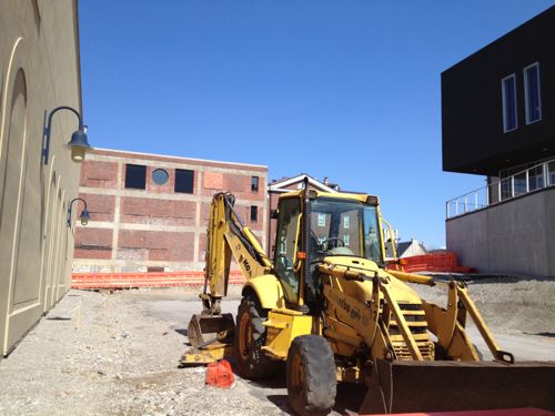
Before getting into those issues, let’s take a look at a current project. The Public Media Commons ground was broken on October 30, 2012:
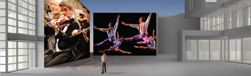
The one-of-a-kind Public Media Commons will give the Grand Center district a focal point for art, culture and public dialogue in an open environment featuring interactive technology, large-screen projections on the entire east wall of the Nine Network building, performance stages for small groups, multiple seating areas, green space and a window into Nine’s studio. It represents the first section of a pedestrian corridor that will extend through the middle of Grand Center linking the district from Grandel Square on the north to Lindell Boulevard on the south. (Oct 30, 2012 ground breaking press release)
The commons will serve as a focal point for art, culture and public dialogue. It will feature interactive te3chnology, large-screen projects on the entire east wall of the Nine Network building, performance stages for small groups, multiple seating areas, green space and a window into Nine’s studio.
Construction is expected to take a year. (KSDK w/video)
Construction was expected to be finished around October 2013. You can see a promotional video here.
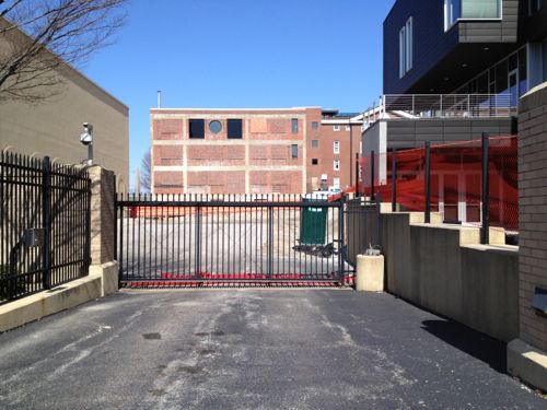
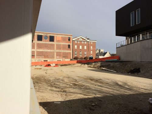
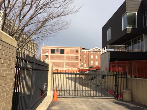
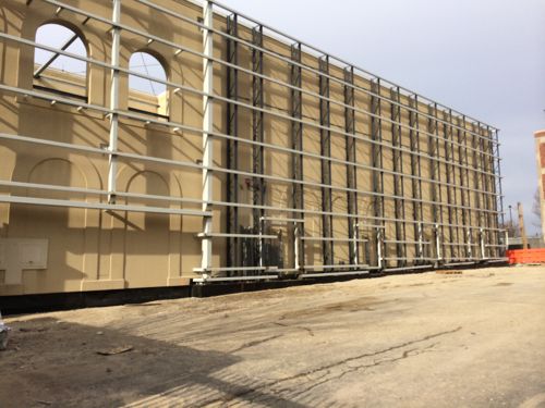
Concept for the Public Media Commons with Nine Net on the left and St. Louis Public Radio on the right, click image to view source.Four and a half months later, March 13, 2013, work had been startedThe location was the Nine Net parking lot. This shot is also from March 13, 2013Fast forward to January 1, 2014, months after it was originally slated to be completed, and it doesn’t look like much has happened.This view hasn’t changed muchThe most visible change is the frame for the west screen.
I inquired about the delay and received the following from Terri Gates, Public Relations Manager at the Nine Network of Public Media:
Since construction began on the Public Media Commons, there has been considerable ongoing work – some of it visible from the street, including foundation work and the recent installation of grids covering the east exterior wall of the Nine Network building. But much of the ongoing work has been behind-the-scenes infrastructure, programming and electrical work not visible from the street. It is a complex project that has required intricate integration of the technology.
As you probably know we’re planning for the Public Media Commons to be an innovative focal point for art, culture and public dialogue with large-screen projections, a performance stage, and digital interaction. The Commons will also include a view of the Nine Network studios in action.
We had planned to complete the project sooner, but we can say with a high level of confidence that the Public Media Commons will open this summer of 2014.
I remain skeptical, but we’ll see.
Ok, let’s dive into the dirty laundry! Over the years I’ve touched on some aspects, like in February 2007 when I wrote St. Louis University is a Secular Institution, Not a Catholic or Jesuit University. SLU prevailed in court but by then Grand Center’s plan to use eminent-domain to take a property from a business owner was dead.
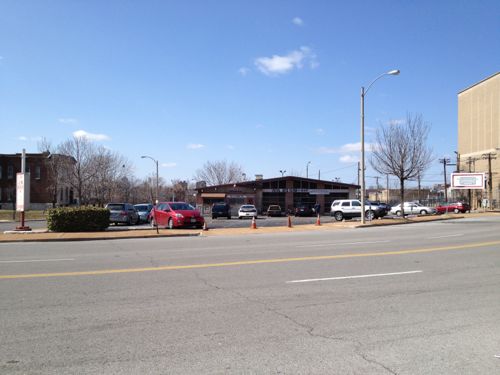
The auto repair shop at 3699 Olive (at Vandeventer) remains in business. Click image for story from the St. Louis American.
The redevelopment in the area is done through Grand Center, Inc., the Vandeventer-Spring Redevelopment Corporation (VSRC), and City Center Redevelopment Corporation CCRC). CCRC was created in February 1980, VSRC in March 1998. Grand Center, Inc in March 1987. Over the years members have come and gone for all three, currently Grand Center’s President Vincent C. Schoemehl, Jr. is the primary member of all three.
These organizations have the ability to issue municipal bonds to fund projects.
I reviewed the board members for both the CCRC and VSRC for the last decade. All of the following were board members had been in place since at least 2005, but were last listed as board members in 2010:
After 2010 the boards of both were Schoemehl, his administrative assistant, and Grand Center’s COO. I inquired to find out why these esteemed members of the St. Louis community were no longer on the boards of CCRC & VSRC, here’s the communications:
Patterson: I’m curious why community leaders like Tom Reeves, Peg Weathers, Emily Pulitzer, etc were directors of two redevelopment corporations for many years but not 2011 and later. A disagreement?
Schoemehl: The state required social security numbers after 2010 and lawyers advised against our limiting the sharing of such info to the smallest number of people possible; liability issues. Thus I am a sole direct.
Patterson: Thanks for the quick reply, but I’m confused. I’ve never had to submit my social security number to the SoS. It seems everything submitted by corporations is public record — no ss #s. Also many of these people are still on the Grand Center board. Can you clarify so that I can understand?
Schoemehl: Let me check with Will Zorn, our lawyer.
I’ve not yet heard back on a more logical reason why these individuals are no longer serving as directors of the two redevelopment corporations, many are still directors on Grand Center’s board.
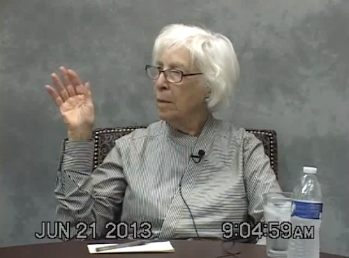
Because of a 2009 lawsuit we can learn more from documents, including deposition transcripts. In a June 2013 deposition Emily Rauh Pulitzer didn’t recall being a director of the organizations.
Emily Pulitzer being sworn into the deposition.
In this 5 minute video from the deposition, Pulitzer starts off saying she wasn’t on the board of either at a prior date but when shown documents she says at 4:30 “well, I guess this indicates I was a member.” For the complete context, the above clip starts at 1:12:15 in the full two hour video deposition. The transcript is here.
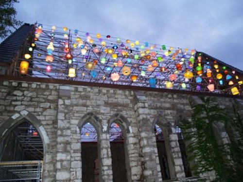
As a director of the redevelopment corporations, Pulitzer moved to borrow funds to stabilize the Spring Ave Church so it could be used in conjunction with The Light Project exhibition the Pulitzer Foundation for the Arts was hosting. This would appear to be a conflict of interest.
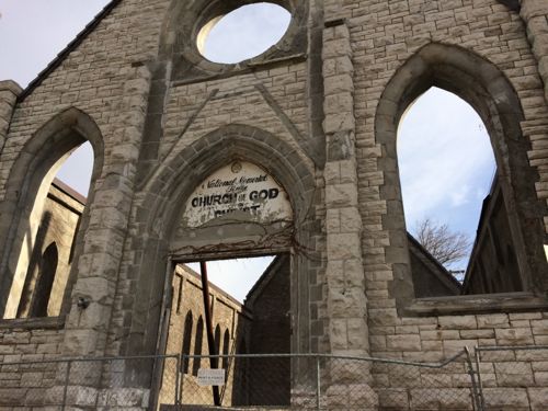
The stabilized church during the exhibit. Source: Pulitzer Foundation for the ArtsThe stabilized Spring Ave Church on New Year’s Day.
The church and lot to the north are owned by Grand Center, Inc. Case 0922-CC01036 – PAUL GUZZARDO V GRAND CENTER INC ETAL was voluntarily dismissed last year, Plaintiff Paul Guzzardo has indicated he plans to refile the case within the next 90 days. I intend to go through the transcripts of the five depositions in this case, looking for more information on how these quasi-governmental boards conduct their business.
Major media, the St. Louis Post-Dispatch, in particular, declined to report the information presented here. The Post-Dispatch was previously owned by the Pulitzer family.
Cortex is a district created by a collaboration of numerous research institutions, self-described as:
Founded in 2002, Cortex is mid-America’s premiere hub for bioscience and technology research, development and commercialization, anchoring St. Louis’ growing ecosystem of innovative startups and established companies. Providing state-of-the-art facilities to support the nation’s most promising technological advances, Cortex offers custom lab and office space, proximity to world-class research institutions, a highly-trained tech workforce, access to venture capital…all surrounded by amenity-rich urban neighborhoods.
Cortex is conveniently located next to I-64 and easily accessible via private or public transportation. The area is home to some of St. Louis’ most exciting attractions and neighborhoods. In addition to being neighbors with other leading science and technology companies, you are within easy reach of Forest Park, which is larger than New York’s Central Park, the St. Louis Science Center, the St. Louis Zoo, The Muny and many other cultural and entertainment centers. Midtown is also home to charming sidewalk cafes, galleries, antique shops, boutiques and pubs. The area has been described as a little European, a little New York, and totally St. Louis.
For a while now Cortex has been working to add a new transit station along the existing MetroLink light rail line. I don’t know if it has been given the green light, but it has been studied at great length. Here are some quotes from a June 2013 ULI Technical Assistance Panel Report:
By placing the station as close to Boyle as possible, riders would be welcomed to the District by the Commons, thereby creating an impressive and distinctive park-like ‘front door’ to the District. The station would be also easily visible from Boyle, making way-finding easier and promoting future ridership by virtue of its visibility to auto traffic.
While the station should be placed close to Boyle, the Panel still felt strongly that the station should be accessible to pedestrians and bicyclists via entrances at Boyle and Sarah, providing riders with two options for ingress/egress. Directional signage should also be placed on and highly visible from both streets to assist passengers with finding the station entrance. (p5)
Of immediate note was the current state of the streets and pedestrian experience in the District. There is a significant amount of overgrowth in the area, particularly along sidewalks, which leaves visitors with a sense that the area is largely ignored or abandoned. To truly operate as a District, care should be taken to maintain the sidewalks and streetscapes throughout the area, not just those in the immediate vicinity of current or complete development. (p10)
With the station nearing reality and additional businesses planning to bring innovation and employees to the District, the members of Cortex are faced with another opportunity to come together once again to solve a need. In this instance, the challenge is parking in the District. By creating a parking district or ownership/management entity consisting of the five Cortex members, a more thoughtful and comprehensive strategy can be put in place which will address future parking needs, create a unified parking solution that is in keeping with the design and operational principles of the District, and help determine the most advantageous pricing strategy that will meet the needs of the consumer, fund the parking entity, and ultimately provide for a system of parking that is successful and sustainable. (p12)
The report also talks about Cortex’s plan to make Duncan Ave a pedestrian-oriented street. I know from personal experience it’ll need a lot of work to get to that point. Cutting off Duncan before it reaches Vandeventer isn’t a good idea, though IKEA could be used a nice terminus.
However, St. Louis has more than two decades of experience with light rail stations surrounded by anything but good transit-oriented development (TOD). Now’s the opportunity to change. I’ve yet to see any evidence, ULI study included, that anyone has looked at the route(s) pedestrians would take to get to/from this proposed station and all the building sites within the district.
Are there barriers to pedestrian circulation within the district? (hint, yes)
Is the pedestrian network sized and designed to handle expected foot traffic at build out? (no)
Does the existing pedestrian network have ADA-compliance issues? (Big YES)
Does the existing pedestrian network encourage transit use and/or walking? (no)
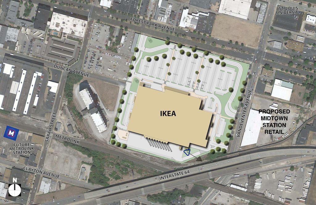
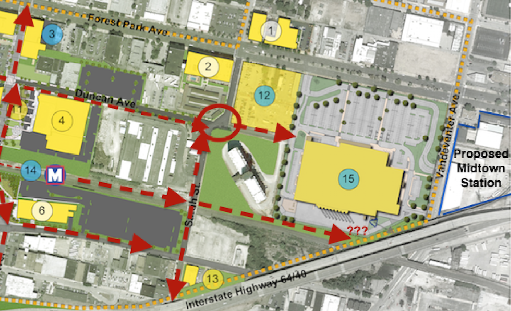
How will pedestrians get from the proposed MetroLink station to the proposed Midtown Station retail development across Vandeventer? (see below)
With these asked and identified new work can be built to reduce problems, not create new ones, and gradually improve the area. Let’s take a look at some specifics:
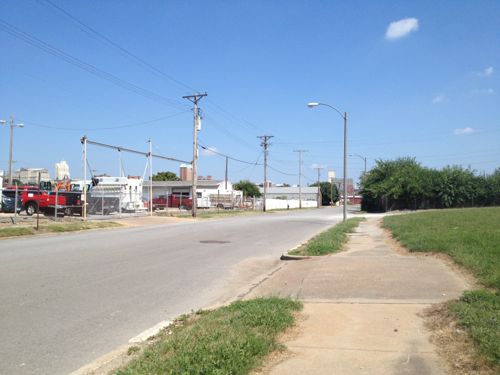
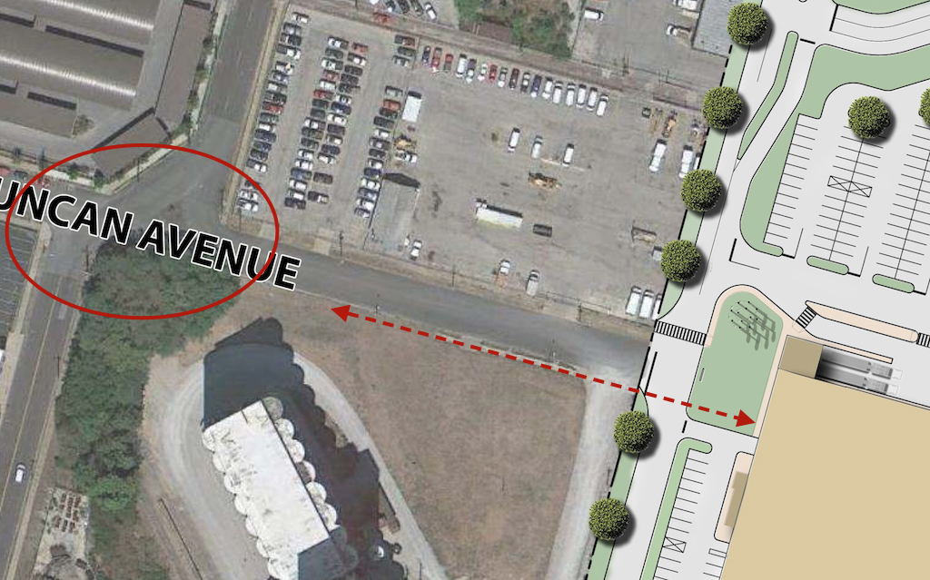
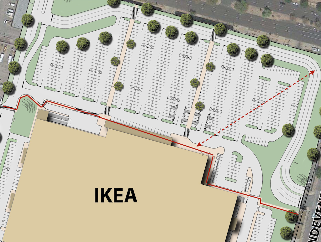
Proposed site plan for the IKEA, I marked the area to the east to indicate the proposed retail development. Click image to view larger version.Looking east from in front of the grain silo toward the future IKEA. A sidewalk exists currently.Current site plan doesn’t show pedestrian access from the south side of Duncan Ave., intersection at Sarah needs to be addressed to connect IKEA to MetroLink. Click image to view larger version.For pedestrians going from MetroLink or other locations to Midtown Station is means taking a convoluted route in front of IKEA. For SLU students arriving at the corner of Forest Park & Vandeventer they’ll likely cut through the parking lot rather than use the ADA accessible routes. Click image to view larger version.
IKEA’s Reed Lyons told me they tried different configurations, including pushing the building out to the corner so it would be more urban. I believe him, but this is the “show-me” state so I’d like to see these rejected configurations. It’s like in school when you had complicated math problems — you had to show your work.
I also want to explore the width of Forest Park and Vandeventer. Both have a parking lane, roughly 10ft wide, that will become useless since there isn’t a reason to park on the street. Will this lane but used to direct traffic into the IKEA or can we do curb bulbs or other treatments to reduce the width of the roadway? There’s no reason to leave unused paving.
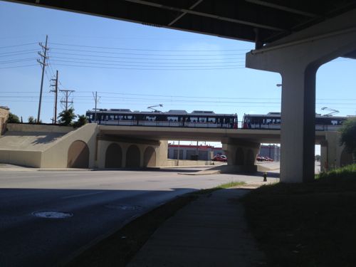
I do have one idea on how to get pedestrians from the proposed MetroLink to Vandeventer and the proposed Midtown Station retail project — a pedestrian route next to the tracks.
Overview of pedestrian routes that need examination. A direct path next to the track down to Vandeventer could help increase the walkability of the area, serving as another way for SLU students to reach a light rail station. Click image to view a larger version.MetroLink train crossing over Vandeventer. A pedestrian path next to the tracks is not unlike the bike/ped peth in St. Clair County, click for information.
I’m excited about IKEA and realize it and Cortex have a lot of potential for St. Louis and the region. I also know just plopping in a light rail station doesn’t automatically create a vibrant & walkable neighborhood/district. Planning today will pay off in the long run.
I’ll never forget the first time I stepped into an IKEA store, in August 1990. At that time IKEA only had a handful of stores in the US, I visited the 2nd located in Woodbridge VA outside Washington D.C. All were on the east coast. Since then I’ve shopped at five more IKEA locations, including the two Chicago-area locations: Schaumburg (opened in 1998) and Bolingbrook (opened in 2005).
Today every room in our loft includes products from IKEA:
Kitchen: Shelves, serving dishes, silverware, gadgets, bar stools, etc
Dining Room: table, art
Living Room: sofa, tv stand, wall shelves, end tables,
We’re happy with the quality of all the items except the sofa — it was the cheapest one they sold about 8 years ago and it needs to be replaced. Was a good value though.
Some of the IKEA trips I’ve had over the years I bought very little — even their compact flat packages are too big for the overhead bins! I can, however, recall 4-5 trips to Schaumburg/Bolingbrook, either by myself or with a friend, where we left with our vehicle packed so tight we barely fit inside to drive back to St. Louis. The time I bought the sofa we were driving a Jeep Grand Cherokee — we tied the sofa to the roof rack because the inside was full. I’ve also made two purchases through a local company that brings back items for a fee. Why share all this? To show I’ve been a customer for many years.
In March I posted that distribution was key to IKEA’s midwest expansion, that we’d see a store only after the Joliet IL distribution center, announced in 2007, was actually open. When it became clear recently that IKEA was going to announce plans for a St. Louis location I wondered if I was off in my assessment so before the press conference last week I asked Joseph Roth about the long-stalled Joliet distribution center. Turns out the St. Louis location is the “tipping point” to justify the new distribution center! When the Kansas City-area IKEA opens next fall it’ll be stocked from an east coast distribution center like the two Chicago area stores have been. Roth said they’re not sure which will open open first: the new distribution center or the St. Louis store. If the St. Louis location opens before the distribution center, it won’t be far behind.
IKEA, the world’s leading home furnishings retailer, today announced it is submitting plans to the City of St. Louis, Missouri for a store that would increase the Swedish retailer’s presence in the Midwestern United States. The application marks the beginning of the governmental approval process. Until the store opens in Fall 2015, customers can shop at the closest IKEA stores: the Chicago-area IKEA Bolingbrook and IKEA Schaumburg; or online at IKEA-USA.com. Additionally, a Kansas City-area store is under construction and on track to open Fall 2014 in Merriam, KS.
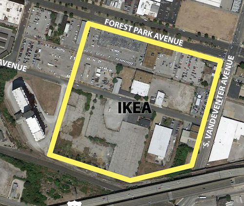
Located in the heart of Midtown St. Louis, the 380,000-square-foot proposed IKEA store would be built along the northern side of Interstate-64 near the Vandeventer Avenue exit. It would sit on nearly 21 acres purchased in the Cortex Innovation District, a vibrant technology community created to commercialize the benefits of university and regional corporate research in St. Louis. One level of parking below the store and spaces accessible at-grade would provide approximately 1,250 parking spaces on-site. Store plans reflect the same unique architectural design for which IKEA stores are known worldwide. IKEA also will evaluate potential on-site power generation to complement its current U.S. renewable energy presence at nearly 90% of its U.S. locations. (IKEA)
IKEA doesn’t own the land yet, that’ll happen if they get approvals to proceed.
Location of the proposed IKEA in St. Louis. Source: IKEA
The store will draw customers from over 100 miles away
Tax revenue generated for the city will be substantial.
300 permanent jobs will be created
Will likely spur adjacent development consisting of more retail, hotel(s), and restaurants.
The bad news:
Most of the activity generated on Vandeventer & Forest Park will be motorists coming and going. Traffic will be a nightmare if signals aren’t well timed.
Despite being near public transit, many customers and some employees will drive.
Getting out of town visitors to stay and spend more money will be a challenge.
What will be the sales tax rate we’ll have to pay? Bolingbrook IL is 8%, Schaumburg is 10%.
Many of the jobs will be low paying.
Adjacent development, such as the proposed Midtown Station, will be low-density sprawl.
On Thursday I’ll look at design issues that need to be addressed by IKEA, CORTEX, and the city.
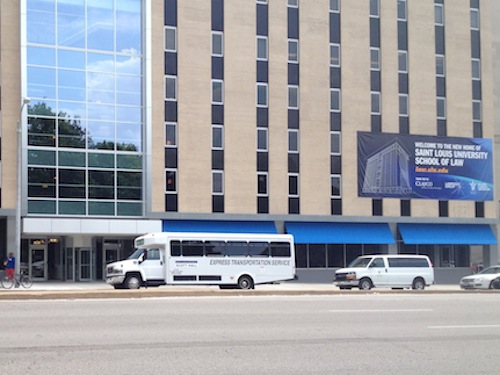
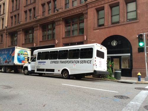
One reason for trying to build the St. Louis Streetcar is to reduce the number of polluting buses on the streets, in particular, from shuttles for the new Saint Louis University School of Law (my review of the building). The law school is open and the diesel-powered shuttles are very visible.
Shuttle in front of Scott HallShuttle idling on Locust at 9th, near Culinaria
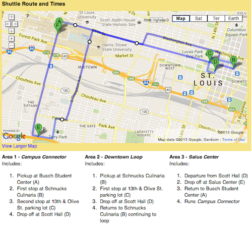
Here’s a quick summary of the route:
Scott Hall Shuttle You can access Scott Hall from the main university and designated law school parking via a new shuttle. Hours and information can be found here. The shuttle will connect Scott Hall to the main University campus, Salus Center and the law school parking at Schnucks Culnaria and 1215 Olive St. surface lot. The final shuttle runs from Scott Hall at 10:10 p.m. with drop-offs at Culinaria, the 1215 parking lot and finally at Busch Student Center. (source)
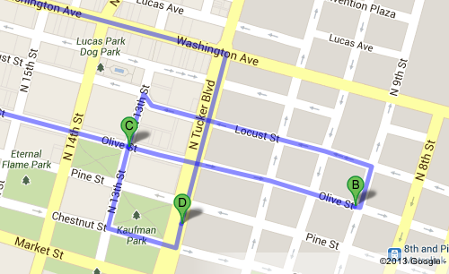
And here’s visuals:
Scott Hall Shuttle route map on SLU websiteClose up of the route in the central business district
Seems excessive too me, especially when they sit and idle, spewing diesel fumes. Guess law students won’t mix with the general public with such an elaborate shuttle system at their disposal. Presumably, though, amy SLU faculty, staff, or student, can ride it.
AARP Livibility Index
The Livability Index scores neighborhoods and communities across the U.S. for the services and amenities that impact your life the most
Built St. Louis
historic architecture of St. Louis, Missouri – mourning the losses, celebrating the survivors.
Geo St. Louis
a guide to geospatial data about the City of St. Louis