Research Notes on the History of Grocery Stores in St. Louis, 35 Years Since Kroger Closed
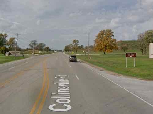
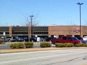
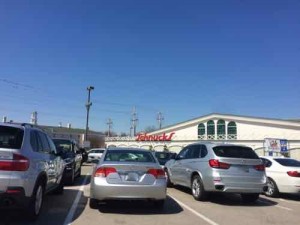
After visiting the newest grocery store in St. Louis last week, I took a deep dive into the history of grocery stores in St. Louis, spending hours in Post-Dispatch archives through the St. Louis Public Library website. I’ll write about the new store soon, but today is my research incomplete notes.
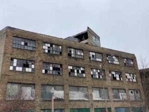
It was 35 years ago today (11/15/1986) the first of Kroger’s 54 St. Louis area stores began closing, following their decision to pull out of the St. Louis market after 74 years. Most would reopen as a National, Shop ‘N Save, or Schnucks. These other chains each closed some of their existing locations in older/smaller buildings. Other Kroger locations closed. Cincinatti-based Kroger remains a huge player in the national grocery market.
I moved to St. Louis in August 1990, so Kroger leaving was recent history. As I recently learned, there’s so much history before Kroger left. My research is still ongoing, but I wanted to share what I found so far:
- A & P was already in St. Louis in 1886. A December 20, 1886 advertisement listed 3 locations: 611 Franklin, 1256 S. Broadway, and 712 N. Broadway. [I’d heard of A & P numerous times of the years, but didn’t know anything about it so I turned to Wikipedia: “The Great Atlantic & Pacific Tea Company, better known as A&P, was an American chain of grocery stores that operated from 1859 to 2015. From 1915 through 1975, A&P was the largest grocery retailer in the United States (and, until 1965, the largest U.S. retailer of any kind).” Wow!]
- A May 5, 1895 A & P ad showed four stores, but one change from 9 years before. The 611 Franklin store wasn’t listed, but 1043 Vandeventer was added.
- 1901 Straub’s opened, per their website.
- March 12, 1908 advertisement for Maurer’s meat & grocery stores listed five locations: 8 & 10 S. Jefferson, 2612-14 Franklin, 3858 Garfield, 1402 Market, and 1740 Division.
9/29/1911 display ad for Maurer-Remley Meat and Grocery Co., 21 locations (not listed) - 11/12/1911 David L Remley sues scale co. Recently merged with Jacob Maurer’s stores.
- 1912 Kroger buys 25 Maurer Remly Meat & Grocery Co. locations. [Maurer & Remley both grew quickly by opening stores or buying out others. In 4 years Maurer went from 5 to 25 locations before selling out to Kroger.
- Saturday 10/12/1912 Kroger bought ground & a plant bounded by Tiffany, vista, rutger, and frisco tracks. Had already purchased 30 Maurer-Remley stores. [25 or 30? stores purchased]
- Per the Dierbergs website: one store was purchased on Olive, east of the present day I-270. A merchant had opened that store in 1854!
- Monday 12/16/1935 ad for A&P — the great Atlantic & pacific tea co. 2300 n union, 2905 n Newstead, 4135 shreve, 3127 s. Grand, 3155 Park, 4065 Shaw, 7501 S. Broadway, 5535 S. Grand, 5009 Gravois, 8126 Gravois, 4607 macklind, 118 Lemay Ferry, 5707 Delmar, 6388 Delmar, 6689 Delmar, 6720 w. Florissant, 6208 natural bridge, 8820 St. Charles rock road, 7200 Oakland, 8 s Euclid, 4753 McPherson, 528 n. Taylor, 4389 Laclede, 46 n. Central, 15 s. Florissant in Ferguson, 2533 Woodson Road in overland, 121 n Kirkwood, new store opening 102 Lockwood in Webster groves.
-
Apparently the Schnucks at 10275 Clayton Rd was originally a Bettendorf or a Bettendorf-Rapp store. 1939 the first Schnucks opened, per their website.
- Wednesday 3/21/1956: New Detroit based food group ACF-Wrigley purchased Fred P. Rapp Inc includes 10 stores and a warehouse. ACF formed in December 1955 by merger of wrigley stores and big bear super markers of Detroit, standard food and humpty dumpy & subsidiaries of okc, A Wolf Inc, a Detroit wholesaler. They later acquired 13 supermarkets operated by food town stores of Cleveland. Five new Rapp stores planned for STL in 1956. By early 1957 this will give ACF 40 total stores. Sale includes warehouse at 8590 Page, supermarket at 8455 Gravois. Others leased. Rapp began about 1930 with a small neighborhood store. Opened 2 more in the following 2 years. In 1935 the first 2 were sold. The third, at 3111 Watson Rd converted into a supermarket to begin the chain.
- December 20, 1956 ad Schnucks giant value markets 4135 Shreve, chambers & west Florissant, 9474 lackland, 9120 Manchester, 4356 Manchester, 6301 St. Louis Ave. [This was the first I found on Schnucks, despite their claim of opening in 1939.]
- December 1957 meat cutters union dispute with all grocery stores.
- Thursday 10/2/1957 merger of Bettendorf and Rapp completed today. Both owned by ACF-Wrigley Inc of Detroit. They purchased Rapp in 1956 and Bettendorf earlier in 1957.
- 1983 coupon war started by Kroger. They also announced plans to build 5 new stores.
- Tuesday 10/7/1986: Kroger to sell/close all 54 stores, sell distribution center. Was 3rd largest STL chain. Schnucks (53 existing units) to buy 8 Kroger locations, close 6 existing. Schnucks is #1, National is #2. Independents served by Wetterau are #4. Wetterau is a distributor that services 2,400 independent grocery stores in 26 states! Kroger started doubling & tripling coupons in 1983, causing a price war. Kroger first expanded beyond Cincinatti to St. Louis in 1912 when it bought 25 Mauer Remly Meat & Grocery Co. Kroger cited large number of discount warehouse & independent grocers as reason for closing.
- Wednesday 10/8/1986: Wetterau Inc to buy 10 of Kroger’s 54 St. Louis stores. These will become Shop ‘N Save. National to buy 26 stores and 560k sf distribution center at 6050 Lindbergh. Two Krogers still under construction: Sarah & Lindell, and north Florissant in Ferguson. National’s 360k sf distribution center on page will eventually close. National had 45 stores, plus 26 will give it 63 in the metro, plus 8 outside. Heard national would close 9 existing locations. National is owned by Toronto based Loblaw. Schnucks buying Kroger’s at river Des Peres road on south side, Maryland heights, Alton, Cahokia, granite city, and Wentzville. Plus under construction in south county and Brentwood.
- 11/12/86 elderly upset about Kroger at 3865 Gravois Ave closing. National buying it, but closing. National also buying 4617 Chippewa, will reopen.
Obviously there are huge gaps in my notes. I presume Schnucks bought Bettendorf-Rapp locations from ACF at some point. Eventually I hope to fill in other major mergers/consolidations.
— Steve Patterson