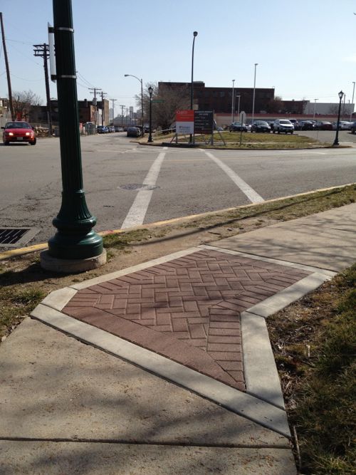
This February 2012 photo looking East across Newstead at Duncan shows a crosswalk that’s clearly not ADA-compliant — no curb ramps! Decorative brick was a higher priority.In March 2015 utility work was going on at this intersection.My next visit was October 9th, by then I noticed they did build curb ramps following the utility work.
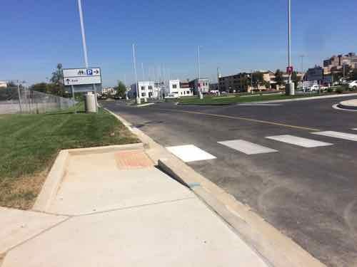
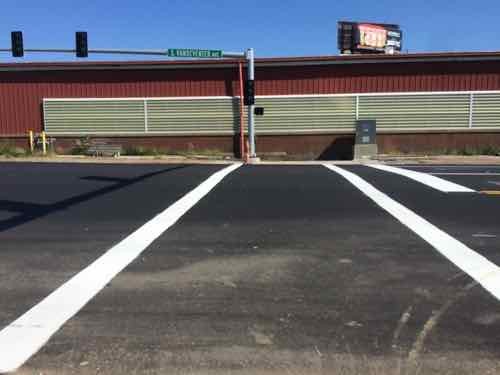
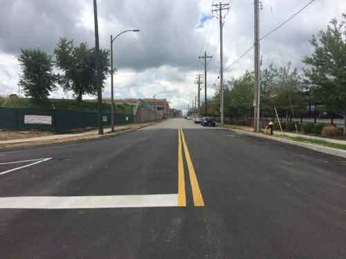
Not sure why the crosswalk is so wide, far wider than the ramps on each end. Duncan Ave is a long way from being pedestrian-friendly.
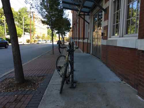
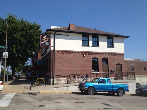
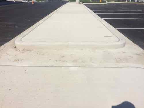
Over the years I’ve posted about new wheelchair ramps & steps into buildings completely choking off the sidewalk. Here’s another.
Last month I took this pic to show how almost no sidewalk was left after an ADA/wheelchair ramp was built to access the CET biotech startup buildingMore recently I was going the opposite direction but a bike was occupying the little bit of sidewalk hat remained.
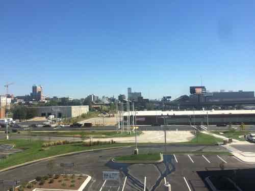
So a person who uses a wheelchair and lives a block North in the universal design 6 North Apartments must deal with this daily to reach their job at a biotech startup, the new IKEA, or the future MetroLink light rail station? The problem, repeated too often, is people tasked with adding ramps/steps don’t think about all users of the public sidewalk.
In this example, the new ramp probably should’ve been the full width of the concrete portion of the sidewalk and two-saided, rather than one-sided. Or not have the brick tree-lawn & street tree at this point so the concrete sidewalk could go around the ramp. An inverted-U bike rack needs to installed in the tree lawn. Even an able-bodied person walking past this would be annoyed.
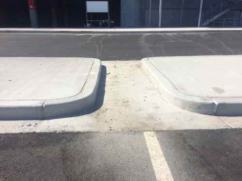
To be a pedestrian-friendly city we must stop placing obstacles in the way of pedestrians!
Big box stores with surface parking lots don’t fit in urban contexts — they’re sub-urban. For example, the Menard’s in O’Fallon IL I drove past on Saturday, a MetroBus stop is right out front but there’s no accessible pedestrian route to get to the entrance. See it on Google Street View here.
Decades ago the big boxes were the downtown department stores, but those days are long gone. However, a few big box retailers have taken over some of the vacant space left behind by shuttered department stores.
Taget in Chicago’s former Carson Pirie Scott department store designed by Louis Sullivan. February 2014. Click image to view the Wikipedia entry on the building
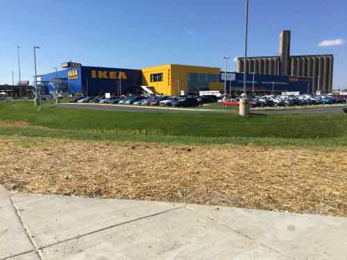
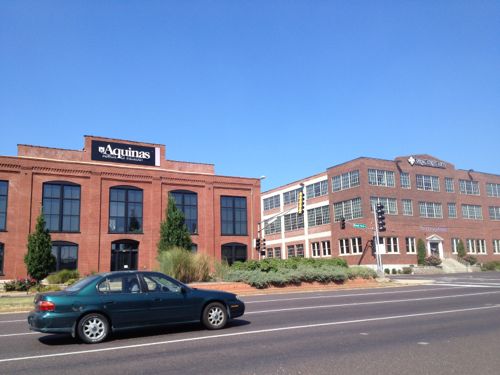
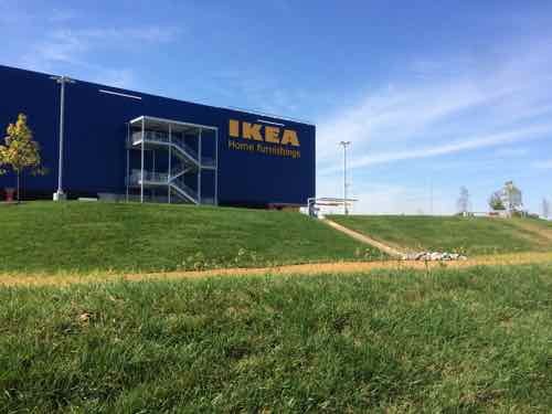
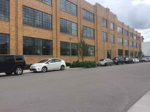
More often, big boxes have been trying to fit into walkable urban neighborhoods; they’ve been concealed by smaller liner storefronts, stacked, etc. The Target at Hampton & Chippewa is built over parking, but it still has surface parking facing Hampton & Bancroft, with docks & garage facing Chippewa. Inevitably someone says “it’s better than what was there” or “It’s better than the location in [insert any suburban municipality.” Sorry, but new development will be around for 20+ years, so standards should be higher than simply doing marginally better than awful suburban development or old derelict properties. Which brings me to IKEA St. Louis, located on the SW corner of Forest Park Ave & Vandeventer Ave.
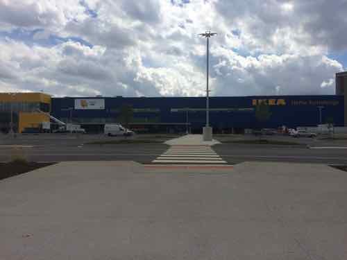
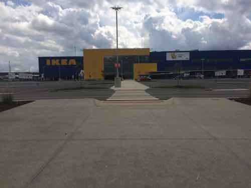
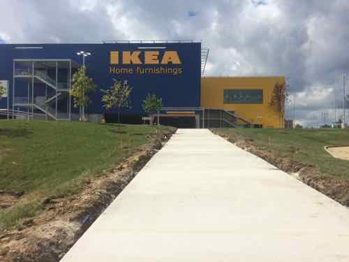
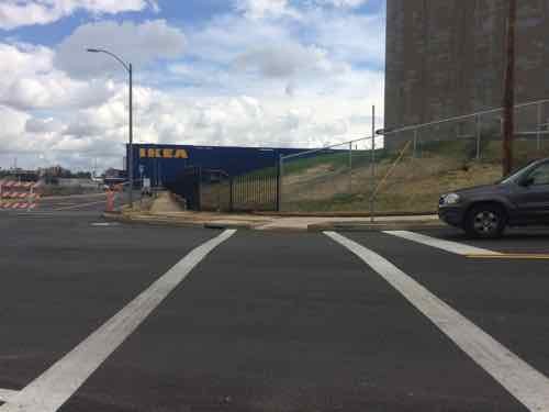
IKEA’s blue & yellow big box set behind a surface parking lot at Forest Park & Vandeventer. View from the point where the two public sidewalks meet.
Opening day I ran into an acquaintance at IKEA — she also arrived via MetroBus — she hadn’t yet seen my post on the pedestrian access points. Upon arriving at the corner pictured above how would a pedestrian know where to find accessible routes to the entry? By big box standards, IKEA St. Louis did an excellent job providing pedestrian access routes from each go the three adjacent streets, but the massive setback from the sidewalks
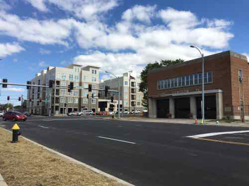
The big question now is what will happen at development sites around IKEA St. Louis? Other buildings, old & new, within a block of the intersection are all urban — built up to the public sidewalk.
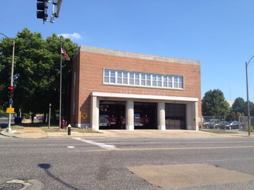
Two other corners contain urban buildings a historic firehouse and a new apartment complex built around a parking garageThe 3-story building on the NW corner was razed 4+ years ago. At right you can see the South end of the historic Gerhart Block that I posted about on Friday.
In July 2011 I posted about the building on this very same corner being razed. The Southeast corner, except for the firehouse, is to be retail.
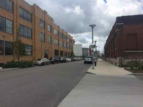
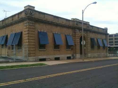
The firehouse is supposed to remain, will help “hold” the corner. But how will everything else relate to the street & sidewalk?Behind the firehouse is largely an old industrial siteBut even the old industrial office is urban in formThe urban form continues across Spring AveAnd across Forest Park Ave more urban form. Will the new retail to the South respect the urban pattern?
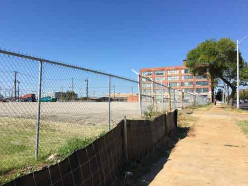
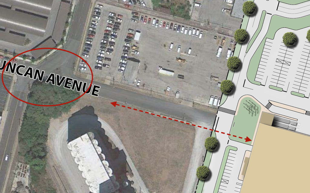
One of the most critical development parcels is immediately to the West of IKEA, at 4052 Forest Park Ave.
Looking West from the IKEA property line. The other three sides are bounded by Forest Park Ave, Sarah Ave, and Duncan Ave. The former Ford plant in the background is now loftsLooking South across Forest Park. IKEA is to the left, just out of view. The development parcel straight ahead will ideally be of similar massing as the lofts on the right, with storefronts at sidewalk level.Looking East on Duncan Ave, from Sarah Ave. The CORTEX master plan wants Duncan to be a pedestrian-friendly spine through the district. The form of new building(s) on the parcel on the left will matter greatly.
This site could be developed similar to new apartments at Forest Park & Vandeventer — a parking garage concealed on all sides by habitable buildings. The difference here is it should have storefront spaces on the ground floor. A boutique hotel, like one of these chains, should occupy part of the upper floors.
Hopefully IKEA St. Louis will be the exception, not the rule.
Last week I looked at Duncan Ave and how it ends at IKEA, from a visit on the 11th. Today we’ll look at the access points to IKEA from Duncan Ave., Forest Park Ave., and Vandeventer Ave., from a visit on the 23rd.
Ended last week’s post on Duncan Ave. looking back West from the IKEA property line
I’d arrived at this point by coming East on Duncan. Today let’s travel the way many pedestrians will, from Sarah & Forest Park. I got off the #10 MetroBus on Lindell at Sarah, then headed South., about a third of a mile
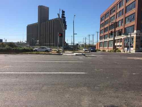
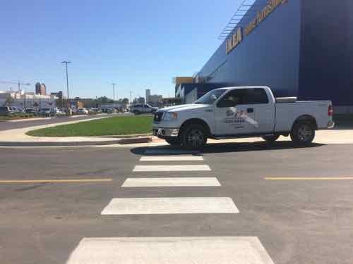
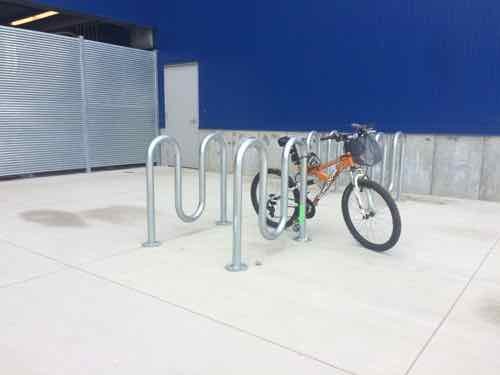
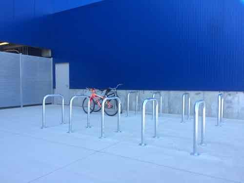
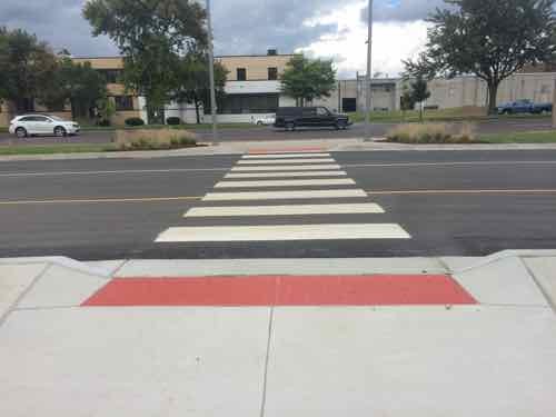
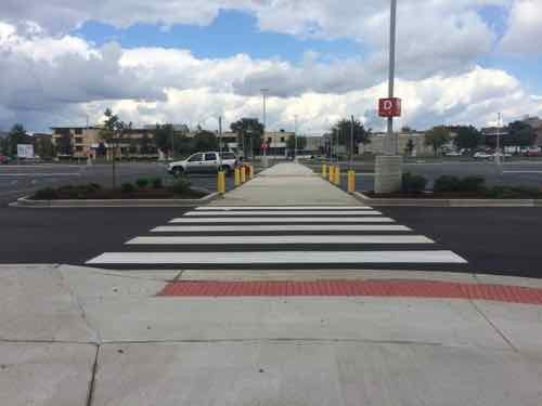
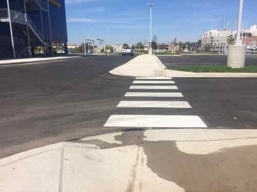
Looking South across Forest Park. The new crossing pedestrian refuge is just getting finished. IKEA is to the left, just out of viewLooking back North after crossing, Hopefully the crosswalk striping will be done soon. Note that it’s a straight shot from side to center to opposite side.The crosswalk & stop line at the East end of Duncan Ave weren’t painted when I visited on the 11th, but it had a basic upon return. This is within the public-right-of-way.Now we start into the West entry to IKEA’s site. Once the new MetroLink light rail station opens this may see a lot of foot traffic. IKEA uses the more visible ‘continental’ crosswalk on site. This auto drive leads out to Forest Park Ave.Looking East toward the store, a construction truck is blocking the view & crosswalk, but they were trying to finish up.On the 11th I was horrified to see four of these awful bike racks placed too close together. Upon inquiry I was told they were temporary, the permanent racks to be installed soon.Less than 2 weeks later excellent inverted-U racks had arrived & were installed. The employees using the racks need to be shown how to use them so their bikes are supported.
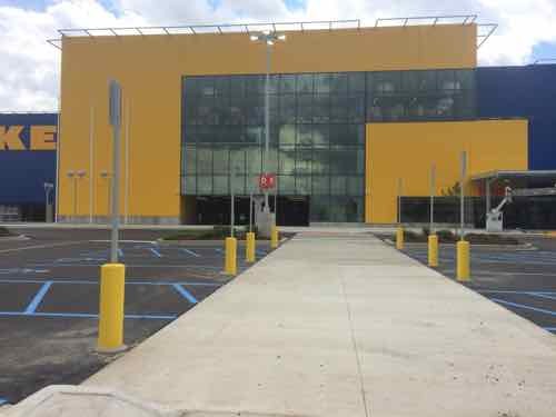
Next let’s assume that after crossing Forest Park Ave I’d headed East to enter IKEA. These photos are all from my visit on the 11th.
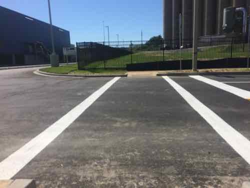
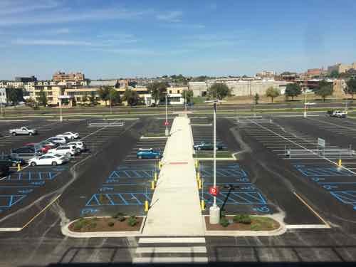
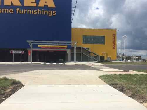
At the edge of the property is the only auto entrance on Forest ParkWe continue East, after crossing this major in/out vehicular driveAfter crossing the drive we can clearly see IKEA beyond the storm water runoff collectorThe first of two pedestrian routes from the Forest Park public sidewalk to the IKEA. Let’s continue East toward Vandeventer Ave and enter on the other accessible routeLooking back we see the walkway crosses over the drainage area.At the other pedestrian entry we can look bak West toward Sarah. The parking lane along Forest Park remains, it would be nice if the city striped it with a solid white line to separate it from the outside drive lane.Looking South at the IKEA entryFrom the walkway looking back North toward Forest Park AveAlmost to the entrance, disabled parking is on both sides of this walkway and under the buildingIn front of the entry looking North. Pedestrians have two ADA-compliant options for getting through the front parking lot. Every big box store needs to do this!From the 3rd floor restaurant looking North we can see the path we just used to get inside from the public sidewalk.
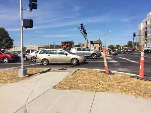
Now let’s go out to the intersection of Forest Park Ave & Vandeventer Ave, the city has been busy trying to make it better for pedestrians.
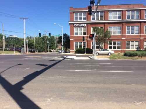
Like we saw at Sarah, crosswalks aren’t yet marked, so vehicles stop where they block the crossing point.Looking North after crossing Vandeventer. Unlike at Sarah, the route here isn’t a straight shot. From the pedestrian refuge in the median I see the curb ramp on the other side aren’t finished. At this point I notice the pedestrian signals speaking for the visually impaired say “Forest Park Parkway” instead of “forest Park Avenue” The visual signs on the street lights are correct thoughGot a break so I can cross..hopefullyLooking back South we see this side has a zig zag pattern too. This will become more apparent once the crosswalk stripes are done.
And last let’s look at access points from Vandeventer Ave. With Saint Louis University nearby and a retail development coming across the street pedestrian volume in this area will rise sharply. These photos were taken on the 11th, 23rd, and 26th.
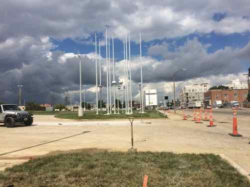
A new signalized intersection on Vandeventer Ave for IKEA Way, which is located about where the non-signalized Duncan Ave was. A new crosswalk was added to the South side of the intersection. Eventually the site to the East will be a retail development. Sept 23rdLooking North we can see the primary vehicular entry from Vandeventer, IKEA Way. Sept 11thTurning again we see a pedestrian entrance up the hill. This is an ADA ramp, due to the grade it has periodic flat rest points, the side handrails weren’t yet installed on the 11thAt the top we see a clear path the entry, only having to cross traffic at one point. Ahead is the exit from the parking level below the building.This East view from the 3rd floor restaurant gives you an overview. Sept 23rd. The parking at the bottom is the “family parking” area
There’s a second entrance off Vandeventer for vehicles, and some pedestrians.
For those coming from the South, such as The Grove, this is the view along Vandeventer before reaching the pedestrian entry & IKEA WayBut navigating this would be a challengeBut they’ve got a sidewalk for pedestrians and a drive for motorists.From the top we turn to the North and we can see the pedestrian route is clearly marked. Onward…But we soon run into a major problem. If you can’t see it that’s part of the problem.Here’s a side view so help you see the uncovered drainage channel breaking up what appears to be a pedestrian route.The opposite view. which I encountered on the 11th when I almost didn’t see it aheadAnother side view, this taken on the 11thAnd looking out toward Vandeventer
Obviously someone screwed up! This is a pity, they were doing so well too. Yes, they have other entries which are ADA-compliant, but this is just stupid — compliance would’ve been so easy had they provided a way to set in a steel plate/grate to cross over the drainage. Someone is going to get hurt here. Despite this mistake, IKEA did more than what is required by the ADA and St. Louis. Pedestrian access turned out better than I’d expected.
Other retailers & developers — please take note they have provided pedestrian access from all three public streets adjacent to their property!
As previously mentioned, the 2-story IKES is elevated over a level of parking
Tomorrow I’ll take you inside the IKEA store, with photos I took last week following the media lunch & during Saturday afternoon’s family & friend’s day.
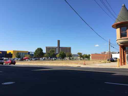
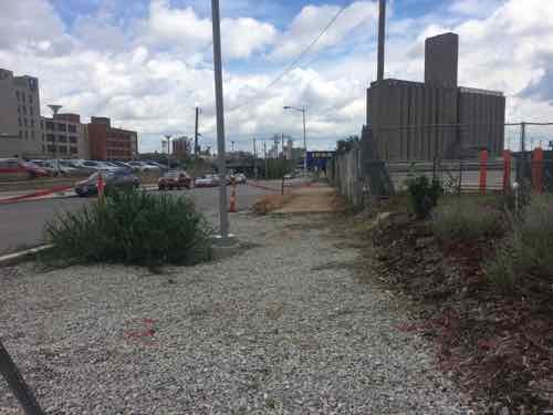
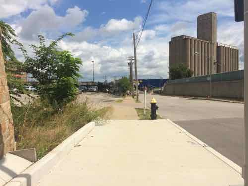
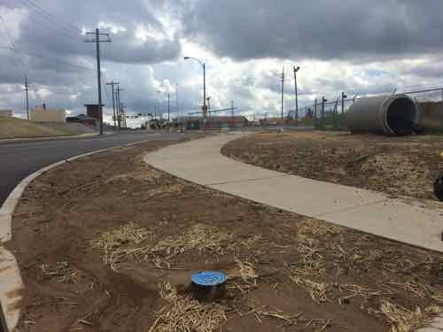
Current site plan doesn’t show pedestrian access from the south side of Duncan Ave., intersection at Sarah needs to be addressed to connect IKEA to MetroLink.Looking east from in front of the grain silo toward the future IKEA. A sidewalk exists currently.
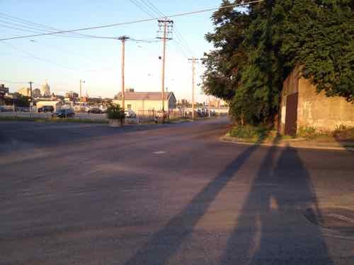
In 2013 I was focused on the horrible intersection of Duncan & Sarah and getting into the IKEA site. The odd configuration made it horrible for motorists, pedestrians, and cyclists.
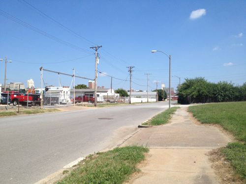
May 2012 — looking East across Sarah from the South side of Duncan.
Thankfully, this has been addressed, as you’ll see later.
Today let’s start at Boyle and the CORTEX Commons — and head East to IKEA.
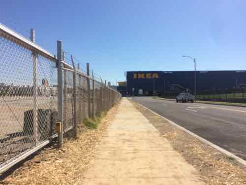
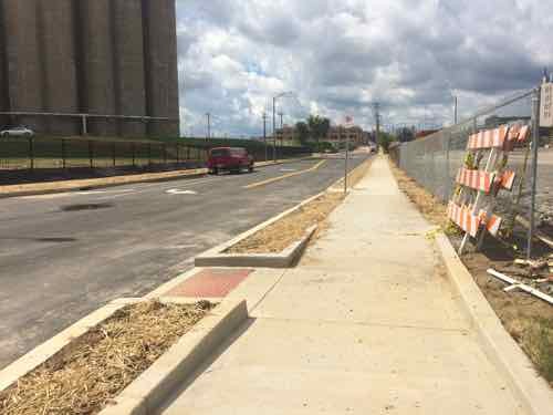
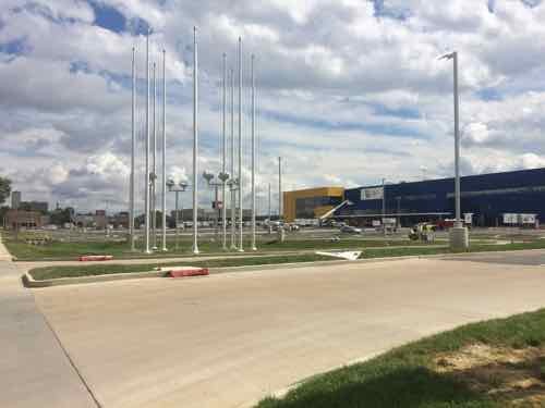
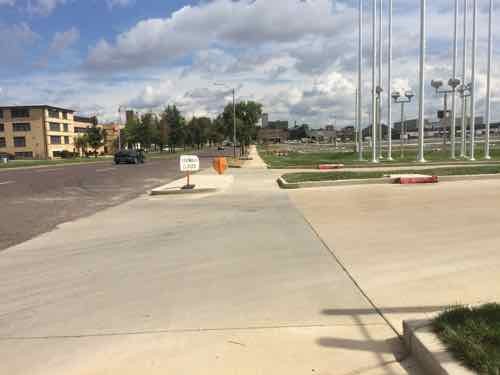
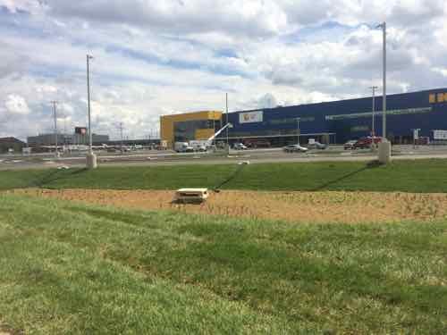
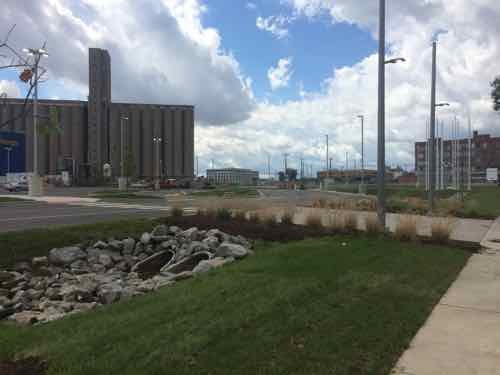
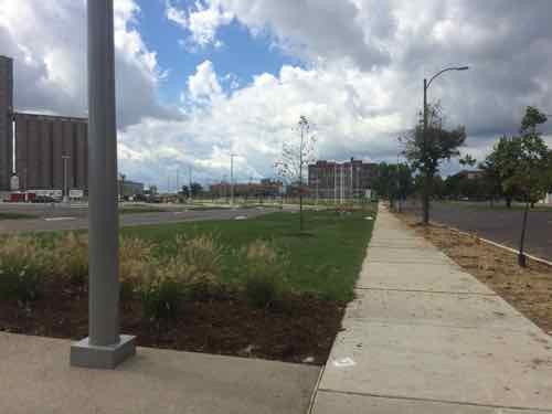
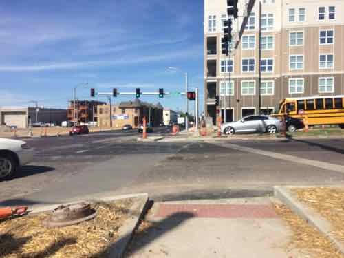
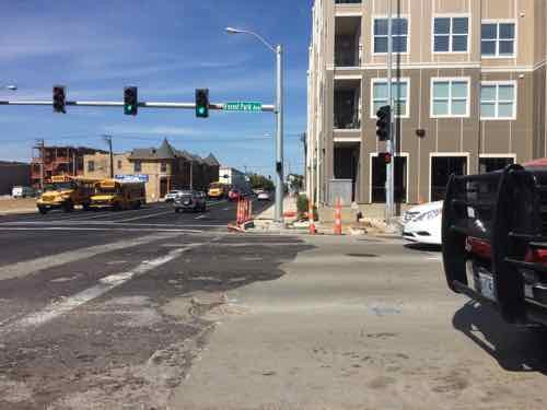
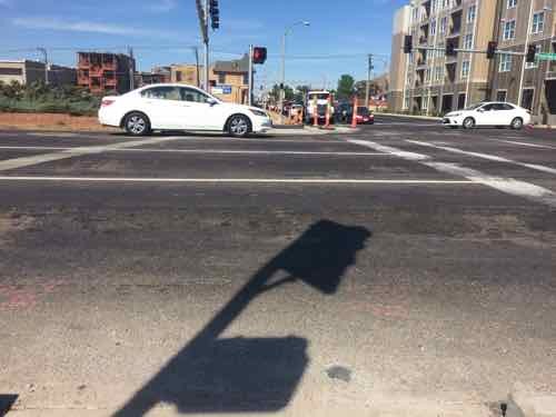
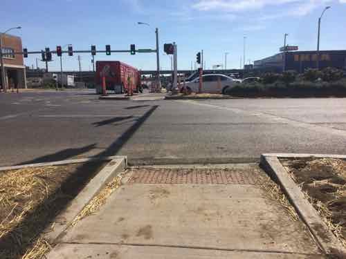
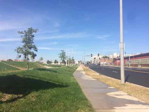
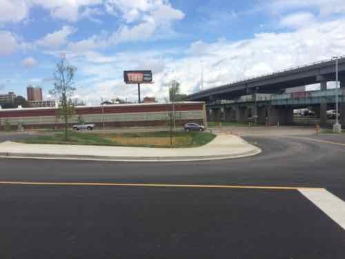
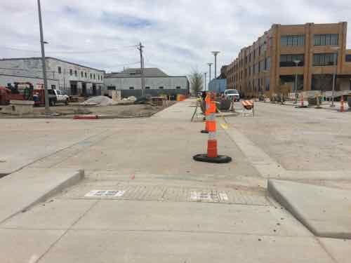
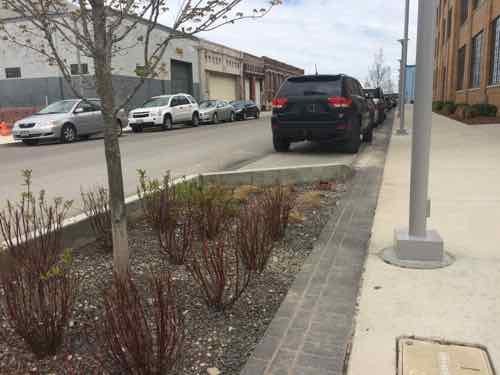
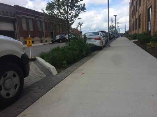
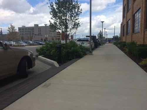
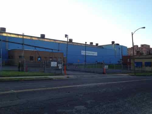
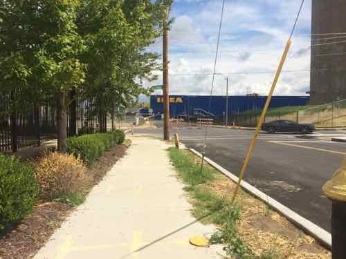
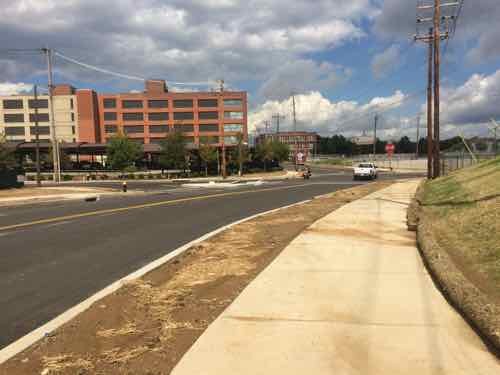
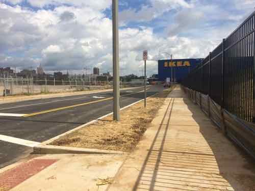
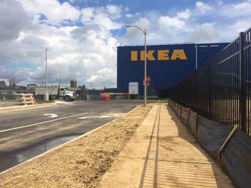
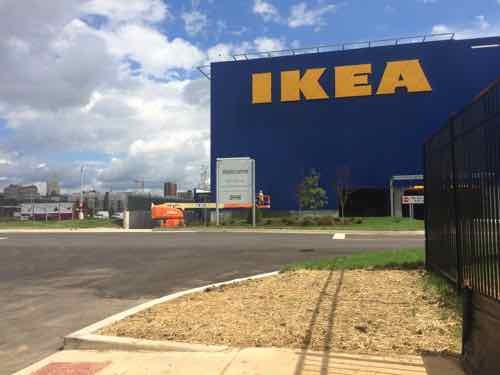
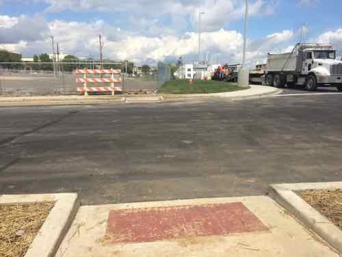
Looking East across Boyle on the North side of Duncan in April 2015Trees planted in the parking lane on the South side of Duncan in front of the @4240 building, also April 2015This similar view from Sept 11th shows the plants have matured, the parking paving is permeable. If you look closely you can see the side of IKEA’s big blue box at the end of the sidewalk.A little further East. In St. Louis this is a very generous sidewalk, in Chicago it would be on the smaller side. Still, I like that it is so open.Back on the North side we can see how the trees break up the line of parked cars.Looking back West toward Boyle, the North side didn’t get the same treatment with street trees.During my visit on the 11th work was still ongoing on the South side of Duncan just before SarahPart of the work is on the adjacent site where this massive US Metals building used to be. View from Sarah, May 2012The former office on Sarah was also razed, which is a shame. May 2012.Ok, so we’re back on Duncan facing East. Because the sidewalk was out on the South we’re on the North.As we approach Sarah we can see it looks different than beforeBefore we look at Sarah, a look back West on DuncanNow looking East across SarahHere’s the May 2012 photo from before so you can compare them, The tall wall is gone and the traffic flow shifted.Turning South we can now see how Sarah curvesThis view looking North from the East side of Sarah shows how Sarah now curves to the right for a conventional intersection at DuncanLooking East after crossing SarahGetting closerThe sidewalk on the South side of Duncan ends, but a crosswalk point to the North is providedLooking North, the crosswalk wasn’t marked on my visit but paint crews were working on site. This would’ve been an excellent spot for a raised crosswalk.Looking back West.
Monday next week I’ll take a closer look at the various pedestrian access points to IKEA St. Louis, as well as a peak inside!
Duncan Ave is bookended by BJC hospital just West of Taylor, and IKEA just East of Sarah — about a mile total in length — the pedestrian experience is highly inconsistent and doesn’t begin to approach friendly. Yet, this is the mile stretch the CORTEX Master Plan says should be pedestrian-friendly, the primary East-West means for pedestrian circulation. At best it’s less hostile in a few spots than it was a few years ago.
AARP Livibility Index
The Livability Index scores neighborhoods and communities across the U.S. for the services and amenities that impact your life the most
Built St. Louis
historic architecture of St. Louis, Missouri – mourning the losses, celebrating the survivors.
Geo St. Louis
a guide to geospatial data about the City of St. Louis