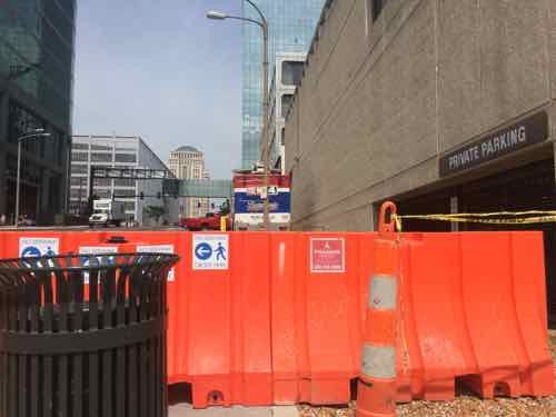
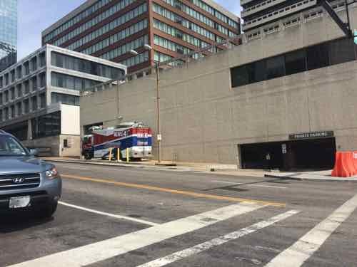
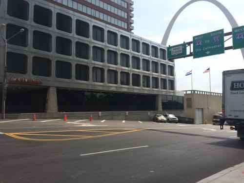
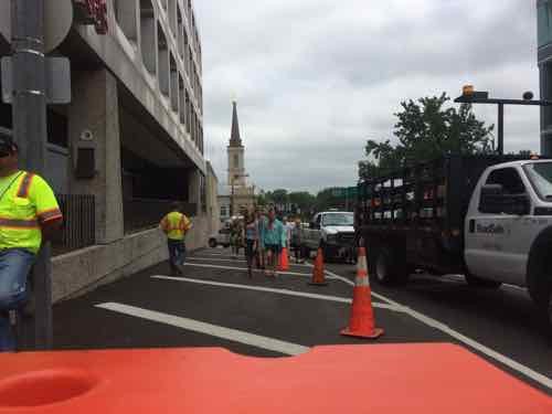
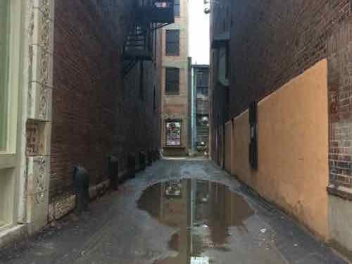
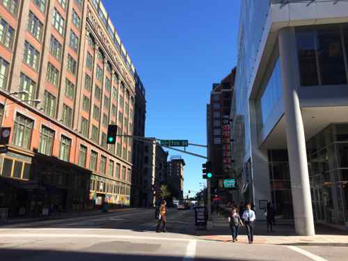
Currently there’s only one way in/out of the Arch grounds — via Walnut Street over I-44 (formerly I-70). While the new lid at the center is being completed, everyone is routed via the new bridge over the interstate, on the North side of Walnut Street. However, at some point, St. Louis removed the sidewalk on the North side of Walnut St, between Memorial (3rd St) and 4th.
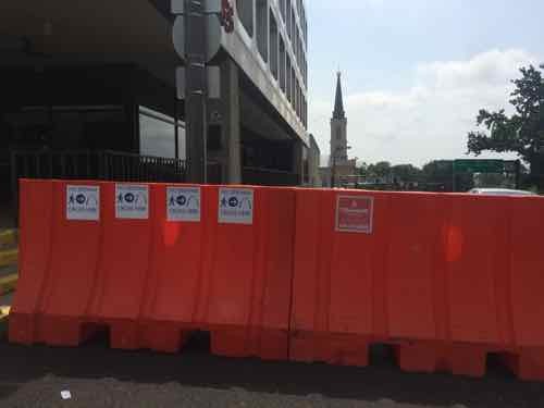
Pedestrians crossing back downtown are directed to not walk straight ahead, to go to the South side of Walnut (left) or go one block North to Market (right)The South side of Gateway Tower, KMOV’s truck parks where the public sidewalk should beWhere the sidewalk used to be next to the former American Zinc building, is angled parking. Click image to view the National Register nomination of this buildingLooking East from 4th the same barricades indicate pedestrians shouldn’t walk in a straight lineCrowds of people walking West into downtown on a Thursday afternoon
Looking at GEO St. Louis it appears this remains part of the public right-of-way (PROW), not vacated to private interests. The PROW was reallocated to give pedestrian space to automobiles. At the time the Cardinals played in Busch Stadium II and Walnut Street was a major point of vehicular egress after games.
I think we need to examine the Walnut PROW to see if the amount for vehicle travel can be reduced by one lane so that a sidewalk can be replaced. Remember, hundreds of millions of dollars are being spent to connect the Arch ground to downtown. The lack of a sidewalk connecting to the South highway crossing point is a huge disconnect.
People know the shortest distance between two points is a straight line.
One of the most frustrating things about using a wheelchair in the public right-of-way (ROW) is how many routes are 99% accessible — the 1% inaccessible part can be a bigger obstacle than you might think. Today’s example shows the lack of thought put into making an entire corridor accessible — it’s done piecemeal.
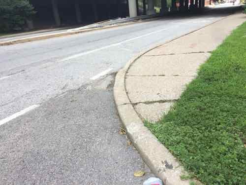
Saturday morning my husband and I took the bus to the Missouri Botanical Gardens, we spent a few hours there. Afterwards we decided to have lunch at OLIO — just a short walk (map). Turning North on the East side of Tower Grove Ave I encountered a problem after crossing De Tonty St.
Tower Grove @ De Tonty St
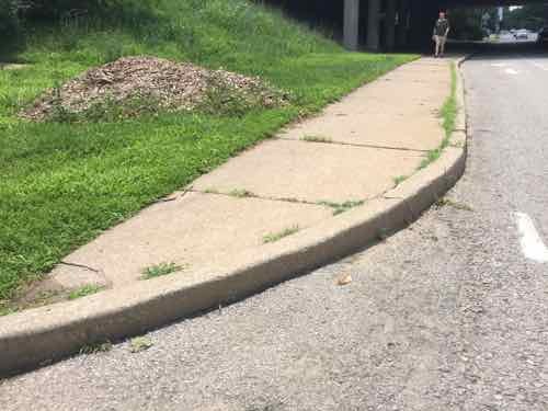
The curb was lower to the right, but not enough that I could get up onto the sidewalk. Thankfully the bike lane exists, I used that on high speed to reach the next street as quickly as possible. At Lafayette Ave I looked back South and the same problem exists on this end!
Tower Grove Ave @ Lafayette Ave., that’s my husband in the background catching up
Good thing I couldn’t get onto the sidewalk at the other end — I couldn’t have gotten off on this end!
I crossed Lafayette Ave and got back on the sidewalk without any issues. I had no other problems after lunch, catching our bus a couple of blocks further North. So why hasn’t this small section been updated in the 25 years since the Americans with Disabilities Act (ADA) was signed into law? Fragmentation is my best guess. This sidewalk runs under I-44, so MoDOT is likely responsible instead of the city.
Another possibility is gerrymandering, both ends of this sidewalk are in the 19th ward. Yes…seriously!
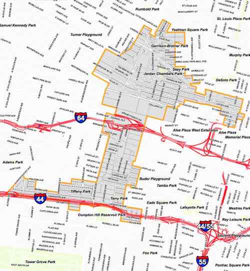
This area is in the very bottom left area pf the 2011 ward boundaries. Click image to see a larger ward map.
To be fair, most likely this was in a different ward(s) before 2011. Still, the 19th Ward is probably the worst in the city for curb ramps.
My experiences have shown over and over again that nobody is concerned about making corridors accessible from end to end. A person examining Tower Grove Ave would’ve caught this issue. Maybe someone has but they can’t get funding from the 19th ward budget to correct it? Maybe MoDOT is aware but it too busy avoiding tolling I-70 to worry about two ramps.
The West side of Tower Grove is better — only one end is missing a ramp, at Lafayette.
Over the years St. Louis has vacated both streets & alleys, this means land previously part of the public right-of-way (PROW) is now private. Usually the phrase “vacate public surface rights for vehicle, equestrian and pedestrian travel” is used in the ordinance (from a block west), typically splitting the surface rights between the adjacent properties. The description of the vacated surface rights are very precise, also from the block to the West:
Beginning at the point of intersection of the western line of 11th Street, 60 feet wide, with the northern line of said alley; thence south 14 degrees 58 minutes 30 seconds west 15.00 feet along the western line of said 11th Street, to the southern line of said alley; thence north 75 degrees 05 minutes west 176.75 feet along the southern line of said alley; thence north 14 degrees 58 minutes 30 seconds east 15.00 feet to the northern line of said alley; thence south 75 degrees 05 minutes east 176.75 feet along the northern line of said alley, to the western line of said 11th street and the point of beginning, and containing 2651 square feet. are, upon the conditions hereinafter set out, vacated.
The alley that is the subject today must have been vacated prior to the library putting ordinances online.
February 1909 Sunburn map shows city block 280 bounded by Olive, 10th, 11th & Locust. I’ve circled the vacated alley that is the subject of this post. Click image to view full page.
This section of alley was extra, the vacation still allowed access to all buildings and 10th & 11th Street — note that the number & configuration of buildings has changed since 1909.
Looking south from the Locust St sidewalk into the vacated alley
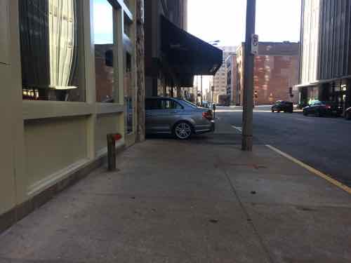
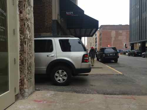
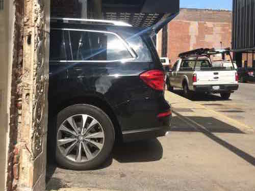
Ok, so we’ve established the surface rights are now private — but this changes where? The building line — not the curb. From the 1909 Sunburn map we know the Locust PROW is 60 feet wide — from building face to the opposite building face. The roadway and sidewalks on both sides are within this 60 foot wide PROW. Unfortunately, one tenant/owner thinks the alley surface rights extend past the building line to the curb line. Ever since the former Bride’s House building at 1008-10 Locust was renovated people have been partially parking in the PROW. I finally began photographing to document the ongoing problem.
November 28, 2014December 19, 2014
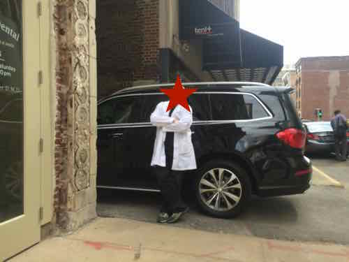
Finally last month, on May 7th, I went into the adjacent business, asking if the SUV belonged to them. When they said yes I told them they can’t park blocking the public sidewalk. We had a big argument outside which continued via text after I left my business card.
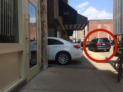
May 7, 2015 — this owner of this SUV had received “7 tickets this year and between 40-50 tickets in the last two years at that same address.”On May 29, 2015 at 10:01am it was back, I emailed the Director of Streets Steve Runde, a patient of the business, and the city parking enforcement dept that keeps ticketing vehicles that park here. I also texted the business.May 29, 2015 at 10:58am: An hour later the SUV had moved to a metered parking space (circled in red), but a white sedan took its place
I don’t know the total number of tickets the city has issued for vehicles here, likely in the hundreds. The business even got another patient involved — an elected official. I returned her phone call explaining where the line is between private property and the PROW, I also emailed her the pictures through May 7th. Hopefully she got back to more important business in Jefferson City.
In the future I’m not going to text the business, I’m just going to email Streets & Parking Enforcement and hope the vehicle’s owner must negotiate with a tow truck operator. I don’t know the total number of tickets the city has issued for vehicles here, likely in the hundreds.
Parking is allowed in the PROW — we have meters placed to know where it is ok to do so.
Five years ago today work began on reversing a mistake that had been in place for 25 years. The “Bridge Bash” event started with comments from numerous white men, followed by Mayor Slay operation the wrecking ball, pyrotechnics made breaking glass a little more exciting. Here’s the video I uploaded from the scene — the action starts at 8:45.
St. Louis Centre was part of the ‘bring the suburbs to the city’ movement. The inwardly focused mall was a killer to the sidewalks downtown — especially under the Washington & Locust wide bridges connecting to Dillard’s & Famous-Barr, respectively.
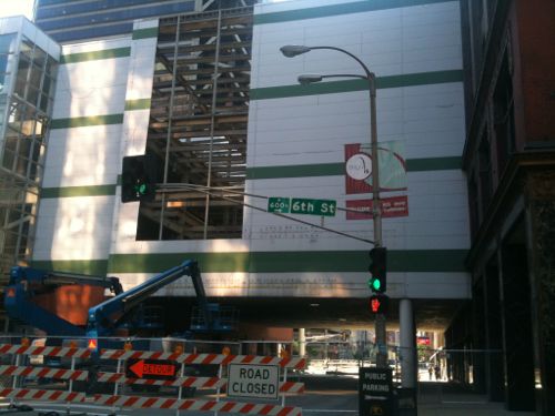
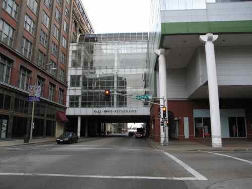
Looking west from 6th Street May 2010Looking east along Washington Ave from 7th, February 2006Same view after the bridge was removed
Removal of this oppressive bridge and facing the ground level retail of the MX (formerly St. Louis Centre) has done wonders for this part of downtown. If only we hadn’t wasted decades trying to be like the burbs.
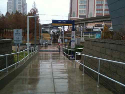
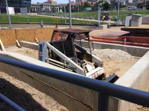
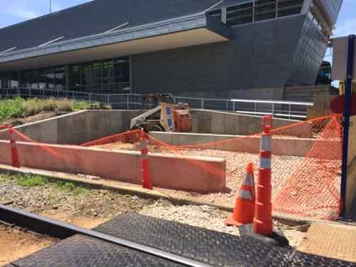
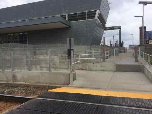
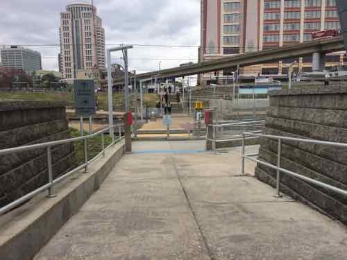
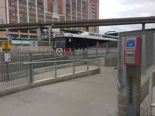
To reduce pedestrians being hit by light rail trains they’ve been making changes to conflict points, this is about the access to the Civic Center MetroLink Station from the Gateway Transportation Center, which opened in late 2008.
When the Gateway Transportation Center (Amtrak & Greyhound) opened in the Fall of 2008 the access to the adjacent Civic Center MetroLink Station was a straight shot. November 2010 photoIn May 2014 work was underwayView looking the opposite directionBy March 2015 the change was completeNow it isn’t a straight shot across the tracks.Everyone must go through a wide switchback
This change may also be related to the coming smart card technology, a reader is shown above. The question I have is will I have a problem passing through the Civic Center MetroLink to reach the Gateway Transportation Center?
AARP Livibility Index
The Livability Index scores neighborhoods and communities across the U.S. for the services and amenities that impact your life the most
Built St. Louis
historic architecture of St. Louis, Missouri – mourning the losses, celebrating the survivors.
Geo St. Louis
a guide to geospatial data about the City of St. Louis