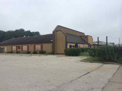
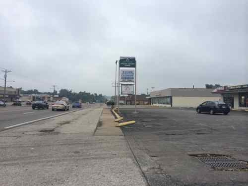
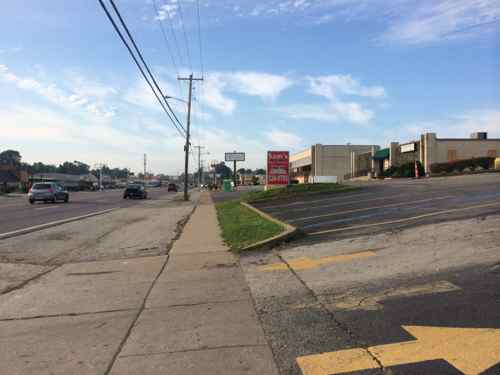
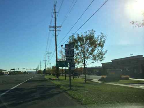
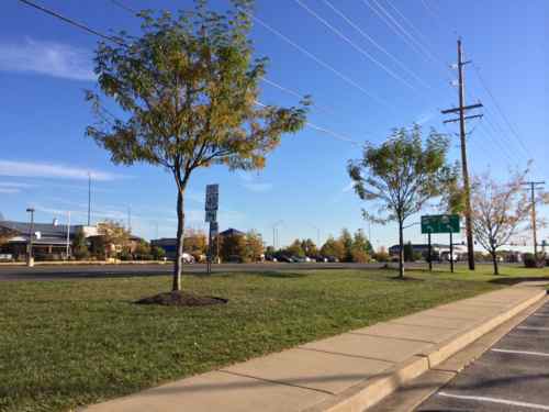
For 3+ weeks now I’ve been thinking about the physical environment of West Florissant from the burnt out QuikTrip location south to the elevated train tracks, just under half a mile. Let’s take a look:
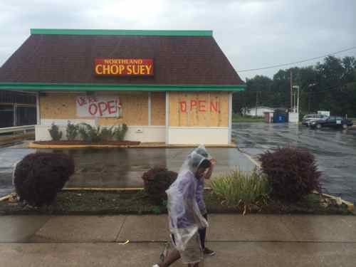
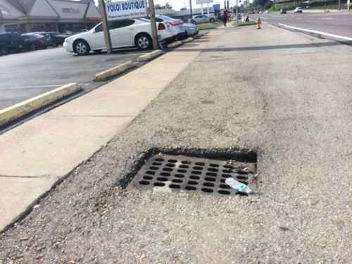
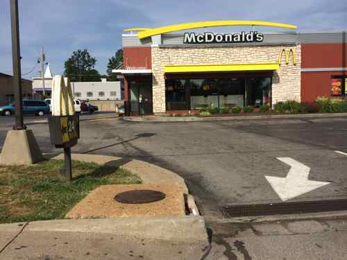
The former Ponderosa at 9200 W. Florissant was built in 1972, it closed sometime between September 2012 and August 2014. A Google Streetview camera from 9/2012 showed the business openJack in the Box built this in 1969, now it’s a locally owned businessThe streetscape design is pure 1960s, lacking anything that would appeal to a pedestrian. The absence of curbs & street trees make you feel vulnerable to traffic. What is this like during heavy rains?Drains for runoff waterThe West side of W. Florissant is very similar to the East. lots and lots of pavingVery few crosswalks exist, the ones that do are poorly designed. Here the crosswalk and ramp have no relationship to each other. One of the rare spots where curbs exist.Pedestrians are many but they’re subjected to narrow broken sidewalksNeither of these storefronts are accessible in a wheelchair. Why hasn’t the Chesterfield-bsaed company that owns numerous buildings on W. Florissant made required ADA improvements in the last 21+ years?The McDonald’s was built in 1989, but recently remodeled inside & out. An ADA accessible route was forgotten in the remodeling though.Pedestrians arriving in wheelchairs must roll into the site from the public sidewalk to nest the rear of the building before finding a ramp.
The area looks & feels tired. Ferguson, Jennings, Dellwood, St. Louis County, Emerson, etc. all need to look at updating the public streetscape along W. Florissant. The use of rain gardens on both sides would visually improve the look as well as absorbing considerable water runoff. Walk Score gives the area a low 36 (Car Dependent) rating, embarrassing for an area with so many pedestrians and frequent transit users.
In Part 2 I’ll look at similar issues a little further North, in Dellwood.
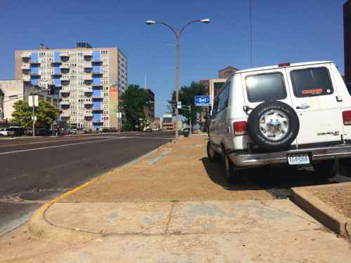
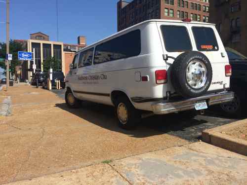
A lot of space in St. Louis is designated for vehicles, with a little for pedestrians. As a result, I get upset when a vehicle reduces the sidewalk space further.
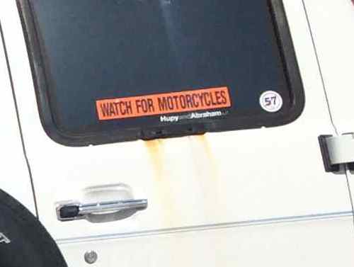
Van parked part way on the Olive sidewalk at 9:40am on a Tuesday morningClose-up of sticker on back windowSide view of van, unsure if it’s still associated with Southwest Christian Church in Fenton
If your vehicle can’t be parked without being part way on the sidewalk I suggest you find a different parking spot. If you’re a motorist do please watch for motorcycles, bicyclists, and pedestrians.
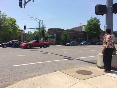
I believe the design of our physical environment plays a role in our decisions, just as other factors, like time & money, might. When the route between point A and B is a pleasant walk, many will opt to walk. But those same people who’ll opt to walk in ideal conditions will decide not to walk if the route isn’t pleasant. I also think the design of our pedestrian network is lagging, motorists would never accept equivalent conditions. For example, crossing Gravois at McNair.
The design says you should cross only on the west side of McNair. Those traveling on the east side of McNair need to use the west side to cross Gravois, per the roadway design. Because of how Gravois cuts through the orthogonal street grid, setting up the proper crossing on the east side would be complicated. With only one side of McNair available as a crossing point you’d think it would be correct.
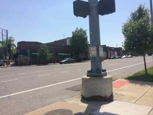
The woman at right just pressed the button to get a walk signal, but what’s missing? Crosswalk stripes & curb ramp. The sewer inlet prevents a ramp on this side of the poll.If we change the camera angle we can see a ramp does exist on the other side of the traffic signal base, opposite of the button.
The button and ramp are supposed to be on the same side…basic common sense. It’s also common sense to stripe a crosswalk to guide pedestrians crossing 8 lanes (6 traffic, 2 parking).
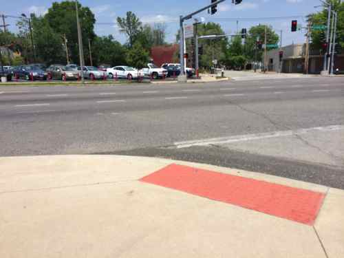
Looking back from across Gravois it isn’t clear the ramp is to the left of the post. It’s not clear to motorists this is a pedestrian crossing. Also, this ramp was built too high so asphalt was used to make it usable for some, though not ADA-compliant.
Just don’t blame the City of St. Louis for this, Gravois is a state road maintained by the Missouri Department of Transportation (MoDOT). I accept that crosswalks can’t/shouldn’t be striped at every street that intersects with Gravois, but if pedestrian signals are in place so should a visible crosswalk.
Can you imagine roads designed with so little thought for the users? I can’t. I’ll send a link to this post to MoDOT & city officials to alert them of the problems at this intersection.
I applaud Chesterfield’s continued support of pubic transportation. Last week I read about more potentially good news:
Chesterfield’s City Council on Monday night gave initial approval an cooperation agreement between the city, Metro, and the Chesterfield Valley Transportation Development District for of bus stop shelters in Chesterfield valley and in other areas of the city in which there are Metro bus routes. A final vote on the legislation is set for June 16. (stltoday)
Bus shelters are an improvement, but what about getting to/from the shelters?
One of five MetroBus stops along Chesterfield Airport Rd serving retail in the Chesterfield Valley, just a sign on the shoulder (below highway 40 sign). Click image for map.The other side of the same stop shows the grass that must be crossed to/from the stop. A sidewalk exists at this spot but not all stops have a sidewalk nearby.
I took these images in October when I checked out the area in a rental car. My conclusion was Chesterfield Valley is an ADA nightmare, taking MetroBus to shop wouldn’t be possible in a wheelchair. Given that everything was built since the big flood of 1993, it should be ADA-compliant. I checked Chesterfield’s ADA Transition Plan, there’s no mention of their responsibility in the public right-of-way.
I’d love to meet former Chesterfield Mayor & Metro President John Nations and current mayor Bob Nation at one of these MetroBus stops to have them see the challenges the transit-using public, including the able-bodied, face in navigating this area on foot.
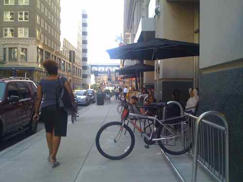
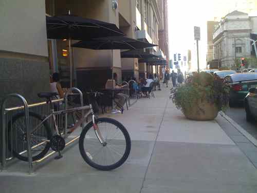
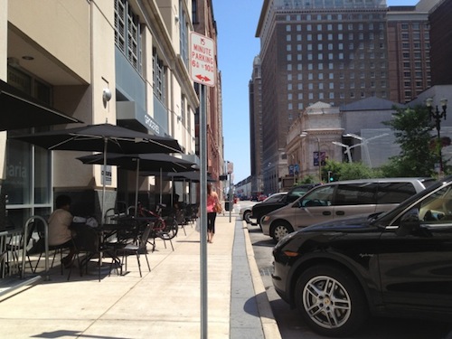
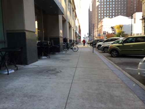
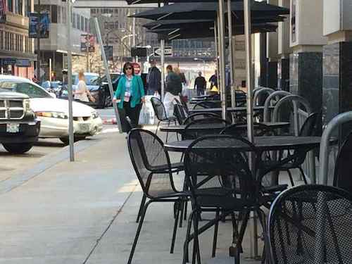
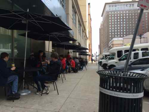
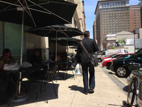
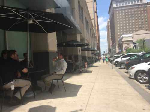
I love outdoor seating, see Lunch Al Fresco from last month, but I also think public sidewalks should remain passable. Achieving both requires effort to create an ideal balance. When the downtown grocery store Culinaria first opened in August 2009 there was a good balance, but over time the walkability was sacrificed in favor of twice as many tables & chairs. Take a look:
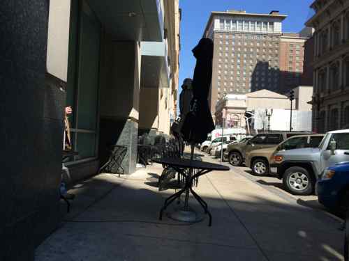
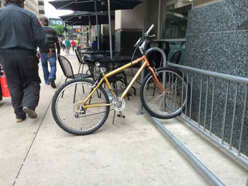
When Culinaria opened in August 2009 bikes were the biggest obstacle on the sidewalkThere was even a nice planter.Over the years the number of tables & chairs doubled! The remaining sidewalk was so narrow people had to walk single file the entire city block. Photo from June 2013In November 2013 the tables & chairs were pushed aside for winter, not done in prior winters. The sidewalk was again clear. except for the occasional bike perpendicular to the curb.On the afternoon of March 18, 2014 I spotted the chairs pulled back out like they’d been in prior years. Thirty minutes later I emailed this plc to the new store manager, starting a dialog.On April 4th the many tables were still being pulled out too farApril 10th, our dialog continuedBy April 16th nearly half the tables & chairs were removed and placed on pallets along the Locust Street sideApril 24th there were fewer tables & chairs but they were still using the same amount of sidewalkThis May 2nd photo shows the tables & chairs still taking up nearly as much space as a bikeMay 6th no improvement in the sidewalk, but the manager says they’ve received compliments for reducing the number of tables & chairs
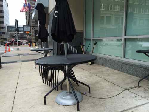
I was glad to see fewer tables, but I knew they could be arranged better. Also, the remaining tables were the larger round tables that seat four, the smaller rectangle tables for two were gone. I think I’ve convinced them to remove a couple more round tables and bring back four of the rectangular tables. This will give another option for customers while maintaining the same seat count. The seating area, and sidewalk, are now more generous and comfortable for everyone.
Yesterday the round tables were positioned as we discussed. The 4 rectangular tables weren’t yet added back as of yesterday.
AARP Livibility Index
The Livability Index scores neighborhoods and communities across the U.S. for the services and amenities that impact your life the most
Built St. Louis
historic architecture of St. Louis, Missouri – mourning the losses, celebrating the survivors.
Geo St. Louis
a guide to geospatial data about the City of St. Louis