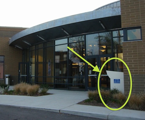
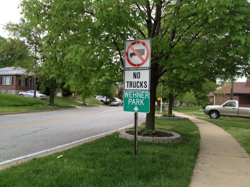
Our library system is wonderful, I feel fortunate to live just two blocks from the magnificent Central Library, which recently had a $70 million dollar renovation. Returning a few items the other day when the library wasn’t open I realized the renovation included a new return box.
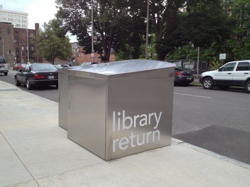
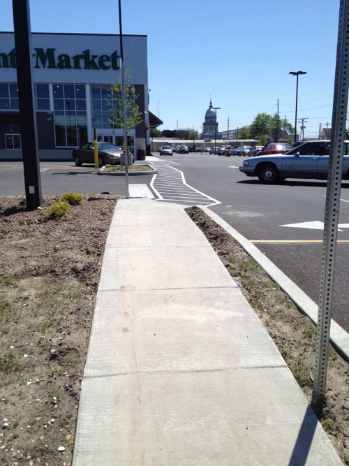
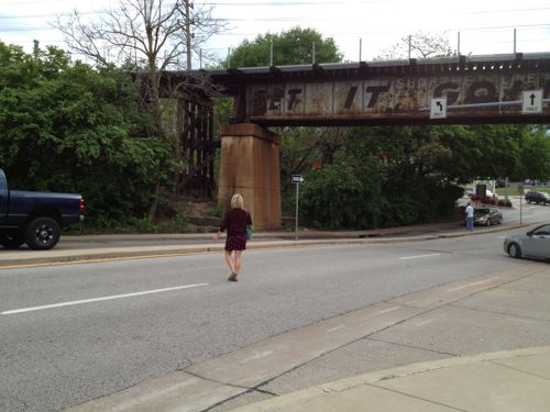
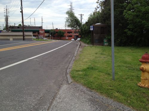
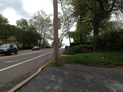
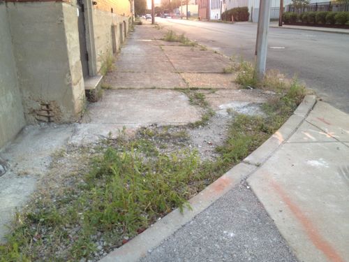
There I am on the sidewalk in my wheelchair looking for the slot to slide the items in.
East side of the after hours book return at the Central LibraryThe return slots are only accessible from Locust Street, not the sidewalk
I had previously assumed the ramp you see behind the library return box was for passenger loading/unloading, but perhaps it is so pedestrians could easily get into the street to return books & videos.
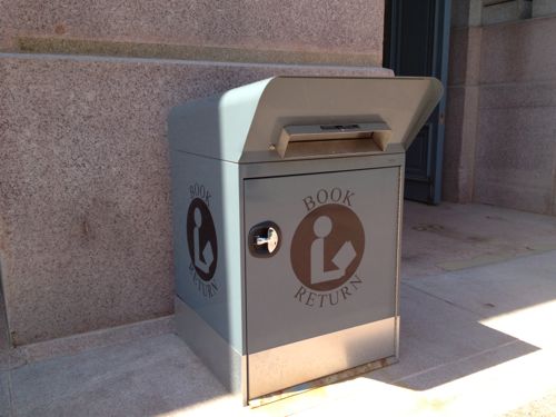
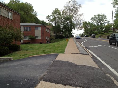
Most other libraries in St. Louis have easily accessed return boxes, not requiring competing with moving traffic. Here are a few examples:
Central Express 4 blocks east of CentralBaden, far north cityKingshighway at SouthwestBuder, south Hampton
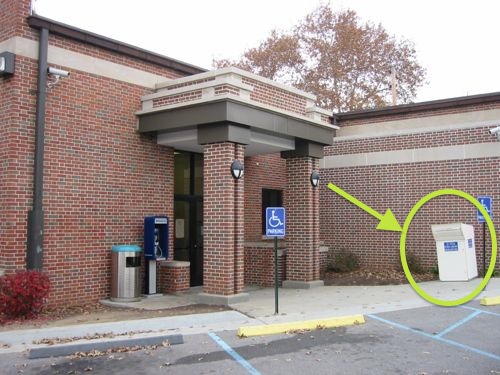
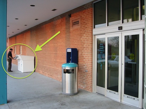
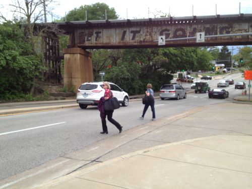
Does someone at the St. Louis Public Library think everyone downtown drives everywhere? Returning books a few blocks away means getting in the car? Another day I asked a librarian at the circulation desk who confirmed they only have the one return box.
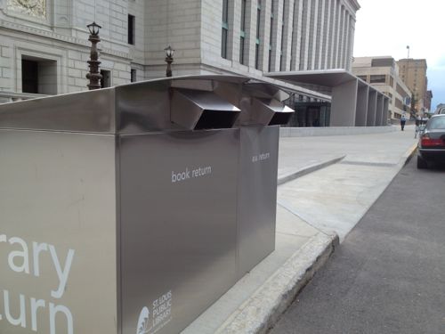
It appears the new book return is accessed from below so librarians don’t need to go out with a cart to retrieve items, a wise choice given the volume at Central. Not providing a way for pedestrians to return items without having to enter the street is yet another example how everyone involved either 1) drives and didn’t consider the pedestrian viewpoint or 2) deliberately made a decision to make returns a challenge for pedestrians.
In March I posted about a new grocery store on the edge of downtown Springfield IL (map) that anticipated many customers on foot, but they expected these pedestrians to either use the automobile driveways or walk over curbs and through grass & lots of parking. A few days after my post, Springfield Journal-Register columnist Dave Bakke wrote Some criticisms of Springfield justified mentioning my criticism, later Bakke followed up with Critique of Springfield’s image touches nerve.
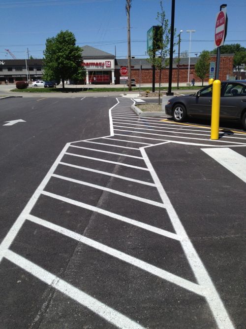
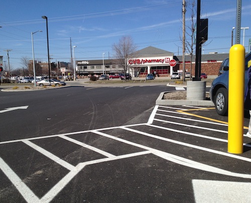
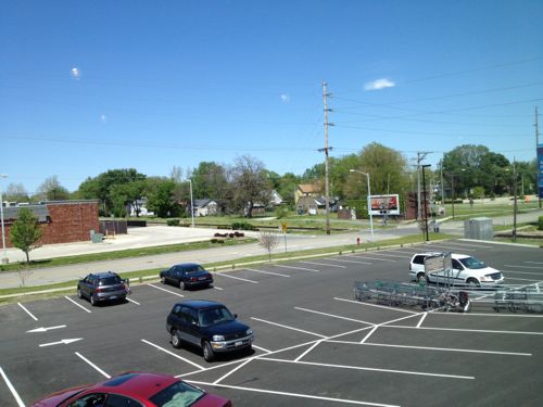
Here’s what customers leaving the entrance facing Carpenter see now.Back in March the New County Market near downtown Springfield didn’t have a route for pedestrians to/from the public sidewalk. The only provision was to reach disabled parking.
From this angle the change isn’t significant, no paint on asphalt will keep a distracted driver from hitting a pedestrian. But look out toward the street and you’ll see new concrete.
From the public sidewalk you can see the new route they added so pedestrians don’t have to compete with cars.
I appreciate the after the fact gesture, but this is a good example why pedestrian access, just like automobile access, must be planned from the beginning. The new concrete walk does not meet ADA guidelines, it is too steep in places. I didn’t have my digital level with me on our Mother’s Day trip, but I could tell by walking it.
This route shown above is a consolation prize for pedestrians, it connects to Carpenter St only, not to 2nd St. Even if they retrofitted a route to 2nd it still wouldn’t be considered pedestrian-friendly. As I pointed out in my original post, the County Market in Champaign-Urbana is the model that should’ve been built in Springfield. It was built on a corner with direct access from both sidewalks. It also has a parking lot behind the building, with another entrance. Same number of entrances as the Springfield location, just arranged so customers arriving on foot or car are equally accommodated.
From the mezzanine you can see the route able-bodied pedestrians will likely take, cutting across the parking lot at a diagonal.
Springfield, like St. Louis and most cities, should not allow parking between the public sidewalk and buildings in areas where they seek to be pedestrian-friendly. In all other areas where public sidewalks are present/required they should require developers to actually connect to them. Public sidewalks are not window dressing, people actually use them.
If motorists were treated like pedestrians, no parking lot would have a driveway connecting to the public street. You’d be forced to drive over multiple curbs and through grass. All cars could be able to enter & exit, but 4X4 vehicles would have an easier time. While people could use parkings lot this way, they’d soon realize it wasn’t friendly and is potentially damaging their vehicle. Those with high-clearance SUVs wouldn’t understand why a person driving a vintage MG Midget would complain, besides how often do you see one of those on the road… Why build costly driveways for the few people who have low cars?
Municipal zoning & building codes in cities coast to coast go to great lengths to detail every aspect of our arrival at developments by car: driveways, width of aisles, parking space dimensions, number of spaces, etc. Few say a word about arrival on foot.
It is no wonder so few people walk given our built environment.
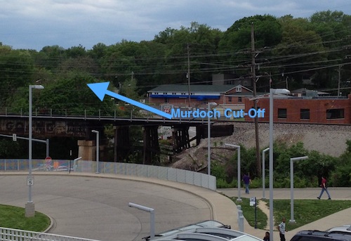
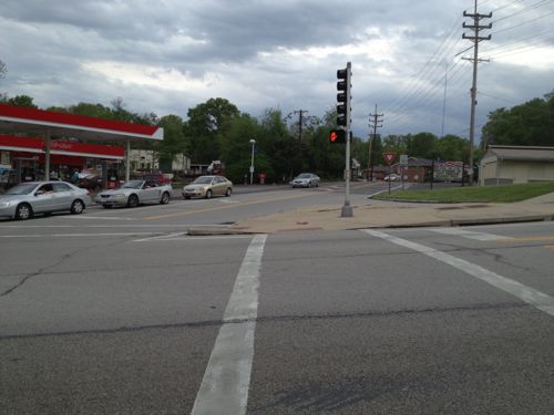
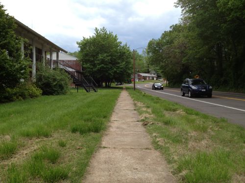
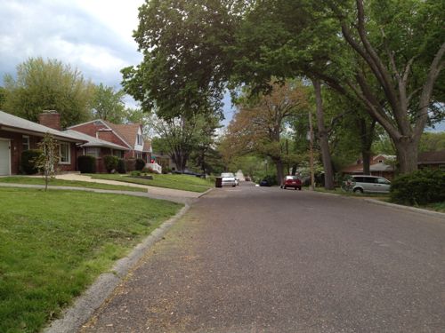
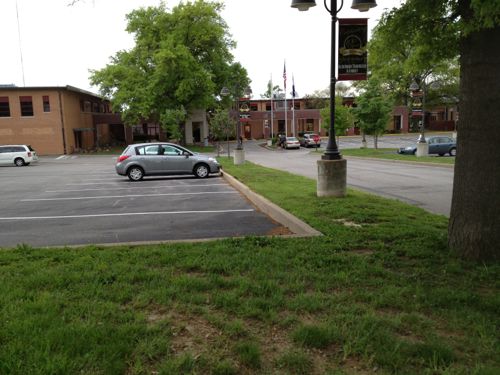
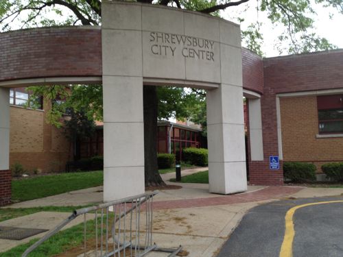
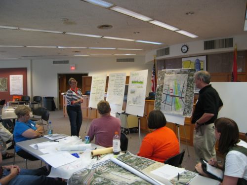
I love rail transit, but a problem with our MetroLink light rail system is getting from the stations to your destination. Last week I attended a meeting hosted by Trailnet at Shrewsbury City Hall, a mile from the station. I could’ve caught a bus that would’ve dropped me off at Murdoch & Shrewsbury Ave but I still would’ve had 4/10ths of a mile to reach city hall. It was decent out and my power chair had a full charge so I decided to “walk” the mile.
But first a little background information.
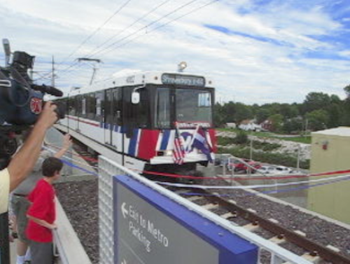
The Shrewsbury MetroLink station opened with the blue line extension on August 26, 2006. Click image to view video of the arrival of the first train pictured above.
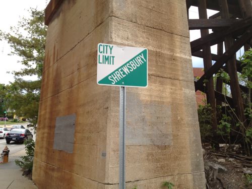
The Shrewsbury MetroLink station is located in the City of St. Louis, but the Shrewsbury city limits is the western edge of the commuter parking lot. The station has been open neatly 7 years now so there’s been time to better connect the surrounding neighborhoods to transit.
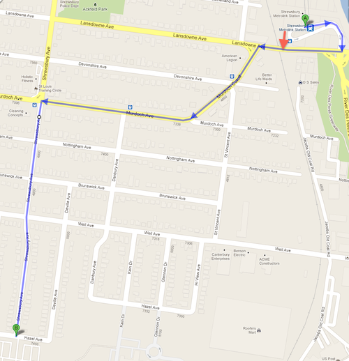
Okay, let’s head to Shrewsbury City Hall located one mile away at 5200 Shrewsbury Ave.
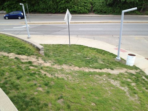
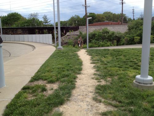
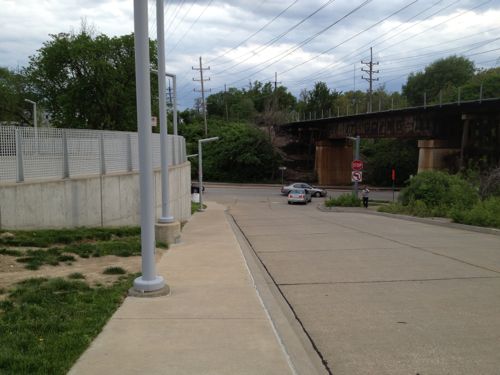
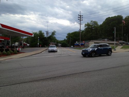
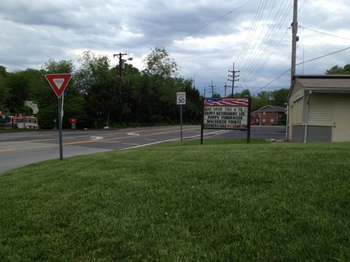
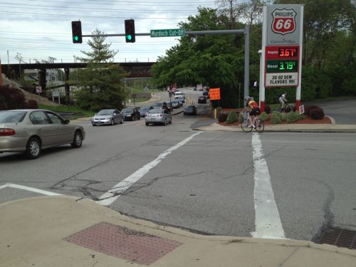
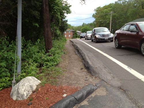
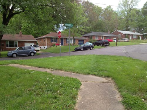
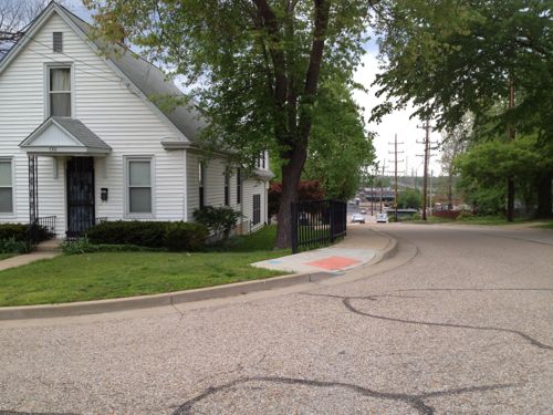
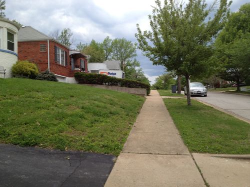
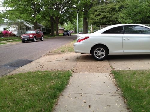
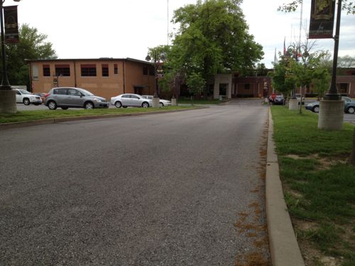
My planned route Lansdowne, Murdoch Cut-Off, Murdoch, Shrewsbury Ave, click map to view in Google MapsFrom the station platform I could see the direction I needed to go to reach the Shrewsbury City Hall.Looks like many walk up/down this hillOthers walk here, but I’d better find a sidewalk I can use.Now I’m headed down toward Lansdowne Ave, sandwiched between the retaining wall on the left and the auto driveway on the right. Not a friendly environment!At Lansdowne Ave I see pedestrians crossing the street without a crosswalk. I couldn’t cross here even if I wanted to because of the numerous curbs.More pedestrians risking getting hit by carsI stick to the north side of Lansdowne Ave and head west under the railroad tracks, the Shrewsbury city limit.I want to cross Lansdowne Ave here but there is no curb cut or crosswalk to allow me to do so.I’m able to use this crosswalk to reach the other side of Murdoch Cut-OffBut there’s no sidewalk on this side of Murdoch Cut-OffSo I returned to the intersection to cross Murdoch Cut-Off to reach the point I originally wanted to reach but couldn’tAfter passing the gas station I discover there’s no sidewalk on this side of Murdoch Cut-Off either. It looks like many pedestrians walk in the narrow dirt path, I had to use the narrow shoulder. This point is about 400 feet from where I left the station property.Looking back from where I’d just traveled you can see a bus stop encouraging pedestrian use of this area.As Murdoch Cut-Off approaches Murdoch a sidewalk does exist.But the sidewalk doesn’t continue, it turns and heads back east. This is about 1/8th of a mile from the station.I head south on St. Vincent Ave, this view is looking back north from Notttingham. Only the west side of St. Vincent Ave has a narrow sidewalk.The streets intersecting with St. Vincent don’t have sidewalks for the first block to Danbury Ave., I cautiously proceed in the street.Once past Danbury Ave sidewalks are availableThat doesn’t mean the sidewalks weren’t blocked at times. This owner had more room on their driveway before their garage door, more than enough to keep the sidewalk clear.After I reached Shrewsbury Ave I went north to Murdoch to see where sou;d’ve been dropped off had I taken a bus. This point is about a third of a mile from the corner of the transit station property.Looking east on Murdoch, the direction I originally thought I’d take. No sidewalk, only shoulder.The north side of Murdoch has a sidewalk next to the apartment buildings only.This is the bus stop heading back toward the MetroLink station, I caught a bus here a couples of hours later to return downtown.Heading back south toward city hall I passed charming houses and the route was paved and easy to navigate. The distance was over a half mile but it was fine, the worst part of the journey was closest to the transit station.Getting closer to city hall and the adjacent Wehner ParkNewer houses mix well with older houses.Almost there!The sidewalk just ends, dumping me into the street. No crosswalk or visible sidewalk into the Shrewsbury City Center complex grounds, just a sidewalk going east & west.No way in on the east side of the auto drive.No pedestrian route on the west side either, so I had no choice but to use the auto drivewayA pedestrian route along the east side of the auto driveway would be a direct path to the main entrance of the Shrewsbury City Center complex. Voters approved a bond in 1991 to pay for the renovations to city hall, the work was completed in 1993 — both after The Americans with Disabilities Act of 1990.Leaving at night via the auto driveway. I’d imagine many neighbors drive here from just blocks away because that’s the message the design suggests.My only other time here was Saturday June 17,2006 for a charrette on connecting St. Louis & Shrewsbury to the open MetroLink line, attended by residents, businesses and elected officials. I drove on that visit.
Given the substantial capital investment made in the MetroLink expansion and the commitment of sales taxes to help fund Metro I find it unacceptable that nothing has been done in nearly 7 years. Well, the sidewalk along one side of St. Vincent looks like it was done in that time frame, but nothing else looks different. Employees & customers should be able to walk from the MetroLink station to the businesses along Murdoch & Murdock Cut-Off. Shrewsbury residents living within a 1/4 mile of the station should have a easy walk, but they don’t.
I suggest the following action steps:
Metro, St. Louis, Shrewsbury, Trailnet, etc. begin to examine ways to improve the pedestrian experience to/from the Shrewsbury MetroLink/MetroBus station.
Shrewsbury begin to evaluate multiple routes from the station to destinations with Shrewsbury, starting with a walking audit. I’d be happy to participate. Dan Burden from the Walkable & Livable Communities Institute would be an outstanding facilitator.
Shrewsbury work to add an ADA-compliant accessible route to the main accessible entrance of the Shrewsbury City Center complex.
I’m emailing various officials at Shrewsbury & St. Louis this morning to try to raise awareness and get some action.
Today when I visit Solae it won’t be a challenge like it has been, last month I discovered a problem that existed since the building opened in 2008 has finally been fixed. Last July I posted about the problem and contacted Solae, Cortex and Washington University.
Here’s what it used to look like, the gap was nearly impossible to navigate:
Photo from July 2012 post: Solae’s contractor left a wide gap between old and new sidewalk on Duncan
It was suggested in the comments on my post last year that the adjacent building (shown above) owner was responsible. I rejected that idea because it was the construction work at Solae that created the gap that caused the problem. The architect and/or contractor didn’t consider patching the area where they had to over dig.
Now the sidewalk is passable.
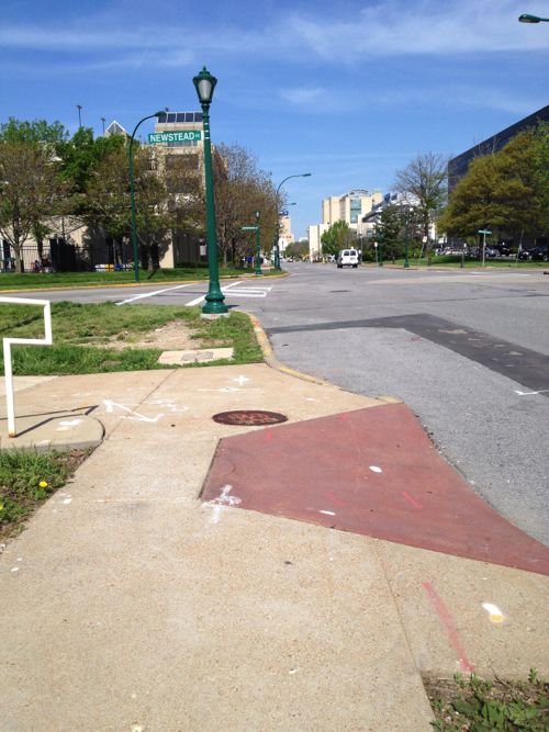
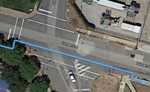
Unfortunately, my trip from the Central West End MetroBus Transfer Center/MetroLink Station still has a major access problem. At Duncan & S. Newstead (map) I can’t use the crosswalk to cross Newstead.
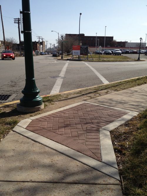
The crosswalk exists but only if you can walk through grass and down a curb, then jump a curb on the west side of Newstead.Stepping back we can see the nearest ramp which id designed to cross Duncan, not NewsteadThe blue line shows the route I take to cross NewsteadThe opposite view shows one of the many decorative stamped concrete inserts Washington University added throughout their medical campus district to enhance the pedestrian experience. Feb 2012 photo.
Washington University spent considerable time and money on these decorative inserts, seemingly without thought to the functionality of the pedestrian network. This infuriates me beyond words. The money spent could’ve been used to make the area accessible and the sidewalks wide enough so when you meet someone they don’t have to step off the sidewalk into the grass. These decorative inserts are the type of pedestrian improvements are designed to look good on paper and driving by.
Can you imagine if roads were designed for aesthetics rather than function?
We’ll see how long it takes before I can use the crosswalk.
AARP Livibility Index
The Livability Index scores neighborhoods and communities across the U.S. for the services and amenities that impact your life the most
Built St. Louis
historic architecture of St. Louis, Missouri – mourning the losses, celebrating the survivors.
Geo St. Louis
a guide to geospatial data about the City of St. Louis