Home » Planning & Design » Recent Articles:

Another Downtown/CBD Traffic Study In The Works, Looking Back At The 2005 Study

I recently learned that a traffic study will be done for downtown’s Central Business District (CBT), a good thing.  But then I thought about the last CBD traffic study. A search of this blog turned up posts from a decade ago:

I’m a digital packrat, so I saved the presentation:

First slide of presentation, click image to view 53 page PDF on Scribd.

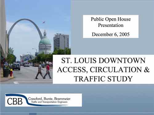
You can view the presentation and draw your own conclusions — I want to call attention to some of my thoughts at the time along with how things have changed, or stayed the same:

Doug Shatto, President of the consulting firm Crawford, Bunte, Brammeier did an excellent job of explaining the tradeoffs between various methods such as one-way vs. two-way streets. I felt he understands what it takes to create a pedestrian & retail-friendly environment. What I didn’t get was a sense that he will fight for that. Instead I think he’ll do whatever the city tells him.

Shatto has changed jobs.

Washington Avenue East of Tucker. While they say that on-street parking has not been ruled out I’m suspicious. They hinted at allowing parking except during peak hours. I pointed out after the meeting to Doug Shatto how KitchenK will not use their sidewalk cafe license until they have a row of parked cars to make sidewalk dining more hospitable to their patrons. I also pointed out that Copia is allowed to take a traffic lane for valet parking. If we can take a lane for a valet we can certainly take the balance of the lane for parking as the flow is already restricted. I still want to see on-street parking all the way from Tucker to at least Broadway.

Ah yes, a decade ago parking wasn’t allowed on Washington Ave East of Tucker. I did a number of posts at the time about this, finally we got limited parking on the EB block between 11th & Tucker and 10th-11th in both directions –except during morning & afternoon rush. On-street parking is still needed East of 10th, but it hasn’t happened. It’s needed to separate pedestrians from moving vehicles, reduce drive lines from four to two. The anticipated long line of WB cars turning right onto Tucker toward the new bridge never materialized, yet the rentire WB right lane from 11th to Tucker remains no-parking. Why?

I asked at the end of the meeting about Cole street being abel to take some of the traffic off Washington Avenue. Shatto did indicate that if Washington Avenue was restricted from four lanes to two lanes through drivers would likely alter their route and use the nearly vacant Cole. Another factor that may reduce some traffic on Washington Avenue is people going around the block due to one-way streets. They are recommending changing 8th & 11th from one-way to two-way (more later).

  • Streets they deemed “appropriate” to change from one-way to two-way were 8th, 11th (North of Market only), and Walnut (from Tucker to either to 4th or Broadway).
  • Streets they deemed “inappropriate” to change from one-way to two-way were 9th, 10th and Pine.
  • Streets they deemed “inappropriate but viable” to change from one-way to two-way were 6th, 7th, and Locust.
  • One-way streets not even mentioned were Broadway or Chestnut.

Balpark Village did cause portions of some one-way streets to become tw0-way again. Downtown remains confusing with one-way, two-ways, and streets that don’t go through because of vacations of blocks here and there. Decades of butchering the grid has created a nightmare.

  • The immediate plan (2006) is to change the controllers for the existing signals. This will allow them greater flexibility in controlling the signals via computer. This might include changing the timing for game days or setting the signals to flash after a certain time. I think changing the timing makes sense as this could help with special events. I’m not sure how I feel about the flashing signals after hours. Does this say we have so little going on that we don’t need normal timing? Or does it say that we change over to a pedestrian environment after hours?

Presumably the controllers were changed. Many signals themselves remain the same. Many intersections still lack any type of pedestrian signal, others need countdown timers.

  • They mentioned trying to change Missouri law to allow a left turn on red on one-way streets. Apparently this is allowed in 16 or so states but not Missouri. It is commonplace downtown to see drivers do this.

I posted about this in June — Missouri law still doesn’t allow left turns on red.

  • I think they did an excellent job of evaluating pedestrian concerns and will do a good job upgrading the system and reducing conflicts. One of the changes it to go to a simple two-phase system where pedestrians are permitted to cross with the flow of traffic. Currently some intersections are considered scrambled where pedestrians can cross any direction while cars wait. While this sounds good that also means that they are generally not allowed to cross with the flow. It seems more natural to have the simpler system.

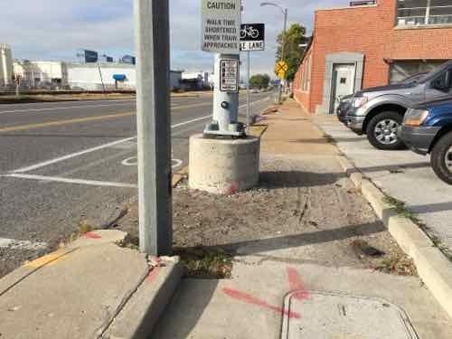
The pedestrian experience downtown is horrible — highly inconsistent from one block to the next. With the Arch parking garage gone we’re expecting visitors to parking in garages in the CBD and walk to the new downtown-facing entry. The pedestrian experience doesn’t seen to have been given the scrutiny that traffic flow & space availability has.

Hopefully once a new plan is complete we can actually take some action!

– Steve Patterson


Sunday Poll: Feelings on Proposed Entry Markers for Forest Park?

In August it was announced new entry markers would be coming to Forest Park entrances:

The City of St. Louis and the private nonprofit conservancy Forest Park Forever have announced plans to construct the first of eight new arrival markers at key Forest Park entrances. Called for in the 1995 Forest Park Master Plan, these thresholds will more formally welcome visitors arriving by foot, on bicycle and by car, clearly identify the Park’s primary and secondary entrances — especially key for visitors from around the region and country — and create welcoming nodes where visitors can meet and gather. 

At the first site selected, the popular entrance at Skinker/Wells/Clayton at the Park’s southwest edge, a temporary mock-up will be installed in fall 2015; this will allow stakeholders and the Forest Park Advisory Board — established in the Master Plan to ensure public involvement in any new capital projects in the Park — to assess scale, positioning and Park context before continuing on with construction, which is planned for 2016. Design and construction costs for this entrance are estimated to be approximately $300,000. Forest Park Forever has raised the private funds necessary to proceed and complete it. St. Louis-based SWT Design has served as the project’s designer. (Forest Park Forever — with images)

I didn’t see the temporary mock-up in person, but late last month St. Louis Public Radio had a story on pushback & support.

Please vote below
Please vote below

Today’s poll wants to see where readers stand.

As always, the answers are presented in random order. This poll closes at 8pm tonight.

— Steve Patterson


The Future of Grant’s Farm is Uncertain

The future of Grant’s Farm is coming between siblings — children of the late August Anheuser “Gussie” Busch, Jr. (1899-1989). I find it unsettling to see wealthy siblings, in their 50s & 60s, disagreeing m public.

Before I go any further, I have a confession: I’ve never been inside the gates of Grant’s Farm or the Ulysses S. Grant National Historic Site located across…Grant Rd. I’ve certainly driven past on Gravois many times, even exploring the perimeter like Pardee Rd. On Sunday we drove around the site completely. Though the site contains many buildings, it’s still very much unspoiled nature.

The Gravois Rd entry gates to Grant's Farm
The Gravois Rd entry gates to Grant’s Farm

One comment on the Sunday Poll post was:

FYI your 3rd choice isn’t an option. Do a little research on what municipality Grant’s Farm lies in and what it’s zoning laws and ordinances are. Also look up what part lies in a flood plain. Not going to have to worry about any commercial or residential development here!

While poll answers are presented in random order, this was a reference to the poll answer: “Sell to a developer for houses &/or retail”  Not only is it possible, this is the concern of the four Busch siblings that would like to sell the animal preserve to the St. Louis Zoo.

Four Anheuser-Busch heirs worry that their brother, Billy Busch, will turn Grant’s Farm into a subdivision.

No one man can finance and maintain the sprawling South St. Louis County animal park, said Trudy Busch Valentine and Andy Busch. It’s just too expensive.

They have seen housing plat maps already drafted for the Grant’s Farm land, they both said, and know it’s an option for any owner if times get tough.

Billy Busch responded, saying he wouldn’t sell off land. St. Louis County classifies the land as single family, Grantwood Village has it zoned “Animal Preserve.” The Lindbergh School District would likely object to a loss of tax revenue if it went to the Zoo.

County records show the site as 214 acres, though news reports say 198 acres
Parking & farm land on the East side of Grant Rd is a different ownership from the trust.
Pedestrian entrance from Grant Rd parking lot
The National site is less than 9 acres

Here are the results of the Sunday Poll:

Q: Six Busch siblings can’t agree on Grant’s Farm, what would you like to see happen?

  1. William “Billy” Busch buys it, builds Kräftig Brewery on part, allows Zoo to use part. 31 [58.49%]
  2. St. Louis Zoo buys it, the region fund a new sales tax to cover annual operating expenses. 12 [22.64%]
  3. Stay as is, owned by the family trust & operated at an annual loss by AB InBev 9 [16.98%]
  4. Other — county buys, becomes affordable housing: 1 [1.89%]
  5. Sell to a developer for houses &/or retail 0 [0%]

A century ago such a family would’ve donated the land to the Zoo, along with an endowment to help cover upkeep. Are taxpayers willing to pay to keep this land as an animal preserve? Doubtful. The future seems uncertain.

— Steve Patterson


The St. Louis Region Should’ve Planned For Commuter Rail A Century Ago

In thinking about transit in other regions compared to ours, it is clear to me that natural geography and historic development patterns play a role in transportation planning in the 21st century. Decisions made a century ago, good & bad, still affect us today.

One hundred years ago St. Louis hired a 26 year-old civil engineer, Harland Bartholomew, to be its first planner. During the previous 151 years it developed organically, without planning, He quickly proposed widening many public rights-of-way (PROW) to make room for more cars.

Franklin Ave looking East from 9th, 1928. Collection of the Landmarks Association of St Louis

St. Louis city invested heavily in widening streets like Natural Bridge, Jefferson, Gravois.

More than three decades after arriving in St. Louis, Bartholomew got a Comprehensive Plan officially adopted (1947). His plan was all about remaking St. Louis because it would have a million residents by 1960 — or so he thought!

Here’s the intro to the Mass Transportation section:

St. Louis’ early mass transportation facilities consisted of street car lines operated by a considerable number of independent companies having separate franchises. Gradually these were consolidated into a single operating company shortly after the turn of the century. In 1923 an independent system of bus lines was established but later consolidated with the street car company. Despite receivership, re-organization and several changes of ownership the mass transportation facilities have been kept fairly well abreast of the city’s needs. Numerous street openings and widenings provided by the first City Plan have made possible numerous more direct routings and reduced travel time.

Approximately 88 per cent of the total area of the city and 99 per cent of the total population is now served directly by streetcar lines or bus lines, i.e., being not more than one quarter mile walking distance therefrom. Streetcar lines or bus lines operate directly from the central business district to all parts of the city’s area. There are also numerous cross-town streetcar lines or bus lines, operating both in an east-west and north-south direction. 

No mention of a regional need for commuter rail. Some might point out this was the city’s plan, not the region’s. That would be a valid point if it weren’t for the regional nature of the next section: Air Transportation:

It is reasonable to assume that the developments in air transportation during the next few decades will parallel that of automobile transportation, which really started about three decades ago. St. Louis must be prepared to accept and make the most of conditions that will arise. Provision of the several types of airfields required must be on a metropolitan basis. The recently prepared Metropolitan Airport Plan proposes thirty-five airfields. See Plate Number 27. These are classified as follows:

  • Major Airports – for major transport 3
  • Secondary Airports – for feeder transport 1
  • Minor Fields – for non-scheduled traffic, commercial uses and for training 15
  • Local Personal Fields – for private planes 13
  • Congested Area Airports – for service to congested business centers 3
     
    [Total] 35

Of these, two major, eight minor, twelve personal and three congested area airports would be in Missouri. Lack of available land in the City of St. Louis limited the number within the corporate limits to two minor, one personal and two congested area airports. The selection of sites for the latter involves great cost and should await further technological developments in design and operation of various types of aircraft, including the small high powered airplane, the autogyro and the helicopter.

The three airports within the city are:

  • A Minor Field at the southern city limits east of Morganford Road.
  • A Minor Field in the northern section of the city between Broadway and the Mississippi River. (Since the publishing of the above report this field has been placed in operation by the city.)
  • A Local Personal Field in the western section of the city on Hampton Boulevard north of Columbia Avenue.

The latter is of special significance because of the great concentration of potential private plane owners in fairly close proximity. The northern minor field is adjacent to a large industrial area. The southern minor field would also serve a large industrial area as well as a considerable number of potential private plane owners.

So the region should have 35 airports but no commuter rail service? It should have numerous new highways but no commuter rail? Here’s the visual of the region with 35 airports:

Bartholomew's 1947 plan called for 35 airports un the St, Louis region!
Bartholomew’s 1947 plan called for 35 airports un the St, Louis region!

Thirty-five airports but no plan for mass transit beyond bus service?

Bartholomew left St. Louis in 1953 to chair the National Capital Planning Commission, where he created the 1956 plan for 450 miles of highway in the capital region.

During the 1960s, plans were laid for a massive freeway system in Washington. Harland Bartholomew, who chaired the National Capital Planning Commission, thought that a rail transit system would never be self-sufficient because of low density land uses and general transit ridership decline. But the plan met fierce opposition, and was altered to include a Capital Beltway system plus rail line radials. The Beltway received full funding; funding for the ambitious Inner Loop Freeway system was partially reallocated toward construction of the Metro system. (Wikipedia)

A book written by a partner of Bartholomew revises history to suggest he pushed for Washington’s Metro — see Chapter 10.

https://www.stlouis-mo.gov/archive/harland-bartholomew/HBaACh10.pdf

Washington has fewer miles of freeways within its borders than any other major city on the East Coast.” Thirty-eight of the planned 450 miles would have routed through D.C. proper; today, there are just 10. Instead, after a wrenching and protracted political battle, they write, “the Washington area got Metro—all $5 billion and 103 miles of it.” (Slate)

In 1945, as a paid consultant, Bartholomew said “the density of population of the Washington area would never be sufficient to warrant a regional rail system.” (Lovelace P141, chapter 10 p3). Most likely he felt that way about the St. Louis region. Though the city was quite dense during his decades here, the surrounding suburbs were low-density, still are.

But what if he had guided the region to develop boulevards to the North, West, & South of downtown with streetcars in the median? Today that right-of-way could be used for light rail. Cleveland, for example, is fortunate that Shaker Blvd & Van Aken Blvd  were planned as such, providing room for their Green Line & Blue Line, respectively.

Bartholomew was highly influential — the one person in the region that might have been able to lay the ground work for better mass transit in the 21st century. It wasn’t feasible like lots of highways & airports.

My point is when we think about future transportation infrastructure, and we look at other regions, we must keep in mind their planning & development decisions a century ago. Many still think we should’ve put light rail down the center of I-64 during the big rebuild — failing to realize there wasn’t a way to get a line into the center and it wouldn’t work well if we could since the housing along the route wasn’t developed around transit.

We were able to leverage rail tunnels under downtown and a rail corridor to get light rail to the airport. Other former rail corridors exist for new light rail lines, such as North along I-170 out of Clayton into North County. We do have excessively wide boulevards in the city & county, but cutting up the street pattern after the fact by putting light rail down the center and significantly reducing crossing points is similar to building a highway — it separates.

Moving forward with plans for new regional transportation infrastructure we must recognize we simply don’t have the advantages many other regions enjoy.  We can’t go back and undo decisions Bartholomew & others made a century ago.

— Steve Patterson


Macklind Ave Is An Inaccesible, Incomplete Street

At the start of this month I had an appointment with an orthopedic specialist, to get a cast made for a new ankle-foot orthosis (AFO).  Orthotic & Prosthetic Design is located at 5467 Highland Park Drive, off of Macklind Ave. between Manchester & Oakland. I’d been there before, usually driving. Once via the #59 MetroBus on Oakland — which goes as far East as the Central West End. With my husband at work with our car, I decided to take the #32 MetroBus — no transfer needed. I boarded at 14th & Washington.

This is the Eastbound #32 I took, the Macklind bus stop is just West of the intersection. I snapped this photo at 9:21am on November 2, 2015.
This is the Eastbound #32 I took, the Macklind bus stop is just West of the intersection. I snapped this photo at 9:21am on November 2, 2015. Click image to map bus stop.
The lowered section here is to be able to cross Manchester, but it's filled with debris.
The lowered section here is to be able to cross Manchester, but it’s filled with debris.
I wanted to locate the bus stop for my return trip, it's East of Macklind. The concrete pad isn't accessible -- no sidewalk to reach it. I'm forced to take a different MetroBus and transfer at the CWE or travel further East or West on Manchester until I find an accessible stop.
I wanted to locate the bus stop for my return trip, it’s East of Macklind. The concrete pad isn’t accessible — no sidewalk to reach it. I’m forced to take a different MetroBus and transfer at the CWE or travel further East or West on Manchester until I find an accessible stop. Click image to view closer view on Google Street View.
I rotated back toward Macklind to show you how far away from the intersection I was.
To head North on Macklind I can't go up the East side. The sidewalk is missing behind the corner but just out of view is a curb. My only option is the West side, which is ok because my destination is to the West.
To head North on Macklind I can’t go up the East side. The sidewalk is missing behind the corner but just out of view is a curb. My only option is the West side, which is ok because my destination is to the West.
At 9:26am I get to 1249 Macklind, owned by American Pulverizer, and see there's no sidewalk. Rather than risk getting hit in the street, I risk tipping over on uneven ground. If it had rained I might have gotten stuck.
At 9:26am I get to 1249 Macklind, owned by American Pulverizer, and see there’s no sidewalk. Rather than risk getting hit in the street, I risk tipping over on uneven ground. If it had rained I might have gotten stuck.
In front of the Humane Society I reach Wise Ave -- no curb cut on either side. I decide to go West on Wide to cross over to the other side at a driveway.
In front of the Humane Society I reach Wise Ave — no curb cut on either side. I decide to go West on Wide to cross over to the other side at a driveway.
On the North side of Wise Ave I managed to slowly get past the parking meters next to the Pasta House headquarters, but then...
On the North side of Wise Ave I managed to slowly get past the parking meters next to the Pasta House headquarters, but then…
I couldn't get past a light pole because the slope of the grass. I had to stand to get my chair reversed, all while not falling or sending my chair over the curb into the street.
I couldn’t get past a light pole because the slope of the grass. I had to stand to get my chair reversed, all while not falling or sending my chair over the curb into the street.
So I returned to the driveway off Wise and rode back toward Macklind in the street. But I can't get onto the sidewalk. I had to choice but to use Macklind Ave -- going into a drive and to go around parked cars until I reached a curb ramp or driveway.
So I returned to the driveway off Wise and rode back toward Macklind in the street. But I can’t get onto the sidewalk. I had to choice but to use Macklind Ave — going into a drive and to go around parked cars until I reached a curb ramp or driveway.
The next point was the street I needed, Highland Park Drive. No curb ramps here either, but I was able to get over this curb. Others might not be able to.
My destination is at the end of the street, but CBRE decided their sign was more important than pedestrians, I went around but the slope & condition of the asphalt was another challenge in a difficult morning, I arrived right on time at 9:40am.
After my appointment I headed North to Oakland Ave, at St. Louis Community College I encountered another curb. I used a nearby drive to once again go onto Macklind Ave to get around the lack of a curb cut. Whoever painted it yellow probably didn't think about wheelchair access.
After my appointment I headed North to Oakland Ave, at St. Louis Community College I encountered another curb. I used a nearby drive to once again go onto Macklind Ave to get around the lack of a curb cut. Whoever painted it yellow probably didn’t think about wheelchair access.

I did reach the bus stop on Oakland — in front of Paraquad.

When the Humane Society of Missouri opened their new headquarters nearly 18 years ago it seems nobody worried about pedestrians reaching the property — no sidewalk to the South and no curb cut to the North. Not sure how long the Pasta House Company has been in their location. And what if my destination had been on the East side of Macklind?

This morning I’ll email a link to this post to various people with the City of St, Louis, Metro, the Humane Society, American Pulverizer, the Pasta House Company, St. Louis Community College, Paraquad, and 24th Ward Alderman Scott Ogilvie. Hopefully they can collectively figure out a plan to make this area comply with the American’s with Disabilities Act of 1990. Twenty-five years is long enough, this shouldn’t still be like this.

— Steve Patterson


Advertisement


[custom-facebook-feed]

Archives

Categories

Advertisement


Subscribe