Home » History/Preservation » Recent Articles:

A Tour of City Foundry St. Louis, the Food Hall, and Fresh Thyme Market

December 21, 2021 Featured, History/Preservation, Midtown, Planning & Design, Real Estate, Retail Comments Off on A Tour of City Foundry St. Louis, the Food Hall, and Fresh Thyme Market
One of my favorite views is seeing the remains of the elevated railroad line.

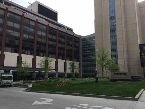
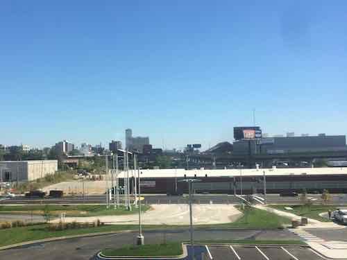
Today’s post is a look at City Foundry St. Louis, a new retail & office development in an old foundry along Forest Park Ave., between Spring and Vandeveter.

Almost 100 years ago, the Century Electric company purchased the Midtown St. Louis property now known as City Foundry STL. At the time, Midtown was a manufacturing hub for the city, thanks to its proximity to the Wabash Railroad line, which cuts across the City Foundry STL Property.

Century Electric was one of the top 3 manufacturers in the city, manufacturing motors and generators that were sold internationally. In fact, Century’s motors helped spark the development of small household appliances.

While the foundry changed owners over the years, and the products produced there changed, one thing did not: nearly 24-hour-a-day work continued on the site until 2007.

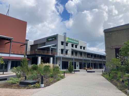
Today, this 15-acre site is being reimagined as City Foundry STL, with first-to-the-area makers and merchants moving to the complex. We can’t wait to for you to be a part of the next chapter of this storied creative complex. (City Foundry St. Louis)

First, a definition:

A foundry is a factory that produces metal castings. Metals are cast into shapes by melting them into a liquid, pouring the metal into a mold, and removing the mold material after the metal has solidified as it cools. The most common metals processed are aluminum and cast iron. However, other metals, such as bronze, brass, steel, magnesium, and zinc, are also used to produce castings in foundries. In this process, parts of desired shapes and sizes can be formed. (Wikipedia)    [An aside: a segment from a 1997 Simpsons episode comes to mind]

I’ve lived in St. Louis for over 31 years now, but don’t recall the name Century Electric. My memory of the foundry was the smell making automotive brake parts for Federal-Mogul. My post from last month: A Look at City Foundry St. Louis…in August 2013.

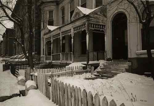
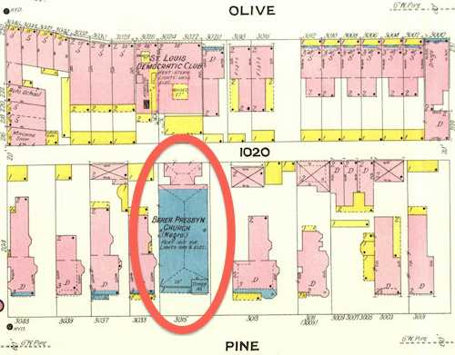
The 1909 Sanborn Fire Insurance maps show a few scattered wood frame buildings in this area, not a foundry. City records list four buildings on the site:

  • Manufacturing 1932: 146,015 square feet
  • Warehouse 1937: 66,197sf
  • Warehouse 1953: 38,640sf
  • Manufacturing 1982: 5,760

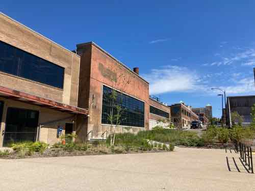
Let’s take a look, getting into some history along the way.

This 2015 photo looking east shows a new intersection on Vandeveter with a driveway for the then-new IKEA.
Leaving IKEA we see the low building along Vandeventer no longer exists. My assumption is this was the 1982 building.
Looking left we see the intersection of Vandeveter & IKEA Way now includes Foundry Way to the east.
Foundry Way would be named Clark Ave if they continued the name from east of Spring Ave. The open land on either side here is for future phases. Sidewalk only on the south side, for now.
One of my favorite views is seeing the remains of the elevated railroad line.
My 2nd favorite view is toward the left, looking NE. The repetition of old piers the held the railroad tracks is just lovely to my eyes. The bright red wall on the left, not so much.

I wanted to know more about Century Electric so I began scouring the Post-Dispatch archives online via the St. Louis Public Library. Here’s a bit of what I found in a Post-Dispatch article from December 25, 1949, P61:

  • Century Electric organized 1900, incorporated 1901
  • first workshop an old church at 1011 Locust
  • first working motor tested on thanksgiving day 1903 — sold to Rosenthal-Sloan Millinary Co.
  • products shipped to 90 foreign countries
  • first to offer repulsion type motor in small sizes
  • a century motor was in the first successful home refrigerator
  • manufactures everything except the wire
  • foundry address is/was 3711 Market Street — before I-64/Hwy 40 went though.

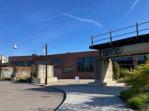
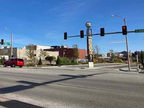
Let’s resume the tour.

Again, I love the concrete railroad piers. Using them as an element is better & cheaper than removal and dumping in a landfill.
Here it begins to open up. The silver metal building is one of two new buildings designed to hide the new multi-level parking garage that was cut into the land between Forest Park Ave and the historic foundry.  These new buildings are considered “liner buildings”, shallow structures designed to screen and offer a nicer street view. We’ll visit that upper area later.
Now we’re facing east, with the old foundry on the right, new liner buildings hiding the parking on the left.
The food hall is the main public attraction in the old foundry building. More on this food destination below.
Continuing further east, toward Spring Ave. Old foundry still on the right, liner still on the left.
Almost to Spring Ave we get to the 1937 building that houses Fresh Thyme grocery store. You can see the east end of the parking garage.
Looking north/uphill along Spring Ave from near I-64 we can see foundry offices that used to front onto Market Street, the foundry, and the SE corner of the building that’s now Fresh Thyme.

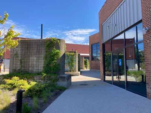
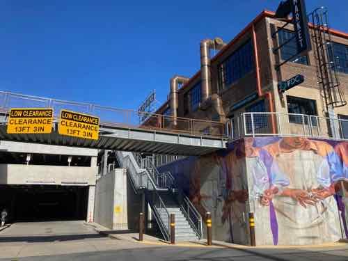
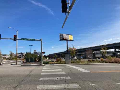
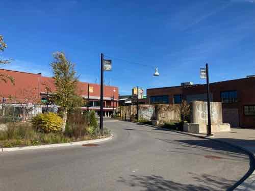
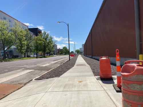
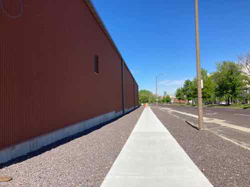
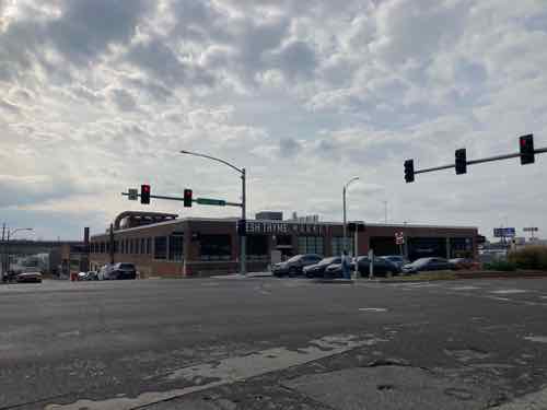
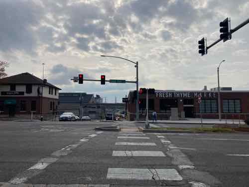
Let’s go out to Forest Park Ave and approach from the west.

This approach is the worst, blank wall, no street trees, gravel instead of landscaping.
Looking back west, toward Vandeventer Ave.
This is the primary pedestrian access from Forest Park Ave., the new garage on the left. Dreary, but at least it’s wide. This brings you in at the upper level, mentioned previously.
Looking west, toward IKEA. Again, the vacant land will be for a future phase.
Looking southeast we get a good look at the old foundry.

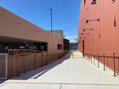
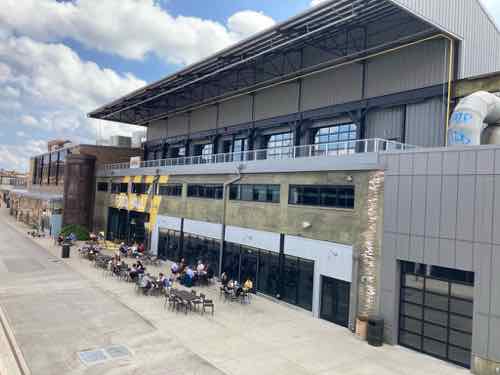
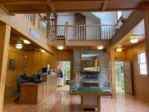
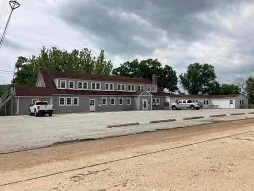
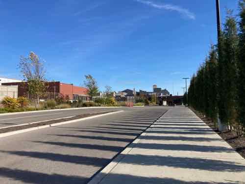
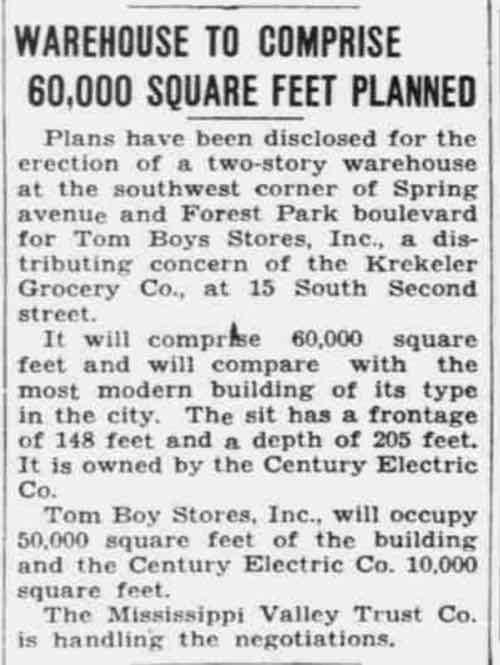
One last exterior area to show you, the building on the SW corner of Forest Park & Spring avenues. It began as the new offices of a local grocery chain, so using it for a new grocery store is very fitting. From the Post-Dispatch July 18, 1937:

This 1937 article announces the construction of a new building to be built for the Tom Boy Stores grocery chain. A few years later I saw it written Tom-Boy and then Tomboy before disappearing in the archives.
Looking SW from the opposite corner at Spring & Forest Park avenues. Spring continues down the hill, where we were earlier.
Looking south across Forest Park Ave
In front, the door isn’t the main entry. I love that a building built for the offices of a grocery chain with late 19th century roots is now used as a grocery store.
The main entry is in the west facade, facing the top level of the parking garage. This photo was taken on opening day, 11/10/2021.
Looking back north toward Forest Park we see a protected pedestrian route to the right of the yellow bollards. Unfortunately they’ve been filing it with extra shopping carts lately, defeating the purpose.
Looking back out toward the parking. New hotel with rooftop bar across the street, in the background.

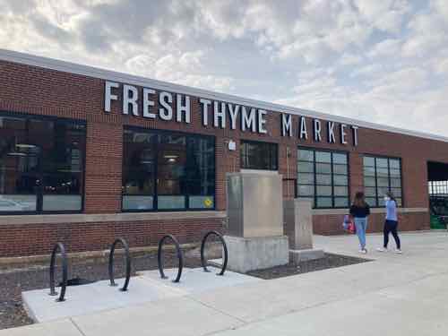
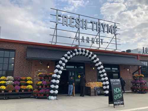
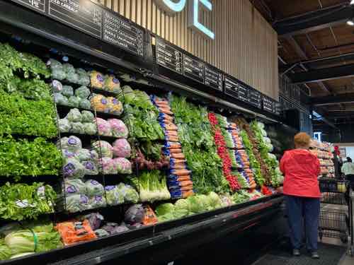
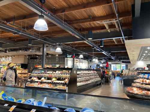
Let’s go inside Fresh Thyme, later we’ll go into the Food Hall.

When you enter the main doors, you head to the left.
They’re known for having nice produce that’s nicely displayed.
I love the old industrial skylight.
Inside looking north toward the meat & deli areas.
In the NE corner is a seating area, I can imagine Saint Louis University students/staff/faculty walking over here, meeting friends.
The compact store is well-stocked, though they don’t yet have sweetened condensed milk.
Even checkout is self serve, though there are a lot of employees to help you. Some are for smaller purchases while others are for larger with more area for scanned items.

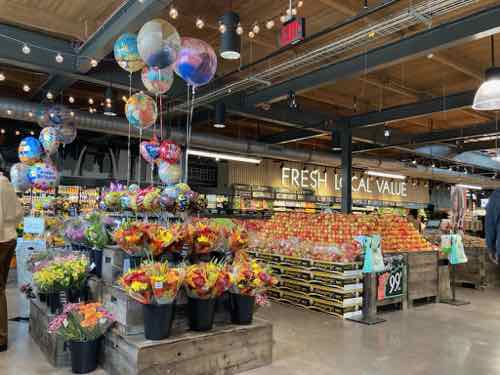
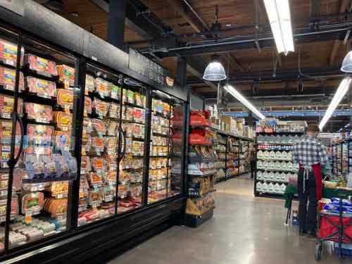
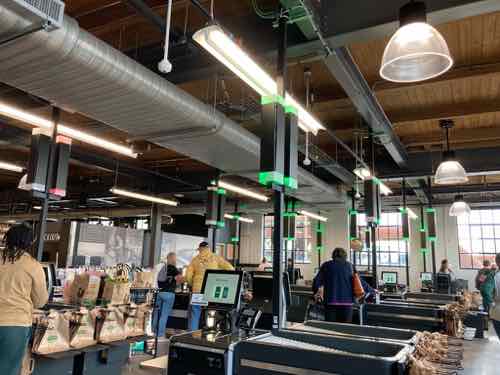
Fresh Thyme Market has other locations in the region, on both sides of the river. The grocery chain in based in suburban Chicago (Downers Grove, IL). The large chain Meijer is an investor, their nearest location is Springfield IL. So you’ll see some Meijer products on shelves.

On opening day I planned to get a package of Meijer frozen tuna steaks that I priced on the Fresh Thyme’s website (Kirkwood location). At this new location the very same item was 50% more than in Kirkwood. WTF!?! I ask the manager why the price is so much more. The answer was unexpected. The Fresh Thyme Market at City Foundry STL isn’t part of Fresh Thyme’s system, including pricing. Fresh Thyme investor Meijer is a partner on this location, so the pricing is based on that.  The manager told me they’d match the significantly better price at checkout. To this day if you do a search on the actual Fresh Thyme website for the nearest location it won’t find the City Foundry location. It’s not on the Meijer website either. Very weird.

Other than the frozen tuna steaks the prices I’ve checked have all been reasonable, their milk price is the best I’ve seen anywhere in the region. We’ve been back numerous times, a welcome new addition. Now if they’ll just stop filling the ADSA-compliant accessible route with extra shopping carts.

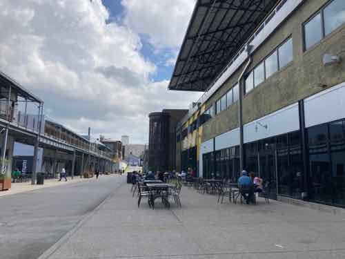
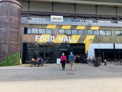
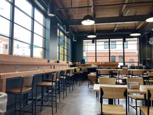
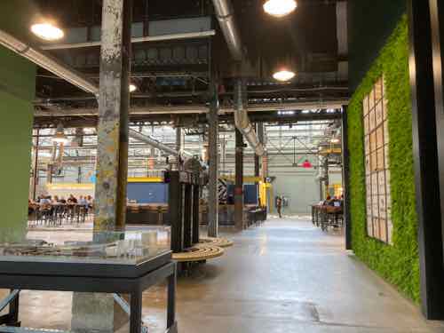
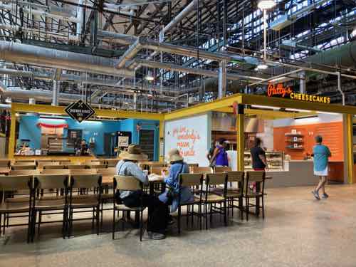
Moving on, let’s visit the Food Hall.  First, a food hall is not the same as a food court:

Here are 4 things about food halls and what makes people love them:

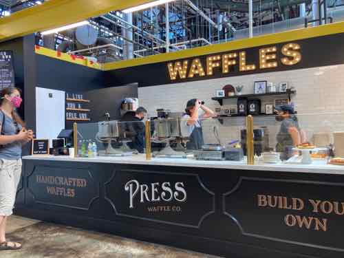
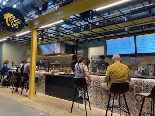
  • Food halls are usually a collection of small, locally-developed restaurant concepts or outright new creations that come from the minds of local chefs or start-up entrepreneurs and restauranteurs. They offer an assortment of unique food and beverage items that are usually cooked from scratch (prepared from raw ingredients vs. shipped in partially or wholly made) or nearby in a commissary (but still from scratch). On the other hand, food courts are usually filled with national chain restaurants that offer little scratch cooking and little-to-no brand cache.

  • Food courts will typically feature a cast of usual players like one or two Asian concepts (with one or both of them serving a version of Bourbon chicken), an ice cream place, a pizza place, a burger chain or two, a Latin concept, a hot dog concept, a cheesesteak concept, and maybe a cookie place. The dining options in a food hall are more in line with a collection of food trucksat a food truck park than the food found in a food court, with ethnic favorites like Vietnamese bao buns, Cuban street sandwiches, wine and cheese, Italian sandwich or pasta shop, local ice cream or gelato, chocolatiers, or Napolitano style pizza (vs. Sbarro’s par-cook-n-reheat slices), southern fried chicken sandwiches, and just about anything you can imagine.

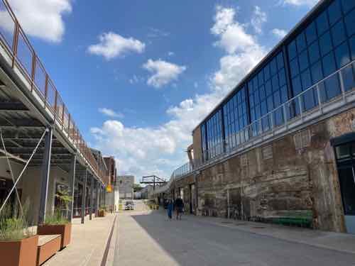
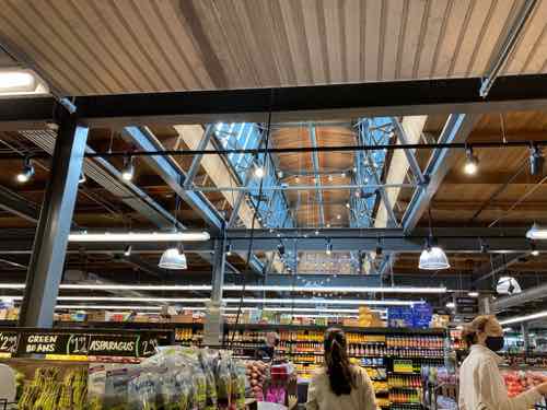
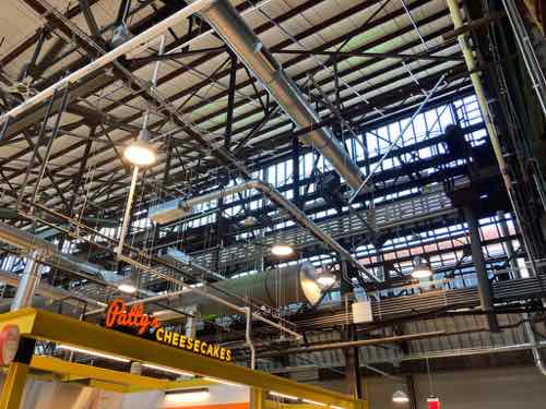
  • Food halls are aesthetically pleasing, often in turn-of-the-century warehouses, train stations, or old mills with high ceilings where the building’s history is partially or mostly preserved. Ponce City Market was originally a Sears & Roebuck distribution warehouse. Chelsea Market in New York was a Nabisco factory where the Oreo was invented. Quincy Market in Boston is one of the oldest food halls in America (it was a food hall before folks started calling them food halls) and sits next to historic Faneuil Hall…it was designed from the beginning (1824-1826) to be a marketplace. In a food hall, the charm of historic significance combines with the unique food offerings and the novelty of reclaimed industrial space to form a city’s social nucleus, while food courts are really little more than uninspired feeding pit stops for mall shoppers.

  • Food halls are destinations. Retail stores are few and are injected to add interest and shopping-as-entertainment to the food experience, but they must convey a consistent lifestyle “voice” to their visitors. Anthropologie, Lululemon, or Madewell are common national retail supplements. Food courts are designed to keep shoppers shopping so they don’t leave the mall when they get hungry… the food supports the shopping, not the other way around like in a food hall.

Ready?

Entry before you get into the main space.
The main space is in the heart of the old foundry, very industrial.
Tables & chairs are throughout the large space. Vendors have small storefronts.
Most vendors are walk up.
But a few also offer bar seating. This might not be ADA-compliant because a person in a wheelchair couldn’t eat here, will need to see if they have a provision for that.

Concluding thoughts on City Foundry St. Louis

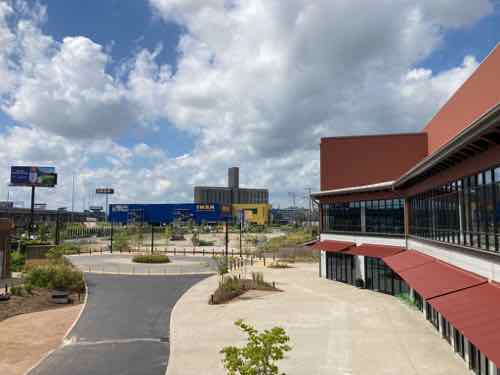
I was very happy & curious when I first heard the developers planned to keep the old industrial buildings rather than scrape the site clean. Overall I’m pleasantly surprised by how they’ve turned an old dirty industrial site into a retail & office destination. If you haven’t been I recommend visiting.

Transit users can take MetroLink to either Grand or Cortex, the nearest bus lines are the 42 & 70.

— Steve Patterson


Corrections to the Mill Creek Valley Narrative

November 29, 2021 Featured, History/Preservation, North City Comments Off on Corrections to the Mill Creek Valley Narrative

I feel the need to correct the record regarding Mill Creek Valley, to counter the false information being repeated.

“Horizontal, black and white photograph showing a row of dilapidated residential buildings in the 3200 block of Lawton in Mill Creek Valley. The buildings appear to be empty and awaiting demolition. Low wooden fences enclose the small front yards. There are several inches of snow on the ground.” February 16, 1960. Missouri Historical Society

Though St. Louis was founded in 1764 it wasn’t incorporated until 1823. At that time “the city limits were expanded west to Seventh Street and north and south by approximately 5 blocks each.” (Wikipedia) In 1861 the limits were expanded west to Grand, but streets and development had already gone further west. The land for Forest Park was purchased in 1875 — it was located in St. Louis County, not within the city limits of St. Louis. The current municipal boundaries were set in the 1876 divorce from St. Louis County, they were rural at the time.

There was no singular cohesive Mill Creek Valley neighborhood. The large rectangular area (454 acres) the city demolished for “urban renewal”, bounded by 20th St, creek/railroad, Grand Ave, Olive St., included many communities, businesses, homes, etc. was built over many decades — neighborhoods plural. Our modern perception of neighborhoods having distinct edges didn’t exist then, your neighborhood was where you lived. People who lived between 20th & Jefferson didn’t see their area belonging to the newer area west of Compton. The fact this large area ended up being grouped together and labeled by the city as a redevelopment area doesn’t make it a single neighborhood.

Commonly the word “downtown” refers to a city’s central business district (CBD). The size/location of “downtown St. Louis ” varies depending upon who you ask. To some anything east of I-270 is downtown. When St. Louis Union Station reopened at its new facility on September 1, 1894 it was considered far west of the CBD/downtown. The original station, on the east side of 12th (now Tucker), opened on June 1, 1875.

Thus, the Mill Creek redevelopment area wasn’t the heart of downtown. Not even close. Starting at 20th and going west, it wasn’t the oldest part of the city either. The stately row houses in this area were significantly newer and nicer than the tenements east of 10th Street. It was certain old by the 1940s, just not the oldest. It was also dense and lively, with everything within a short walk. Market Street ran down the center of the rectangular redevelopment area and contained the majority of the commercial activity, but corner shops also existed.

Since the city’s founding African-Americans lived in tight pockets throughout the city and St. Louis County. The black population before the Civil War was a very small percentage.

Not all persons of color in St. Louis were slaves, and in fact, as the 19th century progressed, the number of free blacks continued to rise. This can be explained by looking at several factors. Conditions in St. Louis enabled self-purchase. St. Louis’ proximity to Illinois, a state where slavery was supposed to be illegal, allowed a small number of slaves to sue for their freedom in St. Louis courts based on the premise that they had been held as slaves for a period of time in a free state. A very small number were also set free by masters who had come to see slavery as a moral wrong. Former slaves who wished to remain in the State of Missouri as free blacks were supposed to obtain a license from the state.

In addition to the over 1,000 free blacks in St. Louis who owned small businesses, were laborers or worked odd jobs, a certain elite group of African-American St. Louisans styled “the Colored Aristocracy” were large landowners and businesspersons, many descended from some of St. Louis’ earliest residents. Several owned the large barber emporiums, while others owned drayage businesses which moved goods from steamboat to steamboat on the levee. Still others, like Madame Pelagie Rutgers, owned huge tracts of land which they sold at great profit as the city expanded. The “Colored Aristocracy” of St. Louis had its own social season and debutante balls. A member of this social class, Cyprian Clamorgan, wrote a book in 1858 called the Colored Aristocracy of St. Louis, in which he profiled the group. (National Park Service — highly recommended)

Yes, wealthy blacks in the 19th century. They didn’t live in the area we know today as Mill Creek. They lived in The Ville.

During the 1920s, The Ville was home to an elite community that included black professionals, businessmen, entertainers and Annie Malone, one of the country’s first African-American millionaires. One of St. Louis’ most historically significant neighborhoods, The Ville was home to Sumner High School, the first school west of the Mississippi River to provide secondary education for blacks. Some of the school’s best known alumni are Rock ‘n’ Roll Hall of Famer Chuck Berry, opera diva Grace Bumbry, and tennis great Arthur Ashe. During the 1920s and ‘30s, the neighborhood thrived, as more and more African-American institutions were established, including Harriet Beecher Stowe College and Homer G. Phillips Hospital.

The Ville served as the cradle of African-American culture and nurtured its rich heritage for the black population of St. Louis. Today, the soaring Ville Monument pays tribute to the neighborhood’s achievements and its famous sons and daughters. (Explore St. Louis)


Sumner High School, mentioned above, opened downtown on 11th between Poplar & Spruce in 1875 — the same year as the adjacent first new Union Station mentioned earlier:

Charlton Tandy led protests of the planned siting of Sumner High School in a heavily polluted area in close proximity to a lead works, lumber and tobacco warehouses, and the train station as well as brothels. He said that black students deserved clean and quiet schools the same way white students do. The location went unchanged, and Sumner High opened in 1875, the first high school opened for African Americans west of the Mississippi. The school is named after the well-known abolitionist senator Charles H. Sumner. The high school was established on Eleventh Street in St. Louis between Poplar and Spruce Street, in response to demands to provide educational opportunities, following a requirement that school boards support black education after Republicans passed the “radical” Constitution of 1865 in Missouri that also abolished slavery.

The school was moved in the 1880s because parents complained that their children were walking past the city gallows and morgue on their way to school. The current structure, built in 1908, was designed by architect William B. Ittner. Sumner was the only black public high school in St. Louis City until the opening of Vashon High School in 1927. Famous instructors include Edward Bouchet and Charles H. Turner. Other later black high schools in St. Louis County were Douglass High School (opened in 1925) and Kinloch High School (1936). (Wikipedia)

Sumner High was an 1867 school renamed. Originally it was District School Number Three. Source: 1960 handbook.

Locations:

  • 1867, 5th & Lombard
  • 10th & Chambers
  • 1875, 11th & Spruce — now known as Sumner instead of #3.
  • 1896, 15th & Walnut
  • 1908 construction on the current location in The Ville neighborhood began
  • 1910 classes began, moving from 15th & Walnut.

Wealthy blacks in St. Louis were successful in relocating Sumner t0 their neighborhood, where their homes and businesses were located.

Another well-known institution in The Ville was Homer G. Phillips Hospital.

Between 1910 and 1920, the black population of St. Louis increased by sixty percent, as rural migrants came North in the Great Migration to take industrial jobs, yet the public City Hospital served only whites, and had no facilities for black patients or staff. A group of black community leaders persuaded the city in 1919 to purchase a 177-bed hospital (formerly owned by Barnes Medical College) at Garrison and Lawton avenues to serve African Americans. This hospital, denoted City Hospital #2, was inadequate to the needs of the more than 70,000 black St. Louisans. Local black attorney Homer G. Phillips led a campaign for a civic improvements bond issue that would provide for the construction of a larger hospital for blacks.

When the bond issue was passed in 1923, the city refused to allocate funding for the hospital, instead advocating a segregated addition to the original City Hospital, located in the Peabody-Darst-Webbe neighborhood and distant from the center of black population. Phillips again led the efforts to implement the original plan for a new hospital, successfully debating the St. Louis Board of Aldermen for allocation of funds to this purpose. Site acquisition resulted in the purchase of 6.3 acres in the Ville, the center of the black community of St. Louis. But, before construction could begin, Homer G. Phillips was shot and killed. Although two men were arrested and charged with the crime, they were acquitted; and Phillips’ murder remains unsolved.

Construction on the site began in October 1932, with the city initially using funds from the 1923 bond issue and later from the newly formed Public Works Administration. City architect Albert Osburg was the primary designer of the building, which was completed in phases. The central building was finished between 1933 and 1935, while the two wings were finished between 1936 and 1937. The hospital was dedicated on February 22, 1937, with a parade and speeches by Missouri Governor Lloyd C. Stark, St. Louis Mayor Bernard Francis Dickmann, and Secretary of the Interior Harold L. Ickes. Speaking to the black community of St. Louis, Ickes noted that the hospital would help the community “achieve your rightful place in our economic system.” It was renamed in 1942 from City Hospital #2 to Homer G. Phillips, in his honor. (Wikipedia)

Prior to Homer G. Philips Hospital in the Ville, an existing building was used as City Hospital #2 between 1919-1936. That 19th century building was at Garrison & Lawton. That intersection no longer exists. Lawton was an east-west street between Pine and Laclede, known as Chestnut east of Jefferson. So yes, the first hospital for blacks in St. Louis was within the boundaries of the Mill Creek redevelopment area, for 17 years. Then the significantly larger City Hospital #2 opened in the Ville — where the wealthier black families lived.

February 1909 Sanborn Map showed a stone (blue) church at 3015 Pine, labeled “Berea Presby’n Church (Negro)”. This is one the few buildings to survive the clearance of the Mill Creek redevelopment area.

As stated at the beginning, black residents lived in small pockets throughout the city. Wealth, social class, and geography separated the residents of the Ville from those in the older Mill Creek redevelopment area.

This is not to say every black person living in The Ville was wealthy, that was not the case. As poor blacks moved north to escape the Jim Crow south they likely lived where they could, including in The Ville. I know of one family that lived in The Ville during the 1940 census that had migrated from Alabama. I’d love to see maps showing where black persons lived in the region following the Civil War, showing shifts each decade.  The change from 1950 to 1960 would give us better information on where families displaced by the demolition of Mill Creek relocated.

We know white home owners in the areas immediately outside The Ville had racially restrictive covenants on their properties since the early years of the 20th century. One block, now part of the Greater Ville neighborhood, was still white when the Shelley family had a white person act as the buyer so they could purchase 4600 Labdie in 1945. In 1948 the U.S. Supreme Court ruled the court system couldn’t be used to enforce restrictive covenants (Shelley v Kraemer).

This prompted many white homeowners surrounding The Ville to sell and move further away. At the same time people were being forced to leave the  Mill Creek Valley redevelopment area many more options were available on the city’s north side.  Yes, some may have moved into numerous high-rise public housing projects that were open prior to the February 16, 1959 start of demolition in Mill Creek.

  •  Cochran Garden Apts, April 1953
  • Pruitt-Igoe, 1955
  • (In December 1955) a judge ruled St. Louis and the housing authority had to stop segregation in public housing.
  • Vaughn Apts, October 1957

The low-rise Neighborhood Gardens and Carr Square Village opened in May 1935 and August 1942, respectively. Again, segregated until 1956. One of the problems with large-scale demolition is people get scattered in the process.

The demolition was certainly a land grab, no question. Wealthy whites living west in the Central West End, Clayton, Ladue, etc had to drive on Market Street to reach Union Station and the CBD. They didn’t like driving through old dense areas, especially predominantly occupied by African-Americans.

Back east demolition was increasingly happening. Soldiers Memorial opened in 1938, Aloe Plaza opened two years later — both on the north side of Market Street. St. Louis leaders got hooked on demolition so clearing out the west entry to downtown followed. Also in the late 1930s the Oakland Express opened, a highway from Skinker to Vandeventer & Chouteau.

Hopefully the incorrect information will cease.

— Steve Patterson


Jewish Hospital Merged With Barnes Hospital in 1996, But An Older Jewish Hospital Building Remains Integral To Current Treatment

October 27, 2021 Central West End, Featured, History/Preservation Comments Off on Jewish Hospital Merged With Barnes Hospital in 1996, But An Older Jewish Hospital Building Remains Integral To Current Treatment

The Washington University Medical School campus (aka Barnes, BJC) in St. Louis’ Central West End neighborhood has changed considerably in the last 100+ years. It’s also quite a bit different from when I moved to St. Louis in 1990. It will continue to evolve. This post isn’t a detailed look at the huge number of incremental changes, it’s a look at a little bit of history about the Jewish in Barnes-Jewish Hospital.

It’s not clear to me which medical facility first located within the area bounded today by Kingshighway on the west, Forest Park Ave. on the north, Sarah on the east, and I-64 (US-40) on the south. I do know the automobile either hadn’t been invented, or was just a toy for the wealthy.  Hopefully someone will do a book on the history of medical facilities in the region.

St. Louis’ first hospital for Jewish residents perhaps began with a meeting 143 years ago today, on October 27, 1878. This was just after the city/county divorce so the city’s current limits were already set. Forest Park was still wild, much of the city’s new limits were rural.

Leaders of the city’s Jewish community met at Harmonic Hall to form the Jewish Infirmary and Hospital Association of St. Louis. As early as 1853 Isidor Bush, businessman and philanthropist, had joined with other Jewish leaders to establish a Jewish hospital. After several false starts, Bernard Singer president of the United Hebrew Relief Association of St. Louis, subscribed $1,620 toward the establishment of a home for old and infirm Jews. The meeting that he called was well attended and an additional $870 was pledged.

More money was slow in coming , however, and finally the association revised its plans to allow for the building of a home for the aged and infirm, with a hospital as an appendage. In 1882 the United Hebrew Association dedicated the Home for the Aged and Infirm Israelites at 3652 S. Jefferson Avenue. Today Jewish Hospital, as part of the Washington University Medical Center, is one of the city’s finest medical institutions. (Source: St. Louis Day by Day by Frances Hurd Stadler, 1990, pp204-05)

The author doesn’t connect the dots between the 1882 dedication and the 1990 second printing of her book. I suspect the hospital appendage never happened, but one finally opened:

In 1902, The Jewish Hospital of St. Louis opened at 5415 Delmar Boulevard. Prior attempts to create such a hospital had cited the need to care for the poor Jewish refugees of St. Louis; however, when the Jewish Hospital become a reality, it did so under the directive to afford care to the sick and disabled of, “any creed or nationality.” By 1905, additions to the original hospital building were already required to accommodate more patients, marking the first in a long line of expansions the Jewish Hospital would undergo over the years.

By 1915, the hospital was treating close to 2,000 patients annually. The following years made it clear that further expansion was needed, and in 1920 the hospital purchased land on Kingshighway Boulevard for the purpose of erecting a larger hospital building. The Delmar location was sold, and, following years of construction and funding campaigns, the hospital at 216 South Kingshighway Boulevard was dedicated in May 1926. By the end of 1927, the new building’s first full year in operation, the hospital had treated 5,146 patients. In 1951, a plan was finalized which provided for the integration of three St. Louis Jewish health agencies into what would become the Jewish Hospital Medical Center. The Jewish Hospital of St. Louis merged its operations with those of the Jewish Sanatorium, the Miriam Rosa Bry Convalescent-Rehabilitation Hospital of St. Louis, and the Jewish Medical Social Service Bureau. To accommodate the operations and patients of these health agencies, the Jewish Hospital was required to expand at its Kingshighway location. A building expansion program which included the addition of two new buildings and a six-story wing created room for the patients of the three other agencies to be moved to the newly named Jewish Hospital Medical Center in 1956.

Over its years of growth, Jewish Hospital and its staff have achieved several medical firsts, including performing the first successful in vitro fertilization in Missouri in 1985 and creating the first major in-patient child psychiatric service in the St. Louis area in 1958. When Washington University Medical School and Associated Hospitals (WUMSAH) was formed in 1962, Jewish Hospital was one of the original participating institutions, and in 1963 Jewish Hospital became a major teaching affiliate of Washington University Medical School.

In November 1992, Barnes and Jewish Hospitals signed an affiliation agreement, agreeing to pool resources wherever possible. This affiliation agreement was completed in March 1993 to create Barnes-Jewish, Incorporated (BJI). In April of 1993, BJI and Christian Health Services announced that they would affiliate to create BJC Health System, an affiliation which was finalized in June 1993. In January of 1996, a merger of Barnes and Jewish Hospital, built on the sharing of resources which began with the completion of the affiliation agreement in 1993, was legally completed, and the two became the present day Barnes-Jewish Hospital. Barnes-Jewish Hospital is consistently ranked among the best hospitals in America by U.S. News and World Report. (Wash U/Becker Archives Database)

Only one Jewish Hospital building remains: the 1970s (60s?) Schoenberg Pavilion.

The former entrance to Scheonberg Pavilion is now closed. Entry is only through The Center for Advanced Medicine or the Parkview Tower.
This photo looking the opposite direction was taken just before the oldest Jewish Hospital building on the corner was razed.
This is a crop of the previous photo, you can see a little of the building that was razed to build the Parkview Tower. I regret not taking any photos of the building old Jewish Hospital building before being demolished.

Schoenberg Pavilion was a building at Jewish Hospital, before the 1996 merger with Barnes Hospital — creating Barnes-Jewish Hospital. Today it looks very different than it did then. You cannot directly enter the building from the outdoors — only through the Center for Advanced Medicine (CAM) on the east or the newish Parkview Tower, on the west.  The north side faces Forest Park Ave. and the south side is green space over an underground parking garage.

The south side of Schoenberg with Parkview Tower on the left.
Also the south side of Schoenberg Pavilion, now with the Center for Advanced Medicine on the right.

Inside the Schoenberg name is preset at the bank of elevators inside the 70s building.

Schoenberg Pavilion elevators, 1st floor.
Directory next to the Schoenberg Pavilion elevators. I’ve been to the Cancer Care Clinic a couple of times — this is a referral only urgent care clinic for cancer patients.
Schoenberg Pavilion elevators, 3rd floor.

Inside the entry at the new Parkview Tower is a big sign with mottos from Barnes Hospital and Jewish Hospital.

Jewish Hospital began a dozen years before Barnes Hospital, likely serving Jewish and n0n-Jewish patients. Though probably not black patients for many years.

And finally, in the main floor hallway connection the Center for Advanced Medicine to the Parkview Tower people from the history of Barnes & Jewish are highlighted in a beautiful display.

Four different members of the Schoenberg family going back multiple generations
Hard to photograph, but Moses Schoenberg and David May owned a dry goods store in Colorado. When they moved to St. Louis they opened up Famous-Barr department store. David was married to Moses’ sister Rosa.
This part lists the many medical-related donations family members have made over the generations.

As I receive treatment at Washington University Medical School/BJC I’m thankful for the generosity of those who helped start and continue such a fine institution.

— Steve Patterson


Times Beach Summer Resort Fascinates Me From Beginning To End

July 8, 2021 Environment, Featured, History/Preservation, St. Louis County Comments Off on Times Beach Summer Resort Fascinates Me From Beginning To End

To escape the heat & smell of city life  wealthy St. Louisans in the 19th century would take a train out to various resorts along the Meramec River.

In the late 19th century, several popular summer resorts were founded southwest of St. Louis, Missouri on the Meramec River, including Meramec Highlands, Valley Park, Fenton, and Castle Park. As the Frisco Railroad trains started running on a regular basis to the Meramec Highlands and Valley Park train stations, Meramec River attractions became popular for wealthy St Louis families. Unfortunately, for the masses of St. Louisans, the cost of the train ride prohibited frequent visits for the common folk of St Louis.

The Meramec Highlands “Frisco” Railroad Station was constructed in 1891 by the Meramec Highlands Company, the developers of a summer getaway for wealthy Midwesterners. Located on the bluffs overlooking the Meramec River, two miles west of present-day Kirkwood, the station was built in the Romanesque Revival architecture. Once completed, it was deeded to St Louis and San Francisco Railroad for $1 in exchange for regularly scheduled service. (Source)

By 1896 streetcars had reached the area, allowing the masses to afford the trip to cool off in the water for the day.  The area was no longer exclusive, so the wealthy went elsewhere.

This had to be in mind when the owners of the St. Louis Times newspaper decided to sell off lots on property they owned along the Meramec, but further west.

1920s advertisement for lots in a new resort located too far west for streetcars. The Ford Model T had been on sale since 1908, but many households didn’t own cars. The wealthy did have cars.
Much later aerial photo shows the streets followed the curve of the river.

Decades earlier the wealthy could stay in impressive 2-story cottages in the Meramec Highlands area, but now simpler wood structures were built on the tiny lots. By the mid/late 1020s the wealthy were building impressive homes further from downtown, a bunch of frame shacks doesn’t sound very exclusive.  I think the Times target audience wasn’t wealthy folks, but those much better off than they had been. They’ve got a car and want to drive it somewhere to get away from the heat. Newly middle class.

Along Route 66 at the eastern edge of the Meramec a roadhouse opened in 1935 that catered to elegant dining, appropriately named the Bridgehead Inn.  This was after the start of the Great Depression, so perhaps the truly wealthy were among the first to have summer places here.

Lobby of the Route 66 State Park visitor’s center inside the former roadhouse. Click image for state park website.
By 1946 the Bridgehead Inn was closed, the property sold. The wealthy either lost everything in the depression and had to move out to their summer shack or they moved elsewhere.
Until very recently this old Route 66 bridge over the Meramec was still open to traffic, Times Beach was on the right on the west bank of the river.

For decades Times Beach was home to poor whites, in a flood zone. Municipal tax revenue was limited. Roads went unpaved, which created a lot of dust. The solution to the dust is why no structure from Times Beach survives today. A man was hired to spray used oil on the ground to control dust, but that oil had been mixed with toxic dioxin. In 1983 the EPA shut the town down, becoming a large superfund cleanup site. In 1997 it reopened as Missouri’s Route 66 State Park.

The bridge landing on the Times Beach side
This mound is where some material is buried.
This treeless field is there the large incinerator stood for years.
Much of the 419 acre park is covered with trees.
It’s actually quite picturesque.

So much went wrong with Times Beach, from the initial planning to the later tragic poisoning of the entire town. It was already closed by the first time I drove to St. Louis along I-44 in August 1990. I’d love to go back in time to see it in the first 5-10 years.

Further Reading:

I’m glad we made the trip out there recently to see the visitors center, route 66 bridge (remains), and park.

— Steve Patterson


Mid-Century Modern vs. 21st Century Density

June 17, 2021 Central West End, Featured, History/Preservation, Planning & Design, Real Estate Comments Off on Mid-Century Modern vs. 21st Century Density

A developer has proposed a new apartment building that was require the demolition of a mid-century modern (MCM) building. I’ve been watching the debate of preservation of MCM verses increased density on Twitter & Facebook. I want to weight in, but first some background.

The non-profit service group Optimist International was founded elsewhere more than a century ago. In 1924 St. Louis was selected as the location for its worldwide headquarters. Decades later their 2-story building at 4494 Lindell (@ Taylor) was designed by local architects Schwartz & Van Hoefen.

Optimists International’s headquarters at 4494 Lindell was dedicated at 3pm on Sunday June 17, 1962 — 59 years ago today. Previously they were located in the Railway Exchange building, Image from May 2014

Schwartz & Van Hoefen is also known for:

  • Marchetti Towers I & II, SLU campus.
  • Mansion House, 4th Street downtown.
  • Council Plaza, which included a “flying saucer” gas station (later various places like Naugles & Del Taco, now a Starbucks & Chipotle)
  • Northland Cinema (demolished)
  • Busch Stadium II (local architect, demolished)
Optimist International has formally listed their property for sale a number of years ago, it includes the slightly taller building next door. Photo from May 2021.

There have been numerous proposals for the property, including one for renovated and updated office space. The most recent, announced last week, calls for demolition of the original 2-story building and late 70s 4-story addition. In their place a new 7-story apartment building.

This recent proposal is what got people fiercely debating, falling roughly into 3 camps: we need to preserve our few remaining mid-century modern buildings, more density is good, and preservation focus should be on saving 19th century buildings. This is a generalization of their points so let’s get into some specifics.

This view shows the Taylor side of the proposal.

Many see an artist’s rendering of a proposed project from a bird’s eye and get all excited. From this vantage point artists can make anything look good — they could make the workhouse look like a lush resort.  Humans, however, don’t experience the built environment from a bird’s viewpoint.

Those on the side of preservation of Optimist International are correct that increasingly we’re seeing MCM buildings being razed, especially in the Central West End. Last century these MCM buildings were seen as important symbols of reinvestment as the wealthy began to flee the city, as Gaslight Square began to fade.

One disputed point is “architectural merit”, I’m not qualified to argue for or against on this particular building. However, from the Mansion House nomination to the National Register of Historic Places I can learn about the firm responsible:

The firm of Schwarz & Van Hoefen was a midcentury incarnation of one of the longest-running continuously operating firms in St. Louis. It began in 1900 as Mauran, Russell & Garden when three architects broke away from the St. Louis office of Shepley, Rutan & Coolidge (which was set up locally as Shepley, Rutan, Coolidge, and Mauran). John Lawrence Mauran brought along two younger colleagues, Ernest Russell and Edward Garden, and the firm almost immediately received several important commissions. Ned Garden left the firm in 1909, to be replaced by William Crowell in 1911. After Mauran’s death in 1933, Russell & Crowell added W.Oscar Mullgardt.

By the mid-20 century, more than half a century into its existence, the partnership remained one of the leading architectural firms in St. Louis. Esley Hamilton wrote that in the 1950s and 60s, the firm “was unusual in maintaining its design flare while working on large commercial projects. The firm completed many architecturally significant works during this period. In addition to the Mansion House, four of their other projects were recommended for National Register listing in the City of St. Louis’ Modern Movements survey of 2013.

This means that 1/5 of the 25 properties on the list were by the various iterations of this single partnership, more than any on other firm on the list.

The four other buildings on the list are as follows. The Wohl Recreation Center (1959) at 1515 N. Kingshighway Boulevard is a glass-skinned neighborhood recreation center commissioned by the City of St. Louis. The Engineers Club of St. Louis (1959) at 4359 Lindell Boulevard is a low-rise addition to the emerging Modernist corridor; its use of traditional masonry and playful forms is very striking. The original two-story section of the Optimist Building (1961, 4490-94 Lindell Boulevard), a block to the west of the Engineers Club, has an exposed concrete frame.[Emphasis added] Finally, the Steinberg Art Gallery Building at Washington University was a collaboration between the partnership and architect Fumihiko Maki, who is credited with the design (1960, 6201-53 Forsyth Blvd.)

In addition to the buildings recommended for listing in the City’s Modernism survey, the partnership of Schwarz & Van Hoefen designed many other important buildings in St. Louis. Among the most visible is Council Plaza, which consists of two towers and two smaller buildings located at 212 – 310 S. Grand Boulevard (NRHP 3/02/2007).

So the architectural firm is an important part of our history. The city’s modern architecture page includes the survey mentioned above, which lists the Optimist International property as significant and worthy of individual listing. The list only contains 25 properties. So one of the two buildings is architecturally significant. Saying otherwise ignores the established record.

I love density, but it’s also correct that the Central West End isn’t where we need to be building more density. That said, I do like that the proposed apartment building includes small studio apartments. If only new CWE residential projects included some affordable and low-income units — they are not the same thing. An alternative is paying into a fund the help building units elsewhere in the city. Elsewhere means cheaper, less desirable neighborhoods…like where I’ve lived for before and for the last 2+ years.

One pro-preservation argument I saw said the Optimist International building was urban, in line with adjacent properties. Well, yes and no. It’s not set back behind a surface parking lot and the entrance clearly fronts onto the primary street.   The Lindell facade respects the established building line, the Taylor side is a set further back than the slightly older Grant Medical Clinic at 114 N. Taylor, designed by Harris Armstrong. In addition to being set back further than other buildings a low stone wall & raised lawn separates the building from the Taylor facade.  As a result of the design, the Taylor side has zero activity/openings/entrances. This is not urban form.

Looking south you can see the substantial setback behind the raised lawn. The low wall is the established building line along Taylor.

The proposed 7-story apartment building would be built out to the building line, not set back. It would have have a few retail storefront spaces right off the Taylor sidewalk. Balconies would also face Taylor, the common pool area also faces Taylor. I believe Taylor Ave would be more active and interesting with the proposed building, compared with the existing.

I do think we need to save our architectural history from all centuries. Both 19th & 20th century buildings are threatened, often for different reasons. While I love clean 20th century modernism it often is a negative to the urban experience. Claiming MCM buildings are urban is just as disingenuous as those who say the Optimist International building has no architectural merit.

In the event the current proposal falls through, I could see a reuse project where the 1979 4-story addition is replaced by a taller tower with west-facing balconies. A few storefronts or entrances are carefully cut into the Taylor facade. with a section of lawn & wall removed to create an entrance to each. Cafe tables with umbrellas would look great. Maybe the main building has storefronts, residential lobby on the ground floor and structured parking on the upper floor? New residential units would all be in the new tower to the east. The roof of the old building could be a green roof with outdoor seating, activities.

— Steve Patterson


Advertisement


[custom-facebook-feed]

Archives

Categories

Advertisement


Subscribe