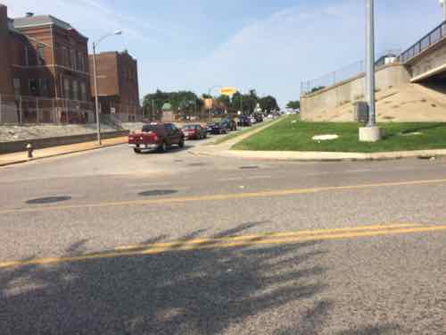
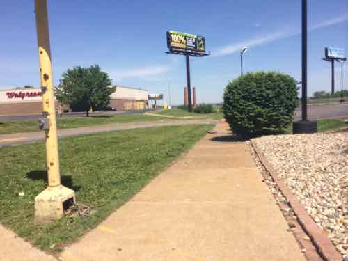
Last week I was near Manchester & Hampton doing research, I arrived & departed on the #32 (ML King-Chouteau) MetroBus. Arriving the bus was headed West on Manchester, so the stop was on the adjacent sidewalk. For the return trip I needed to catch the bus as it headed East on Manchester — no sidewalk on that side. But there is a just big enough concrete pad. I didn’t get a pic from across the street but you can see it on Google Street View here.
It took a while but I finally got a break in traffic where I could quickly cross Manchester to the stop I needed.
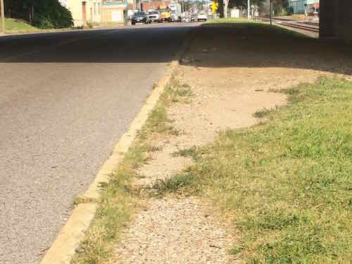
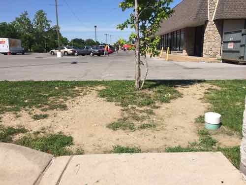
Looking North from Metro Stop ID: 13572Looking West I was concerned the bus driver wouldn’t be able to see me. A path was worn in the grass from others using this stop.The ground was also worn East of the stop.
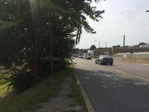
I was right at the edge waving as the bus approached. Another passenger got off at my stop so she stood close to my wheelchair on the small pad while the driver extended the lift so I could board. Would the driver have seen me if a passenger wasn’t wanting to exit at my stop?
I had wanted to go to the next stop to the East where I could cross at a crosswalk, but vegetation (upper left of last photo) blocked the sidewalk.
So who’s responsible?
Metro
MoDOT
St. Louis
All three are involved, but fragmentation means the pedestrian experience here sucks. The quick solution is to trim the vegetation in both directions. A crosswalk with warning signs for motorists to stop for pedestrians would be relatively cheap. I’m going to email Ald. Vollmer (10th) & Ald. Ogilvie (24th) to let them know about the issues here.
Regular readers know I’ve long been a supporter of modern streetcars, such as those in Portland & Seattle, but I’d like to know more about Bus Rapid Transit (BRT). I’ve experienced Kansas City’s MAX line a few of times — but it is best described as “enhanced bus service” — not true BRT.
Starting with Metro’s BRT studies last year, I’ve been reading up on BRT, the results are both positive and negative. First, the negative:
Delhi’s six-year-old BRT project has run into numerous snags, including the incursion of cars and other vehicles into the BRT lanes — a development that can defeat the purpose of a system designed to be faster than general traffic. City officials once hoped to create 14 additional BRT corridors, but the system has not expanded beyond its inaugural 3.6-mile stretch. (In New Delhi, A Rough Road For Bus Rapid Transit Systems)
Closer to home, Los Angeles:
The Orange Line BRT runs on its own busway: basically a bus-only street built on former railroad right-of-way. The busway runs generally east-west and, at signalized intersections, crosses numerous north-south streets. In its first few months of operation, the Orange Line ran faster than it does today. There were a handful of car-bus collisions on the route, reportedly due to drivers failing to obey traffic signals. The excuse that has been repeated is that the drivers were not used to seeing any traffic on that long-abandoned right-of-way.
“Both BRT and LRT can leverage many times more development investment than they cost. Now we can say that for sure,” according to the institute’s director for the U.S. and Africa, Annie Weinstock, who previewed the findings at a Metropolitan Planning Council Roundtable in Chicago last week.
“Per dollar of transit investment, and under similar conditions, BRT can leverage more (development) investment than LRT or streetcars.”
For example, Cleveland’s Healthline, a BRT project completed on Cleveland’s Euclid Avenue in 2008, has generated $5.8 billion in development —$114 for each transit dollar invested. Portland’s Blue Line, a light rail project completed in 1986, generated $3.74 per dollar invested. (Bus Rapid Transit Spurs Development Better Than Light Rail Or Streetcars: Study)
Some candidates for local office and others in Chicago have raised reasonable concerns about a proposed rapid-transit bus line on Ashland Avenue. They wonder how limiting left-hand turns would affect car traffic and whether paying for the new line would divert money from the many other CTA improvements needed.
But let’s not lose sight of why Chicago needs its first rapid-transit line — bus or L — that doesn’t go downtown, one that connects west side communities and CTA’s Orange, Blue, Brown and Green lines: it’s because not everyone works downtown or is going downtown, which is the outdated premise behind the CTA’s hub-and-spoke system. (Why Chicago needs bus rapid transit on Ashland)
As with so many things, there’a no substitute for personal experience. There are numerous BRT lines in North America, but one of the highest rated is Cleveland’s HealthLine — which operates 24 hours a day! Over the years I’ve driven through Ohio a few times, I think I went through Cleveland on a 2006 Greyhound trip to Toronto. I want to visit Cleveland to experience their transit system: light rail, bus, BRT, and trolley.
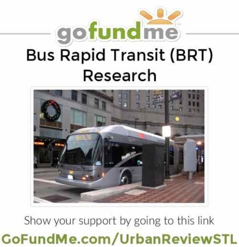
Click the image above to open GoFundMe.com/UrbanReviewSTL in a new tab/window. Image via Wikipedia
Here are just some of the questions I hope to answer:
Why do they have four different modes?
How did they decide to use one mode at a location rather than another?
With respect to public transit, what are the similarities & differences between St. Louis & Cleveland?
Would their BRT better serve the public had they done the things to earn a higher ranking?
How does Cleveland’s State Line BRT compare to their HealthLine BRT? How much development has it generated?
How much of the new development is because of the HealthLine, how much is because it operates 24/7?
Why didn’t they build either BRT line as light rail? In retrospect, would BRT have been a better choice?
In October my husband and I will be vacationing in Chicago for a week, so I’d like to take a few days of that time to go to Cleveland for two nights to use & observe their transit system. Over the weekend we purchased the roundtrip tickets on Megabus, fares are lowest the more lead time you have. We’ll leave Chicago on a Thursday morning, arriving in Cleveland 7+ hours later at 3:35pm. Our return bus leaves at 5:45pm on Saturday, getting back to Chicago just past midnight. I’m asking for readers to help with the costs, so this research trip is possible.
Here is the budget:
Megabus: $36.50
Hotel (2 nights): $300+
Local transit fares: $25
Misc: $13.50
TOTAL $375+
Most of the budget is hotel, I want to stay right on the HealthLine to facilitate riding the 24-hour BRT at various times. I’m still researching hotels, but none are cheap. Rates do very though, I just need to see which ones have rooms available with a “roll-in shower” on the two nights we’d be there.
If you can donate it would be greatly appreciated.
One of my pet peeves is blocked bus stops, people thinking they’re entitled to park in them. To be fair, many drivers who do so may just be oblivious to the fact that buses need to pull up next to the curb so some of us can board/deboard. The response of some is “call the police” or “tow them away.” Yes, enforcement is part of the solution — but the St. Louis Police really have more important things to do. I don’t think Metro’s Police have jurisdiction on city streets.
Besides, the police can be just as guilty.
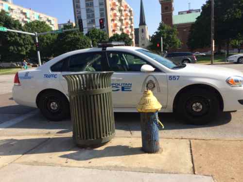
Last year A St. Louis traffic police officer parked in front of a fire hydrant and blocked the adjacent bus stop. Market at 16th.
When you’re on the bus and need to get off at a blocked stop you can’t expect it to wait a couple of hours for a tow truck to remove the offending car, or when you need to get on the bus you don’t have time for enforcement to work. Ticketing the car still doesn’t get you on the bus.
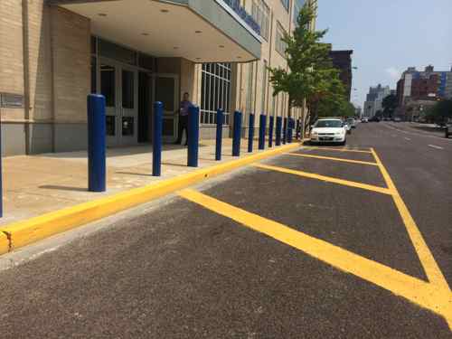
What’s needed at some bus stops is highly visible markings so the oblivious drivers see they shouldn’t park there. Those who don’t care will potentially be more embarrassed parking in a visible bus stop than at a yellow curb. It doesn’t need to be complicated, just out of the ordinary.
Paint is cheap, by painting the pavement in addition to the curb they’ve made it clear this isn’t for parking. Location: in front of St. Louis Police Headquarters on Olive.
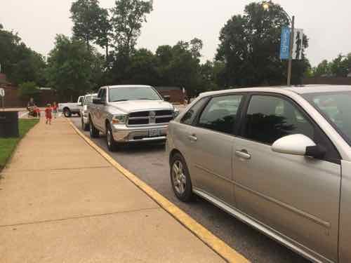
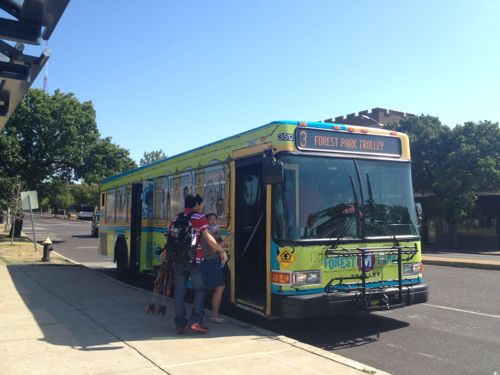
I’ve said all this before, so why bring it up again? Last Tuesday morning my husband and I visited the St. Louis Zoo, we were there for four hours — great time. I returned downtown the way I arrived, via public transit in my wheelchair. My husband drove our car, going directly to work. Leaving the Zoo’s North entrance I saw a problem as soon as I started across the street to the bus stop.
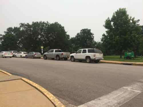
The last three vehicles are parked in the bus stop I need to get homeI’m now at the spot where the bus should extend the ramp to pick me up.
I went down to the corner to wave at the bus as it approached. It turned the corner and stopped in the street since it couldn’t get to the curb. All traffic was now stopped. I rolled in the street to reach the bus. After I paid the fare the ramp was folded back into the bus — the #3 Forest Park Trolley. I was inconvenienced, the other passengers were inconvenienced, other motorists were inconvenienced, the bus was delayed so more people were inconvenienced.
My goal is compliance, to ensure people don’t park in the bus stop. Sure, increased enforcement of tickets, booting, & towing might also keep it clear. But at what cost? First the person(s) that would be assigned to increased enforcement wouldn’t be able to serve the public elsewhere in the city or park. Ticketing, booting, & towing also isn’t free — and it just server to anger motorists. Yes, they parked at a yellow curb. I suspect many didn’t notice, or didn’t see any harm.
If there is paint on the pavement though, the oblivious excuse goes out the window. Adding the words “NO PARKING”, “BUS STOP, and/or “TOW AWAY ZONE” would convey the message to the driver that parking here isn’t a good idea.
The stop above is served by the #90 (Hampton) and #3 (Forest Park Trolley)
The Metro #3 Forest Park Trolley is a partnership between Forest Park Forever, Bi-State Development Agency/Metro, Missouri History Museum, Saint Louis Art Museum, Saint Louis Science Center, Saint Louis Zoo, and the City of St. Louis. (Forest Park Forever)
This trolley bus operates May through September, largely to mitigate the summer problem of traffic congestion within the park.
2012: People board the Forest Park Trolley to visit the park
I’d like to see these seven partners take action so the bus can reliably be used by everyone. On Twitter I offered to ride the trolley with them so they can see which stops are problematic. I suggested the stops be painted solid so they’re not only visible to motorists but to visitors. The stops could become part of the marketing effort.
I emailed Forest Park Forever President & Executive Director Lesley Hoffarth, who replied, and said they’re working on new striping for the park now, this issue will be taken into consideration. I’m not optimistic it’ll be solved. The new striping work should be done before Fall, I’ll keep trying to influence the work before it’s done.
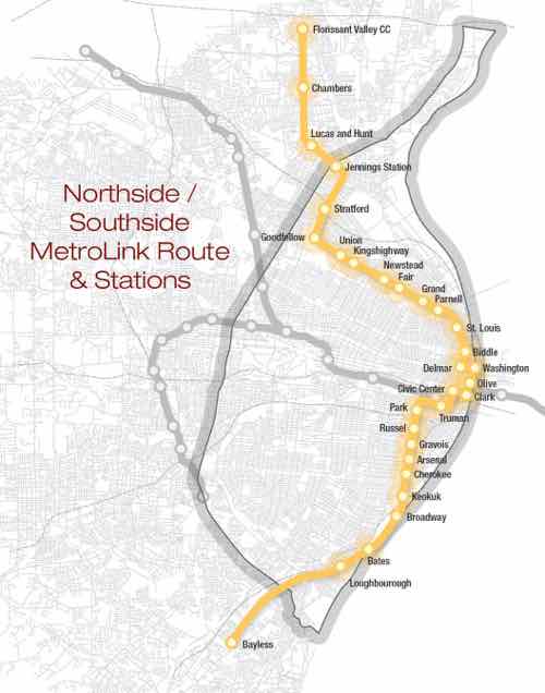
In a guest piece in the St. Louis American 20th Ward Ald. Cara Spencer makes a passionate plea for expanding MetroLink light rail:
The St. Louis region needs a high-quality light rail system to connect Florissant/Ferguson and our densely populated South Side to Downtown and the Central Corridor. Now is the time to push for economic investment to help stabilize some of the city and county’s most vulnerable communities. We should be demanding that our local leaders prioritize North Side/South Side MetroLink expansion as imperative to making St. Louis a progressive and economically just metropolitan area.
Public transportation speaks volumes about a society. Lack of transportation is an indicator of economic injustice and is the number one deterrent to employment and community involvement across the country. (St. Louis American)
Would light rail be more “just”? Those who don’t actually use public transit on a daily basis may think so, but the reality is the opposite.
Map currently being circulated, click image to view larger PDF in Scribd.
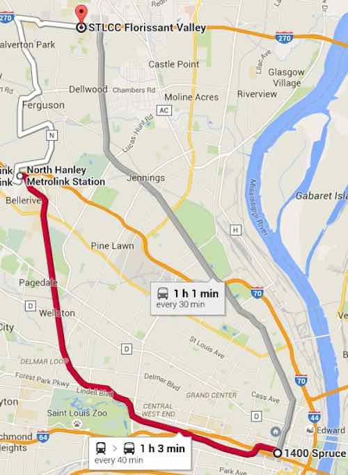
Currently to get from downtown (14th & Spruce) to Ferguson and the Florissant Valley Community College there are two options:
#74 (Florissant) MetroBus is the most direct option. This takes 1 hour and 1 minute with up to 68 potential stops along the way. That’s a long time, I’ve done it many times in the last year.
MetroLink (Red) to Hanley Station plus #36 (Spanish Lake) MetroBus. This option takes a total of 1 hour and 2 minutes. This route is 23 minutes on light rail with 10 stops, 10 minutes between modes, and 29 minutes on bus with up to 40 stops. I’vc also done this a few times.
The two primary choices for getting from downtown to Florissant Valley CC, click image to view in Google Maps. Note that times may vary, just depends on when you depart.
The proposed light rail line would certainly cut this down to 30-45 minutes. That’s a good thing, right? Not necessarily.
Very few ride the #74 MetroBus end to end. It’s a busy bus route but people get on/off where they need to. With 68 points of access it serves the corridor well. More frequent headways would be better though. The proposed light rail route would most certainly mean the #74 would end at a new Jennings Station MetroLink Station at Goodfellow & W. Florissant, rather than duplicate service from that point North. From Goodfellow & W. Florissant it currently takes 24 minutes to reach the community college at the end of the #74. The light rail map floating around would instead have just 4 stops including the start & end stops! How is that just?
The proposed light rail has zero stops in the area of W. Florissant that most uses transit.
Sure a light rail train may be faster and be more frequent, but that’s little consolation if you’re walking a mile further in the rain to get to a limited access point. For many current riders they’d now just end up having to walk their entire trip. Unless we ran a bus on the same route as the light rail train, which kinda defeats the point of spending tens/hundreds of millions on light rail.
Southside:
A similar situation occurs along the proposed Southside route. Currently a person downtown (14th & Spruce) seeking to get to Cherokee & Jefferson using public transit has two choices, both via MetroBus: #11 & #73
How long does it take to get from 14th & Spruce to Cherokee & Jefferson on these two MetroBus routes?
#73: 17 minutes, running every 30 minutes weekdays, with up to 18 points of access in that distance.
#11: 16 minutes, running every 20 minutes weekdays, with up to 19 access points.
Both are pretty quick. The Southside light rail being pushed follows the #11 route exactly between these points so let’s take a closer look. Google Maps includes the start & end stops in their 19 stop count. Here are the 17 access points in between:
14th St @ Papin SB
Chouteau Ave @ 14th Street WB
Chouteau Ave @ 18th Street WB
Chouteau Ave @ Mississippi WB
Chouteau Ave @ 22ND Street WB
Jefferson Ave @ Chouteau SB
Jefferson Ave @ Hickory SB
Jefferson Ave @ Park SB
Jefferson Ave @ 1605 S Jefferson SB
Jefferson Ave @ Layfayette SB
Jefferson Ave @ Russell SB
Jefferson Ave @ Shenandoah SB
Jefferson Ave @ Gravois SB
Jefferson Ave @ Pestalozzi SB
Jefferson Ave @ Arsenal SB
Jefferson Ave @ Wyoming SB
Jefferson Ave @ Utah SB
So how many stops would this “just” light rail make to serve the “densely populated South Side”? Five!
Chouteau & Truman Parkway
Jefferson & Park
Jefferson & Russell
Jefferson & Gravois
Jefferson & Arsenal
The density isn’t concentrated at just 5 points! Only a person who doesn’t understand transit can ague that spending millions while reducing 17 access points to 5 is “fair, just and equitable.” For example, everyone who works & shops at Jefferson Commons would now have to walk further. Sorry folks, remember this is “just” as your grocery trips are longer.
Back to Ald. Spencer’s op-ed:
On the one hand, it is exciting to see renewed interest in light rail in St. Louis County. Yet on the other hand, it is alarming that the expansions mentioned did not include a north/south route, but instead focused on the Clayton-Westport, Lambert-Florissant and Shrewsbury-Butler Hill lines. These three lines fail to provide service to the region’s most densely populated areas and many communities that have the highest need.
Northside/Southside light rail also fails to address actual needs — it would provide service for whites who are uncomfortable riding the bus with non-whites, see Race, Class, and the Stigma of Riding the Bus in America. You can have a free train running every 5 minutes 24/7 but if a person must walk a mile to reach a point of access they’re not going to use it. Stop pretending it benefits them.
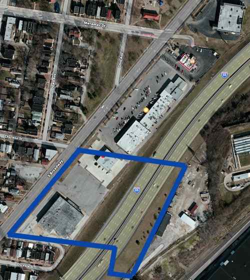
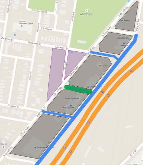
The blue lines mark the approximate outline of the 1964 theater site. Click image for map to area.
In that post I indicated I would do a followup on ideas for the tired auto-centric Chariton Square strip shopping center:
In the coming weeks I’ll take a look at the commercial development along this stretch of Broadway and share my concept for an urban redevelopment.
But I got married a week later and never got to it. Recently a friend inquired about my ideas so here they are…finally. Before I get into my solution I want to show you some of the problems I hope to solve.
THE PROBLEM
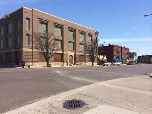
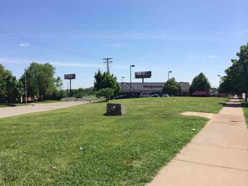
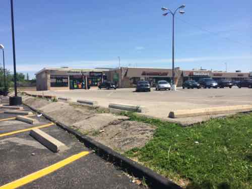
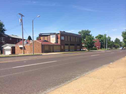
As you head sSouth on Broadway it is bounded by handsome 2-3 story brick urban buildings, but this changes after passing Gasconade St one block further South. The large 3-story building is owned by Ameren.South of Gasconade the pattern changes from from the established urban patternChariton Square was built on the 1960s when walkability & accessibility weren’t consideredEven once inside the site getting from building to building is difficult.More disconnect from one building to the nextLots of hardscape creates water runoff and separates pedestrians from storefrontsThe old street grid was cut off.
ONE SOLUTION
Let me preface this by saying this is a rough digital napkin sketch about what I think could physically be built to replace the existing strip shopping center. The intent is to trigger people’s imagination to see this as potentially being redeveloped in a different manner than it has been for the last half century. The only other vision I’ve seen put forward was as a park-n-ride lot for a light rail line, see Northside-Southside Light Rail Wouldn’t Be Good For St. Louis Neighborhoods.
KEY: Lt Green: existing park space Gray: new buildings Purple: existing green space to consider developing BLUE LINE: New public street, extensions of existing street grid DK GREN LINE: New common plaza Click image to view in Google Maps
NOTES:
The best streets have a similar building type across the street, which is hard to accomplish in this narrow site. The extensions of Chariton & Meramec would help create quality urban faces on opposite sides of s street.
Building on the open areas (purple) would help with changing the feel of Broadway.
Broadway and all newly extended streets would have parking on both sides — angled on Broadway and Piedmont Ave parallel to I-55.
Narrow drive lanes and curb bulbs would allow vehicular traffic to move but also be pedestrian-friendly. Protected bike lanes are possible on Broadway.
The proposed buildings wouldn’t be monolithic masses, these might be several buildings within that newly created block. They might be separated by pedestrian-only street parallel to Broadway & I-55, depending upon the depth of the property. They might have structured parking in the middle surrounded by habitable building on all sides.
The natural slope down to the highway would help facilitate a level of parking under some/most of the new buildings.
A streetcar/BRT line could loop around this project. A light rail stop could be in the center of Broadway.
The site has excellent highway visibility. Some taller buildings might have good views of the Mississippi River.
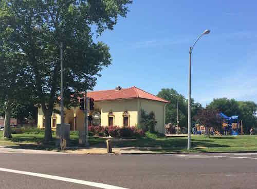
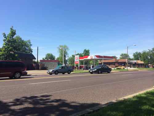
Minnie Wood Park at Meramec & Broadway is a great asset to the future development potential of the areaThis 1920 property on Broadway & Chariton could be a part of the bigger projectTwo gas stations where Broadway & Osceola meet might become one urban station with building in front, pumps behind.
Again, this is a rough sketch of an idea that’s been bouncing around in my head. I wouldn’t expect anything to get built exactly as I’ve indicated. I would like to see residers of the 9th & 20th Wards to work on planning for the future of this area — coming up with a form-based overlay to guide what they’d like to see this become over the next 20-50 years.
AARP Livibility Index
The Livability Index scores neighborhoods and communities across the U.S. for the services and amenities that impact your life the most
Built St. Louis
historic architecture of St. Louis, Missouri – mourning the losses, celebrating the survivors.
Geo St. Louis
a guide to geospatial data about the City of St. Louis