November 26, 2018Featured, Planning & Design, Public TransitComments Off on Possible Development at Forest Park-DeBaliviere MetroLink Station Will Include Lots of Parking
After 25 years the Forest Park-DeBaliviere MetroLink (light rail) station may finally be getting new higher-density development. From last week:
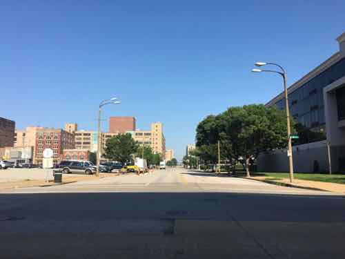
An Indianapolis developer plans to transform the block around the Forest Park-DeBaliviere MetroLink station with a $70 million development adding 265 apartments and 34,000 square feet of retail.
The Bi-State Development Board of Commissioners on Friday voted to proceed with the project. The Bi-State-owned parking lot at the northwest corner of Forest Park Parkway and DeBaliviere Avenue along with the drop-off lot on the east side of DeBaliviere Avenue are targeted for new apartment and retail buildings. The privately owned strip mall to the north of the Bi-State parking lot is also part of the project, slated for a four-story, 106-apartment building with 16,000 square feet of ground-floor retail. The Bi-State parking lot will be turned into a six-story building with 108 apartments and almost 13,000 square feet of ground-floor retail. Metro’s drop-off lot across the street would become a five-story, 51-apartment building with 5,000 square feet of street-level retail. Plans also call for public art and streetscape improvements. (Post-Dispatch)
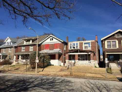
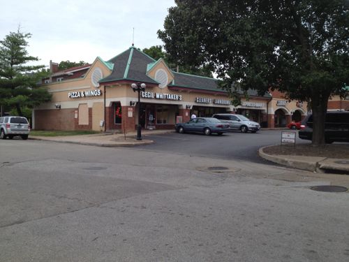
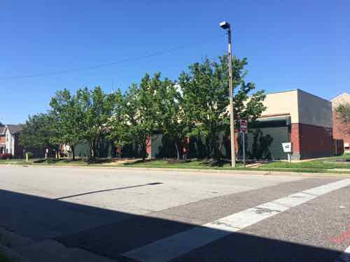
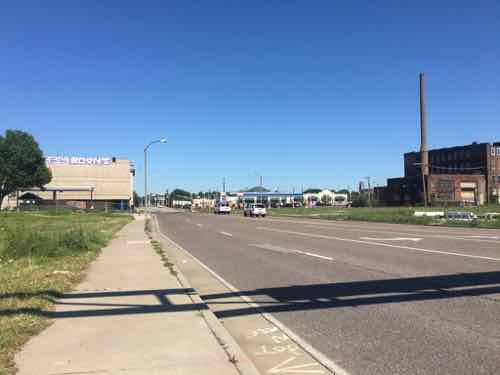
Over the last quarter century other developers have also talked about developing around the station. Maybe it’ll finally happen. Over the last few years we have seen high-end high-density housing filling in gaps along Pershing Ave, to the East of DeBaliviere. Yet, five houses West on De Giverville, facing the parking lot to be developed. are two houses in poor condition.
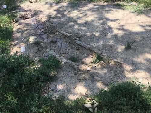
The house missing the roof is 5727 De Giverville.
Across from a light rail transit station for 25 years. Part of the problem with this area is a lack of retail/services — namely a grocery store:
5727 De Giverville Avenue has a Walk Score of 64 out of 100. This location is Somewhat Walkable so some errands can be accomplished on foot.
5727 De Giverville Avenue is a three minute walk from the MLB MetroLink Blue Line and the MLR MetroLink Red Line at the FOREST PARK METROLINK STATION stop. (WalkScore)
Hopefully the new development will substantially increase the WalkScore for this area. Certainly couldn’t lower it!
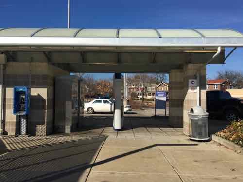
Metro’s free park & ride lot was redone in 2006 when the Blue line was added. This structure is also from 2006. The houses on De Giverville can be seen in the background.Full on weekdays, the free parking at the station is usually empty on the weekendsThe old kiss & ride space on the East side of DeBaliviere will also be developed.
I’ve previously posted about how awful the strip retail building at DeGiverville & DeBaliviere is — especially need to a light rail station.
Low-density suburban style strip center isn’t an asset for the area, tenants include Metro’s Transit Access Center where Call-A-Ride operations are and where disabled riders. like myself, go to get a reduced=fare card. Very low volume.
Can’t wait to see that building demolished!
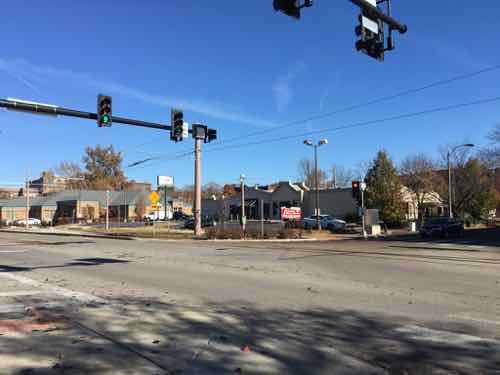
Hopefully a developer will snap up the former Talayna’s on the NE corner of DeBaliviere & Pershing.
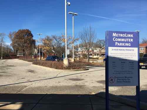
While I’m happy a new developer is interested in this area, I’m not thrilled Metro will still have 100 parking spaces (per Wikipedia). This just increases the cost of housing & commercial rents in the new development — meaning those of us on the low end of the income scale who use transit won’t be able to afford to live here.
I do recall using public transit in St. Louis (and a few other cities) before the age of modern smartphones. Compared to today’s technology, it was primitive. Even since I’ve been a regular smartphone-carrying transit user the technology has advanced substantially.
The vast majority of Americans – 95% – now own a cellphone of some kind. The share of Americans that own smartphones is now 77%, up from just 35% in Pew Research Center’s first survey of smartphone ownership conducted in 2011.
A substantial majority of Americans are cellphone owners across a wide range of demographic groups. By contrast, smartphone ownership exhibits greater variation based on age, household income and educational attainment. (Pew Internet Mobile)
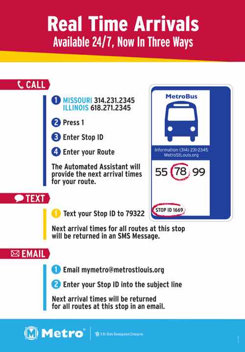
Even though a majority have a smartphone now, it doesn’t mean they all have lots of storage space for various transit apps or enough data to get information on them. Before we get into smartphone apps, here’s a graphic that shows you phone, text, and email options from our transit agency, Metro:
Call, text, or email to find out real time transit information. Click image for more information from Metro.
I’ve used the texting feature several times — works great. Even MetroLink platforms have stop IDs so I can text to see if the next train is the Red or Blue line. For this post I tested the phone & email options, both also worked fine.
Since my cataracts surgery (left eye) in August, I can actually read my phone while outside — including small print! As a result of being able to see again, I’ve been looking into other options besides the familiarity of Google Maps for local transit directions.
While driving I prefer Apple Maps, first released 6 years ago. Transit directions didn’t come to the app for quite a while, then only in bigger cities. I tried using it when we’ve visited Chicago, but I don’t know their system/routes well enough to trust a new app, so I stuck with Google Maps. In late March St. Louis was added to Apple Maps and I’ve been testing it off & on since.
The smartphone market consists of only two platforms now — Google’s Android and Apple’s iOS (iPhone). Google Maps is available on both, but Apple Maps isn’t on Android. I’ve also been testing Metro’s ‘Metro On The Go’ app which is available for both platforms. For this post I downloaded two other apps that are also available on both platforms: Transit & Citymapper. The latter doesn’t have St. Louis mapped, but it has some very nice functionality — more on it later.
I tested all, except the one that doesn’t have St. Louis map info, by trying to go from home at 16th & Locust to Solae/DuPont at 4300 Duncan Ave. — I go there frequently for taste tests. This is in the Cortex District and across Boyle from Cortex Commons & the Cortex MetroLink station that opened on July 31, 2018.
Google Maps (Android & iOS)
The majority of smartphone owners use navigation apps and most prefer Google Maps, according to new survey data from The Manifest. It has 67% of the market compared to 12% for Waze, 11% for Apple Maps, and 8% for MapQuest. (Apple World)
Google Maps, launched in 2005, is the dominant mapping service for both driving & transit. It shows me the most transit options and gives me the option to reduce transfers, reduce walking, etc.
Google Maps on iPad
Google Maps defaulted to the #10 bus, which I often take. For train only it wanted me to go to Union Station, not Civic Center, an easier route of the same distance, no elevator to deal with. I was able to use options to have it give me bus directions to Civic Center where I could catch a Westbound train. Interestingly, it wanted me to pass through the new Cortex station and get off at the Central West End station and walk back 2/10ths of a mile. D’oh!
I do like that when I open Google Maps, and search for a location, it defaults to the mode last used, usually transit on my phone. Having used it for transit in many cities, I’m most familiar with this interface. Other than wanting me to pass the Cortex station and walk back it does a good job. Earlier this year it did want me to transfer from one bus to another, not at the Civic Center MetroBus Center, but at 14th & Chouteau. I can’t recall where I was going when it did that, I reported it to Metro.
Apple Maps (iOS only)
Apple Maps rightly got skewered when it first came out, but like I said now I prefer it for driving directions. I tried using it for transit a few times in Chicago, but I don’t know their bus routes well enough to trust it.
Once St. Louis was added I felt comfortable giving it a try.
Apple Maps on iPad
Apple Maps defaulted to driving…it always defaults to driving. Very frustrating! On transit mode it defaulted to train from Union Station. No option to catch a bus to Civic Center to catch a train. However, it knows the Cortex MetroLink station is open and closer to my destination than CWE Station. For my simple routes Apple Maps works fine.
Metro On The Go (Android & iOS)
Metro’s app is basically their web format in a handy spot. The next departure feature from favorite or nearby stops is now my go to for quick departure times. For example, when I finish at the doctor I can quickly find when the next Northbound bus is leaving from the nearby stop.
Metro On The Go app on iPad
For the test it also knew to direct me from the Cortex Station. It defaulted to taking a bus to Civic Center to catch a train — what I do since the Cortex station opened 3+ months ago. The app is still a little crude compared to the more polished apps from Google & Apple.
Transit app (Android & iOS)
This app has good ratings and a fresh interface. I like at the bottom it shows you times to walk, bike, or the an UberX — with estimated cost.
Like Google Maps, it directed me to the CWE station rather than the closer Cortex station. I’m not going to delete it yet, will continue to use occasionally to compare to others.
Citymapper (Android & iOS)
Like I said above, this app doesn’t include St. Louis at this time. Still, I like the interface and options presented.
Options for the journey between the Chicago condo where we stay when visiting the Windy City and Union Station to return home. The #151 bus is the most common method we use.
Showing walking & biking first is excellent, in my view.
Final thoughts
With 95% owning a cellphone, 77% a smartphone, the explosion of mapping apps, text services, etc really benefits the transit rider — both the daily & occasional rider. The trick is finding the right app for your particular needs. Being open to trying new apps is also a good idea.
Usually when I go to my regular doctor I take either the #97 (Delmar) MetroBus or MetroLink to connect with the southbound #90 MetroBus at Goodfellow or Forest Park station, respectively. However, depending on the bus schedule and my appointment time I’ll take the #10 MetroBus from Olive @ 16th to the Gravois-Hampton MetroBus Transit Center, and then catch the #90 MetroBus heading northbound. The alternative takes about 15 minutes longer, but often will get me to my destination closer to my appointment time.
The #10 (Lindell-Gravois) MetroBus ends at the transfer center on the NE corner of Hampton & Gravois
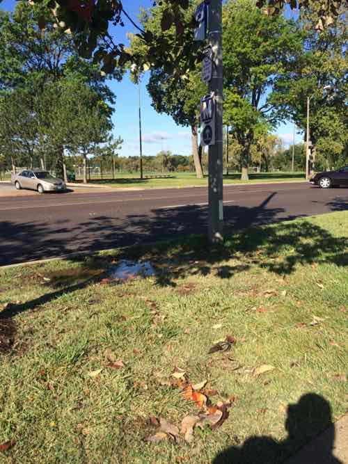
But I only take the Gravois-Hampton alternate if it hasn’t rained recently. You see, the bus stop I use to catch the Northbound #90 is a muddy hole if it has rained recently.
The bus stop is where thw standing water is on this October 2014 photo.
‘The Northbound #90 bus stays on Hampton rather than pulling into the transit center. Riders getting off/on must use the grassy tree lawn.
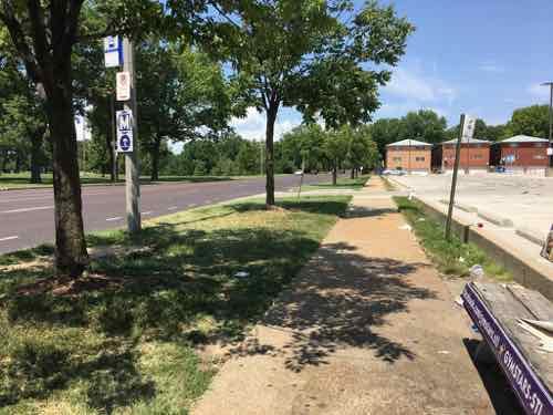
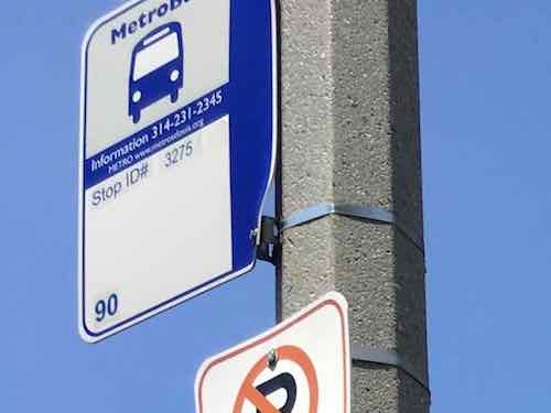
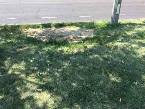
At the bus stop looking South toward the MetroBus transit centerLooking North, note the bus stop sign is mounted very high on the poll — and facing the street. I couldn’t read the stop ID from my wheelchair.Cropping later I could see it’s stop #3275The tree lawn is quite wide here, you can see how the grass is well-worn.Up close I could see a tire track likely made when it was muddy
Even dry this stop is a problem when boarding. When the bus driver puts out the ramp/lift it leaves a huge gap my chair must get up — this is because all the use has worn this spot down so it’s lower than the curb and surrounding grass. Recently I was waiting in the grass just before the stop to avoid this problem. It’s adenegrated experience for everyone dry or wet, impossible for us wheelchair users when wet.
Metro occasionally gets grants to improve accessibility of MetroBus stops — #3275 needs to be toward the top of the list for improvement.
July 30, 2018Featured, Public Transit, TransportationComments Off on After A Quarter Century, Still No Transit-Oriented Development At St. Louis’ Light Rail Stations
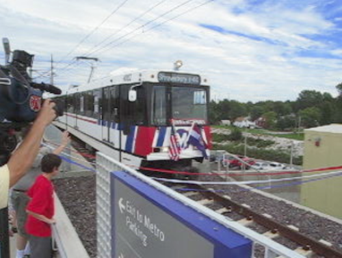
Tomorrow is an important day for transit in St. Louis. At 10am Tuesday 7/31, 2018 a new MetroLink station will open along the original segment. The original light rail alignment opened 25 years earlier on July 31, 1993.
I was 26 and a huge supporter of rail transit, but I didn’t live or work anywhere near amy of the stations. At the time I lived in Old North St. Louis, a year later I bought a 2-family in Dutchtown. I was working in Rock Hill. MO.
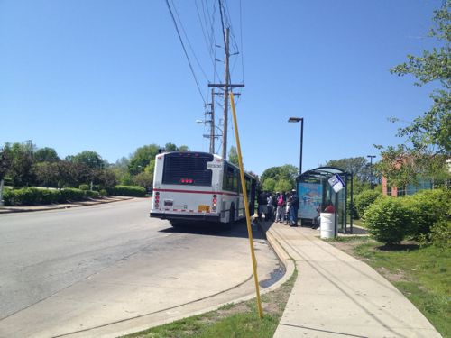
MetroBus picking up riders at the Wellston MetroLink station– taking them to their final destination. The Wellston Station still lacks any transit-orioented development (TOD).
As a result of where I lived & worked, light rail wasn’t of any use to me. Switching jobs from Rock Hill to North St. Louis to Kirkwood didn’t change the lack of usefulness to me. However, I do recall a few times I’d catch the bud to take MetroLink to the airport for a rare trip.
East St Louis
It wasn’t until after moving downtown, and my February 2008 stroke a few months later, that I really began to use our public transit system on a regular basis. In the last decade I’ve traveled far more miles on MetroBus than via light rail. Trips involving light rail almost always involve a MetroBus on one end, or both.
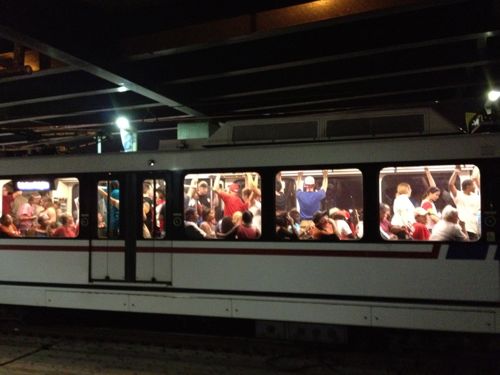
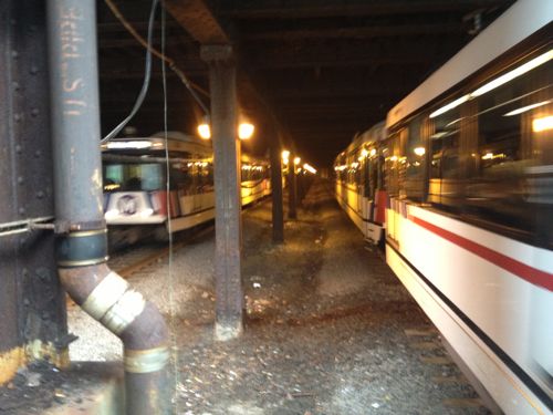
Crowds fill trains after fireworks on July 4th, 2012MetroLink trains travel in a short tunnel under the historic Union Station train shed.
The St. Louis region only a little bit of heavy rail commuter lines to places like Jennings & Ferguson, Webster Groves, Kirkwood, etc. Light rail in the form of streetcars was the primary type of rail transit in the St, Louis region. A line even connoted Illinois into downtown St. Louis, coming in under Tucker Blvd.
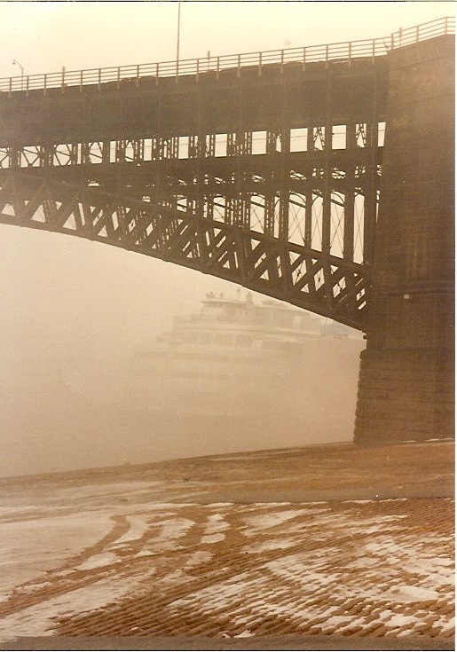
Prior to WWII the bus began to replace streetcar lines — it was smoother and quieter than the old streetcars. The final streetcar line ended in May 1966. So when modern rail transit was being conceived in the 1980s the choices of right-of-way was limited. In 1989, as part of the work on light rail the City of St. Louis traded bridges with the Terminal Railroad Association. The TRA got ownership of the MacArthur Bridge and the city got the Eads Bridge and tunnel under downtown’s central business district. Rail use of the Eads/tunnel ended in 1974 because then-new locomotives couldn’t navigate the bridge or tunnel. New light rail vehicles, however, would fit nicely. This was an excellent use of right-of-way and a great way to cross the Mississippi River.
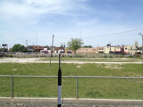
Eads Bridge with the Admiral in early 1991ABOVE: The view to the west of the Sunnen MetroLink station in Maplewood is radically different now, just bare earth.
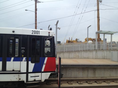
An old freight corridor was acquired that would take the original alignment from downtown St. Louis through numerous municipalities in St. Louis County toward the airport. On opening day trains didn’t reach the airport terminals, it stopped at the Hanley Station. The main terminal was opened soon after. The East Terminal (#2) station came years later.
The only structure at North Hanley is a parking garage, added years after the station opened.
Extensions were made in St. Clair County, IL and in 2006 a Missouri extension to Shrewsbury via Clayton.
The Shrewsbury MetroLink station opened with the blue line extension on August 26, 2006.
The Blue Line to Shrewsbury was costly as many residents along the alignment wanted the trains underground rather than at grade. The line was built to continue South from Shrewsbury, but nearly 12 years later that seems like a non-starter.
In the 25 years since the original line (Red) opened, and nearly 12 years since the Shrewsbury line (Blue) opened, we’ve not seen any transit-oriented development around the stations. We’ve had some transit-adjacent development, but mostly nothing. This is because smart land use planning wasn’t implemented at each station prior to construction. Development around the Maplewood station on the Blue line has been a lot of new car dealerships.
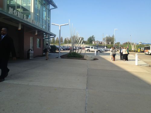
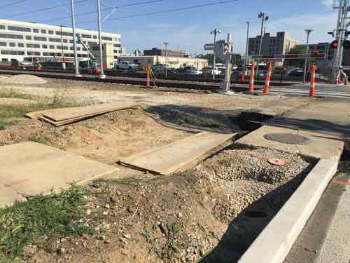
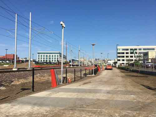
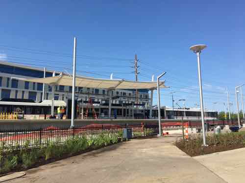
Tomorrow morning service will begin at the new CORTEX station located between Grand and Central West End (BJC). The CORTEX district tries to market itself as pedestrian-friendly. Compared to most of the St. Louis region, it’s a pedestrian’s paradise. For this pedestrian, however, it’s a typical mediocre attempt at best. Sidewalks are narrow, surface parking lots face rail line, the original CORTEX building still lacks an ADA-compliant accessible route. Ribbon cutting for the new station begins at 10am, I’ll be there, weather permitting.
The new station can be tracked from Boyle Ave on the West, or Sarah Street on the East end, though it’s closer to Boyle. Those using Boyle from the North or South will have no problems tomorrow. Same for those using Sarah from the North. As of Thursday last week, those trying to enter/exit the station from/to South Sarah will have ro use the street.
You’d think finishing sidewalks to/from a transit station would be important, but not in St. LouisA wide sidewalk runs along the North side of the tracks between Sarah & Boyle, looking West from Sarah Street.An Eastbound train is seen passing by the station last week.
We’ve invested a lot in light rail, but we’ve not always been smart about it. We’ve not leveraged it to created dense walkable nodes around stations. Going back after the fact is proving just as hard, if not harder, than if it had been done 25 years ago.
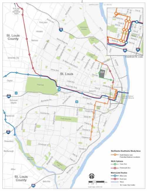
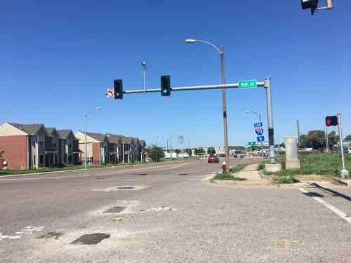
Last week I promised an alternative to the proposed alignment for the proposed northside-southside light rail study. At the time I thought my alternative would work only with the Cass option, but it could work with the North Florissant alignment. First, a look at the overall plan at this point.
The overall route map
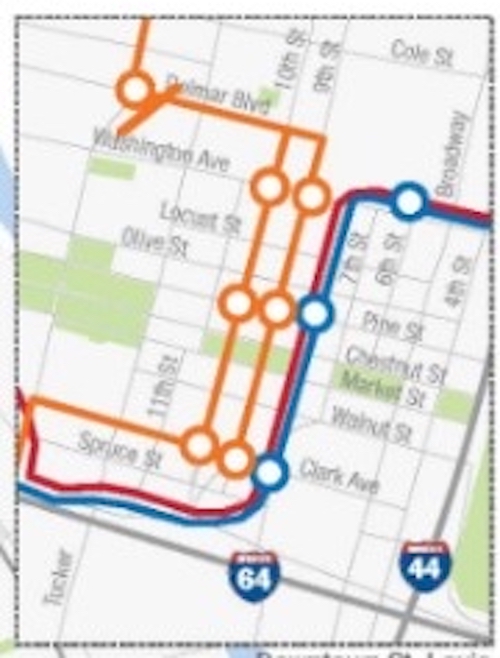
Now let’s examine the downtown inset from the upper right.
From the South the line comes North on 14th from Chouteau, East on Clark. 9th Street would be used for northbound vehicles, 10yth Street for Southbound. All would use Convention Plaza (aka Delmar) to 14th Street. Stations would be at Clark, Pine, & Washington.
Now let’s examine the downtown inset from the upper right.
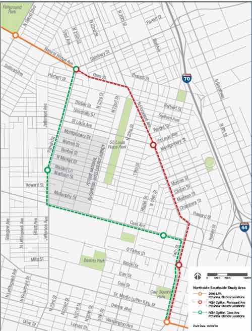
Two alternatives to 14th & Cass to Parnell (Jefferson) & Natural Bridge
In 2007-2008 the plan stayed on 14th rather than go East into the Central Business District. This new alignment through the CBD is much better for transit users and visibility that transit is an option.
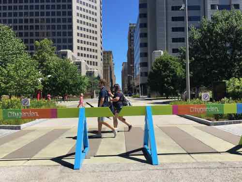
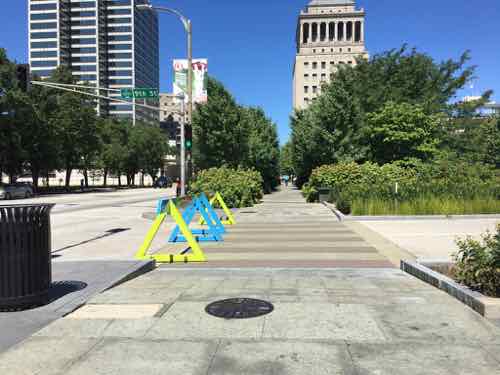
This is looking West at Clark from 9th. The rail line would come toward us on Clark then turn North on 9th (our right)Now we’re looking North on 9th, the Stadium West garage is on the rightLooking North on 9th from Walnut — there’s plenty of height for the rail vehicles, overhead wires, etcSince opening in 2009 Citygarden has unofficially closed 9th Street. Would rail be allowed but not other vehicles?The reason they closed 9th is because they didn’t figure out how to let pedestrians using the “hallway” to know when it was safe to cross 9thAt 10th Street the “hallway” needs to be continued into the next block, along with a system of pedestrian signals.Looking West at Convention Plaza, formerly Delmar, from 9th Street.
My question was why rush to get to 14th Street? Why not go further North on 9th/10th before heading West? It’s likely too late for a change since they plan to submit to East-West Gateway, our MPO, late next month. Still, I took a look at alternatives to Delmar to reach 14th from 9th/10th.
The next block North of Delmar is MLK DrSt. Louis loves to give away public property, is MLK between 10th-11th is a narrow private service drive. MLK was also vacated West of 11thCole is a nice wide option, but West of Tucker you can see it narrows considerably.
With MLK & Cole ruled out that leaves only one other option: Cass Ave. I’ve written before about 9th & 10th through the Columbus Square neighborhood being excessively wide one-way streets — from when they served as long on/off streets for I-70. Since the bridge construction changed traffic patterns, 9th/10th are way too wide and little used. Running the rail lines on 9th/10th through the center of this neighborhood would help connect it to downtown, partially making up for the convention center (1977) and dome (1993) closing access via 6th/7th/8th.
Looking South at 9th from CassCommercial storefront building might become viable if served by rail transit rather than infrequent bus service.Looking West on Cass from 9thLooking North from Cass & Tucker. It would be nice if people driving intro St. Louis from this point saw rail transit on CassLots of vacant land at this important intersection, development could be served by rail transit,,Looking West on Cass from Tucker,The long-vacant Cass Bank at 13h & Cass might get developed if rail t=ran down Cass14th Street sidewalks near Cass are horrible, booked in many places or too natrrow due to encroachments like this.
I think more north city residents would be served by extending the line on 9th/19th to Cass. It could continue on Cass to Jefferson or use 13th or 14th to connect to North Florissant ,Connecting the development node at Cass & Tucker to downtown and to NGA West is important.
In the interest of full disclosure, by the end of this year my husband and I will very likely be new residents of the Columbus Square neighborhood, moving from our loft in Downtown West to a smaller place.More on that later. Still, I’ve been photographing & writing about the area for years.
It’s probably too late to consider 9th.10th to Cass, but I had to share it.
AARP Livibility Index
The Livability Index scores neighborhoods and communities across the U.S. for the services and amenities that impact your life the most
Built St. Louis
historic architecture of St. Louis, Missouri – mourning the losses, celebrating the survivors.
Geo St. Louis
a guide to geospatial data about the City of St. Louis