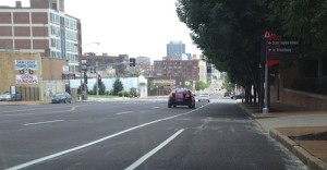
Eastbound on Olive just before Jefferson the bike lane becomes part of the right turn lane
Few aspects of the public right-of-way are as controversial as bike lanes. This may surprise you: bicyclists are deeply divided on them. One side argues bike lanes make riders feel for comfortable biking near traffic. The other side argues trained cyclists don’t need bike lanes. Both are correct.
For the poll this week I’ve listed diverse statements about bike lanes, I’d like you to pick which most closely matches your views. You may agree with more than one so pick the one that’s a better match or that you feel more strongly about. The poll is in the right sidebar.
Results and more on the subject on Wednesday December 18th.
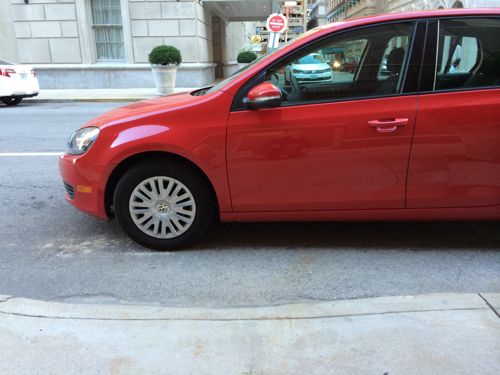
Not every crosswalk point in the city is marked with paint. Ninth Street at St. Charles St was such an example, a well-used point that was unmarked. Hotel guests cross here to reach the parking garage. But unmarked crossing points can inadvertently get blocked by motorists.
November 4th a VW Golf is parked blocking the ramp to cross 9th at St. Charles St.As seen from the opposite corner
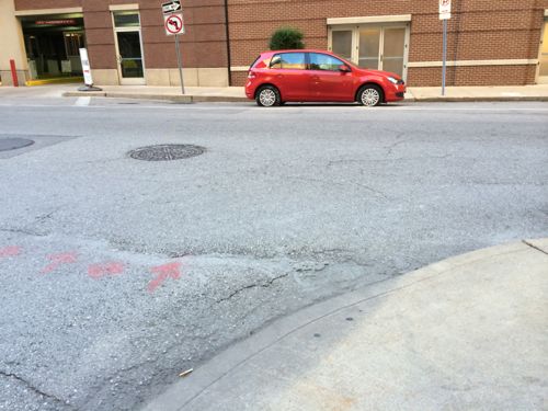
The lane where the Golf is parked is has been marked as no parking for a long time, not sure why. On the morning of December 4th I met with traffic commissioner Steve Runde to discuss allowing parking on 9th, mentioning a crosswalk designation would be nice. The following morning it was already done!
By December 5th the crosswalk had been painted.
Should the crosswalk get blocked now it’ll be easier to get parking enforcement to issue a ticket. Once the parking meters get installed on 9th I’ll do another post.
Thanks to Steve Runde for listening and responding!
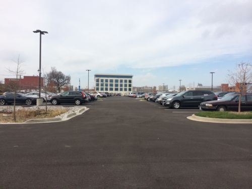
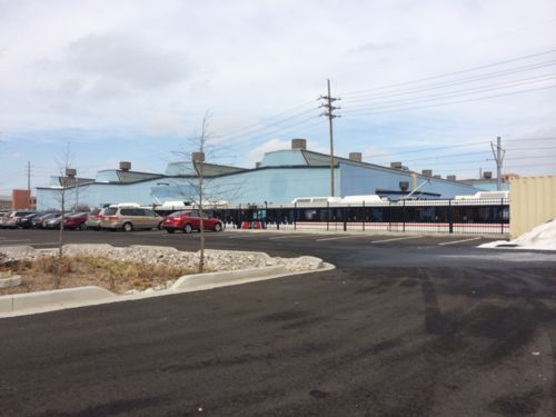
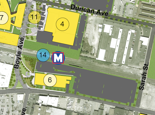
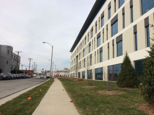
The newly completed BJC @ The Commons is an example of what not to build next to a proposed light rail station.
Looking west through new surface parking lotMetroLink train heads eastBJS @ The Commons (6) is adjacent to the proposed transit station (14)The industrial building that was razed filled the site, including being built up to the Clayton Ave sidewalkBJC @ The Commons is set back in office park fashion, even though the grass is green this isn’t an environment designed to attract pedestrians.
All brand new, from scratch. Totally wrong. Transit passengers see little but parking, why exit and walk? On Clayton Ave pedestrians don’t have a sense of enclosure — the building it too far back from the narrow sidewalk.
Unfortunately the people planning the CORTEX area don’t understand pedestrian behavior and how to create a vibrant transit-oriented environment. Office park next to tracks doesn’t cut it.
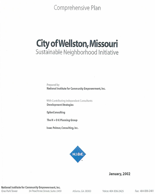
In October I posted about the New Wellston Child Care Center Under Construction, Adjacent To MetroLink Station, and noted promotional materials referenced compliance with the Wellston Sustainable Neighborhood Initiative. I wanted to see this initiative to see how the new construction complies, if it all. After a few emails I received a copy of the initiative — it had to be scanned! The initiative process started in 1998, the final document was from January 2002.
Click cover to view PDF on Scribd
The goals detailed were:
Raise the incomes of Wellston’s residents.
Improve the system of education in Wellston.
Improve the quality of Wellston’s neighborhoods.
Establish a central destination place in Wellston.
Improve access to employment, goods, and services for Wellston’s residents.
Improve the health and well being of Wellston’s citizens.
Enhance the image of Wellston and pride its citizens hold about their community.
Stimulate local economic growth.
Increase the social capital and improve the community capacity in Wellston.
Revitalize the MLK Corridor.
It’s hard to know how well Wellston has done with many of the above, however, the early development child care center now under construction should pay future dividends with respect to education, and eventually incomes.
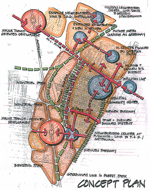
Diagram from page 17
The report was prepared by The National Institute for Community Empowerment, Inc., which no longer seems to exist. I couldn’t find a website and their last phone number is not in service. A local contributor was the Regional Housing and Community Development Alliance (RHCDA), rebranded this year as Rise. Area Resources for Community and Human Services (ARCHES‘) is still around as well.
I’ve been looking through the report for the last month, developing questions to ask about the progress that’s been made in the last dozen years. The most obvious are measurable results toward the ten goals listed above. Do they consider a recent Family Dollar store and a gas station as having met #10, revitalizing the MLK corridor? Any positive gains in education? Given the Wellston School District shut down in 2010 and unaccredited Normandy School District struggles, I rather doubt there’s good news to report.
The new Wellston Early Childhood Center will open in the fall of 2014, not a moment too soon.
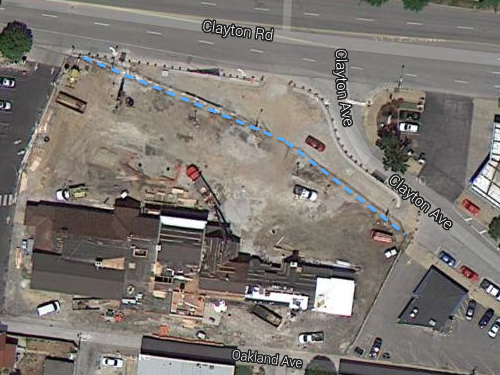
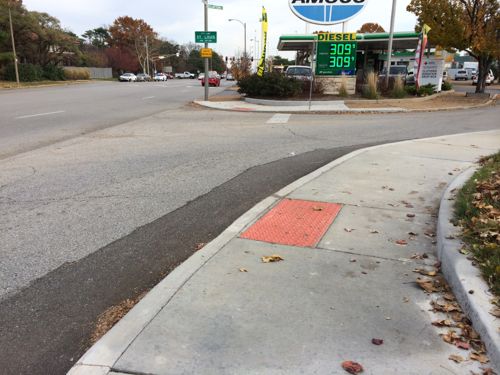
In the last couple of years the intersection of Clayton Rd & Clayton Ave, between the giant Amoco sign and Cheshire Inn, went on a much-needed road diet.
The dashed blue line shows the curb line that existed for decades. The new configuration puts these two perpendicular to each other, improving safety for motorists, bicyclists, and pedestrians. Click image to view map
The space gained from reducing the public right-of-way is now part of the Cheshire parking lot, see the related: Pedestrian Access Route to The Cheshire Easily Blocked. Finally there was a chance to improve this intersection and get it right. Well, it’s improved — no doubt about that. Unfortunately, it isn’t “right” given that it’s new construction.
Looking east across the new intersection. The ramps/detectable warnings point the user into traffic, not a straight line across.Looking west from the opposite side. Again, the detectable warnings are used to guide the visually-impaired. Wheelchair users need to approach ramps perpendicular.
In addition to the ramps/detectable warnings being poorly situated, there’s no crosswalk. Crosswalks help guide the visually-impaired and reinforce to motorists to look out for pedestrians crossing the street. Pedestrians have the right-of-way, motorists must yield to pedestrians.
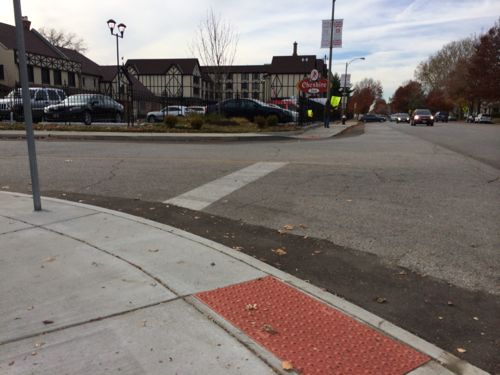
The City of St. Louis either designed this, or approved the drawings of the contractor. Either way it’s pretty pathetic given how easy it would’ve been to do it right. What would be right? Just look at the nearly identical situation at Olive & Lindell.
The pedestrian is allowed to continue on a straight path with ramps, detectable warnings, and crosswalk that reinforce each other. Click image to see post from June 2012
I’m emailing this post to various officials, including 28th ward alderman Lyda Krewson, though it’s too late now without great expense.
AARP Livibility Index
The Livability Index scores neighborhoods and communities across the U.S. for the services and amenities that impact your life the most
Built St. Louis
historic architecture of St. Louis, Missouri – mourning the losses, celebrating the survivors.
Geo St. Louis
a guide to geospatial data about the City of St. Louis