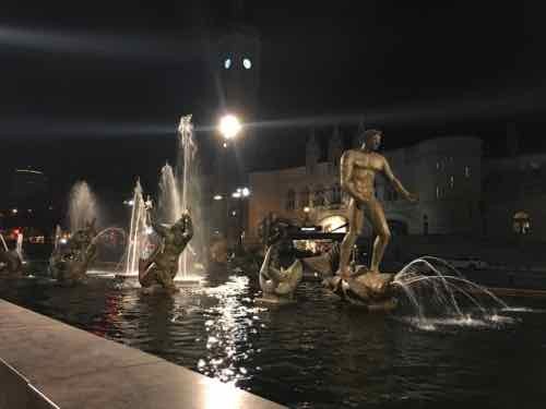
Aloe Plaza, across Market Street from Union Station, used to be very dark at night — too dark. While Kacie Starr Triplett was Alderman of the 6th Ward new lighting was added. The best that can be said is that it’s no longer dark.
Two new light poles were added to shine lights on Carl Milles’ “Meeting of the Waters”:, October 22nd
From a distance, the lighting does a good job. Before nobody wanted to be there after dark because it too dark, but now it’a too bright! Trying to get a good photo with Union Station in the background is impossible.
Not sure how much was spent on this lighting, or if it can be modified. It shouldn’t stay like this.
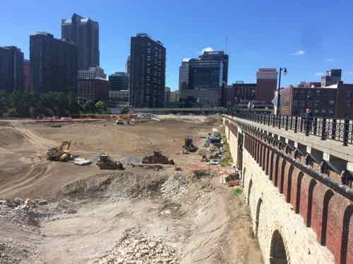
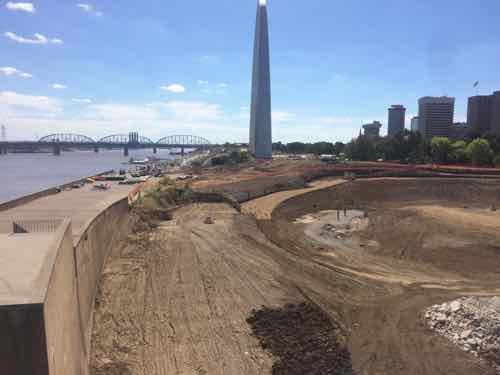
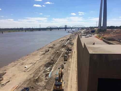
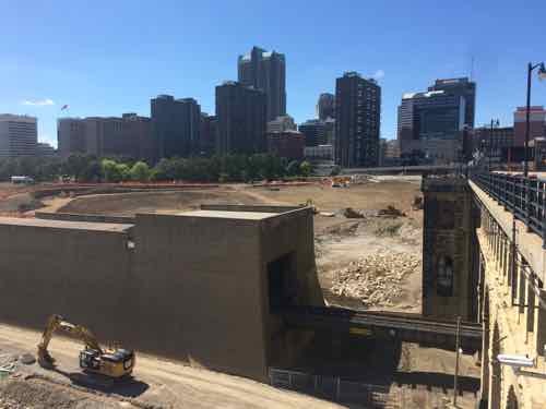
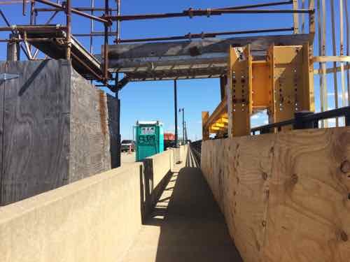
Over the weekend we walked down to see the progress at Luther Ely Smith Square, and the Arch. before heading back to our loft we went out on the pedestrian walkway of the Eads Bridge.
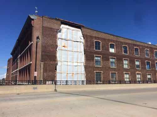
Laclede’s Landing building that lost pare of a wall last monthLooking out where the Arch garage used to beWith the Arch in the backgroundLooking back toward downtownThe wall/lookout (left) conceals the train tracks, part of the historic landscape design .Work continues on the North end of Lenore K. Sullivan — raising it was delayed by flooding.The South end has already been raised about 4 feet.Again, looking back toward downtownNote sure what this was about on the Eads, presumably something to do with the restoration work going on below the top deck
Next nice day we have I’d encourage you to go for a walk on the Eads. Over the next year the view below will change dramatically.
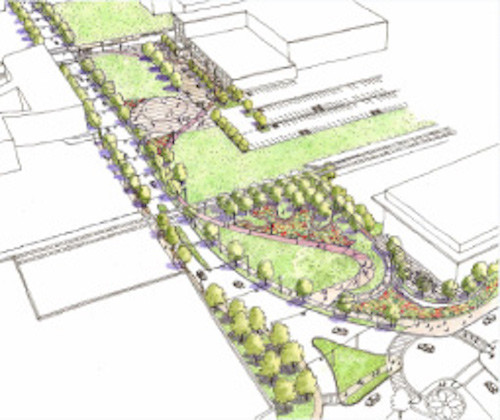
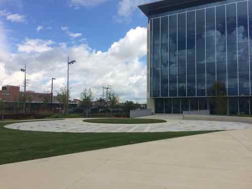
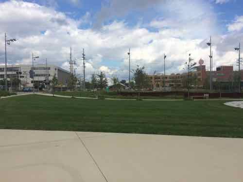
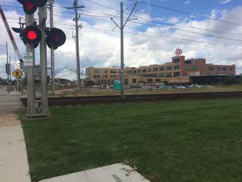
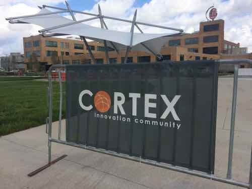
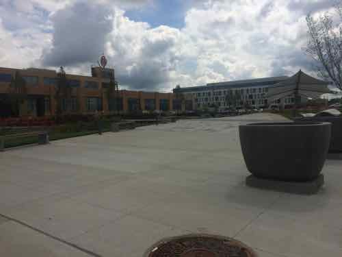
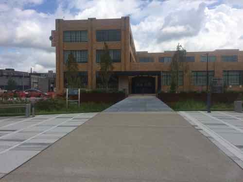
The masterplan for St. Louis’ technology district, called CORTEX, included a significant green space. Originally formed in 2002, the green space is just now being completed. Here is how they describe the CORTEX campus:
The intent of the CORTEX Master Plan is to create well-designed public open spaces that will contribute significantly to the quality of life within the district, community and city. The Master Plan calls for the creation of the CORTEX Commons, a public park that will be accessible to all who work and live in the district and surrounding neighborhoods.
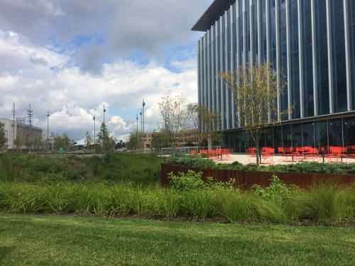
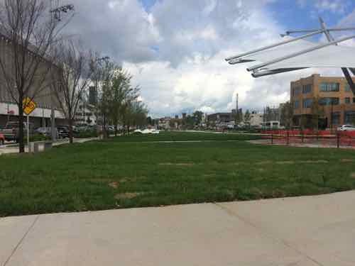
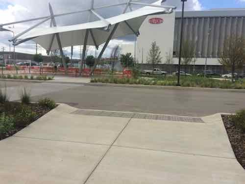
The Commons: right in front of the @4240 entrance you’ll find a beautiful green space with areas for relaxing, meeting, or just enjoying the fresh air.
Restaurants/Cafes: surrounding the @4240 building will be cafes, restaurants and other places to grab lunch, dinner, or have cocktails after work.
Living Space: within walking distance of @4240 are lofts, apartments and other living spaces that allow for a commute that is literally minutes away.
Shops: retail space will be part of the new Phase II expansion, providing convenient shopping and unique boutiques all within a short stroll of the office and laboratory space.
Transportation: getting to and from work will be simplified for those driving as well as those wishing to use public transportation. A new highway interchange at the major east-west Interstate 64 provides convenient access for drivers, plus a new MetroLink light rail station will be within a block of the @4240 building.
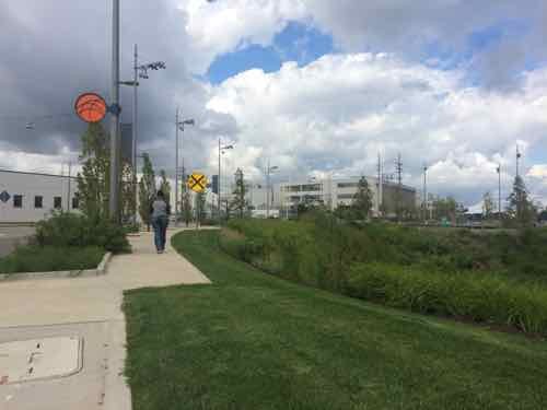
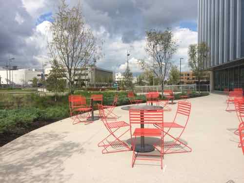
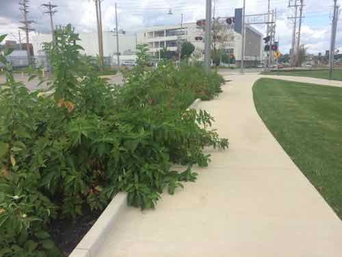
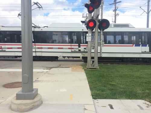
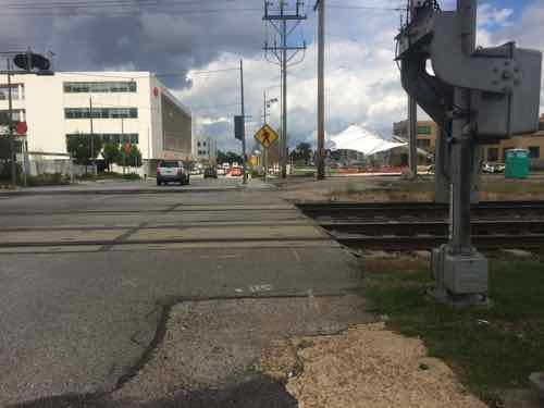
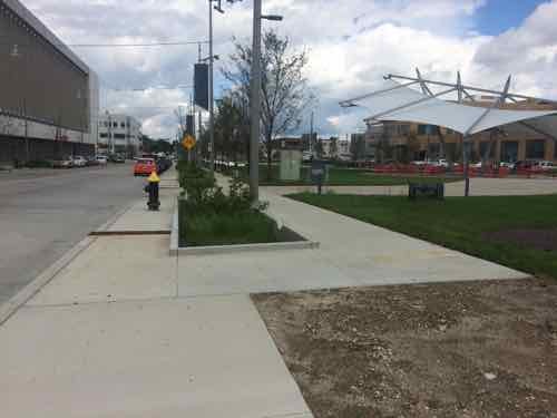
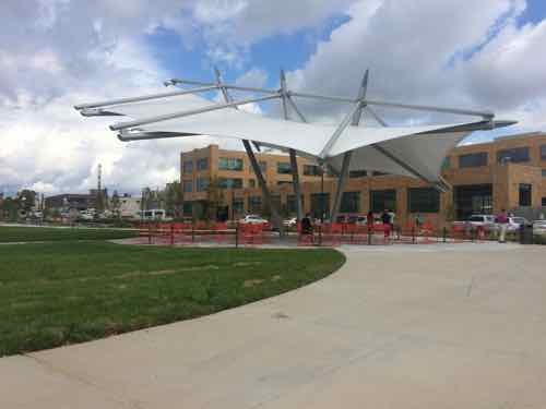
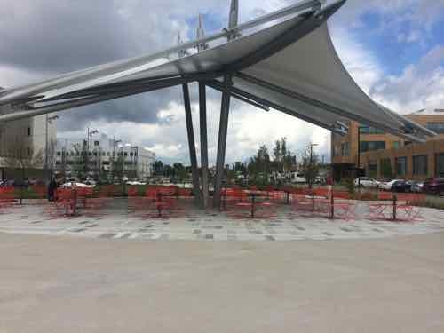
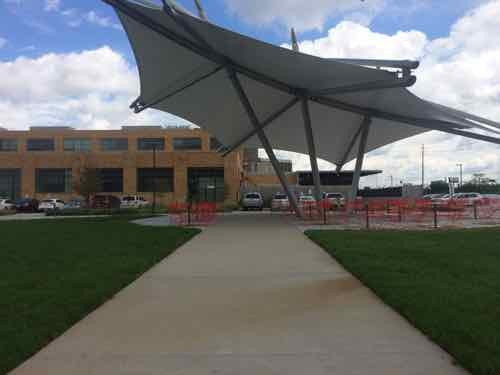
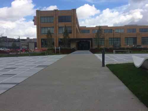
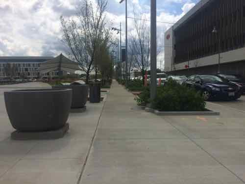
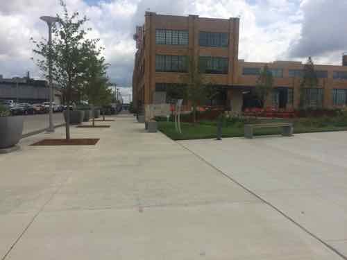
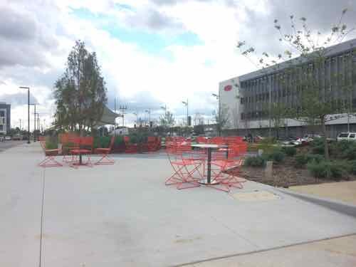
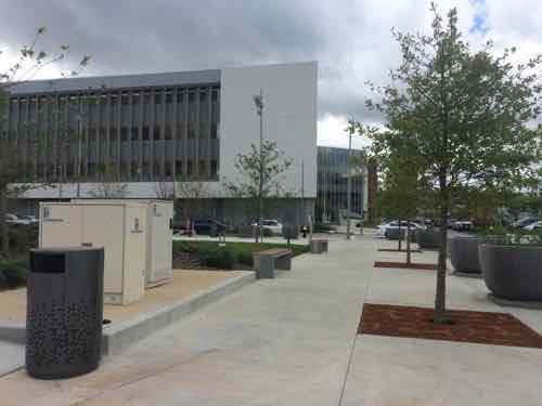
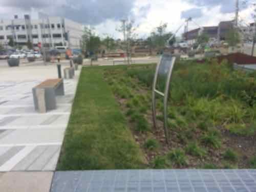
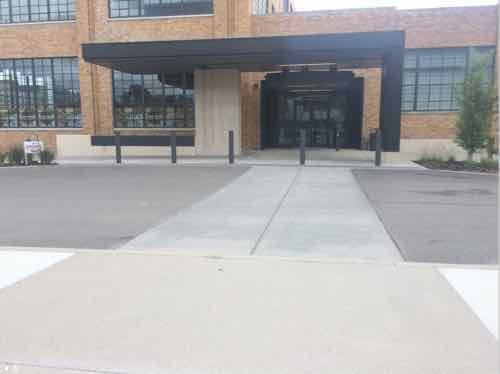
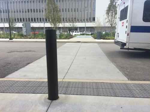
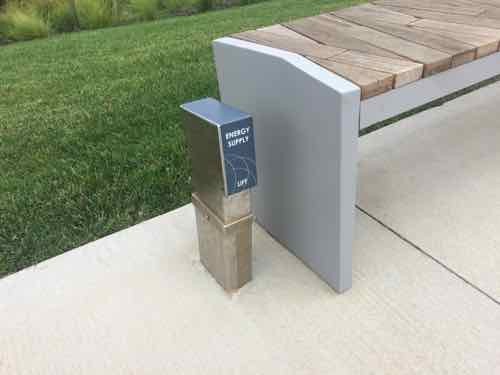
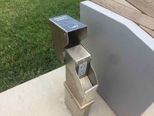
The visitor sees lush landscaping, at right is the new BJC @ The Commons buildingTurning to the left we see the sidewalk follows the curve of Boyle. The orange circle is the logo for the CORTEX Commons. In a couple of places the sidewalk make a sharp shift.An open area hardscape area to the West of the buildingLooking back toward Clayton we can see the sign marking the rain garden and the patio beyond. I couldn’t get close enough to the sigh to read the body text. Numerous such signs throughout are also too far away to be read.Looking North from the patio, the movable tables & chairs are better than fixed furnishings — allows people to rearrange.Back out by the hardscape circle, looking NorthHeading North on the Boyle sidewalk these plants in the rain garden are already reducing the sidewalk width. This is the only plant choice I didn’t like.We can now see the light rail line, known as MetroLink, divides the space. Will discuss the renovated building in the background later in this post.The sidewalk narrows at the track crossing, this is the low point in the experience.With the train gone we can cross.Looking back South after having crossed the two MetroLink tracks and a third extra track (nearest)Looking back North we are again faced with the sidewalk making a hard shift to the right. The parked cars on Boyle don’t have a bulb out to enclose the parking lane.Turning toward the Southeast we can see an unfinished spot, this is likely to connect to the new light rail station to be built. Hopefully the track crossing will be improved at that time.Approaching the @4240 buildingLooking North. DuPont, formerly Solae, is across Boyle on the left.Turning Eastward we see the centerpiece shade canopy.Looking North at the canopy, the same movable tables & chairs are used.Back at the sidewalk parallel with Boyle we see the first of numerous connections to draw you into the space from the edge.The Northernmost of the connections leads right to the @4240 building entrance, more on that in a bit.Looking back South along the Boyle sidewalkLooking diagonally into the CORTEX CommonsLooking East along Duncan Ave, the main East-West spine in the district.Looking South from a position closer to the @4240 building we see another patio with the same movable furnishings. Most of this area is a metal grate over a rain garden.Looking back West toward Boyle, with DuPont/Solae in the backgroundBack in the Commons we can approach the @4240 building after crossing the rain garden on the metal grate pedestrian bridge — love this!Another pf the informational signs that can’t be read from the paved areasLooking out to Boyle & Duncan we can see the South facade of the first CORTEX building. It was built without an ADA-complianfr accessible route and hasn’t yet been correctedThe paving clearly directs the user to the entry but the the curb on this side of the drive prevents me from continuingThe view out from the entry shows the accessible entry on the near side and the non-accessible curb on the far side. D’oh!The next area, connecting to accessible parking, has the same problemAnd the next one, a good place for a raised crosswalkAnd again. Clearly, someone goofed! The disabled shouldn’t have to go all the way to the Duncan public sidewalkTo finish on a positive, here’s a detail I liked. Next to fixed benches are power outlets.Just lift the cover and plug in your phone, tablet, laptop, or wheelchair.
I hope get CORTEX to correct the accessibility issues to the @4240 building. Read more about the building and how it is being used here.
On October 28, 1965 the last piece of the Arch was lowered into place, so October 28, 2015 is the 50th anniversary of that event.
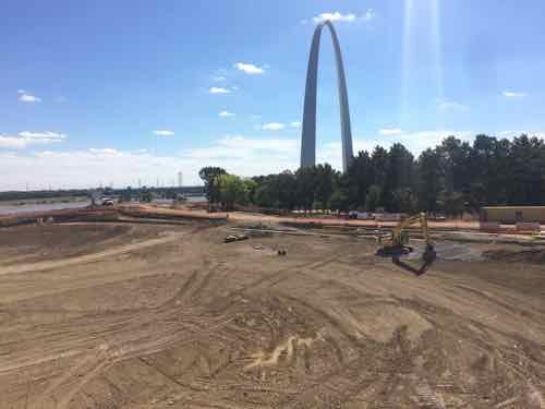
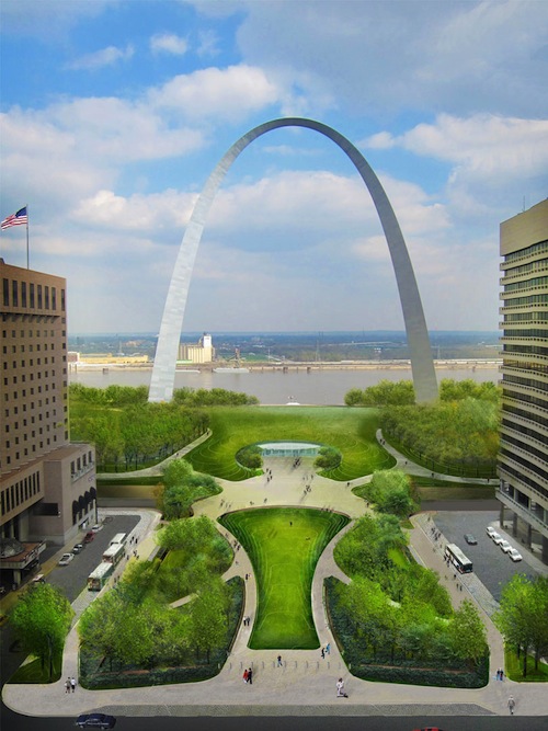
I’ve been posting the following image when discussing the CityArchRiver project for nearly 3 years now, the view is looking East from the Old Courthouse.
2012 rendering of Luther Ely Square extended over the highway, leading to the future Arch/museum entrance
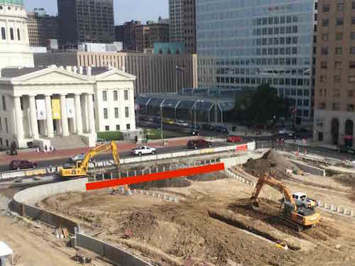
Two weeks ago, looking out from the 7th floor balcony of the CityArchRiver offices, I saw the work underway.
Construction on Luther Ely Square with the Old Courthouse in the background, the red line indicates the central sidewalk area
At first I thought we were going to have lots of people crossing 4th Street between Market & Chestnut — going to & from the Old Courthouse and Luther Ely Square & Arch. But as I put the rendering into this post I looked closely at the bottom and it looks like a wall is shown keeping pedestrians from crossing 4th Street mid-block. Or it’s a cut-out to pull over and drop people off — not sure.
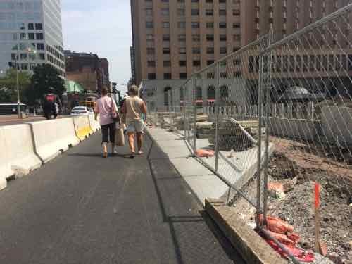
Looking North along 4th, with Luther Ely Square on the right, temporary Jersey Barrier wall on left.
If there isn’t a wall people will cross mid-block. If there is a wall, pedestrians will be taken via a circuitous route.
Plans for the 50th anniversary will be announced shortly, but Luther Ely Square is supposed to be completed by then. The riverfront work maybe — the high river level has delayed the project. If they can clean the mud off the work area quickly then it to should be complete, in a few weeks we’ll know. Plans will include a festival the weekend before October 28th, and a ceremony that day.
Remember the original landscaping wasn’t finished until the early 80s, here’s a look from May 1982:
It has been almost five years since the CityArchRiver competition was reduced to five finalists.
One of my pet peeves is blocked bus stops, people thinking they’re entitled to park in them. To be fair, many drivers who do so may just be oblivious to the fact that buses need to pull up next to the curb so some of us can board/deboard. The response of some is “call the police” or “tow them away.” Yes, enforcement is part of the solution — but the St. Louis Police really have more important things to do. I don’t think Metro’s Police have jurisdiction on city streets.
Besides, the police can be just as guilty.
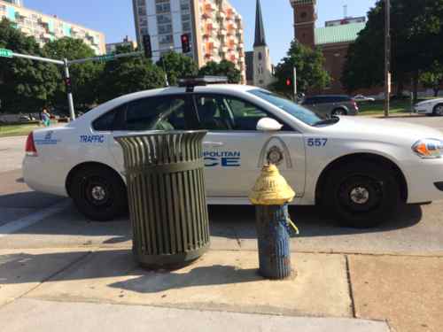
Last year A St. Louis traffic police officer parked in front of a fire hydrant and blocked the adjacent bus stop. Market at 16th.
When you’re on the bus and need to get off at a blocked stop you can’t expect it to wait a couple of hours for a tow truck to remove the offending car, or when you need to get on the bus you don’t have time for enforcement to work. Ticketing the car still doesn’t get you on the bus.
What’s needed at some bus stops is highly visible markings so the oblivious drivers see they shouldn’t park there. Those who don’t care will potentially be more embarrassed parking in a visible bus stop than at a yellow curb. It doesn’t need to be complicated, just out of the ordinary.
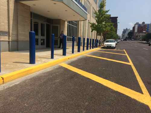
Paint is cheap, by painting the pavement in addition to the curb they’ve made it clear this isn’t for parking. Location: in front of St. Louis Police Headquarters on Olive.
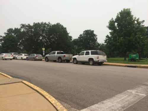
I’ve said all this before, so why bring it up again? Last Tuesday morning my husband and I visited the St. Louis Zoo, we were there for four hours — great time. I returned downtown the way I arrived, via public transit in my wheelchair. My husband drove our car, going directly to work. Leaving the Zoo’s North entrance I saw a problem as soon as I started across the street to the bus stop.
The last three vehicles are parked in the bus stop I need to get homeI’m now at the spot where the bus should extend the ramp to pick me up.
I went down to the corner to wave at the bus as it approached. It turned the corner and stopped in the street since it couldn’t get to the curb. All traffic was now stopped. I rolled in the street to reach the bus. After I paid the fare the ramp was folded back into the bus — the #3 Forest Park Trolley. I was inconvenienced, the other passengers were inconvenienced, other motorists were inconvenienced, the bus was delayed so more people were inconvenienced.
My goal is compliance, to ensure people don’t park in the bus stop. Sure, increased enforcement of tickets, booting, & towing might also keep it clear. But at what cost? First the person(s) that would be assigned to increased enforcement wouldn’t be able to serve the public elsewhere in the city or park. Ticketing, booting, & towing also isn’t free — and it just server to anger motorists. Yes, they parked at a yellow curb. I suspect many didn’t notice, or didn’t see any harm.
If there is paint on the pavement though, the oblivious excuse goes out the window. Adding the words “NO PARKING”, “BUS STOP, and/or “TOW AWAY ZONE” would convey the message to the driver that parking here isn’t a good idea.
The stop above is served by the #90 (Hampton) and #3 (Forest Park Trolley)
The Metro #3 Forest Park Trolley is a partnership between Forest Park Forever, Bi-State Development Agency/Metro, Missouri History Museum, Saint Louis Art Museum, Saint Louis Science Center, Saint Louis Zoo, and the City of St. Louis. (Forest Park Forever)
This trolley bus operates May through September, largely to mitigate the summer problem of traffic congestion within the park.
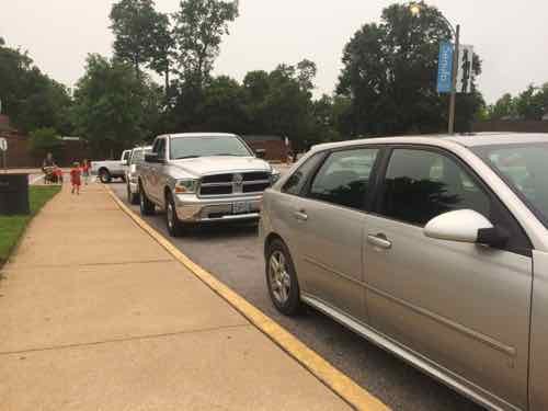
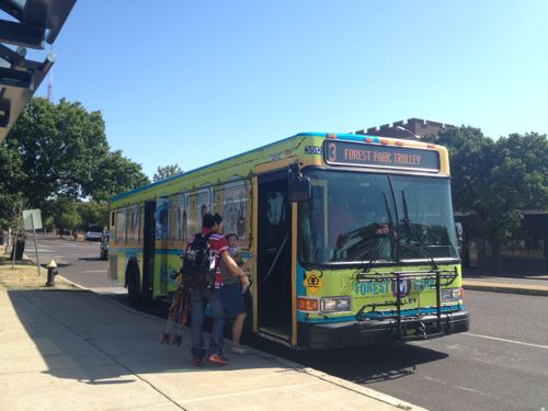
2012: People board the Forest Park Trolley to visit the park
I’d like to see these seven partners take action so the bus can reliably be used by everyone. On Twitter I offered to ride the trolley with them so they can see which stops are problematic. I suggested the stops be painted solid so they’re not only visible to motorists but to visitors. The stops could become part of the marketing effort.
I emailed Forest Park Forever President & Executive Director Lesley Hoffarth, who replied, and said they’re working on new striping for the park now, this issue will be taken into consideration. I’m not optimistic it’ll be solved. The new striping work should be done before Fall, I’ll keep trying to influence the work before it’s done.
AARP Livibility Index
The Livability Index scores neighborhoods and communities across the U.S. for the services and amenities that impact your life the most
Built St. Louis
historic architecture of St. Louis, Missouri – mourning the losses, celebrating the survivors.
Geo St. Louis
a guide to geospatial data about the City of St. Louis