Home » Parks » Recent Articles:

Metro Resumes Forest Park Trolley Service Today

May 3, 2014 Featured, Parks, Public Transit Comments Off on Metro Resumes Forest Park Trolley Service Today

As summer approaches that means vehicle traffic in Forest Park increases, especially on the weekends. Parking is limited, traffic moves slowly, exhaust pollution increases. If only there was a better way to get to the outstanding institutions in the park!

2012: People board the Forest Park Trolley to visit the park

The press release explains the best way to navigate the park other than as a pedestrian or cyclist:

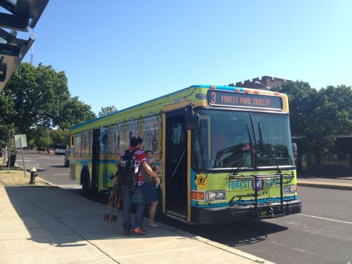
The Metro Forest Park Trolley will return to Forest Park on Saturday, May 3, giving individuals visiting Forest Park a convenient method of navigating the Park, in addition to assisting to alleviate Park congestion.

The Metro Forest Park Trolley Service (MetroBus route #3) will operate daily from 9 a.m. – 5 p.m. from May 3 through September 28 with summer hours of 9 a.m. – 7 p.m., Memorial Day weekend through Labor Day. It will connect all Park attractions, as well as the Forest Park-DeBaliviere MetroLink Station. Adult Trolley fares are $2 per adult. Children 5-12, seniors and disabled passengers ride for $1. A valid Metro Reduced Fare permit is required for the Senior and Disabled discount. Kids 4 and under ride free. Two convenient Park N’ Ride options are available for visitors: the Twin Parking Lots across from the Dennis & Judith Jones Visitor and Education Center and the Upper Muny Parking Lot. From these lots, visitors can hop aboard the Forest Park Trolley for a lift to their desired attraction.

The Metro #3 Forest Park Trolley is a partnership between Forest Park Forever, Bi-State Development Agency/Metro, Missouri History Museum, Saint Louis Art Museum, Saint Louis Science Center, Saint Louis Zoo, and the City of St. Louis.

#3 Forest Park Trolley Hours and Timing:
9 a.m. to 5 p.m., daily, May 3 through September 28. Weekday service will be every 20 minutes and every 15 minutes on weekends.
Extended summer hours, 9 a.m. to 7 p.m., daily, Memorial Day weekend through Labor Day (Saturday, May 24 – Monday, September 1.)
During Friday, Saturday and Sunday Trolley operating hours, the #90 Hampton MetroBus will reroute outside the Park. This will improve the on-time performance of the #90 Hampton and reduce the number of MetroBus vehicles in Forest Park. Contact Metro transit regarding the #90 Hampton schedule at 314-231-2345 or 618-271-2345.

Forest Park Trolley Rider Tips:
Fare is purchased on-board the Trolley, exact change required (paper or coin). Each Trolley ticket allows unlimited on & off privileges for the day the fare is purchased.
Metro Day, Weekly and Monthly Passes are acceptable fares for the Forest Park Trolley. Day passes are available for purchase at Metro Ticket Machines located at all MetroLink stations.
Trolley Head Signs – #3 Forest Park Trolley vehicles coming from the Forest Park-DeBaliviere MetroLink station are identified as Southbound – To Science Center. Forest Park Trolley vehicles heading toward MetroLink are identified as Northbound – To Forest Park MetroLink Station.
The #3 Forest Park Trolley is fully accessible to persons with disabilities.

Information on Obtaining Senior Reduced Fare Permits
Seniors (age 65 and older) and the disabled can ride MetroBus and MetroLink at a reduced rate. Qualifying individuals must complete the following:
Apply in person at the MetroStore – 701 Convention Plaza, St. Louis, MO 63101 – or at one of Metro’s mobile registration events. MetroStore hours: Monday – Friday, 8:30 a.m. to 5 p.m.
Show a government issued picture identification card verifying age (age 65 and older) Acceptable forms of identification include a state vehicle driver’s license, state ID, passport or alien registration card.

Additional Traffic Support for Forest Park
While the #3 Forest Park Trolley will have a meaningful impact on alleviating traffic in the Park this summer, a Traffic Relief Route will again be implemented as an additional measure on especially busy days. When traffic congestion is particularly heavy at Forest Park’s popular Hampton entrance, the Park Rangers will put this Relief Route in motion. This effort is done in coordination with MoDOT as a means to reduce backups and closures on Interstate 64 at Hampton Avenue. To prevent traffic back-ups and highway closures, the Traffic Relief Route will direct drivers from Hampton on a circular path through the Park, past many available parking lots at the Upper Muny, the Visitor Center and ultimately along Government Drive and Saint Louis Zoo. After parking, visitors may then hop on the Trolley to reach their destination and navigate Forest Park.

Helpful Websites
www.metrostlouis.org/forestparktrolley
www.forestparkforever.org/navigation

So if you’re planning a trip to Forest Park please consider using the #3 Forest Park Trolley, or #90 Hampton. You can view the Forest Park Trolley map here (PDF).

— Steve Patterson


An Update on Lucas Park

The land that’s now Lucas Park was given to St. Louis by the Lucas family in the 1850s. Read about Lucas Place, now Locust, and Lucas Park here. In the last couple of decades the park became the gather place for the homeless downtown. For a couple of years the park has been closed as it undergoes a much-needed refresh. Slowly the park has been opening up again.

Lucas Park yesterday
Lucas Park yesterday, the former center fountain is now filled in with lawn grass
Temporary fencing remains up to allow the grass and perennials to get well established
At the west end a former playground now has exercise equipment.
At the west end a former playground now has exercise equipment. I’ve yet to see this get used.
The east end has new children's playground equipment
The east end has new children’s playground equipment, the playground is frequently used.
Belongings of the homeless surround the park at the base of the construction fence.

Old habits don’t die easily. 

— Steve Patterson


Readers: Mixed-Use Building Better Than Laclede’s Landing Park

I agree with the majority of the voters in last week’s poll, a mixed-use building would be better than a park in Laclede’s Landing!

The planned park space is to the right of the trucks parked in the alley, click for larger image.
The planned park space is to the right of the trucks parked in the alley, click to view larger image.

Q: Great Rivers Greenway Bought Laclede’s Landing Property, Plans Park. Thoughts?

  1. A mixed-use building would be better 53 [51.96%]
  2. A park is a good idea 21 [20.59%]
  3. A residential building would be better 15 [14.71%]
  4. A Taco Bell with drive-thru would be better 4 [3.92%]
  5. Other: 4 [3.92%]
    1. greenway along the river
    2. “Other Compatable Development” appears to leave much open to consideration.
    3. Park? Restrooms? Sounds like a great place for the homeless!
    4. It’s a nasty dirty area
  6. Unsure/No Answer 3 [2.94%]
  7. A parking garage would be better 2 [1.96%]

Laclede’s Landing is barely a place anymore, with so many holes in the formerly urban fabric. Between grassy blocks are harsh surface parking lots, it’s clear there needs to be a plan to infill some of these holes with new construction. It make take 20 years to happen, but the planning needs to happen now.

The site of the former Switzer Building, recently purchased by Great Rivers Greenway, is shown with the red X. Click to view in Google Maps.

With such a tiny amount of land between the King & Eads bridges I think every bit should get filled in. Knowing that isn’t likely, the land closer to the south should be filled in while land to the north isn’t as critical to completing streetscapes and urban vistas.

But if Great Rivers Greenway goes ahead with this park next to the Eads Bridge, what should we call it? Eads Transit Park?

Metro dedicated the Eads Transit Park on May 16, 1996. I'm not sure what year they padlocked it.
Metro dedicated the Eads Transit Park on May 16, 1996. I’m not sure what year they padlocked it.

A tiny park next to a massive park that is growing in size by the size of the Arch parking garage and the width of Washington Ave is a huge mistake! This land is an opportunity to add much-needed building mass, people, activity, etc right next to a light rail station. Great Rivers Greenway can’t get into the development business but I’d think they could buy and hold for a developer. If they really have the urge to green up Laclede’s Landing they could unlock Metro’s Eads Transit Park and/or do something with the mess under the King Bridge.

This land needs help that Great Rivers Greenway could provide, a green park extending toward the city from the riverfront leading cyclists up and into Laclede's Landing.
This land needs help that Great Rivers Greenway could provide, a green park extending toward the city from the riverfront leading cyclists up and into Laclede’s Landing.


Hopefully Great Rivers Greenway will reconsider, so the land adjacent to the Eads Bridge might someday see new constriction. Maybe a demonstration is needed to convince them?

— Steve Patterson


Arch Topping 50th Anniversary Just Two Years Away

October 28, 2013 Downtown, Featured, Parks, Planning & Design Comments Off on Arch Topping 50th Anniversary Just Two Years Away
ABOVE: This should be the view three years from today.
This planned view three years from today

Two years from today marks the 50th anniversary of the topping of the Gateway Arch. October 28th wasn’t the original date, but delays happen:

President Lyndon B. Johnson and Mayor Alfonso J. Cervantes decided on a date for the topping out ceremony, but the arch had not been completed by then. The ceremony date was reset to October 17, 1965, and workers strained to meet the deadline, taking double shifts, but by October 17, the arch was still not complete. The chairman of the ceremony anticipated the ceremony to be held on October 30, a Saturday, to allow 1,500 schoolchildren, whose signatures were to be placed in a time capsule, to attend. Ultimately, the Pittsburgh-Des Moines Steel(Warren, Pa) set the ceremony date to October 28.

The time capsule, containing the signatures of 762,000 students and others, was welded into the keystone before the final piece was set in place. On October 28, the arch was topped out as then Vice President Hubert Humphrey observed from a helicopter. A Catholic priest and a rabbi prayed over the keystone, a 10 short tons (9.1 t), 8 feet (2.4 m)-long triangular section. It was slated to be inserted at 10:00 a.m. local time but was done 30 minutes early because thermal expansion had constricted the 8.5-foot gap at the top by 5 inches (13 cm). To mitigate this, workers used fire hoses to spray water on the surface of the south leg to cool it down and make it contract. The keystone was inserted in 13 minutes,[30] only 6 inches (15 cm) remained. For the next section, a hydraulic jack had to pry apart the legs six feet. The last section was left only 2.5 feet (0.76 m). By 12:00 p.m., the keystone was secured. Some filmmakers, in hope that the two legs would not meet, had chronicled every phase of construction. (Wikipedia)

So 48 years ago delays were common. In fact, it was years later before the Arch opened to visitors. Landscaping came later as well.

MoDOT recently closed Washington @ I-70 to rework the intersection before Memorial Drive is closed for construction of the lid/park

What will be completed in two years, what won’t be? Word is still that Kiener Plaza will be done as this is key to directing visitors to the newly planned museum entrance from various downtown parking garages.  That must happen so the existing garage on the north end can be razed.

— Steve Patterson


Future Gateway Mall ‘Civic Room’ Needs To Be Designed Without Curbs

Event areas shouldn’t have curbs! Yes, in most areas curbs are necessary for water flow and keeping cars off sidewalks. Yesterday I posted about a conflict between major events and transit access, primarily at 14th @ Chestnut. Today is about curbs — actually my wish for no curbs when a festival area gets designed in the Gateway Mall.

The problem with holding events in an area not designed for events is crowd control and accessibility. Here crowd control blocks access to the curb ramps
The two blocks of Washington Ave feature a mostly curb-free design

When the two blocks of Washington Ave from Tucker to 14th are closed for an event the design doesn’t present accessibility issues.

Of course there are many other issues to consider when designing a festival area: power distribution, lighting, sound, sanitation, etc.  Flexibility is important too. Event planners need to be a part of the planning & design process.

— Steve Patterson


Advertisement


[custom-facebook-feed]

Archives

Categories

Advertisement


Subscribe