Home » Transportation » Recent Articles:

The St. Louis Region Should’ve Planned For Commuter Rail A Century Ago

In thinking about transit in other regions compared to ours, it is clear to me that natural geography and historic development patterns play a role in transportation planning in the 21st century. Decisions made a century ago, good & bad, still affect us today.

One hundred years ago St. Louis hired a 26 year-old civil engineer, Harland Bartholomew, to be its first planner. During the previous 151 years it developed organically, without planning, He quickly proposed widening many public rights-of-way (PROW) to make room for more cars.

Franklin Ave looking East from 9th, 1928. Collection of the Landmarks Association of St Louis

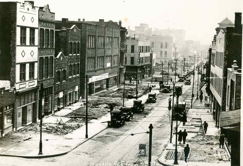
St. Louis city invested heavily in widening streets like Natural Bridge, Jefferson, Gravois.

More than three decades after arriving in St. Louis, Bartholomew got a Comprehensive Plan officially adopted (1947). His plan was all about remaking St. Louis because it would have a million residents by 1960 — or so he thought!

Here’s the intro to the Mass Transportation section:

St. Louis’ early mass transportation facilities consisted of street car lines operated by a considerable number of independent companies having separate franchises. Gradually these were consolidated into a single operating company shortly after the turn of the century. In 1923 an independent system of bus lines was established but later consolidated with the street car company. Despite receivership, re-organization and several changes of ownership the mass transportation facilities have been kept fairly well abreast of the city’s needs. Numerous street openings and widenings provided by the first City Plan have made possible numerous more direct routings and reduced travel time.

Approximately 88 per cent of the total area of the city and 99 per cent of the total population is now served directly by streetcar lines or bus lines, i.e., being not more than one quarter mile walking distance therefrom. Streetcar lines or bus lines operate directly from the central business district to all parts of the city’s area. There are also numerous cross-town streetcar lines or bus lines, operating both in an east-west and north-south direction. 

No mention of a regional need for commuter rail. Some might point out this was the city’s plan, not the region’s. That would be a valid point if it weren’t for the regional nature of the next section: Air Transportation:

It is reasonable to assume that the developments in air transportation during the next few decades will parallel that of automobile transportation, which really started about three decades ago. St. Louis must be prepared to accept and make the most of conditions that will arise. Provision of the several types of airfields required must be on a metropolitan basis. The recently prepared Metropolitan Airport Plan proposes thirty-five airfields. See Plate Number 27. These are classified as follows:

  • Major Airports – for major transport 3
  • Secondary Airports – for feeder transport 1
  • Minor Fields – for non-scheduled traffic, commercial uses and for training 15
  • Local Personal Fields – for private planes 13
  • Congested Area Airports – for service to congested business centers 3
     
    [Total] 35

Of these, two major, eight minor, twelve personal and three congested area airports would be in Missouri. Lack of available land in the City of St. Louis limited the number within the corporate limits to two minor, one personal and two congested area airports. The selection of sites for the latter involves great cost and should await further technological developments in design and operation of various types of aircraft, including the small high powered airplane, the autogyro and the helicopter.

The three airports within the city are:

  • A Minor Field at the southern city limits east of Morganford Road.
  • A Minor Field in the northern section of the city between Broadway and the Mississippi River. (Since the publishing of the above report this field has been placed in operation by the city.)
  • A Local Personal Field in the western section of the city on Hampton Boulevard north of Columbia Avenue.

The latter is of special significance because of the great concentration of potential private plane owners in fairly close proximity. The northern minor field is adjacent to a large industrial area. The southern minor field would also serve a large industrial area as well as a considerable number of potential private plane owners.

So the region should have 35 airports but no commuter rail service? It should have numerous new highways but no commuter rail? Here’s the visual of the region with 35 airports:

Bartholomew's 1947 plan called for 35 airports un the St, Louis region!
Bartholomew’s 1947 plan called for 35 airports un the St, Louis region!

Thirty-five airports but no plan for mass transit beyond bus service?

Bartholomew left St. Louis in 1953 to chair the National Capital Planning Commission, where he created the 1956 plan for 450 miles of highway in the capital region.

During the 1960s, plans were laid for a massive freeway system in Washington. Harland Bartholomew, who chaired the National Capital Planning Commission, thought that a rail transit system would never be self-sufficient because of low density land uses and general transit ridership decline. But the plan met fierce opposition, and was altered to include a Capital Beltway system plus rail line radials. The Beltway received full funding; funding for the ambitious Inner Loop Freeway system was partially reallocated toward construction of the Metro system. (Wikipedia)

A book written by a partner of Bartholomew revises history to suggest he pushed for Washington’s Metro — see Chapter 10.

https://www.stlouis-mo.gov/archive/harland-bartholomew/HBaACh10.pdf

Washington has fewer miles of freeways within its borders than any other major city on the East Coast.” Thirty-eight of the planned 450 miles would have routed through D.C. proper; today, there are just 10. Instead, after a wrenching and protracted political battle, they write, “the Washington area got Metro—all $5 billion and 103 miles of it.” (Slate)

In 1945, as a paid consultant, Bartholomew said “the density of population of the Washington area would never be sufficient to warrant a regional rail system.” (Lovelace P141, chapter 10 p3). Most likely he felt that way about the St. Louis region. Though the city was quite dense during his decades here, the surrounding suburbs were low-density, still are.

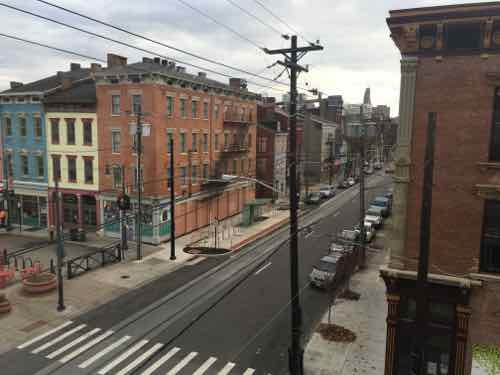
But what if he had guided the region to develop boulevards to the North, West, & South of downtown with streetcars in the median? Today that right-of-way could be used for light rail. Cleveland, for example, is fortunate that Shaker Blvd & Van Aken Blvd  were planned as such, providing room for their Green Line & Blue Line, respectively.

Bartholomew was highly influential — the one person in the region that might have been able to lay the ground work for better mass transit in the 21st century. It wasn’t feasible like lots of highways & airports.

My point is when we think about future transportation infrastructure, and we look at other regions, we must keep in mind their planning & development decisions a century ago. Many still think we should’ve put light rail down the center of I-64 during the big rebuild — failing to realize there wasn’t a way to get a line into the center and it wouldn’t work well if we could since the housing along the route wasn’t developed around transit.

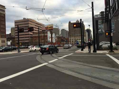
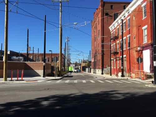
We were able to leverage rail tunnels under downtown and a rail corridor to get light rail to the airport. Other former rail corridors exist for new light rail lines, such as North along I-170 out of Clayton into North County. We do have excessively wide boulevards in the city & county, but cutting up the street pattern after the fact by putting light rail down the center and significantly reducing crossing points is similar to building a highway — it separates.

Moving forward with plans for new regional transportation infrastructure we must recognize we simply don’t have the advantages many other regions enjoy.  We can’t go back and undo decisions Bartholomew & others made a century ago.

— Steve Patterson


Loop Trolley Cannot Use Two Existing Cars Owned For A Decade, Seeking Bids To Restore A Different Type

Construction of the 2,2 mile Loop Trolley continues, the track work in most of the Western portion was largely completed by November 10th.

With track completed in the main Delmar Loop crews are now working on platforms and such.

The issue of what vehicle will operate on them, however, remains an issue. A decade ago Citizens for Modern Transit restored two vintage cars, which sat outside along the Delmar Loop and in front of the Missouri History Museum. They’ve since been removed from display.

We've had two fully restored Ex-Milan Peter Witt single-ended cars for a decade. Click image for the Wikipedia entry on this car design named after the inventor, Cleveland Railway head Peter Witt.
We’ve had two fully restored Ex-Milan Peter Witt single-ended cars for a decade. Click image for the Wikipedia entry on this car design named after the inventor, Cleveland Railway head Peter Witt.

When the Loop Trolley opens late next year you won’t see either of them on the route.  The why requires diving into some technical issues, but I’ll try to simplify it.

The Delmar Loop is called that because decades ago the original Westbound streetcar made a loop around buildings and then returned Eastbound toward downtown. Similar loops existed in Dutchtown & Wellson.

When the new Loop Trolley was conceived it was to do a circle on the West end near the University City Hall and loop around the Missouri History Museum. Looping the track allows the driver to stay in one position to operate the vehicle in both directions.   This meant the vehicles only needed driver controls at one end — single-ended.

But the Loop Trolley route was simplified to meet budget, ironically, it won’t loop!

Like our light rail, both ends come to a dead end. To go the other direction, the operator must switch to the other end — double-ended.  Thus, the Loop Trolley needs double-ended vehicles.

Seattle’s King County has five vehicles that will work, they’ve been in storage since they ceased their waterfront streetcar line a decade ago:

Metro’s green and yellow waterfront streetcars used to run on a track along Alaskan Way and part of S. Main Street. The streetcars were powered by electricity. They were built in Australia for the Melborne and Metropolitan Tramways Board between 1925 and 1930. The cars are double end, double truck, and designed for two-person operation.

Manufacturer: Melborne shops or James Moore
Fleet Numbers: 272, 482, 512, 518, 605
Seats: 43 passengers
Length: 48 feet
Two of the 1928 Australian streetcars began service along Elliott Bay between Pier 70 and Main Street in 1982. Three more streetcars joined the fleet between 1990 and 1993 when Metro extended the line to the International District. The streetcars featured Tasmanian mahogany and white ash woodwork, capturing the elegance of travel in a bygone era.

The waterfront streetcar line is named after George Benson, former City of Seattle and Metro Council member. Known as the “father of the Waterfront Streetcar,” Benson was the driving force behind development of the historic streetcar line.

Our Metro is seeking restoration bids:

REQUEST FOR PROPOSALS 16-RFP-102339-DGR
LOOP TROLLEY SEATTLE CAR REHABILITATION

HERITAGE TROLLEY REFURBISHMENT

Loop Trolley Transit Development District (LTTDD) requests Proposals for the refurbishment of One (1) Melbourne W2 vehicle and the Option (at the District’s discretion) of One or Two more Melbourne W2 vehicles. The Work shall also include shipment of the vehicles, delivery of manuals and drawings, and testing as described in the Technical Specifications.

Site Visit:

A site visit will be held at 1:00 pm on December 7, 2015. The meeting will convene at the Metro King County’s Frye Warehouse, 1501 Sixth Ave. South, Seattle, WA (across Sixth Ave. from the bus yard).

Proposers will be given access to the cars at this time so they may put together their proposals.

Clarifications may be addressed at this time but technical questions and responses will be handled by Amendment.

Questions Due:
December 14, 2015 by 2:00 p.m. St. Louis Time.

Proposals Due:
January 19, 2016 by 02:00 p.m. St. Louis Time.

So they want the price to restore just one Melbourne W2 car, with the option to restore one or two more.  If you’ve ridden Memphis’ trolley then you’ve likely been on a Melbourne W2 car, one caught on fire in 2013.

Restored cars cost a fraction new modern ones do, but they’re also costlier to operate.

— Steve Patterson


Cincinnati’s Modern Streetcar

Last month I visited Cleveland to check out the best Bus Rapid Transit (BRT) route in the country, see Cleveland’s Healthline Bus Rapid Transit (BRT), Part 4. Earlier this month I was back in Ohio, this time in Cincinnati.

During my 3-day visit for a Streetsblog meeting we checked out the upcoming Cincinnati Streetcar. Expected to be operational by the end of September 2016, the tracks, overhead wires, & platforms are all in place.

My first sighting of their streetcar project was the tracks near The Banks (development between stadiums) turning to cross the highway and enter the central business district.
My first sighting of their streetcar project was the tracks near The Banks (development between stadiums) turning to cross the highway and enter the central business district. Second St to Main St
The platform here is little more than the sidewalk.
Most platforms are higher than the adjacent sidewalk, but very close
The platforms, built within the parking lane, are higher than the sidewalk to allow for level boarding.
Same platform from the other direction. This platform had ramps at both ends, some only have one ramp.
Warning signs are up to alert cyclists to the danger of the tracks.
A colorful welcome at one platform
Looking east
Looking east
The overhead wires are visible in this view, looking East along Central Parkway from Race St
Looking West on Central Parkway from Walnut, the streetcar track cut into the median to make the turn into the near land on Walnut. At numerous intersections cameras are able to detect the streetcar, causing the traffic signals to go into a special mode to stop all traffic -- in this case allowing the streetcar to turn right across several lanes of traffic.
Looking West on Central Parkway from Walnut, the streetcar track cut into the median to make the turn into the near land on Walnut. At numerous intersections cameras are able to detect the streetcar, causing the traffic signals to go into a special mode to stop all traffic — in this case allowing the streetcar to turn right across several lanes of traffic.
On Walnut the streetcar turns into the right travel lane
This platform on Elm @ Elder is next to Findlay public market, 1.5 miles from The Banks. The streetcar will connect these points and everything in between.
The far end of the initial line is Henry St., now closed to cars because streetcars will enter/exit maintenance yard to the left. This is at the edge of Cincinnati's Brewery District
The far end of the initial line is Henry St., now closed to cars because streetcars will enter/exit maintenance yard to the left. This is at the edge of Cincinnati’s Brewery District
The maintenance facility is a new structure.
End of the maintenance building as seen from the yard,
End of the maintenance building as seen from the yard
They've received their first of five vehicles, #1175. Their last streetcars ended in #1174. Each costs $2.9 million
They’ve received their first of five vehicles, #1175. Their last streetcars ended in #1174. Each costs $2.9 million

Their streetcar will run north-south on their grid of streets. Where we’ve butchered our grid, theirs remains largely intact, albeit mostly one-way couplets. I traveled over a mile on each of four parallel streets: Elm, Race, Vine, & Walnut. Their rights-of-way are also much narrower than ours are now — they didn’t have someone like our Harland Bartholomew aggressively widening streets by forcibly taking the front bay of buildings.

What we call a trolley or streetcar, Europeans call a tram.  Same thing, different name.

The vehicles are CAF Urbos 3, which are 100% low floor. If Cincinnati decides to do a light rail line out to the suburbs in the future they can use the same vehicles. Yes, modern streetcars use the same vehicles as light rail. The difference comes in how the route is designed. Kansas City is using the same vehicle for their streetcar line, which will also open next Fall.

If we do street-running light rail, or a streetcar, these would be in consideration. To meet requirements for federal projects, they have at least 60% US content.

Like most cities, Cincinnati had streetcars in the 19th century, a subway was started but abandoned. Cincinnati hasn’t had rail transit in decades. See their official stteetcar page here.

— Steve Patterson


Cleveland’s Healthline Bus Rapid Transit (BRT), Part 4

This is my final part on Cleveland’s Healthline Bus Rapid Transit (BRT). However, donations to offset the cost are still accepted here.

Earlier posts:

One of the articles that got me seriously looking at BRT was from Forbes in September 2013: Bus Rapid Transit Spurs Development Better Than Light Rail Or Streetcars: Study. Two parts stood out:

“Per dollar of transit investment, and under similar conditions, BRT can leverage more (development) investment than LRT or streetcars.”

For example, Cleveland’s Healthline, a BRT project completed on Cleveland’s Euclid Avenue in 2008, has generated $5.8 billion in development —$114 for each transit dollar invested. Portland’s Blue Line, a light rail project completed in 1986, generated $3.74 per dollar invested.

and…

The U.S. has seven authentic BRT lines in Cleveland, Las Vegas, Los Angeles, Eugene Ore., and several in Pittsburgh. None achieve the internationally recognized “gold standard” of BRT like Bogota’s TransMilenio line. But one planned for Chicago’s Ashland Avenue might.

“There’s no gold standard BRT in the U.S. yet,” Weinstock said, “but if we continue with the Ashland project on the current trajectory, Ashland could be the first gold in the U.S.”

I’ll address Chicago’s Ashland Ave in a future post. BRT — more development return than LRT or streetcars?

Long-time readers know I love rail — especially streetcars. Public transit was often about real estate development, to get people to a new project, developers would build a streetcar line to get them there. Cities would lease part of the public right-of-way (PROW) so they could operate. Cities, including St. Louis, would have multiple private companies providing public transit. Eventually cities would increase the fees for the track & overhead wires in the PROW or even require the operators to repave roads where they operated. This quickly made streetcar operations unprofitable. One solution, of course, was to abandon the track and use rubber tire vehicles — the bus.

Eventually governments bought up all the private systems — remaining streetcar lines and those that had been converted to bus. Remember, their origin was rooted in the development of real estate. With land developed these lines became strictly about moving people to/from. We need to retuning to the days of the connection between transit and development!

Which brings me back to Cleveland’s Healthline, it had an amazing $114.54 dollars of development for every dollar spent on the BRT line. Below is page 9 from More Development for Your Transit Dollar: An Analysis of 21 North American Transit Corridors.

Click to open larger version

As you can see from the BRT, LRT, and streetcar limes above the return on investment is all over the board. In the top section (Strong TOD Impacts) we see the LRT cost more than the BRT or streetcar lines, but had significantly less development.  A return of $3,74 on every dollar looks good until compared to $41.68 or more. Kansas City’s MAX bus line doesn’t even meet the basics to be BRT — yet it has had a return of $101.96 per dollar!

The report begins talking about the Metro subway system in Washington D.C. — a long & costly undertaking:

A growing number of US cities are finding, however, that metro or subway systems are simply too expensive and take too long to implement to effect significant changes in ongoing trends toward suburban sprawl. As such, cities are turning to lower-cost mass transit options such as LRT, BRT, and streetcars. These systems, which frequently use surface streets, are much less expensive and can be built more quickly than heavy-rail subways or metro systems. Over the past decade, some evidence has emerged that some LRT systems in the US have had positive development impacts. Outside of the US, in cities like Curitiba, Brazil, and Guangzhou, China, there is copious evidence that BRT systems have successfully stimulated development. Curitiba’s early silver-standard BRT corridors, completed in the 1970s, were developed together with a master plan that concentrated development along them. The population growth along the corridor rate was 98% between 1980 and 1985, compared to an average citywide population growth rate of only 9.5%. However, because bronze-, silver-, or gold-standard BRT is still relatively new to the US, evidence of the impact of good-quality BRT on domestic development is only now beginning to emerge and has been largely undocumented. (p14)

A detailed look at the Corridors with Strong TOD Impacts begins on page 110:

The analysis shows that all of the corridors in the Strong TOD Impacts category had Strong government TOD support and either Emerging or Strong land potential.

The only two transit corridors in our study that rate above bronze — the Cleveland HealthLine BRT and the Blue Line LRT — both fell into the Strong TOD Impacts category and were in Emerging
land markets. The Blue Line LRT leveraged $6.6 billion in new TOD investments, and the Cleveland HealthLine BRT leveraged $5.8 billion, making them the two most successful transit investments in the country from a TOD perspective. Portland achieved this over a much longer time period and in a stronger economy than Cleveland did.

In the Strong TOD Impacts category, three corridors with below-basic-quality transit had Strong land development potential and Strong government TOD support: the Portland Streetcar, the Seattle SLU Streetcar, and the Kansas City Main Street MAX.

In each of these cases, local developers and development authorities did not feel that the transit investment was all that critical to the TOD impacts. Thus, we can conclude that if the land market is strong enough, and the government TOD efforts strong enough, a below-basic transit investment might suffice; but a higher-quality transit investment could have even greater impacts.

Not all of the investment along Cleveland’s Healthline is urban. We visited this CVS  — built right after the line opened. The building is set back behind a fenced parking lot.

A typical suburban CVS is among the new development along Cleveland's Healthline
A typical suburban CVS is among the new development along Cleveland’s Healthline. Click image to view in Google Maps.
Like most newer CVS stores, it has an ADA accessible route out to the public sidewalk.
Like most newer CVS stores, it has an ADA accessible route out to the public sidewalk. In this view from the entry pedestrians must go left to the intersection to reach the EB & WB stations. If the entry were at the corner less walking would be required.

As I noted previously. a lot of the new development was on college & hospital campuses — it would’ve happened anyway — but it faces the street rather than looking internal (like SLU, BJC, etc).

I’ve got to read the full report a few more times so absorb it all — while recognizing it was written with a pro-BRT viewpoint.

Any TOD effort is most successful when land-use planning and urban development efforts are concentrated around a high-quality mass transit corridor that serves land with inherent development potential. Assistance from regional and city-level agencies, community development corporations, and local stakeholders can help create more targeted policies to direct development to such transit corridors. Local foundations can be critical to the process of funding redevelopment and providing capital and equity for projects. Local NGOs, which can communicate the projects to the public to help broaden support, are also important.

Although cities in the US are still far from fully transforming their declined urban neighborhoods into high-quality, mixed-use urban developments, they are well on their way. Gold-, silver-, or bronze-standard BRT, when combined with institutional, financial, and planning support for TOD, is proving to be a cost-effective way of rebuilding our cities into more livable, transit-oriented communities.

Regardless of their bias, the above is true — we’ve invested hundreds of millions in light rail and have little TOD to show for it because of poor land-use planning.

Like streetcars & LRT, I think BRT is a great option to consider in the St. Louis region, We can argue about the mode, but we need to take action to have land-use planning that will strongly support transit-oriented development!

— Steve Patterson


MetroBus Stop Now Visible

November 13, 2015 Accessibility, Featured, Public Transit, Walkability Comments Off on MetroBus Stop Now Visible

In September I posted about a dangerous to reach MetroBus stop, and once there it was nearly impossible for the driver to see me waiting. It stopped because a passenger wanted to get off, not because he saw me. The problem was overgrown trees just before the stop.

Looking West for the approaching MetroBus, August 2015
Looking Eastbound on November 1st

Driving down Manchester recently I noticed the overgrowth had been trimmed, as I had requested, by the City and/or Metro. Crossing Manchester at this point is still dangerous, nothing has been done to address that. In August I used this stop to take the #32 back downtown because overgrowth on the other side blocked the sidewalk — preventing me from reaching the next stop at the traffic light seen in the background. That overgrowth was also cleared.

It’s far from perfect — but it’s also far more user-friendly than before.

— Steve Patterson


Advertisement


[custom-facebook-feed]

Archives

Categories

Advertisement


Subscribe