Cleveland’s Healthline Bus Rapid Transit (BRT), Part 1
I’m back from my brief Bus Rapid Transit (BRT) research trip in Cleveland. I’m still processing the experience so today I want to introduce their transit system, the Healthline BRT in particular.
BRT is an innovative, high capacity, lower cost public transit solution that can significantly improve urban mobility. This permanent, integrated system uses buses or specialized vehicles on roadways or dedicated lanes to quickly and efficiently transport passengers to their destinations, while offering the flexibility to meet transit demand. BRT systems can easily be customized to community needs and incorporate state-of-the-art, low-cost technologies that result in more passengers and less congestion. (National BRT Institute)
In short, BRT is an alternative to light rail/streetcar systems.
The HealthLine route travels 6.8 miles (11 km) along Euclid Avenue from Public Square in Downtown Cleveland to Louis Stokes Station at Windermere in East Cleveland. It passes through the neighborhoods of Downtown, Midtown, Fairfax, University Circle and the suburb of East Cleveland.
Between Public Square and East 105th Street, Euclid Avenue has two “bus only” lanes close to the inner median which only allow HealthLine vehicles passage, reducing delays due to conflicts with general traffic during busy times. Complementing the HealthLine is a set of bike lanes on the outer edges of the stretch Euclid Avenue that connects Cleveland State University with Case Western Reserve University. (Wikipedia)
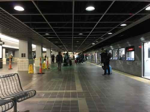
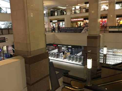
It should be noted they don’t have a newer light rail system like our MetroLink, their rail lines all date from the early to mid-20th century. Two 1913 suburban streetcar lines are now considered light rail, Blue & Green. Their main rail line, Red, is a heavy rail line. Planned before 1930, it didn’t open until 1955. The last extension, to their airport, was in 1968. Red, Blue, & Green share some track & stations. All three stop at Tower City-Public Square, an underground station connected to the 1930 Terminal Tower.
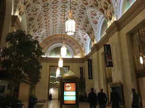
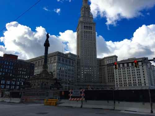
Built for $179 million by the Van Sweringen brothers, the tower was to serve as an office building atop the city’s new rail station, the Cleveland Union Terminal. Originally planned to be 14 stories, the structure was expanded to 52 floors with a height of 708 feet (216 m). It rests on 280-foot (85 m) caissons. Designed by the firm of Graham, Anderson, Probst & White, the tower was modeled after the Beaux-Arts New York Municipal Building by McKim, Mead, and White. The Terminal Tower opened for tenants in 1928, though the Union Terminal complex wasn’t dedicated until 1930.
It remained the tallest building in the world outside of New York City until the completion of the main building of Moscow State University in Moscow in 1953; it was the tallest building in North America outside of New York until the Prudential Center in Boston, Massachusetts, was completed in 1964. (Wikipedia)
Let’s state a look.
During construction the cross streets, Ontario & Superior, are blocked off:
Public Square is the four-block central plaza of downtown Cleveland, Ohio. Based on an 18th-century New England model, it was part of the original 1796 town plat overseen by Moses Cleaveland, and remains today as an integral part of the city’s center. The 10-acre (4.0 ha) square is centered on the intersection of Superior Avenue and Ontario Street. Cleveland’s three tallest buildings, Key Tower, 200 Public Square and the Terminal Tower, face the square. Other Public Square landmarks include the 1855 Old Stone Church and the former Higbee’s department store made famous in the 1983 film A Christmas Story. It reopened as the Horseshoe Casino Cleveland on May 14, 2012.
A 125-foot monument to Civil War soldiers and sailors occupies the southeast quadrant of the square. City founder Moses Cleaveland and reformist mayor Tom L. Johnson each have statues on the square. (Wikipedia)
It appears Ontario will remain closed, with Superior reopening in 2016 — the four distinctive blocks will become two rectilinear blocks visually connected on other side of Superior. For more information click here.
Why have I spent so much time leading up to Public Square? Because prominent corridor, Euclid Avenue, traveling from Public Square out to the adjacent suburb of East Cleveland. Euclid Ave is Cleveland’s Main Street.
St. Louis has no equivalent. Broadway travels North & South from our downtown out into the suburbs, but it doesn’t have major institutions. Extending West from downtown Olive/Lindell has many institutions and population density, but it doesn’t even reach the city limits.
For decades Cleveland’s Euclid corridor was served by bus, the No. 6. Like our #70 MetroBus route on Grand, their No. 6 was heavily used. Like our long-diuscuyssed North-South MetroLink, their original plan was for street-running light rail.
RTA originally conceived the project in the 1980s as the “Dual Hub” light-rail line, but found in the 1990s that a rail line would have cost $700 million to $800 million. Inspired by the rapid bus system in Curitiba, Brazil, RTA redesigned the Euclid Avenue project to achieve the speed and high-class feel of light rail at the lower cost of a bus line. (Euclid Corridor Health Line is a strong RX for Cleveland’s once and future Main Street)
From the same November 2008 article:
Critics complained about the two years of surgery on the avenue, which disrupted traffic and killed some small businesses. The work, however, was absolutely necessary; it replaced water and sewer lines that dated as far back as the turn of the 20th century.
Critics also called the Health Line a boondoggle, saying it will do little more than provide a marginal improvement over the former No. 6 bus line, which was already the city’s most successful and heavily used route. The new line will cover the distance between downtown and University Circle in 20 minutes, 10 minutes less than the old line.
It’s true that when measured purely in cost efficiency per rider, the project didn’t score high on tests required by the Federal Transit Administration as a condition for funding. But the project did meet those basic requirements. (Euclid Corridor Health Line is a strong RX for Cleveland’s once and future Main Street)
A year later, during the worst of the recession, there were positive signs:
Despite the challenging financial climate, the $197 million renovation of Euclid Avenue has become an economic development engine for the city. More than $3.3 billion worth of projects are in the works or recently finished along five miles of the vital artery.
To be sure, the progress has been slower than many would like. The number of projects would be far greater if not for an economic crisis that has stalled or killed developments across the country. And given a shortage of private lending, many of the high-profile projects along the corridor depend on institutions, tax credits and other incentives.
Nevertheless, builders are staring down the shaky real estate market and finishing town houses in University Circle. They’re completing apartments in former department stores downtown. And they’re pitching plans to make Midtown a biomedical and technology hub. (Cleveland’s Euclid corridor project has paved the way to economic development)
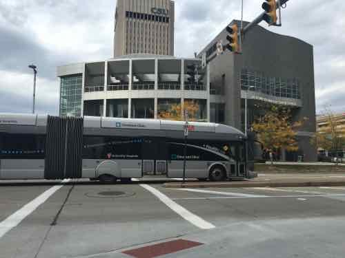
Going from the Megabus stop to our hotel we first spotted the Healthline, at E. 21st & Euclid Ave.
As I rode the Healthline I kept thinking much of the new development on hospital & university campuses would’ve happened anyway, but a good point was made in the 2009 article quoted above:
Without the corridor project, the university’s new buildings probably would have turned their backs to Euclid Avenue, creating a more insular campus. But the remade road has encouraged CSU to put its front doors on Euclid, to build on both sides of the street and to consider how the appearance of new university buildings fits with the avenue. (Cleveland’s Euclid corridor project has paved the way to economic development)
And therein lies a difference the BRT made versus a standard bus line — new buildings were built oriented toward the public street rather than internally.
Next week, in Part 2, we’ll take a closer look at specifics of the Healthline, list pros & cons, and discuss lessons for St. Louis.
— Steve Patterson