Home » Transportation » Recent Articles:

St. Louis’ Last Streetcar Line Ended 50 Years Ago Tomorrow

May 20, 2016 Featured, History/Preservation, Public Transit, Transportation Comments Off on St. Louis’ Last Streetcar Line Ended 50 Years Ago Tomorrow

The last streetcar in St. Louis made its final run fifty years ago tomorrow.

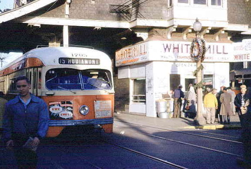
Mr. and Mrs. Leslie Heinz stepped aboard clad in the same tuxedo and beaded dress they had worn to a New Year’s Eve party 36 years before. Railroad enthusiasts took pictures at every stop. A young man brought a case of beer.

Such was the clientele on Car No. 1628 on May 21, 1966, the last day of streetcar service in St. Louis. It ended an unbroken run of 107 years of public transportation on rails, sundered by family sedans and cul-de-sacs.

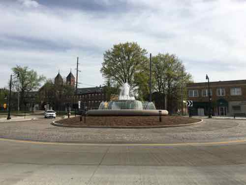
In the 1920s, about 1,650 streetcars rumbled along 485 miles of tracks in and near the city. Other lines ran to Florissant, Creve Coeur, Alton and Belleville. They ran across the Eads and McKinley bridges and down most every major street. Whole neighborhoods were built to be near them, and large apartment buildings sprouted at junctions and loops (turnarounds).

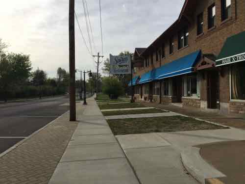
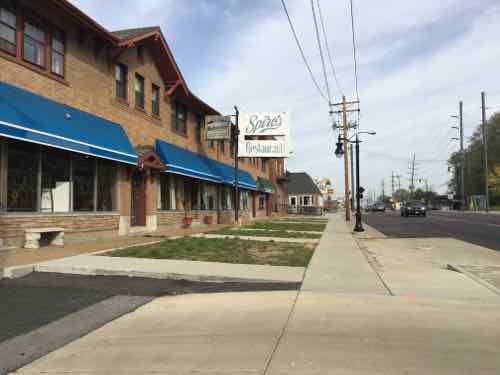
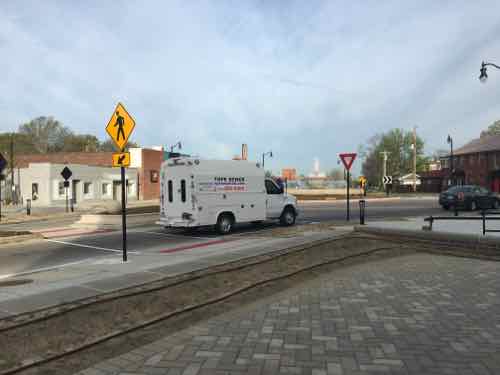
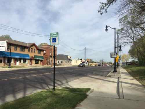
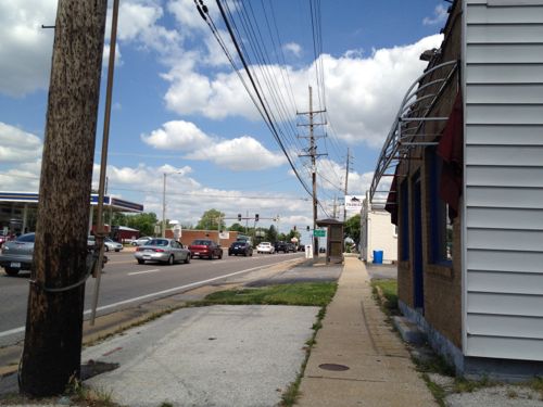
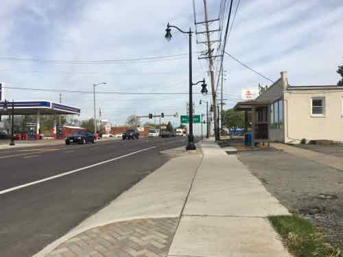
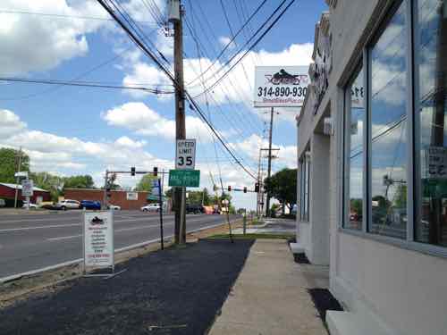
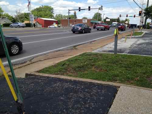
Then came buses and, fatally, automobiles. St. Louis Public Service Co., forerunner of the Bi-State Transit Authority (now Metro), bought a last fleet of streamlined streetcars shortly after World War II. But ridership continued to plunge while complaints rose from motorists about streetcars. Only three lines were left in April 1964, when the new Bi-State agency winnowed the system to the Hodiamont line, which ran from downtown to the Wellston Loop. Along the way through north St. Louis, the Hodiamont had its own right-of-way, like a railroad. (Post-Dispatch — with great images)

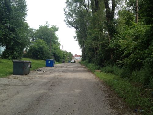
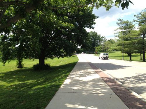
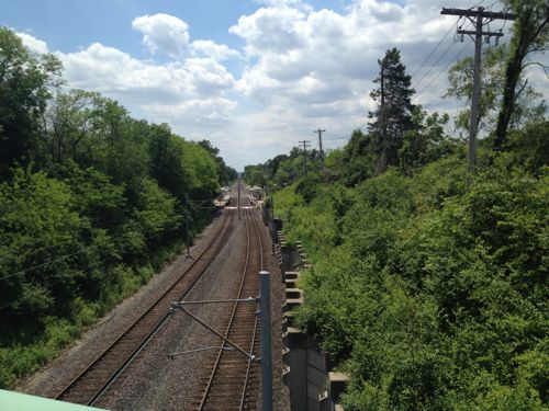
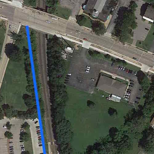
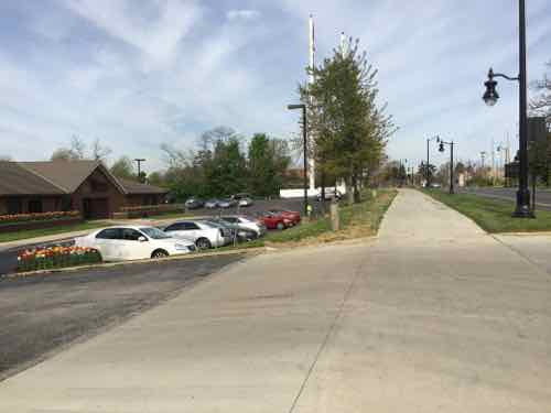
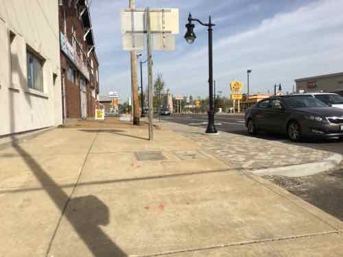
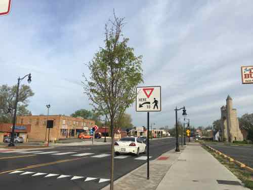
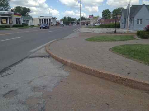
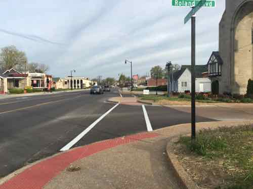
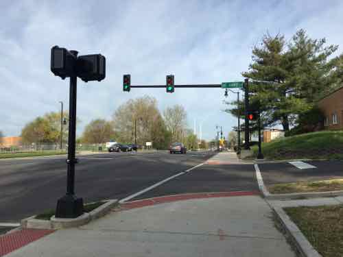
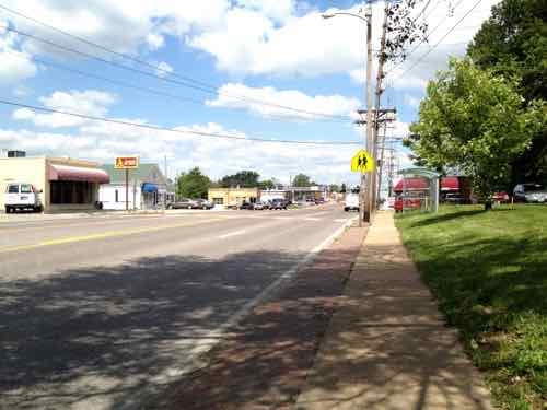
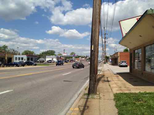
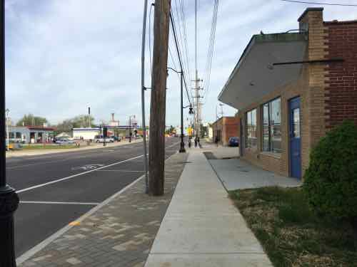
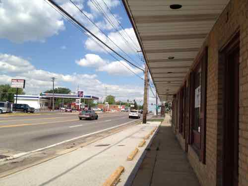
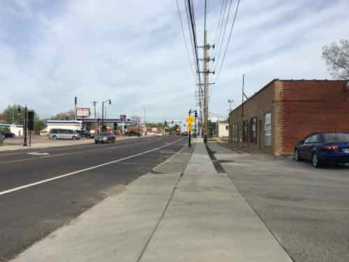
The Hodiamont line ran in exclusive right-of-way between Vandeventer to near the Western city limits, otherwise it ran on rail imbedded in the streets.

Looking East on the last eastern section of the Hodiamont Right-of-Way, 2012
1966 photo of the Hodiamont streetcar at the Wellston Loop. Source: Ancestry.com -- click image to view
1966 photo of the Hodiamont streetcar at the Wellston Loop. Source: Ancestry.com — click image to view

Other cities ended their streetcar lines prior to St. Louis.  For example, Kansas City replaced their last streetcar lime(s) with buses in 1957 (Source). Two week ago today a new modern streetcar line opened in Kansas City — an absence of 59 years. We’ll be in Kansas City for Memorial weekend to ride their new line.

Many incorrectly think streetcars are just about nostalgia. Not true.

Streetcars bring people right to their destination, in a way out light rail in old freight right-of-way can’t. A half century ago the bus was quieter & smoother to the dated streetcar. Today, however, the modern 100% low-floor streetcar is the quieter & smoother choice. Streets with streetcars, trams across the pond, look & function differently. For me it is about how well the public right-of-way functions for all users.

— Steve Patterson


The ‘Great Streets’ Project on Natural Bridge, Part 3

Now sidewalks are generous, pedestrians feel protected from passing vehicles

The last two days I’ve shown you before & after photos of the Great Streets makeover/road diet of Natural Bridge Rd — a 1.7 mile stretch from Lucas & Hunt on the East end to Hanley Rd in the West end (map):

In May 2012 I posted about the upcoming project, see Redeveloping Natural Bridge & The UMSL South MetroLink Station.

Many have said it now looks better, or is prettier.  True, but it functions & feels better — at least for pedestrians in my experience. I’ve also driven the stretch both directions, before and after, but that was on weekends. It also felt better to me as a motorist.

One complaint I received last month is that driving it now can take quite a bit longer. Only two options — either it does take longer or the perception is that it takes longer. I have no method to determine which it is.

The number of traffic signals seems about the same as before, I didn’t tally the number, though that could be done via Google Street View. The major change was reducing the number of driving lanes  per direction from two to one. This freed up a significant amount of the public right-of-way (PROW) for use by pedestrian amenities.

Where such road diets have been performed, the actual number of vehicles through the area, in a given period, remains the same as before. Are there times where it might take longer? No doubt. But any speed that was achieved during the prior decades was at the expense of other users of the PROW.  Before this project vehicles traveled too fast. Two wide lanes per direction made drivers think it was OK.

Posted speed limits have little bearing on vehicle speed — motorists drive at speeds that feel comfortable to them. Give them only one narrow lane per direction and they’ll slow down. However, they can’t pass like they used to. To those who like to race to the next red light, it must be frustrating being behind someone going at or below the posted speed limit.

I plan to return during an afternoon rush hour to see if I can see backups at any of the lights, it’s possible the timing needs to be adjusted.

On the other hand, I received an email from someone who says his significant other walks from home to/from the MetroLink station weekdays — the project is a huge improvement.

While there are some issues I pointed out in the first two parts, the public right-of-way (PROW) is now well-balanced between vehicles & pedestrians. Designing streets that are great for those of us who are disabled also turns out to be great for every pedestrian. Hopefully in the new couple of decades we’ll see new urban infill in the various commercial areas along this stretch.

— Steve Patterson


The ‘Great Streets’ Project on Natural Bridge, Part 2

Natural Bridge received a ‘Great Streets’ road diet and makeover, yesterday I looked at the North side from Lucas & Hunt to Hanley Rd — see Part 1. My May 2012 visit was exactly four years ago today.

In today’s post we’ll look at the South side on the return trip.

At new curb ramp looking from the NE corner South across Natural Bridge
But nothing was changed at the SE corner, the right turn cur off should've been eliminated
But nothing was changed at the SE corner, the right turn cur off should’ve been eliminated
The "ramp" on the side isn't remotely close to being AFA-compliant
The “ramp” on the side isn’t remotely close to being AFA-compliant
Looking West toward Hanley in 2012
And now pedestrians have more room
This was one of the worst areas I encountered in 2012
Now there's parallel street parking. a clear pedestrian path, and room for patio tables
Now there’s parallel street parking. a clear pedestrian path, and room for patio tables
There still isn't a ramp into the building. The owners retired last year, the next person who operates a business here will need to figure out wheelchair access. Click image for article on the closing.
There still isn’t a ramp into the building. The owners retired last year, the next person who operates a business here will need to figure out wheelchair access. Click image for article on the closing.
This is the point where the woman crossed with her child that I showed in yesterday's post
This is the point where the woman crossed with her child that I showed in yesterday’s post
Leave MetroLink for the school across Natural Bridge, the nearest crossing is out of view to the left

Which brings us to the UMSL South MetroLink/MetroBus station. From a 2012 study:

The Station is somewhat remote and largely surrounded by the University. People using Natural Bridge Road – either in cars or on foot – are not able to see the Station from Natural Bridge and vehicular access
is not obvious. As mentioned previously, the Station is also inaccessible from properties immediately east and requires passengers to enter via Natural Bridge and East Drive. Lacking even basic restroom facilities, the Station is very austere and does not encourage riders to linger. Currently, there are 680 parking spaces at the Station and excess parking capacity is the norm. One area resident noted that he “loves the stop because no one knows about it. [He] can pull right up, park, and hop on the train.”

While basic transit connectivity exists via the existence of the UMSL South Station, rider connectivity to Natural Bridge Road and to the east needs to be enhanced to better support the community and Metro ridership. Through development at and around this Station, the Station will achieve greater visibility, and riders will have an increased sense of the built environment and a greater sense of security. (Urban Land Institute, St. Louis)

In my 2012 post I looked at the poor connection to transit from Natural Bridge — an indirect 2/10ths of a mile!

The sidewalk on the east side of UMSL's South Drive will lead you to the light rail station
The sidewalk on the east side of UMSL’s South Drive will lead you to the light rail station
Once visible the most direct path is through an unfriendly park-n-ride lot
The pedestrian route takes an unpleasant circuitous route

Let’s take a look at how this has changed. Sadly, it hasn’t.

The blue star on the left indicates the approximate location of the destination. Able-bodied pedestrians have worn a more direct route but the rest of us must follow the official route to the right
The sidewalk isn't wide enough for one person, has tilted. This was built in 1993 -- was designed to meet the bare minimum
The sidewalk isn’t wide enough for one person, has tilted. This was built in 1993 — was designed to meet the bare minimum
This view is leaving the station looking toward Natural Bridge. The sidewalk should be wider and go off to the right for a direct route to Natural Bridge. The grade isn't the big deal you might be thinking it is
This view is leaving the station looking toward Natural Bridge. The sidewalk should be wider and go off to the right for a direct route to Natural Bridge. The grade isn’t the big deal you might be thinking it is
From Natural Bridge we can see the station and how the grade drops off. Excess soil can be used on the East side of the station
The blue line represents a straight path from station to Natural Bridge. The remaining triangle cam be a pocket p;ark and/or a mixed-use TOD site. Click image to view in Google Maps

The 2012 ULI study totally missed the straightforward opportunity to connect to Natural Bridge. They focused on development of the underutilized site to the East of the station, right above. From the 2012 ULI study:

To create the destination development and a corridor of mixed use, the Panel recommends building a new street from Natural Bridge Road south through the City Hall property. The new street would terminate in an event space due east of the UMSL South Station. The Station would connect to the new development via a pedestrian walkway or bridge. To rebrand the area and create the much-desired sense of place, the area would be named Plank Street Station and would encompass the UMSL South Station, rebranded Plank Street Station. “Plank Street” gives a nod to the history of Natural Bridge road, yet should not bring to mind any existing negative references. Through the use of one brand name for the development area, a new name without existing negative connotations, development and investment in the area might be more easily realized.

The University, MetroLink station, and neighborhood surrounding Plank Street Station would benefit from the development’s amenities and provide additional support for the development. In addition to on-street parking and parking in the existing MetroLink lot, the land north of the existing Station could be utilized for parking for Plank Street Station via a new parking garage. To the south of the new Plank Street, the driving range could become a mix of residential uses and could provide a direct connection to the Station for members Glen Echo Country Club. Within the neighborhood to the east of Plank Street, access to the Plank Street residential area component and the Country Club could be realized via an improved Oakmont Street.

The Plank Street Station entertainment district becomes a critical amenity for the University, attracting and retaining students and professional staff and sheltering its student housing flank and investment.

The ULI wants a pedestrian bridge over the tracks? Why? There is a platform on each side with a walkway between them across the tracks. All that’s needed it to develop the land to the East and connect to the existing Northbound platform.  Ok, let’s look at the Normandy City Hall just East of the MetroLink light rail tracks.

Looking East in 2012, the grade change makes a level of parking under a building(s) worth considering
Now looking West from the other driveway, toward UMSL and MetroLink
A variety of surfaces at different levels in 2012
Much better now
Much better now
At this gas station there is clear physical separation between the public sidewalk and drive for the gas pumps. This is important for maintaining pedestrian space
Back at the new fountain at the circle where Florissant Rd meets Natural Bridge, this commercial district is known as The Wedge
In 2012 the buildings along the South side were fronted by parking, no clear pedestrian sidewalk
Today it's dramatically different! Hoping cafes open so I can return and eat outside
Today it’s dramatically different! Hoping cafes open so I can return and eat outside
Looking East toward Lucas & Hunt, wider sidewalk with trees. What's hard to see in person and it pictures the right rises up higher than the left side
Looking East toward Lucas & Hunt, wider sidewalk with trees. What’s hard to see in person and it pictures the right rises up higher than the left side
Looking back West we see the new lower sidewalk stops short pf the corner, which is already filling with debris. If in a wheelchair on the new/lower section you'd need to return to the split and take the old to reach the corner
Looking back West we see the new lower sidewalk stops short pf the corner, which is already filling with debris. If in a wheelchair on the new/lower section you’d need to return to the split and take the old to reach the corner

Tomorrow I’ll recap, add some additional thoughts, and discuss differing options I’ve received about this project.

— Steve Patterson


The ‘Great Streets’ Project on Natural Bridge, Part 1

In May 2012 I posted about a plan to make a stretch of Natural Bridge in St. Louis County less hostile to pedestrians, see Redeveloping Natural Bridge & The UMSL South MetroLink Station.  Natural Bridge was to become one of East-West Gateway’s “Great Streets Initiative“:

Great Streets are representative of their places. A Great Street reflects the neighborhood through which it passes and has a scale and design appropriate to the character of the abutting properties and land uses.

Great Streets allow people to walk comfortably and safely. The pedestrian environment on, along and near the street is well?designed and well?furnished. The relationship between the street and its adjacent buildings is organic, conducive to walking, and inviting to people.

Great Streets contribute to the economic vitality of the area. Great Streets facilitate the interaction of people and the promotion of commerce. They serve as destinations, not just transportation channels. They are good commercial addresses and provide location value to businesses that power the local economy.

Great Streets are functionally complete. Great Streets support balanced mobility with appropriate provision for safe and convenient travel by all of the ground transportation modes: transit, walking, bicycling, personal motor vehicles and freight movement.

Great Streets provide mobility. Great Streets strike an appropriate balance among the three elements of modern mobility: through travel, local circulation and access. The right balance varies with the function of the street and the character of its neighborhoods and abutting properties.

Great Streets facilitate placemaking. Great Streets incorporate within them places that are memorable and interesting. These may include plazas, pocket parks, attractive intersections and corners, or simply wide sidewalks fostering an active street life.

Great Streets are green. Great Streets provide an attractive and refreshing environment by working with natural systems. They incorporate environmentally sensitive design standards and green development techniques, including generous provision of street trees and other plantings and application of modern storm water management practices. (From Natural Bridge study)

For that 2012 post I traveled about 3.5 miles as a pedestrian in my wheelchair. I started on the North side of Natural Bridge, just East of Lucas & Hunt, traveled Westbound to Hanley, then returned on the South side of Natural Bridge. See map.

Last month, on April 18th, I repeated this journey. Today’s post, part 1, will compare & contrast my experience as a pedestrian from Lucas & Hunt to Hanley Rd. Tomorrow, part 2 will do the same from Hanley back to Lucas & Hunt. Part 3, on Wednesday, will summarize and discuss positive & negative feedback received from readers who use the area on a daily basis.

In my 2012 post I used only 25 of the 382 photos I took, last month I took only 151.

In 2012 the places to cross Natural Bridge were very limited, but that has changed
In 2012 I didn't talk about the historic Pasadena Hills subdivision, or the beautiful entrance marker
In 2012 I didn’t talk about the historic Pasadena Hills subdivision, or the beautiful entrance marker
But I couldn't get past the median -- I had to roll in the Natural Bridge Roadway around this curb!
But I couldn’t get past the median — I had to roll in the Natural Bridge Roadway around this curb!
Now there are no obstacles
In fact, I was able to go through the arch and explore the landscaping maintained by the subdivision.
Approaching Florissant Rd in 2012, the little pedestrian space available was invaded by a vehicle parked on the narrow sidewalk
Now the pedestrian has defined space
In 2012 the intersection of Natural Bridge & Florissant Rd was ugly, confusing to motorists, and a nightmare for pedestrians. It was a non-place.
Now it's still confusing to motorists -- some stop rather than yield -- at the circle. For pedestrians it is now easy and safer to cross. More importantly, it now feels like a real place. I hope to see restaurants open with patio seating.
Now it’s still confusing to motorists — some stop rather than yield — at the circle. For pedestrians it is now easy and safer to cross. More importantly, it now feels like a real place. I hope to see restaurants open with patio seating.
Continuing WB in 2012, sidewalks were narrow. There was no accessible connection to adjacent residential neighborhoods on the right
Now sidewalks are generous, pedestrians feel protected from passing vehicles
Two ramps now provide access to the houses up the hill. This helps those of us in wheelchairs, but also parents pushing strollers or seniors returning home with groceries
At St Ann's Ln I was confused why pedestrians wouldn't automatically get a WALK signal with traffic on Natural Bridge has a green light
At St Ann’s Ln I was confused why pedestrians wouldn’t automatically get a WALK signal with traffic on Natural Bridge has a green light
In 2012 the sidewalk on the bridge over the MetroLink light rail tracks was a narrow tunnel
Now it's still narrow, but just less tunnel-like
Now it’s still narrow, but just less tunnel-like
Just after going over the MetroLink tracks I spotted a woman and child cross Natural Bridge at a point without a crossing
It was a mom walking her child to elementary school, they'd come from the UMSL South MetroLink station
It was a mom walking her child to elementary school, they’d come from the UMSL South MetroLink station
Yes, this project failed to provide a crossing point at a transit hub. D'oh!
Yes, this project failed to provide a crossing point at a transit hub. D’oh!
After walking 2/10ths of a mile to reach Natural Bridge, pedestrians going to/from this school are expected to walk another 2/10th of a mile out of their way to cross at this light
Up at the light we can see extra space for a MetroBus to stop without stopping traffic
Diagonally across the intersection I noticed a child waiting for the walk signal to cross the side street
Unfortunately, he didn't bother pressing to button to get a walk signal to cross Natural Bridge
Unfortunately, he didn’t bother pressing to button to get a walk signal to cross Natural Bridge
Just after the bus stop I saw where a street tree had been run over, did someone try to pass in the bus area?
Next up was another crossing point. Here the median is wide enough to job the pathway o people are less likely to dart out into traffic on the other side
West of UMSL the sidewalks were narrow in 2012
Now the sidewalks are wider and parallel parking exists in this commercial area
In 2012 I was ab;re to get past this building, but it didn't look great
In 2012 I was ab;re to get past this building, but it didn’t look great
Now it looks & functions better
Here's where it became challenging in 2012
Here’s where it became challenging in 2012
And now
And now
In 2012 I had to be up next to this building to continue going west
Now there's more room
Now there’s more room
Looking West toward Hanley Rd, 8519 Natural Bridge was razed between Aug 2012 and September 2014
Like earlier, the sidewalk has switched to the South side of the electric poles.
In 2012 I had to be up against the last building
But this presented issues getting out to the upcoming sidewalk and ramp at Hanley to cross Natural Bridge
No longer an issue
No longer an issue
The actual bus stop is just West of the older bus shelter. The indent of the sidewalk to the right is to give room to load/unload wheelchairs from the bus

Tomorrow will look at the South side of Natural Bridge from Hanley Rd to North & South (map).

— Steve Patterson


A Great Idea I Need To Get Used To: The Zipper Merge

MoDOTI’ve been driving for thirty-three plus years now, considering myself a good driver most of that time. That said, I’ve recently learned the way most of us merge at lane closures contributes to backups. Minnesota has taken the lead to push The Zipper Merge:

The state of Minnesota began openly advertising the zipper merge in the early 2000s, even including its description in the state’s driver’s manual, but the measure didn’t begin to widely catch on until a few years ago, thanks to a state-wide advertising campaign in both traditional and online platforms. Now Washington state has followed suit to encourage zipper merging as the result of highly publicized construction zones, particularly on bridges that connect Seattle to many tech offices (including Microsoft’s campuses) in Bellevue and Redmond. (Arstechnica)

From Minnesota’s Zipper Merge page:

What is a zipper merge?
When a lane is closed in a construction zone, a zipper merge occurs when motorists use both lanes of traffic until reaching the defined merge area, and then alternate in “zipper” fashion into the open lane.

Zipper merge vs. early merge
When most drivers see the first “lane closed ahead” sign in a work zone, they slow too quickly and move to the lane that will continue through the construction area. This driving behavior can lead to unexpected and dangerous lane switching, serious crashes and road rage.

Zipper merging, however, benefits individual drivers as well as the public at large. Research shows that these dangers decrease when motorists use both lanes until reaching the defined merge area and then alternate in “zipper” fashion into the open lane. Watch a brief video of how it works.

So I’m supposed to merge late?
Yes! As you see the “lane closed ahead” sign and traffic backing up, stay in your current lane up to the point of merge. Then take turns with other drivers to safely and smoothly ease into the remaining lane. Don’t worry about being “Minnesota nice.” When traffic is heavy and slow, it is much safer for motorists to remain in their current lane until the point where traffic can orderly take turns merging.

When not to do the zipper merge
When traffic is moving at highway speeds and there are no backups, it makes sense to move sooner to the lane that will remain open through construction. The bottom line is to merge when it is safe to do so.

Benefits

  • Reduces differences in speeds between two lanes
  • Reduces the overall length of traffic backup by as much as 40 percent
  • Reduces congestion on freeway interchanges
  • Creates a sense of fairness and equity that all lanes are moving at the same rate

Ok, so I tend to get into the open lane early when traffic is still moving — as it says I should. But it’s not that simple — from the first article quoted above:

Johnson said that electronic, conditional signs have proven more effective than static ones, and he pointed to a study from 2010 which revealed that 80 percent of Minnesota drivers still considered themselves “early mergers.” An advertising and public outreach campaign followed, and a follow-up study in 2012 showed a massive turnaround in thinking in which 73 percent of respondents thought zipper merging was a good idea after all. (“When we were starting the campaign,” Johnson added, “we worked with an east coast advertising firm who said, ‘Wait, you have people who voluntarily leave a lane?'”)

The zipper’s catch, of course, is that every driver on the road has to be aware of, and believe in, the style of merging before it reaches maximum efficiency. So long as enough drivers don’t fill both lanes or intentionally block the soon-to-end lane in the form of vigilante car justice, the concept still has to contend with confusion, whether from out-of-town travelers or oblivious commuters.

Like so many things — public education is the key to this working smoothly in practice. MoDOT has started to promote the zipper merge in Missouri.

Since Minnesota has been doing this longer they have more videos. The first is rather dry, the second shows how there road  construction signage helps explain this as people are instructed to merge into a single lane.

I also compared the Minnesota driver’s manual to Missouri’s.  The Minnesota manual covers the zipper merge on pages 47-48, Missouri’s makes no mention.

— Steve Patterson


Advertisement


[custom-facebook-feed]

Archives

Categories

Advertisement


Subscribe