Great Streets are representative of their places. A Great Street reflects the neighborhood through which it passes and has a scale and design appropriate to the character of the abutting properties and land uses.
Great Streets allow people to walk comfortably and safely. The pedestrian environment on, along and near the street is well?designed and well?furnished. The relationship between the street and its adjacent buildings is organic, conducive to walking, and inviting to people.
Great Streets contribute to the economic vitality of the area. Great Streets facilitate the interaction of people and the promotion of commerce. They serve as destinations, not just transportation channels. They are good commercial addresses and provide location value to businesses that power the local economy.
Great Streets are functionally complete. Great Streets support balanced mobility with appropriate provision for safe and convenient travel by all of the ground transportation modes: transit, walking, bicycling, personal motor vehicles and freight movement.
Great Streets provide mobility. Great Streets strike an appropriate balance among the three elements of modern mobility: through travel, local circulation and access. The right balance varies with the function of the street and the character of its neighborhoods and abutting properties.
Great Streets facilitate placemaking. Great Streets incorporate within them places that are memorable and interesting. These may include plazas, pocket parks, attractive intersections and corners, or simply wide sidewalks fostering an active street life.
Great Streets are green. Great Streets provide an attractive and refreshing environment by working with natural systems. They incorporate environmentally sensitive design standards and green development techniques, including generous provision of street trees and other plantings and application of modern storm water management practices. (From Natural Bridge study)
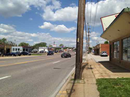
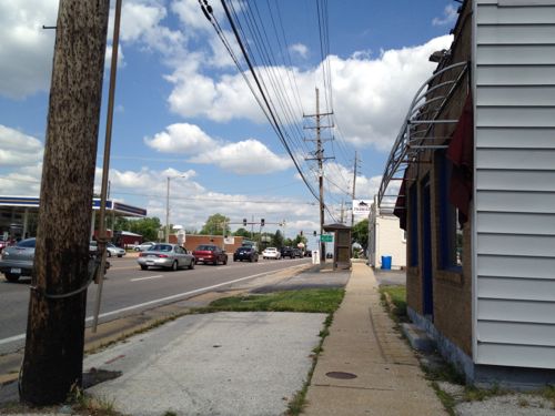
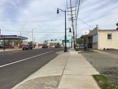
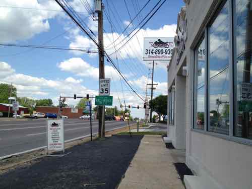
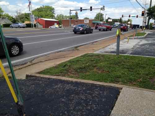
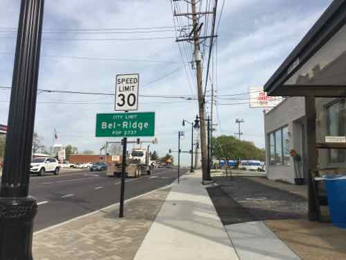
For that 2012 post I traveled about 3.5 miles as a pedestrian in my wheelchair. I started on the North side of Natural Bridge, just East of Lucas & Hunt, traveled Westbound to Hanley, then returned on the South side of Natural Bridge. See map.
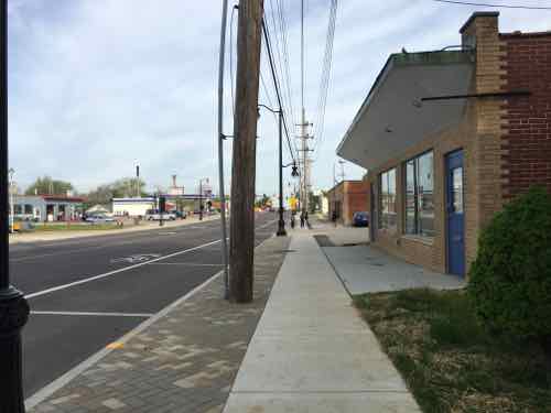
Last month, on April 18th, I repeated this journey. Today’s post, part 1, will compare & contrast my experience as a pedestrian from Lucas & Hunt to Hanley Rd. Tomorrow, part 2 will do the same from Hanley back to Lucas & Hunt. Part 3, on Wednesday, will summarize and discuss positive & negative feedback received from readers who use the area on a daily basis.
In my 2012 post I used only 25 of the 382 photos I took, last month I took only 151.
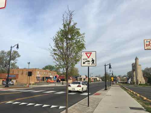
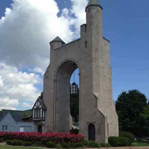
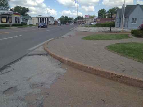
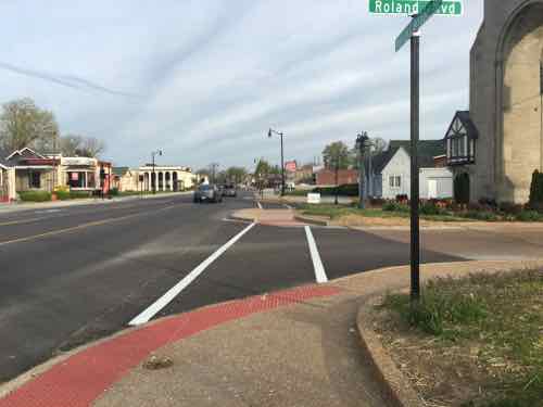
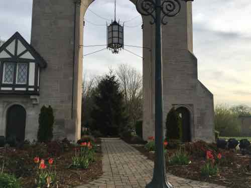
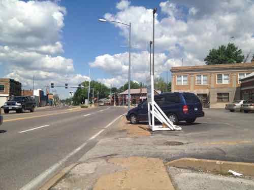
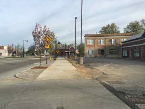
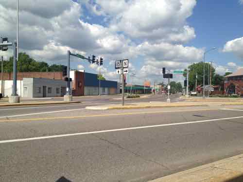
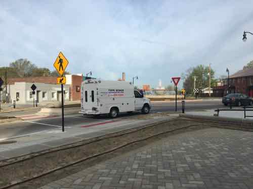
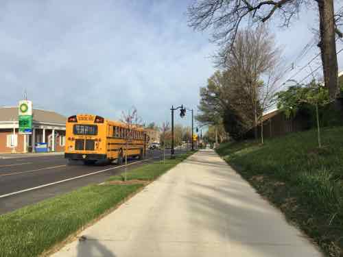
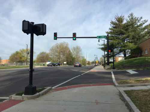
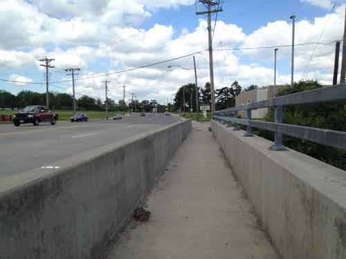
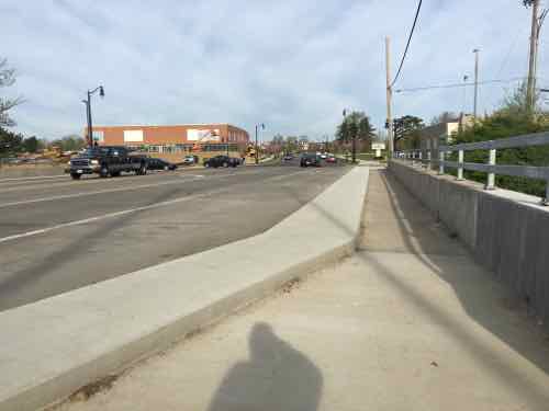
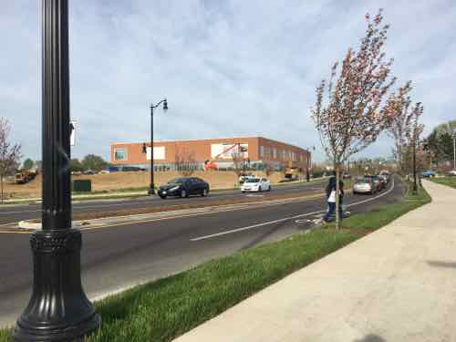
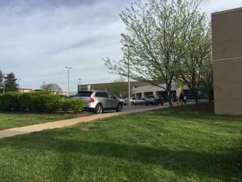
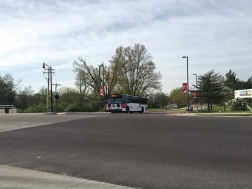
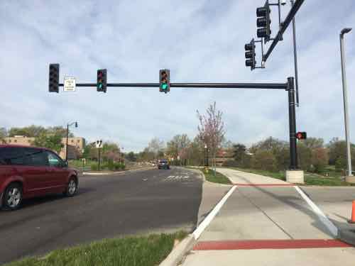
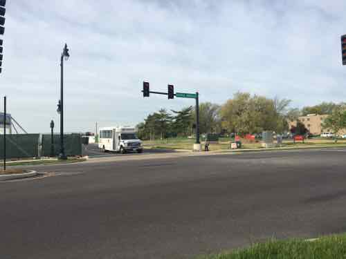
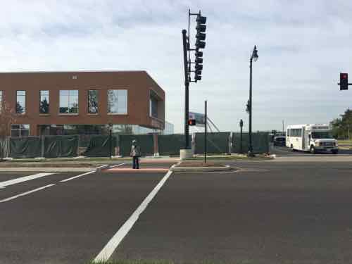
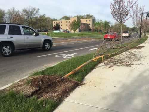
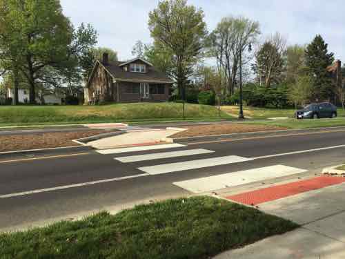
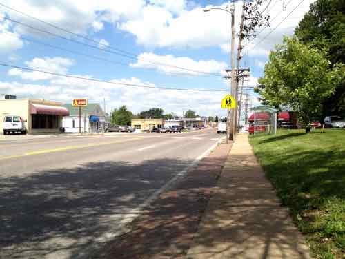
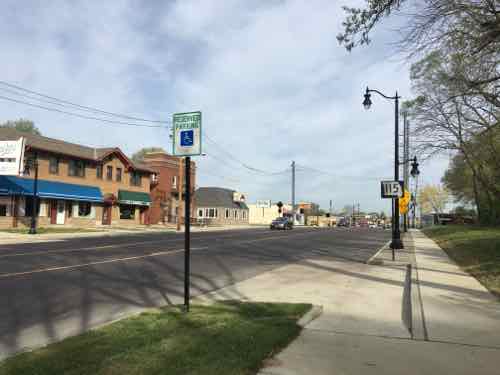
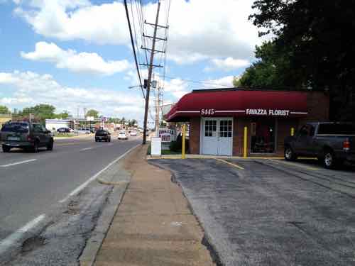
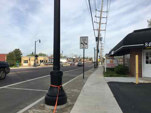
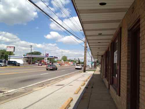
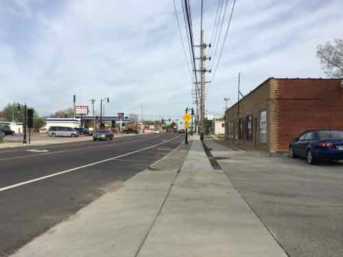
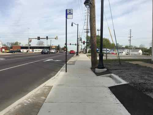
In 2012 the places to cross Natural Bridge were very limited, but that has changedIn 2012 I didn’t talk about the historic Pasadena Hills subdivision, or the beautiful entrance markerBut I couldn’t get past the median — I had to roll in the Natural Bridge Roadway around this curb!Now there are no obstaclesIn fact, I was able to go through the arch and explore the landscaping maintained by the subdivision.Approaching Florissant Rd in 2012, the little pedestrian space available was invaded by a vehicle parked on the narrow sidewalkNow the pedestrian has defined spaceIn 2012 the intersection of Natural Bridge & Florissant Rd was ugly, confusing to motorists, and a nightmare for pedestrians. It was a non-place.Now it’s still confusing to motorists — some stop rather than yield — at the circle. For pedestrians it is now easy and safer to cross. More importantly, it now feels like a real place. I hope to see restaurants open with patio seating.Continuing WB in 2012, sidewalks were narrow. There was no accessible connection to adjacent residential neighborhoods on the rightNow sidewalks are generous, pedestrians feel protected from passing vehiclesTwo ramps now provide access to the houses up the hill. This helps those of us in wheelchairs, but also parents pushing strollers or seniors returning home with groceriesAt St Ann’s Ln I was confused why pedestrians wouldn’t automatically get a WALK signal with traffic on Natural Bridge has a green lightIn 2012 the sidewalk on the bridge over the MetroLink light rail tracks was a narrow tunnelNow it’s still narrow, but just less tunnel-likeJust after going over the MetroLink tracks I spotted a woman and child cross Natural Bridge at a point without a crossingIt was a mom walking her child to elementary school, they’d come from the UMSL South MetroLink stationYes, this project failed to provide a crossing point at a transit hub. D’oh!After walking 2/10ths of a mile to reach Natural Bridge, pedestrians going to/from this school are expected to walk another 2/10th of a mile out of their way to cross at this lightUp at the light we can see extra space for a MetroBus to stop without stopping trafficDiagonally across the intersection I noticed a child waiting for the walk signal to cross the side streetUnfortunately, he didn’t bother pressing to button to get a walk signal to cross Natural BridgeJust after the bus stop I saw where a street tree had been run over, did someone try to pass in the bus area?Next up was another crossing point. Here the median is wide enough to job the pathway o people are less likely to dart out into traffic on the other sideWest of UMSL the sidewalks were narrow in 2012Now the sidewalks are wider and parallel parking exists in this commercial areaIn 2012 I was ab;re to get past this building, but it didn’t look greatNow it looks & functions betterHere’s where it became challenging in 2012And nowIn 2012 I had to be up next to this building to continue going westNow there’s more roomLooking West toward Hanley Rd, 8519 Natural Bridge was razed between Aug 2012 and September 2014Like earlier, the sidewalk has switched to the South side of the electric poles.In 2012 I had to be up against the last buildingBut this presented issues getting out to the upcoming sidewalk and ramp at Hanley to cross Natural BridgeNo longer an issueThe actual bus stop is just West of the older bus shelter. The indent of the sidewalk to the right is to give room to load/unload wheelchairs from the bus
Tomorrow will look at the South side of Natural Bridge from Hanley Rd to North & South (map).
Build it and they will come?! Yes, this is prettier, nicer smoother and more connected. But out of ALL of your photos, I see two, repeat two, pedestrians, and one is NOT even using the new infrastructure correctly! As with ANY public works project, we need to do a better job at looking at not just what was spent, but what was the return on that investment? We have limited dollars. Getting things 95%-99% right, here, at great expense, may create a great benchmark, but how does it help with all the other crappy infrastructure that gets nothing, because all the dollars that were spent here?! For, apparently, very few actual users?!
There were pedestrians I met along the way, I even talked to tourists at the subdivision entry — only one spoke English. The return on investment with such a project can’t be measured in the months following completion.
I last emailed you in April and to date have not heard from you.
It looks like you made the trip along NB again, but only seeing this situation through the eyes of a pedestrian. This view does not reflect the reality of the traffic situation.
Here is part of my email from April to refresh your memory.
Many were in favor of reducing the number of lanes on Natural Bridge between Hanley and Lucas and Hunt. I was not. I would rather have seen a “gentle” upgrade of street lights and plantings without reducing lanes. I live in Bel-Nor and my transportation life has become a nightmare. Previously, my trip home from work was enjoyable. The four lanes from Hanley to UMSL were low traffic areas and I was able to quickly get home ~ one mile. NOW, there are huge traffic jams and to go less than one mile can take as long as 15 minutes. I frequently have to wait four lights on Hanley to turn east onto NB where I encounter traffic backed up from UMSL to Hanley where it crawls toward UMSL and the entrance to Bel-Nor. I spoke with MO-DOT where they continued to tell me that it wasn’t finished yet and that it would be GREAT. IT IS NOT. The other day, for the first time, I was traveling east on NB towards Hanley with hot pizza in hand when again I was met with a horrendous traffic jam. It took me around 15 minutes to reach Hanley and doesn’t include the traffic backup once Hanley is crossed. Pizza cold by time I got home. NOT A HAPPY CAMPER.
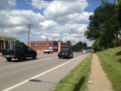
This change is supposed to increase walking traffic except there are few places to walk from UMSL west on Hanley unless current businesses are evicted. They include Traffic Law Center, a tax preparation service, a Realty Net office, and the new University Textbooks on the north side. Street Rides left and was replaced by Ali Babba Imports, not a business I would have considered valuable to the area. On the south side there is a beauty supply place, the Oasis Restaurant, a hair salon, Village of Bel-Nor/Police Dept, Breakaway Cafe, Asadorian Rug Company, Coldwell Banker office, Freidhoff Auto Repair, car wash and gas station. Again, these are not destination places.
I have seen more car accidents than before. One car was turned over (going east on NB), 2 weeks later, a westbound car took out one of the trees between West and Bellerive entrance. Both blocked traffic.
With UMSL putting up more buildings and wooing more students, I see only additional traffic problems. For me, this “upgrade” is a failure. NB could have been brought up to code and beautified without removing functionality.
After having lived with this now through the summer I can only say that it has gotten worse. Whenever classes change, traffic is bad. I now cut through UMSL from Florissant Rd since there is “0” (zero) traffic. I cross over NB into the Village of Bel-Nor from West Drive and have almost been hit twice with cars turning left from Clearview onto NB.
The crosswalks with the urns and flea market balls on them protrude so far into the intersection that cars are forced to intrude into oncoming traffic before they can turn. It prevents cars from turning left at the same time or they will collide. Another failed design.
I cannot say that I have seen more walkers than before.
Parallel parking in front of the Oasis is a safety hazard. I can’t imagine stopping traffic while I try to park. I believe the previous pull-in type was a better fit.
It looks like the County is taking care of the plants, many of which look like weeds.
I would rather have spent the money on road repairs (UMSL’s are terrible, NB, Florissant Rd, Hanley, and others).
The one bright spot to all of this is the Oasis Restaurant which has received very good reviews from Bel-Nor residents and I could easily see it being the quintessential neighborhood gathering spot. They have Greek food as well as the usual American food.
You can beautify a pig by putting lipstick on it, but, it’s still a pig. I see reduced NB function as the pig, the streetlights are the lipstick. Now, if they had left functionality and added streetlights and “gentle” beautification, we could have had a Beauty Queen.
My comments had nothing to do with cars, they were directed at how our limited resources (allocated to pedestrian infrastructure) are being spent (and, potentially, misspent). We can either spend a LOT in a few “special” areas (like here) OR we can focus on fixing the myriad missing links on our pedestrian travel paths, everything from no sidewalk (at all), no curb ramps, damaged and failing paving (where there currently ARE sidewalks in place) to a serious lack of enforcement of the laws related to pedestrians (aka spending a little in a lot of places). Steve posted more than three dozen photos of a multi-million dollar investment. What have we actually gained? Are more pedestrians being attracted to the area? Are businesses seeing a growth in sales? I have no quarrel with how the project looks or functions, I’m just questioning if this is the best way to spend “nearly 13 million dollars”* in less than 3 miles when there are many, many, many less-glamorous needs across our region? *http://www.modot.org/stlouis/major_projects/NaturalBridgeGreatStreetsProject.htm
It’s nice they are improving the pedestrian experience. The trouble with their target area is that the neighborhoods bordering this length of Natural Bridge are laid out in suburban fashion and not geared to density or walking. Bellerive Acres requires a lot size of a 1/3 of an acre and parking for 4 cars if you want to build a new house. They aren’t walking far.
Don’t get me wrong, these are all nice communities along this route, well built homes, but completely car orientated.
Trying to make this area a Great Street is an uphill battle right from the start. There are some good features along this route, but probably not enough to overcome the inherent flaws of how the surrounding housing relates to Natural Bridge.
What we’re seeing is a good example of “Retrofitting Suburbia” — improving the main arterial road so it’ll support pedestrians, transit, and denser development — while leaving existing neighborhoods unchanged. This is how we’ll improve our suburbs — especially older inner-ring suburbs. Watch https://www.ted.com/talks/ellen_dunham_jones_retrofitting_suburbia?language=en
They’ll never had core density levels — and that’s ok. Over the next couple of decades new multi-story buildings can replace low-density auto-centric structures to add density.
The problem is there isn’t a land use commitment on the part of the muni’s to encourage density or pedestrian friendly environments, at least I couldn’t find any going through the Great Street pdf file several times.
It is like the St. Louis sustainability plan the the city signed off on which claims wanting to enhance transit blah, blah blah and yet Paul McKee offers up autocentric projects without a peep from the city.
Government officials are experts are writing down the right words for public consumption, but when it comes to actually accomplishing anything, the results are few.
Same goes with the Great Street project. The sidewalks are what they should be without the Great Street initiative, other than that they may restripe the roads, but the section of Great Streets on Natural Bridge is unlikely to advance much further without a major changes in policy making.
In the TED talk her initial before and after retrofit photos show enormous changes in the buildings and their relationship to the street. The Belmar project in Denver she mentions also was a huge rebuild, in fact she separates road upgrades from rebuilding.
The rebuilding of environments for pedestrians and transit is the exact point regional leadership falls flat on its face. (again see McKee above for an example of this failure).
She ends on calling for systematic changes throughout the environment. This is the other place the region fails. it seems St. Louis does little more than offer a endless stream of fragmented projects that largely abandon relationships even to nearby environments.
AARP Livibility Index
The Livability Index scores neighborhoods and communities across the U.S. for the services and amenities that impact your life the most
Built St. Louis
historic architecture of St. Louis, Missouri – mourning the losses, celebrating the survivors.
Geo St. Louis
a guide to geospatial data about the City of St. Louis
Build it and they will come?! Yes, this is prettier, nicer smoother and more connected. But out of ALL of your photos, I see two, repeat two, pedestrians, and one is NOT even using the new infrastructure correctly! As with ANY public works project, we need to do a better job at looking at not just what was spent, but what was the return on that investment? We have limited dollars. Getting things 95%-99% right, here, at great expense, may create a great benchmark, but how does it help with all the other crappy infrastructure that gets nothing, because all the dollars that were spent here?! For, apparently, very few actual users?!
There were pedestrians I met along the way, I even talked to tourists at the subdivision entry — only one spoke English. The return on investment with such a project can’t be measured in the months following completion.
There is always traffic on Natural Bridge. UMSL is right there, lots of businesses, schools, plus residential.
I last emailed you in April and to date have not heard from you.
It looks like you made the trip along NB again, but only seeing this situation through the eyes of a pedestrian. This view does not reflect the reality of the traffic situation.
Here is part of my email from April to refresh your memory.
Many were in favor of reducing the number of lanes on Natural Bridge between Hanley and Lucas and Hunt. I was not. I would rather have seen a “gentle” upgrade of street lights and plantings without reducing lanes. I live in Bel-Nor and my transportation life has become a nightmare. Previously, my trip home from work was enjoyable. The four lanes from Hanley to UMSL were low traffic areas and I was able to quickly get home ~ one mile. NOW, there are huge traffic jams and to go less than one mile can take as long as 15 minutes. I frequently have to wait four lights on Hanley to turn east onto NB where I encounter traffic backed up from UMSL to Hanley where it crawls toward UMSL and the entrance to Bel-Nor. I spoke with MO-DOT where they continued to tell me that it wasn’t finished yet and that it would be GREAT. IT IS NOT. The other day, for the first time, I was traveling east on NB towards Hanley with hot pizza in hand when again I was met with a horrendous traffic jam. It took me around 15 minutes to reach Hanley and doesn’t include the traffic backup once Hanley is crossed. Pizza cold by time I got home. NOT A HAPPY CAMPER.
This change is supposed to increase walking traffic except there are few places to walk from UMSL west on Hanley unless current businesses are evicted. They include Traffic Law Center, a tax preparation service, a Realty Net office, and the new University Textbooks on the north side. Street Rides left and was replaced by Ali Babba Imports, not a business I would have considered valuable to the area. On the south side there is a beauty supply place, the Oasis Restaurant, a hair salon, Village of Bel-Nor/Police Dept, Breakaway Cafe, Asadorian Rug Company, Coldwell Banker office, Freidhoff Auto Repair, car wash and gas station. Again, these are not destination places.
I have seen more car accidents than before. One car was turned over (going east on NB), 2 weeks later, a westbound car took out one of the trees between West and Bellerive entrance. Both blocked traffic.
With UMSL putting up more buildings and wooing more students, I see only additional traffic problems. For me, this “upgrade” is a failure. NB could have been brought up to code and beautified without removing functionality.
After having lived with this now through the summer I can only say that it has gotten worse. Whenever classes change, traffic is bad. I now cut through UMSL from Florissant Rd since there is “0” (zero) traffic. I cross over NB into the Village of Bel-Nor from West Drive and have almost been hit twice with cars turning left from Clearview onto NB.
The crosswalks with the urns and flea market balls on them protrude so far into the intersection that cars are forced to intrude into oncoming traffic before they can turn. It prevents cars from turning left at the same time or they will collide. Another failed design.
I cannot say that I have seen more walkers than before.
Parallel parking in front of the Oasis is a safety hazard. I can’t imagine stopping traffic while I try to park. I believe the previous pull-in type was a better fit.
It looks like the County is taking care of the plants, many of which look like weeds.
I would rather have spent the money on road repairs (UMSL’s are terrible, NB, Florissant Rd, Hanley, and others).
The one bright spot to all of this is the Oasis Restaurant which has received very good reviews from Bel-Nor residents and I could easily see it being the quintessential neighborhood gathering spot. They have Greek food as well as the usual American food.
You can beautify a pig by putting lipstick on it, but, it’s still a pig. I see reduced NB function as the pig, the streetlights are the lipstick. Now, if they had left functionality and added streetlights and “gentle” beautification, we could have had a Beauty Queen.
Someone please think of the cars!
My comments had nothing to do with cars, they were directed at how our limited resources (allocated to pedestrian infrastructure) are being spent (and, potentially, misspent). We can either spend a LOT in a few “special” areas (like here) OR we can focus on fixing the myriad missing links on our pedestrian travel paths, everything from no sidewalk (at all), no curb ramps, damaged and failing paving (where there currently ARE sidewalks in place) to a serious lack of enforcement of the laws related to pedestrians (aka spending a little in a lot of places). Steve posted more than three dozen photos of a multi-million dollar investment. What have we actually gained? Are more pedestrians being attracted to the area? Are businesses seeing a growth in sales? I have no quarrel with how the project looks or functions, I’m just questioning if this is the best way to spend “nearly 13 million dollars”* in less than 3 miles when there are many, many, many less-glamorous needs across our region? *http://www.modot.org/stlouis/major_projects/NaturalBridgeGreatStreetsProject.htm
It’s nice they are improving the pedestrian experience. The trouble with their target area is that the neighborhoods bordering this length of Natural Bridge are laid out in suburban fashion and not geared to density or walking. Bellerive Acres requires a lot size of a 1/3 of an acre and parking for 4 cars if you want to build a new house. They aren’t walking far.
Don’t get me wrong, these are all nice communities along this route, well built homes, but completely car orientated.
Trying to make this area a Great Street is an uphill battle right from the start. There are some good features along this route, but probably not enough to overcome the inherent flaws of how the surrounding housing relates to Natural Bridge.
What we’re seeing is a good example of “Retrofitting Suburbia” — improving the main arterial road so it’ll support pedestrians, transit, and denser development — while leaving existing neighborhoods unchanged. This is how we’ll improve our suburbs — especially older inner-ring suburbs. Watch https://www.ted.com/talks/ellen_dunham_jones_retrofitting_suburbia?language=en
They’ll never had core density levels — and that’s ok. Over the next couple of decades new multi-story buildings can replace low-density auto-centric structures to add density.
The problem is there isn’t a land use commitment on the part of the muni’s to encourage density or pedestrian friendly environments, at least I couldn’t find any going through the Great Street pdf file several times.
It is like the St. Louis sustainability plan the the city signed off on which claims wanting to enhance transit blah, blah blah and yet Paul McKee offers up autocentric projects without a peep from the city.
Government officials are experts are writing down the right words for public consumption, but when it comes to actually accomplishing anything, the results are few.
Same goes with the Great Street project. The sidewalks are what they should be without the Great Street initiative, other than that they may restripe the roads, but the section of Great Streets on Natural Bridge is unlikely to advance much further without a major changes in policy making.
In the TED talk her initial before and after retrofit photos show enormous changes in the buildings and their relationship to the street. The Belmar project in Denver she mentions also was a huge rebuild, in fact she separates road upgrades from rebuilding.
The rebuilding of environments for pedestrians and transit is the exact point regional leadership falls flat on its face. (again see McKee above for an example of this failure).
She ends on calling for systematic changes throughout the environment. This is the other place the region fails. it seems St. Louis does little more than offer a endless stream of fragmented projects that largely abandon relationships even to nearby environments.