The ‘Great Streets’ Project on Natural Bridge, Part 2
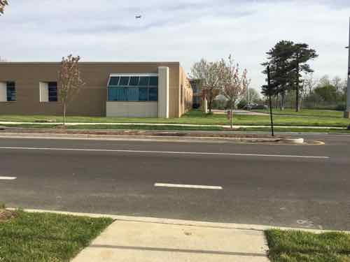
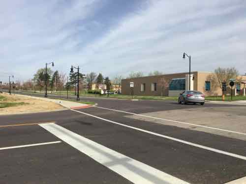
Natural Bridge received a ‘Great Streets’ road diet and makeover, yesterday I looked at the North side from Lucas & Hunt to Hanley Rd — see Part 1. My May 2012 visit was exactly four years ago today.
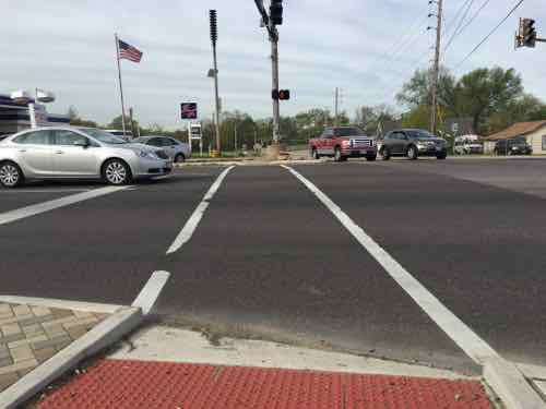
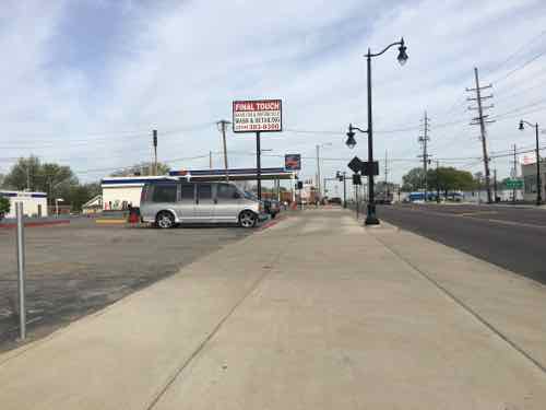
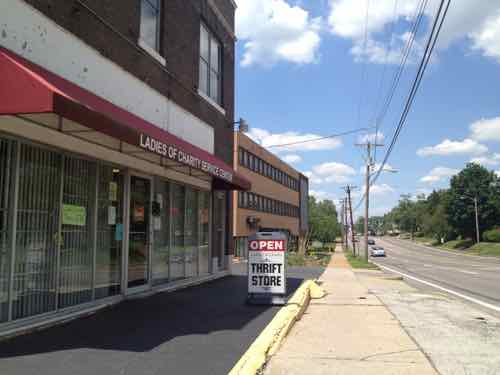
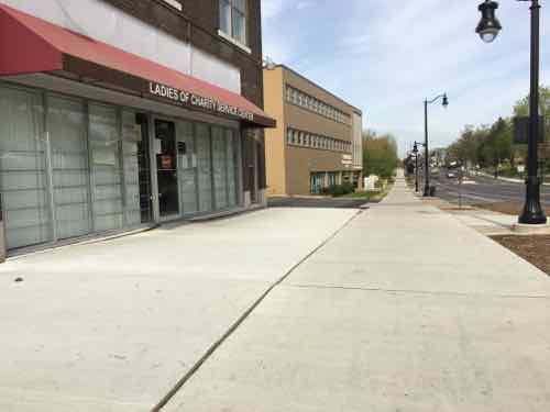
In today’s post we’ll look at the South side on the return trip.
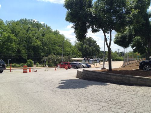
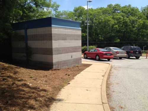
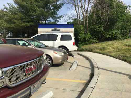
Which brings us to the UMSL South MetroLink/MetroBus station. From a 2012 study:
The Station is somewhat remote and largely surrounded by the University. People using Natural Bridge Road – either in cars or on foot – are not able to see the Station from Natural Bridge and vehicular access
is not obvious. As mentioned previously, the Station is also inaccessible from properties immediately east and requires passengers to enter via Natural Bridge and East Drive. Lacking even basic restroom facilities, the Station is very austere and does not encourage riders to linger. Currently, there are 680 parking spaces at the Station and excess parking capacity is the norm. One area resident noted that he “loves the stop because no one knows about it. [He] can pull right up, park, and hop on the train.”While basic transit connectivity exists via the existence of the UMSL South Station, rider connectivity to Natural Bridge Road and to the east needs to be enhanced to better support the community and Metro ridership. Through development at and around this Station, the Station will achieve greater visibility, and riders will have an increased sense of the built environment and a greater sense of security. (Urban Land Institute, St. Louis)
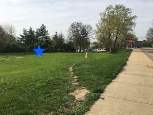
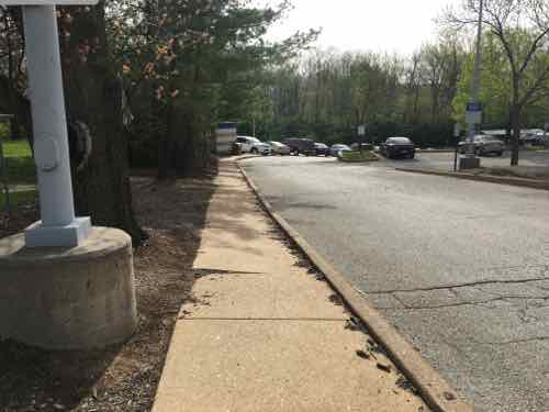
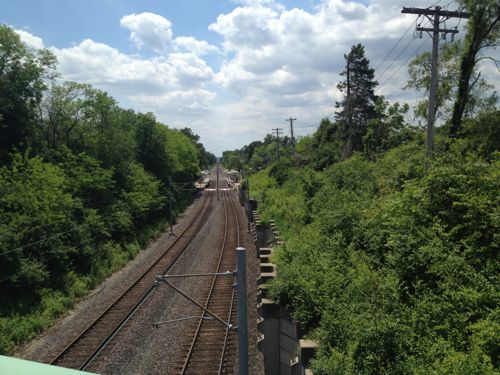
In my 2012 post I looked at the poor connection to transit from Natural Bridge — an indirect 2/10ths of a mile!
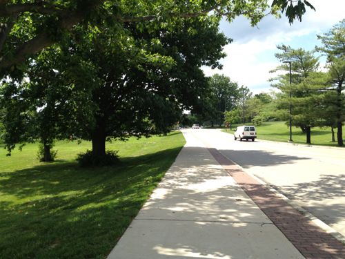
Let’s take a look at how this has changed. Sadly, it hasn’t.
The 2012 ULI study totally missed the straightforward opportunity to connect to Natural Bridge. They focused on development of the underutilized site to the East of the station, right above. From the 2012 ULI study:
To create the destination development and a corridor of mixed use, the Panel recommends building a new street from Natural Bridge Road south through the City Hall property. The new street would terminate in an event space due east of the UMSL South Station. The Station would connect to the new development via a pedestrian walkway or bridge. To rebrand the area and create the much-desired sense of place, the area would be named Plank Street Station and would encompass the UMSL South Station, rebranded Plank Street Station. “Plank Street” gives a nod to the history of Natural Bridge road, yet should not bring to mind any existing negative references. Through the use of one brand name for the development area, a new name without existing negative connotations, development and investment in the area might be more easily realized.
The University, MetroLink station, and neighborhood surrounding Plank Street Station would benefit from the development’s amenities and provide additional support for the development. In addition to on-street parking and parking in the existing MetroLink lot, the land north of the existing Station could be utilized for parking for Plank Street Station via a new parking garage. To the south of the new Plank Street, the driving range could become a mix of residential uses and could provide a direct connection to the Station for members Glen Echo Country Club. Within the neighborhood to the east of Plank Street, access to the Plank Street residential area component and the Country Club could be realized via an improved Oakmont Street.
The Plank Street Station entertainment district becomes a critical amenity for the University, attracting and retaining students and professional staff and sheltering its student housing flank and investment.
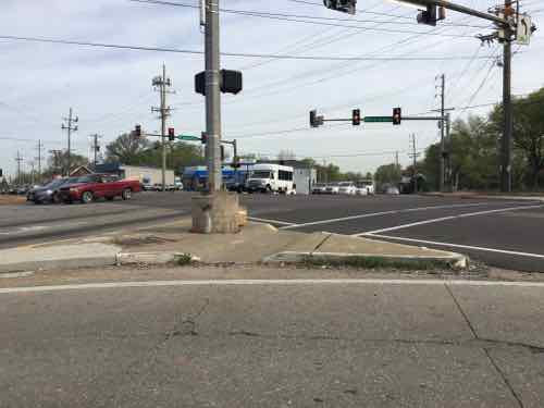
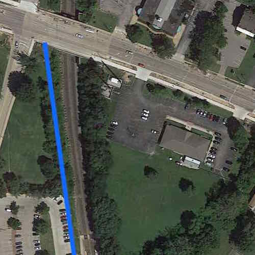
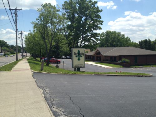
The ULI wants a pedestrian bridge over the tracks? Why? There is a platform on each side with a walkway between them across the tracks. All that’s needed it to develop the land to the East and connect to the existing Northbound platform. Ok, let’s look at the Normandy City Hall just East of the MetroLink light rail tracks.
Tomorrow I’ll recap, add some additional thoughts, and discuss differing options I’ve received about this project.
— Steve Patterson
In the ULI study you quote, they propose some type of development and seem to think the name they gave it, Plank Street, is the most important thing about their discussion.
What really gets me is how the metrolink station is surrounded by parking, almost all metrolink stations are like that. Basically the current South UMSL Metrolink leaves the transit rider and pedestrian in a wasteland. It is over 400 feet to Natural Bridge.
It is not a welcoming environment for the pedestrian using transit. Instead auto driven cars are treated as the priority. They could have put services or a school building with a plaza, or something for students around the metrolink stop that could serve transit users also.
Instead trying to figure out something with existing projects, a Plank Road development proposal is presented that will likely never materialize. Yet clearly money was spent on the south campus while completely ignoring the existence of the metrolink station.
Why was this opportunity ignored?
This same issue goes back to McKee and his autocentric proposals for the Northside,
Establishing a physical environment that supports transit and the pedestrian is an ongoing and pervasive problem in St. Louis.
I just looked again at the Map link you provided above. Basically where the metrolink south station sits, all of that parking to the west should be buildings and the buildings are where the parking should be. Then as a pedestrian and transit user, you walk directly into a pedestrian campus. That type of approach makes pedestrians the priority. Find ways to build a continuous pedestrian experience instead of handing everything to cars.
In thinking about this a little more. Compare what you have at the UMSL south campus to Washington U. or SLU. They both, as many colleges, have dedicated public space to walking. The south campus is completely autocentric, look close and you can hardly walk anywhere without crossing a parking lot or street.
This same attitude of development is being applied by McKee on the North side and many other areas of the city.
The problem with Great Streets is everything else needs to be great too. The UMSL south campus is a huge blow to the walkable environment they claim they want.