Home » Walkability » Recent Articles:

Emerson Park MetroLink Station East St. Louis, Illinois

Yesterday I posted about the challenge of bringing back the area around the 5th & Missouri Station in downtown East St. Louis.Today I’m focusing on the next station to the east on the light rail line: Emerson Park.

Construction on the St. Clair County MetroLink extension from the 5th & Missouri station to the College station in Belleville began in 1998 and opened in May 2001. The extension added eight new stations and seven park-ride lots. The total project cost was $339.2 million, with the FTA and St. Clair County Transit District sharing the burden at 72% ($243.9 million) and 28% ($95.2 million), respectively. Local funding was provided by the St. Clair County Transit District as a result of a 1/2 cent sales tax passed in November 1993.

May 5th marks the 11th anniversary of the Emerson Park station and the area has seen considerable positive change, but planning mistakes were made.

The Good:

New housing, lots of it, has been built and more is under construction now. From last year:

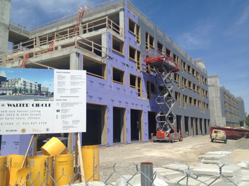
Today marked the groundbreaking of a $17 million development in East St. Louis adjacent to the Emerson Park MetroLink Station, Jazz @ Walter Circle. The $17 million development is a public-private partnership between the East St. Louis Housing Authority (ESLHA), Hampton Roads Ventures and Dudley Ventures, and is the first in the nation to combine public housing development funds from the U.S. Department of Housing and Urban Development with New Market Tax Credits. (NextStopSTL)

This station has seen a steady flow of new construction over the last 11 years.
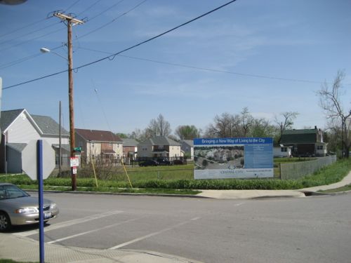
ABOVE: NW corner of Bowman Ave & N 15th St on April 27, 2007, click image for aerial in Google Maps
ABOVE: The same corner 5 years later on April 19, 2012 with Jazz @ Walter Circle under construction. Click image for more information on this project
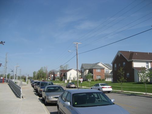
ABOVE: Central City Apartments across Bowman Ave from the Emerson Park Station in April 2007
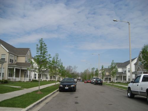
ABOVE': A typical street in the Parsons Place development just notheast of the Emerson Park Station, April 2007
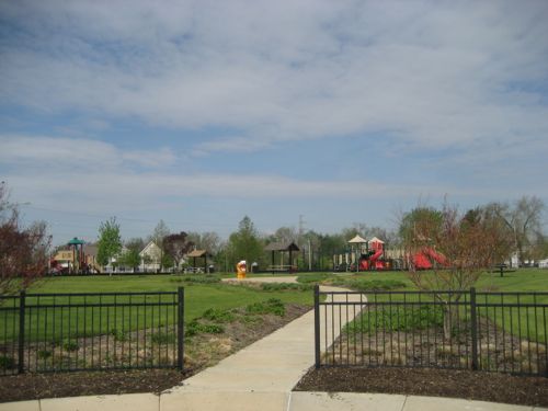
ABOVE: Park in the center of the Parsons Place development

I’m thrilled with how much has been built in the last decade around the Emerson Park Station. The new senior housing over storefronts will be outstanding for this neighborhood.

The Bad:

As you might expect, mistakes have been made in the past and that continues. Where to begin? Parking is a good place, this station has three parking lots with a total of 816 parking spaces! This is the 2nd highest number of spaces at Illinois MetroLink stations, Fairview Heights has the highest with 853 spaces. The parking is divided among three lots — the main lot and two overflow lots.
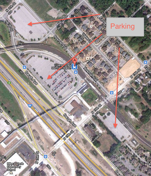
ABOVE: 816 parking spaces divided among three parking lots, click image to view aerial in Google Maps

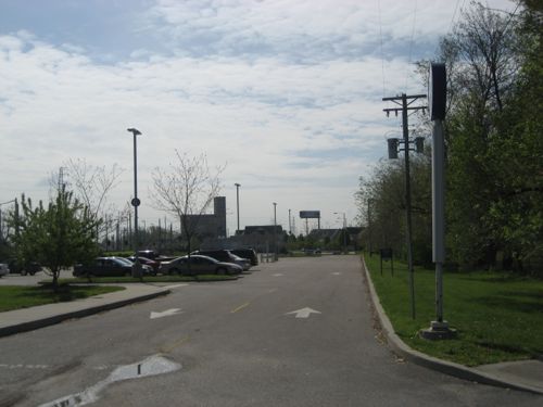
The lot to the far right should go away immediately or at least be significantly reduced in size, it serves as a barrier between the new housing to the east of the station. I first noticed the disconnect when I drove there and walked around in April 2007 before I was disabled.
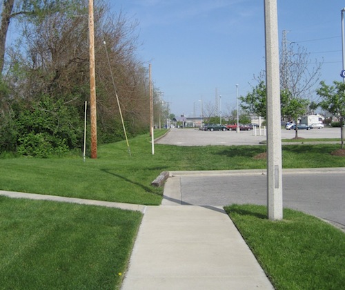
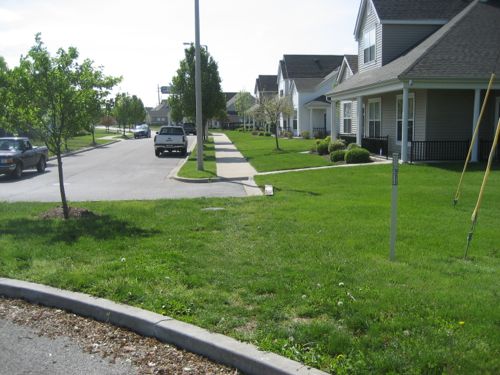
ABOVE: At the end of Parsons Ave looking across the parking lot at the Emerson Park station. Why doesn't the sidewalk continue? April 2007
ABOVE: Same location as viewed from the opposite side, not friendly to pedestrians, difficult pushing a stroller and impossible in a wheelchair. April 2007
ABOVE: Looking toward Parsons Place after leaving the Emerson Park Station. Not exactly inviting. April 2007
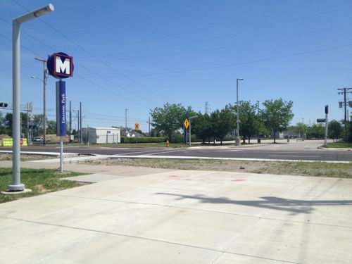
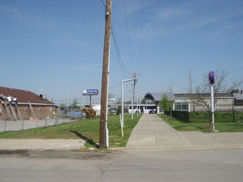
ABOVE: The walkway leaving the station is nice and wide but a newly built crosswalk across N 15th is off to the left rather than a direct line. April 2012
ABOVE: In April 2007 the connection was more direct, but the crosswalk and curb ramp was still indirect
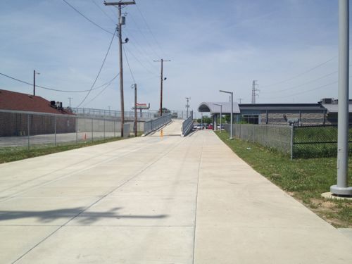
ABOVE: Now the amount of concrete is greater and a new pedestrian bridge takes pedestrians over the interstate. Bleak! Shade trees and seating would have been nice here.

In 2007 this east overflow parking lot had a few cars but on my recent visit it had none. Even if it’s 100% full on days the Cardinals play at home it shouldn’t be allowed to separate the nice newer housing from transit. Huge fail. Who’s fault? No clue, but nobody figured out that a continuous sidewalk would figuratively and literally connect housing to the station.
… Continue Reading


Peabody Opera House Valets Caught Driving On 14th Street Sidewalk

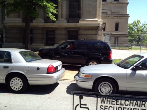
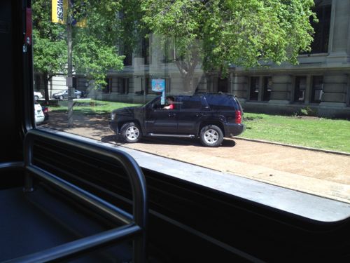
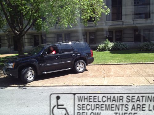
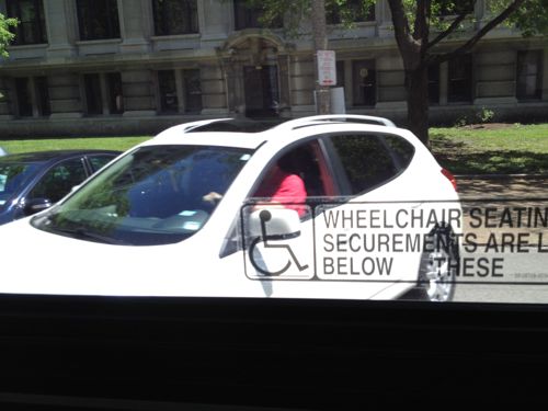
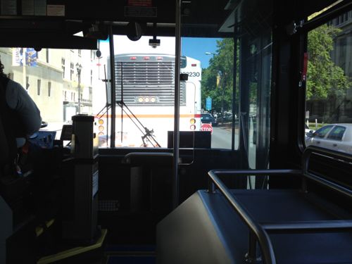
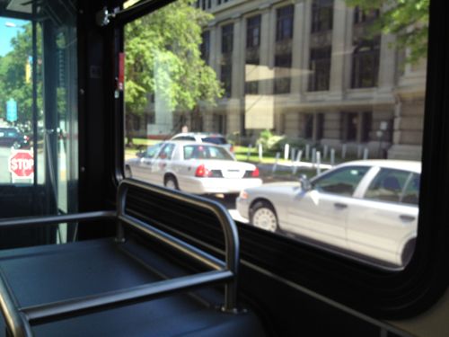
Last Sunday I was heading home on the bus just before 1:30pm in the afternoon. Something big was going on at the Peabody Opera House because traffic was backed up. At first I was happy to see cars weren’t being parked on the east sidewalk along 14th like the previous time I came through the area during an event. But, I was soon shocked — the valets were driving on the sidewalk to park customer’s vehicles diagonally on 14th.  Here are the pictures I got from the bus:

ABOVE: Stopped traffic on 14th, beyond the temporary stop sign you can see cars parked on the road diagonally
ABOVE: Two cars are parked on the road but in the background you can see a vehicle on the sidewalk, it was being driven
ABOVE: I spotted a 2nd vehicle passing the bus on the sidewalk!
ABOVE: Valet about to drive off the sidewalk onto the road
ABOVE: The bus was moving now and we caught up with the sidewalk-driving valets
ABOVE: The 1st vehicle I spotted driving on the sidewalk just after the valet parked it on the road

I posted one of the images to Twitter and Facebook then once home emailed a few to various city officials. I’ll email this post to people at the Peabody. Sidewalks are for pedestrians! They are not overflow parking or private driveways. If I have to sit in my power chair in the middle of that sidewalk  to get this to stop, I will.

– Steve Patterson


Urbanizing A 1980s Suburban Municipality Is A Lengthy Process

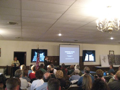
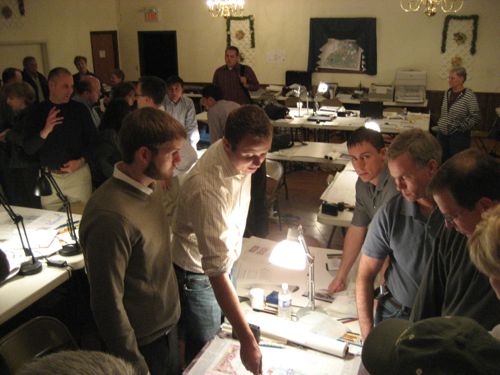
In April 2007 the St. Charles County municipality of Dardenne Prairie held a design charrette led by new urbanist firm DPZ, the goal was to plan a walkable town center.  Dardenne Prairie was incorporated in 1983 and they wanted a town center? Were they crazy? I attended several of the charrette events to observe the process.

ABOVE: Residents at the opening of the charrette in April 2007

Many of the residents attended came ready to oppose anything different than the standard suburbia typical of St. Charles County.

ABOVE: DPZ staff & consultants talking with residents
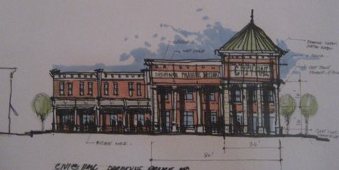
ABOVE: Sketch for a new city hall to replace the trailer they used

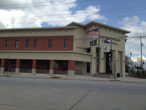
Over the few days I witnessed the local residents buy into the urban/walkable vision. Not urban as in high rise buildings but buildings defining the streets and connected via sidewalks. Urban as in not suburban. In 2009 the city hall was finished but I didn’t get out there until earlier this month.

ABOVE: Dardenne Prairie's city hall, click image for aerial in Google Maps
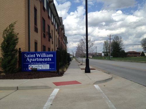
ABOVE: Hanley Rd will soon have on-street parking

When I arrived I briefly chatted with Mayor Pam Fogarty, but I’d arranged to meet my friend Alderman Scott Kolbe for a tour.  Dardenne Prairie has three wards with two aldermen per ward for a total of six. These municipal offices are non-partisan. Buildings near the road and on-street parking are all part of Dardenne Prairie’s new urbanist City Plan.

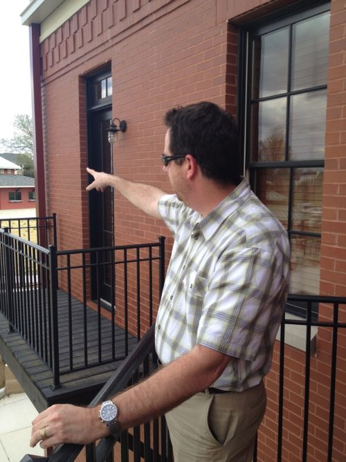
ABOVE: Ald Scott Kolbe talks about the park behind city hall from the mayor's balcony

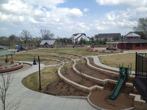
While city hall opened in 2009 the park opened in September 2011.

ABOVE: View of park from the mayor's balcony
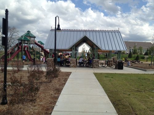
ABOVE: On the weekday afternoon I visited the playground area was filled with kids and their parents

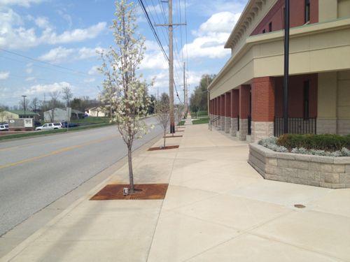
Kolbe tells me residents of the subdivision directly behind the park welcome the activity and encourage people to trespass through their yards to reach the park. I can imagine a paved path in the future. As I left city hall people were walking to city hall. If you connect the dots people will, at least on nice days, walk rather than drive.The sidewalk has to replace the roadside drainage ditch for that to happen. Down the street a senior housing development conforms to the new city plan, built up to the sidewalk with a pedestrian entrance facing the street.

ABOVE:

It will be years before Dardenne Prairie has a complete walkable downtown but they are putting the right pieces in place to make sure each new private development contributes toward the long-term vision. – Steve Patterson


Pedestrian Expert Killed Crossing St. Louis Street A Decade Ago

March 21, 2012 Downtown, Walkability 15 Comments
Susie Stephens

Ten years ago today was a sad day for all of us who fight for pedestrian safety:

ST. LOUIS — A Washington state woman who was one of the country’s top experts on bicycle and pedestrian safety was killed yesterday morning when she was struck by a tour bus while crossing a downtown intersection here.

Susie Stephens, 36, of Winthrop, Wash., was struck shortly after 8:30 a.m.

The driver of the Vandalia Bus Lines vehicle told police he did not see Stephens as he made a left turn.

Stephens, a consultant, was in St. Louis to help stage a conference on innovative approaches to transportation sponsored by the Forest Service, said William “Bill” Wilkinson of the National Center for Bicycling and Walking in Washington. (seattlepi.com)

Susie was a year older than me at the time she was killed:

The Susie Forest is a living, growing, legacy to my daughter Susie and her commitment to creating livable communities. Susie was a bicyclist, an environmentalist, an activist, and a world traveler. She was dedicated to educating others about bicyclist and pedestrian safety, and she was killed in 2002 after being struck by a bus while legally walking across the street in St. Louis. (The Susie Forest)

For details of the accident at 4th & Chestnut click here.

– Steve Patterson


Walkability Impacts Number of Pedestrians Using Sidewalks & Transit

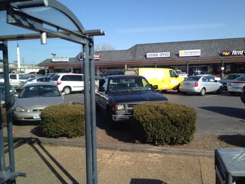
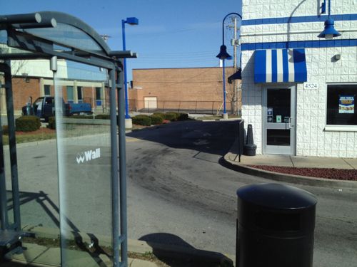
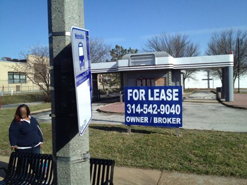
The form our buildings take has a direct connection to the number of pedestrians on the sidewalk: streats lined with urban buildings will see more pedestrians than those with anti-urban buildings (read: suburban). Transit riders are pedestrians on part of their journey, but many of us have no choice but to be pedestrians in unfriendly places where few pedestrians are spotted. On a recent ride on a packed #95 (Kingshighway) MetroBus this became clear.

ABOVE: Car storage separates pedestrians at the bus stop from numerous businesses.
ABOVE: The able-bodied can get inside but not everyone can
ABOVE: Eventually this building will get reused or replaced, but will pedestrians have access?

We don’t design buildings to be used by pedestrians. Sure, some will say there are no pedestrians so why should we? I say there are few pedestrians in many places because that is the result of decades of anti-urban policy.

 – Steve Patterson


Advertisement


[custom-facebook-feed]

Archives

Categories

Advertisement


Subscribe