August 6, 2020Accessibility, Featured, North City, WalkabilityComments Off on Checking Out New Pedestrian Bridge Over I-70 Connecting Old North St. Louis and Near North Riverfront Neighborhoods
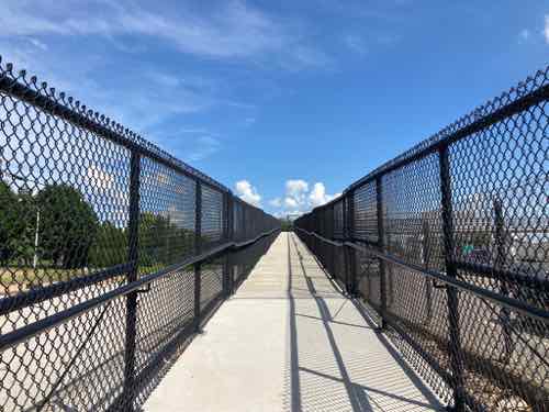
In December 2018 MoDOT temporarily closed I-70 to remove an old pedestrian bridge at North Market Street. A similar pedestrian bridge was removed from over I-44 at Marconi Ave, and at other locations. Yesterday I checked out the new ADA-compliant replacement over I-70.
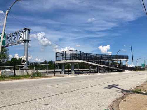
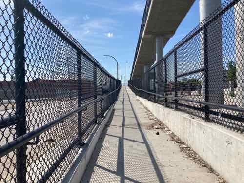
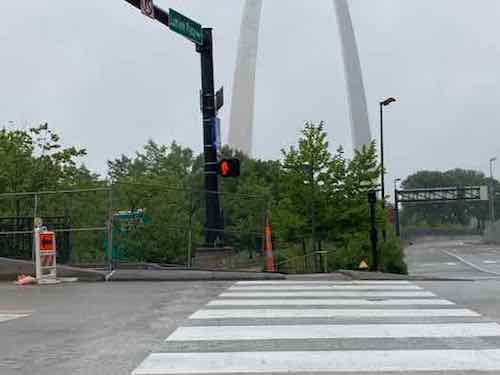
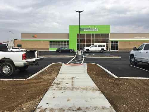
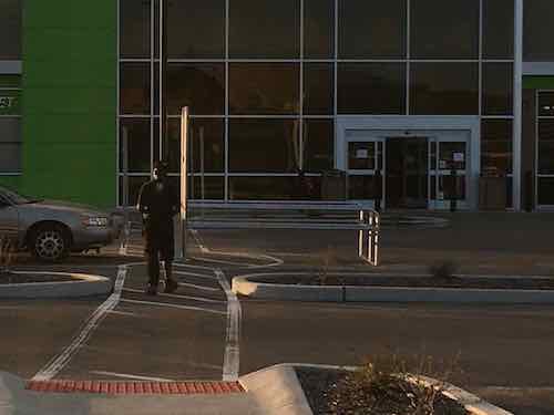
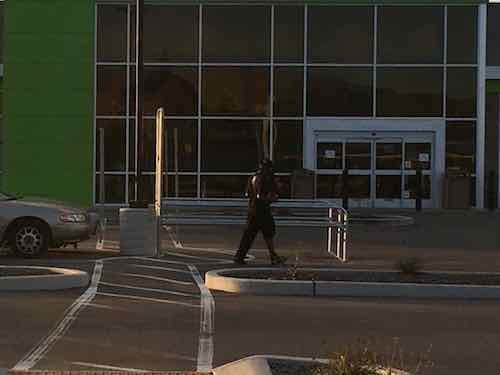
The East side of the new pedestrian bridge, along Northbound 10th Street, has a switchback ramp.
Before getting into the new bridge we should look at what it replaced. Interstate 70 was built decades before the Americans with Disabilities Act of 1990, so the old pedestrian bridge had stairs on each side.
This 2010 photo is from the West side along 11th Street. The stairs on each end went down in opposite directions.
Stairs make such a bridge impossible for those of us who use wheelchairs, but also difficult for people who walk using a cane or walker. They’re also a challenge to a parent pushing a stroller, cyclists, etc.
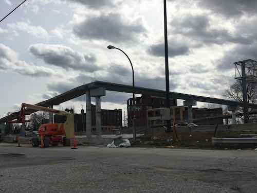
In April 2019 I snapped this image of construction on the new bridge as I was driving by. Yes, I drive too!
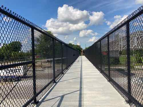
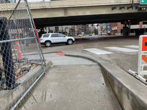
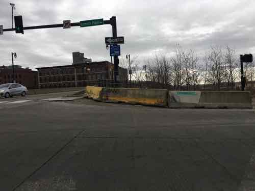
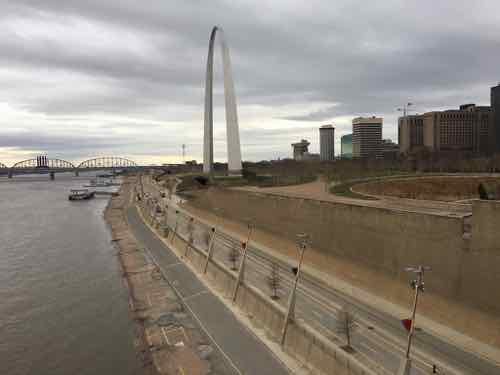
Yesterday’s weather was so nice I decided to check out the completed bridge. It was 1.2 miles just getting there from our apartment near 7th & Cass Ave. I did encounter missing curb ramps in a few places — often missing sidewalks. But I made it.
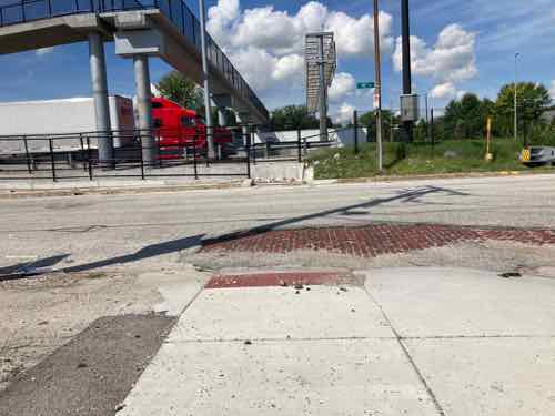
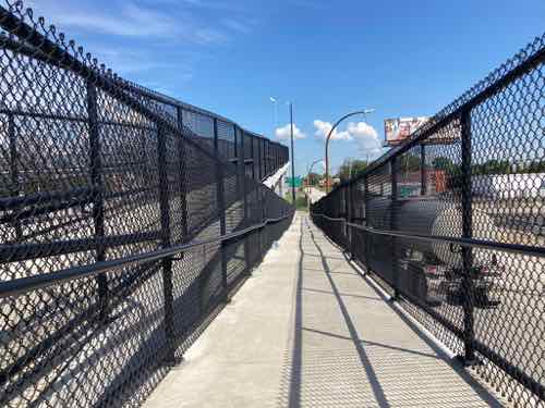
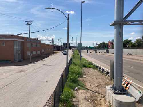
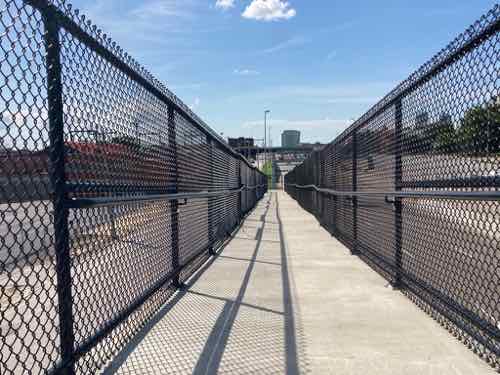
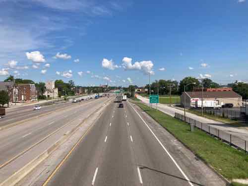
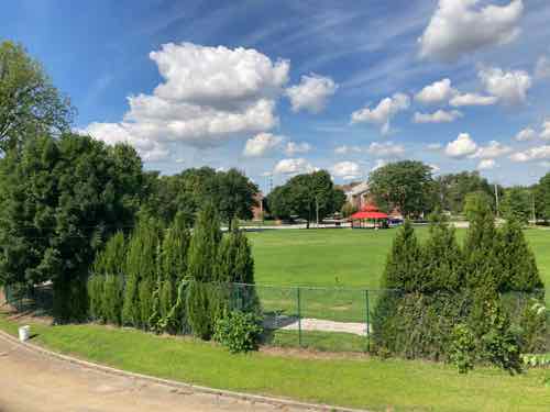
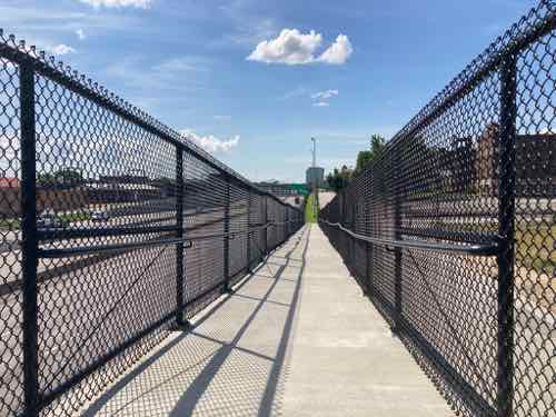
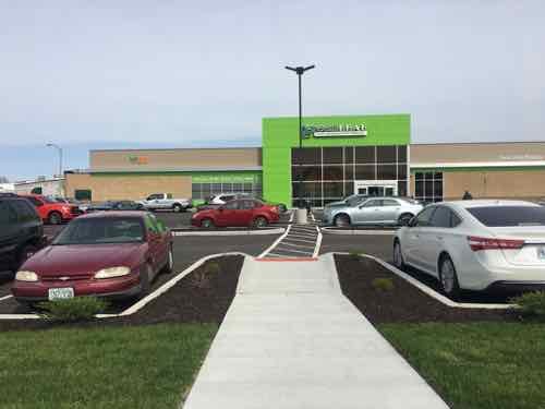
The access point on the East side of I-70 is at North Market Street. There is no painted crosswalk, no signs warning drivers to yield to pedestrians. No curb bulbs to narrow the crossing distance. Nothing. 10th Street traffic is one-way northbound — and it is fast.Once safely across 10th Street you see trash has accumulated. The city has equipment to clean streets but tight spots like this don’t get cleaned.From the base looking up the ramp to the landing. I use a power chair which had no problem with the incline. Being ADA-compliant means the maximum level should be acceptable to person using a manual wheelchair. Every so often there are level spots to give someone s rest.From the landing, looking back down.Looking South from the landingFrom the very top looking back at the landingLooking East at North Market Street from the top.Looking West across the level top of the bridge.Looking North at Northbound I-70.Looking South at Northbound I-70. The switchback ramp can be seen on the left.Looking South at Southbound I-70. The straight ramp on the West side (11th Street) can be seen on the right.From the West end of the bridge you get an excellent view of Jackson Place Park. This was the center of three circles in the original plan of the separate Village of North St. Louis.Looking South down the straight ramp on the West side (11th Street).Looking back up from the bottom.At the bottom you look across 11th Street at Monroe Street. A new curb ramp was built across the street. Like the other side, 11th is one-way and there is no crosswalk markings, signs, etc.Back up toward Jackson Place Park you can get an overview of the West side.
It is nothing fancy, but it gets the job done. Highways divided many neighborhoods, many previously connected streets permanently severed. I have no idea how much this cost, but it was worth every penny. The highway is still an at-grade divider at this point, but the bridge makes it possible for everyone to safely to cross over it.
Once the current pandemic is over I’ll take the bus to other new pedestrian highway bridges so I can compare. Yesterday I explored in Old North, got takeout from Crown Candy, and returned home 3.5 hours after leaving. Roundtrip was about 3 miles.
The renovation of the Arch grounds a few years back greatly improved accessibility for the public. Going from the top of the steps down to the riverfront used to be a major challenge if you were pushing a stroller, or using a wheelchair. New ramps now make it very easy.
But the project accidentally cut off access to the pedestrian walkway on the Eads Bridge, as early as May 2015. This month it was finally rectified, though the solution created another problem.
Looking west heading into St. Louis from the Eads Bridge. May 13, 2020
Let’s do a quick recap of the problem caused when a contractor busted through into the light rail tunnel below.
The earliest I can find the issue on Google Street View is from May 2015, how much earlier it began is uncertain.
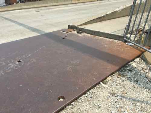
May 7, 2017 is my oldest photo of the problem. This is when I began conversations with various officials about being able to access the pedestrian walkway in my wheelchair.By March 16, 2019 the broken concrete had been removed but the height from steel plate to bridge sidewalk was too much for 99.9% of wheelchairs.
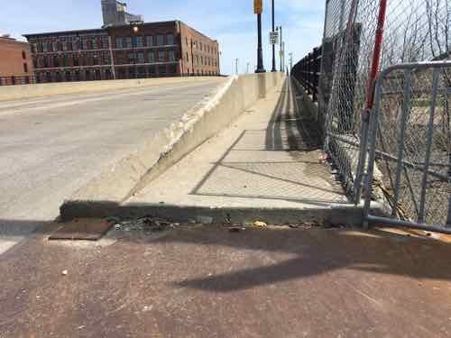
A week ago a friend sent a pic to me showing work happening. Yay, finally! Yesterday I went by to see the result, approaching from the North.
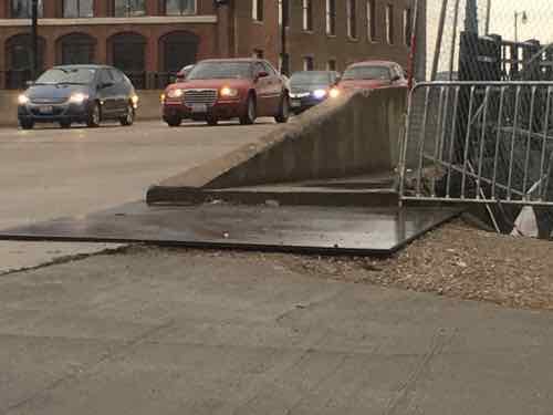
Approaching from Laclede’s Landing. I’m happy to see a smooth transition to the bridge, but the width of the crosswalk markings have no relationship to the width of the ramps on either end.
I’m happy to report the accessibility is better than it ever was. The slopes, cross-slopes, ramps, etc. are all improved. I was very relived to be able to access the bridge. I then went to head West toward downtown.
Approaching the corner from the Arch grounds. At left is the point to cross the street to head into downtown proper.Here’s a more direct view. Like before, the crosswalk is much wider than the ramp, but that’s not the main problem.The stupid “beg button” for a walk signal is set back too far from the curb — only by leaning and stretching could I reach it.
Walkable areas shouldn’t have buttons to get a walk signal — they should always come up in the cycle. But if you’re going to make us press these damn buttons at least place them where they can be reached! I can see bottlenecks here post-covid with lots of tourists coming and going.
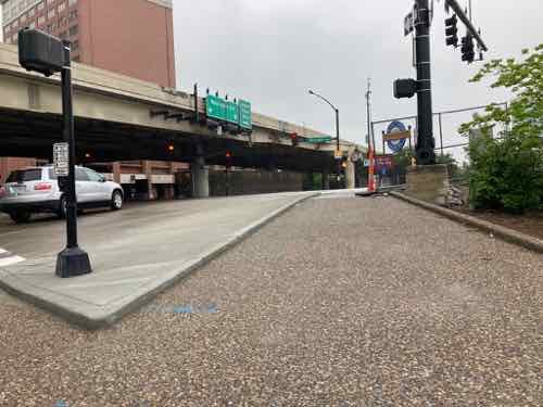
Yesterday morning I had minor outpatient surgery (post surgery photo) at Barnes-Jewish Hospital. Last evening, after my husband left for work as a Home Health Aide, I decided to take advantage of the nice weather and get a few things we needed from the nearby GreenLeaf Market — he’d called earlier to confirm they were open until 8pm. I had my mask on, hand sanitized, and canvas shopping bag on the back of the headrest on my power wheelchair.
Before I continue the story of last night I want to discuss their ADA accessible route — the route for pedestrians off of the Tucker public sidewalk.
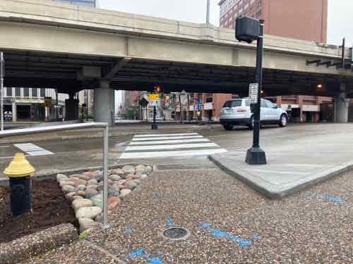
During construction I was excited to see the inclusion of an accessible route, though the light post was in the path I could see the striped around it, to the East/right.GreenLeaf Market opened on April 1, 2019 — just over a year ago.A parking stop protected the accessible route going around the light base and provided a parking space for a compact car.
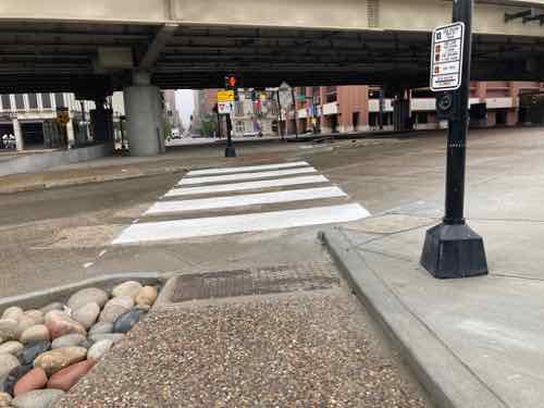
It didn’t take long, however, for a change to be made. The parking stop was removed and a cart carousel was put there instead — but it was initially kept back from the light base to keep the accessible route clear. Over the last year I arrived and found the cart carousel pushed up against the light base numerous times. I always extended my right foot and used my power wheelchair to put the carousel back into place for them, then went inside and did my shopping — leaving through the cleared accessible route.
Last night I arrived just before 7pm to find it pushed against the light base yet again. This time a staff member was retrieving carts from the carousel so I asked him to please move it back from the light base. He said, “go around.” I mentioned the route was an ADA route, that this was a civil rights issue. Unfazed, he continued with the carts.
In hindsight I could’ve handled this differently, but it had been a very long day.
I said I can push it. To I quickly pushed one side away from the light base, it came close to him. He was upset, I was upset. He yelled at the security guard to not allow me into the store — he was blocking the doorway as I arrived. I headed back out but stopped to take the following photograph.
The cart carousel was right where I’d left it.
The security guard came out to tell me to leave the premises immediately, which I did. I went out to the public sidewalk to tweet about the experience. While sitting there tweeting (1/2) I noticed numerous people walking past me, and using the accessible route to enter the store. I also noticed the staff, however, had pushed the cart carousel back up against the light base!
Here a man is using the accessible route to reach the store from the public sidewalk.When he gets to the blockage he is forced to go around.
Again, I own a big part of this. I had numerous times throughout the last year to point this out to management, but I didn’t. And last night rather than get upset with a guy just doing his job I should’ve just gone around and then mentioned the problem to the manager while leaving with my purchase.
And yes JZ, it can get designed & built correctly and the end user can screw it up. Hopefully I can speak to the manager today. The solution is simple, some pins to prevent the cart carousel from getting pushed up against the light base.
January 13, 2020Accessibility, Featured, WalkabilityComments Off on Eads Bridge Remains Inaccessible Years After Arch Project “Completed”
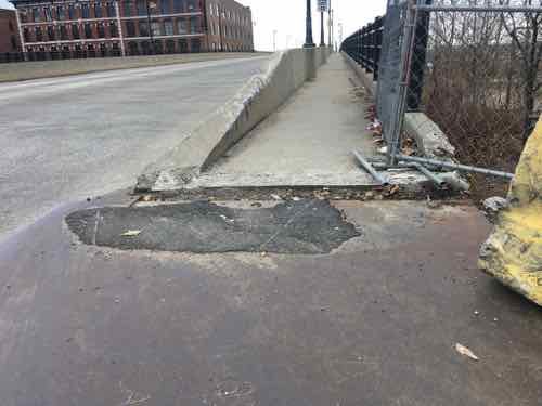
Thursday last week I decided to go see the level of the Mississippi River before we began getting rains and localized flooding. The best view is from the pedestrian walkway on the south side of the Eads Bridge top deck. I knew there had been accessibility issues at the west end of the sidewalk, but the I’d seen some asphalt had been put down to lessen the problem.
The loaner wheelchair I’m using couldn’t get over the huge gap.
So I had to stand up and, while not falling, drag the chair up onto the sidewalk by pulling on each front caster, alternating from left to right. Someone saw me and came to help when I was nearly finished.
This is the view as I approached. The steel plate and asphalt are more recent, but now ineffective.If we step back across Memorial Drive we see barricades have been placed to physically prevent anyone from going from the Eads to Arch grounds, or vice versa.
It seems a contractor on the Arch project accidentally busted into the MetroLink light rail tunnel beneath the Eads Bridge/Washington Ave. Since Metro owns the bridge & tunnel it’s up to them to get it fixed.
Let’s take a look at my older photos, in reverse order.
May 31, 2019. A steel plate covered the gravel but no asphalt yet to get upMay 2, 2019April 1, 2019March 16, 2019May 7, 2017 is my oldest photo of the problem. This is when I began conversations with various officials about being able to access the pedestrian walkway in my wheelchair.
So this problem is about three years old at this point. Three years!
I did get to see the river level last week, but it took far more effort than it should have.
As Spring flooding season begins I’d like to get regular photos to show how water is approaching and eventually covering Lenore K. Sullivan Blvd. I live close by so this shouldn’t be the issue it is.
On Wednesday a long expected, though still unconfirmed, report indicated St. Louis will be the next city to get a Major League Soccer (MLS) expansion team.
Major League Soccer will award an expansion franchise to St. Louis, a source close to the prospective ownership group has confirmed to ESPN. The deal is expected to be announced as soon as next Tuesday.
The St. Louis Post-Dispatch was first to report that St. Louis will be MLS’s 28th team.
The ownership group, MLS4TheLou, declined to directly comment on the reports, issuing the following statement: “Major League Soccer is responsible for the timing of any announcements around League expansion, but we remain confident St. Louis has made a strong case for a team.”
MLS didn’t immediately respond to a request for comment.” (ESPN)
Now that it looks likely the team and new stadium will happen we can delve more seriously into the design of the stadium and, more importantly, the surrounding blocks.
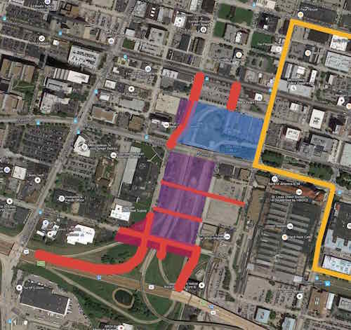
My map of the area from 2016
Nearly four months ago we got our first look at the proposed stadium, here’s how I ended my post then:
Here’s what I think about the site, both north & south of Market Street:
The stadium & new buildings should take advantage of the existing hole for basement or underground parking.
Market Street between 20th & 21st is a deteriorating bridge, it should be removed. Under it can be filled in with foam so a new road/sidewalks can be built at grade.
Market Street should be redesigned to be friendly to pedestrians. This means narrowing the road (fewer, narrower lanes) and more crossing points. Right now there’s a crosswalk at 20th and at Jefferson –this is nearly a half a mile without a crossing.
Hopefully the changes at Union Station, including the upcoming Farris Wheel along 20th Street, will mean easier access under the train shed between the Union Station MetroLink platform on the East side of 18th to the new MLS stadium.
Metro will need to rethink downtown circulation with a revised Union Station, a MLS stadium, and hopefully active surroundings.
Pine & Chestnut have been a one-way couplet for decades. Once the on/off ramps to/from I-64 are gone both streets should be returned to two-way traffic. The revised Soldiers Memorial, however, has only one eastbound lane on Chestnut between 13th-14th. Chestnut has our only protected bike lane.
I’ll probably think of more issues, hopefully the site planning being done now will address at least some of these.
My views haven’t changed, but I do have some additional thoughts now that we’re getting close. Most are questions, in no particular order:
We still need to see a proposed site plan. What is the current ownership of the current land? How much city & state property will exist beyond the stadium boundaries? Is the stadium site too small? Too large?
Because not everything will get built by the date of the first match, we need to think long-term. What might this large vacant hole look like in 10-15-20 years? What do we as a community want it to look like?
I think minority businesses should get work from infrastructure improvements, stadium, and new construction adjacent to the stadium. Big investments are being made, every part of the community should benefit.
We need to plan an area larger than the stadium — I-64 on the South (since it’s a hard boundary), the West side of Jefferson (since the city is looking at Jefferson changes to accommodate the coming NGA West headquarters further North, to the North I’d say at least include Locust. To the East Union Station is a hard boundary but there are development opportunities surrounding the historic train station (16th, perhaps 14th).
Housing should be included within the larger area described above. This should be at all price points from low-income to high-end. It should include purchase & rental.
Hopefully we can agree that new low-density uses like gas stations & stand-alone fast food restaurants would be inappropriate.
Pedestrian circulation needs to be considered as much, or more, than vehicular circulation. We’re going to have lots of visitors coming into town for future MLS matches, they need to be able to fly into St. Louis, take MetroLink to Union Station, easily walk to their hotel, walk from their hotel to the stadium, patronizing local businesses along the way. Will pedestrians be able to freely walk from 18th to 20th through the Union Station train shed, or will they be forced to go up to Market Street?
New infrastructure (water, sewer, electric, etc) needs to be planned for future development. Initial surface parking lots should be development sites in the future. For example, we shouldn’t need to move a water line just five years later.
Unlike Ballpark Village, the surroundings shouldn’t all be owned by the team ownership. It shouldn’t even be just one entity. A different company might work each direction from the stadium. The community plan, hopefully with form-based zoning, will ensure they all work to create what we want this area to become over time.
How can we make the area active on days without a match? One option might be having one street where restaurants are concentrated on both sides. Or maybe just at all corners?
How do we create a good West terminus to The Gateway Mall? Currently there’s a little bit of the linear park west of 20th Street. Do we end at 20th? End at a new 21st? At a new 22nd?
Will there be a place for match-day events? A side street that gets closed? A plaza adjacent to the stadium? The west end of The Gateway Mall?
Though this area is part of the Downtown West neighborhood, the stadium area needs a good name. This will help identify this district.
My fear is the rush to get a new stadium built mistakes with long-term consequences will be made. We’ve got one chance to do this right.
AARP Livibility Index
The Livability Index scores neighborhoods and communities across the U.S. for the services and amenities that impact your life the most
Built St. Louis
historic architecture of St. Louis, Missouri – mourning the losses, celebrating the survivors.
Geo St. Louis
a guide to geospatial data about the City of St. Louis