Home » History/Preservation » Recent Articles:

New Mission & Neighborhood for Ittner’s Henry School

Last year’s redistricting meant I was now in the 5th ward, rather than the 6th. As such my polling place for voting changed from the senior apartment building on Olive west of Jefferson to Patrick Henry Elementary on North 10th St.
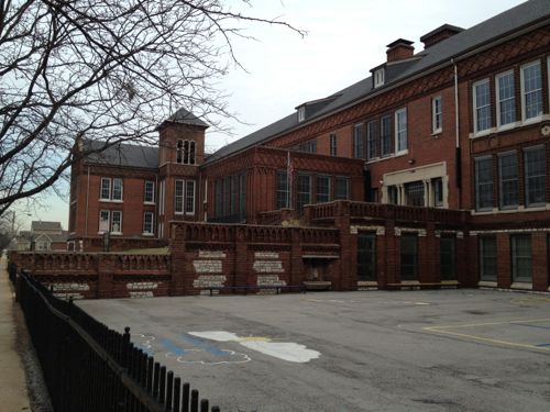
ABOVE: Henry Elementary at 1220 N. 10th, click image to view in Google Maps

It’s official name is now Patrick Henry Downtown Academy:

Nestled in the heart of downtown St. Louis, Patrick Henry Downtown Academy, located at 1220 N. 10th Street, offers a tuition-free world-class urban educational experience for children grades Pre-K-6th. We are beginning the first phase in the implementation of a GREEN School Model. We will emphasize ecological sustainability, environmental health, nutrition, personal responsibility, leadership and a comprehensive, high-quality academic program.

Patrick Henry Downtown Academy will serve as a unique springboard for students who will be at the forefront of the industries and disciplines of the 21st Century. There will be an emphasis on the environmental sciences, energy alternatives and conservation, recycling, organic gardening and the food sciences, and the emerging “green” economy, students will focus on developing the math, science, writing and “hands-on” skills that will make them successful leaders to make a difference in improving the environment for humanity. Our goal is to be the first urban GREEN Model Pilot School in the country! (Saint Louis Public Schools).

The Henry school is one of many designed by architect William B. Ittner (Landmarks Association, Wikipedia). Voters entered through a basement entry to get to the small gym so the areas I saw weren’t grand spaces designed by Ittner. They were nice and clean and students going from class to class were well behaved. School staff were clearly in charge of the students. Those working the polls were helpful.

Last November I voted absentee but I’m glad I went in person on Tuesday, even though I had to walk down numerous steps. The area to the east was the Cochran Gardens high-rise public housing projects. Cochran has been replaced by Cambridge Heights, a mixed income neighborhood. Now that construction is nearly complete I’ll be visiting and posting about the changes, including pictures of the high-rise buildings before they were razed.

– Steve Patterson
 

One Block of Cherokee Street Took 17 Years to Build

My friend suggested we meet for lunch at Tower Tacos on Cherokee. I knew that meant I’d have to drive there and he could walk, but I rarely pass up lunch on Cherokee.

ABOVE: Tower Tacos at 3147 Cherokee is in the middle of a block, click to view in Google Maps

This side of Cherokee between Compton Ave on the west and Michigan Ave on the east contains seven buildings. At a casual glance I didn’t give much thought to them, they all looked like they were from the same period. Out of curiosity I decided to find out using Geo St. Louis, “a guide to geospatial data about the City of St. Louis.” What I found out was these seven buildings were built over a 17-year period (1896-1913):

  1. The first, 3137 Cherokee, was built in 1896 , a two-flat originally. This was the second lot from the east, not the corner.
  2. In 1905 a brick one story house was built to the lot to the west, at 3139 Cherokee. For nine years the other house stood alone, unless previous structures existed on this block.
  3. In 1909 a corner storefront was built next door to the east at 3133 Cherokee. This is the corner at Michigan Ave. Now we’ve got three buildings in a row.
  4. Also in 1909 a 2-story with first floor storefront space was built at 3147 Cherokee. This skipped a lot. This is now Tower Tacos
  5. A year later, 1910,brick 4-family was built at 3143-45 Cherokee filling in the gap left the previous year. Five buildings now in a row.
  6. In 1911 2-story with two storefronts and two flats was built on the next lot at 3151 Cherokee.
  7. Finally in 1913 a large 2-story  building with storefronts & flats was built at 3155-59 Cherokee, finishing the block at Compton Ave.

It’s possible earlier frame or soft brick buildings existed on this block but I have no knowledge of such. The point? Development, residential & commercial, used to be done a building at a time based on demand. The financing package was limited to buying the lot and building a single structure.

Today all 42 buildings on city block 1502 would have been built at once — or at least in the same development package. After the first developer goes under someone else would come in to finish building on the remaining vacant lots. All the buildings would have the same basic look, the exact same brick color and the same setback from the sidewalk. Boring.

The days of people buying lots and building their own home are long gone but in parts of the country it’s not uncommon for a developer to create building lots and then have many builders buy those lots. Some would get built on a speculative basis and some would be custom for a specific buyer. For filling in vacant parts of the city I’d like to see us try the idea of separating the development of build-able lots and the construction of new buildings.

– Steve Patterson


Where Josephine Baker Grew Up

I love the Post-Dispatch’s “A Look Back” series of photographs and articles. I eagerly read the recent story on St. Louis native Josephine Baker (1906-1975) and one sentence stood out:

“She told the Post-Dispatch in 1950 that she began dancing for friends in her home at 2632 Bernard Street, in an area obliterated for Highway 40.” (STLtoday.com)

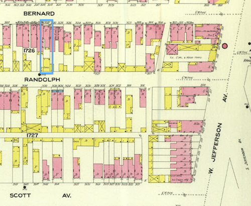
Anytime I see an address my instinct is to look it up on Google Maps, but it was “obliterated for Highway 40.”  So I went to the University of Missouri’s Digital Library to look it up on the Sanborn Fire Insurance Co maps in their collection.

ABOVE: I've highlighted Josephine Baker's childhood flat in blue in the upper left, Sanborn map from University of Missouri Digital Library, click image for access

Jefferson Ave & Scott Ave both still exist (map) but Randolph & Bernard are no longer part of the street grid. But looking at the map it wasn’t clear her house and neighborhood were razed for the highway, it looked just south of the highway.

Next I went to HistoricAerials.com to try to find an aerial photograph prior to demolition. The oldest photo they have for St. Louis is 1958 so I wasn’t certain. But prior to 1967 the expressways from the west merged onto eastbound Market Street near Compton Ave. Sure enough her flat was just south of the highway right-of-way. Like streets next to I-44, Bernard would have only had houses remaining on the south with the north part of the highway. But Baker’s childhood flat was on the south, not the north.  Thus, her flat wasn’t “obliterated for Highway 40” as the Post-Dispatch wrote.

In the 1971 image for the same location looks like

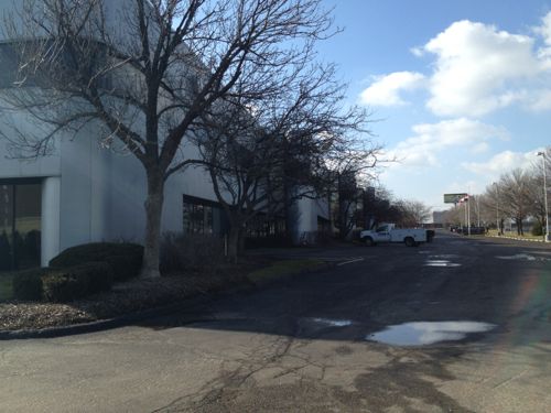
ABOVE: The St. Louis Business Center stands on what was part of Baker's childhood neighborhood

City records show the four buildings of the St. Louis Business Center were built in 1986 — at least 15 years after the area was razed.

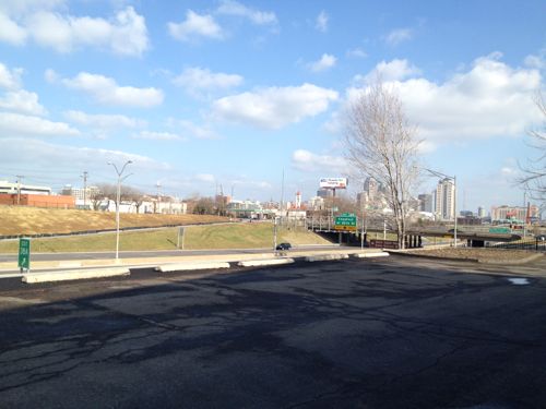
ABOVE: View of highway and downtown from what used to be Baker's street

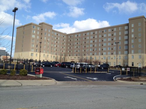
Baker’s flat was probably about on the dividing line between the 80s business center and what’s now a Marriott hotel, built in 2004.

ABOVE: The automobile entrance to the Marriott is off Scott Ave, no pedestrian access is provided, a clear violation of the ADA

Before the Marriott, a Napa auto parts warehouse was located on this site.

So now I’m curious to find out just when the houses on these blocks were razed. Baker was already world famous when the wrecking ball destroyed where she lived.  Did anyone suggest saving her flat as a historic site?  Were St. Louisans upset Baker refused to perform in St. Louis prior to 1952 because she wouldn’t perform for segregated  audiences?

– Steve Patterson


3519 Page Blvd

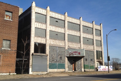
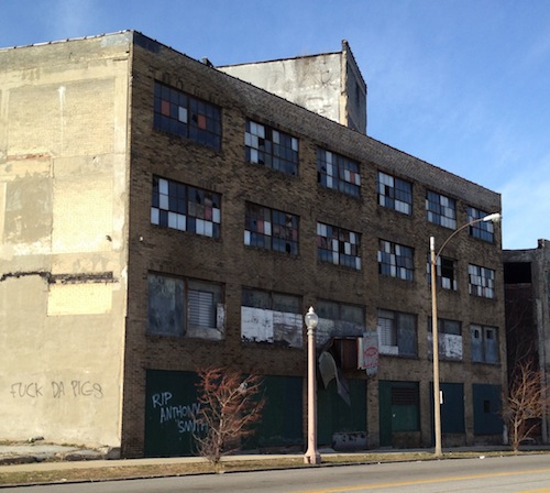
The vacant 4-story warehouse building at 3519 Page Blvd is a favorite of mine, it was built in 1909.

ABOVE: Beautiful detailing on the Page Blvd facade
ABOVE: The simpler rear elevation of 3159 Page faces MLK Dr

The building and it’s 1926 neighbor to the west are owned by NorthSide Regeneration LLC, Paul McKee’s project. Hopefully this building will be renovated into office or residential space.

 – Steve Patterson


Stop By The Court of Honor Saturday During Iraq War Parade

Come downtown tomorrow morning for a parade to honor Iraq War veterans:

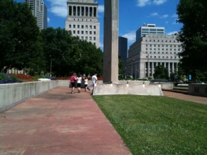
ABOVE: A family walks through St. Louis' Court of Honor, June 2010

The parade will step off at noon Saturday from Kiener Plaza and travel west on Market Street to Union Station. Inside Union Station, organizers plan to offer a “resource village” from 11 a.m. to 5 p.m. where veterans can connect with service providers such as the Red Cross or Department of Veterans Affairs. Entertainment is planned from 3 to 8:30 p.m. (STLtoday.com)

While you are downtown along Market Street be sure to visit the Court of Honor (between 13th & 14th streets).   The Court of Honor was the subject of my posts on Monday & Tuesday. Officials at the Soldiers’ Memorial say the space sees few visitors. The design of the space is remarkable from all sides, it opened Memorial Day 1948.

-Steve Patterson


Advertisement


[custom-facebook-feed]

Archives

Categories

Advertisement


Subscribe